Tuamotu Archipelago… the Dangerous Islands
Originally dubbed the "Dangerous Islands" by French explorer Bougainville, these low-lying islands present a challenge because of the difficulty in navigating around and between them. This is not an area to sail at night nor without a good bow watch for coral heads and shoals. Although we found that our chart plotter and electronic charts were an excellent aid to navigation, we rarely sailed anywhere without one of us keeping a keen lookout on the bow.
The Tuamotu Archipelago
From Iles Gambier, we continued west and north to the Tuamotus. The Tuamotus are the heart of French Polynesia comprised of about 78 atolls. Many of the islands are not approachable by a sailboat, nor do they have a pass into their lagoons.
BTW, an atoll is a ring-shaped reef, island, or chain of islands formed of coral. The Tuamotu Archipelago is the largest group of coral atolls in the world
Tahanea Atoll
16S51.67 / 144W40.16 (Lat and Long)
Our first stop was Tahanea Atoll, about 700 miles from the Gambier. Since we only had 90 days in French Polynesia and we spent nearly a month in the Gambier, we needed to get a move on if we wanted to spend some time in the Society Islands (Tahiti et al). We had a great downwind sail... fast and akin to a sleigh ride and covered the distance in 5 days. The passage time could have been less, but we slowed down to time our approach through the pass into the lagoon near slack tide and in good daylight to see coral heads. As you can see to the right, the approach to an atoll doesn't look like much: low-lying, palm-treed islands with natural passes through the surrounding reefs which can't be sighted until you're very close. Luckily, the pass was well-charted, wide, deep and with no obstructions.
First sighting of Tahanea Atoll
We found a pleasant anchorage for Cups to the east of the pass entrance.
A lagoon within the lagoon was a pleasant place to relax in the warm water and explore
On this uninhabited atoll, signs reminded us that this was a now natural reserve.
Exploring on the reef, we found this eel stuck in a small tidal pool and not enjoying it a bit.
The crabs were aggressive! Their beady red eyes got all fired up on our approach, they spread their claws, pincers opened wide and hissed at us. No fear!
Lots of sea birds around including frigates, tropic birds, noddies and this gray-backed tern.
The Tuamotus were first discovered by Ferdinand Magellan, during his circumglobal voyage in 1521.
Our booty from an afternoon of beachcombing along the reef on Punaruku island... mostly cowries and cones.
The little village of d'Otao is currently abandoned, used now only for copra harvesting and fishing.
Two large covered cisterns provided us with water for laundry and washing.
Though uninhabited at the moment, a small chapel and well-kept graves await the locals' return.
Further exploration of little, shallow inner lagoons rendered closeup photos of threaded butterfly fish and reef black tip sharks
Fakarava - South Anchorage
16S30.42 / 145W27.44 (Lat and Long)
Fakarava is the second largest atoll in the Tuamotus. This 20x50 mile lagoon is surrounded by the typical coral reef and flanked by 80 coconut-covered motus (islands).
After a week at Tahanea, we headed for the south entrance of the Fakarava Atoll. We left early one morning and bounced our way through the ebbing tide at Tahanea and had a glorious 50nm sail to Fakarava arriving around 4pm with sufficient light to maneuver our way through the Tamakohua (South) pass. Above left, huts at the entrance to the pass. Above right, Cups at anchor.
The next day we did a drift dive through this same pass at slack water after low tide. This experience was incredible as we hung on to our dinghy and drifted with literally hundreds of fish and sharks, all colors, sizes and shapes, through the narrow pass entrance. Sorry, no underwater photography. :-(
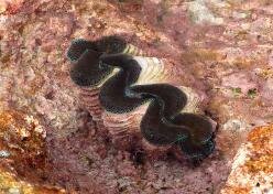
We find exploring the reef very interesting. The water is clear and warm and teeming with colorful fish, giant clams, crustaceans and lots of shells.
Rotoava, Fakarava
16S03.46 / 145W37.36 (Lat and Long)
After several days in the south, we finally had a day that was sunny and clear enough to read the water and spot all those coral heads. We moved north along the coastal route to the little village of Rotoava.
The view from the dinghy dock was pretty impressive.
Obviously, these folks see more retail trade as there were several black pearl jewelry stores with comparatively high prices.
We did our usual walk about town and found the cemetery and then roamed the reef for awhile beachcombing. Lots of cowries.
The local geckos were plentiful.
While beachcombing, we met a young crab which was intent on shaking hands with David.
On our walk, we found several ripe coconuts and brought them back aboard. Amazingly, David still has all ten digits.
As we are prone to do, we change our plans on a whim. We had heard about the Tahiti-Moorea Sailing Rendezvous, but had no intentions of attending and then... we changed our minds! Why not? So we were off to Tahiti! See you there.
s/y Nine of Cups 2009


