

Three Days in Page, Arizona
/We left Old Scottsdale mid-morning to head north to Flagstaff. We’d seen the sign for Agua Fria National Monument about 40 miles north of Phoenix as we’d driven along I-17 in the past, but we’d never stopped. We needed some steps so we turned off at the Bloody Basin exit (conjures up an image, doesn’t it?) and proceeded a short distance to the monument entrance.
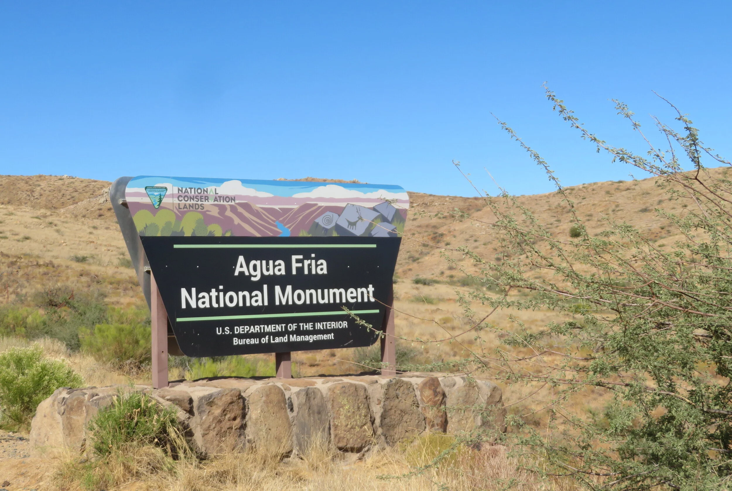
Administered by the Bureau of Land Management, their website describes the monument like this: “This expansive mosaic of semi-desert area, cut by ribbons of valuable riparian forest, offers one of the most significant systems of prehistoric sites in the American Southwest.”
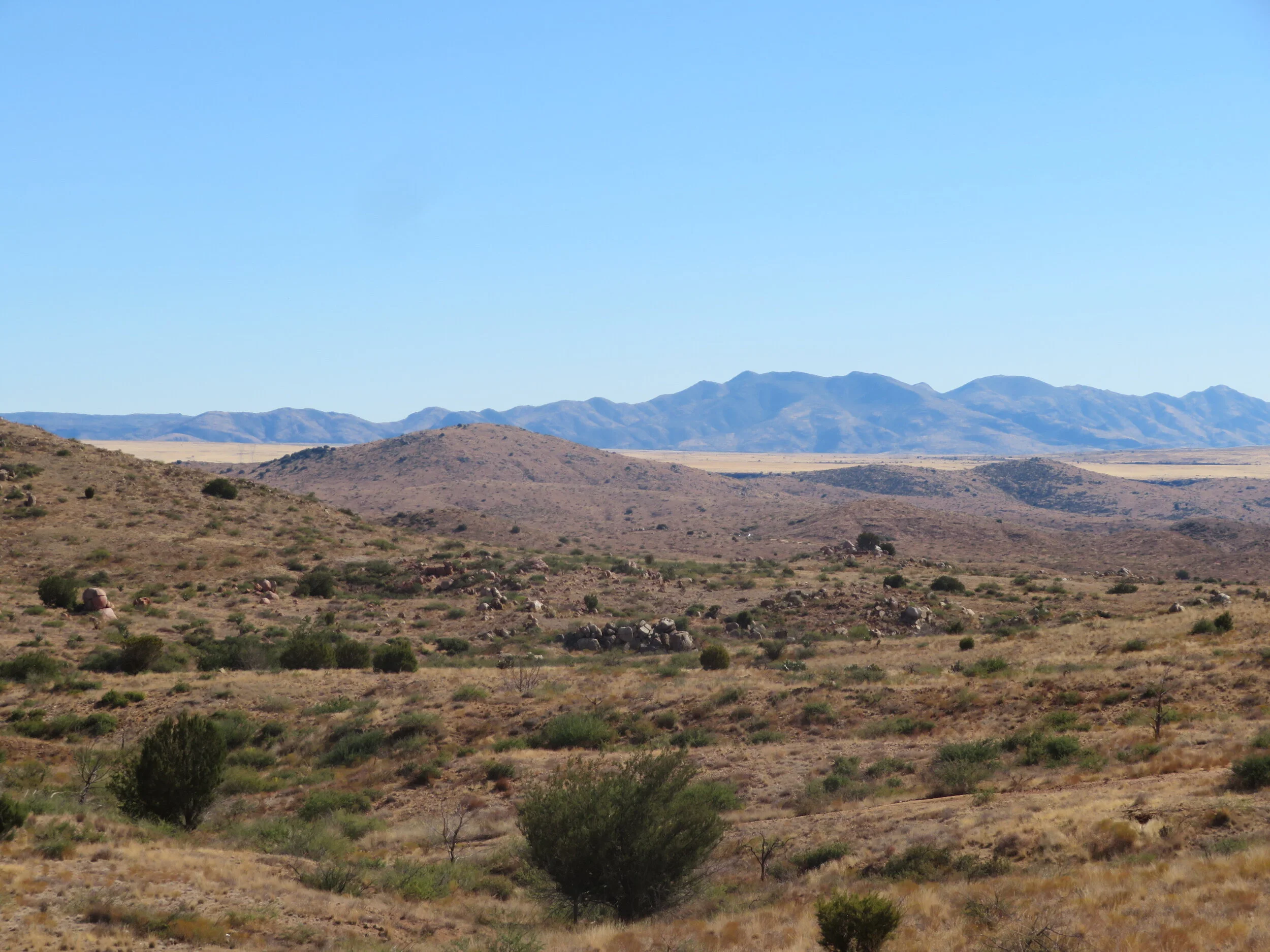
Agua Fria view
Unfortunately, what we saw wasn’t all that impressive. After a short distance, the entrance road is passable only by 4-wheel drive, high clearance vehicles and there’s not much to see. We walked along a dirt road for our requisite 10K steps per day, but there was only more of the same parched, dry land.

A stop at a rest area along I-17 made us very aware that we were definitely in the desert.
We continued north to Flagstaff with great views of the snow-covered San Francisco Peaks. As we climbed to Flagstaff’s altitude of 7,000’ above sea level, we watched the temperature drop dramatically. Snow patches appeared on the roadside.

Views of the snow-capped San Francisco Peaks as we neared Flagstaff
We spent the night in Flagstaff where the temperature dipped to 15F during the night. David commented that he never again wanted to live in an area where snow shovels and salt were the best sellers at the local WalMart and snowmobile dealers were on every corner. The cold air hit us like a brick as we trundled to the car the next morning to head further north to Page.
The 2-1/4 hour, 135 mile to Page was through Navajo dry, dusty tribal lands. Stalls selling Indian jewelry and trinkets were set up intermittently along the route. Pre-fab modular houses and mobile homes were common. There were no towns or facilities for miles. Horses, cattle and sheep grazed and tumbleweeds blew across the highway.

At 4,300’, Page is a bit more temperate (and a lot less cold) than Flagstaff. We were still hoping to hear some word about Blue and decided to spend a few days in Page for some hiking while we waited. David already wrote about our little foray on the AZT, but beyond the AZT, there’s a myriad of trails and hikes to choose from in this beautiful area of Arizona.
Like the town of Boulder City that was established as a construction camp for the building of the Hoover Dam, the town of Page was established in 1957 as a temporary work camp for builders of the Glen Canyon Dam. It’s a gem of a place with spectacular red buttes and mesas set against azure blue skies with miles and miles Lake Powell shoreline.
As a late birthday gift, I was hoping we’d be able to hike into Antelope Slot Canyon. The Canyon is located on Navajo tribal lands and can only be accessed by Navajo-sponsored tours. However, like most things during the pandemic, the tours were canceled. I dealt with the disappointment and we found lots of alternate options over the next few days.

A raven takes in the view
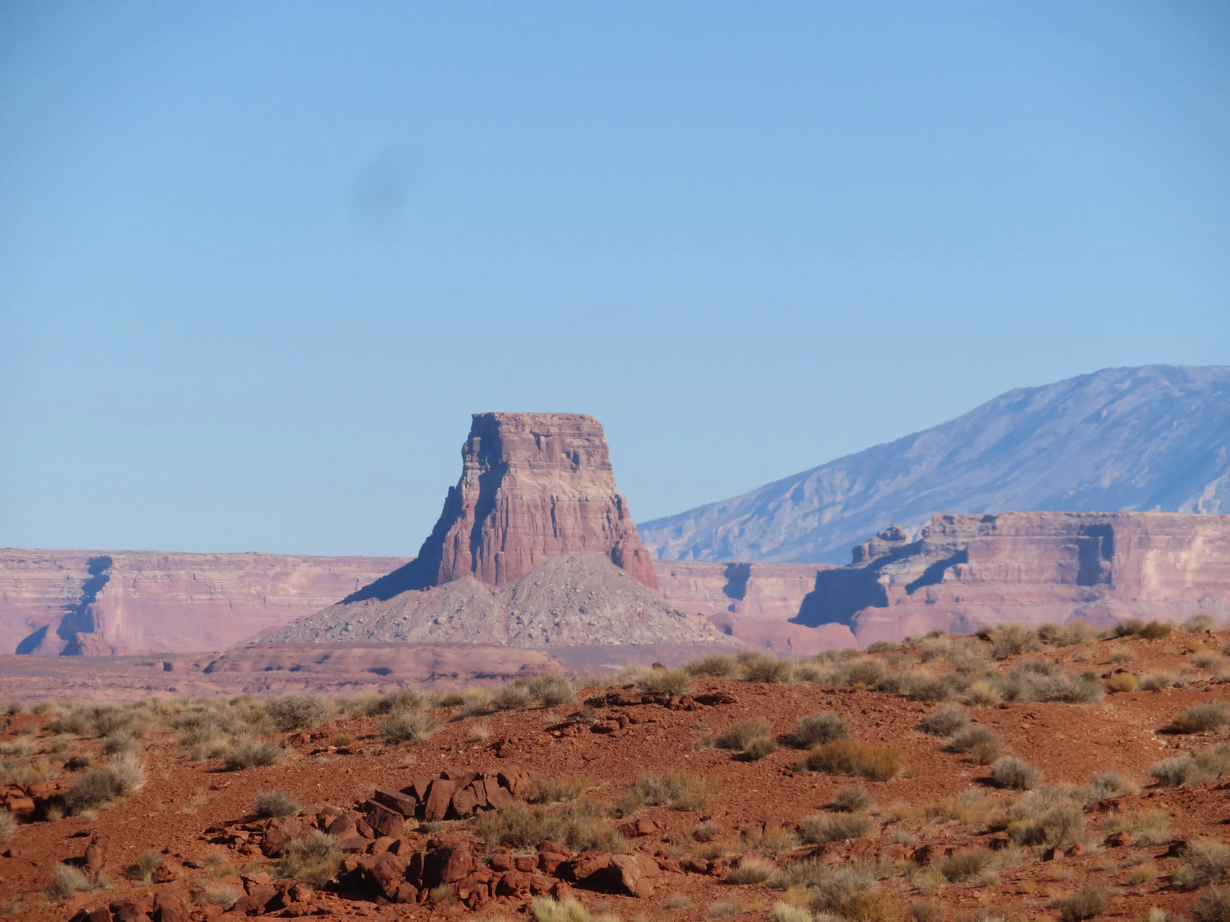
Great view of Tower Butte from the Rim View Trail
On several days, we walked portions of the Rim View Trail, a 10-mile moderately trafficked loop trail that circumnavigates Manson Mesa. We could access it from several points and had great views of Glen Canyon, Lake Powell and the surrounding desert.

For millennia, the Colorado River has carved its way through the Glen Canyon Gorge,
In-town, there was the Scenic View Trail that overlooks the Colorado River and the Glen Canyon Dam. This short trail has a handrail and descends rather steeply over flat, layered rock to an awesome view of the dramatic scenery far below.

Overlook of the Glen Canyon Dam from the Scenic Overlook Trail
Not far away was the short, but interesting Hanging Gardens Trail. We walked in the desert sand along a path outlined in rocks and stones. It wasn’t very impressive until we arrived at the Hanging Gardens which is naturally formed grotto lush with vegetation which seemed to be growing directly out of the rock walls.
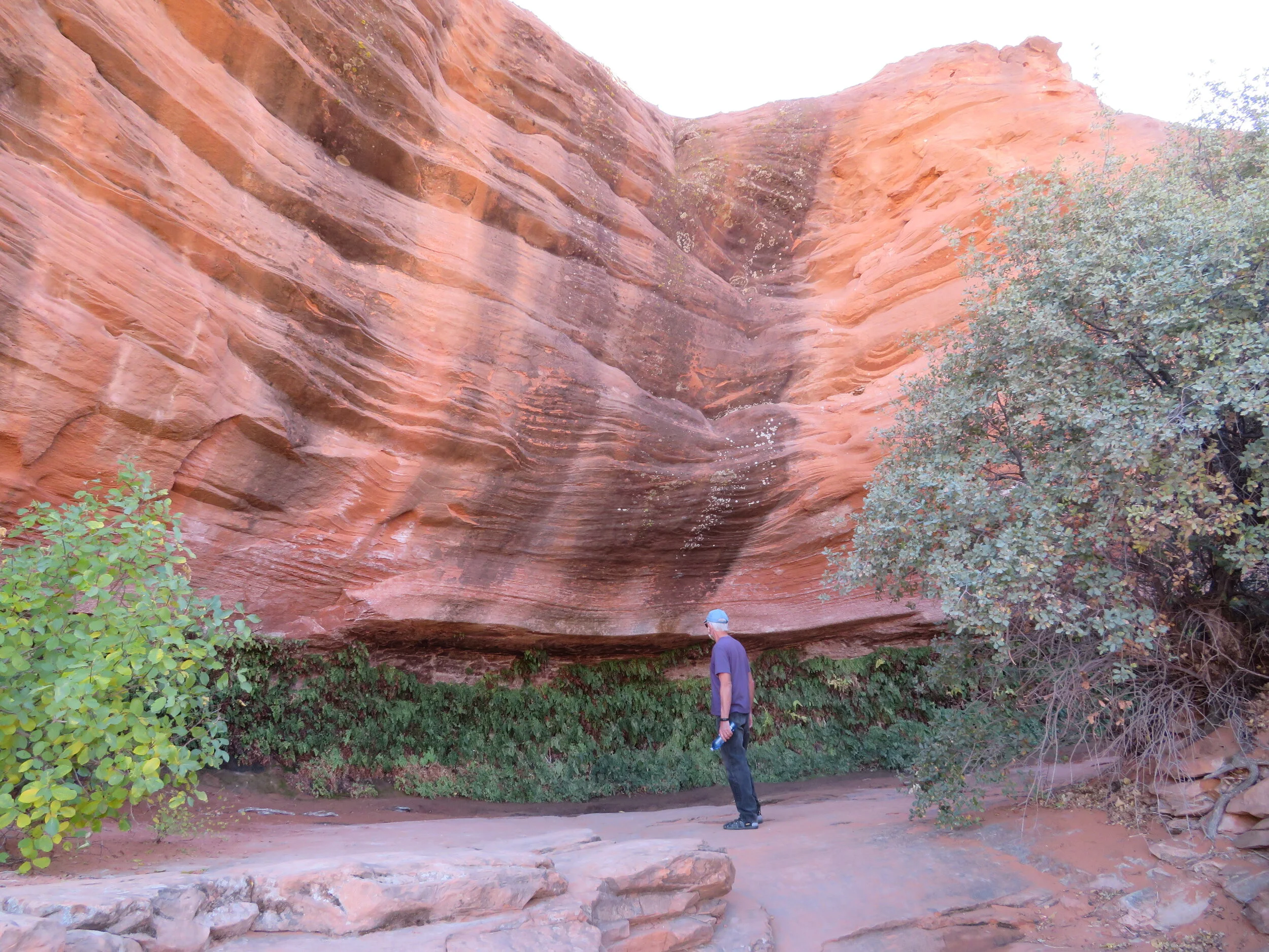
The end of the Hanging Garden Trail totally surprised us.
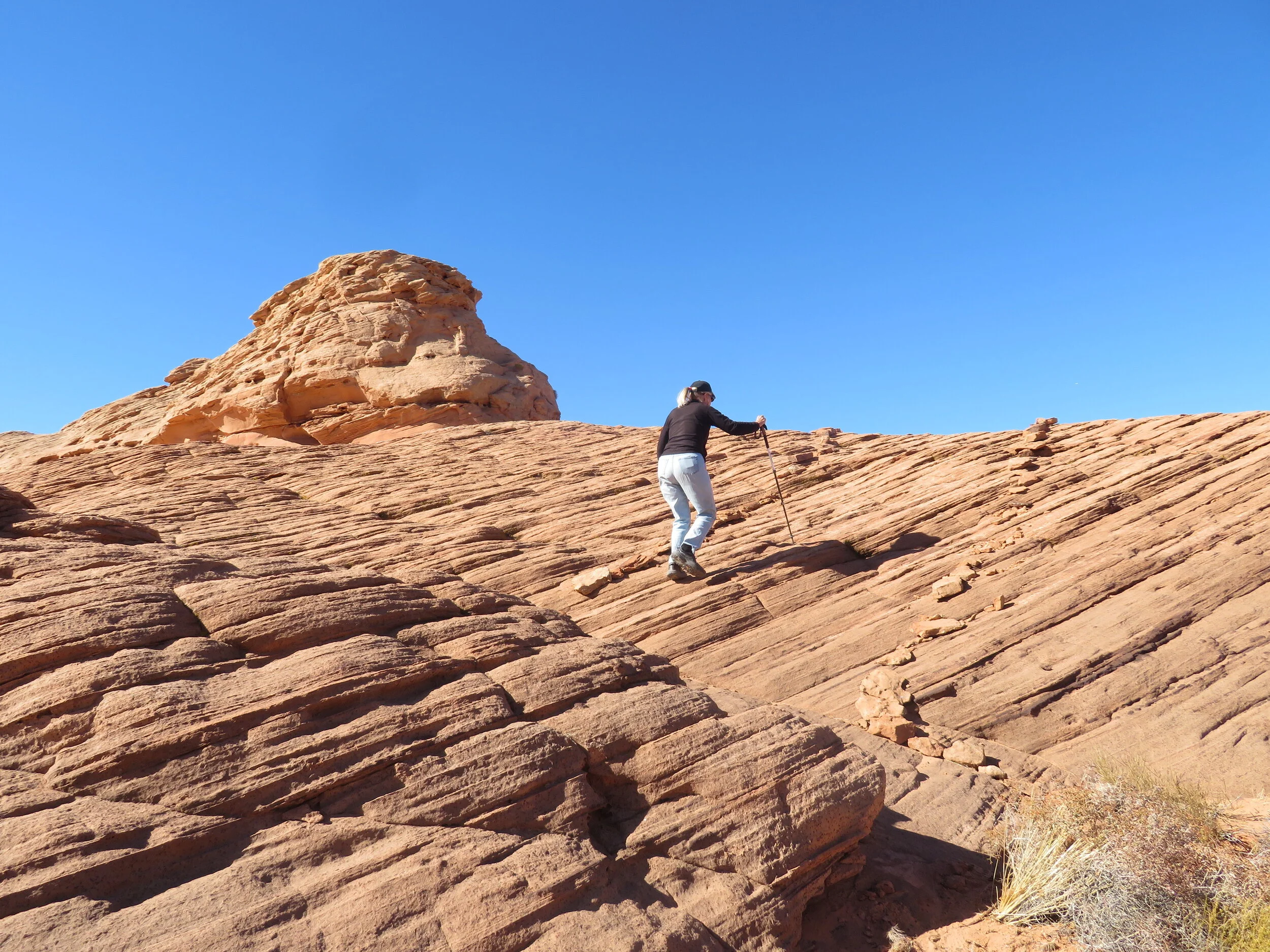
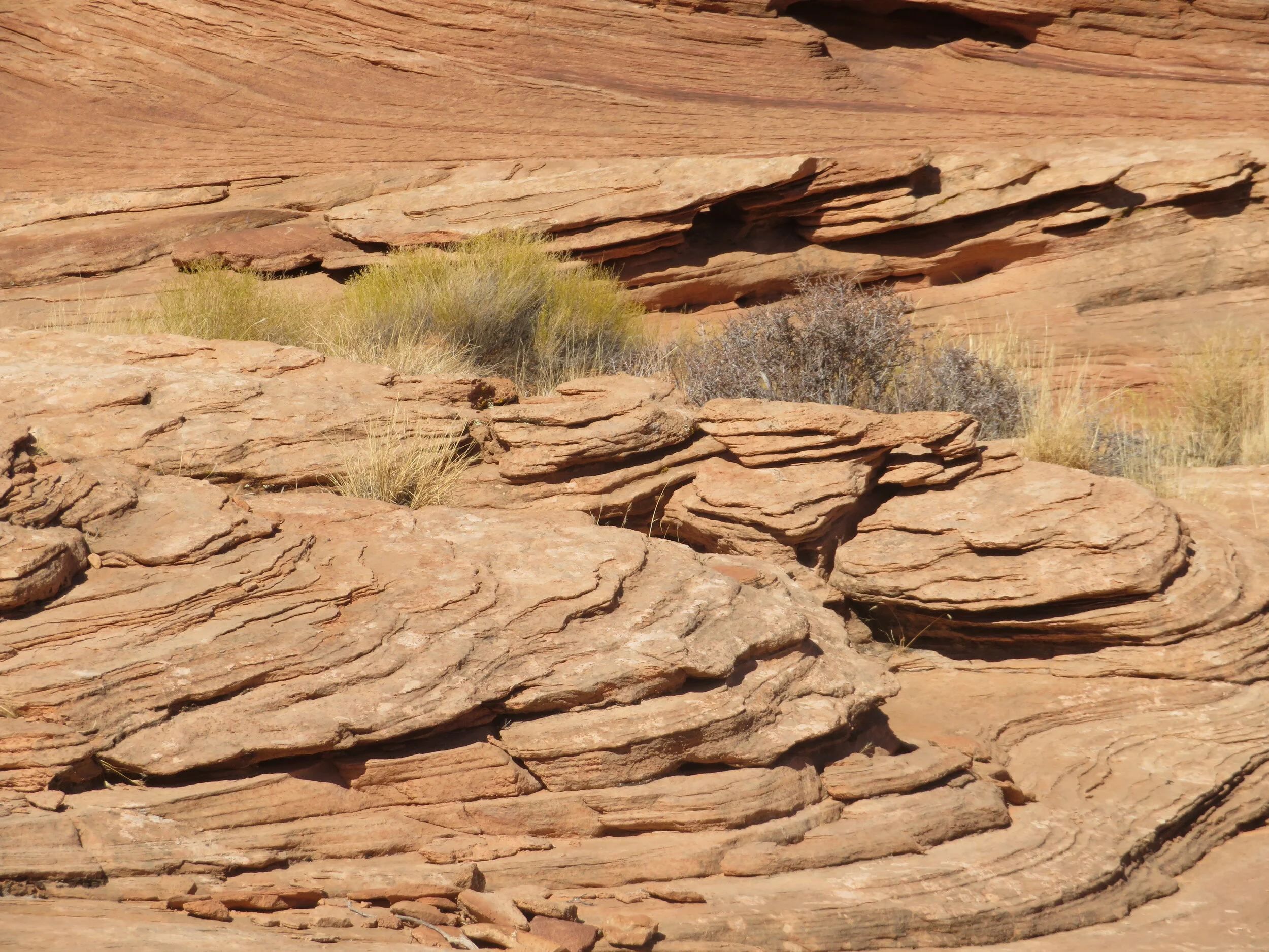
My favorite hike was the Rock Lane Trail, a few miles out of town. The trail is appropriately named as it, too, was lined and marked with rocks set upon massive flat, layered rocks. The rock formations were beautiful as the trail meandered around them and between them.


We could have spent more time in Page, but with the days passing and still no Blue, we were weary of hotel rooms, in-room dinners and living out of a suitcase. We opted to head back home for a Thanksgiving feast with Mary and Paul and wait for word of Blue’s diagnosis and recovery. We stayed a night Kanab, Utah and then made the final trip home. Once back in Las Vegas, we did finally hear.
David will fill you in on the details of Blue’s travail, but for us, the No Destination/No Blue road trip has come to an end. Hope you enjoyed Arizona as much as we did.