

Fort Bowie Arizona - A National Historic Site
/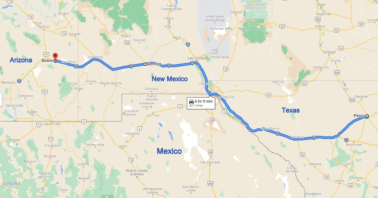
Our route took us from Texas along the Mexican border to New Mexico and then into Arizona.
Pecos, Texas to Deming, New Mexico is a long, cold and windy, rather boring ride along I-10, hugging the US-Mexican border. Having no inclination to deal with cold and wind, we car-danced to get our steps in for the day. The next morning we were heading to Tucson, Arizona. The temperatures had warmed and wind had subsided. When it was time for a leg stretch I checked the map and noted that the Fort Bowie National Historic Site was only a ~12 miles off the highway. We’d never visited before and here was our chance. After about 10 miles or so the paved road turned to packed gravel and ended abruptly in a parking lot at which no fort was visible.

An info kiosk provided a map and a brochure which explained that “The original route into Fort Bowie was a wagon road built by soldiers who garrisoned the post. For most visitors today, access to the fort is via a 1.5 mile hiking trail of moderate difficulty.” Sounded like just what we had in mind… a walk into history.

Drifting along with the tumbling tumbleweeds
The trail was well-marked and dominated by desert grasses, oak juniper, and pinyon pine with thickets of manzanita. Giant tumbleweeds (Russian sage) blew across the trail.

The Post Cemetery
We passed by the ruins of the old Butterfield Stage station (not much to see) and stopped at the Post Cemetery, barren and seemingly forsaken, for a look-see and to pay our respects. Though no exact numbers are available, it is reckoned there are ~100 graves here, mostly soldiers, children, and Native Americans. Replica grave markers told stories of those buried here. “O.O. SPENCE, Born in Pennsylvania, Aged 28 years. Killed by Indians April 7, 1876." and nearby, "NICHOLAS M. ROGERS, Born in St. Joseph, Mo. Killed by Indians April 7, 1876."

The little brook known as Apache Spring was still gurgling and bubbling and we pondered how many others had stopped here over the centuries for water and rest.
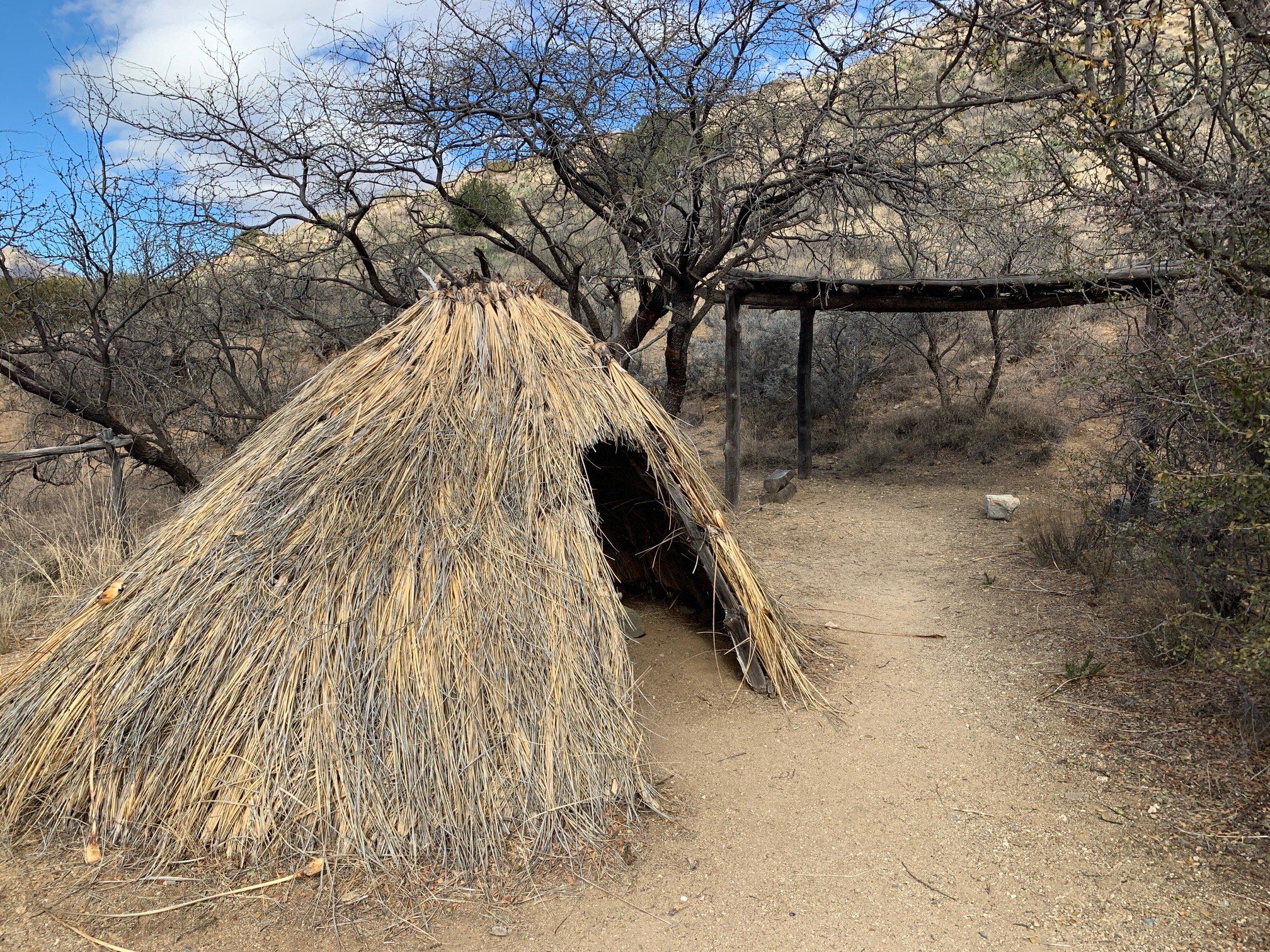
Informational signs provided interesting tidbits about the history of the area including a replica wikiup, a native Chiricahua Apache thatched shelter/camp.

At the 1.5 mile marker, we spotted the remains of a storehouse and the Visitor Center in the distance.
The fort was built in 1862 to secure Apache Pass, a natural spring source and route through the Chiricahua and Dos Cabezas mountains, used by emigrants, prospectors, and the Butterfield stage line. The pass led through traditional Apache lands and the native Chiricahua Apaches led by Cochise and later Geronimo were not happy with the territorial invasion. Bitter struggles ensued resulting in constant battles and bloodshed. Between 1862 and 1886, the fort was active, but when Geronimo was defeated in 1886, the fort’s military usefulness came to end. It finally closed down in 1894. Only ruins of the adobe and stone fort are visible today.
The Visitor Center offered drinking water, exhibits, a small gift shop, and a pleasant rest stop before exploring the fort ruins. We had assumed that the fort was named after legendary folk hero, Jim Bowie. We learned it was instead named after Brigadier General George Washington Bowie, a Civil War Union officer who was subsequently assigned to the Arizona Territory. The exhibit of Captain Roberts’ false teeth found in the ruins of the fort elicited an unexpected chuckle.


The remans of the fort were in ruins and we needed to use our imaginations to conjure up what the post might have looked like when it was active.

Adobe wall ruins of Fort Bowie
The sky clouded over, the temperature dropped and the wind began to blow. We retraced our steps the 1.5 miles back to parking lot and resumed our drive to Tucson. Next time? Finally, you’ll get to meet The Thing! I can’t wait to introduce you.