

Alaska Highway - Dawson Creek to Liard Hot Springs
/The Mile 0 Campground was an easy choice. It was close to town, reasonably priced and had all the amenities, including hot showers and once again, laundry facilities… just can’t escape the dirty clothes. There were plenty of sites available and we ended up staying a couple days just to catch up on stuff we’d bee putting off.

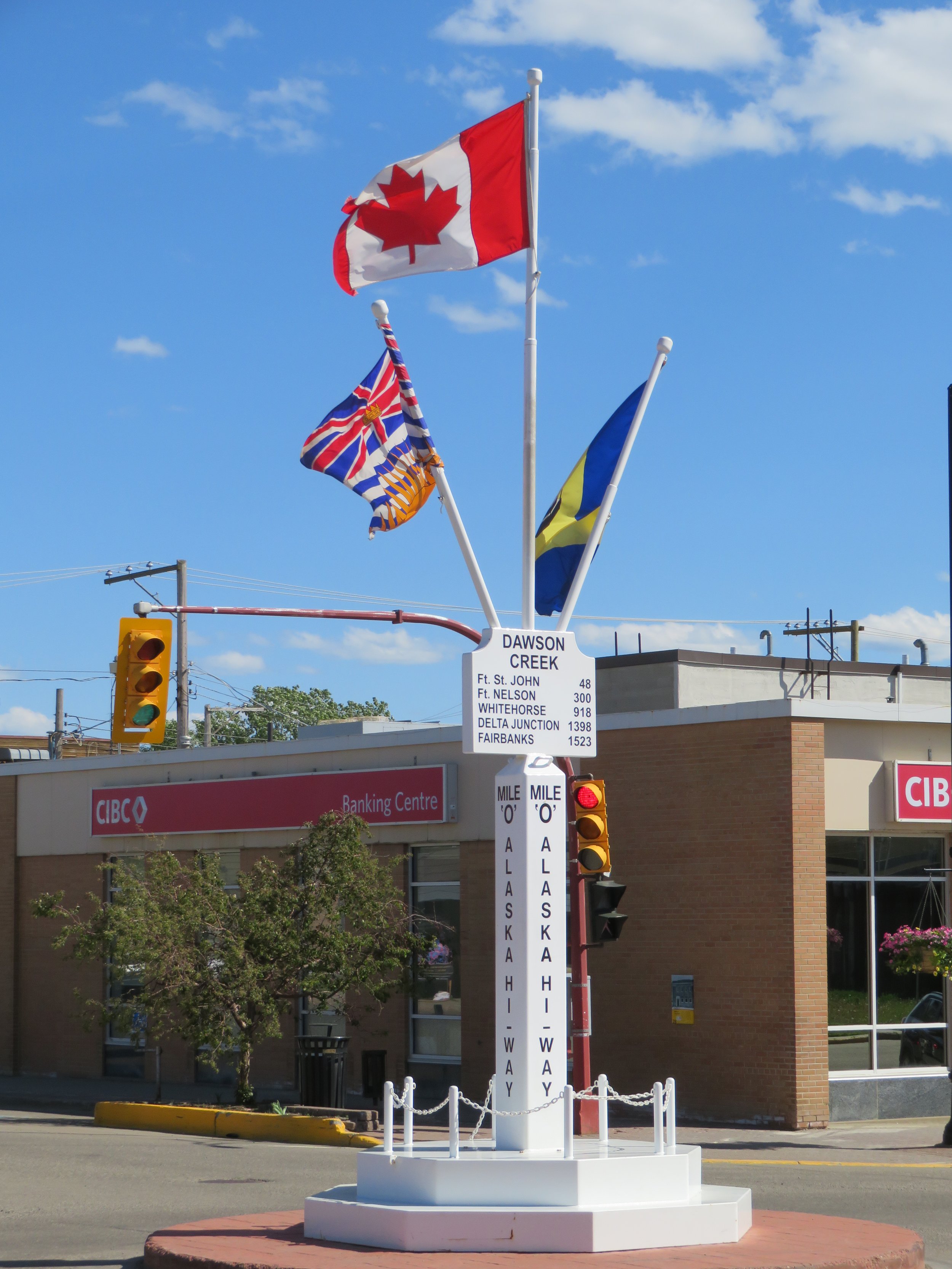
After settling in the first day and photographing the iconic Mile 0 sign, we visited the Visitor’s Centre, picked up more brochures (we already have quite a stack) then walked a couple blocks downtown for a photo opp of the Mile 0 signpost and checked out some of the wall murals.
There are several supermarkets in town, including a Walmart and perhaps by habit we went there first. It was a mediocre Walmart at best and we left the store empty-handed, figuring that perhaps this is what we could expect a we traveled further North. Then we stopped at the local Safeway… wow! It was large, modern and unbelievably well-stocked with a fresh deli, fish counter, bakery, salad bar, sushi bar… it had everything as well as the cheapest gas in town at their nearby pumps.
It was one of those nights when we were just plain tired and decided we’d lay down for an hour or so to rest. The next morning when we finally awoke, we were feeling pretty refreshed. Amazing what 12 hours of sleep can do for you..
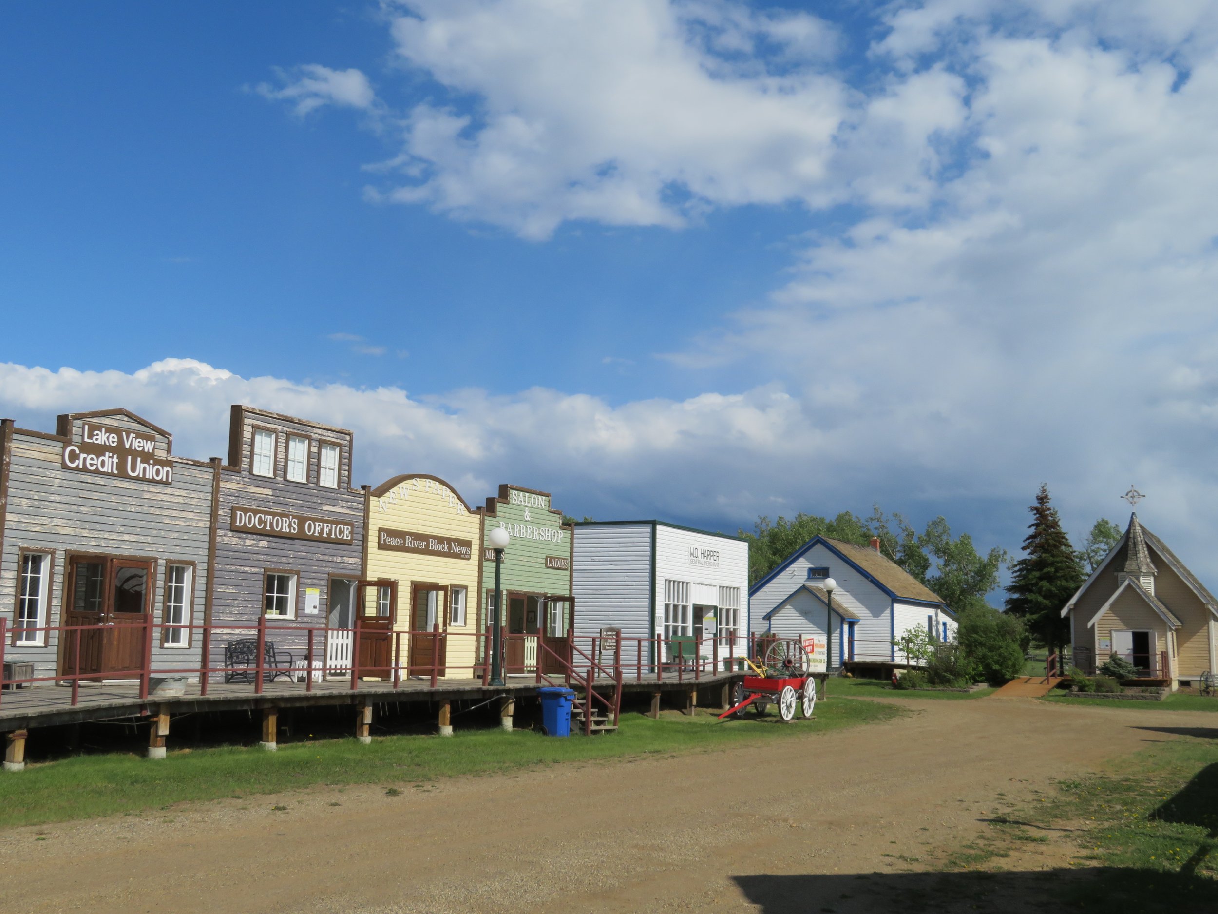
David puttered around a bit with Blanche chores while I did laundry and some requisite cleaning. Next door to the campground is the Walter Wright Pioneer Village, representing life in the Dawson Creek and surrounding area from 1912-1950. It’s an eclectic collection of buildings and artifacts with a Main Street lined on both sides with houses and shops all appropriately furnished. Admission is by donation. We enjoyed a brief walk around then headed back ‘home’.
The evening was particularly sunny and warm enough to cook outside and just sit and watch the world go by.
As we were poring over the Milepost guide that evening to figure out our next stops of interest, we came across Watson Lake and its ‘sign forest’. I remembered reading this before, but it slipped my mind. In 1942, a soldier working on the Alaska Highway was told to put up mileage and directional signs and being a bit homesick, he added one for his hometown, Danville, Illinois. Since then, thousands of people have added signs to the ‘sign forest’.
We thought we might want to consider making our own sign for the ‘forest’, but we really didn’t have much time. Next morning, we walked over to the nearby Home Hardware to suss out possible sign material. Everything seemed too big and definitely too expensive for our purposes until Catherine, one of the managers, listened to our story and offered an odd piece of laminate flooring gratis. Awesome! Sure it was a bit too long, but it was waterproof and it could be cut. David carried it home and began making plans for the sign that very evening.

Next morning we gassed up at Safeway, bought a hot baguette to go and headed out on the Alaska Highway. I was, to say the least, very excited. David was even-keeled as always.
Some of the historic mile markers are left to designate points of interest, there are no longer any ‘mile’ markers on the Alaska Highway as there were in the past. Instead, they have now be replaced by kilometer markers every 5km. The highway, for the most part, is in excellent condition. There are a few rough spots, but no worse than you’d encounter on any other highway. It’s mostly 2-lane with frequent passing zones and lots of pull-outs for slow traffic. Rest areas and historic markers are plentiful. Unless posted, several of the rest areas have pit toilets and could be and are used for overnight stops.
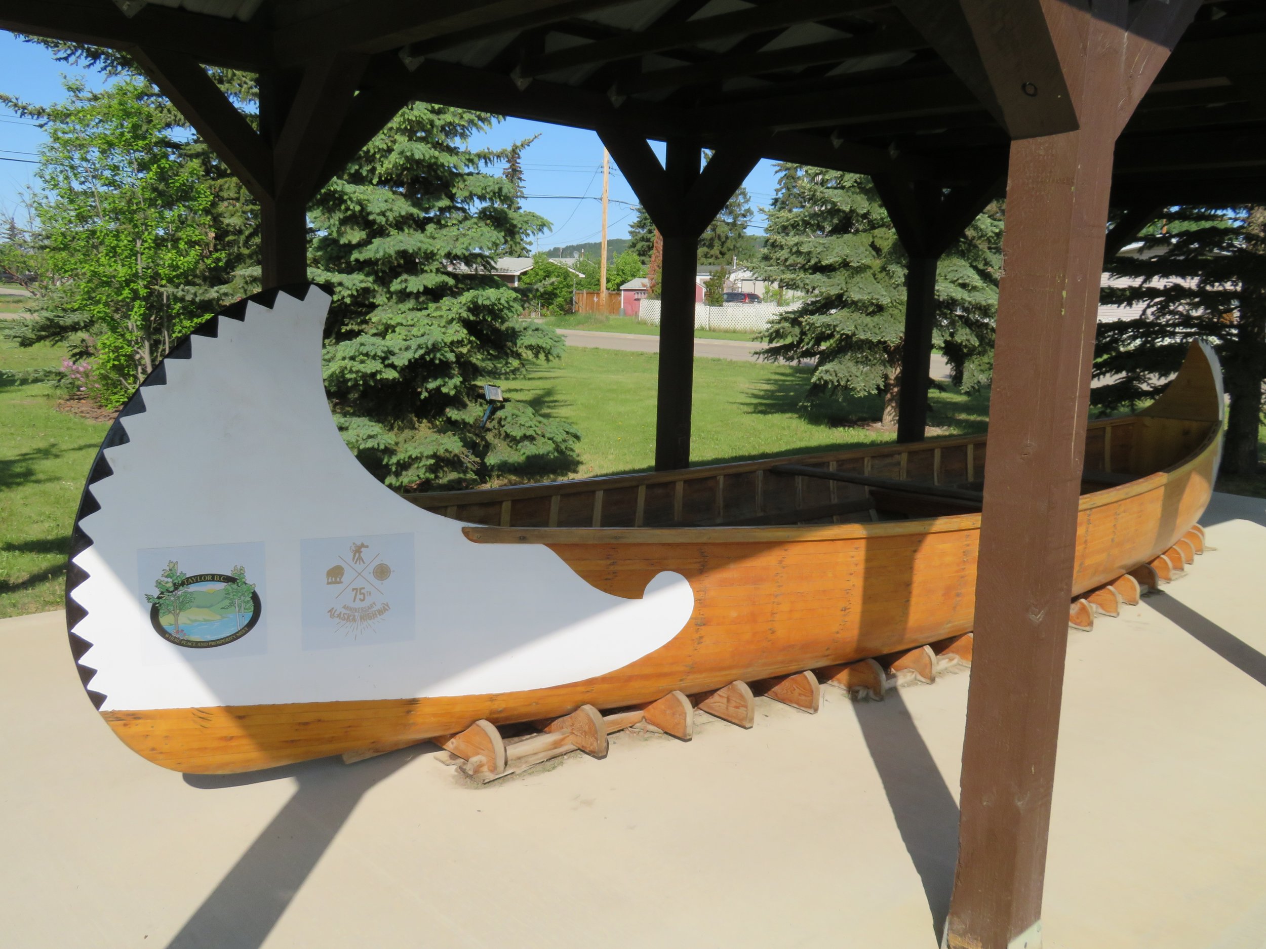
We stopped at the Visitor Centre in the little town of Taylor where Amanda and Marie greeted us enthusiastically. On display is a replica of Alexander Mackenzie’s canoe. In 1789 and 1793, Mackenzie, while working for North West Trading crossed the northern wilderness via Canadian rivers to reach the Arctic and Pacific Oceans.
There’s also a chainsaw carved gold-panner situated next to the Centre. Each year, Taylor celebrates Gold Panning Days for a full weekend in August. We’ll miss it, but I’ll bet it’s a fun event.

The day remained sunny, but had become cold and blustery. We passed through Fort St. John and stopped long enough to pick up some paint and materials for the Watson Lake sign and then being the lazy duffs that we are, picked up a campsite at Charlie Lake Provincial Park. We’d managed nearly 50 miles today before calling it quits.

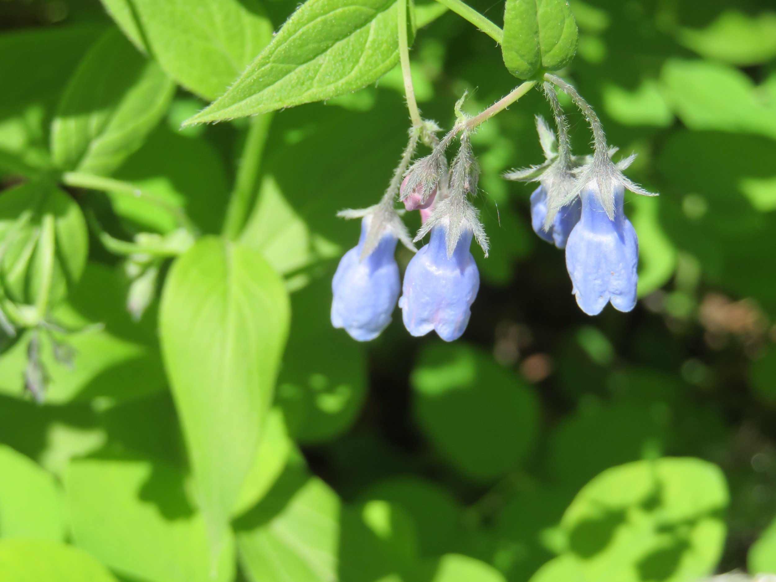
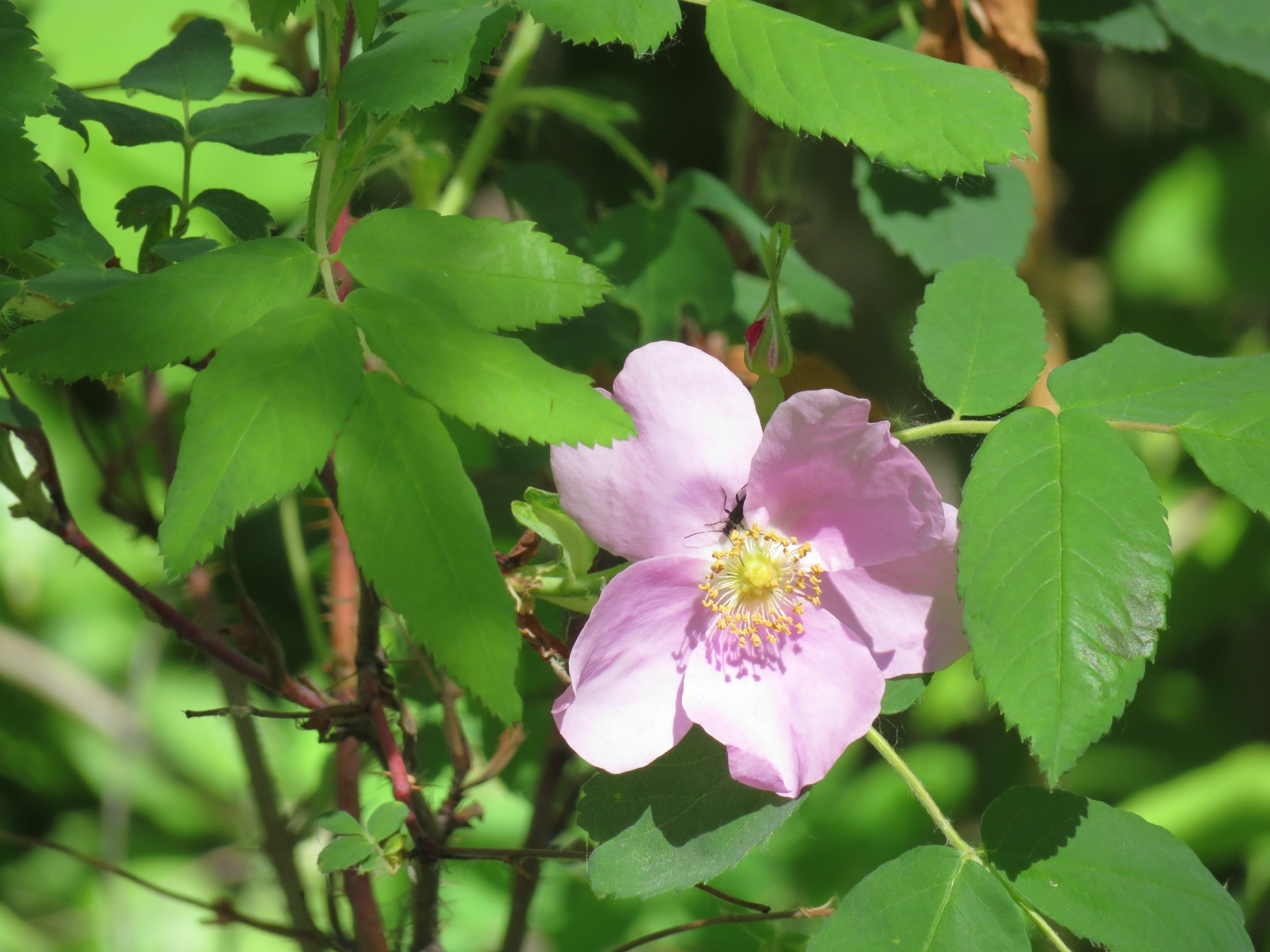
There are nearly 50 sites to choose from in this park and only a few were occupied. We chose a spacious one nestled in a grove of aspens. Canada violets, tall bluebells and wild roses grew in the undergrowth.

I made lunch/dinner while David began lettering our sign. The day warms up here as it gets later. Usually 6-7pm is the warmest part of the day and that’s how it was today. The wind abated and we sat in our camp chairs with the aspen leaves ‘quaking’ gently. A deer came to visit while we were sitting there.

The next morning was cold, cold, cold… in the 30s (0° C) and very brrrr-y on the bum as we headed to the vault toilets. We’ve been following the B.C. wildfires and checked the on-line map to see if the area in which we would be traveling was clear. Severe smoke advisories were in effect and though we’d planned a stop along the way, we opted to drive on through.
Timing is everything. We had our first moose sighting today! A cow and her twin calves hesitated on the side of the road and then bolted across, making it safely into the woods.


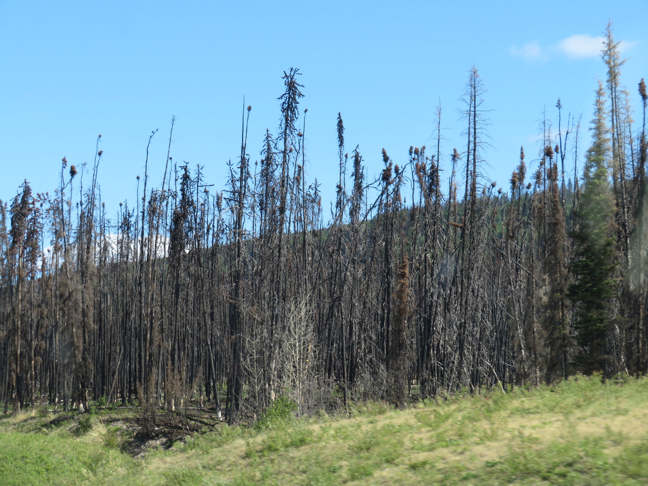
The Big Beaver Creek Fire of 2015 had burned 20,000 acres in this area and the residual wildfire damage was still evident.
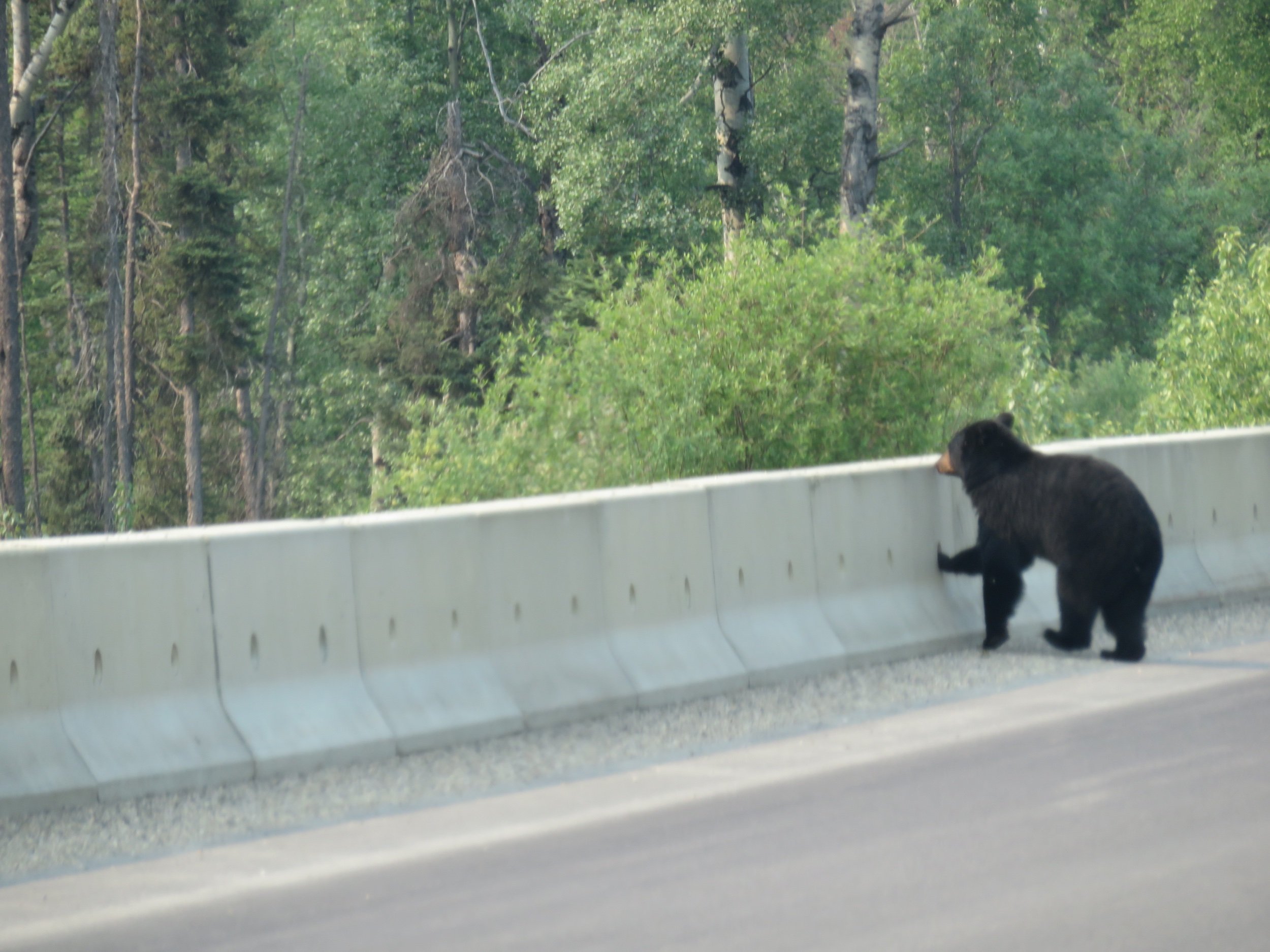
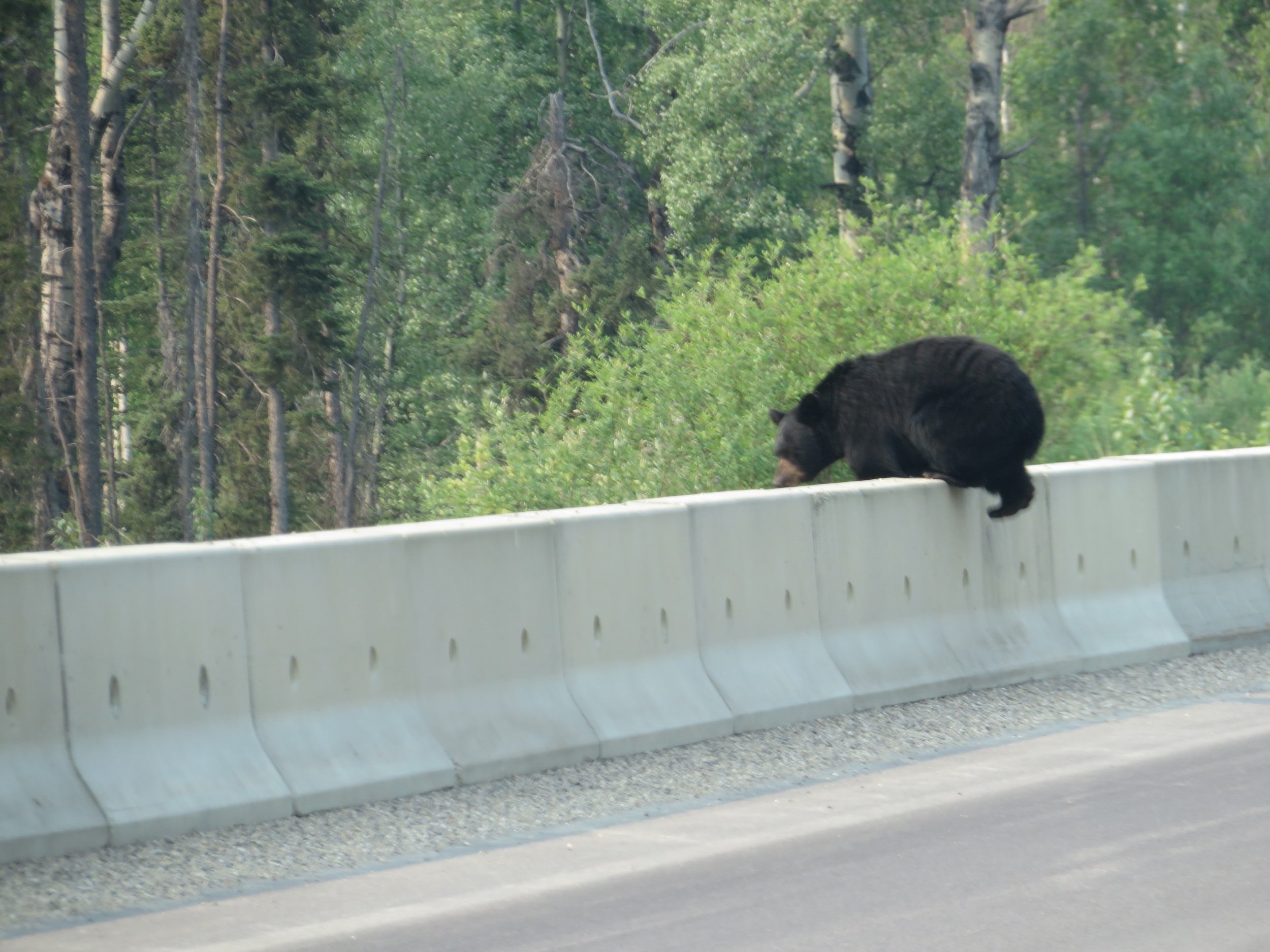
Two more black bear were spotted on the roadside. We wondered how one would make it over the barricade, but he didn’t hesitate for a second. Just tap on the thumbnails to enlarge them.

We stopped at the Triple G Campground in Fort Nelson for the night. It was nice enough in a rustic way with a saloon/restaurant, gift shops chock-a-block full of Alaska Highway souvenirs, hot showers ($1 for 5 minutes) and very slow Wi-Fi for a whopping $50/night with electric. Interesting to note that traveling as we are on a popular route is in many ways much the same as cruising in a sailboat. We will continue to meet people at the campgrounds or sites of interest or local supermarkets and then see them over and over again.
After finishing up our blogs and some chores, we took a long walk then stopped briefly at the Fort Nelson Heritage Museum, next door to the campground. Once again, an eclectic collection of stuff… old cars and tractors, memorabilia, a huge crayon, lots of old stuff… all in the yard in front of the museum, we didn’t even go in.


We were up early enough the next morning, but lollygagged around reading the paper, doing the crossword and the Wordle. You know how it is sometimes. Although the air was thick and acrid with smoke from the wildfires east of us, the fires themselves were not a threat to us. Visibility was definitely reduced.

We stopped at the Tetsa River Lodge, highly recommended for their cinnamon buns. Gail, owner and baker, makes several batches a day, everyday. Though we usually avoid sweets, we made an exception here. Oh, my! We’ll walk a bunch of extra steps later today.

Similar to Rocky Mountain bighorn sheep, stone sheep (aka Stone’s sheep) are smaller and darker in color and found primarily in northern B.C. As we passed through the area of Summit Lake which is noted as a good place to see them, we were disappointed when we didn’t see any.
In the distance, we could see the gray, barren peaks of the Canadian Rockies and as we went over a mountain pass, the smoke abated and the air cleared. Rivers and lakes looked clear and pristine. The aquamarine waters of Toad River were especially beautiful.

A bull moose appeared out of nowhere on the side of the road.

Then, at Muncho Lake… stone sheep… lots of them and even a lamb.. What a beautiful sight.

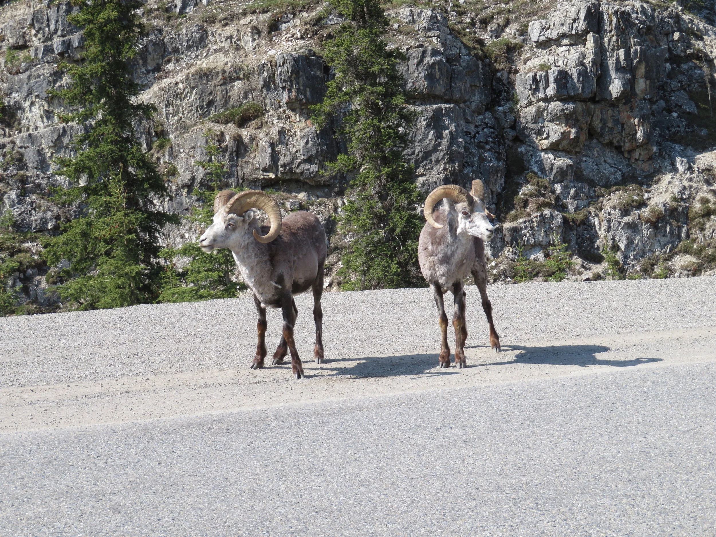

And my favorite stone sheep photo…

We stopped at the Mineral Licks Trail, a noted spot for animals and saw nary a one. But… I did see Mistassini primrose, small round-leaved orchids and yellow lady’s slippers, so it wasn’t a complete loss. We still use the iNaturalist free app, ‘Seek’ for identifying just about any living thing, especially flowers and trees.


It was getting later in the day when we pulled into the Liard Hot Springs Provincial Campground. We fortunately snagged the very last campsite and settled in. The hot springs are well known in the area and entry was included in the campground fee. The walk to the springs is across a large boggy area accessed via a boardwalk. The sulphur-y smell of the springs met us as we drew near. We’re not what you’d call ‘hot springs’ people, so though we enjoyed seeing them, we preferred to take a nearby nature walk. We gave the springs a pass thus allowing others to have a little more room to splash around and soak.

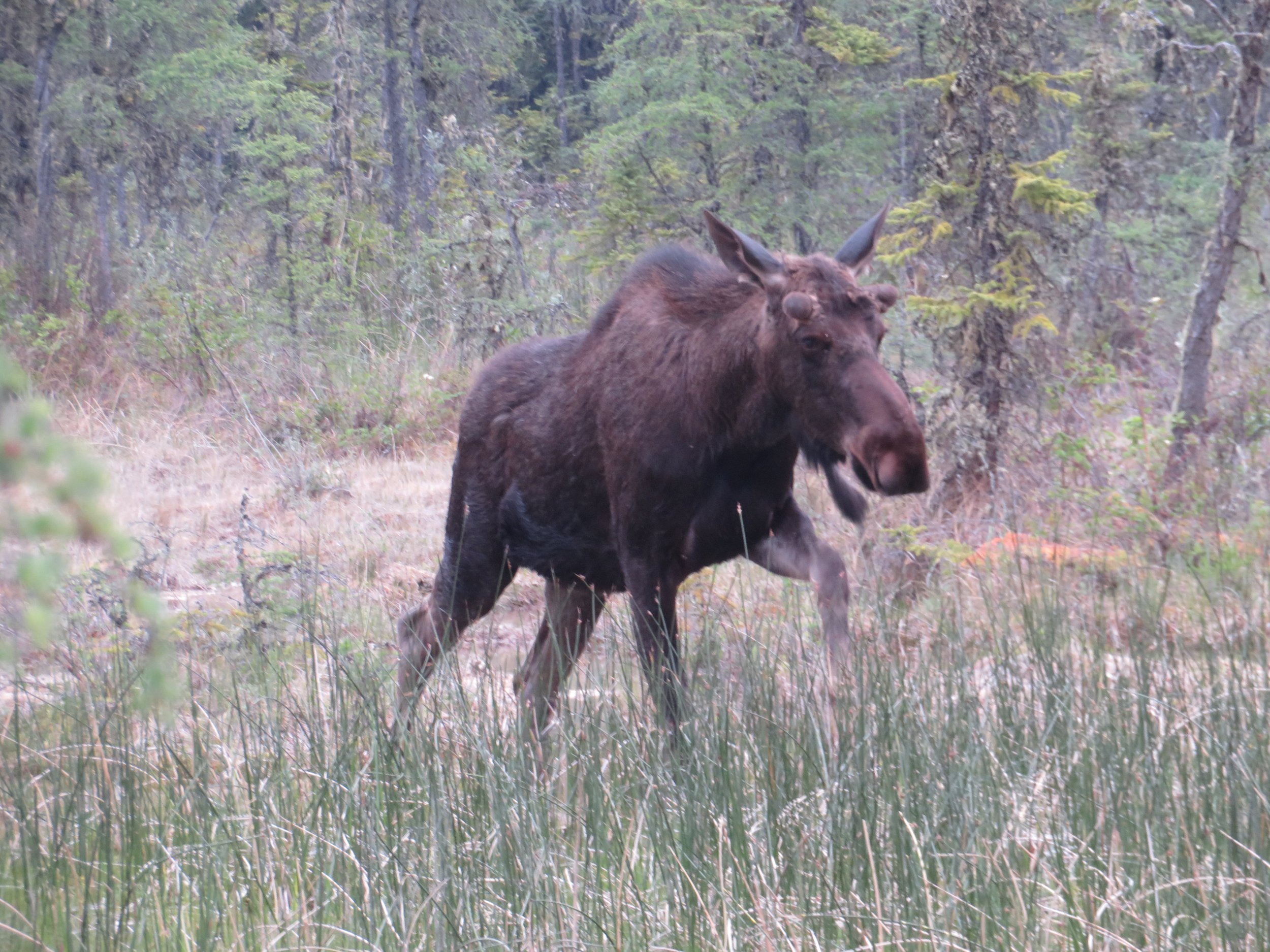
As we returned across the boardwalk, we caught sight of a moose munching its way through the bog’s tender roots. We stopped and he kept on coming. We finally eased our way off the boardwalk, while others joined the crowd of moose-watchers.

We returned to Blanche and David commenced to working on our Watson Lake sign. Sitting outside at the campsite picnic table, he worked and worked and lettered and lettered. We planned to be in Watson Lake the next day and he was feeling pressured to get it done. He lettered and he erased and lettered again. The engineer in him would get it done and done perfectly. After two hours, I coaxed him back into Blanche. Perhaps, we didn’t need a sign after all?
Join us next time as we cross into the Yukon Territory, check out the Watson Lake ‘Sign Forest’, see more wildlife, and then visit Yukon’s capital city, Whitehorse.