

Welcome to the Spit
/When we returned to the campground after our Kenai Fjord’s boat trip, we found a serious looking notice attached to Blanche’s driver’s side door indicating that our vehicle was not allowed to park in the camping section, it had to park in the RV section across the street. We were duly warned that failure to move to the other side of the street would be grounds for fines and other potential dire consequences. Hmm! We moved, but not to the other side of the street. First, we had a mediocre, albeit quite expensive, dinner at Ray’s Waterfront restaurant, then we left Seward altogether and found a turnout about 20 miles up the road to spend the night.
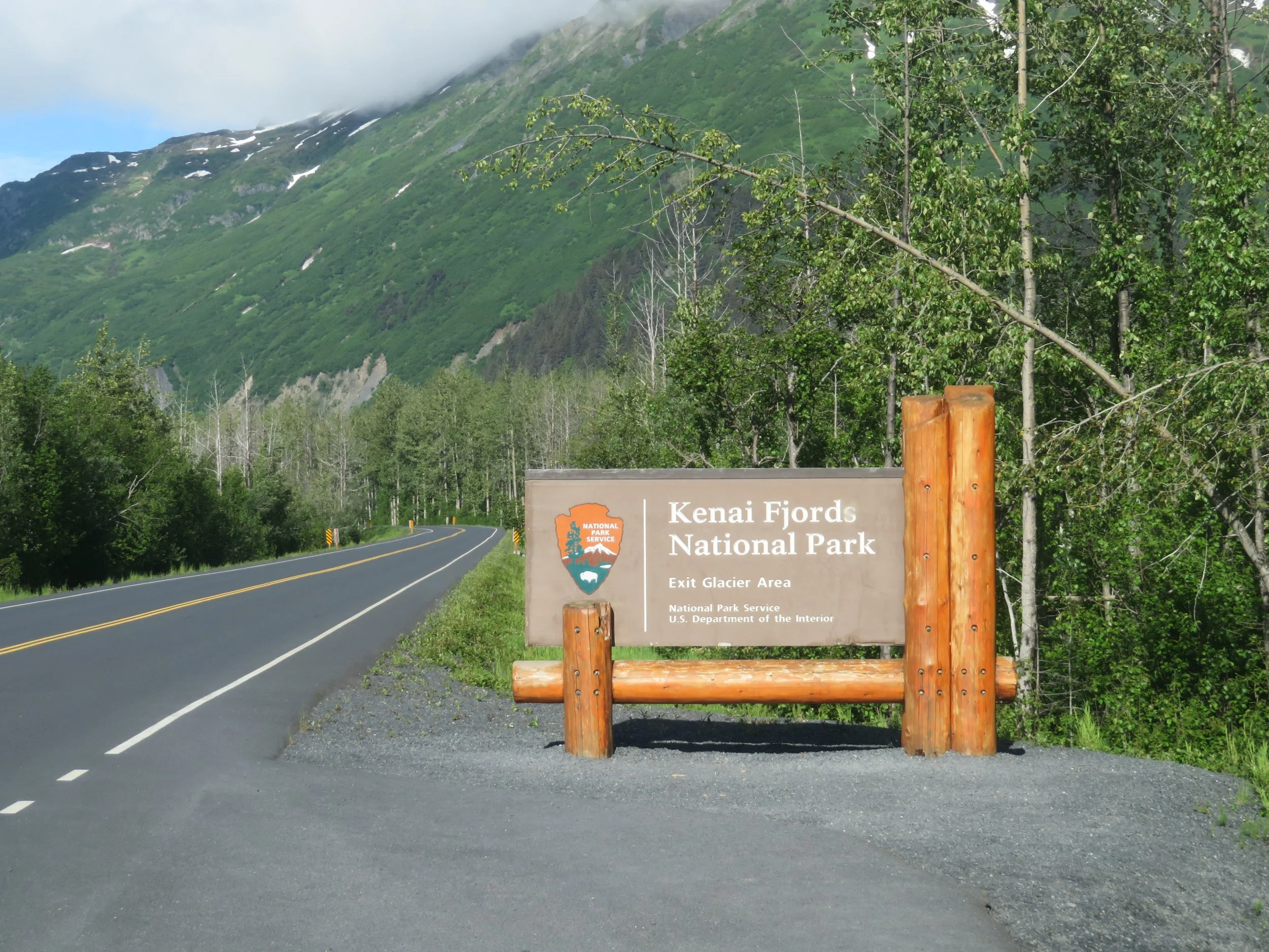

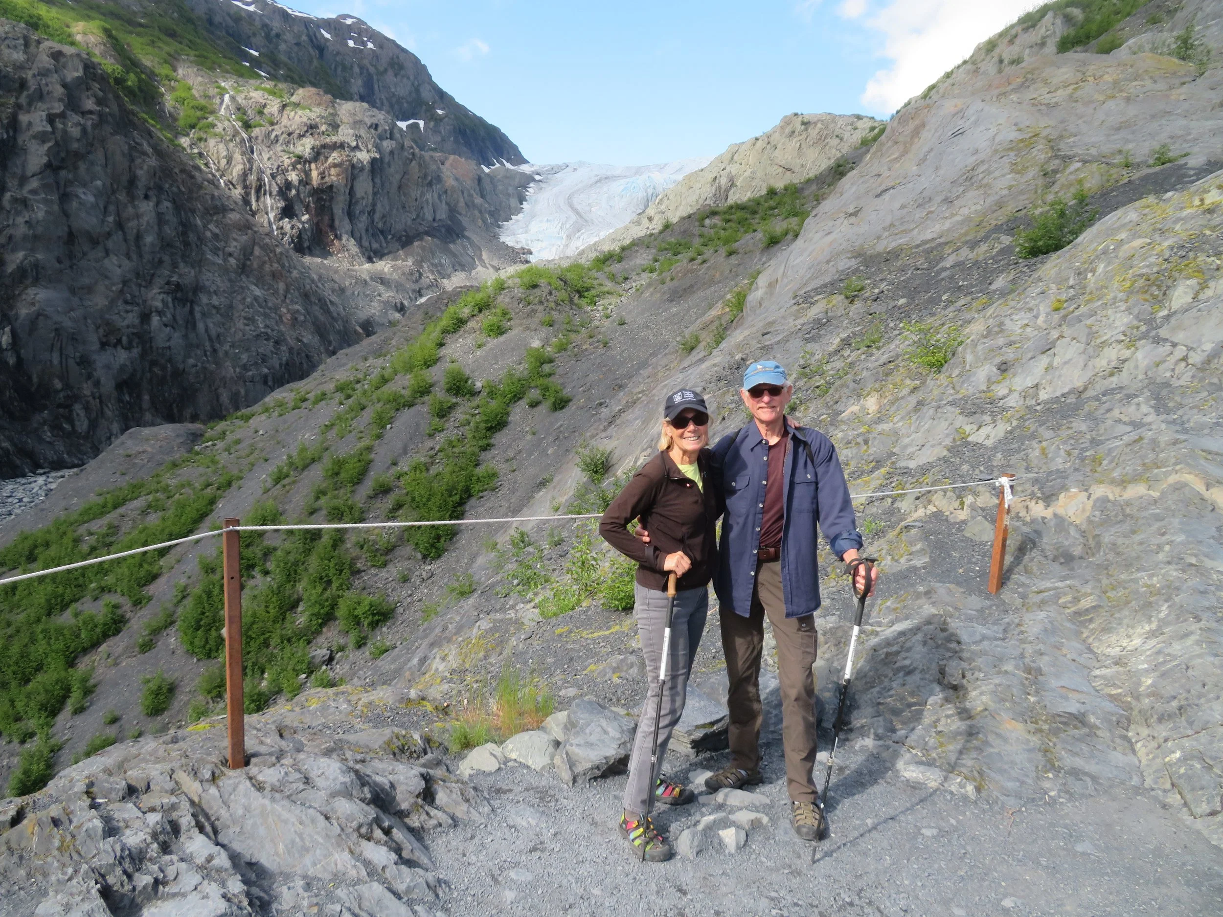
What’s this? Sun? Yup, a sunny morning dawned. We backtracked a few miles to visit Kenai Fjord’s National Park… along with a zillion other tourists, many of whom arrived by the bus load. The Nature Center there was informative with a helpful staff that provided a trail map for the Exit Glacier Overlook, the closest we could get to the glacier other than flight-seeing.
At 14 mi², Exit Glacier is one of the smaller glaciers spawned by the Harding Icefield which covers 700 mi² at a depth of 1000-4000’ and the largest icefield entirely within the USA. Exit Glacier is, however, the only glacier accessible by road in the Kenai Fjords National Park and a short hike from the Nature Center.
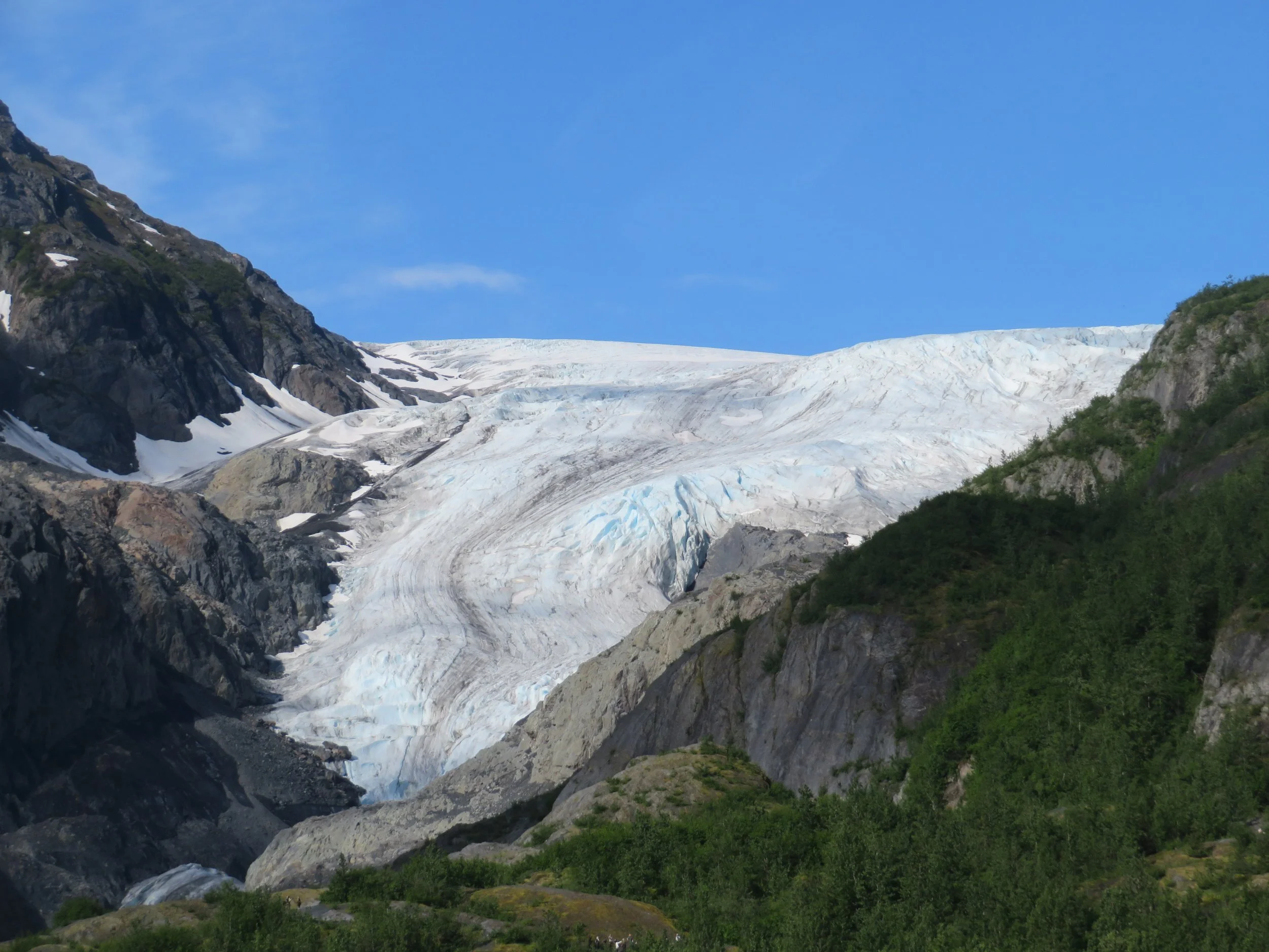
A ‘valley’ glacier, Exit descends ~3000’ in four miles providing a great vista from the overlook accessed via an easy 2-mile loop trail. Due to constant recession over the past years, it’s not possible to walk up and touch the glacier any longer, but you can get pretty close, feel its ‘cold’ and, if you listen carefully, hear it ‘talk’.
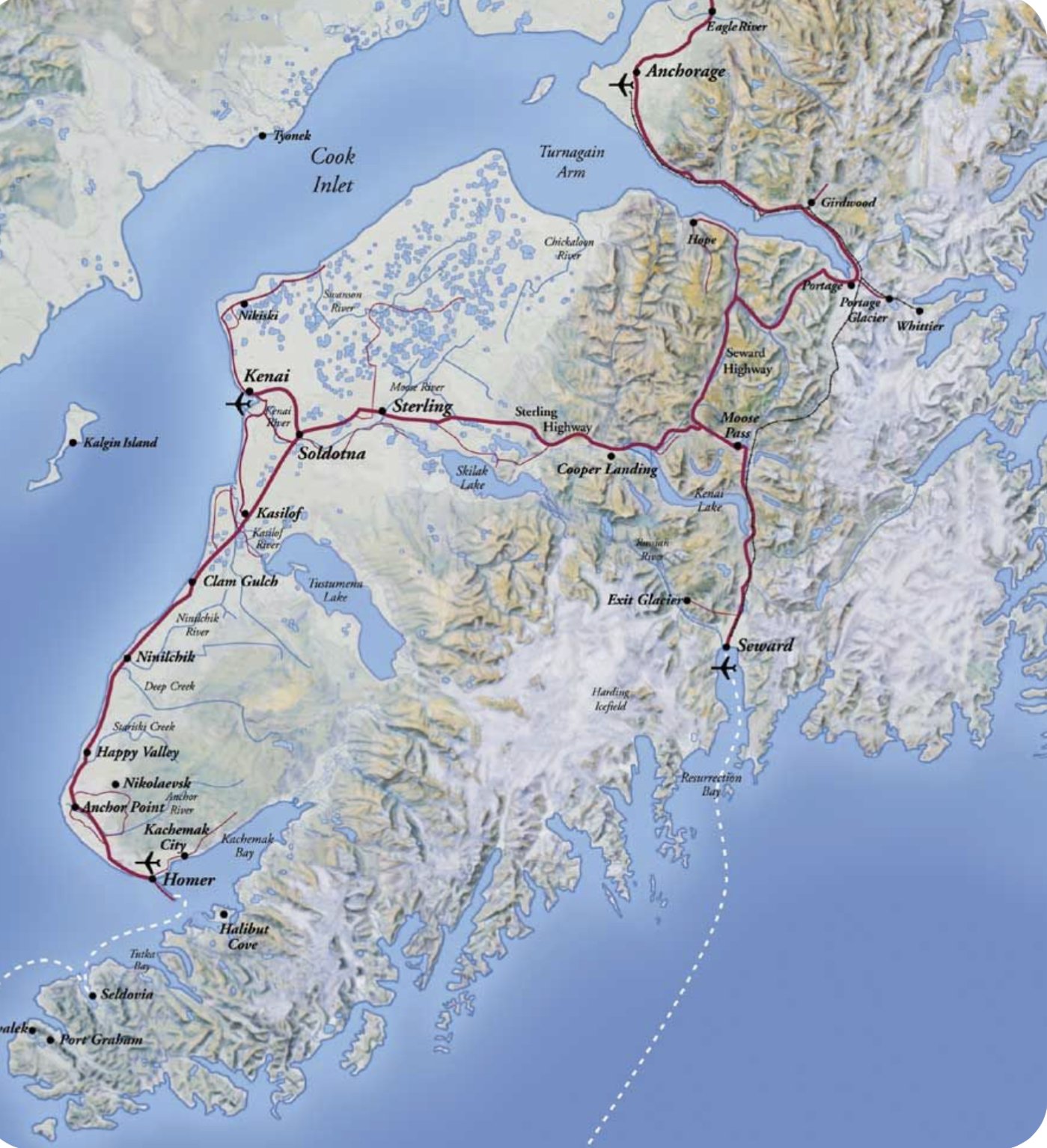
We returned to the Seward Highway heading north, the odometer read 8,000 miles and still so much more to see and do. We hung a left onto the Sterling Highway heading west en route to Homer, the extreme southwestern tip of the Kenai. Here’s the Kenai Peninsula map again so you can see the route.
We stopped briefly at the Quartz Creek Campground and ‘borrowed’ a site long enough to cook up several meals on the outside chance that it just ‘might’ rain again. Heading west we passed the impossibly turquoise-blue waters of Kenai Lake.
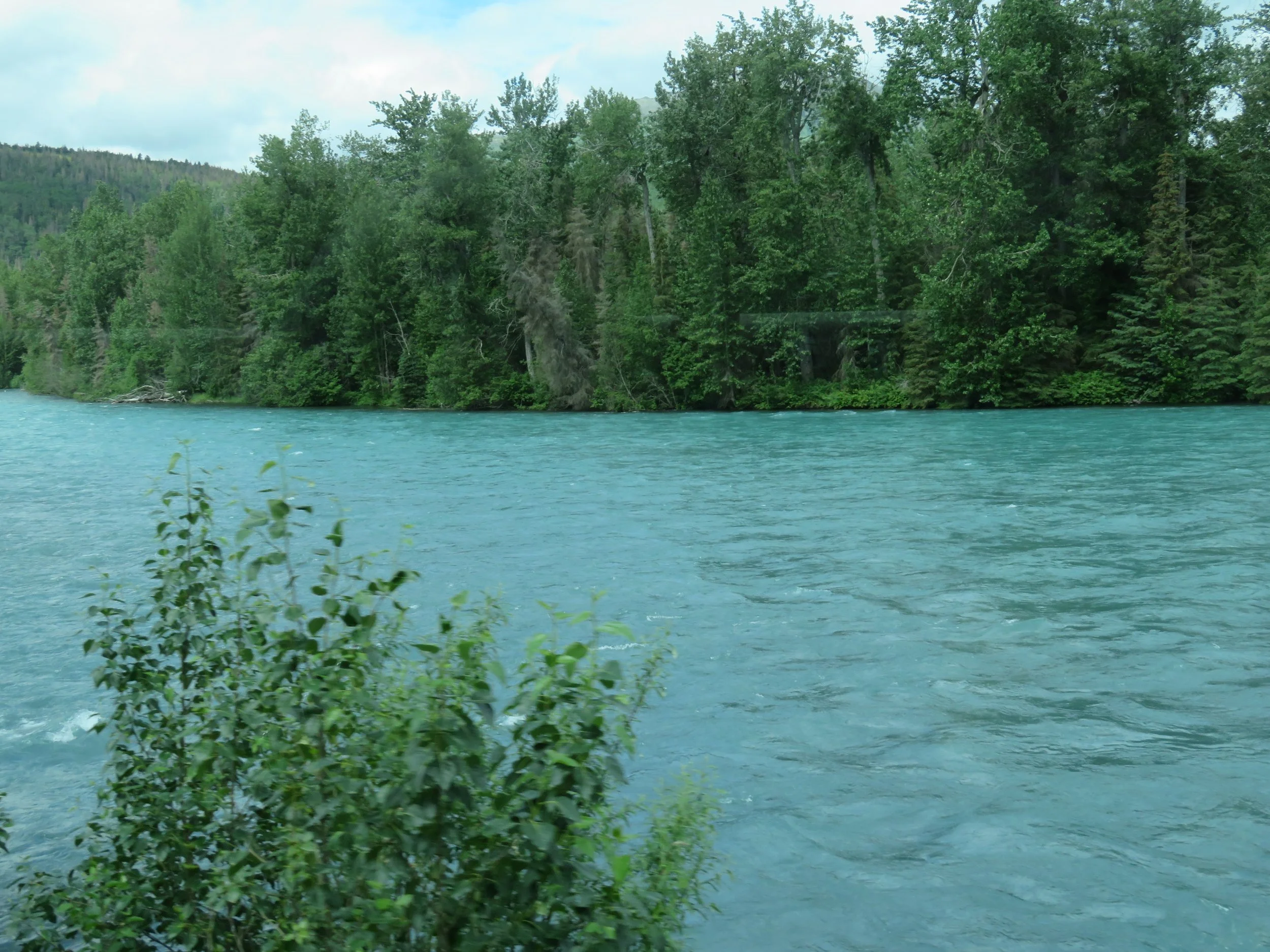
The waters of Kenai River are world famous for fishing and the tiny town of Cooper’s Landing offered every and all forms of fishing gear, bait & tackle, waders, canoe/boat rentals, fishing guides, tours and lodging for anglers and non-anglers alike.
We stopped at Wildman’s, a liquor/general store/cafe/ice cream shop in search of an ice cream cone. We haven’t had ice cream since Tillamook Creamery in Oregon, not because ice cream has not been available, but because I’m very finicky about my ice cream flavors. Though we’ve stopped at several shops, so far there hasn’t been a flavor on which I’d consider wasting the calories. Bubblegum? Birthday Cake? Rainbow Sherbet? Gummy Bear? Wildman’s didn’t make the cut and we continued on without ice cream.
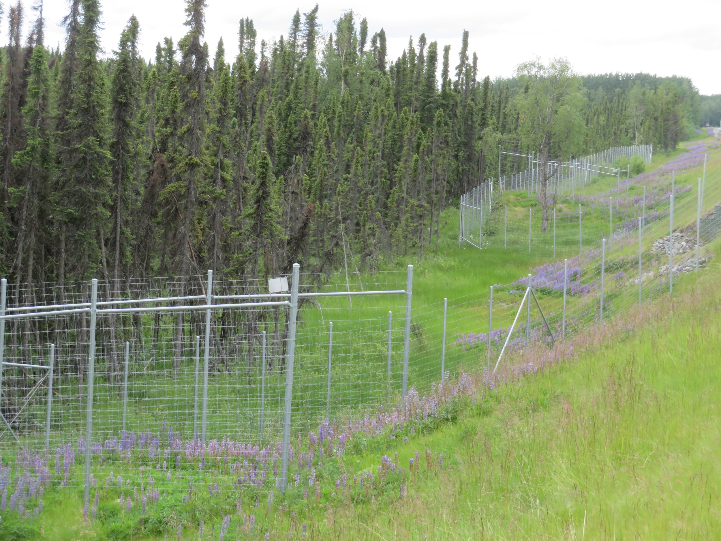
The moose population in this area is evidently extremely high and the moose really like crossing the highway thus the collision rates are high. An elaborate system of high fences that attempt to channel the moose to highway underpasses has been constructed.
We camped at Johnson Lake Campground for the evening and resumed our drive to Homer the next morning. Further down the Sterling Highway, we turned off onto a gravel road to visit the Holy Transfiguration of Our Lord Russian Orthodox Church in Ninilchik. Built in 1901, this beautiful little church sits atop a bluff overlooking the Cook Inlet. This was, of course, Russian territory prior to 1867 and the Russian Orthodox influence still remains here in many communities.

Behind a white picket fence beside the church, graves marked with white iconic Russian Orthodox crosses lie serenely in a churchyard overgrown with weeds and wildflowers. Narrow paths, about 18” wide, had tromped down the high grass and led to the front door of the church.
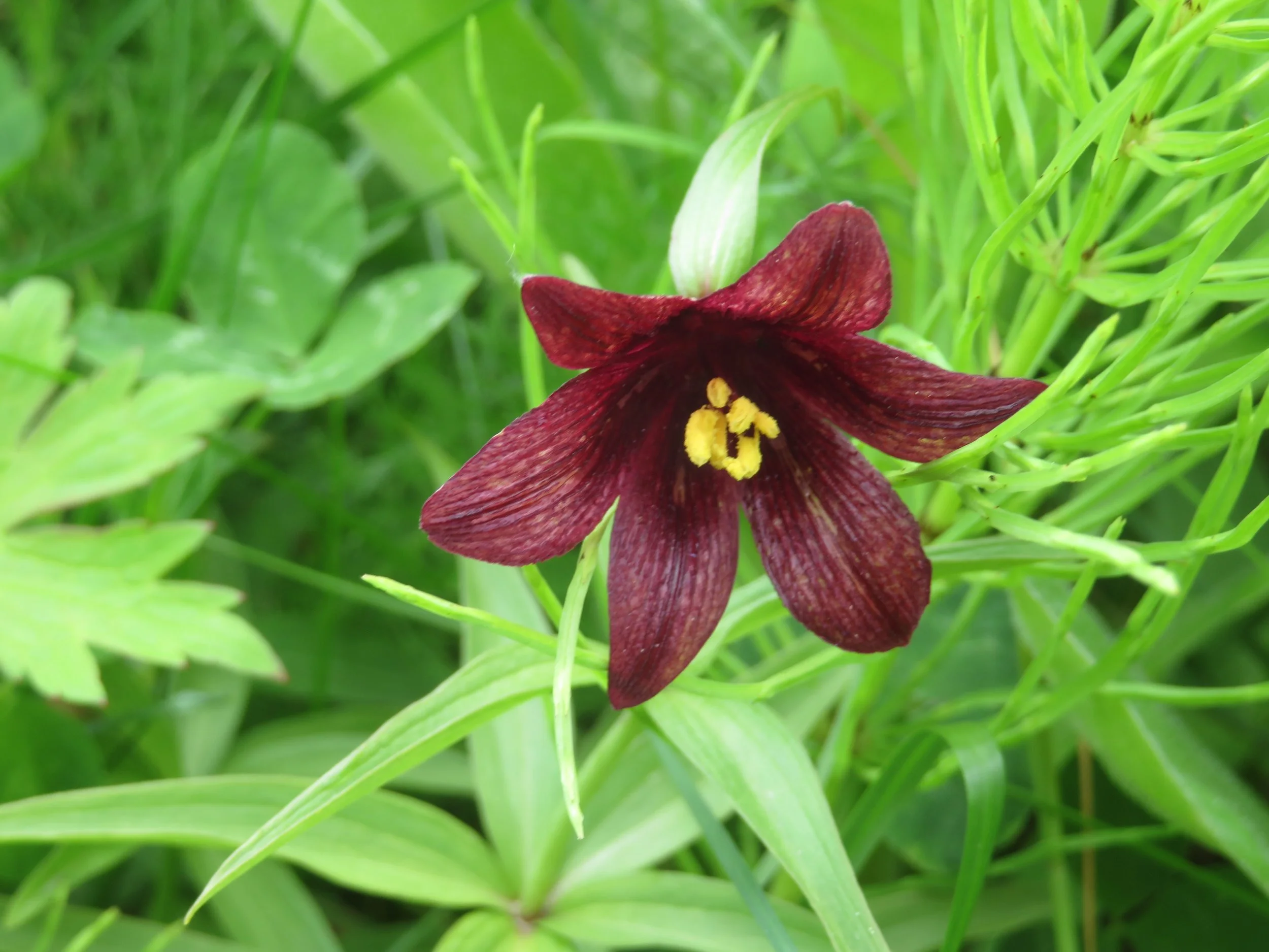
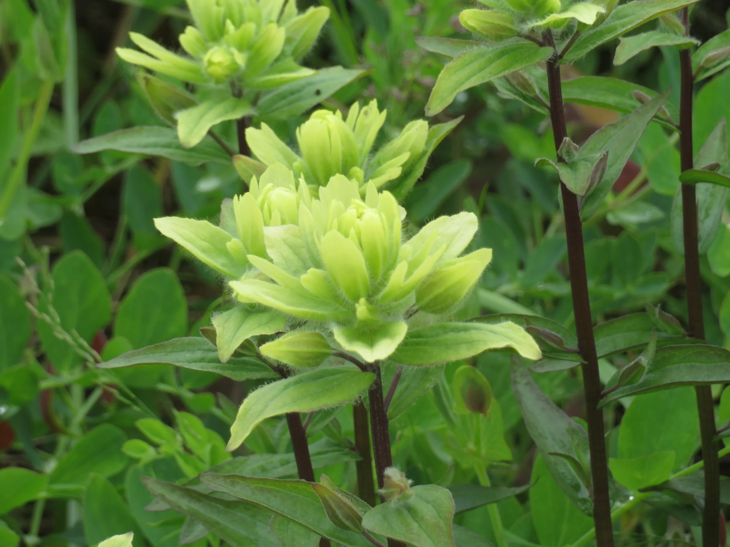
The parish is still active and worship was in progress so we didn’t go in, but we did enjoy the views and the gorgeous wildflowers, among them bright blue cornflowers and delicate chocolate lilies aka Kamchatka fritillary or wild rice, a new species observation for us.
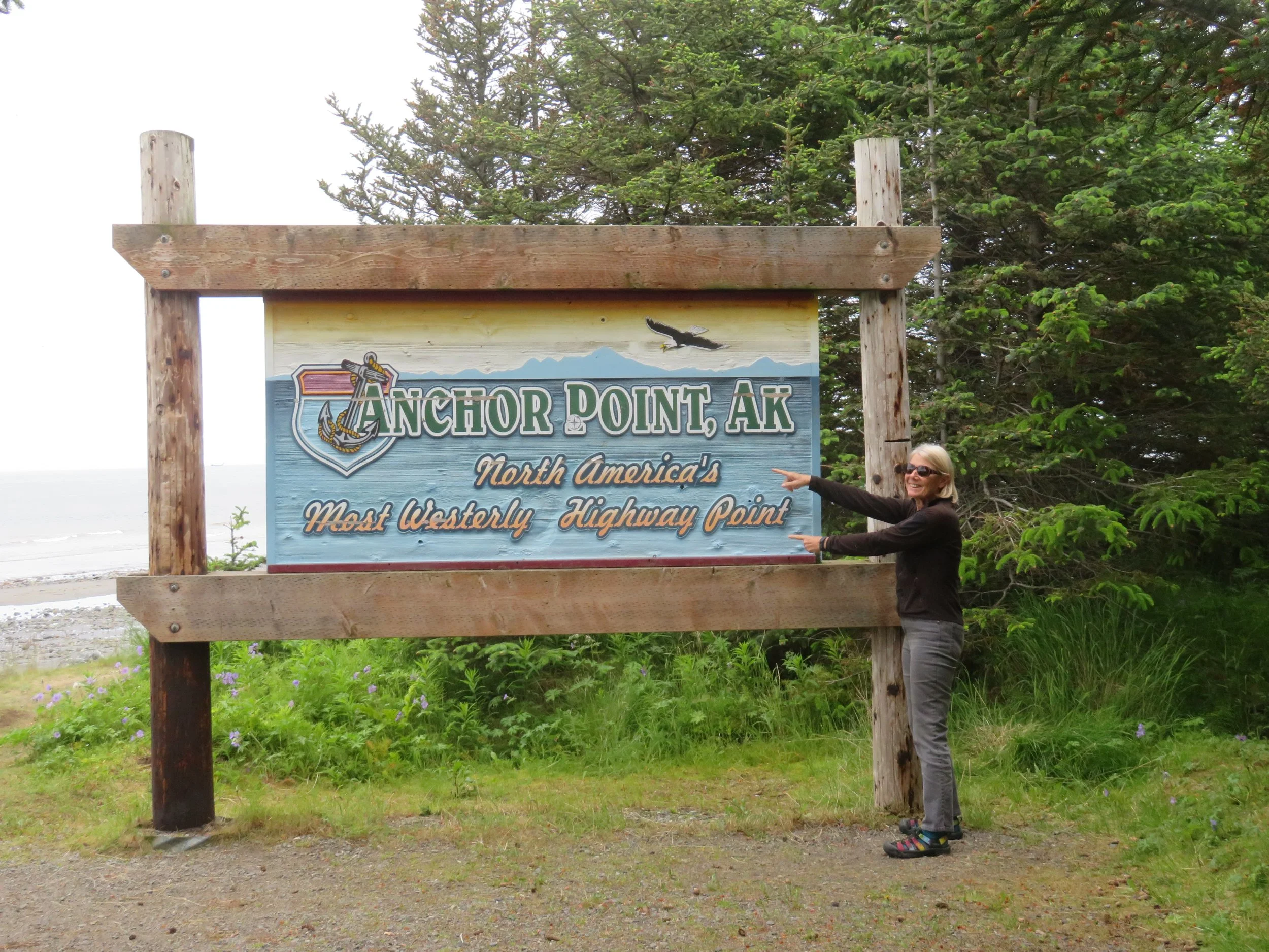
Back on the Sterling Highway, we took another brief detour to Anchor Point, so named because Captain Cook lost an anchor here… very clever name, Captain. Anchor Point claims the title of the ‘North America’s Most Westerly Highway Point’. The Milepost guide continues to be an excellent resource for us and we consult it regularly before and during our travels to make sure we don’t miss anything.
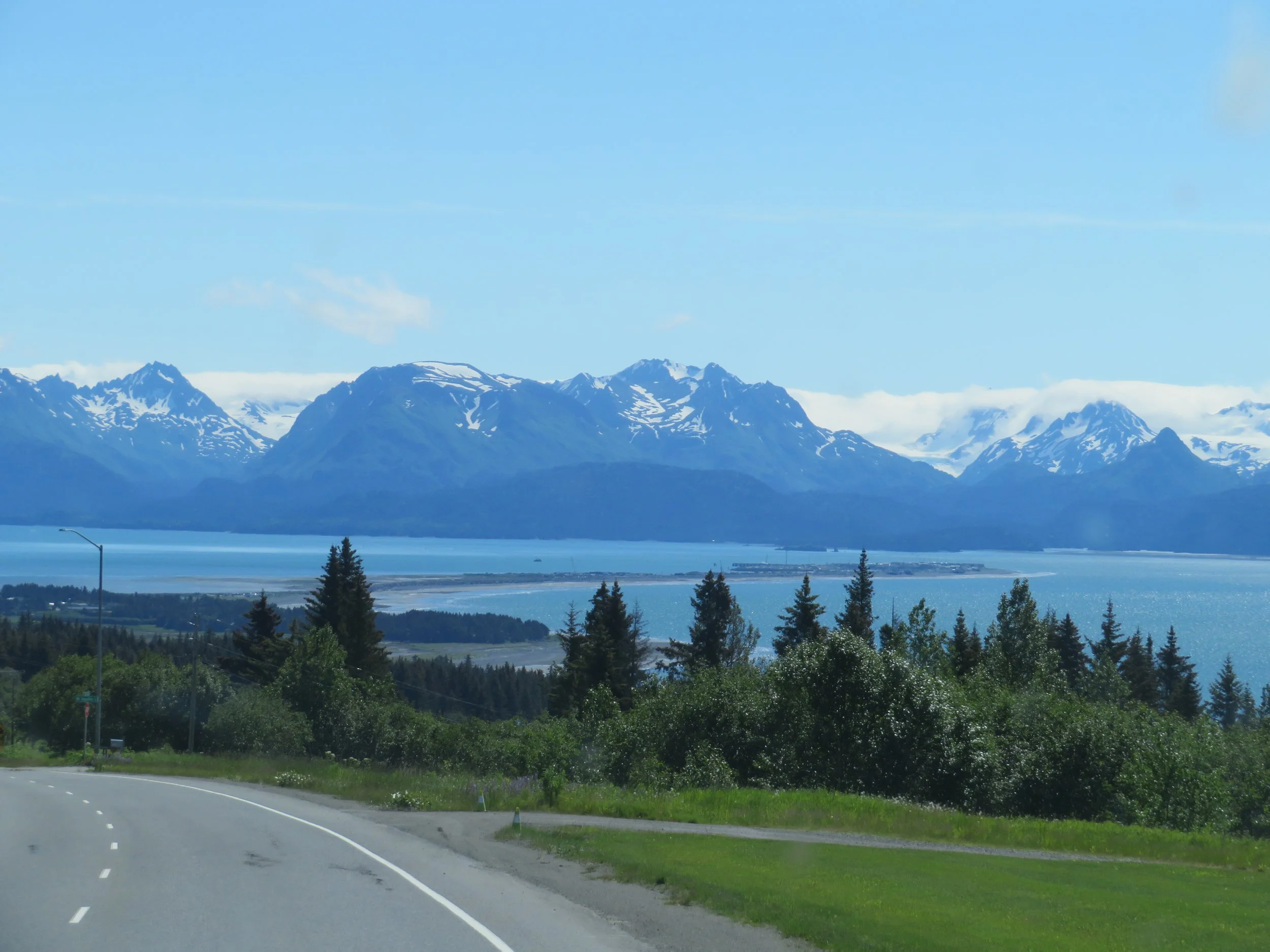
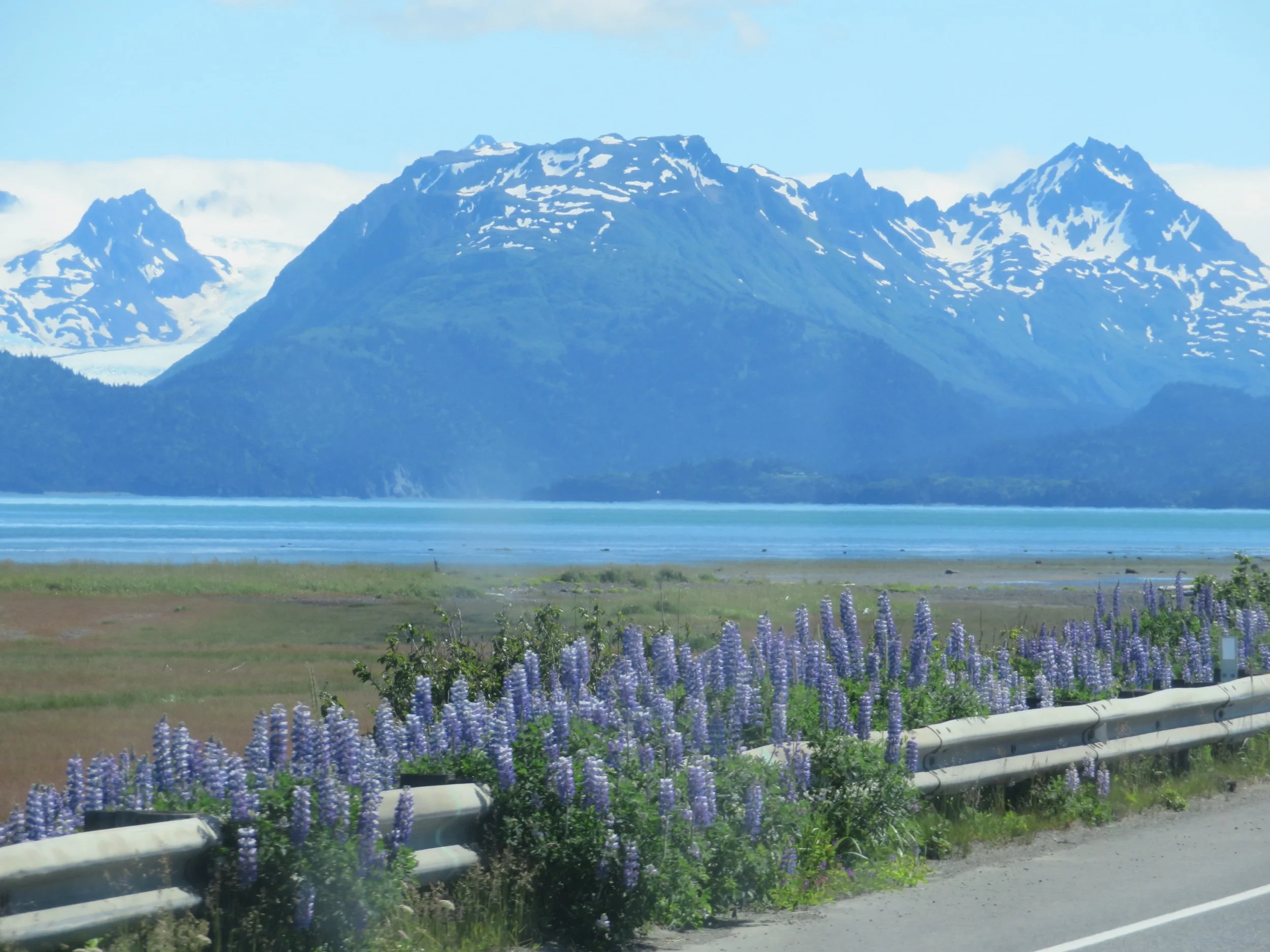
Another 20 minutes and we were coming over the hill and looking down on the Homer Spit at last. We’ve driven this road twice before and on a gorgeous day like today, we still consider it one of the most beautiful sights in the world. The extremely thin slip of land that juts out into Kachemak Bay is known as ‘The Spit’, the abrupt terminus of the Sterling Highway. According to several sources, “the Spit features the longest road (4.5 miles) into ocean waters in the entire world”.
We arrived midday and secured a site at the Ocean Shores RV Park (~$65/night with veteran’s discount). Though it’s a typical RV park with tight quarters, it was on a bluff overlooking the bay which kind of made up for the close proximity to our neighbors.
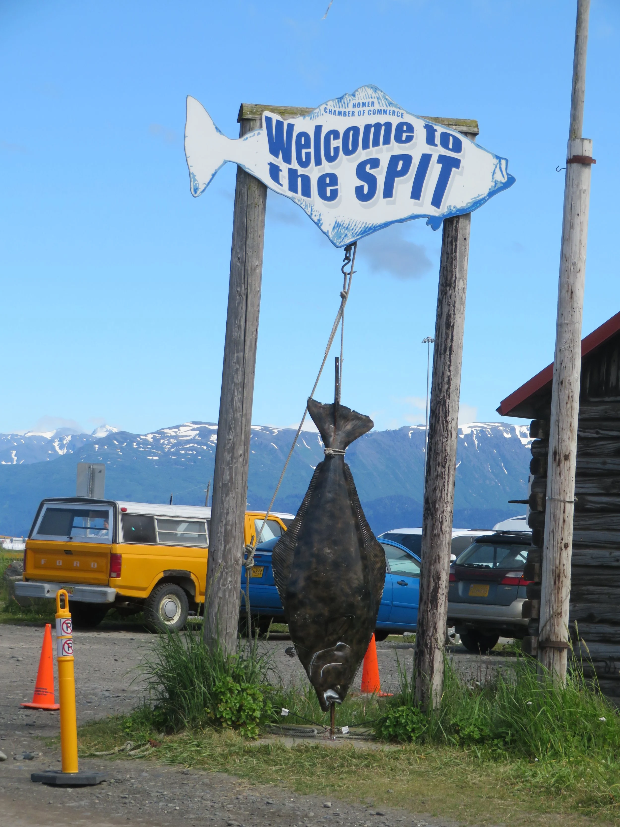
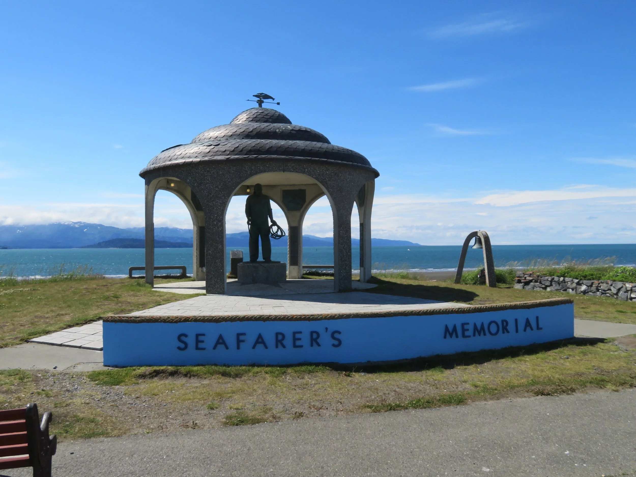
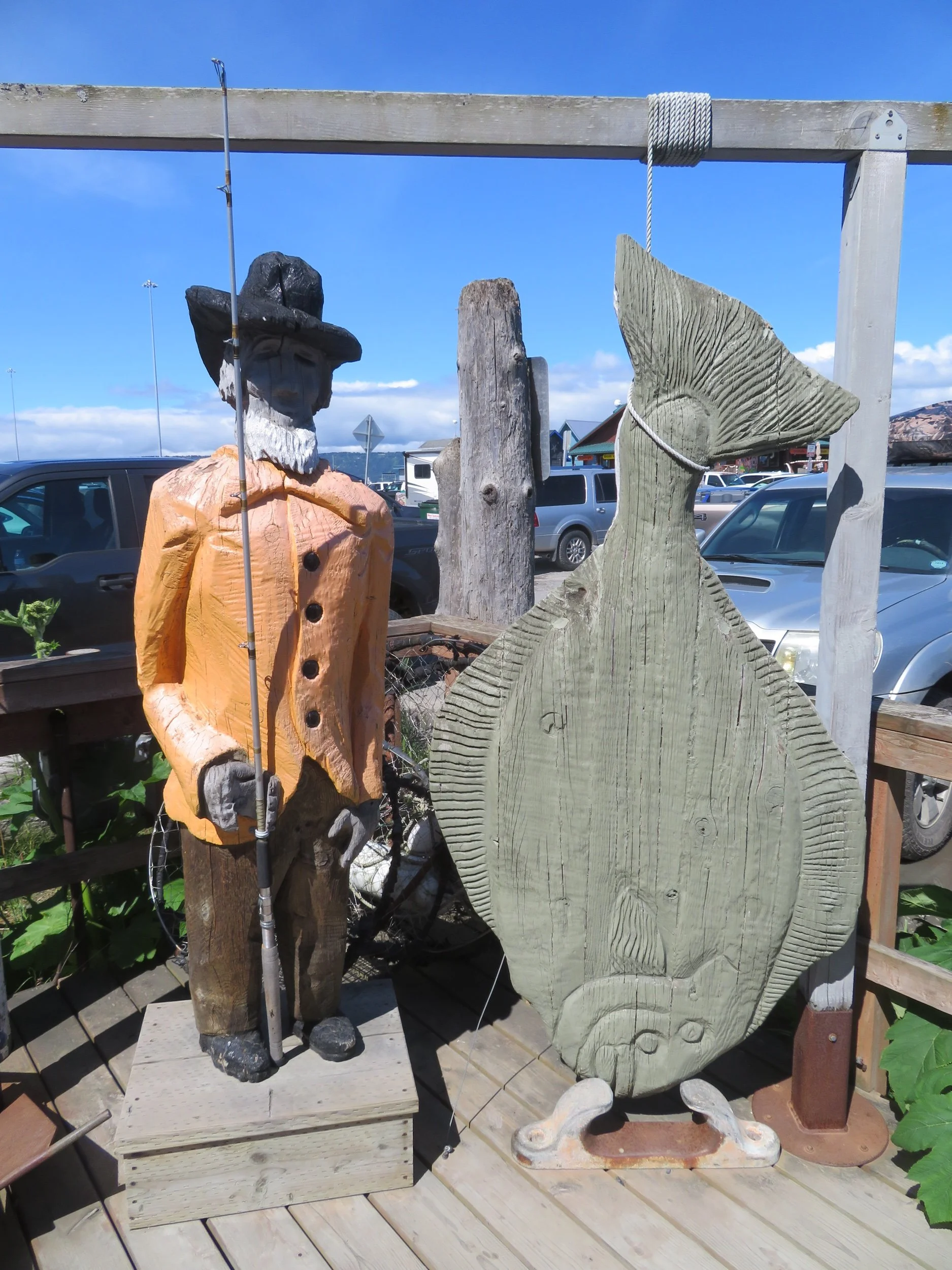
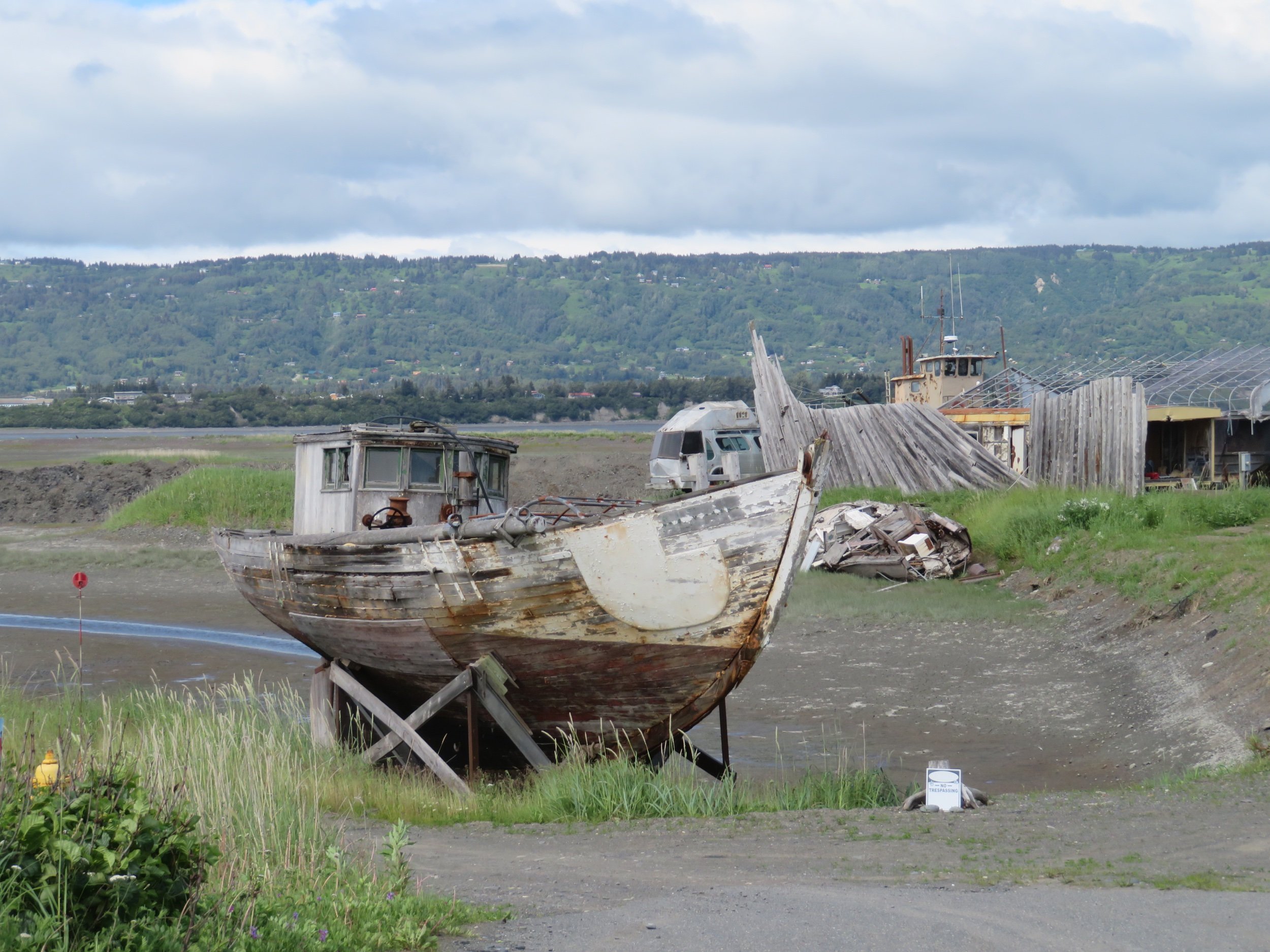
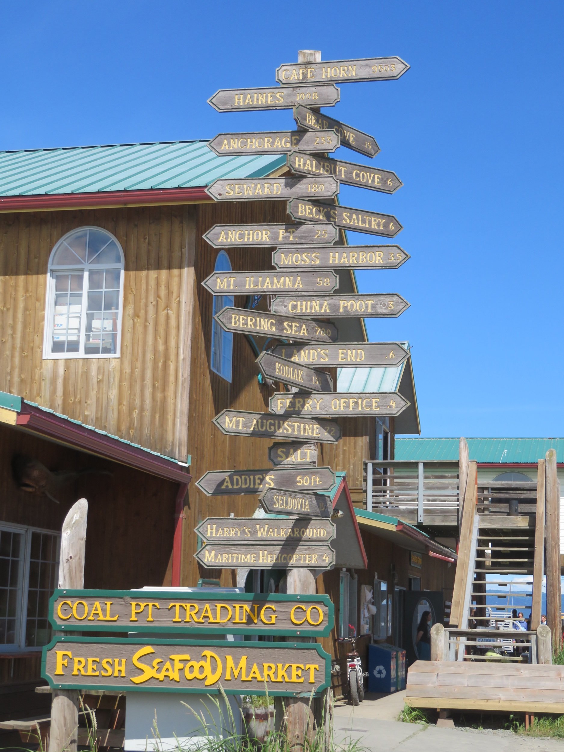
We wasted no time in driving down to the Spit which is home to the small boat harbor, the ferry and cruise ship terminals as well as most of the tourist attractions for the town. We had to park 1/2 mile away (good for the daily ‘step’ count) and thread our way through masses of people to get to the many shops and restaurants that line the single, narrow road. Take a look at some of the sights along the way…
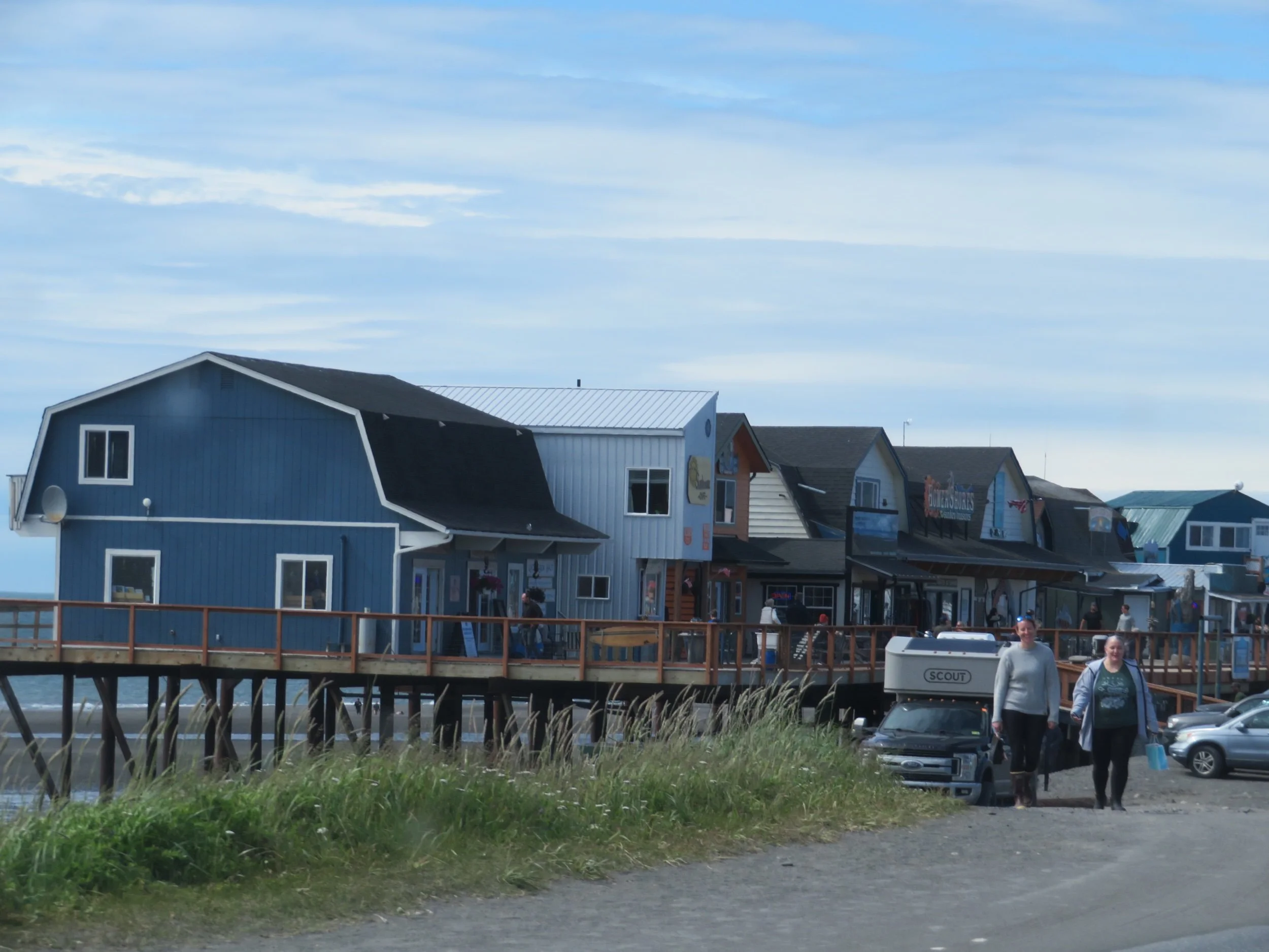
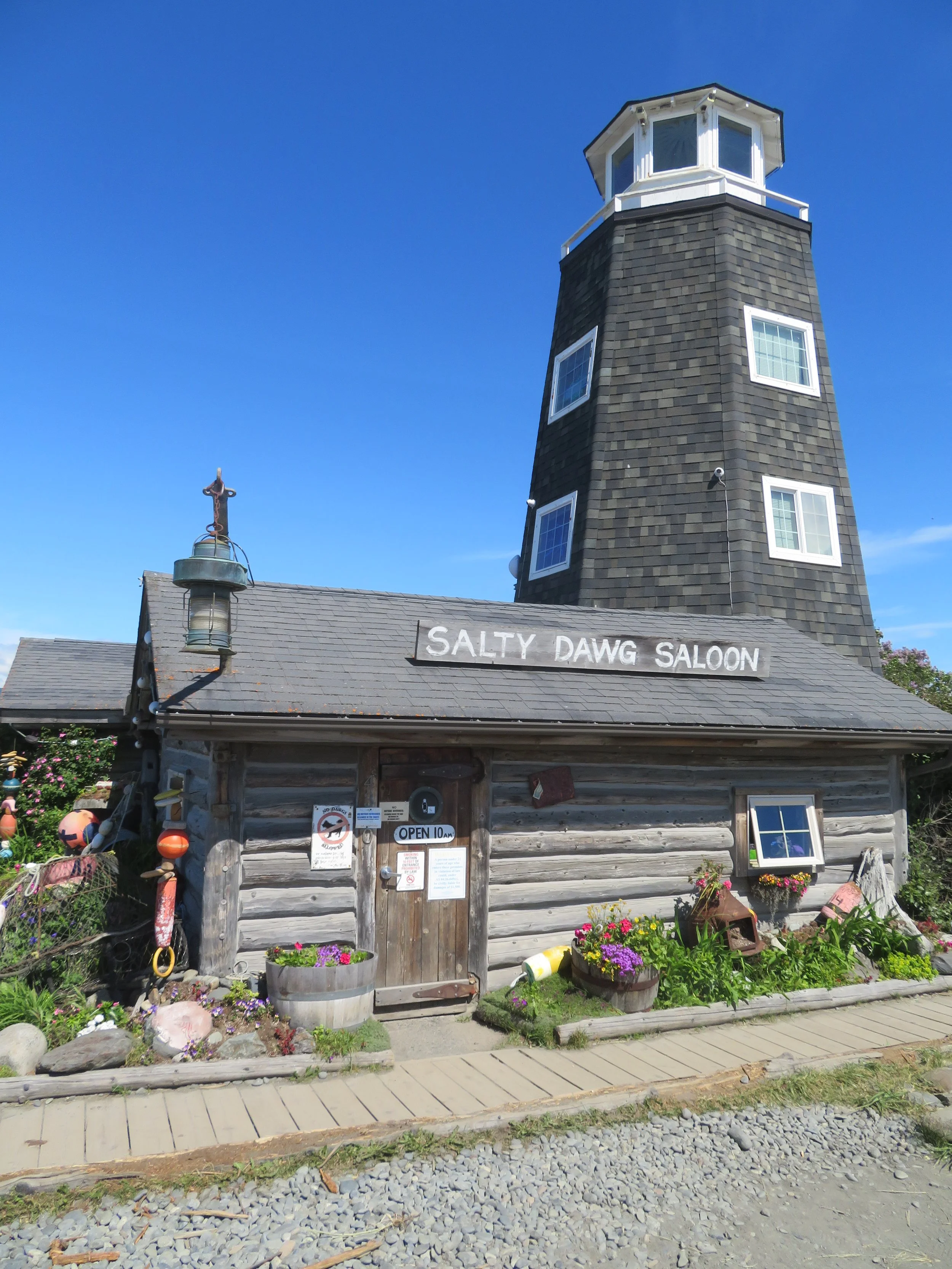
We pottered up and down the street and along the boardwalk, peeking into this shop, wandering into that one, and alternately checking out the many restaurant menus. We poked our heads into the Salty Dawg Saloon.
From the Salty Dawg’s website: “The Salty Dawg started out as one of the first cabins built in 1897, soon after Homer became a town site. It served as the first post office, a railroad station, a grocery store, and a coal mining office for twenty years. In 1909 a second building was constructed, and it served as a school house, post office, grocery store. And at one time, it housed three adults and eleven children. It was acquired in the late 1940’s by Chuck Abbott to be used as an office for Standard Oil Company. In April of 1957, he opened it as the Salty Dawg Saloon.” It has passed through several owners since then, but it’s still one of the most historical buildings and watering holes in Homer. \
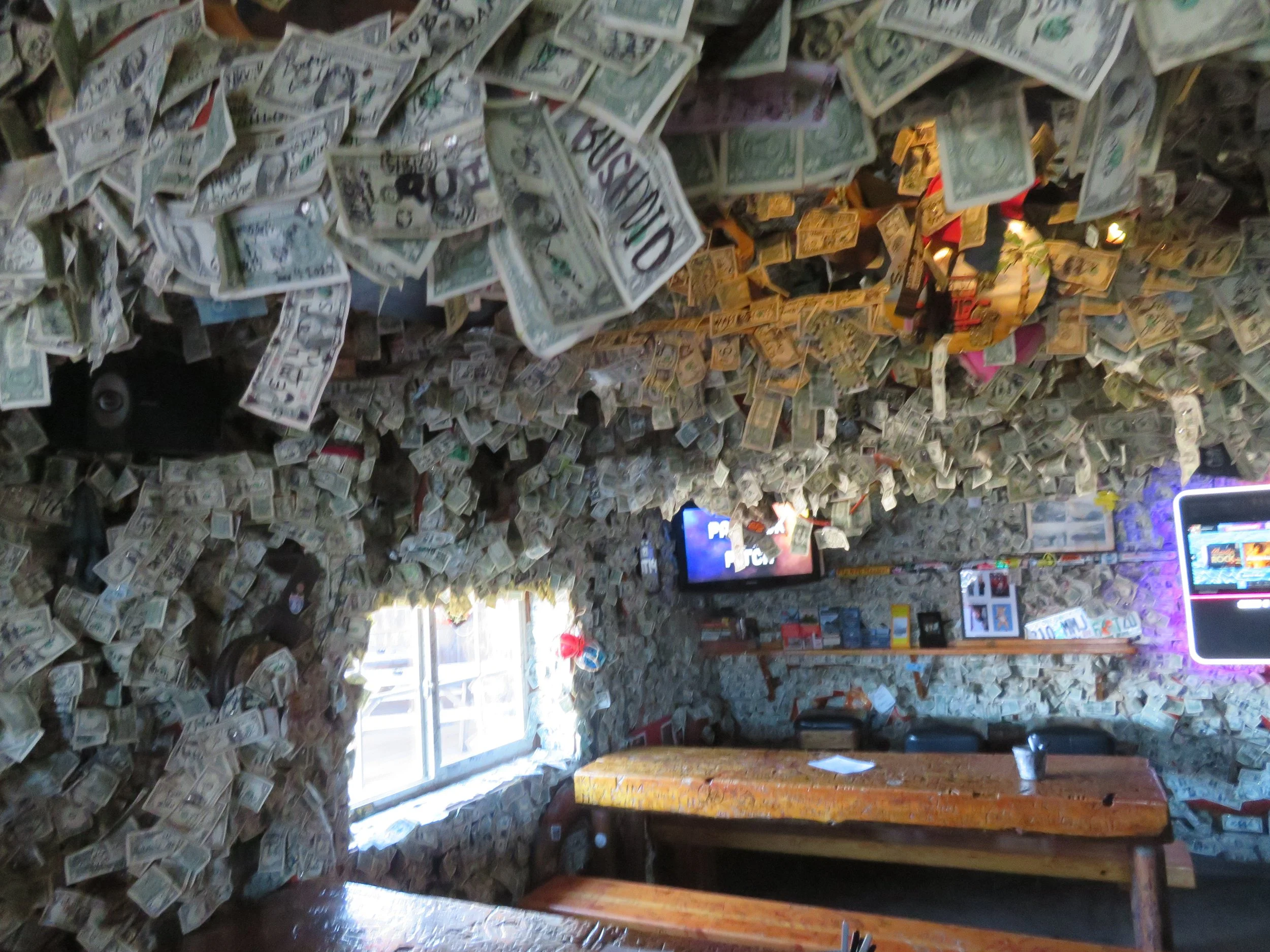
We were flabbergasted by the sheer number of dollar bills stuck to the walls. Evidently the tradition began several decades ago when a patron stuck a buck to the wall to buy a beer for a friend who would be arriving later. For some reason, sticking dollars to the wall became a ‘thing’ for tourists and there doesn’t seem to be an inch of space without a dollar bill attached to it. Unfortunately, they only serve booze and no food… we wanted both.
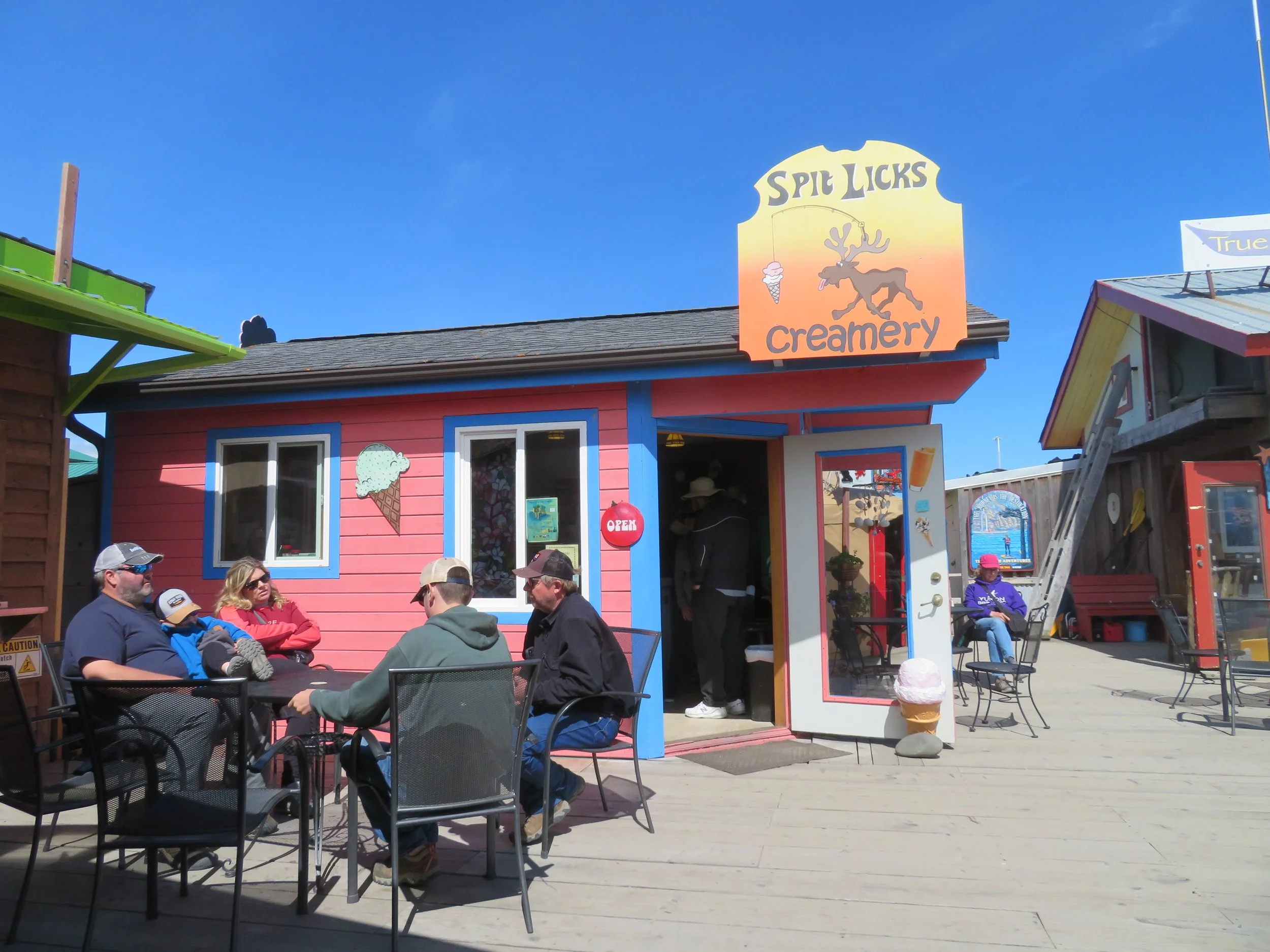
Actually, the best surprise of the day was finding an ice cream shop that had my favorite flavor… maple walnut. This knowledge made it easier to plan a light lunch since I already knew what I’d be having for dessert. We decided on Captain Patties Fish House for a very late, almost supper, lunch. The halibut was good, and as expected, expensive. The ice cream cone at Spit Licks was wonderful… and also expensive. This is the high cost of being in a tourist area and still wanting to eat what you want. This makes up for all the meals out and ice cream cones we haven’t had along the trip… at least that’s my story and I’m sticking to it.
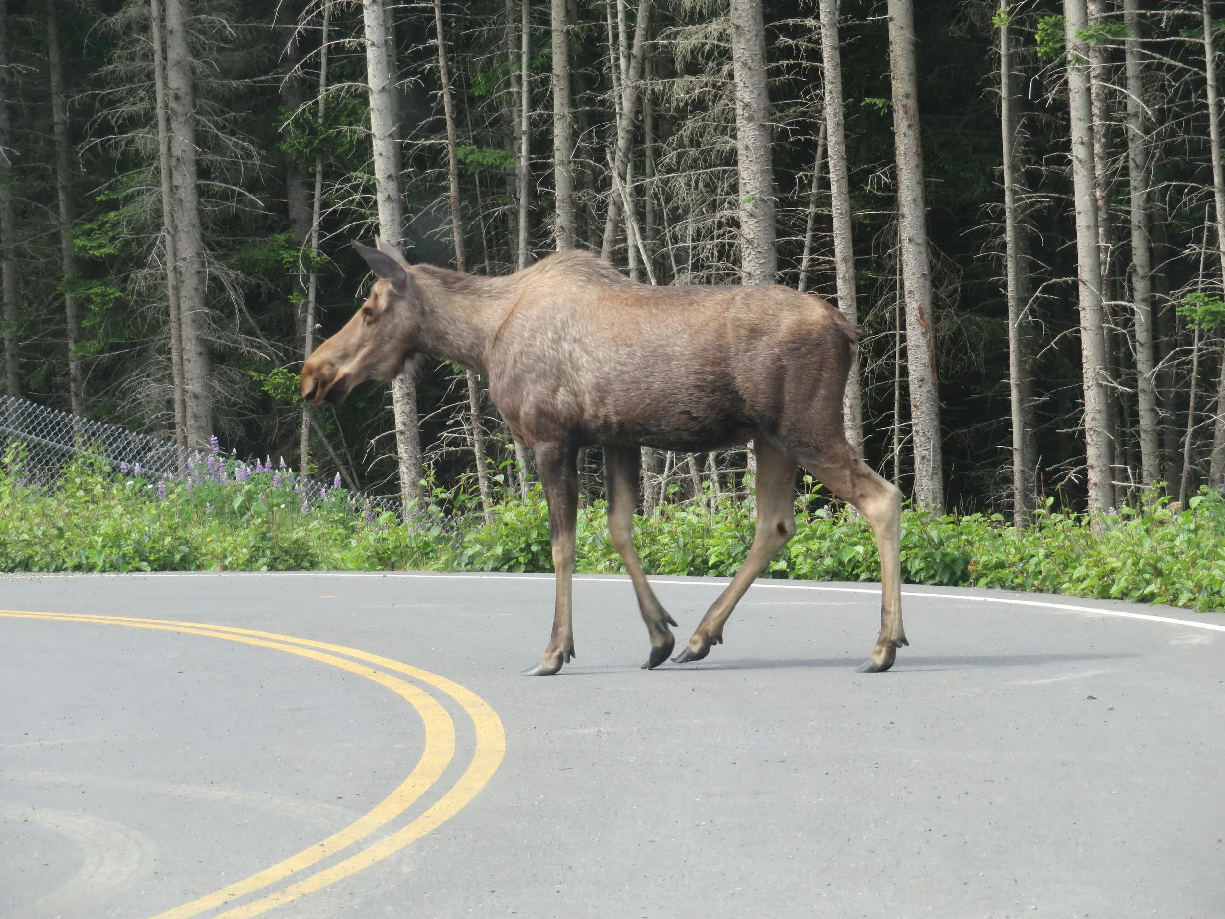
On the way back to the RV park, we stopped at a wetlands observation area for a quick walk. We saw nothing there, but on the way back, we spotted a cow moose was browsing. She obligingly posed for us.
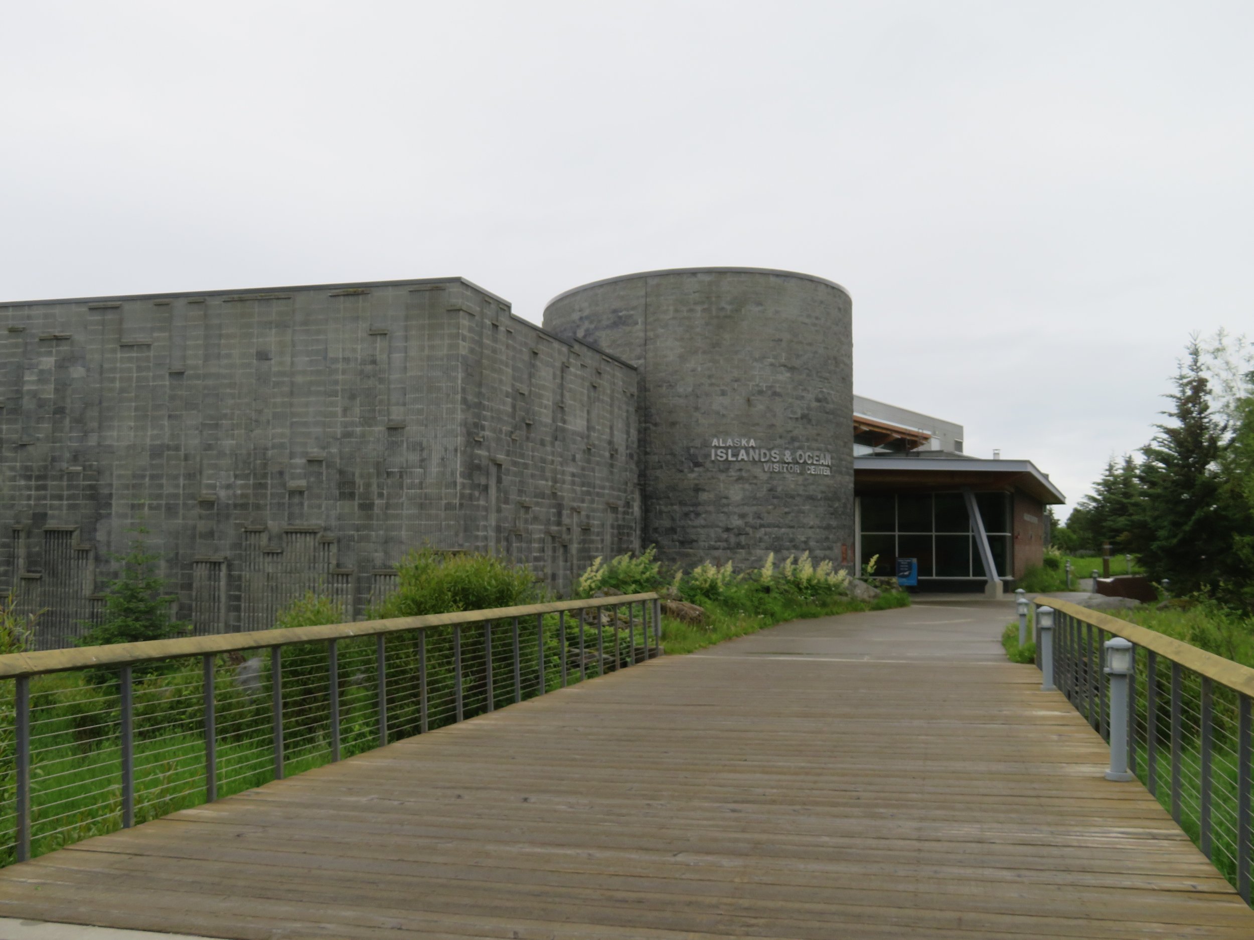
The next day was gray, overcast and dreary which accounted for our laziness. Still at the RV park, we managed to do the laundry, then walked down to the Alaska Islands & Ocean Visitor Center, not far away. It’s a splendid place with lots of good information and excellent exhibits highlighting the conservation and research efforts in the Aleutian Islands.
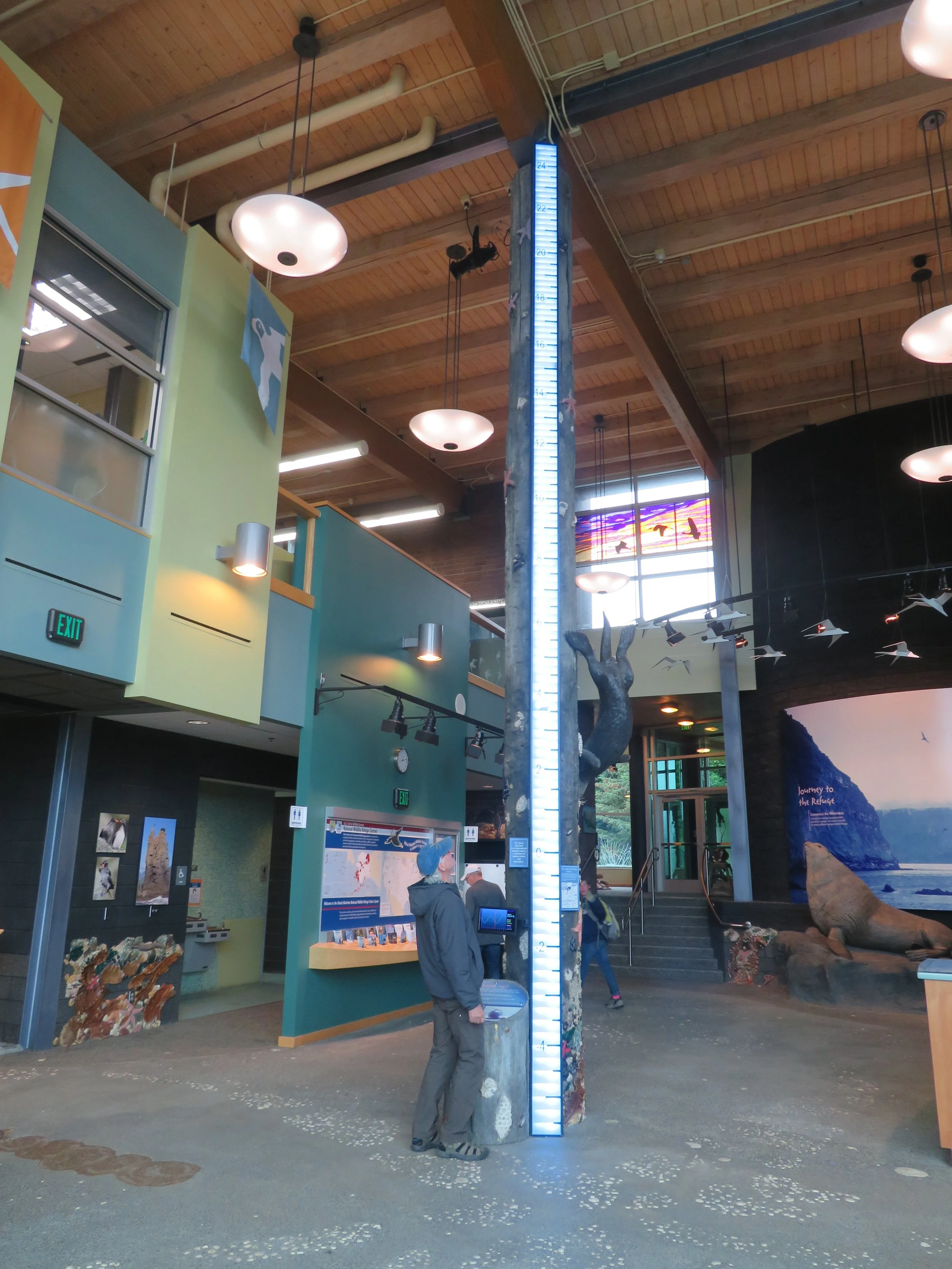
As mentioned before, the tidal changes in the Cook Inlet are some of the largest in the world as illustrated by this exhibit at the Center.
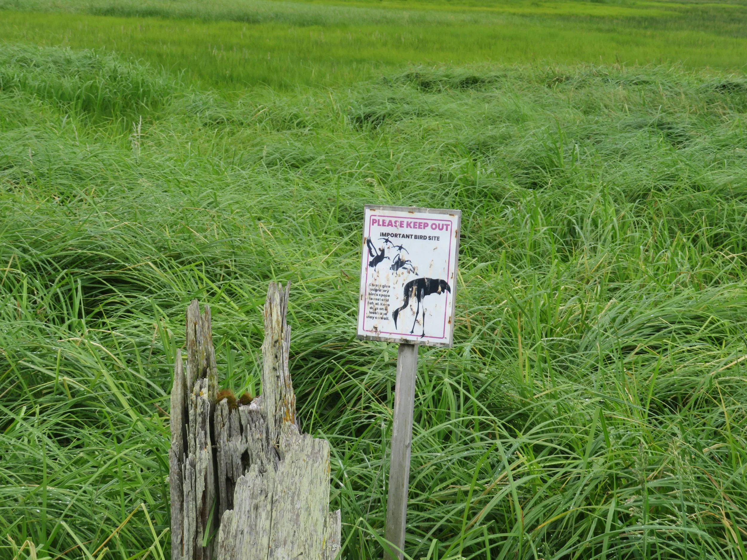
We followed a path from the Center to the Beluga Slough, a wetlands area favored by nesting sandhill cranes. We could barely make out two nesting pair in the distance, but could approach no closer.
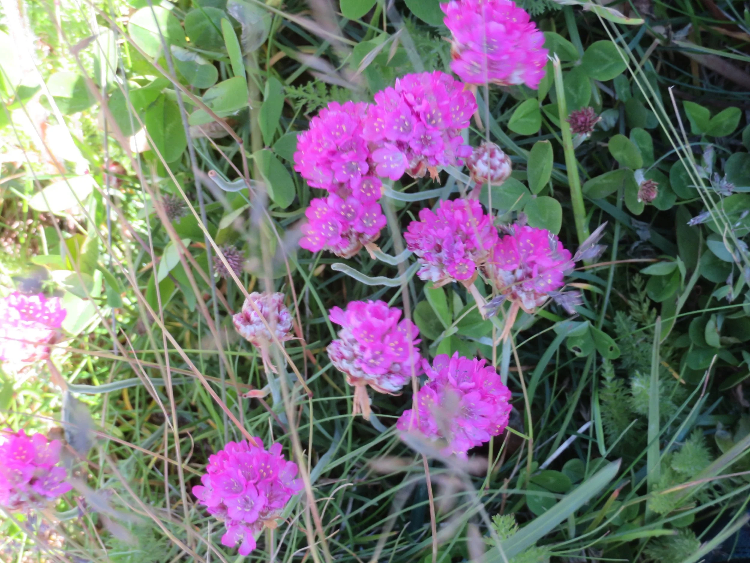
We continued onto Bishop’s Beach and wandered along the sandy shore. The tide was low and the wrack line was littered with debris. We did find some wildflowers to add to our photographic collection: seathrift and Alaskan paintbrush.
The gray sky blackened and the rain began. It continued throughout the night and into the next morning. The Cook Inlet was totally fogged in. The RV park yard was slick and muddy with large rivulets streaming down the hill. There’s more gravel in Blanche than on the road now. A clearing by late morning had us climbing up along Skyline Drive for the views of the spit below.
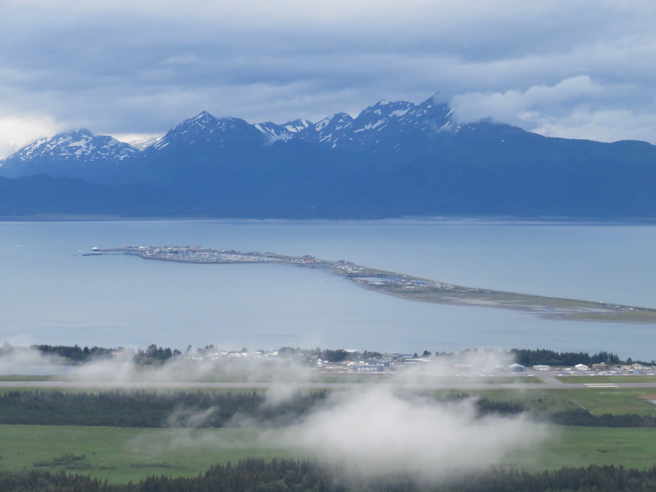
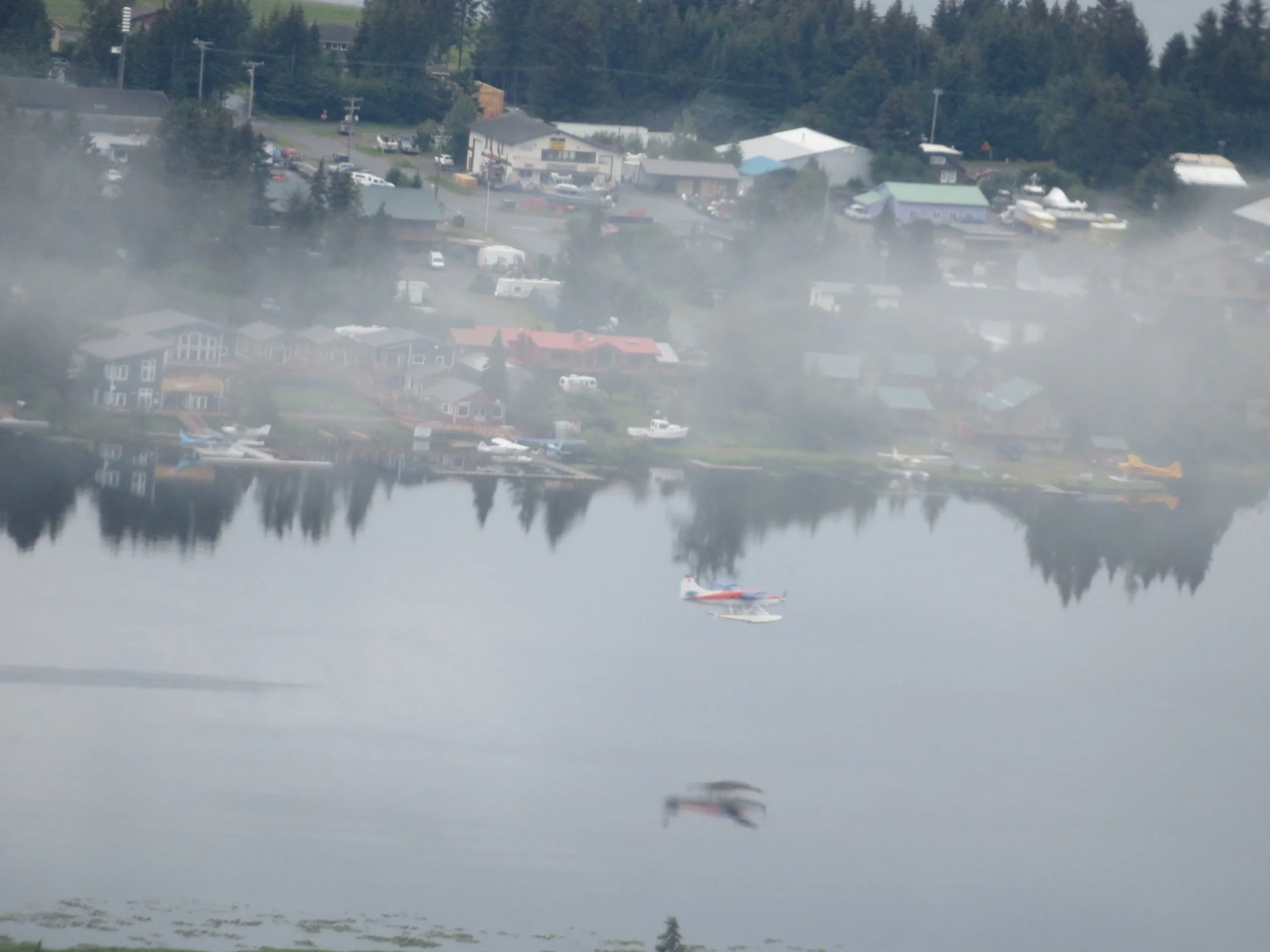
We watched float planes landing and taking off in Beluga Lake and twenty minutes later, the entire area was socked in again with dense fog.
We headed back to Blanche, got warm and dry and spent the rest of the day reading, writing and planning.
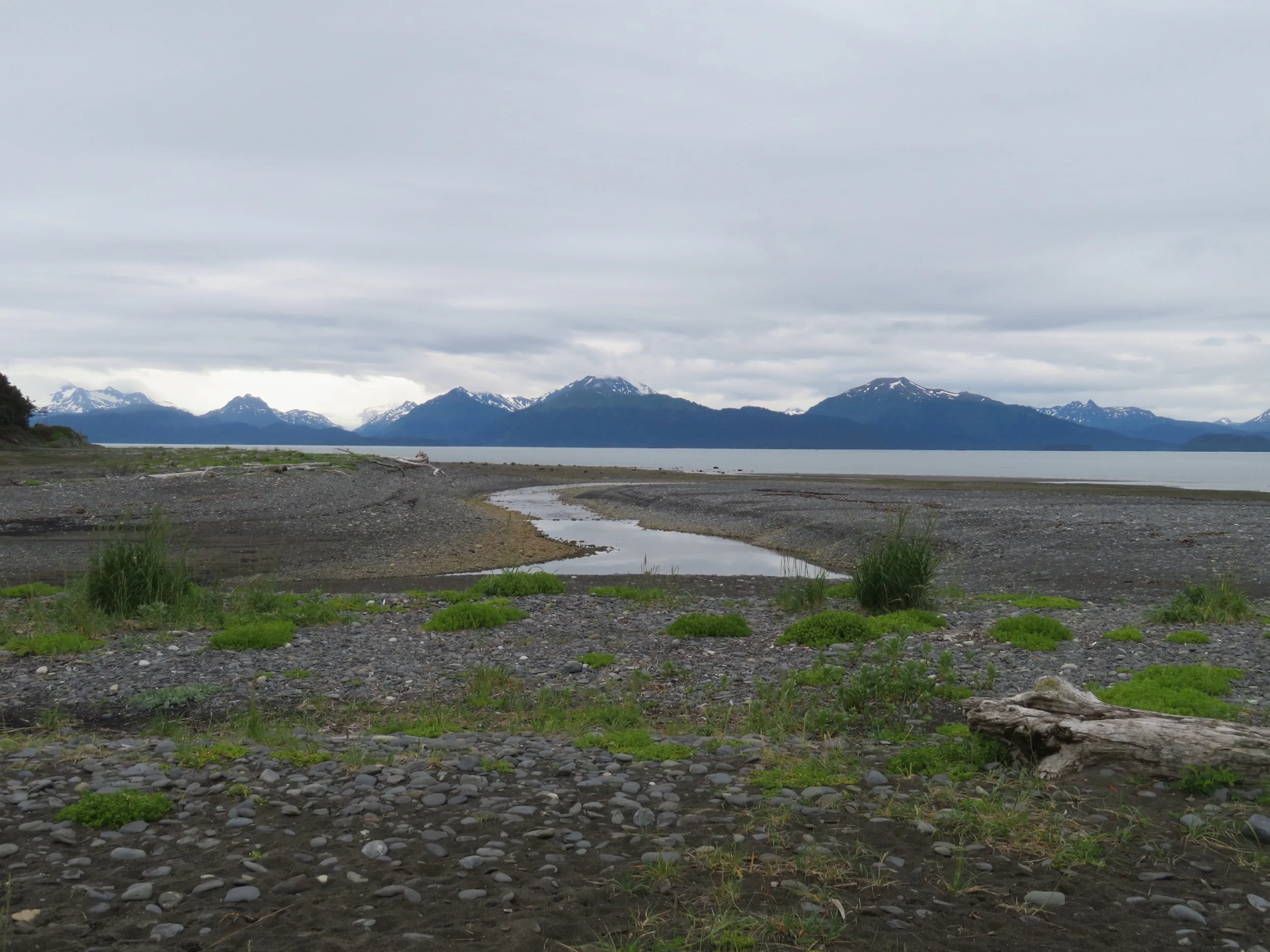
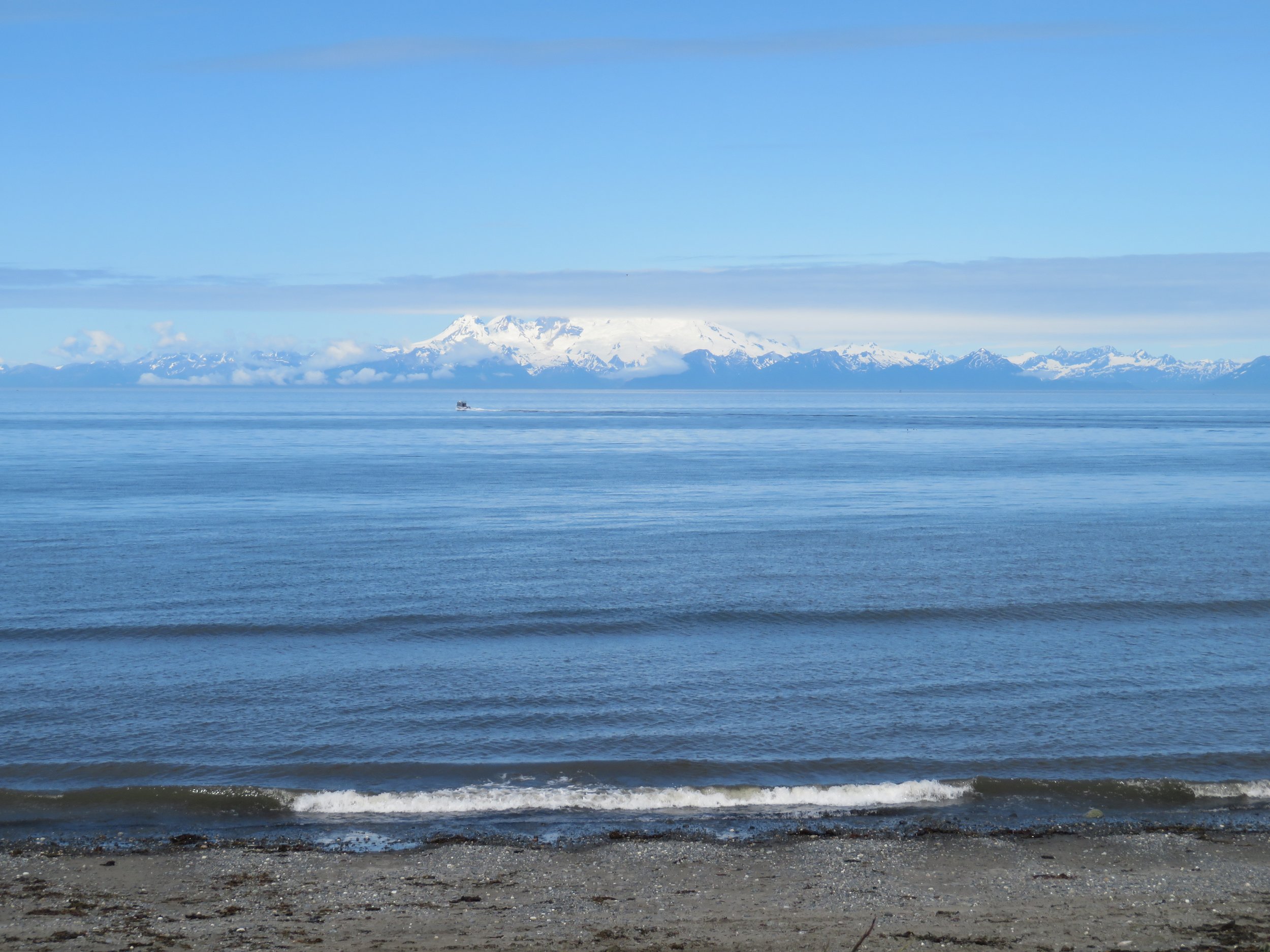
It rained hard again all night and by morning we were ready to head out back north up the Sterling Highway to the northwest part of the peninsula. The weatherman was calling for clearing and partly sunny skies. We were hoping he was right as we maneuvered through drizzle and fog so thick we couldn’t discern the sea from the sky. Our goal for the day was the Discovery Campground in the Captain Cook State Recreation Area.
The fog dissipated quickly. It sprinkled off and on for a minute or two then the sun came out. Twenty miles north of Homer… here was our view!
Next time, join us as we explore the northwest part of the Kenai Peninsula and then head back to Anchorage and points north.