

Jasper National Park and on to Banff
/A bright, sunny morning greeted us at Wabasso Campground. With cell coverage, we weren’t in a hurry to get moving. We read the paper, then took the opportunity to dump the toilet canister and the gray water and fill up with fresh water before we left.
Still on the secondary 93A highway off the Icefields Parkway, the next stop was Athabasca Falls. Parking lots are crowded in most of the places we’ve stopped, but we’ve always managed to find a spot if we’re patient. (That’s the royal ‘we’ as Marcie is never patient.) This is considered the shoulder season. We can’t imagine how crowded it is here during peak season in mid-summer.

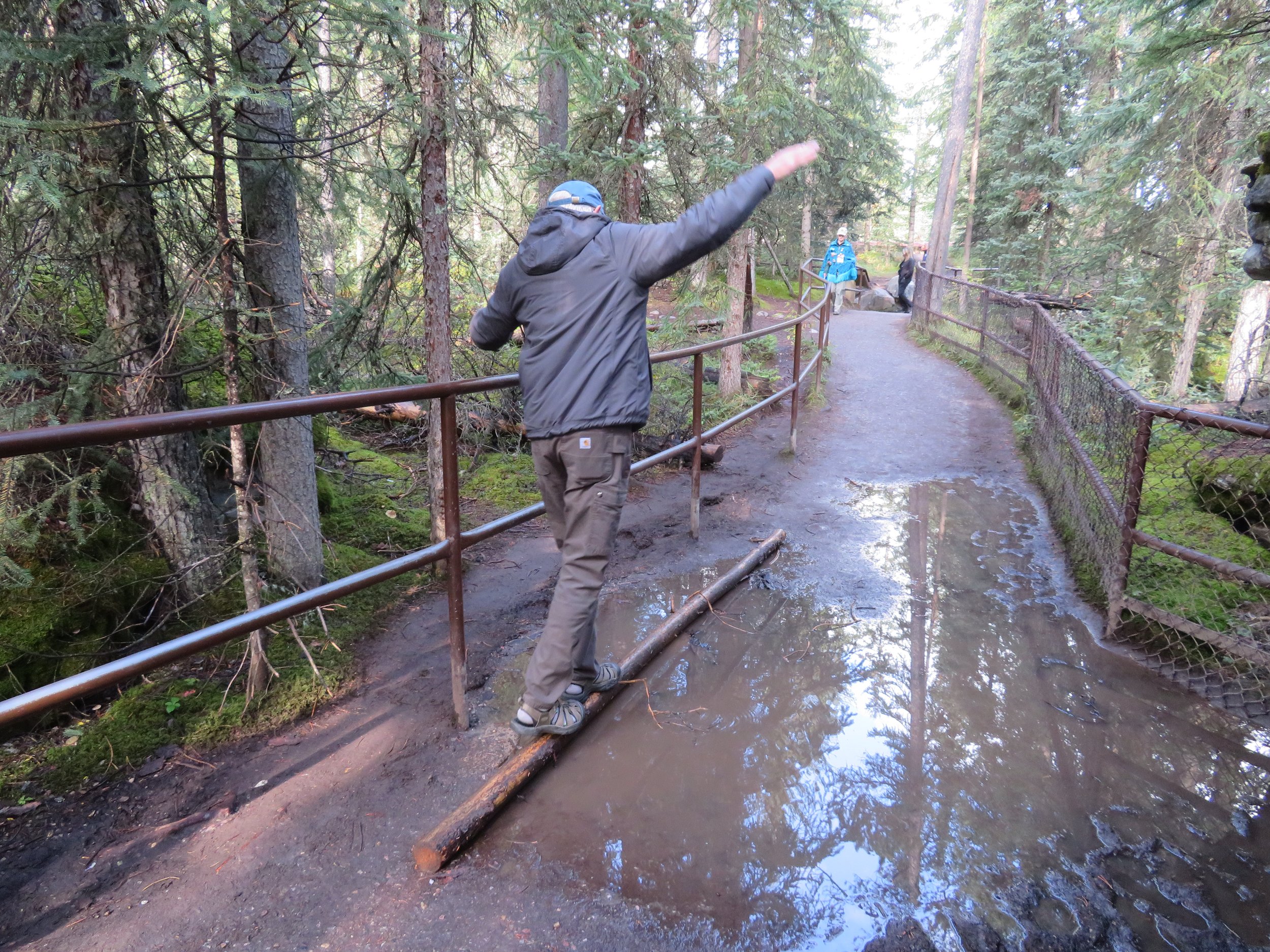
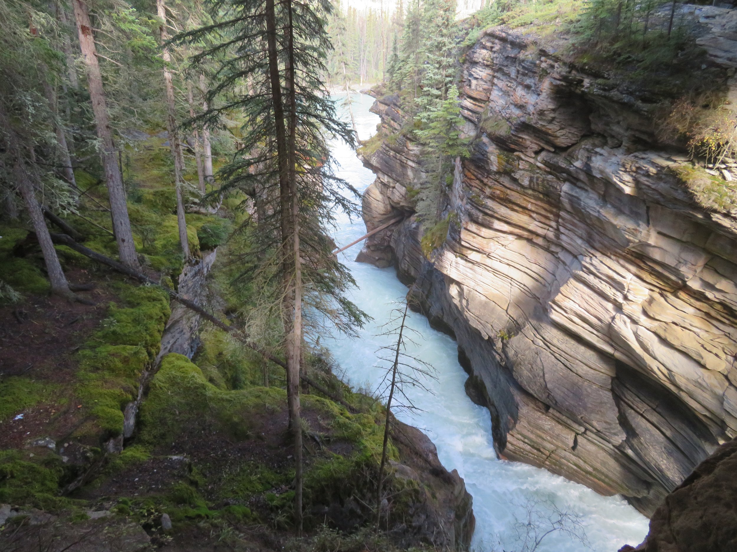
The Athabasca, Alberta’s longest river (765 miles/1231 km), originates here in the Columbia Icefields of Jasper National Park. It travels north and after joining with the Mackenzie River, eventually drains into the Arctic Ocean. The Athabasca Falls may not be as large or spectacular as Niagara or Iguazu, but, wow, they’re absolutely awesome. Well laid-out interpretive paths and viewing platforms offer perspectives of the falls from both sides as well as above and below.


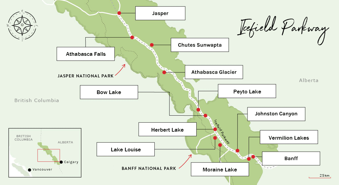
After a couple of days of rain, some of the pathways were puddled and muddy requiring a balancing act to pass through without getting our feet wet.
The weather is autumn-ish, cool and crisp and cold enough to see your breath.

Whirlpools and eddies swirl, and the sheer volume of the roiling, tumbling, forceful water over the centuries has carved a deep gorge and cavernous potholes.

The height of the falls is only about 80’, but the mass and intensity of the water that passes through produces a spectacular sight. Rainbows are visible in the mist when the sun is reflected just right… and it was.

We rejoined the Icefields Parkway and stopped next at Sunwapta Falls. Not as impressive as Athabasca, but stunning nonetheless.

We walked the Lower Sunwapta Falls Trail through a deliciously evergreen-scented forest along the riverside to view more waterfalls. The aromatic scent, so fresh and clean, made you want to keep taking deep, deep breaths to breathe it all in. The muddy, heavily rooted 2-mile roundtrip was easy enough and definitely pleasant as long as you watched your step.


Some road construction had us waiting for 10 minutes or so on the highway. We spent the waiting time being amused by the flag person who was quite the expert bubblegum bubble blower.

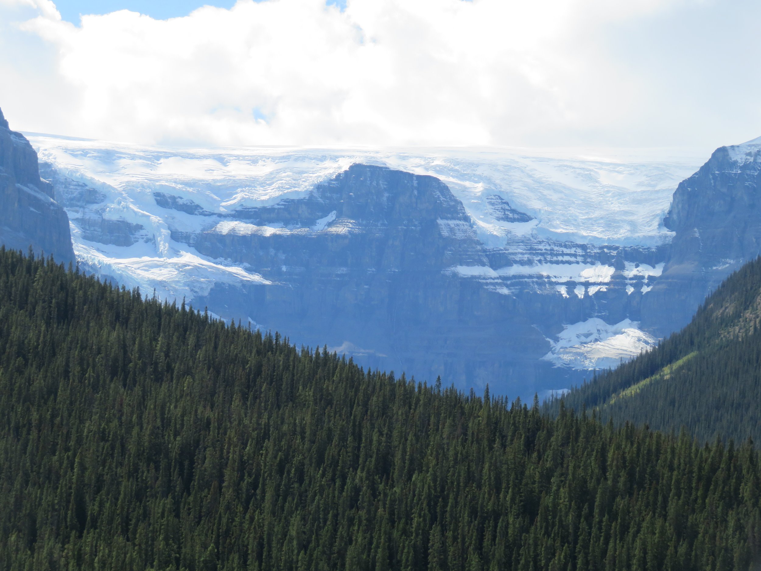
Spectacular view after view… glacier after glacier. This is an eye-candy store and the views are almost (but not quite) overwhelming. We slowed our speed and pulled over to view the Stutfield Glacier.
We passed by the Icefield Skywalk, only accessible via tour bus from the Icefields Centre. We managed a shot while on the move.

The Columbia Icefield Centre is the main Visitor Center for the Icefields Parkway. There are restaurants, gift shops, Starbucks with a long, long line, a hotel, tour reservations and the National Park Glacier Gallery info center.

We visited the Glacier Gallery and learned about the Columbia Icefield, the largest ice field in the Rocky Mountains. Covering about 125 sq miles (325 sq km) along the B.C.-Alberta border, the icefield ranges between 328-1198’ deep (100-365m).

A cool fact from the Jasper Fitzhugh newspaper, “Known as a hydrological apex, water from the Columbia Icefield flows to three different oceans. On the British Columbia side, meltwater flows into the Columbia river and to the Pacific Ocean. On the Alberta side, the North Saskatchewan and Athabasca rivers feed into the Atlantic and Arctic Oceans, respectively.”

It was getting late in the day when we found a campsite at the Wilcox Campground ($26.25/night) only a few miles south of the Icefield Centre. This was not our favorite campground. It was parallel parking alongside the campsite with little room for maneuvering. The vault toilets were dark, dank and smelly. We ended up driving out of the camp to a another public toilet in the morning rather than using the ones at the campground.
During the night, we heard the constant scratching and rustling of an animal either right outside or potentially in Blanche’s ‘garage’. It drove us nuts. We’d bang on the wall and it would stop and as soon as we started to doze again, the noises would return. Was there a mouse in the house?
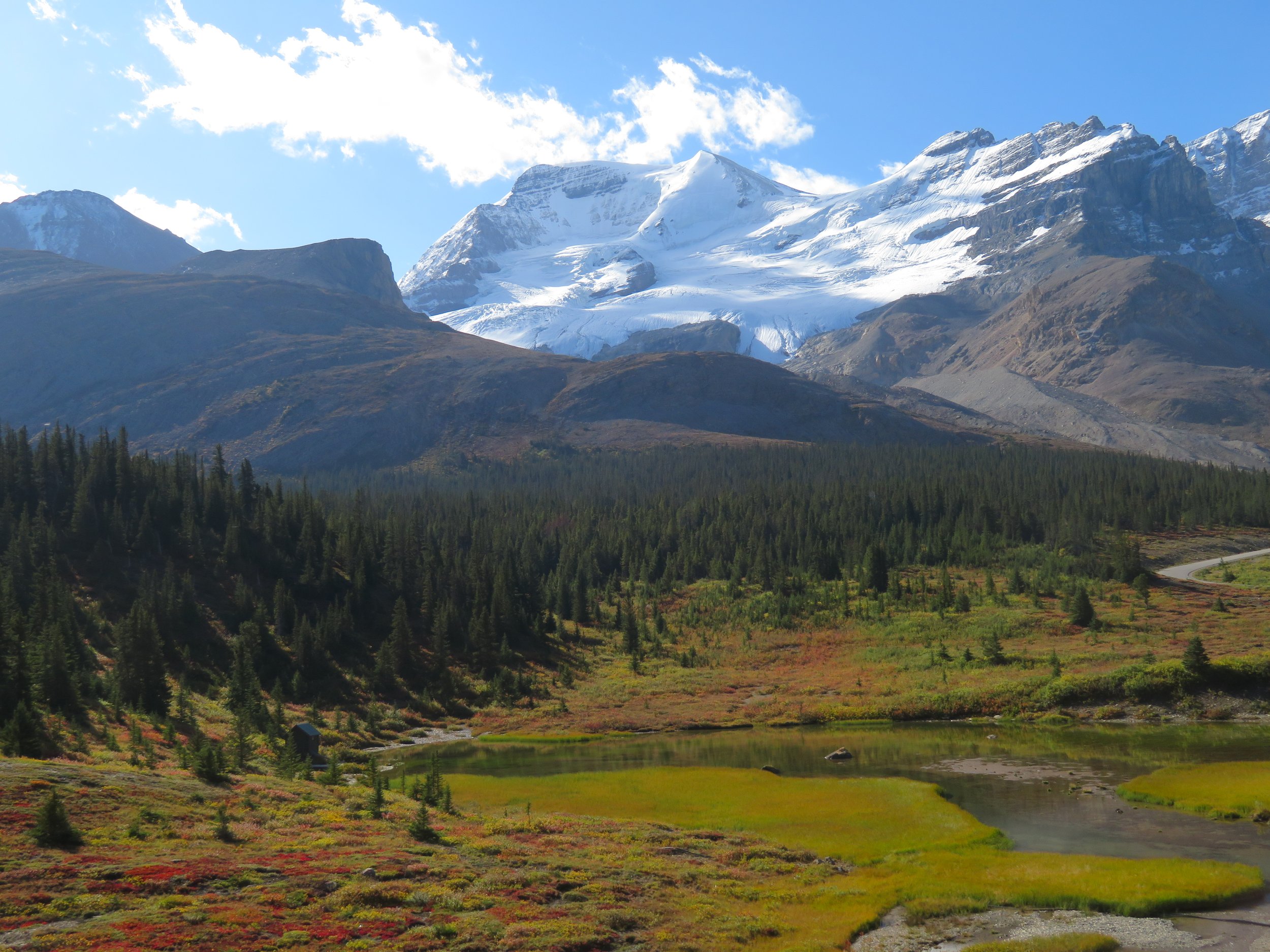
We finally gave up and just before sunrise, we headed to the Athabasca Glacier to walk the 1-mile RT ‘Toe of the Glacier’ trail. It was 27F (-3C) when we headed out and we bundled up to brave the morning cold. It was a steep, short-of-breath climb up a gravel and rock trail, but worth the effort. Photo credit: Nick from Netherlands

Because of its accessibility, the Athabasca Glacier is the most visited glacier in North America. According to Wikipedia, ‘The glacier currently loses depth at a rate of about 5 m(16 ft) per year and has receded more than 1.5 km (0.93 mi) and lost over half of its volume in the past 125 years.’ Markers along the path showing where the glacier extended at different points through the past century, accentuate the extent of its recession.


Walking onto the glacier is not allowed without a guide, so we stopped at the ‘toe’. Tours are offered aboard a special ‘Ice Explorer’ vehicle that drives onto the glacier and allows folks to walk on the glacier for a few minutes. Inside the Icefield Centre, we checked out the long lines for this tour and decided to give it a pass.

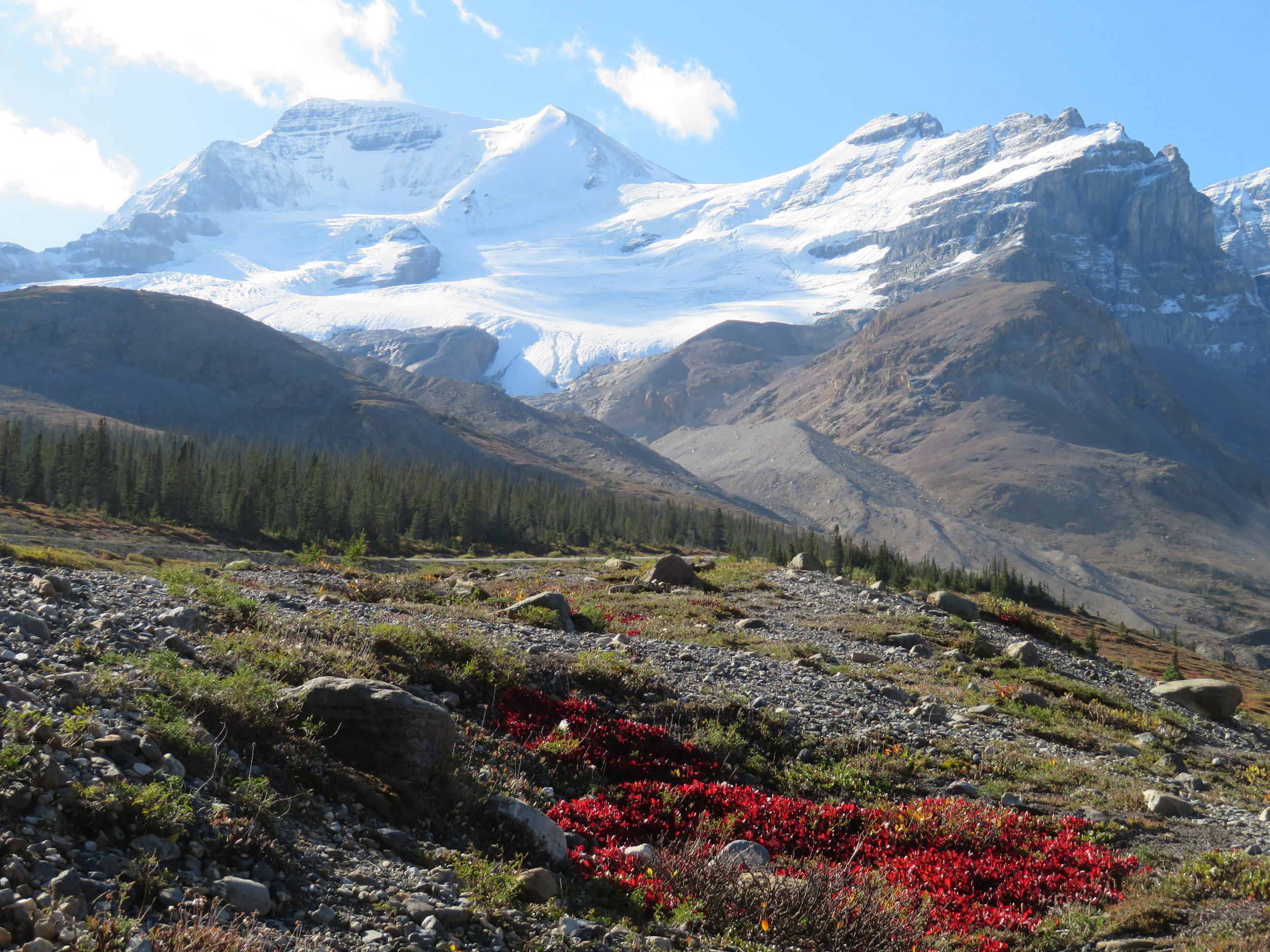
The views of the Athabascar and Dome Glaciers were magnificent. Brilliant red alpine bearberry leaves added a vibrant splash of color to the scene. We took photo after photo here, looking for just the right angle on the glaciers and the mountains, the most brilliant patches of red, just the right amount sun.

Just beyond the Icefield Centre and over Sunwapta Pass is the Jasper boundary and we entered Banff National Park. The sky was crystal clear blue and the air was fresh and crisp… autumn-ish. We think driving from north to south on this parkway may be the best way to experience the dramatic scenery. The glaciers tend to be on the north sides of mountains so heading south, you see them all. After awhile we couldn’t keep count of how many we saw… valley glaciers, hanging glaciers… outstanding.

We reached Lake Louise in late morning in hopes that we’d get a campsite, but it was the weekend and it was full to capacity. The gate attendant mentioned an overflow lot and we checked it out. It was no more than a large parking lot, and it certainly would have sufficed in a pinch, but we had another idea.
Yoho National Park is only about 15 miles west on the Trans-Canada Highway in British Columbia. We figured we’d try our luck there and sure enough there was room. We booked in for two nights at the Kicking Horse Campground.
Come on along with us next time as we explore Yoho National Park, climb the tortuous Yoho Valley Road to the Takakkaw Falls and visit the tiny nearby town of Field.