The Blue View - River Rules Apply
/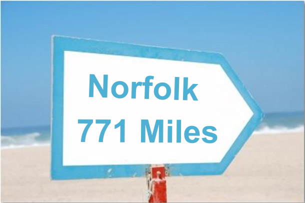 As I write this, we have completed most of the 770+ miles of the ICW from St. Augustine, FL to Norfolk, VA. We went outside into the coastal Atlantic waters for only a short stretch between Charleston and Georgetown, SC, primarily because the tides were wrong and we would have either had to wait most of a day or would have had an almost 100% certainty of running aground in a particular shallow stretch of water.
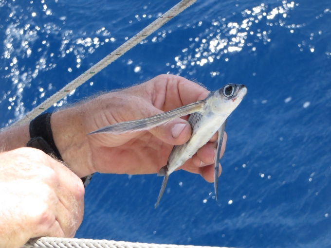
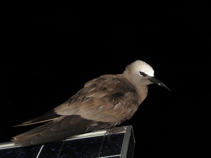
So far we have enjoyed the trip immensely. The scenery and wildlife have been fantastic, and at 6 knots, we've had the time to see it as we navigated our way along the hundreds of lakes, rivers and canals that make up the ICW. Our only regret is that we were pushed for time (as usual) and couldn't stop as much as we would have liked. Maybe next time – and we're pretty sure there will be a next time.
We've had the opportunity to explore a number of rivers around the world, from South America to Panama to New Zealand to Tasmania, and we've acquired a number of guidelines that help when navigating most rivers. These are usually referred to as 'River Rules', and we've discovered that they also apply to much of the ICW. Here is my list of 'River Rules':
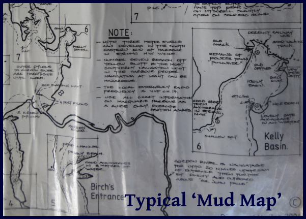
- Local knowledge. Rivers are forever changing. What was a deep section last year (or when the chart was last updated) might have shoaling due to winter storms or flooding or any number of other reasons, and the local sailors and fishermen who routinely ply these waters will likely be aware of the changes. When possible, we ask around and try to gather whatever local knowledge we can. On several occasions, we've been able to copy the local 'mud maps' - hand drawn sketches with hazards, depths and the best routes for a particular river we were planning to explore – absolute gold! For the ICW, the Active Captain app for our iPad has been our source for local knowledge. It compiles notes from hundreds of other sailors that have traveled the ICW over the past few years, and provides tons of information about uncharted hazards, shoals and other navigational issues.
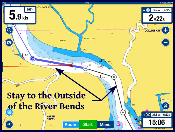
- Outside curves. As a river goes around a bend, the water flows faster on the outside of the curve and slower on the inside. Because of this, the outside of a curve will usually be deeper than the inside. This isn't always the case – there might be some underwater obstacle that diverts the flow or a rock ledge on the outside curve, but in general, lacking any information to the contrary, we will favor the outside of a bend and avoid the inside.
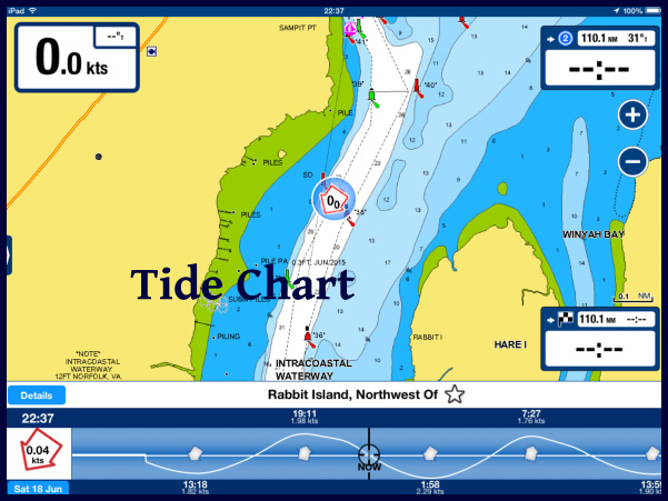
- Tides. Most of the rivers we have navigated have been tidal, and the tidal changes have been large enough to be a significant factor. We've seen a few tidal swings of as much as 30+ feet, and many that were 15-20 feet. In the ICW, it was common to see 7 foot swings, and so with our 7'2” draft, at high tide, we can pass over any point that isn't awash at low tide. There are a number of spots along the ICW that have only 5-7 feet of depth at low tide, making it important to time our passage at mid tide or higher – preferably on a rising tide.
- Currents. Along with big tidal swings come big currents. We've seen tidal flows of ten knots or more in our travels – much more than we could possibly motor against – and navigation must be planned around the current. On the ICW, the tidal currents are typically 1-2 knots, though in some narrow channels, up to 5 knots have been noted. We try to plan around the current when we can, but it isn't always possible. The current switches direction every 6 hours, so it often works out that half our day has a current push and half the day we find ourselves fighting it. Sometimes it's not consistent - a stretch of water might have an inlet on both ends, so a rising tide will give us a nice push as we enter one end, but it will be an adverse current as we near the other end. We've also noticed that the tides are slightly later as we work northward. Depending on where we are on the tide table, we sometimes find we have a push almost all day long, and a few days later we have an adverse current most of the day.
- Winds. The wind direction and strength will often affect water levels. A strong onshore wind can make river levels a foot or two higher than normal, affecting bridge clearances, while a strong offshore wind may reduce the water depth significantly below the charted depths.
- Reading the water. A number of clues can be gleaned by reading the water. If the current is flowing, an indication of its strength and direction can be seen by watching the flow around posts or how floating markers are leaning. A standing disturbance in the water may indicate a submerged hazard. If the water is still and the sun is high, shoals and bars can often be detected by the water color. In the high latitudes, kelp on the water surface often marks rocks below the surface.
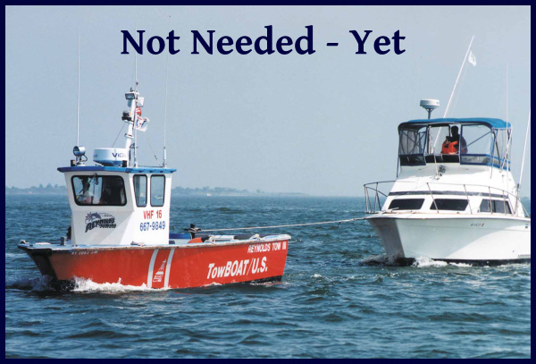
So, with all our navigation electronics, Active Captain providing us with local knowledge, and applying our River Rules, how'd we do? We still ran aground three times! All three times were soft landings in mud or sand with no damage done. Twice, we were able to back off or torque turn our way off the shoal within a couple of minutes. We were stuck pretty well the third time and it took about a half hour to extricate ourselves. We still had a few techniques to try before finding out how good our towing insurance was.
I like to look at the positives – we were able to remove all those hard-to-get-at barnacles on the bottom of the keel, and we got to practice our 'extrication' techniques. Plus, three groundings in 600 miles is a big improvement over our last foray on the ICW 15 years ago - I think we had at least that many groundings per hundred miles back then.