The Blue View - My Little Black Book

little black book  

I never go anywhere without my little black book. I often forget to grab my cell phone, and once in awhile forget to check for my wallet as I go out the door, but I rarely forget my LBB. My LBB does not contain phone numbers for old girlfriends. Instead, it contains pretty much all the information I need to keep my life in order.

Some of the information is pretty much to be expected. Phone numbers and addresses of friends and family for example. I also have a section with all those birthdays we need to remember (which I forget anyway)

Then there is the section devoted to the dozens of passwords and user IDs I need. As we all know, the list is long and gets added to frequently. I use a sort of shorthand encryption for my passwords in case I lose my LBB. This might slow down a dishonest old fart, but a halfway intelligent 3rd grader would probably figure out all my passwords in half an hour. I don't know what the solution is – I couldn't possibly remember all those account numbers, user IDs and passwords, and if my encryption method is too complex, I might need a 3rd grader on call to help me figure out how to unscramble my information. They have software programs for corralling all those passwords, but you need another password to get into the program.
 

inside the little black book


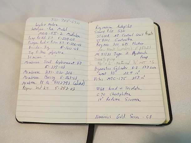
The most important section, however, is all the boat information I keep with me. I have all the pertinent information for every system on board Nine of Cups. For example, I have the watermaker model and serial number. I also list the part numbers for the various spares kits for it, as well as the contact info for the manufacturer and a couple of distributors. I include the usual prices for the spares in case I run across one in a chandlery or nautical flea market somewhere. That way I can tell immediately if the price is outrageous or a bargain, and whether the part is the correct one. Finally, I make a notation about where the spares for the watermaker are stored on board Cups.

There are similar notes about the diesel engine, outboard engine, electronics, autopilots, wind generator, solar panels, pumps, and the myriad of other devices and systems on board. Where it makes sense, I also make a note of dimensions. Our propane locker, for example, will fit some 20 lb. propane tanks, but not all. If I need to exchange one or buy a new one, I can measure the critical dimensions before lugging it back to the boat. Likewise, when we were looking for the new mattress for Nine of Cups, I had a drawing with the dimensions in my LBB.

I also have a list of all the lines we use aboard, with diameters and lengths. That way, if I come across a sale or another one of those flea markets, I don't have to rely on my notoriously bad memory to remember that we use a 9/16” line, 120 feet long for the mainsail halyard.

Ditto the sail dimensions. That's not so much in case I run across a used sail somewhere, but to make it easy when it's time to reorder a new sail. All the information I need is at hand and easy to find.

As I write this, I am thumbing through my LBB, and here are a few other miscellaneous items I've filed away: beer brewing records for each batch; gold leaf suppliers for the gold on the name boards; equalization records for the batteries; battery and charger information for our laptops; my list of things to do when preparing for a storm – one if we are anchored and one if we are at sea (hmm...maybe a future blog topic?); a table of fuel capacities and rate of fuel consumption at different RPMs; information on how much wobble I measured on the prop shaft after the last time I aligned the engine; combinations to all the locks we have aboard...

My LBB lasts about a year riding around in my back pocket. Then I buy a new one and before copying everything, I reorganize and regroup the information, deleting anything that is no longer relevant, like a bilge pump that has been replaced with a different model for example. Then I store the old one in a safe place as a backup in case the new one ever gets lost.
 

smart leatherman


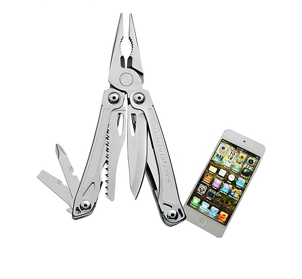
At some point, I will undoubtedly make the conversion from my LBB to the electronic version. I am resisting, mainly because my LBB works quite well, costs far less, and I don't have to worry about dropping it. Now if Leatherman ever comes out with multi-tool that combines pliers, wire cutters and a knife or two with a touchscreen mobile device, I'm there.
The Blue View - Repairing Sail Slides

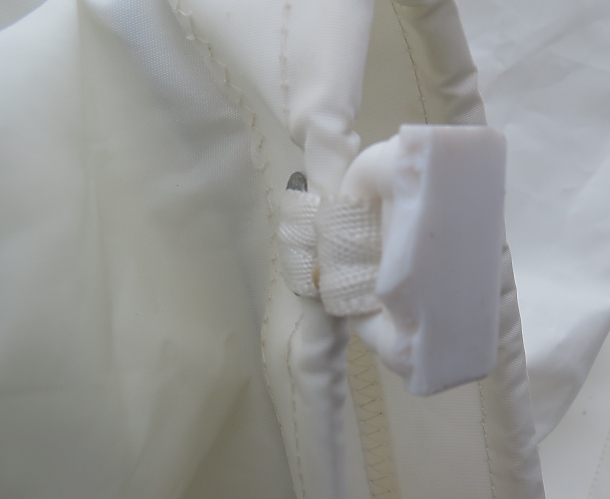
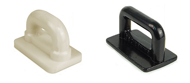
We've found a multitude of ways to break sail slides and consider ourselves quite adept at it. These are small T-shaped parts that are used to attach the main sail to the mast. On Nine of Cups, we use stainless steel sail slides at the high stress points and nylon sail slides at the intermediate points, and it is the nylon sail slides that break. We tried using all stainless sail slides, but found they were more prone to jamming than the nylon type, and we prefer to repair the odd broken sail slide to having a sail slide jam when we are in a hurry to get the main down.  

broken sail slide


They rarely break when the wind is strong. They are much more likely to break in light winds when the roll of the boat makes the main sail flog from side to side. When we are sailing downwind, we use a preventer to keep the boom from jibing, but the sail will sometimes try to jibe if the seas are running, and this often results in two or three broken sail slides. The lower slides are more prone to break, which is good, because they are easier to replace.


sail slides


We never set out without plenty of spares, and we've had enough practice that it now takes only minutes to replace a sail slide. While we have replaced several while at sea, we can usually reef the main enough to postpone the repair if conditions are bad or if we will be arriving in an anchorage soon.


repaired sail slide


Take a look at a video clip we made that shows how we replace a sail slide.

The Blue View - Paper Charts

  chilean charts


When we first moved aboard Nine of Cups, chartplotters were expensive and used a lot of power. Despite being the gadget freak I am, we opted to rely on paper charts. Over the last decade, chartplotters have become less expensive, and it has become pretty rare to find a cruising sailboat that doesn't have one. Now, with the advent of all the navigation apps for the tablet and smart phone devices, many cruisers actually have two or three chart plotters aboard.


chartplotter


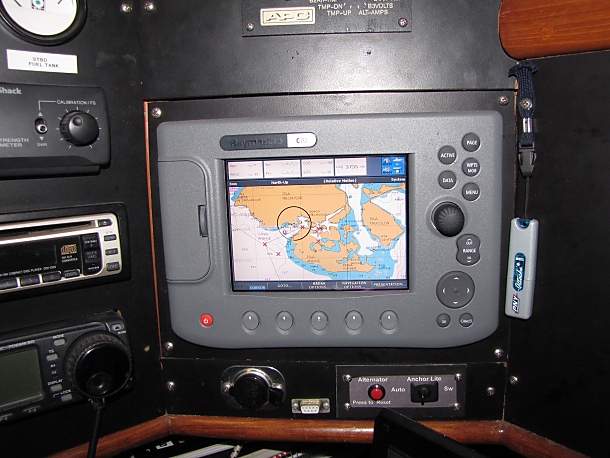
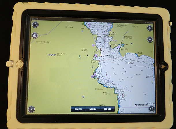
After delivering a friend's boat with a chartplotter aboard, we made the change to the electronic navigation world about five years ago with the addition of a Raymarine chartplotter. Then last year, we bought an iPad and the Navionics navigation app and charts. It is a true marvel to be able to glance at the electronic display and see in an instant exactly where we are, and to plot a course simply by moving a cursor around and dropping a waypoint. Nothing to figure out … just touch the screen.


ipad chart


Not only is it easier, but it is less error prone than marking waypoints on a paper chart, determining the latitude and longitude of each point, then calculating the heading and distance between waypoints. We would usually do this together, and check each others' calculations. For a complicated route, this process sometimes took us an hour or two. Now all the calculations are done by the computer, and a route is computed at the push of a button.

So is it time to get rid of all those expensive, heavy paper charts? A lot of our cruising friends no longer invest in paper charts. One chap we met actually decided his compass was now unnecessary, and got rid of it so as to be able to add a larger cup holder. Call us Luddites if you will, but we don't agree with this philosophy.

There are several pitfalls we see when relying solely on electronic charts. The first issue in my mind is a direct result of how easy it is to create a route on a chartplotter. If we are sailing a passage between ports, there is the tendency to zoom in to a high resolution view of the port at each end to plot waypoints, and then to zoom out to view the route connecting the two ports. This low resolution view of the route will miss any small hazards along the route. For example, the passage from Luganville, Vanuatu to Bundaberg, Australia passes right through Chesterfield Reef. This reef is very clearly marked on the paper charts for the area, but is only shown on the higher resolution views on our Raymarine chartplotter. Sailing onto this reef at 6 knots would certainly spoil your nightwatch.

Even if you painstakingly view your route at high resolution, you miss any hazards that are just off your route. If you're driving a motor vessel, this is probably not a problem, but sailboats don't always sail the rhumb line.

In addition, when we both spent an hour or more determining our route, by the time we were finished, we both had a pretty good familiarity with the route and any potential hazards along the way. The plotting process on the chartplotter is a one person activity, so usually only one of us has spent time reviewing the route.

Then there is always the possibility of losing the electronics due to a lightning strike or because of an electrical or equipment malfunction. We have a couple of handheld GPS's aboard as backup, one of which is stored in the microwave in the hopes it might survive a lightning strike. As long as we have the paper charts and a GPS, we'd be no worse off than we were a few years ago before the chartplotter.

And if all else fails, I still have my trusty sextant tucked away. Admittedly, I'm a bit rusty with it – I haven't used it in over a decade. Even when I was at my best, my accuracy was probably no better than +20 miles or so. But as long as we still had a compass, the sextant and the paper charts, we'd be able to jury rig a speed log, and I feel certain we could make landfall somewhere. Of course it would help if the land we were aiming for was big – like say Australia or South America.


reviewing charts


Finally, there is one more thought about paper charts. It is not uncommon to meet a fellow cruiser in some remote anchorage who is heading somewhere you've been and is coming from a place you're planning to go. It is very pleasant spending an evening going over the charts, exchanging information on anchorages, navigation, and swapping all the other good info we've each collected. I'm not sure if we can add little notes to our iPad charts, but even if we could, it just wouldn't be the same.