Intracoastal Waterway - Day 7

Day 7 – 365 nm to go We were up with the sun once again and plying our way up the Waccamaw River. We were under the fixed Ocean Highway Bridge by just after 0630. Yes, there was another beautiful sunrise. Yes, I took a photo or two … and yes, I'm sharing the best one. Some things (and people) are very predictable.

sunrise on the intracoastal waterway

We passed by the entrance to Georgetown, noting that it would make a fine stop on our southern transit next season. The area was known in the past for “Carolina gold”, i.e. rice fields, and indigo plantations … and, also, alligators. No swimming. The rice fields still stretch for acres and acres, but more noticeable is the acrid smell of paper mills and the smokestacks on the horizon.

rice fields along the intracoastal waterway

The Waccamaw River is wide and deep and it was a pleasure to be on it so early in the morning. The landscape has changed once again. The Waccamaw National Wildlife Refuge, a 55,000 acre reserve, borders the rugged eastern bank of the ICW. Forested wetlands, tidal marshes and pine forests are home to a wide variety of native bird, fish and mammal species including red fox and black bear. Having a canoe to paddle around in the tiny inlets and streams would be perfect. Spanish moss aka Old Man's Beard, hangs from the trees and provided a lasting image of this picturesque area in my mind.

spanish moss along the intracoastal waterway

The water here is the color of iced tea … tannic from the heavy tree growth on and near the riverbanks. We could see the brown water lapping against the shore. Tannin is a naturally occurring substance and isn't usually harmful, just not very appealing. Cruisers who travel the ICW regularly refer to it as the “ICW mustache” because it leaves a brown stain on white boat hulls.

intracoastal waterway mustache

By 0930 the bright sunny day had disappeared, leaving a dull, gray, overcast sky in its wake. Motoring as we're doing requires fuel, a rather unusual occurrence for us. We'd passed up several fuel stops along the way in favor of the highly recommended Osprey Marina ... “cheapest fuel on the ICW”. The entry channel was narrow and a bit dicey for Nine of Cups, but we arrived unscathed at the fuel dock where a friendly and efficient dockhand helped with lines, a fill-up (at a bargain price), some ice and an uneventful send-off back down the channel. We were back on the ICW in less than an hour. Interestingly enough, marina signs and fuel prices are advertised along the ICW and reminded us of the old billboards on US highways in days gone by.

osprey marina along the intracoastal waterway

Ospreys are absolutely everywhere along the ICW waterways. We saw them in trees, on docks and flying above us. They particularly like building their huge, terribly untidy nests on the post markers. It was unusual to see a marker without an occupied osprey nest.

osprey nest on the intracoastal waterway

We left the quiet, solitude of the wildlife refuge and headed towards Myrtle Beach. The river traffic increased significantly. We now shared the river with barges and tugs, pontoon boats and speedboats. coast gaurd barge on the intracoastal waterway

We knew we'd arrived at the most congested area when the jet skis, like a swarm of gnats, descended upon us. They travel fast, swerve and spray, make wakes, are noisy and annoy us significantly. We have little tolerance for them, but of course, each to his own and they have as much right on the rivers as we do. We just wish they were a bit more aware of the nuisance they cause.

jet skier on the intracoastal waterway

The adrenaline rush of the day, not counting the 13 bridges we had to pass through, was transiting “the Rockpile”, an infamous stretch of the ICW with rock ledges at the narrow river's edge that jut out precariously into the channel. We managed to get through without harm or foul and continued on across the Little River Inlet into North Carolina and up the Cape Fear River. Our anchorage for the evening is known as Tina's Pocket, a little spot just behind the channel leading light towers to drop the hook off the Cape Fear River.

danger rocks

IMG_0008

It had been a long, 14-hour day. After charting and dinner, we attempted to watch Nick Nolte and Robert DeNiro in Cape Fear. We were highly unsuccessful in this endeavor. We woke each other up half way through and called it a night.
Along the Intracoastal Waterway - Day 6

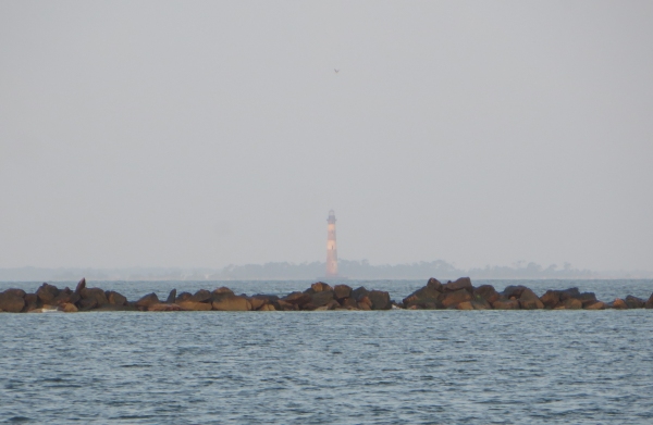
Day 6 – 420 nm to go With regret, we departed from Charleston as the sun rose. Our intent was to continue along the ICW, but the winds were favorable, and the tides and bridge schedules weren't, at least for the day, and so we decided we'd head outside for a change. We traveled down the Cooper, met the Ashley and found the Atlantic Ocean once again. The Charleston Light appeared hazy in the distance behind the rock jetty that lines the channel to the sea.

charleston lighthouse

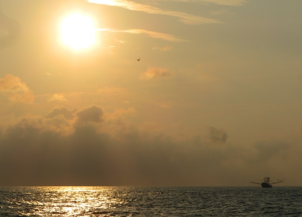
Shrimp boats with dolphins and gulls following their trail, were out in full force as a hot, rising sun melted away the morning haze and we prepared for another sizzling day, but at least we'd have a sea breeze to cool us.

shrimp boat at dawn

We headed out of the Charleston Channel, cleared Rattlesnake Shoals and observed no anchoring or dredging warnings on the charts due to unexploded mines, a remnant of WWI and WWII harbor protection programs. We rounded Cape Romain and headed for the Georgetown Inlet. We only had a one day forecast of favorable winds but had yet to find them. We saw 5-8 knots with gusts of 10-11, but not much more. We were motor-sailing, moving along smartly in the 7s and 8s.

As we headed up the Georgetown Inlet, a long 15nm channel, we began to hear distant rumbles of thunder above the engine roar and the sky began to cloud up. The VHF wailed a weather alert … thunder and lightning cells moving fast and furiously in our area. We could see lightning bolts piercing the blackened sky to the west. The extra iPad and GPS went into the microwave immediately.

blackened sky

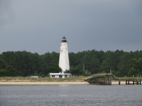
We passed South Carolina's oldest lighthouse, the scenic Georgetown Light, but our minds were concentrated on getting to a secure anchorage before the heavens broke loose.

georgetown lighthouse

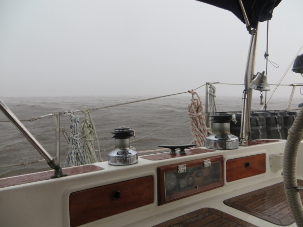
We anchored just before the Ocean Highway Bridge in a perfect little spot just off the ICW. We'd no sooner got the anchor down and snubbed than the heavens opened and the decks were washed clean. The thunder and lightning provided a good visual and audio show, but nothing came close enough to be of concern. It blew away in an hour or so, leaving us with a cool sleeping night for a change.

squall

Dinner, a movie and plotting the next day's route took up the rest of the evening and we zonked out shortly after the sun went down. It's amazing how just sitting in the cockpit and steering for 12 hours can tire out a body.

A Day in Charming Charleston

Native Charlestonians will tell you that the Ashley and Cooper Rivers join to form the Atlantic Ocean. Located at about the middle of South Carolina's coastline at the confluence of the two rivers, Charleston is the oldest city in the state and it's a gem. We discovered its charms in 2000 on our first trip up the US East Coast. We visited again in 2001, 2002 and again in 2007. It's that kind of city … it just keeps calling you back. Historic painting of Charleston by George E. Cooke, 1838

Founded in 1670 and originally called Charles Towne, the city was named for King Charles II. The city has enjoyed great prosperity and suffered great losses. Major battles of both the Revolutionary War and the Civil War were fought here and the city endured the occupation of invading armies. There have been numerous skirmishes with pirates and local Indians, catastrophic fires that obliterated entire blocks of the city, devastating hurricanes and the largest earthquake ever to rock the east coast of the USA. Yet it survives and thrives today.

Old photo of 1886 Charleston Earthquake

We only had one day to enjoy the city and ourselves plus get caught up on some chores. Some things change, some things don't. We vaguely remembered our way around, but seeing certain landmarks brought it all back to us. We did laundry (free washers/dryers at the marina … wow!) and re-provisioned at nearby Harris Teeters, a wonderful supermarket. On our way to the grocery as we passed the Port Authority, we remembered the facade of the Bennett Rice Mill building, propped up and standing there behind the fence in the middle of the parking lot. I tried to get closer for a good photo through the chain link fence, but I was shooed away, rather rudely, by the security guard. Why put something so unusual and beautiful in the middle of a secured area that precludes picture-taking?

rice mill facade charleston, south carolina

We found our favorite bakery/cafe, Saffrons, which still offered the most scrumptious pastries, breads and mid-Eastern cuisine … we took advantage. Ludens, a chandlery we'd liked back in 2000 that subsequently morphed to a sporting goods and outfitters store, was out of business. There was a Starbucks on every corner. Parks, open spaces, historic buildings and churches dominate the downtown. It's a pleasure to walk around and take it all in.

gadsdenboro park in charlestone, south carolina

We walked up Calhoun Street, enjoying the day and our surroundings. One of South Carolina's favorite sons, John C. Calhoun's statue stands high and proud above the trees, surveying the city from his pedestal of Carolina granite in Marion Square.

calhoun statue in charleston, south carolina

We turned onto King Street, the main street for shops, boutiques and restaurants. It's changed. There are more shops, more traffic and definitely more people. We found the Blue Bicycle Bookshop, a favorite place to browse in years past. It has expanded and reorganized … all the more fun to browse.

blue bicycle book in charleston, south carolina

Heading the opposite way down King Street, we saw Goorin Bros. Hats. We only found out later that Goorin is a chain of hat shops established back in 1895. What a treat to stroll through this shop. We tried on a few hats then asked about getting David's fine Panama hat blocked. After several years aboard Nine of Cups, it was looking pretty dismal … something Harpo Marx might wear. Not only did the friendly Goorin staff agree to block it, but they did it for free. Awesome! David looked pretty dapper walking down King Street with his Panama hat. He fit right in. We splurged and bought a hat box to store the hat for future use.

goorin bros. hat shop in charleston, south carolina

We caught a free trolley down to Liberty Square, adjacent to the Maritime Center. The Visitor's Center for the Fort Sumter National Monument was open and we wandered in. We had no time to take the ferry to the fort, but enjoyed the well-presented exhibits.

fort sumter in charleston, south carolina

We had so little time to visit all our favorite places. We never did get to the Customs House nor the old slave market where ladies still gather each day to sell their finely-woven sweetgrass baskets. We didn't walk along the Battery nor stroll past Rainbow Row … all within walking distance. Then, of course, there are the places outside the city to visit. This visit was just a taste of what we'll do when we stop on the way back down the coast next season.

All too soon, it was evening and we were charting our course for tomorrow's route.