Intracoastal Waterway - Days 11 & 12

Day 11 - 182 nm to go The full moon was bright as the sun rose to meet the day. The sun, not to be outdone by her nocturnal counterpart, splashed on the scene with flashy color and brilliance and soon diminished all thoughts of the previous night. It was duck pond calm and still quite cool . We had on our long-sleeved shirts once again to ward off the early morning chill.

sunrise on the intracoastal waterway

As we entered Core Creek, shafts of sunlight highlighted the rising mist from the river, giving it a mystic kind of look.

rising mist on the intracoastal waterway

It was a working day on the river. Shrimpers and trawlers were plying the local waters. Gulls crowded around them like gnats looking for an easy breakfast bite. Crabbers checked their pots. Men netted bait fish on the river's edge.

shrimper on the intracoastal waterway

We moved from tiny waterway to waterway, one eye on the depth meter and one on the channel, but there were no adrenaline rushes today. The creeks were narrow, but easy enough to negotiate. The riverbanks were heavily forested wetlands. Big stumps and dead trees crowded into the creeks.

intracoastal waterway

We crossed the wide, deep Neuse River, then worked our way along Goose Creek, across the Pamlico and headed up the Pungo River. We found a fine anchorage, midst crab pots, 20 miles up the Pungo River. There were no ATT bars, no houses, no nothing. We were in the backwoods of Nowheresville, North Carolina. David kept whistling “Dueling Banjos” as if someone hidden on shore might join in.  We had no visitors, however, and by nightfall, five other cruising boats heading north up the ICW were anchored around us. We'd circled the wagons just in case the natives got restless.

Day 12 – ICW Mile marker 128 - 115 nm to go

There was no brilliant sunrise this morning. A cool, lackluster sun made its appearance without fanfare. The wind had picked up during the night and it was tending towards blustery on a grey, grey day. We were stuck good in mud and the chain and anchor needed a washdown. The nozzle on the hose popped off and headed directly for the drink. Darn … I made do with a thumb over the end of the hose, but put a new nozzle on the buy-list.

We extricated ourselves on a slalom course around anchored boats and crab pots and set out up the Pungo-Alligator Canal. A bald eagle flew by, too quick for a photo, but easy enough to recognize. I spotted another high up in a tree, looking stern and serious the way eagles do. There's something exhilarating about seeing an eagle in the wild.

bald eagle on the intracoastal waterway

There were lots of birds flitting about and their morning songs were vibrant in the early morning quiet. The evergreens were thick on the north side of the channel contrasting with the grassy wetlands to the south. Old tree trunks stood rotting along the riverside and encroached into the channel … or were we encroaching upon them? The smell was musty and acrid, like a damp, mildewed closet.

grassy wetlands on the intracoastal waterway

A very friendly butterfly flew into the cockpit and lighted on the captain's shoulder, then proceeded to hitch a ride with us for the next few miles riding on a fuel jug on the aft deck.

butterfly hitches a ride

For some reason, dragonflies were out in great numbers today and as the wind increased, they hopped aboard and hung on for dear life. There were black ones the size of hummingbirds, yellow ones and green ones. They clung to lines and sheets and shrouds and one bright blue one found its way into the cockpit and lit on my finger for awhile, then my leg and then in the shelter of the windscreen. This one stuck around for several hours until we anchored, then left without a fare-thee-well.

dragonflies of the intracoastal waterway

We had the jib up as we crossed the Abermarle Sound … we were sailing! Well, at least motor-sailing. The wind was 15-20 knots and the Sound was rough and choppy with nasty square waves spaced only a couple seconds apart. We bounced along, avoided the ever-present crab pots and finally anchored in one of the few spots that afforded us the depth we needed. It wasn't the best spot for protection from the southwest winds, but it was the best we could find at the end of the day.

Intracoastal Waterway - Day 10

Still  206 nm to go- that's what happens when you don't move! I never thought I'd say this after the heat of the last few months but … BRRRR! With the strong northerlies came a significant drop in temperature and it's been downright chilly. This morning we rose to 64F/18C, 93% humidity. The winds had calmed during the night, but there was still a brisk 15+ knot winds blowing. Despite the sun, in the cockpit as the wind whistled through, it was cold and raw. I dug out long-sleeved shirts to keep us warm, but we just couldn't face long pants or shoes. Even though it was cool, the high humidity kept everything dewy and sticky. We had to squeegee the windscreen so we could see through it. No defrosters or windshield wipers on the boat!

As we departed Swansboro, we passed local shrimp boats tied up at the dock and weathered houses along the shore … very scenic and maritime-esque.

IMG_0019

We had planned this as a very short day ... for two reasons. First, planning evening anchorages for the next couples of legs was difficult. There weren't many anchorages that would accommodate our 7'2” draft (2.1m), so we chose a closer anchorage for tonight and two anchorages further up the ICW that were about 60 nm apart. The second reason for the short day?  As you know, we are lazy sailors and we can easily rationalize short days. Enough said. Unfortunately, though it was a short day, we still left before 0600 in order to time the rising tide for passing shoal areas.

We headed up the ICW, under the Emerald Isle Bridge and across the wide, flat expanse of the Bogue Sound. The wind whipped up the waves and there were whitecaps until we reached the relative shelter of Morehead City. We smelled wood and sawdust as the huge bulk container vessels unloaded their wood pulp into the waiting barges.

intracoastal waterway

As we turned the corner at the end of the commercial docks, we were exposed to the Morehead City Inlet. The current was in direct conflict with the wind and the waters roiled. We passed through the open, bascule Carolina Coastal Railroad Bridge and then immediately under the fixed Morehead City-Newport River Bridge. Eddies and whirlpools pulled and pushed the boat as it glided through.

intracoastal waterway

Just up the way, we spotted Chimney Island, which by the way, is for sale. Though I'm not sure of its history, its name is obvious.

intracoastal waterway

By mid-morning, it was warming up and comfortable again and we were ready to anchor. Newport Marshes is a tiny little spot just off the ICW that can accommodate about one boat the size of Nine of Cups. We found a fine little 15' pocket, dropped the hook and settled in for the rest of the day and night.

By the light of the full moon, everything looks beautiful.

full moon on the intracoastal waterway

Some new ICW info … We picked up a new navigation app by Navimatics called Charts and Tides, as recommended by Bob423 (aka Bob Sherer), a frequent and trusted contributor to Active Captain. This app overlays the Active Captain info on NOAA charts and it's pretty slick. It has lots of nifty features that we haven't even discovered yet. Though we're still learning about it, so far it's terrific. It's not just for the ICW, however, it also includes charts for the entire USA including Alaska, Hawaii and the US Caribbean islands. We're impressed!

The Blue View - River Rules Apply

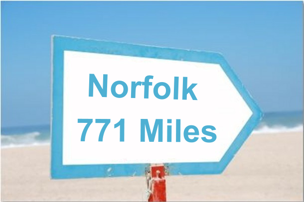
norfolk 771 miles As I write this, we have completed most of the 770+ miles of the ICW from St. Augustine, FL to Norfolk, VA. We went outside into the coastal Atlantic waters for only a short stretch between Charleston and Georgetown, SC, primarily because the tides were wrong and we would have either had to wait most of a day or would have had an almost 100% certainty of running aground in a particular shallow stretch of water.
So far we have enjoyed the trip immensely. The scenery and wildlife have been fantastic, and at 6 knots, we've had the time to see it as we navigated our way along the hundreds of lakes, rivers and canals that make up the ICW. Our only regret is that we were pushed for time (as usual) and couldn't stop as much as we would have liked. Maybe next time – and we're pretty sure there will be a next time.

We've had the opportunity to explore a number of rivers around the world, from South America to Panama to New Zealand to Tasmania, and we've acquired a number of guidelines that help when navigating most rivers. These are usually referred to as 'River Rules', and we've discovered that they also apply to much of the ICW. Here is my list of 'River Rules':

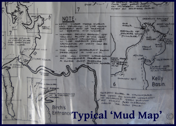
mud map

  • Local knowledge. Rivers are forever changing. What was a deep section last year (or when the chart was last updated) might have shoaling due to winter storms or flooding or any number of other reasons, and the local sailors and fishermen who routinely ply these waters will likely be aware of the changes. When possible, we ask around and try to gather whatever local knowledge we can. On several occasions, we've been able to copy the local 'mud maps' - hand drawn sketches with hazards, depths and the best routes for a particular river we were planning to explore – absolute gold! For the ICW, the Active Captain app for our iPad has been our source for local knowledge. It compiles notes from hundreds of other sailors that have traveled the ICW over the past few years, and provides tons of information about uncharted hazards, shoals and other navigational issues.

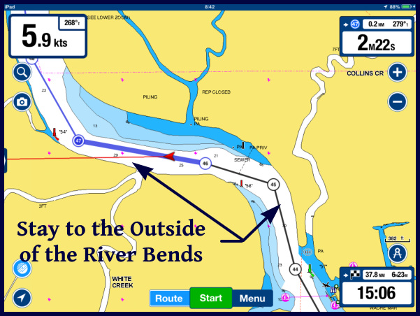
outside bend

  • Outside curves. As a river goes around a bend, the water flows faster on the outside of the curve and slower on the inside. Because of this, the outside of a curve will usually be deeper than the inside. This isn't always the case – there might be some underwater obstacle that diverts the flow or a rock ledge on the outside curve, but in general, lacking any information to the contrary, we will favor the outside of a bend and avoid the inside.

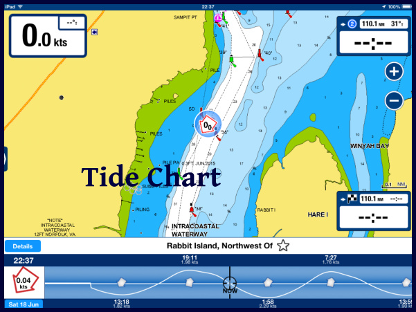
tide chart

  • Tides. Most of the rivers we have navigated have been tidal, and the tidal changes have been large enough to be a significant factor. We've seen a few tidal swings of as much as 30+ feet, and many that were 15-20 feet. In the ICW, it was common to see 7 foot swings, and so with our 7'2” draft, at high tide, we can pass over any point that isn't awash at low tide. There are a number of spots along the ICW that have only 5-7 feet of depth at low tide, making it important to time our passage at mid tide or higher – preferably on a rising tide.
  • Currents. Along with big tidal swings come big currents. We've seen tidal flows of ten knots or more in our travels – much more than we could possibly motor against – and navigation must be planned around the current. On the ICW, the tidal currents are typically 1-2 knots, though in some narrow channels, up to 5 knots have been noted. We try to plan around the current when we can, but it isn't always possible. The current switches direction every 6 hours, so it often works out that half our day has a current push and half the day we find ourselves fighting it. Sometimes it's not consistent - a stretch of water might have an inlet on both ends, so a rising tide will give us a nice push as we enter one end, but it will be an adverse current as we near the other end. We've also noticed that the tides are slightly later as we work northward. Depending on where we are on the tide table, we sometimes find we have a push almost all day long, and a few days later we have an adverse current most of the day.
  • Winds. The wind direction and strength will often affect water levels. A strong onshore wind can make river levels a foot or two higher than normal, affecting bridge clearances, while a strong offshore wind may reduce the water depth significantly below the charted depths.
  • Reading the water. A number of clues can be gleaned by reading the water. If the current is flowing, an indication of its strength and direction can be seen by watching the flow around posts or how floating markers are leaning. A standing disturbance in the water may indicate a submerged hazard. If the water is still and the sun is high, shoals and bars can often be detected by the water color. In the high latitudes, kelp on the water surface often marks rocks below the surface.

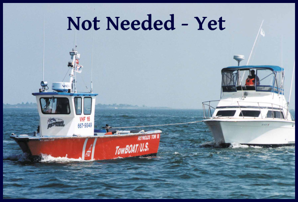
So, with all our navigation electronics, Active Captain providing us with local knowledge, and applying our River Rules, how'd we do? We still ran aground three times! All three times were soft landings in mud or sand with no damage done. Twice, we were able to back off or torque turn our way off the shoal within a couple of minutes. We were stuck pretty well the third time and it took about a half hour to extricate ourselves. We still had a few techniques to try before finding out how good our towing insurance was.

tow boat

I like to look at the positives – we were able to remove all those hard-to-get-at barnacles on the bottom of the keel, and we got to practice our 'extrication' techniques. Plus, three groundings in 600 miles is a big improvement over our last foray on the ICW 15 years ago - I think we had at least that many groundings per hundred miles back then.