

Antarctica… A Sidetrip to the White Continent
It’s the coldest, windiest, darkest, driest and highest (on average) continent in the world. In fact, the lowest temperature ever recorded on Earth, -129.3ºF /-86C was recorded in Antarctica and Antarctica, classified as a desert, has less annual precipitation than the Sahara Desert! The fifth largest of the seven continents, it was the famous British navigator, James Cook, who was the first to cross the Antarctic Circle back in 1773. The Antarctic Treaty signed in 1959 by twelve world nations agrees that no one nation owns the continent. Although several governments have claimed territory and have permanent stations there, the countries active in Antarctica have made a commitment that it should not become the scene or object of international discord. Only research for peaceful means is allowed there.

Antarctica Facts:
Capital: None
Population: Officially none, except at research stations and then 1,200 in winter; 5,000 in summer
Language: No official language
Currency: No currency
High point: Vinson Massif, 16,066 feet above sea level
Low Point: Bentley Subglacial Trench, -779 ft.
Time Zone: A tricky question in a place where all time zones converge. So everyone in Antarctica officially goes by New Zealand time.
Land Area: 5,100,021 sq miles (varies due to changing ice shelves) representing 8.9% of the earth’s land. Antarctica’s coastline measures nearly 19,000 miles of which only ~800 miles is ice free. The Ross Ice Shelf is larger than France.
The plan to visit Antarctica had been hatching for some time. After all, it IS the 7th continent and rarely visited by most travelers. We had even considered trying to work for a season in Antarctica, but our applications, along with 30,000 others, were never even acknowledged. While in Puerto Montt, Chile, we chatted with a Dutch couple who had taken a 10-day passage aboard a research vessel from Ushuaia. Then later, while in Ushuaia, Argentina, we met up with the crew of Asylum who had just returned from an Anarctica cruise. The “bug” got us and never let go. We did not feel comfortable taking Nine of Cups there… most boats that sail there are steel boats able to cope with icebergs and have larger crews. The alternative was to take the route that Asylum took. We ended up rushing through the canals to get to Ushuaia in time to make one of the last cruises of the season. At $2,750 USD per person last-minute rate, it was a large expenditure for us budget-minded cruisers, but a once in a lifetime opportunity, we thought. We rarely regret what we do, only what we do NOT do. In retrospect, we'd definitely do it again.

We left Nine of Cups on a mooring in Ushuaia, secured a caretaker for Jelly and boarded the steel-hulled ship, Explorer (aka The Little Red Ship) bound for Antarctica for 10 days.

The view from our porthole shows a calm sea and a huge tabular iceberg in the distance. Tabular icebergs are those which have broken off an ice shelf.

Ten days is really not very long to explore a continent. In fact, most cruise ships only visit the Anarctica peninsula, the closest point to Ushuaia, Argentina. The red dotted line was our route.
Between the tip of South America and the tip of the Antarctic Peninsula lies the Drake Passage, considered some of the roughest seas in the world.
Our passage was one of the best the Captain remembered in the last 16 years! It was calm, smooth, sunny and unseasonably warm. The Drake Passage is named after the famous British navigator, explorer and privateer, Sir Francis Drake. When the passage is calm, it’s called the Drake Lake. When it’s not, it’s called the Drake Shake or “paying the Drake tax”. The area in which the Atlantic, Pacific and Indian Oceans meet the Southern Ocean is called the Antarctic Convergence or the Polar Front. Another interesting fact… The Antarctic Circumpolar Current is the world’s largest current and flows at a rate of 5.5 billion cubic feet/second … about 1000 times the flow of the Amazon River.
Our first landfall after the Drake Passage was the South Shetland Islands. The 335 mile long chain consists of four main island groups. The Brit, William Smith, discovered them in 1819 after being blown off course while rounding Cape Horn. Sealers took an incredible number of fur seals in 1820-60 almost annihilating the population. The highest point on the islands is Mt. Foster on Smith Island at 2280’.

Our First landfall in Antarctica was the south shetland islands, a major group of islands at the northern point of the Antarctic Peninsular. were named after the Shetland Islands of Scotland,

Our first landing ashore was Aitcho Island in the South Shetlands which were Cleverly named for the British Admiralty’s hydrographic Office (“H-O”), Since the South Shetlands are considered peri-antarctic islands, we were not yet officially in Antarctica.
We were surprised at the how much green there was on the island. The beach where we landed was cobble, but green moss and algae covered the hillside along with a significant amount of penguin poop. Plants on Antarctica are limited to about 350 species of lichens, mosses and algae. There are no trees or bushes. We were also surprised at just how warm it was in the bright sunshine. We were all decked out in our foul weather gear with multiple layers of clothing underneath and we were sweating.
Aitcho Island is home to gentoo and chinstrap penguins. The smell was similar to that of a hen house and we spent a great deal of time scraping and washing our boots before being allowed back aboard the launch and the ship. Though late in the season (referred to as “dead penguin season”), penguins were innumerable and totally unafraid of us. They went about their business, never bothering about us as long as we stayed out of their way. They had an interesting way of spreading their wings as they waddled quickly past as if they had important business to attend to and they were already late. It was molting season for the adults and fledging time for the chicks. The adults lost all of their feathers and the chicks lost their baby down and grew their first feathers. There were down and feathers everywhere and many of the penguins looked miserable waiting for the process to be over with.


Our next landing was Danco Island… still not officially “on” the Antarctic Peninsular, but we were getting close. Danco Island, about 1 mile long, was
established by the British as Base O for the purpose of topographic and geologic surveys. It was occupied from 1956-59 and then abandoned. Per the terms of the Antarctic Treaty in 1994, all disused, non-historic sites were to be abolished and thus the site was cleared except for a small refuge hut in 2004. The island was originally charted by Gerlache in 1897-99 and later named after the expedition’s geophysicist, Emile Danco, who died in Antarctica.

On Danco Island, the sign noting the historical signficance of the island also provided good, but limited, reading material for this local gentoo penguin.


From Danco Island, we went just around the corner to land at Neko Harbor, an actual landing on the Antarctic Peninsular! Located deep inside Andvord Bay, this harbor was discovered by de Gerlache, but takes it name from the Norwegian whaling ship, Neko, which operated in the area between 1911 and 1924. This area is home to a large colony of Gentoo penguins as well as brown skuas and snowy sheathbills.
A little trivia… It was here that American long distance swimmer, Lynne Cox made her historic 25 minute, 2km swim in in near freezing water in December 2002.

Marcie mingled with the local inhabitants who didn’t seem to mind her at all…in fact, they pretty much ignored her. Take a good look at the icy water in the background, definitely not a good place for a swim!

A chubby fledgling Gentoo in the process of losing his baby down and acquiring his first feathers.

Still traveling south, we entered the Lemaire Channel, so scenic its nickname is the Kodak Gap. We took a Zodiac trip through the iceberg fields, threading our way between huge, building sized bergs.
The first photograph of an iceberg was made by Britain’s Challenger Expedition in 1874. One of the biggest icebergs ever, broke free from the Ross Ice Shelf in 2000. It measured ~183 miles long x 23 miles wide with a surface area the size of the Bahamas above water and 10 times larger below. Antarctica’s ice sheets contain 90% of the world’s ice which holds nearly 70% of the world’s fresh water. In fact, if Antarctica’s ice sheets melted, the world’s oceans would rise by over 20’. Global warming?

Antarctic Explorers
Long before Antarctica was discovered, ancient Greek philosophers as far back as 530 BC, believed that a continent covered the southern end of Earth. Specifically, they believed that the world was “balanced” and thus a large southern continent would balance the northern continents. Since they had named the northern ice lands “Arktos” after the northern constellation, the opposite would be “Antarktos”. It was also referred to as Terra Australis Incognita… the hidden southern continent.
During Cook’s explorations of the area in the late 1700’s, he mentioned the abundance of seals at South Georgia and the Sandwich Islands which prompted sealers to begin exploration and exploitation of the area, nearly decimating the seal population. The Antarctica continent was first sighted in 1820 by Fabian Bellinshausen, but not considered a continent until 1840 when sufficient exploration deemed it large enough to be considered a continent rather than just a group of islands. Inland exploration began in the early 1900's. The Norwegian explorer Roald Amundsen reached the South Pole in 1911. In what turned out to be a dramatic race, he arrived there five weeks ahead of a British expedition led by Captain Robert F. Scott. The Heroic Era from about 1895 until 1930 included the Big 4 Explorers: Scott, Amundsen, Shackleton and Mawson.
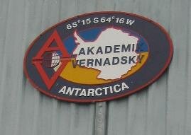
Our next stop was in the Argentine islands at the Ukranian station, Akademik Vernadsky on Galindez Island. At 65º15S / 64º10W, this is the most southern point we would reach on this trip. This station, built by the UK and named Farraday Station was the first to identify the hole in the ozone layer. The station was transferred to the Ukranians for the sum of 1£ in 1996 and is currently the most senior station open continuously in Antarctica.


Before visiting the station itself, we visited Wordie House, an historic site. Built in 1947 (not THAT historic!!) as the first station, it is located about ½ mile from the current station and was restored by the British in the 1990’s back to its early 1950’s appearance. The vintage kitchen to the right included a pantry that still contained canned and packaged goods on the shelves and a true reminder that the place was once British… a Guiness sign.
The outside of the station facility was neat and clean. Storage sheds housed fuel, generators and tools. All refuse is hauled away by supply ships which call infrequently. Our ship left several crates of fresh veggies for the station which we’re sure were much appreciated. At the station itself, we were greeted by one of the 24 Ukranians who man this station year round and given a tour of the facility and an overview of the research work that is performed here. A huge iceberg floated into the little harbor where we unloaded.
At the end of the tour, we all met in the Farraday Pub where we all tried a shot of Ukranian vodka (whew…now that puts hair on your chest!). Our bartender was friendlier than he appears in the photo below. The pub, a remnant left by the Brits, sports a carved wooden bar, a dart board, billiard table and bras hung from the ceiling left by nubile visitors over the years. There is also a souvenir shop with a banner “the most southern souvenir
shop in the world” draped over its entrance. Additionally, there is a post office which sells commemorative postage stamps An interesting note… only American $$$ were accepted.


Life aboard the ship was quite civilized. We had a small, but comfortable room with two twin beds (ugh!), a private bathroom with shower and a hanging locker… not so much different than Cups except the bed situation. The ship had a bar/ lounge, a dining room, a lecture hall with comfy chairs and a small ship’s library with a good Antarctic book selection. Bulletins and charts were posted throughout the ship, showing what activities were available and when and exactly what progress the ship had made.
Meals were quite good. Breakfast and lunch were “help yourself” buffets with a good variety of offerings. Dinner was a sit-down affair, usually 3-4 courses and quite tasty. Additionally, “tea” was served daily at 4pm in the lounge with snacks available. Tea, coffee and fresh fruit was always available. We were honored to be chosen to sit at the Captain’s Table for the Captain’s Dinner event one evening. Our captain, Kenth Grankvist, was a Swede and had been ice piloting for 16 years in both the Arctic and Antarctic waters.
A typical daily routine would include breakfast at 0730, followed by a morning briefing of what to expect ashore then a landing ashore. Back to the ship for lunch while the ship moved on, an afternoon landing, back to the ship for hot showers. A lecture was usually given around 5pm and sometimes another around 7pm. Dinner at 8pm with an end of day review in the lounge followed by a video appropriate to the Antarctic and always good. Full days, everyday… always interesting, always something different.


Our next landing was at the British station, Port Lockroy (French pronunciation of Lock-rwah). Located on Wiencke Island, this station is the most visited by tourists in all of Antarctica. Formerly the British Base A, it was set up in 1943-44 to monitor German ship movement as well as ward off Argentine claims to the area. It was manned continuously until 1962 then abandoned. It was restored in 1996 to its original “glory” and now serves as a self-financing museum and post office. We brought postcards from Argentina and had them hand-cancelled and mailed from here. They purportedly hand cancel over 40,000 pieces of mail per season to over 116 countries. They also maintain a small souvenir shop. The island is also
home to a large Gentoo rookery. The penguins moved in after the station was built, but it appears they are not affected by the 10,000 tourists that tramp through during the season. Like the Wordie House, the museum is 1940-1950’s vintage furniture and equipment. David takes a look at the famous “Beastie”, an early apparatus for upper atmosphere study.

On the other side of Wiencke Island was Jougla Point where even more Gentoo penguins lived. We wandered around, never tiring of watching the penguins. There was also a composite blue whale skeleton reconstructed on shore to view. While here, the wind increased dramatically and the temperature dipped to below freezing. The skies were overcast and gray, and snowflakes whirled through the air.
Ice is a major part of the landscape here. It is everchanging and magnificent. Thick ice buries most of Antarctica. The continent's deepest ice is more than 10 times the height of the Sears Tower. The deepest ice core ever drilled in Antarctica produced ice estimated to be ~950,000 years old at its bottom. We had the opportunity to drift and wander through ice floes aboard Zodiac inflatables. The colors, hues and shadows were incredible. The water was very clear and the submerged portion of the massive ice bergs showed well beneath the surface in shades of shadowy blue-greens. We could hear cracking and loud thuds as the ice settled and sometimes split with a crash to the water and subsequent big waves.
Our “little red ship” seemed to be ice-bound… just an illusion from the vantage point of our Zodiac. Antarctica is called the “white continent”, but at times, all we saw were dazzling shades of blue.


There are 6 species of seals found in the Antarctic. Included in our sightings of “pinnipeds” were crabeater, fur, Weddell, leopard and elephant seals.
Sealers were the first to follow the explorers and were so thorough in their slaughter that they nearly annihilated seals altogether. An example in the
South Shetland Islands, in only four summers between 1819-1923, the entire population of hundreds of thousands of seals was totally gone. Seals were hunted for their fur as well as the oil produced from their blubber.


We headed back north through the Neumayer Channel and the Lemaire Strait to the South Shetlands again. We landed at Hannah Point, Livingston
Island, home to gentoo and chinstrap penguins as well as one pair of macaroni penguins, the only macaronis we saw during the entire trip. We walked along the beach to Walker Bay where a collection of local fossils and minerals had been collected and left on display on one of the flat rock tops. The visiting ships coordinate their landings so that no more than 100 people are ever ashore in one place at one time. The first tourist groups left for Antarctica in the 1960's. In 2005, 20,000+ tourists visited.
From Livingston Island, a short trip to Deception Island, our last shore landing for the trip. A broken-ring shaped island, this excellent natural harbor was formed by a collapsed volcano cone. We entered the inner lagoon via a narrow, rock-strewn break in the volcano’s walls called Neptune’s Bellows, aka “Hell’s Gate” and “Dragon’s Mouth”. The rusting remains of Southern Hunter, a British whale catcher, lies along the side of the entrance, sunk New Year’s Eve 1957. Because of its volcanic origin, the beach at Deception is all black volcanic sand. We landed at Whaler’s Bay. The remains of the whaling station are evident everywhere. Dilapidated wooden huts, large rusting tanks, boilers for processing whale oil and rotting boats dot the beach.
The first whaling station in Antarctica was established in 1904 by an Argentine-Norwegian company which took 183 whales in its first season. Exploitation followed. In 1912-13, six land stations, 21 factory ships and 62 catcher boats killed and processed 10,760 whales. By 1930-31, the kill increased annually to over 40,000 and continued at this level for the next 20 years, almost annihilating the world whale population. In 1986, a world
moratorium on commercial whale catching went into effect. Japan, however, still kills some 400 minke whales each year in the name of “research” and Norway still hunts and kills whales. Why whales? Whale oil was extensively used for lighting, lubrication and tanning in the early 20th century. The market expanded even more when a process was invented to turn it into margarine and soap. More efficient methods of killing and processing the whale made it even more profitable. The records from South Georgia Island, the main site of land-based whale processing operations, recorded a total of 175,250 whales from 1904 to 1965. Little wonder that so few whales exist today!
We saw lots of whales beginning in the Drake Passage and throughout our cruise in the Antarctic waters. Though several species inhabit the area, we saw minkes, fins and humpbacks. A female blue whale caught at Grytviken in the 1911-12 whaling season measured just under 110 feet, making it the largest animal ever recorded on earth!


We had several beautiful, blue- skied days and a couple of bad weather days which gave us a taste of what it could really be like. Even on sunny days, the water was at freezing temperature. One day it snowed heavily and we noted that the snowflakes landed on the water, but did not melt. Since the water temperature was below freezing, the snow just accumulated on the surface.

as grown adults on the Zodiacs, there was only one thing to do with all the snow…. have a snowball fight… which we did.

Remember, this was a volcanic caldera on Deception Island? Well, the sand below us was quite warm. In fact, once a pit was dug, the water which seeped inside warmed up to a balmy 80ºF. The intrepid among us (read that…young and foolish) all went dashing into the icy Southern Ocean for a dip and then returned to bask in the warm mud pit. We were content to watch and take photos.
The Crew’s Reading/Viewing List:
Terra Incognita by Sara Wheeler… a travel journal
The Endurance by Caroline Alexander … Ernest Shackleton’s fateful trip to Antarctica
March of the Penguins…Oscar winning documentary on Emperor penguins
Life in a Freezer…Alastair Fathergill describes spending the winter in Antarctica.
Antarctic Oasis by Pauline Carr…exquisite photo journal of life on South Georgia Island.
Thoughts on visiting Antarctica….
Without a doubt, Antarctica is the most exotic place we have ever visited. It is "other worldly". Beautiful, cold, austere, serene, remote... it is each of these, all of these and so much more. Some thoughts...
It’s the least accessible continent and we’ve been there! Getting to the rest should be easier.
The emptiness, openness, vastness of an uninhabited land makes it so appealing… a last frontier on the Planet Earth.
The colors of ice: hundreds of hues of blues and greens.
The wildlife was incredible... seals, whales, birds and of course, penguins.
Having read and learned much about Antarctica’s history and its explorers, we are humbled by what these men withstood and how severe
the conditions must have been, yet they persevered.Would we come back here in Nine of Cups? Unequivocally, NO! With a fiberglass hull, she is not made for this type of travel in icy waters. We
could never have enjoyed ourselves to the same extent with the peace of mind of going ashore, without worrying about anchorages, the weather or boat issues.Would we come back here in someone else’s boat or at another time? Yes, we think depending on the circumstances and the boat. We saw so
little of the continent, just the peninsula… a mere fraction of its splendor. Knowing in advance how difficult it could be and the type of conditions we might encounter (on the Explorer we were very lucky), we’d think twice about a commitment on a private yacht.Part of the draw for returning is the wildlife and that can be better viewed on some of the Peri-antarctic islands like South Georgia Island.

Extra! Extra! Extra! The Little Red Ship sunk in Antarctic waters on November 23, 2007. All passengers and crew were transferred to a nearby cruise ship without incident. Read the whole story here.
Winter was coming on and by the time we returned to Ushuaia, the mountains were covered with snow and it was getting cold. It was definitely time to head north up the Argentine coast and out of the high latitudes. Want to continue your travels with us in the warm? Next up Argentina.