

The Caribbean ... Paradise on Earth
Reaching the Caribbean was our first exotic destination goal on Nine of Cups. We chartered a few times first, but sailing there on Nine of Cups was a whole new experience. Each new island and each new country was an adventure unto itself and the more we traveled, the more we knew this was the life for us.

Some Caribbean Trivia ...
Area: ~ 1,063,000 sq miles (2,754,000 sq km).
Population: ~43.5 million (est. 2002)
There are at least 28 island nations and more than 7,000 individual islands in the Caribbean.
The Caribbean's greatest depth is called the Cayman Trench, between Cuba and Jamaica and is about 25,216' (1,686 M) below sea level.
Pico Duarte in the Dominican Republic is the highest peak in the Caribbean ... and we climbed it!!
In 1492, when Christopher Columbus began his exploration of the Caribbean islands, he became the first European to venture into the area.
After reportedly landing in San Salvador Island, Bahamas, Columbus named these islands the Indies because he thought he had finally reached Asia (and the East Indies). Hence the name Indians for its inhabitants.
Good reading ... Caribbean by James Michener
Come with us and explore the Caribbean. Browse along our route starting in the Bahamas or select a specific place you’d like to visit by clicking on one of the icons below. You can also click on thumbnail photos within each country to view larger photos.
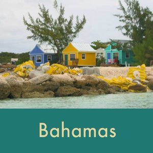
The Bahamas - 2001
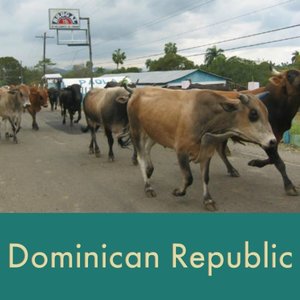
The Bahamas can be as close as 50 miles from Florida across the Gulf Stream Current. With over 700 islands covering 100,000 square miles, a boat could get lost in the Bahamas forever … and some do. Lucayan Indians inhabited the islands when Christopher Columbus first set foot in the New World on San Salvador in 1492. British settlement of the islands began in 1647 and the islands became a British colony in 1783. Since attaining independence from the UK in 1973, The Bahamas have prospered through tourism and international banking and investment management.
We visited several islands on two separate passages. Come on along and explore with us.

Commonwealth of the Bahamas
Capital: Nassau
Area: 13,940 sq km, slightly smaller than Connecticut
Population: 305,655 (est 2001)
Currency: Bahamian dollar (but US $ gladly accepted)
Lowest point: Atlantic Ocean, sea level
Highest point: Mount Alvernia, on Cat Island 63 m
Languages: English (official), Creole (among Haitian immigrants)
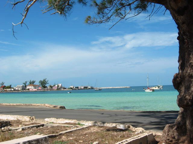
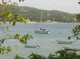
Great Harbour Marina - Berry Islands - 25N75 / 077W86
A weather window for crossing the Gulf Stream was good, so we departed Feb 1, 2001 to make the overnight passage to the Bahamas and the Berry Islands. Shane, a family friend, was sailing with us and he turned out to be a good sailor and crewmate. Our first port of call was Great Harbour in the Berry Islands where we would clear Customs. The entrance to the cut was very narrow and all unknown territory, but we managed just fine.
Being novice sailors, everything was new and seemingly a challenge. We referred to each new challenge as a dragon that needed to be slayed. We had never cleared Customs before into a foreign country and weren't quite sure what the correct procedure should be nor what to expect. The Great Harbour Marina staff took it all in stride and arranged a visit from the Customs official. We presented boat papers, a pet permit for Jelly and our passports and along with $100, we were cleared in for a three-month stay with permission to fish. Voila, another dragon slayed, just like that!


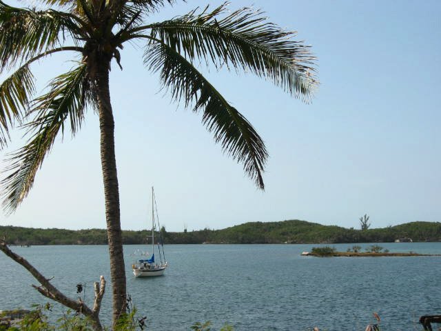
Great Stirrup Cay, Berry Islands - 25N82 / 077W92
We island hopped in the Berry Islands rowing the dinghy ashore when we felt like exploring. Norwegian Cruise Lines was using Great Stirrup Cay as its Fantasy Island. We landed on the opposite side of the island to check it out. The Great Stirrup Cay Lighthouse, built in 1863, was neat, but not functional. The international airport sign was our favorite sight.


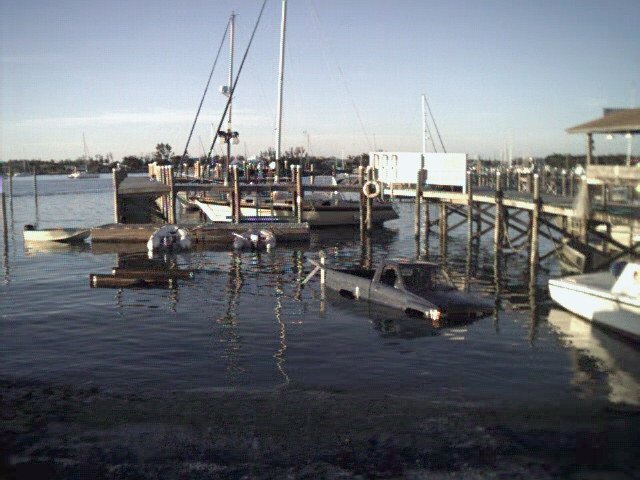
Marsh Harbour, Abacos Islands - 26N54 / 77W05
Shane left us in Marsh Harbour, Abacos and his parents and 7-year-old sister flew in to meet us there. The Brinkman-Davis’are old friends and it was their first time on a boat and first vacation in several years. We snorkeled, walked, explored, played cards, read, visited and generally relaxed. Marsh Harbour is considered a pretty good-sized town by Bahamian standards, but it was quite small and walking from end to end of the town was not difficult. One morning we arrived at the dinghy dock to find a truck parked in the middle of the harbor. It never moved while we were there and may have become a permanent fixture for all we know.
‘Potcakes’, the local name for stray dogs, were everywhere in Marsh Harbour trying to find a place to stay cool and out of the heat. “Potcats” were also in great numbers and local cruisers contributed funds to house, feed and neuter unwanted animals.

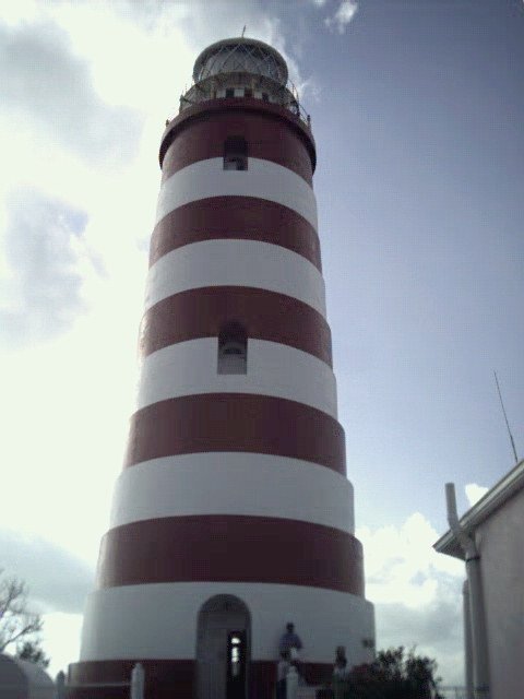
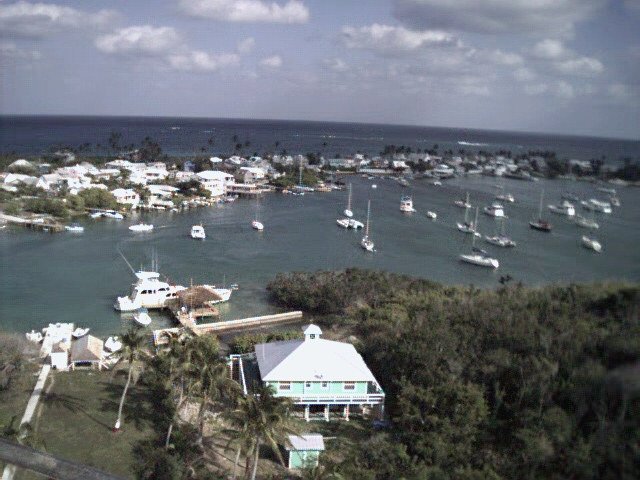
Because the anchorage is so shallow in Hopetown, we took the Albury Ferry to Hopetown. The view from the observation platform at the
top of Hopetown Light was spectacular.
We only had time for a tiny taste of the Bahamas this trip, but next time, we had the opportunity to explore a bit more extensively.
Return to the Bahamas 2002
We left Charleston, SC on 17 January 2002 and headed to West Palm Beach, FL on the "outside" with an overnight stop at the anchorage in St.
Augustine. The passage was calm and cold, however, each degree south brought warmer breezes and dreams of shorts, t-shirts and bare feet.
Our perception of the Bahamas before cruising to the Berries and the Abacos in 2001 had been limited to hearsay about Freeport and Nassau. There’s nothing like visiting by boat to give you a feel for a place.
We stopped briefly in Nassau before heading south. Eleuthera, Concepcion, San Salvador, Rum Cay, the Exumas and finally Mayaguana were our ports of call in the islands. Though we dawdled some, we were always aware that we needed to be in Trinidad by the beginning of hurricane season. We were new at the cruising life and worried we’d have to rush at the end if we lingered too long in one place. Plus, there was much to see along our route and we were always looking ahead.


Of all the places we visited, we enjoyed the Exumas the most. A chain of 365 islands, islets and cays that extend for 130 miles, it’s a paradise. The waters are turquoise blue and the beaches are lovely. Georgetown is the main cruiser hangout, but it was crowded and we gave it a pass. Instead, we found smaller islands to visit; and explore.
The Exumas Land and Sea Park is part of the Bahamas National Trust which works to protect natural and historical resources in the Bahamas. No fishing, shelling or conching is allowed. In return for volunteer work within the park, we were allowed to anchor for free. After providing resumes of our engineering, marketing and management backgrounds, they found tasks for which we were qualified - David on the rock pile and Marcie did some babysitting.
Booboo Hill at Warderick Wells in the Exumas has lots of legends associated with it. Evidently, a ship went missing on the reefs off this area during a storm and all aboard were lost. It is said that their souls haunt the hill. Visitors leave driftwood and signs with their boat name in an offering to Neptune in hopes that he’ll offer safe passage for their ship and crew.
Alan’s Cay was very special. It is inhabited by iguanas! Endemic to three small islands, the iguana population is ~ 1000. It seemed like all of them were coming out to greet Marcie. FYI … the collective for iguanas is a ‘mess’.


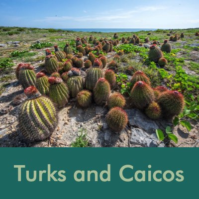
Turks and Caicos - 2002
We left the Bahamas and headed for the Turks and Caicos Islands.


The Turks and Caicos are a British Overseas Territory.
The territory includes eight large islands and numerous smaller cays, islets, and reefs, but only two of the Caicos Islands and six of the Turks group are inhabited.
The Turks are named after the Turk's cap cactus that is native to the island. The Caicos Islands derive from the native term "caya hico" meaning "string of islands".
Grand Turk was the first land reached by astronaut John Glenn after he orbited the Earth in 1962.
We stopped in Providenciales (Provo) to resupply. The anchorage was lovely, but ashore there were swarms of tourists (as if, because we arrived by sailboat, we were not tourists!). Nonetheless, shops, stores and beaches were crowded and we prefer less hubbub. That said, we danced on the deck as we demolished ‘cheeseburgers in paradise’ and cold beers as we sang along with Jimmy Buffet.
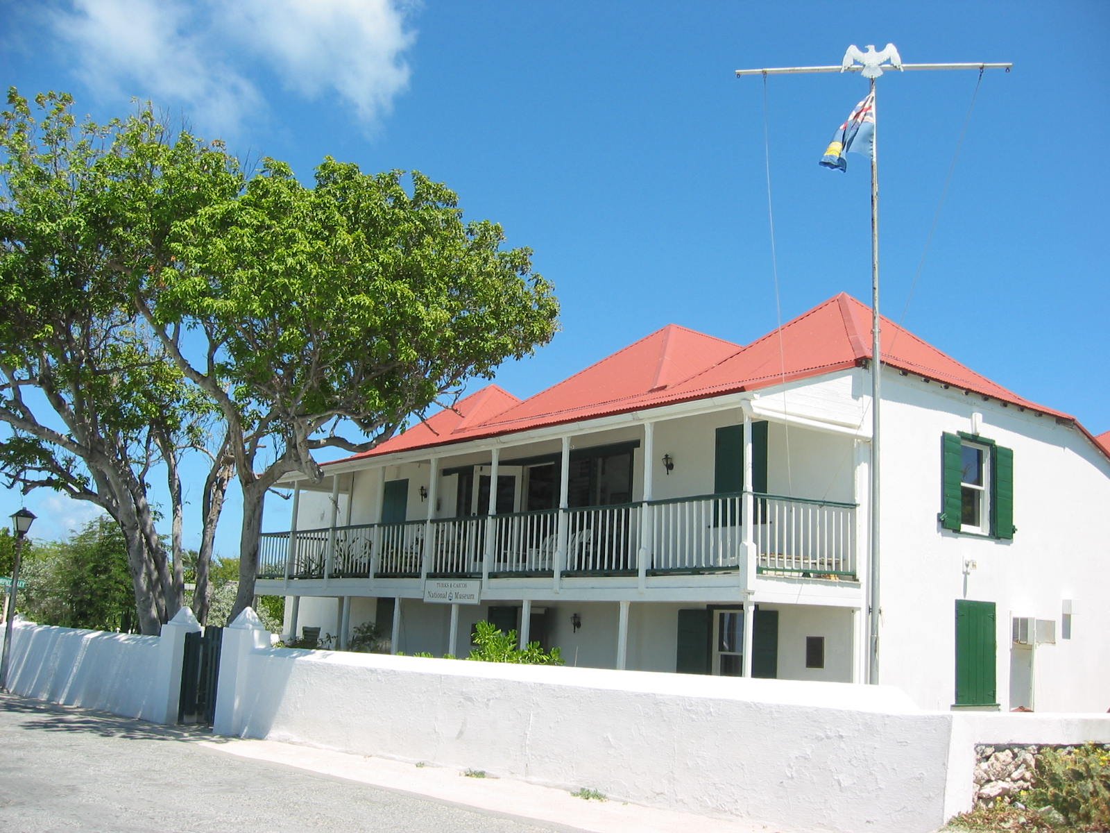
Our favorite stop was Grand Turk Island. We anchored off Cockburn Town and wandered through the wide streets. A visit to the Turks & Caicos National Museum was surprisingly enjoyable and provided lots of information about the islands and their history.
The Grand Turk Lighthouse overlooking Northeast Reef was cast in iron in England and transported to Grand Turk and reassembled in 1852.
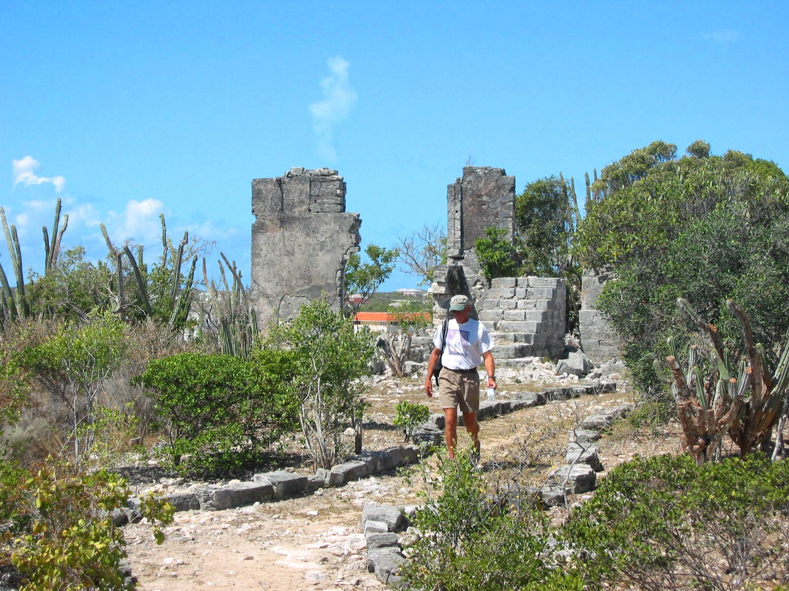
The Bermudian Saltrakers were the first to produce salt commercially in the Turks and Caicos by evaporating sea water in a series of salinas or salt ponds. Since then, salt played an important part of the economy until the 1960s. The salinas still occupy a huge area in Grand Turk and Salt Cay, and are reminders of this history. Pictured are the remains of a windmill used to pump water between salinas.
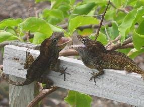
Every island has its own unique species of lizards or anoles (a-NO-lays). The two males pictured below are indigenous to Grand Turks and are fighting over territory. They extend the loose skin under their necks, called dewlaps, to appear bigger and more ferocious.


Dominican Republic - 2002
From the Turks & Caicos, we sailed into the Caribbean Sea, arriving first in the port of Luperon, Dominican Republic. We used Bruce Van Sant's "Gentleman's Guide to Passages South" as our guide and met Bruce and his wife, Rosa, while we were in the DR. This was our first real taste of what we considered "exotic and foreign" and we loved every minute of it. Our Spanish was almost non-existent, but no matter, the people were warm and friendly and more than patient with us. We spent a wonderful month in the DR exploring this beautiful country. Our travels in-country included the cities Puerto Plata, Santiago, Santo Domingo and an ascent of the highest mountain in the Caribbean, Pico Duarte.
The island of Hispaniola is divided between Haiti and the Dominican Republic. Due to government safety warnings, we did not visit the Haiti side. The island was first inhabited by the Ciboney Indians and later by the Tainos who occupied the island when Columbus arrived on December 5, 1492. He named the island “Isla Espanola” (Spanish Island) from which the name Hispaniola was derived. Columbus lived here for many years until his death and his remains are supposedly buried in the cathedral in Santo Domingo.
Our route is noted in red on the map below.

Domincan Republic facts:
Official name: Republicana Dominicana
Capital: Santo Domingo
Population: ~ 7 million
Land Area: 48,730 sq km (about twice the size of New Hampshire)
Language: Spanish
Lowest point: Lago Enriquillo -46 m
Highest point: Pico Duarte 3,175 m
Currency: Peso (RD$)17.20 RD$ = $1US
Local beer: Presidente, a pilsner type brew. Cost for a large beer in a restaurant was about $30 RD ($1.74 US).
Local Rum: Brugal’s - 1.75ml bottle of Brugal’s was $RD118, <$7 US.
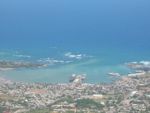
Our port of entry was an anchorage at the tiny fishing village of Luperon on the north coast. As you can see below, the view from the Comandancia's office gives an impression of what the sleepy town of Luperon is like. It was not uncommon for cattle to be herded down the middle of the streets, stopping all traffic.


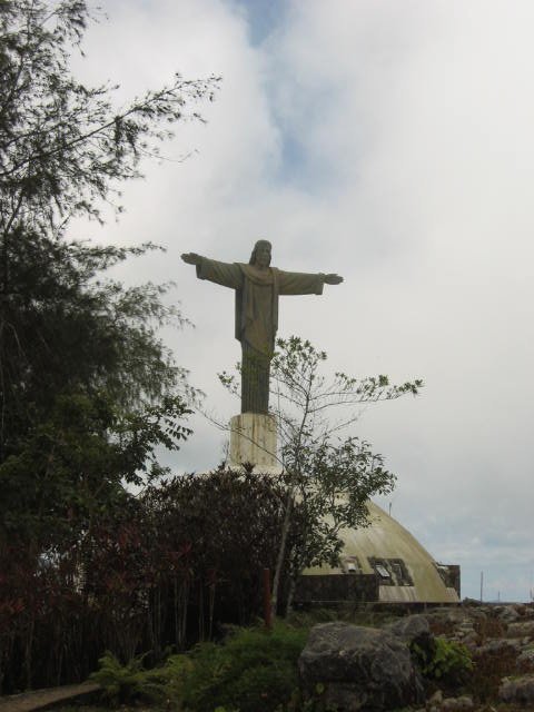
Puerto Plata was the closest "big" city and we traveled there by guagua (gwa-gwa), a van built to accommodate 10 usually carrying in excess of 20 people, some hanging out the doors or off the roof. We took the teleferrico (cable car) to the top of Isabela de Torres for a great view of the harbor taken from the top. Moments later, a huge cloud totally enveloped us. A huge Christ figure stands atop the hillside.
The personal vehicle of choice in the DR is the motoconcho. Whole families would ride on them. They were ubiquitous, noisy and very fast

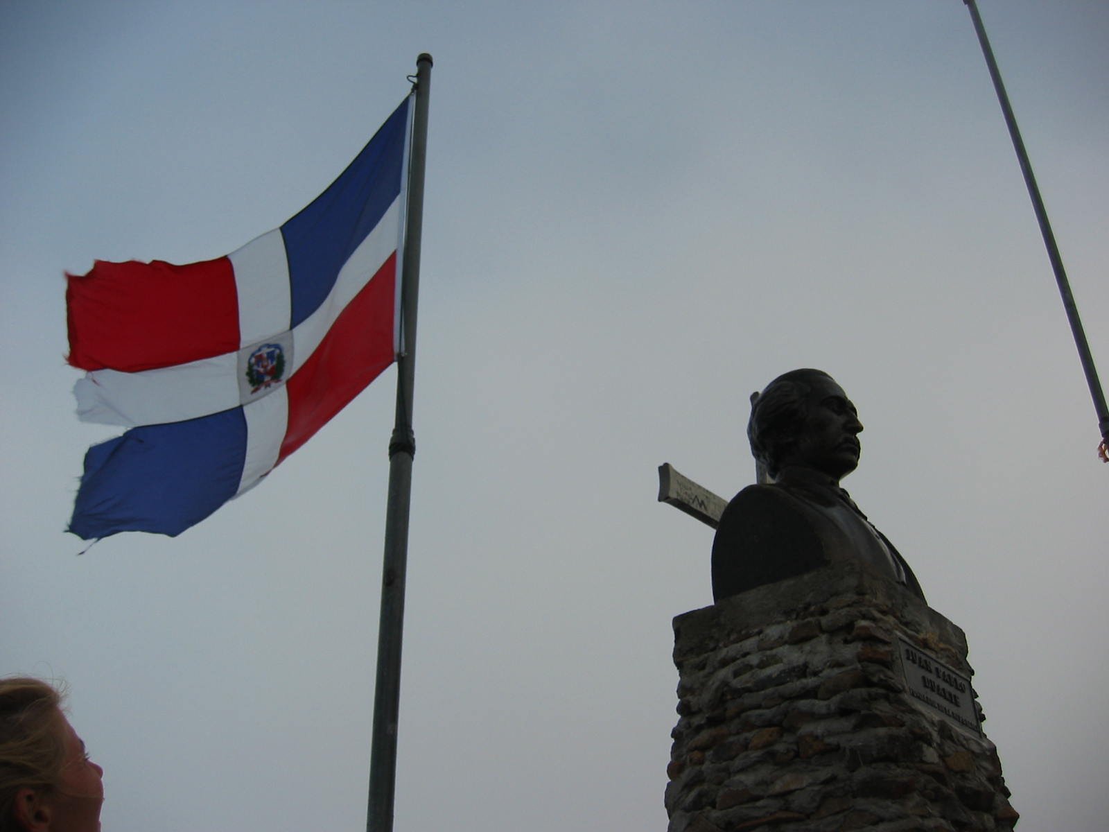
Ascending Pico Duarte
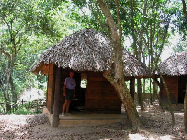
One of the highlights of our visit to the Domican Republic was climbing to its highest point, Pico Duarte, the highest point in the Caribbean. We were referred to an ex-pat Belgian, Dimi, who conducted tours for cruisers. Acting as our tour guide, Dimi arranged a 5-day tour to climb Pico Duarte in the Armando Burmudez National Park.
We traveled in Dimi's truck for hours over rough roads and narrow, one-lane bridges to get to the park entrance. The accommodations were rough, but acceptable. Our first night was spent in this tiny thatch-roofed "casita". We had purchased some cheap air mattresses but had no sleeping bags so we pinned blankets together and slept on the casita floor. By morning, the air mattresses were cold and flat.
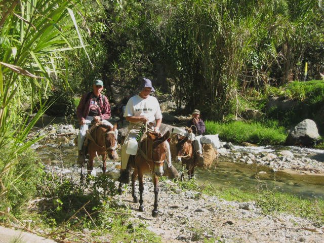
We all rode mules ... a different form of transport for us sailors and at the end of each day our butts ached in distress. We stopped twice each day for breaks and to rest the mules (and our aching butts). Our crew was a tough-looking bunch but looks can be deceiving. In actuality, they were kind,
helpful, shy men whom we grew to depend upon.
A typical night stop was rustic at best ... no electricity; some had outhouses, some not. The higher we got, the colder the nights. We huddled around a campfire for dinner and then snuggled up on hardwood floors for the long, cold nights. We did eat quite well as Dimi was a gourmet cook and despite having to cook on wood-burning stoves, the meals were hardy and delicious. Mama, a diminutive (<5 ft tall) mother of eight had the toughest job of all. She assisted Dimi in cooking for us and made meals for the rest of the crew. She was also responsible for all the clean-up which sometimes happened to be in the local river.
We traveled through tropical rain forests, up dried-up washes and gulches, over campos and sierras. The mules were sometimes knee-deep in mud after a heavy rain. We rode across sierras and campos. boulders at the top. The last morning we were up and on the trail by 0500. It was cold and dark and we used flashlights to see our way. We rode the mules for part of the way and then for the last kilometer or two, we scrambled up the boulders leading to the top.
The total trip was about 63 km roundtrip including a sidetrip that Dimi insisted upon and to which our butts complained immensely. We were glad to get home to "Cups" and spend a warm night in our own bed. All in all, however, a wonderful and memorable trip and a great visit in the Dominican Republic.
Time to move on. We stocked up on beer and wine and received our zarpe. Our next destination? Puerto Rico!


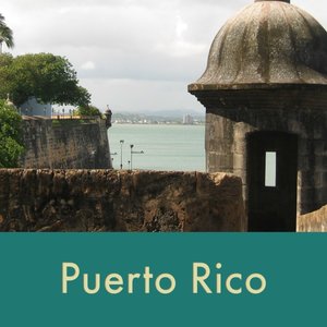
Puerto Rico - Isla del Encanto - 2002
After a month in the DR, we left Luperon and headed directly for Puerto Rico. A 1000 miles southeast of Miami, Columbus ‘discovered’ the island in 1493. The US acquired the territory when it was ceded from Spain in 1898 as a result of the Spanish-American War.
The 48-hour passage was a bit rainy, but otherwise thankfully uneventful. We headed through the sometimes treacherous Mona Passage within a stone’s throw of Isla Deseches. We anchored in Boqueron and cleared U.S. Customs and Immigration via a taxi ride just to Mayaguez.


Puerto Rico Facts...
Official Name: Commonwealth of Puerto Rico, a US territory
Capital: San Juan
Population: ~ 4 million (est 2002)
Area: 100 x 35 square miles…about the size of Connecticut
Currency: US dollar $
Language: English and Spanish
Highest point: Cerro de Punta 1,339 m
Once checked in, we didn't stay long in Boqueron, but opted to sail along PR's southern coast to the beaches of Ponce. The most colorful building in Ponce was the old fire department, now a museum.


San Juan
In Salinas, we rented a car for a few days and drove to San Juan. We'd visited this charming city several times before in the past and especially loved the “old” city.


An iconic garita (sentry box) dating back to the 17th century juts out over the harbor
A couple of days here, a couple of days there. A road trip to West Marine in Fajardo to replace the forward head. Boat chores, provisioning at well-stocked grocery stores and we were on the move again.
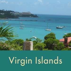
The Virgin Islands

The Virgin Islands were first “discovered” by Christopher Columbus in 1493 on his second voyage to the New World. Seeing the numerous islands, he named them Las Virgenes “the Virgins” in honor of St. Ursula and the 11,000 virgins who, threatened by the marauding Huns in the 4th century Cologne, sacrificed their lives rather than submit to a fate worse than death. The Virgins have been owned or occupied by Spain, France, England, Denmark, Holland, the U.S. and for a short while, the Knights of Malta! There are three Virgin Island groups and each maintains a distinct heritage based upon its history.
* Spanish Virgin Islands are part of Puerto Rico and include Culebra & Vieques.
* American Virgin Islands are a separate U.S. territory purchased from Denmark in 1917 and include St. Thomas, St. John and St. Croix.
* British Virgin Islands are still a British territory and include Tortola, Jost Van Dyke, Anagada, Virgin Gorda and numerous smaller islands.
Spanish Virgin Islands
Culebra and Vieques are part of Puerto Rico and as such are distinctly Spanish. Vieques is known most notably as a site of contention because of the U.S. Navy’s continued use of the island as a naval aircraft bombing range. When cruisers wish to stop at Vieques, they must first make sure that the range is “cold”, i.e. no bombing exercises are planned. We opted to pass by Vieques but stopped for a day and overnight at Culebra. It is known for its beaches and miles of shoreline.
After the longer passages we've made, traveling in the Carribean is a treat. Although a couple of the passages are longer (75+ miles), most are pleasant dayhops from one island to another. The distance from St. John, AVIs to Jost Van Dyke, BVIs for instance, is only five miles. In that short distance, we travel not only to another island but to another country, another round of customs/immigration, a new culture, different foods, different currency and sometimes a different language ... all part of the adventure.

American Virgin Islands
From the Spanish Virgin Islands, we sailed on to St. Thomas in the American Virgin Islands. The SVIs, as part of Puerto Rico, fly the PR territorial flag while the AVIs have their own territorial flag to hoist.
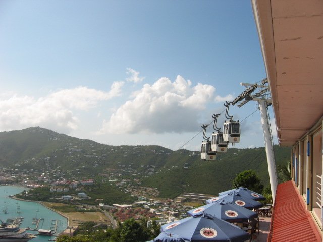
St. Thomas
We spent a day or so exploring the town of Charlotte Amalie (SHAR-lot a-MAL-ya), St. Thomas. We took a cable car up 700’ to the top of a hill at Paradise Point overlooking the harbor. Government House was built in 1867 for meetings of the Danish Colonial Council. A little red guardhouse still stands. The building is now used as the offices of the Governor of the Virgin Islands.
The 99 Steps, (there are 103, I counted) built in the mid-1700s, lead from the lower city to the Government House. Danish architects, who had never been to St. Thomas, insisted that the city be laid out in orderly grids, despite the hilly terrain. Hence, there are several sets of stairs throughout the city built to facilitate the climb. The steps are made of Danish brick brought from Denmark in the holds of ships where they were used as ballast.
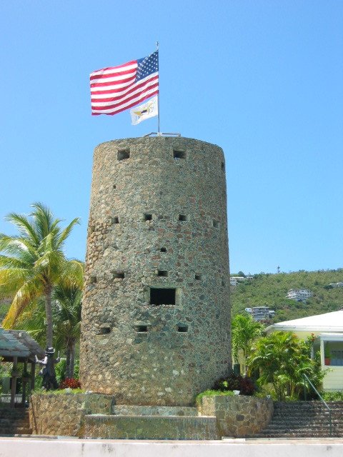
One of the first buildings noticeable when you go ashore is Ft. Christian, built as a harbor fortification by the Danes in 1671. The clock was added in the late 1800s. Ft. Christian is the oldest building still in use in St. Thomas and is now a historic site with a museum.
Climbing up even more stairs, we came to Blackbeard’s Castle built in 1669. Legend has it that it was built by Blackbeard the Pirate (Edward Teach), but more historic authentication indicates it was a military fortress built to augment Ft. Christian and originally called Ft. Skytesborg.


St. Thomas
In contrast to the hustle and bustle of St. Thomas, the island of St. John was quiet and laid back. Two-thirds of the island is National Park land, with nearly 6000 acres donated to the U.S. government by Laurence Rockefeller in 1956. The Virgin Islands National Park in St. John maintains over 200 moorings which were free of charge. Anchoring can damage delicate coral reefs and sea grass beds. Moorings help to protect the marine environment and were also quite a treat for us!


St. John’s early commerce was comprised primarily of sugar production and bay rum oil for the making the making of cologne. The best sugar factory ruins are those at Annaberg, once owned by William Gottschalk, a planter-owner from St. Thomas.
While exploring, we happened upon a basket weaver. Among other bits of sage advice, she told us that reeds for baskets were only collected “at the dark side of the moon at low tide", otherwise they would be bug-infested. Interestingly enough, we subsequently heard this same story from basket weavers throughout the Carib and South America.


British Virgin Islands


The British Virgin Islands, part of a volcanic archipelago, is a British Overseas Territory. It consists of four main islands and a myriad of small islands. It is one of the most spectacular cruising areas in the world. Since we had spent several weeks cruising these islands in the past, we spent only a few days here this time, opting to spend more time in the Leewards and Windwards.
A little trivia: By law, the Britsh Royal Navy was required to provide each member of the crew ½ pint of rum per day. In Here the rum would be Pussers.
Virgin Gorda was named the “Fat Virgin” by Columbus because of the island’s seaward resemblance to a fat woman lying on her back. The island is 10 miles long and boasts a population of ~ 8,000 (est. 2002) people. The Spanish mined as much as 10,000 tons of copper here from the mid-16th to the mid-19th century. We'd visited the Bitter End Yacht Club on Virgin Gorda before and decided to visit again. It's a classy, expensive place, but worth the stop just for its charm and unbeatable pina coladas.


On the Menu…
Roti – a filling of curried chicken, beef or fish wrapped into a crepe-like shell. Kind of like a Caribbean burrito.
Callaloo – a soup of callaloo greens (or spinach), okra, garlic and spices
Anguilla
Leaving Virgin Gorda, BVIs, the weather called for northeast winds, 15-20K. Though not quite sailable, it would be a reasonable overnight motor sail. A distance of 75 miles, we thought we’d arrive by 7-8am latest. Winds were somewhere around 25-35 knots, more on the nose than not, with 7-9’ seas. Marcie was sick most all the way and according to David, even heaved stuff she’d eaten in the DR! The trip took 20 long hours and finally... Anguilla.
After the long sail and challenge with the windlass, we still had to clear into Customs and Immigration. Though a Sunday, we weren’t charged overtime as most ports do and because we were the owners of a private yacht, we weren’t anything at all for clearing in and out including a cruising permit for other Anguillan ports. Needless to say, though tired, hungry and frustrated, we were pleased!

Anguilla facts...
Colonized by English settlers from Saint Kitts in 1650, Anguilla remains a British Overseas Territory
Capital: The Valley
Population: ~7,500
Total area: 35 sq miles; about half the size of Washington, DC
Currency: US $$
Language: English
Lowest point: Caribbean Sea 0 m
Highest point: Crocus Hill 65 m
Anguilla is the most northerly of the Leeward Islands in the Lesser Antilles.
Soon after we had dropped anchor the local police approached the boat to inform us we needed to move as a local regatta was about to begin. So much for resting after our passage. We hauled anchor and moved as requested.
Anguilla reminded us a bit of the Bahamas. A slow pace, not many services available, people friendly, but reserved. The gingerbread trim was representative of the area. We arrived on Sunday and the next day was a national holiday, Whit Monday, so what few shops were there were closed. We tried to buy bread in a small grocery, but were told “No bread today!”
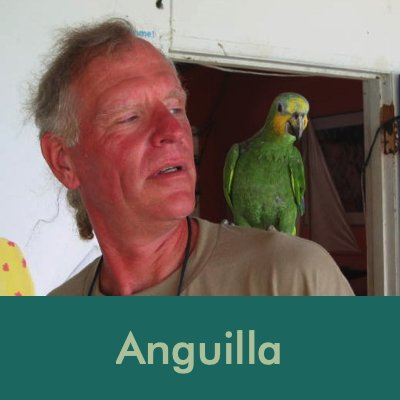
We were able to get a cruising permit for Crocus Bay and visited Roy’s Place, an English pub on the beach and a popular haunt for cruisers. In addition to draught beer and reasonably good food, they have an outstanding book swap and a very friendly bird.


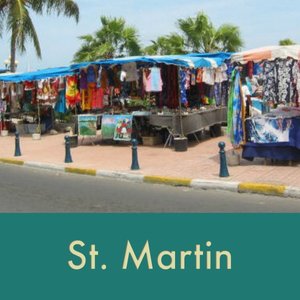
St. Martin/Sint Maarten
One island, two different countries. Sint Maarten is Dutch and St. Martin is French. Here’s the undocumented story: The French and Dutch both wanted the island, however they were too civilized to engage in combat over it. So, a Frenchman armed with a bottle of wine and a Dutchman with a bottle of gin began walking. Where they met, became the boundary line and has remained so since 1648.
We arrived on the Dutch side of Sint Maarten and anchored in Simsonbaai ( Simpson Bay) right outside of the Simpson Bay Lagoon. We cleared Customs and Immigration right at the dock. We didn’t have a Netherlands Antilles courtesy flag, so we flew the Dutch flag which was acceptable.


St. Martin/Sint Maarten facts...
One island, two different countries: France, Holland
Capitals: Marigot (French); Philipsburg (Dutch)
Area: 37 sq miles
Population: ~73,000
High Point: Pic Paradis (1360')
Languages: French, Dutch, English
Currency: Euro, US $

The ift bridge into the Simpson Bay Lagoon opened only three times a day and we waited in line for our turn to pass through the narrow 38' opening.

Heading through the bridge to the anchorage in Simpson Bay Lagoon
When going from one side of the island to the other by boat, you must clear in and out each time. However, via car or dinghy or on foot, we could go back and forth without the hassle so we left Nine of Cups in the Dutch lagoon and traveled the short distance back and forth in the dinghy quite easily. All the good food was on the French side!
On the Dutch side


Guavaberry is a local liqueur which comes in all sorts of exotic fruit flavors. We tried a sample, but quite honestly the only comparison that came to mind was cough syrup.
On the French side
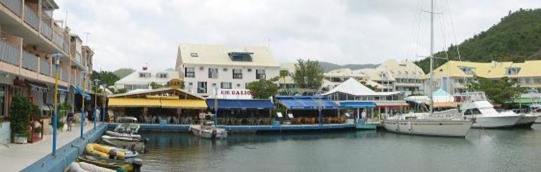
view of lovely Marina Royale, Marigot Bay, St. Martin French West Indies, a great place for dinner.
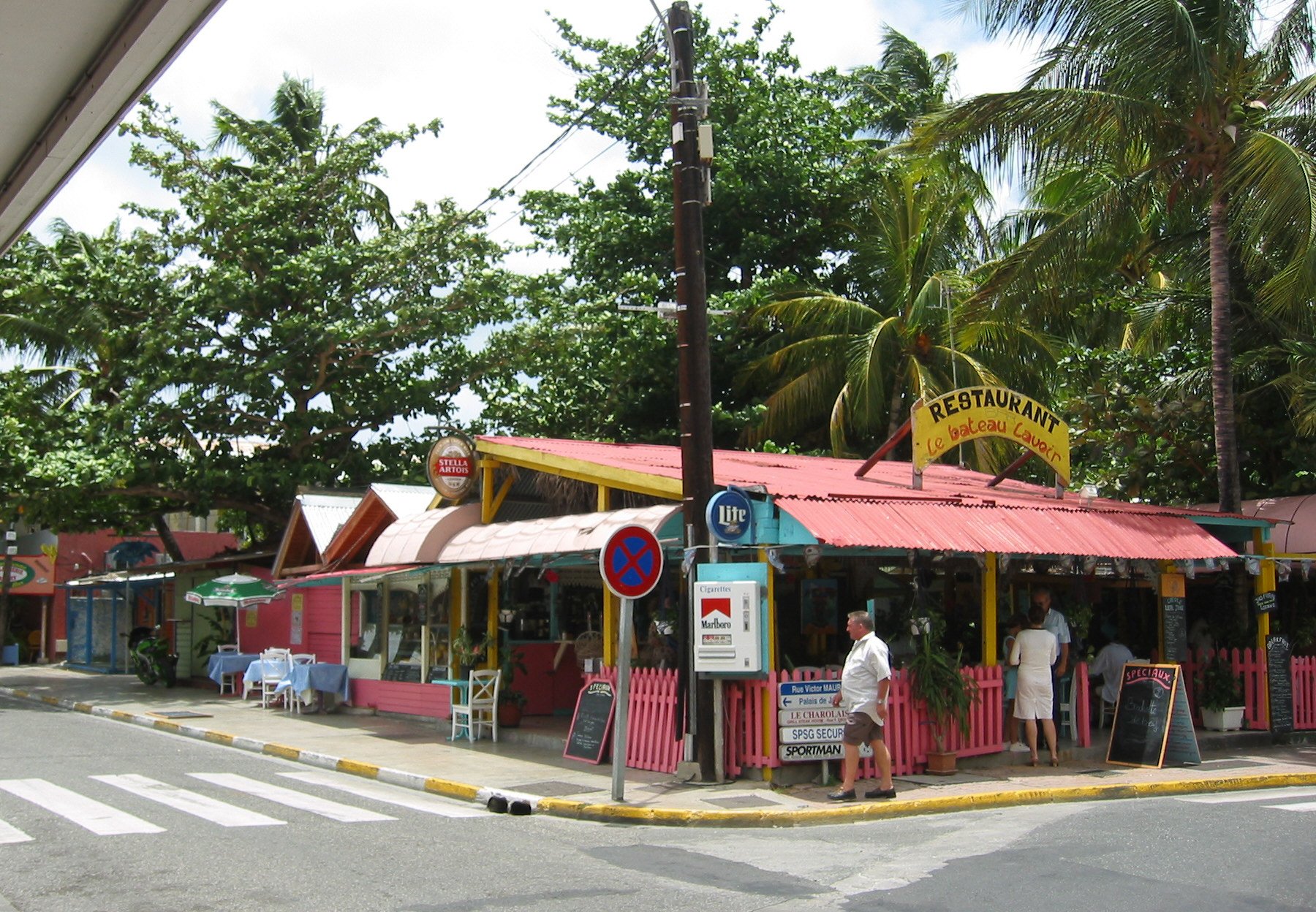

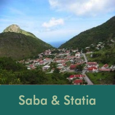
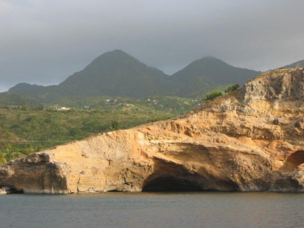
Saba
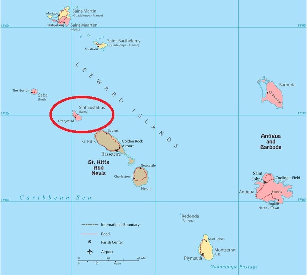
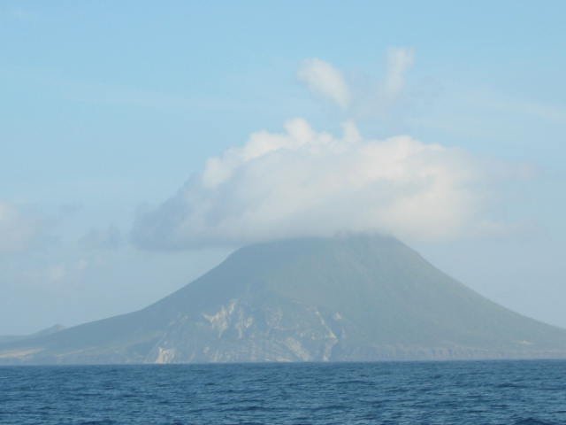
Arriving at Saba (SAY-ba) from St. Maarten was like cruising into a fairy tale. Saba appears to be one big mountain, emerging from the sea continually clothed in a mist. In actuality, it is the peak of a volcano that rises sharply from the ocean floor. Because it is so high, clouds are trapped at the summit, supporting a tropical rainforest. Locals refer to these as "islands that touch the clouds". Saba and neighboring St.Eustatius are both part of the Netherlands Antilles.
Saba is called the “Unspoiled Queen” because of her natural respect for nature. A marine park that encompasses the entire island was formed in 1987 which regulates fishing and all activity. Moorings are available for cruisers at a very low rate: $3/person/ week. A good idea since the island is steep-to and anchoring is not easy due to a water depth of 50’ very close to shore.

Saba Facts
Population: ~1,400 (est 2002)
Area: 5 square miles
Capital: The Bottom
Language: Dutch (English is widely spoken)
Currency: Dutch Antilles Guilder and US$
Highest point: Mt. Scenery (3,084’)

We climbed a well-marked path to the top of Mt. Scenery which, at 3,084’, is not only the highest point on Saba, it is the highest peak in the Kingdom of the Netherlands! It was an interesting hike. There are 1,064 steps carved from stone which lead up the mountain as well as some dirt foothpaths. Of course, once we got up there, we had to hike back down those 1,064 steps. Our aching legs, knees and ankles!


We met Garvis Hessell when we came ashore who graciously offered to take us on a tour of the island.


While having lunch in Bottom, we met Zettie, Miss Saba 2001-2002.
St. Eustatius (Statia)
From Saba, a quick 20-mile motor sail had us anchored off Statia. We’d visited Statia before back in 1997 so our visit was short. We climbed Statia’s highest mountain, The Quill, when we visited last time and found no compelling reason to do it again.
St. Eustatius or Statia (You-STAY-shus or STAY-sha)
Capital: Oranjestad
Population: ~1500 (est 2002)
Area: 12 square miles
Language: Dutch, Spanish, and English
Currency: Dutch Antilles Guilder & US$
Highest point: The Quill (1970’)


Our view of Statia from the anchorage in Oranjebaai. The cliffs are sheer limestone and Ft. Oranje overlooks the harbor. Ft. Oranje was built by the French in 1629 and enlarged and named by the Zeelanders in 1636.
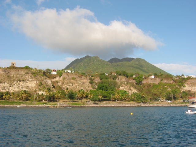
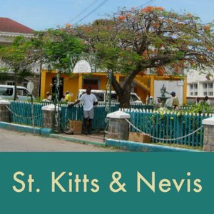
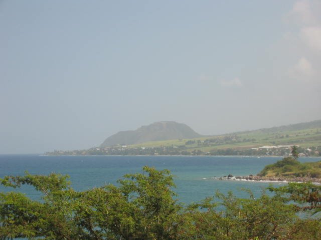
St. Kitts & Nevis
St. Kitts was originally inhabited by the Caribs a fierce warrior people, hence the name Caribbean. The English arrived in 1624 and the French arrived in 1625. In 1626, they banded together (a very rare occurrence indeed), and massacred ~2,000 Caribs at Bloody Point totally annihilating the population. History reports that the river flowed red with blood for days. Note that this was all happening about the same time the Pilgrims landed at Plymouth Rock in the USA.
St. Kitts was yet another 20-mile motor sail from Statia. We kinda like island-hopping. We anchored in Basseterre at the Deep Water Port which was very, very rolly. A stern anchor kept us into the waves and made the anchorage much more tolerable.


St. Kitts:
Population: 30,000 (est 2002)
Area: 68 square miles
Capital: Basseterre
Language: English
Currency: EC$ ( Eastern Caribbean $)
Highest point: Mt. Misery at 3,792’, a volcano.
Saint Kitts became home to the first Caribbean British and French colonies in the mid-1620s. Along with the island of Nevis, Saint Kitts was a member of the British West Indies until gaining independence on 19 September 1983 and is part of the Eastern Caribbean Community.
It was Saturday and we worried about clearing Customs, but no problem: $14US. We found a taxi driver willing to give us an island tour on a Sunday and scheduled it for the next day then decided to dinghy over to the main town at Basseterre. The shops are only open till Noon on Saturday and not at all on Sunday, so we didn’t shop much … much to David’s disappointment. NOT!


The highlight of the tour was visiting the Fort George fortress. "A World Heritage site, the Brimstone Hill Fortress National Park, is an exceptional and well-preserved example of 17th and 18th century military architecture in a Caribbean context. Designed by the British and built by African slave labour, it is a testimony to European colonial expansion, the Atlantic slave trade and the emergence of new societies in the Caribbean.” …from a Ft. George Museum sign
While visiting the fort in St. Kitts and having a quick burger and a beer, we met a Swiss couple, Gabrielle & Emil, and began chatting with them. After about an hour, they invited us to spend a couple of days with them at their plantation home in Nevis. In addition to their fine company, they also offered us our own guest quarters with hot showers and access to their laundry facilities. How could we say “No”? We couldn’t … so off we sailed the 9 miles to Nevis. We checked into Customs in Charlestown and wandered around a bit, then moved the boat to Oualie Beach, at Emil’s recommendation.
A little trivia: What famous American statesman was born in Nevis? Find the answer at the bottom of the Nevis section.
Nevis (NEE-vis) is quite small, only 35 square miles and Charlestown is its only town. Emil us at the anchorage and transported us (and our dirty laundry) to their plantation house. It was an awesome place with views across The Narrows of St. Kitts in the distance. We ate, drank, did laundry and chatted as if we’d known them forever. What an hospitable couple and how fortunate for us to have met them.
On our second day there, we took an island tour in their “Sidekick”. We visited some sugar cane plantation ruins along the Atlantic coast. The area is desert-like along the shore. We also visited the Nevis racetrack which happened to have donkeys and goats grazing on it at the time. About 10 Sundays a year, there is thoroughbred horse racing here. Sometimes, only two horses are competing in a race, but it’s a major social outing on Nevis and everyone who’s anyone attends.


After two days and nights with our new old friends, it was time to head out. As we left the anchorage and sailed by their house, they waved a large white sheet from the verandah so we would see them and we did. What a lovely way to say goodbye!
Famous American statesman born in Nevis? Alexander Hamilton. Several of Thomas Jefferson’s relatives were Nevisians, too.
Montserrat
We sailed on to Montserrat, about 40 miles away, and arrived around 5pm at Carr’s Bay and anchored. Since we didn’t plan to go ashore, we just flew our “Q” flag for the night. There’s not much to say about Montserrat. We anchored for the night and never went ashore. We took our leave for Guadeloupe the next morning. As we passed, we could still see the recently erupted volcano billowing smoke in the distance.

Guadeloupe - A Taste of France
As you can see in the map below, Guadeloupe is comprised of two islands in the shape of a lopsided butterfly. Whoever named the islands had a sense of humor because the higher, more mountainous island is called Bas Terre (low land) and the lower, smaller, flatter island is called Grande Terre (large land). A large river, Riviere Salee, separates the two islands and is navigable by shallow draft boats. It was originally known by the Caribs as Karukera … Island of Pretty Waters.

Guadeloupe - French Overseas Territory
Population: ~330,000
Area: 538,000 square miles
Capital: La Basse Terre
Major industry: “rhum” production and tourism
Official language: French (and Creole)
Currency: Euro
Political: an overseas “department” of France
High Point: La Grande Soufrière (volcano),
4813' (1467m), 8th tallest peak in the Carib
Guadeloupe also administers the islands of St.
Martin, St. Barts, Marie Gallante and Les Saintes
Deshaies (Day-hay) is an interesting little town offering most of the basic services a cruiser might need: Internet, bakery (boulangerie), butcher (bucherie), grocery store (SPAR supermarche), library (bibliotheque), auto rental (louer a voiture), phones, pharmacie and friendly people (personnes amicables) … even an ATM! The irresistible aroma of fresh croissants and strong coffee made it all the way out to the anchorage. Oooh, la la.


About 1-1/2 km from the anchorage was a botanical garden. It was a Sunday afternoon and most things in town were closed, so we decided to hike up the very steep hill to check out the gardens. We didn’t expect much in a small town so we were delighted to find that it was pretty spectacular with over a mile of bricked pathways and several new species of flowers, trees and plants we’d never seen before. Of course, we were thirsty after our hike and stopped at a little outdoor cafe for one of the local brews.
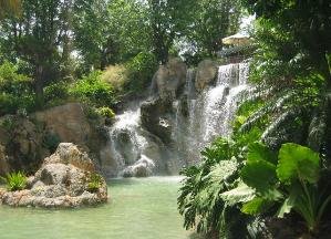


We did more than smell the croissants and watch the birds. We rented a car and drove inland to Guadeloupe National Park to find the Chutes du Carbet … three sets of waterfalls accessible via well-groomed trails. We saw #2 and #3 on two separate hikes, but access to #1 was closed.


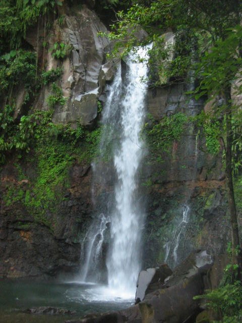

A narrow wooden suspension bridge led into the rainforest and up to the ‘chutes’
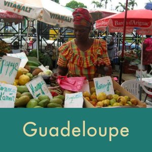
Day 2 of the car rental, we took a drive to Pointe a Pitre across the Route de Traversee, which cuts directly through the middle of the island of Bas Terre and through the National Park. It’s steep and curvy with lots of switchbacks and great views. Pointe a Pitre is Guadeloupe’s largest city and a wonder to explore. We found it hard to get away from the markets. There was too much to see, smell, taste and buy.


The production of “Rhum Agricole” is a major industry in Guadeloupe and the rum produced is highly prized in France. We stopped at a small rum factory for a tour and a sample or two. We didn't much care for it. The cane was being harvested and trailer truck upon trailer truck load was seen on the highway and along the sides of the road.


All too soon, it was time to leave Guadeloupe, but it left us longing for more French islands. Now we started to worry about getting out of the area
by hurricane season. We anchored one night off Iles des Saintes en route to Dominica (not to be confused with the Dominican Republic!). The passage from our anchorage to Portsmouth in Prince Rupert Bay in Dominica was only about 20 miles and a great sail. The bay is well-protected and about 2 miles long and a very pleasant anchorage.
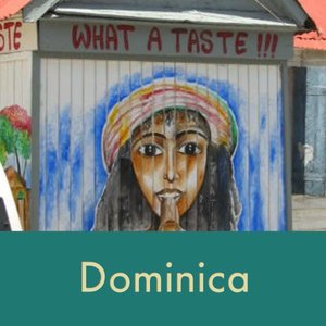
Dominica
“Discovered” by Columbus in 1493, the island was originally inhabited by the Caribs. In fact, some Carib descendants still live in the northeastern part of the island). The Carib name for the island was Waitikubuli (Tall is her body).


Dominica (Dom-in-EEK-a)
Population: 80,000
Size: ~24 miles long x 15 miles wide (290,000 square miles)
Currency: Eastern Caribbean $$ ($2.86 EC = $1US in 2002)
Language: English / Creole
Capital City: Roseau
High Point: Morne Diablatins 4,747’ (1,447 m)
Major industry: Bananas
The island has 365 rivers! There are 8 potentially active volcanoes on the island (most islands have only one), though there had been no eruptions recently.
The bird on the country’s flag is the sisserou parrot endemic to Dominica and their national bird.
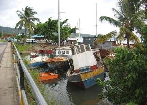
The big hype here is Indian River tours and you don't need to find a guide ... they find you. We met Charley, our guide, at the dinghy dock at the mouth of the Indian River. As you first enter the river, the area is very congested with abandoned and dilapidated boats ... a graveyard of sorts. Once under the bridge and away from the "town", the river became more serene and secluded. No motors here, Charley rowed the entire
way. The river narrows and the overhang of trees makes a tunnel to glide through. It takes about ¾ of an hour to get to the lodge at the end of the
navigable portion of the river. There’s a small restaurant here and a bar. We had a local beer, however, all the locals drank a potent rum concoction
called Painkiller. The lodge wasn't much, but the river trip itself was worth the effort.


Indian River view as we arrived at the lodge.
We took a daytrip via local communal bus (van) to Roseau, Dominica’s capital. It rained a good portion of the day and we spent most of our time running from overhang to overhang but got drenched anyway in the constant downpours. We decided to sail down and spend a couple of days to explore the town more thoroughly. We're glad we did, it was an enjoyable town.
The city of Roseau is an eclectic mix of old and new, quaint and rundown, tidy and filthy. We did not find the people here to be especially friendly, but in retrospect, we figured we'd have gotten the same level of aloofness in most larger American cities.


Roseau is not only the name of the city but also the name of the wild sugar cane vine that grows in Dominica and is collected and dried by the Caribs for use in making baskets. We bought several beautifully woven Carib baskets for souvenirs and gifts.
We had logged over 2200 nautical miles since leaving Charleston, SC in January 2002 and emphatically “NO”… were not tired of this cruising life. Now on to the Martinque and the Windward islands.
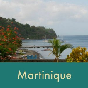
Martinique
The Windward Islands were so-named by the British because to get to any of them, a sail to windward was required. They include the countries and territories of Martinique, St. Lucia, St. Vincent and the Grenadines and Grenada and all territorial islands belonging to these countries.
The passage from Dominica to Martinique was terrific, but we were heeled over so far our rails spent most of their time in the water and the jib was soaked. We anchored in the historic little town of St. Pierre, a delightful blend of French charm and exotic Caribbean.


Martinique
Population: ~300,000+
Area: 427 square miles
Highest point: Mt. Pelee (4800’), 10th highest in the Carib
Currency: Euro
Language: French / Creole
Major industry: sugar, bananas, rum
Largest city: Fort de France
Martinique is the largest of the Windward
Islands is a French Overseas Territory.


St. Pierre was commemorating the 100th anniversary of the eruption of Mt. Pelee which destroyed the city. The volcano erupted on Ascension Day (May 28th) 1902 after giving sufficient warning of ash and minor eruptions for weeks before. The governor and business leaders felt the problem would abate and refused to evacuate the city. The volcano erupted and was followed by a huge tidal wave resulting in the destruction of the town and the deaths of ~30,000 people. All but two of the inhabitants were killed: a cobbler who found refuge in his cellar and a famous prisoner, Cyparis, who was locked in his cell.
Reminders of the disaster are everywhere around the city. New buildings are attached to the foundations of the old and the ruins of several old buildings are still evident as you walk along the streets and alleyways.


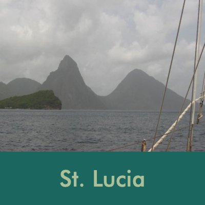
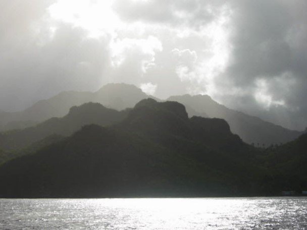
St. Lucia
Since we’d been to St. Lucia before, we opted to anchor overnight in Rodney Bay and “Between the Pitons” one night each, but not go ashore. We
spotted the Pitons, at 2400’ (Petit Piton) and 2500’ (Gros Piton) from more than 10 miles away.
St. Lucia
Population: ~120,000 (est 2002)
Area: 230 sq miles
Language: English
Capital: Castries
Currency: EC$
Highest point: Mt. Gimie, 3,145 ft.
*The largest of the English-speaking Windward Islands
*Member of the Eastern Caribbean States
Les Pitons ... 10 miles away, 5 miles away and then … there they were.
We had anchored “Between the Pitons” once before and it was magical, almost surreal. This time, we lay out in the cockpit till the full moon rose. The ambient light was enough to illuminate the Pitons and it was spectacular.


Gros Piton rose 2,500 feet above us
"Between the Pitons" (sung with gusto)
(A rhythm & blues tune written and composed
by Marcie & David on site … sing along if you
like ... the louder, the better!)
Well, we’ve got Pitons on our left
And Pitons on our right
Pitons on our mind
Because they’re everywhere in sight
Between the Pitons
An- chor – ing
Between the Pitons (ooh, ooh, ooh)
We sailed from Martinique
Just to groove on these two peaks
Between the Pitons.
Because the water is so deep right to shore, the traditional way to anchor between the Pitons (prior to mooring balls) was to drop a bow anchor then
tie two lines from the stern to palm trees on shore. A local tradition of welcome was to give each new cruiser a “hand” of green bananas which they
hung in the cockpit eating them as they ripened. According to local legend, the eccentric English Lord Glenconner (Colin Tenant) once brought an
elephant to the island which he let roam free on his land by the beach. The elephant was pretty intelligent and happened to like bananas. He caused
quite a commotion because he got into the habit of grabbing the stern lines of boats and pulling them closer into shore so he could eat the ripe bananas
St. Vincent and the Grenadines


St. Vincent & The Grenadines
Population: ~138,000 (est 2002)
Area: 153 square miles including St. Vincent and about 100 islands
Capital: Kingstown
Language: English
Currency: EC$
Highest point: Mt. Soufriere (4,048 ft)
Major industry: bananas
*Member of Eastern Caribbean States
*A volcanic eruption in 1979 destroyed a significant amount of the banana crop and agricultural land.
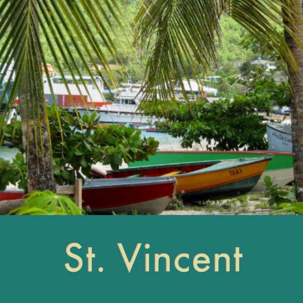
The winds were with us now and each day was an invigorating sail to the next island or port. We left around 0600 for St. Vincent and arrived by 1300, a quick 30 miles to an anchorage in Chateaubelair Harbor. An overnight stay only and we were sailing again by 0600 the next day, an easy 20 miles to the Admiralty Bay anchorage in Port Elizabeth, Bequia (Beh-kway).

The Grenadines are a group of islands that are shared by St Vincent and Grenada. We cleared Customs for St. Vincent and the Grenadines in Port
Elizabeth, Bequia. Customs charges for a privately-owned 45’ yacht (charter boats pay more) and two people for 7 days: $70EC ($26 U.S.). A big hike from the $10EC/person we paid last time we were here.


Though Bequia is pleasant, moving on is a priority right now. However, the wind was so strong (25K+) we decided to stay for two more days. Based on an updated weather report with 25K winds, higher gusts and rain, we stayed in Bequia for another day as the tropical wave passed through. In the evening we heard a hail on the VHF from a friend of ours. Mystic Adventure was just arriving in the bay. We stayed yet another day! Long story short … we ended up staying four days in Bequia to handle some repairs, help friends with their repairs and catch up with the Mystic Adventure crew.
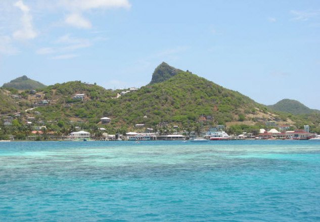
A weather window appeared and we sailed with them to Canouan where we shared dinner aboard, but never went ashore. Next day they headed out to Grenada and we did a quick motor trip to Mayreau, only 5+ miles away. Mayreau is an island of about 300 people. Lovely, friendly and absolutely beautiful.


From Mayreau a quick motor trip to Union Island. We had planned to go to Clifton Harbour, a larger town with shops and restaurants, but a fast-moving tropical wave with predicted heavy rains and wind surges led us to Chatham Bay, a much better-protected anchorage on the lee side of the island. The bay was so pleasant and uncrowded, we stayed for five days and caught up on varnishing and boat chores.
After four days aboard of tough varnish work and being boatbound, we were ready for some shore time. We motored to the other side of Union Island (5 miles) and the town of Clifton Harbor. This was a beautiful anchorage midst several reefs, the water ranging in color from black to turquoise to emerald green to nearly clear. Reading the water on such a sunny day was fairly easy and we managed to not only avoid the reefs but find a great sandy spot for anchoring.

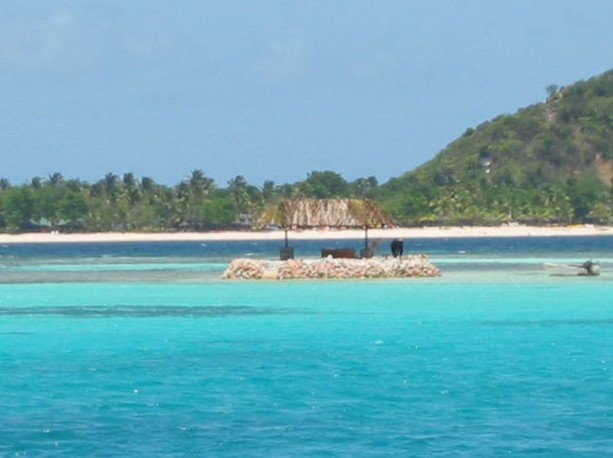
Grenada
The “Nation State” of Grenada is comprised of the inhabited islands Grenada, Carriacou, Petit Martinique and Isle de Rhonde and several other smaller islands. First sighted by Columbus in 1498, Grenada changed hands between the British and the French between 1609 and 1783 until the Treaty of Versailles awarded the island back to Britain. The French heritage is still evident, however with many French place names like Lance aux Epines and the French-African patois spoken by many of the locals.
In 1979, a left-wing coup resulted in Maurice Bishop, an advocate of Castro, assuming power. The USA along with neighboring Eastern Caribbean States launched a “rescue mission” to restore Grenada’s democracy which was welcomed by a majority of Grenadian citizens.

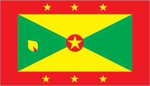
Grenada (Gren-ay-da)
Population: ~92,000 (est 2002)
Area: 133 square miles
Currency: EC$
Capital: St. Georges
Language: English & French/African patois
Highest point: 2,756’, Mt. St. Catherine
Nickname: “Isle of Spice”
Major Industry: Tourism and agriculture
Major crops: bananas, cocoa, nutmeg
and mace (the spice)
Member of the Eastern Caribbean States
Hillsborough was the Customs/ Immigration check-in port for Carriacou and Grenada. Carriacou was named by the original Carib inhabitants and means “land of reefs”. In the 17th & 18th centuries, it was spelled “Kayryouacou”.
We had to visit Customs first, then the fees collector, then the harbor master then the police for Immigration. The town is good-sized by island standards with several stores, shops, restaurants and even an internet café. There is a good “bus” (i.e. van) transit system that services the whole island. They also have a small museum and a botanical garden which we visited. Carriacou is best known for its shipbuilding and its Annual Regatta.
We were too early for the regatta but we did manage to take a bus to the town of Windward where all the shipbuilding activities take place.
Grenada trivia: Architecturally speaking, to preserve the nature of the island, Grenadian law forbids any hotel to be taller than a coconut palm!


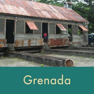
Windward is known for its shipbuilding work.
The 30-mile sail from Carriacou was a delight. Calm seas and 15-20 knot easterly winds provided ideal conditions and we cruised through like a hot knife through butter. Near “Kick ‘em Jenny”, a small island on the way to Grenada, there is an active underwater volcano that erupted in both 1988 and 1989. There are still mariner’s warnings to give the island a wide berth when transiting.
There is an inner lagoon at St. George’s, but we found it too crowded and calm, i.e. not enough wind for the wind generators to turn, so we opted to anchor outside in the bay.
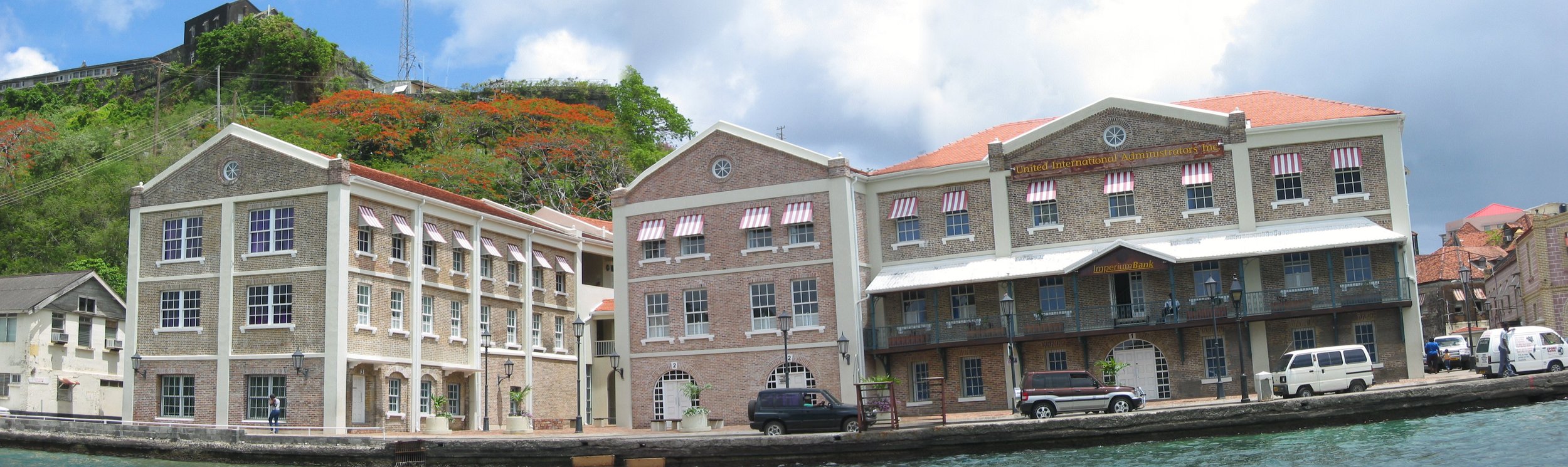
This area of the waterfront is called the Carenage. Many of the old buildings in this area are capped with “fish scale” red tiles, originally brought to the island as ballast in the old trading ships. The hills were ablaze with bright orange flamboyant trees in bloom. According to the locals, the blooms signal the beginning of hurricane season and their passing means another hurricane season has ended. Grenada is “technically” out of the hurricane zone. The last hurricane to
hit (as of 2002) was Hurricane Janet in 1955.

Two days after we arrived, we heard sirens late one evening and throughout the night. In the morning, we saw the results of the night’s fire. This is part of the Carenage waterfront. The charred, gutted remains smoldered and smoked for days.
We took an island tour one day to see the sights Grenada had to offer. The interior of the island is a lush, green rainforest which rises to about 2,000 feet above sea level. The scenery is spectacular. The cool change in temperature as we climbed in altitude was heavenly.
Spice trees abound here growing wild throughout the island. We saw nutmeg trees, cinnamon, clove, and bay. We would stop along the side of the road and our driver would grab a leaf or a fruit or a piece of bark for us to sniff and examine. The best part of the tour was the stop at the Dougalston Spice Estate. Established in ~1700, this 1000-acre estate grew nutmeg, cocoa, cinnamon, bay, and clove as well as banana and sugarcane. We got a tour of the facility and a short educational lecture on the many spices grown in Grenada and their processing.


Happy Birthday, David! The day began with a trumpet-playing friend serenading us in the anchorage at 0730 with the Happy Birthday song and ended with a super dinner at Patrick's Homestyle Restaurant. Patrick’s place is not large, but the food, all 26 local dishes, was outstanding. Dishes included lambi (conch), flying fish, blue marlin, gingered pork, rabbit, curried lamb, a variety of salads and veggies and for dessert, nutmeg ice cream with a slice of rich, dark chocolate cake made from scratch using local cocoa. The place was packed during the evening, but we took our time and were the last to leave.


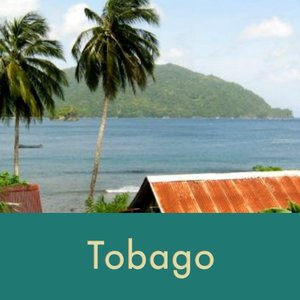
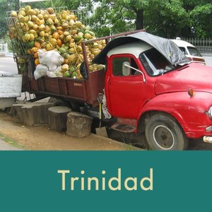
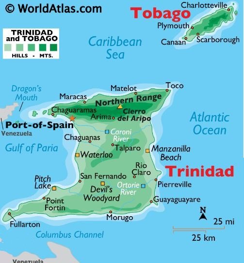
Trinidad and Tobago
Once part of the South American continent, Trinidad and Tobago ‘detached and drifted away” from South America about 11,000 years ago, and as a result, each island has its own flora and fauna... some species attributed to South America others evolved into endemic island species.
Tobago and Trinidad though joined as one republic are very different in nature. Tobago has been owned and passed back and forth between Holland, France Spain, and England and was even part of the Duchy of Courland (part of Latvia) for a short while. It has a predominantly African population because indentured labor was not needed from India as it was in Trinidad for the cane fields. Where Trinidad is very industrialized, Tobago is primarily rural. Chickens, goats, sheep and cows wander along the streets untethered. Life is slow and uncomplicated.


Tobago (Ta-bay-go)
Population: 50,000
Area: 116 square miles
Largest city: Scarborough
Currency: Trinidad & Tobago $ or
TT$ ($1US = about 6TT$)
Language: English
Major industries: Agriculture,
fishing and tourism
Highest point: Pigeon Peak, 1,800 ft (550 m)
Sailing southeast from Grenada, Tobago is about 85 miles, an overnight beat against both wind and current. We left St. George's at about 1700 and arrived in Scarborough at about 1300 the next day. Not a bad passage, but we've certainly been spoiled by short day hops between islands.
Tobago Immigration and Customs clearance is in Scarborough so we headed there to anchor. Immigration first at the Ferry Dock. Several forms, all in triplicate or quintuplicate, with old used carbon paper between sheets. It took about ¾ hour to complete the paperwork and get our passports stamped. No fees. Then on to Customs at another location. More waiting, more forms. We intended to stay ~3 months in the area which was approved and we paid $150TT which sounds like a lot, but it’s only about $8/month! Back to the boat to raise our Trinibago (they used this word, I didn’t make it up) courtesy flag.
There was a very small anchorage inside of a breakwater which kept out most of the roll. When we arrived, there were only three other boats in the anchorage. Two very large car ferries came in daily and turned around right by the boat. The water churned, the boat rolled and we could feel the vibration of the big engines. It was entertaining for us with the caveat that we could always jump overboard if it got any closer!


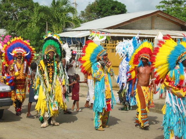
We were fortunate to be in Tobago during the annual Heritage Festival. Though everyone is welcome, the festival is for Tobagonians rather than tourists. It is a celebration of their rich history and cultural traditions through storytelling, dance, music and food. The Ole Time Wedding, one
of the cultural ceremonies re-enacted for the festival, was particularly enjoyable and interesting. Participants representing traditional characters in the wedding paraded down the street. The various items being carried signify wealth, homemaking skills and fertility.


Tobago's Carnival was also held during the Heritage Festival. Although much smaller than the Trinidad Carnival, it maintains most of the same elements and traditional characters. Different events were held in different villages on the island. Sometimes we took a bus and other times we moved the boat to a convenient location to view the festivities. Most of the Carnival traditions originated in medieval Europe and West Africa and were imported by early immigrants and their slaves.
Music is an integral part of Carnival and in the lives of the Tobagonians in general. Everywhere we went, music played usually very loudly. We heard two distinct types of music during Carnival (other than folk tunes): Soca - this is the street “jump up” music; easy beat, easy to dance to and Calypso – slow-paced, strong on lyrics and dating back to the 19th century, evolving from West African songs of praise, narrative, comment or derision.
Carnival has its own vocabulary:
Mas – short for “masquerade
Band – themed groups of Carnival revelers
J’Ouvert – French for “daybreak” is the opening event of the Carnival.
Pan – steel band drums
Fete - party


Jelly, exhausted by Carnival activities, needed a catnap.
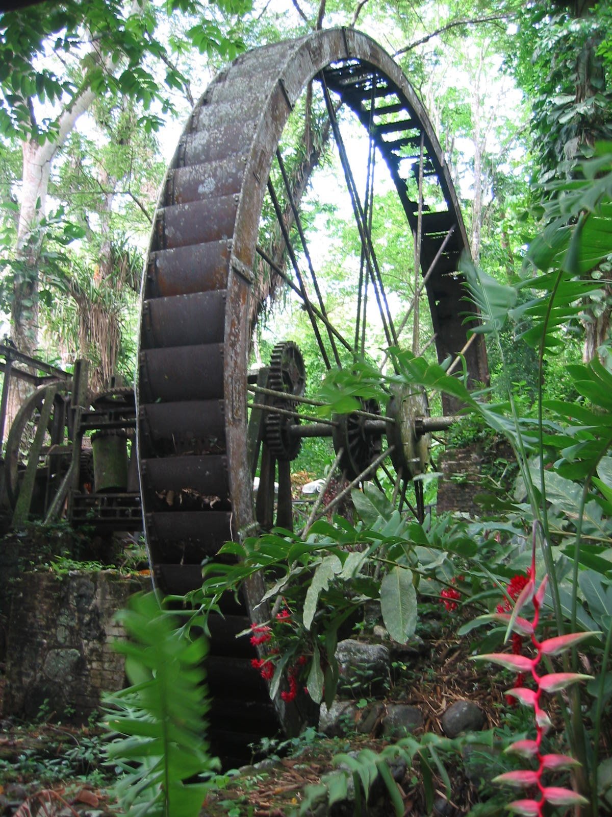
Midst all the Carnival festivities, we decided to take a long walk and ended up at the Arnos Vale Waterwheel Park, a nature preserve on the site of an
old sugar plantation. The original waterwheel, about 20' high is intact and is part of a lovely restaurant in the preserve. From the road, not much is visible. We walked along a thickly forested path, past an empty guard shack to the restaurant entrance. No cars were in the car park, no one around. We thought the place was closed. But, the door was open so we went in and what a surprise. Tiny white lights highlighted the wooden floors
and gracious foyer. Still no sign of life though.
We moved on past a little museum room and a boutique, both closed. We saw tables in the distance and finally a young man materialized out of nowhere and greeted us as we walked through a huge swarm of flying bats. “Only fruit bats”, he said much too calmly, “Staying for lunch?” Lunch was superb. An elegant setting midst the rain forest highlighted by ginger lilies and heliconia everywhere. The meal was a delight topped off with homemade coconut ice cream.


Beautiful Tobago
Trinidad
Finally, on to Trinidad! The island-to-island trip from Tobago to Trinidad is only about 25 miles, but it’s necessary to traverse the entire length of the island, another 50 miles, to access the marina in Chaguaramas. We decided to anchor in Grand Riviere, a small fishing village on the north coast only ~ 30 miles away, and then complete the trip to the marina the next day.
We had mixed emotions about reaching Trinidad. It’s the end of a long passage and we get to stay in a marina. Hooray! But on the other hand, it’s the “end” of a passage and we have to stay in a marina, crowded, hot, with no breezes and no sailing for the next 2-3 months.

Trinidad
Population: 1.3 million
Area: 1,864 square miles
Largest city/capital: Port-of-Spain
Currency: Trinidad & Tobago $ or
TT$; $1US = about 6TT$
Language: English
Major industries: Petroleum, sugar and tourism
Highest point: 3,085 ft (940 m)
Trinidad was claimed for Spain in 1498 by Christopher Columbus .
Trinidad is the southernmost island in the Caribbean chain. Only 7 miles from the Venezuelan coast, it is geologically part of South America.
We have not been in a marina since Riding Rock in San Salvador in the Bahamas and they didn’t offer electricity or water at the dock. Power Boats is the largest boatyard in Chaguaramas and is noted primarily for boat work and storing boats out of the water “on the hard”. There are, however, a few slips available for transients (that’s what we are, “foreign transients”) who wish to stay in the water. Daily rates are about 1/5 the price we paid for
similar services in the States.

A sea of masts
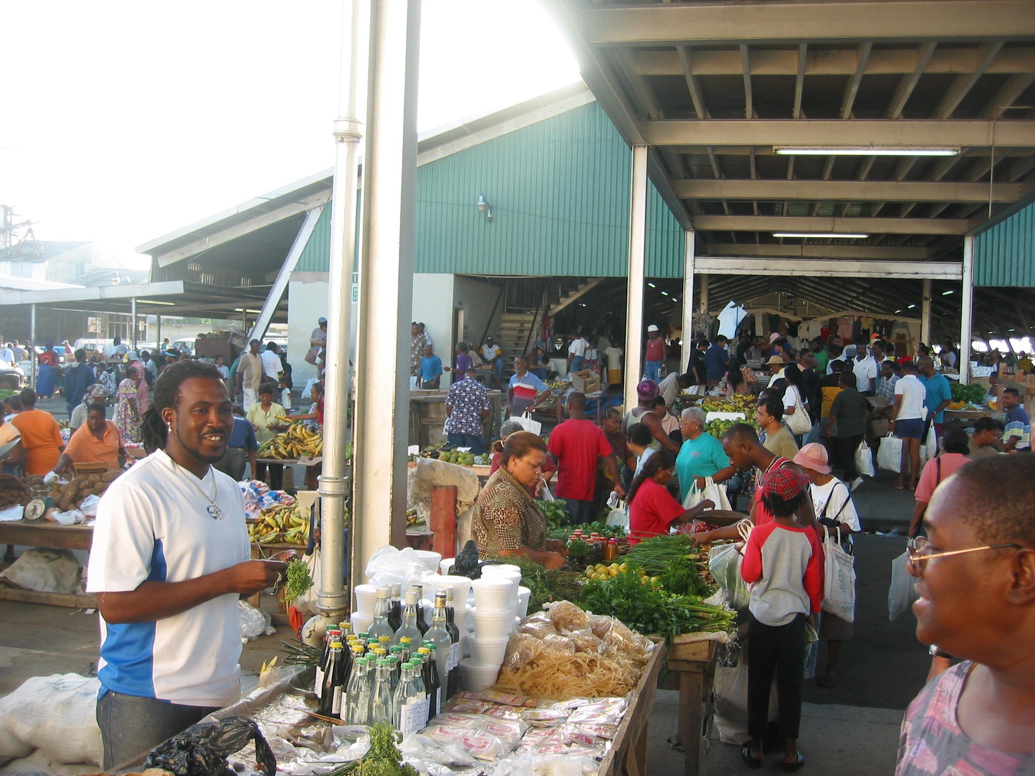
We took a bus into Port-of-Spain, the capital of Trinidad and the trade center of Trinidad/Tobago, was founded in 1560 by Spanish colonists. It's the largest city we'd seen since leaving Puerto Rico. It is crowded and the traffic is heavy. We enjoyed exploring the streets and neighborhoods of the city. Charlotte Street, for instance, has a huge fruit and veggie market, lots of shops selling electronics and housewares, as well as an Asian section where the shops sell everything from dried mushrooms to crystallized ginger.
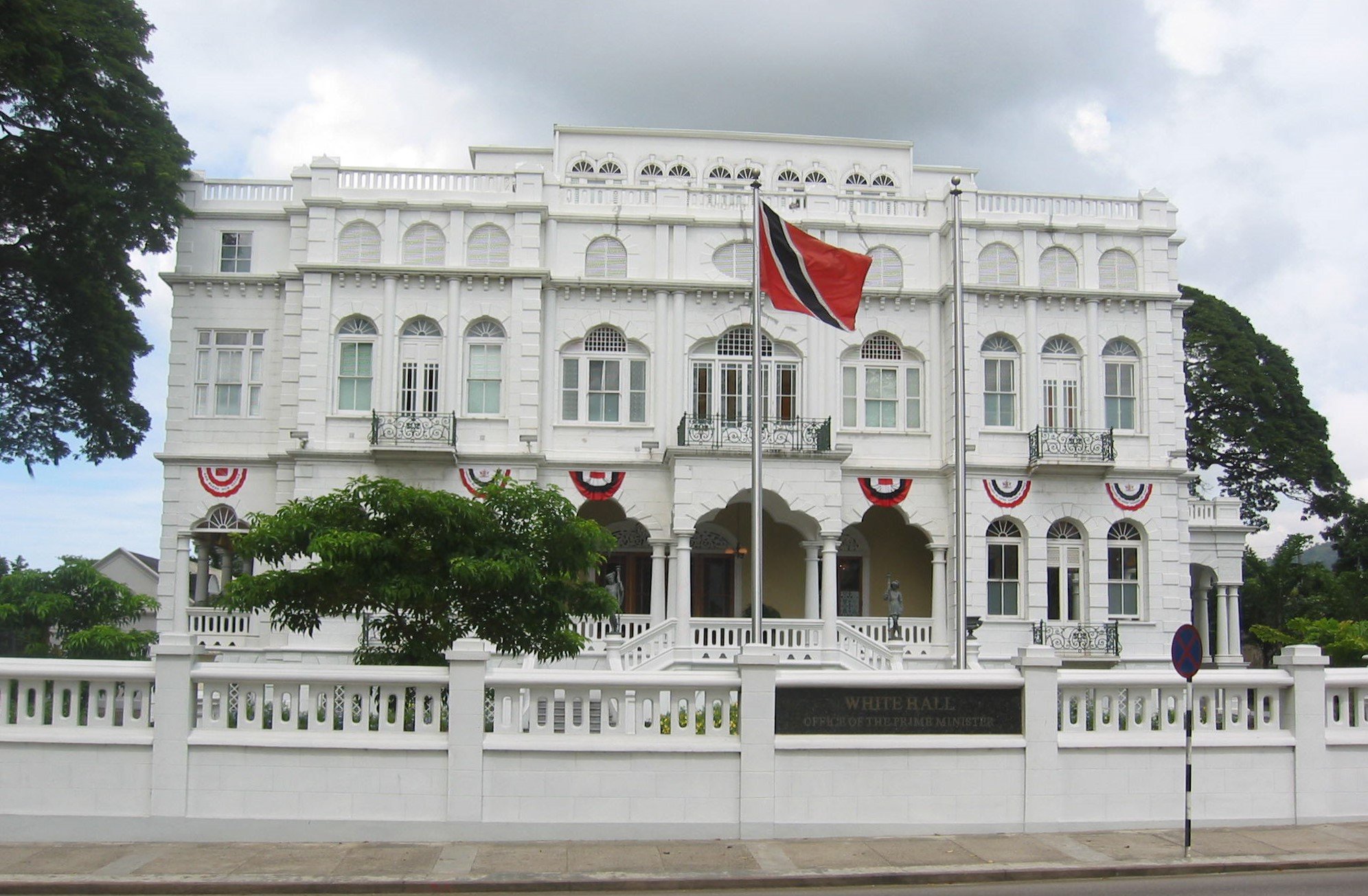
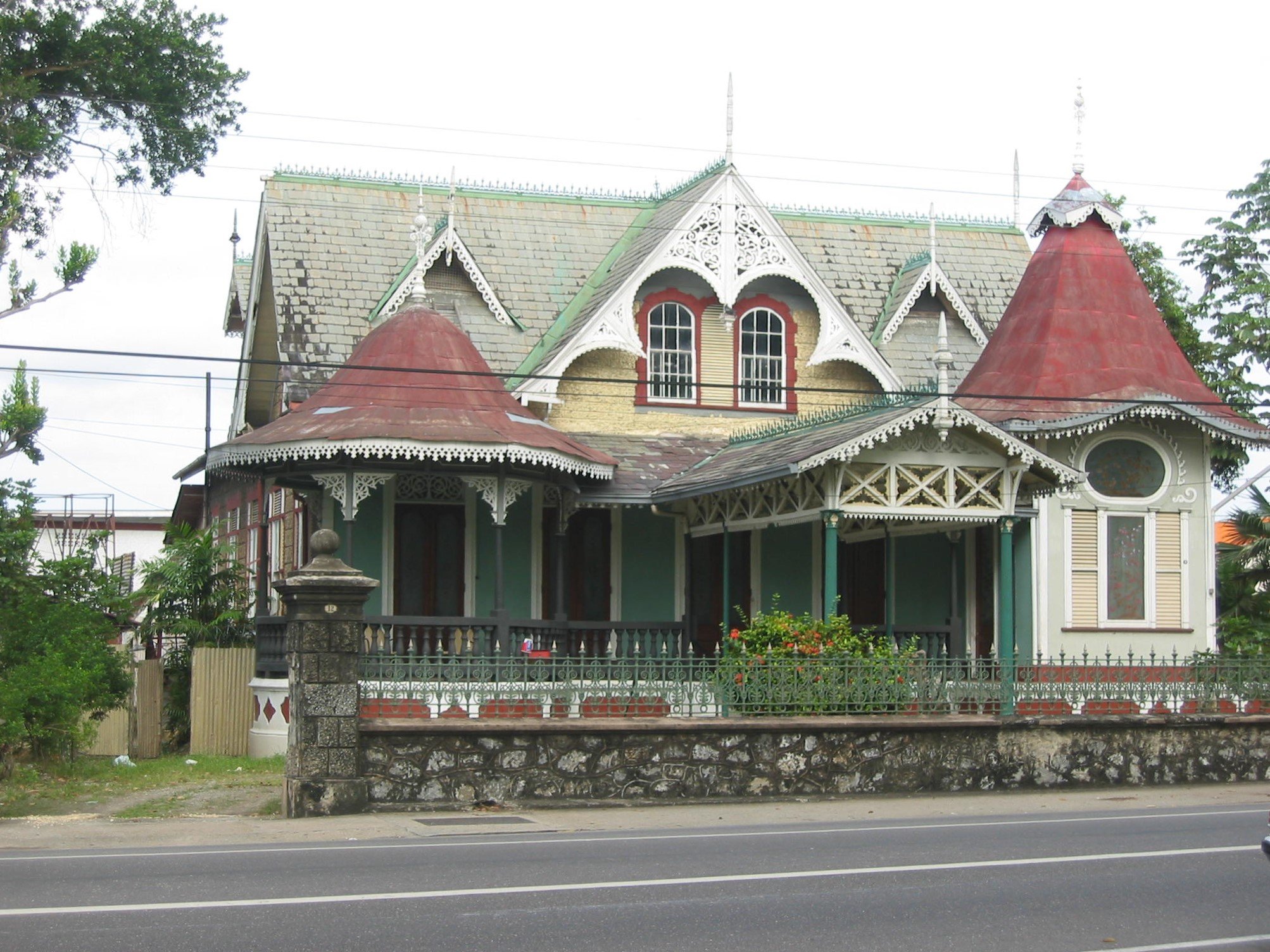
On Abercromby Street, we saw The Red House, Trinidad's House of Parliament. The British influence in architecture and grand government buildings is strong in buildings like Whitehall, Stollmeyer Castle and Queen’s Royal College. On local houses, we saw bright colors and the gingerbread trim that we’d come to associate with Caribbean flourish.


Steel pan music was invented on Trinidad. When British authorities banned African drumming, the people made music from bamboo rods thumped on the ground and reinforced with improvised percussion instruments. During the 1930s and 1940s, improvised percussion like discarded biscuit tins and empty oil drums became a new sort of drum, the steel drum. Each note is tuned by hammering a dent into the surface of the steel. Today's steel bands perform everything from western classics to calypso and you can hear the music everywhere and all the time. Trinidad is the home of calypso and the “limbo”.
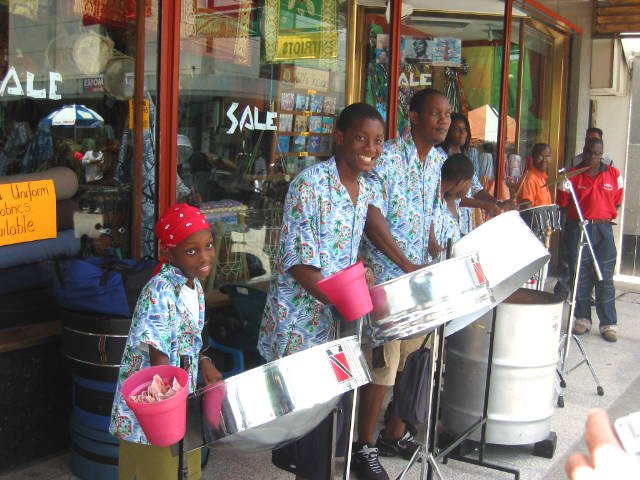
Street steel bands were quite common on the streets of Port of Spain
Of all the places we visited in Trinidad, the one that exceeded all expectations was the Asa Wright Nature Centre. Nestled in the hills of the Arima Valley, we traveled about 1½ hours by van to reach this 193-acre nature preserve. Once a cocoa, coffee & citrus plantation owned by Dr. Henry and Mrs. Asa Wright, the main house provides a reception area, dining room, parlor and verandah for the guests. Separate bungalows offer rustic but
comfortable accommodations. The highlight is the abundance of birds and wildlife that come to feed at dawn and dusk just below the verandah. Asa Wright sold the house in 1967 to a group familiar with the property who wished to protect the area and promote eco-tourism. It is now considered one of the top eco-tour centers in the world. We wandered the network of paths through the forests and took tours. It was incredible.
Trinidad & Tobago are home to over 430 species of birds, 620 different species of butterflies and 2,300 different flowering shrubs and plants, 700 of
which are orchids. There are 108 different mammals including 57 bats and 70 different reptiles. Oilbirds, only found here and in northern South
America, live in caves and maneuver by sonar like bats do. There are fish-eating bats and vampire bats, anacondas, giant leatherback turtles, capuchin and howler monkeys, sightless fish, a unique golden tree frog and an almost extinct bush turkey.


The end of a passage. We left Charleston, SC on 17 January 2002 and arrived in Chaguaramas, Trinidad, West Indies on 30 July 2002. We logged 2,652 nautical miles and visited 17 countries and territories. It was time for some needed maintenance and repairs on Nine of Cups. Time to relax in a marina with shore power, air conditioning, as many lights as we want and unlimited CD and radio playing, unlimited water, dockside laundry … a myriad of amenities. This also meant that boats were so tightly packed together, it was easier and closer to step onto your neighbor’s boat than onto the wharf.
Nine of Cups had now become our “home”. We could wander through her at night with the lights off and not stub our toes or trip. We were comfortable aboard. We found her to be sea-kindly and seaworthy and a most demanding mistress. We couldn’t imagine any other way of life now. We had said from the beginning that we would sail until it wasn’t fun anymore. It was definitely still fun.
Trinidad 2015
We returned to Trinidad 13 years later in 2015 after at the end of our world circumnavigation. Things had changed a bit. A 3-day 349 nautical mile passage had us heading back to Chaguaramas and into the Power Boats marina where we planned to haul out in a few days time.

Customs and Immigration are pretty strict in Trinidad requiring a tie-up at the Custom's dock and immediate check-in upon arrival.The lines at Immigration and Customs were long and slow. We filled out all the requisite forms in duplicate and triplicate, using well-worn carbon paper that Columbus had no doubt used sometime in the past. When we were finally called to the front counter, the Immigration officer was pleasant and informative. An hour later, we headed to Customs where we completed several more forms providing all the same information we had provided to Immigration, paid our TT$50 (~US$9) and headed back to Cups. YSAT had no moorings available and observing the crowded anchorage on our way in was discouraging. What to do? We remembered enjoying the anchorage off Chacachacare Island back in 2002. New Customs rules required a permit to go there. David went back to the Customs office to ask, and amazingly, the officer provided the permit within minutes.
Return to Chacachacare Island
We threaded our way back through the madding crowd of masts and frenzied boat traffic, past all the marinas, past Gasparillo Island and out of Chagaramas Bay. Just 7 nm away was a calm, beautiful paradise and a whole different world. We dropped the hook on the north side of Chacachacare Bay in 15' of clear, we-can-see-the-bottom water. Not another boat was in sight. The anchorage in Chacachacare was paradisaical. The water was blue and clear. We saw fish swimming by and bigger fish chasing them. Birds, especially pelicans, swooped and soared (we ignored all the vultures). There was a turtle that made a regular appearance near the boat. It was hot and humid, but tolerable with a delightful breeze.
The island is steeped in local history. In the past, the island has been a tobacco and cotton plantation, a whaling station, a leper colony and a base for US troops during WWII. We explored the island with friends when we visited Trinidad in 2002 . We decided to take time from our task schedule (read that Marcie convinced the captain) to make a couple of early morning forays ashore and explore again. Our memories being what they are, it was a whole new experience this time. Read more about our exploration of Chacachacare in our blog entitled: Lepers and Lighthouses. Things had definitely changed since our last visit.


We returned to the Power Boats marina in time for our scheduled haul-out then prepared Nine of Cups for our departure. We were going home for the holidays and she’d be alone for a couple of months. All in order, we boarded our Jet Blue flight and headed to Boston for a three-month’s long visit back in the States.

We returned to Trinidad and Nine of Cups in March 2016. Cups was a sight for sore eyes, having been abandoned for three months. We were back and demanding mistress that she was, Nine of Cups commanded our immediate attention (and she would have it!). We set to work on her right away.
It happened every time we left Nine of Cups for a few months and then returned. We were overwhelmed with projects, repairs and maintenance. “Just put it on the list” was always the Captain's usual response to any problem we discovered that required attention. It's just that the list grew and grew until we felt it was untenable … then what? Well, we reverted to our standing philosophy of life aboard… just a little further. Don't worry about the whole list; just worry about getting one thing checked off and moving on to the next. As always, despite my whinging and worrying, we managed to get everything done that needed doing.
A Grand Tour of Trinidad Island
We needed a break from the chores, however, and Marcie’s sister, Lin, was just the thing to provide a respite. She arrived in Trinidad in April and we played vacationers for a few days. We spent the first couple days of her visit locally in Chaguaramas then headed out on a Grand Tour of the island.
We rented a car and headed to Trinidad's north coast for a visit to the beaches.


Asa Wright Nature Centre
When we visited Trinidad in 2002, we had the opportunity to visit the Asa Wright Nature Centre and loved it. We made reservations for an overnight stay there in hopes that Lin would enjoy it as much as we had previously. It was even better than last time and we all enjoyed our stay there. We relaxed in our cabin, swam in a fresh water pool, took afternoon tea at the main house and wandered through a maze of the Centre’s pathways.


Just like our last visit to Asa Wright, the birds stole the show. Hummingbirds, honeycreepers, oropendolas and tanagers flitted about the veranda, some as close as our noses. Fruit and sugar water feeders attracted them in an age-old afternoon ritual not unlike our afternoon tea. The highlight, however, was spotting a hummingbird nest with its occupant at home.


You can read our blogs about Asa Wright Nature Centre here.
Hindu Temples
From Asa Wright, we continued on our journey along Trinidad’s northeast coast and then on to the Hindu Temple in the Sea. When the British abolished slavery in 1833, there was a significant lack of laborers in the Caribbean. Between 1833-1920, over 143,000 Indian workers were sent to Trinidad as indentured laborers to meet the demands. Consequently, there is a high percentage of Indian population on the island and nearly a quarter million of them are Hindus. It only makes sense then that there would be some elaborate Hindu temples on the island which we found to be fascinating and we decided to visit some.
The Temple in the Sea has an interesting history. The indentured laborer, Sewdass Sadhu, came to Trinidad in 1907. He was a devout Hindu and wished to build a temple. He built his first temple in 1947 on land owned by the sugar cane company for which he worked. The company ordered it torn down, charged Sadhu with trespassing, fined him $500 (2 year's wages) and jailed him for 14 days. A determined man, he figured if he couldn’t build his temple on the land, then he would build it in the sea, and thus Sadhu's dream to rebuild his temple began to take shape. With two buckets and an old lady’s bicycle with a carrier on the back, Sadhu began the laborious task of building the temple in the sea… 500 feet into the swamp land of the Gulf of Paria. For 25 years, he worked at building his temple and with the help of local people, businesses and a government grant, it continues today to be a place of worship and serenity. It is a great testament to the devotion and tenacity of the human spirit. A prayer ceremony was in progress so we contented ourselves with quietly tiptoeing around the outside and left without entering.


We headed back inland to find Lord Hanuman, the Monkey King. We were familiar with several Hindu gods, but not Hanuman. It seems that he is regarded as the perfect symbol of selflessness and loyalty. The 85' murti (statue) of Lord Hanuman is reputed to be the largest outside of India.

Caroni Swamp and Scarlet Ibis
According to Wikipedia, the Caroni Swamp is the second largest mangrove wetland in Trinidad located where the Caroni River meets the Gulf of Paria. The swamp is an estuarine system with extensive mangrove forests, numerous brackish channels, salt lagoons and mudflats. It's not far from Port of Spain and it's a major habitat and viewing area for Trinidad's national bird, the scarlet ibis. It was the next stop on our Trinidad tour after visiting the Hindu temples. I'd made a reservation with Darren at Mandoo Tours because they were noted for smaller, more personalized tours. We were pleased when we showed up and there were only two other passengers.
We puttered slowly through the mangrove-lined channels. We'd stop every once in awhile and just drift along noiselessy while our guide pointed out things we would have definitely missed… like the well-camouflaged Cook's tree boa in an overhanging limb (yikes). There were actually two entwined boas; it was mating season. Reptilian love!

Blue herons perched warily on the mangrove roots as we slowly motored through the narrow labyrinth of waterways. We were confounded when Darren spotted a tropical screech owl, nestled high and deep in the mangroves, sleeping. Once out of the mangrove forest and into an open bay, Darren tied the boat to two stakes and we waited. Every morning at dawn, the scarlet ibis fly off to feed in other parts of the swamp. Every evening at dusk, like clockwork, they return to roost on a nearby island of mangroves. Then we waited patiently for the first of the scarlet ibis to appear in the sky. They came in great numbers to roost in mangroves and rest for the night before performing the same routine the next day and the next.


Afternoon Tea at Mount Saint Benedict
It was a Brazilian Benedictine monk, Dom de Caigny, who originally purchased 240 acres in 1912 to establish the Mount Saint Benedict Abbey. Located 700' above sea level, overlooking the town of Tunapuna, the Abbey looked rather majestic with its tower and red roofs as we drove the tortuous, narrow, steep road below which leads up to it.
We were each offered a choice of three tea services… the Presidential, the Traditional and the British. We ordered one of each. What had enticed us to come to the tea room was this description: “A famous room at the Pax House is the Tea Room. The Tea Room was constructed during World War II and it is the oldest Tea House in the country. The Tea Room serves a variety of teas from different countries.” They were out of two of the three teas offered, so we settled on one big pot of Earl Grey (which I have every morning for breakfast, by the way...nothing too exotic there). After a short wait, the tea and accompaniments were served.


Lin poured. We drank and nibbled, unimpressed by the tea, the food and the tea room. It was, indeed, very quiet, almost too quiet. Our voices echoed in the near empty room. After delivering the tea, the server never appeared again. We had hoped to learn more of the history of the Pax House or perhaps which areas of the grounds were open for further explanation, but alas we found no information available, nor anyone to provide any insight.
Time with Lin was growing short. The next day we headed into Port of Spain for a self-guided walking tour and look-around. Lin had Marriott points and we camped out for a couple of nights at a Courtyard close to the city center. What a lovely, luxurious change. We walked and walked and walked and walked, taking in all the sights we could see. Finally, we headed to Buzo’s for an excellent dinner and our final night with Lin.


Lin departed and we slowly ticked items off the chore list. We departed Trinidad in May 2016 and headed back to the USA, completing a bonafide circumnavigation in the process.

And now, join us once again as we return to 2002 and resume our first trip through the Caribbean and head to Venezuela and points east.

We stayed in Trinidad for the hurricane season and then ventured into Venezuela and its Caribbean out-islands, only a few miles away and another continent. Come on along with us. Just click on this link.
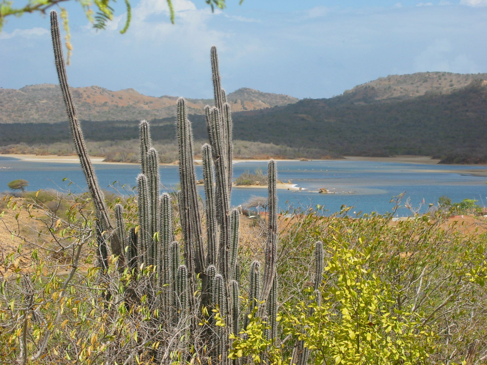
The ABC’s … Aruba, Curacao & Bonaire

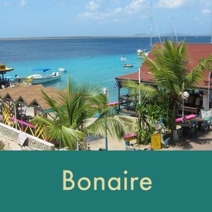
Bonaire
After more than a month in Venezuela’s Caribbean out-islands, a weather window appeared which allowed us a day of moderate winds and seas and a wonderful 40-mile downwind sail from Las Aves to Bonaire. It was time to re-enter civilization, replenish the larder and sample yet another country.
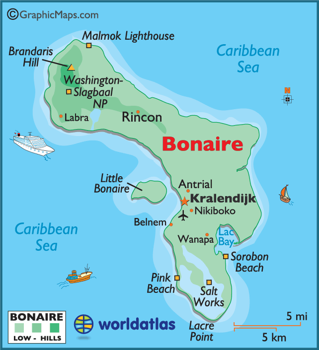
Bonaire, part of the Netherland Antilles, is one of the ABCs and the first island we encountered approaching from the east. The ABCs are noted for beautiful beaches, diving and tourist resorts.
Bonaire
Capital/largest city: Kralendijk (KRAW-len-dike)
Population: 11,800 (est 2002)
Size: 112 sq miles (24 miles long x 3.7 miles wide)
Official Languages: Dutch & Papiamentu
Currency: Netherlands Antilles Guilder (ANG) $1US = $1.75ANG (2002)
Major industries: tourism and salt
High Point: Brandaris Hill, 784'
Government: One of five Netherlands Antilles islands belonging to Holland.
Bonaire, the "B" of the ABCs, is a small boomerang-shaped island touted to be one of the best diving locations in the world.
One of the official languages of Bonaire is Papiamentu, an interesting blend of Spanish, Dutch and African.
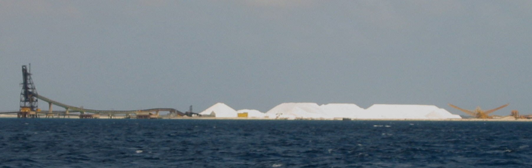
The most distinguishing characteristics of the island on approach from sea are the mountains of sea salt stacked along the shore.
The entire sea area surrounding the island is a national marine park. The fish and coral are abundant and the number of dive and snorkel sites is astounding. We were able to dive and snorkel right from the boat. Moorings are provided for easy tie-up and in an effort to protect the sea floor. Karel's Beach Bar is close by and offers the main dinghy dock for cruisers. It’s a major hub of activity.
Downtown Kralendijk is an easy walk. It’s clean, neat and well laid out. The paving-blocked streets are lined with colorful shops and restaurants. Since tourism is one of the main industries of the island, there is no lack of t-shirt and souvenir items.


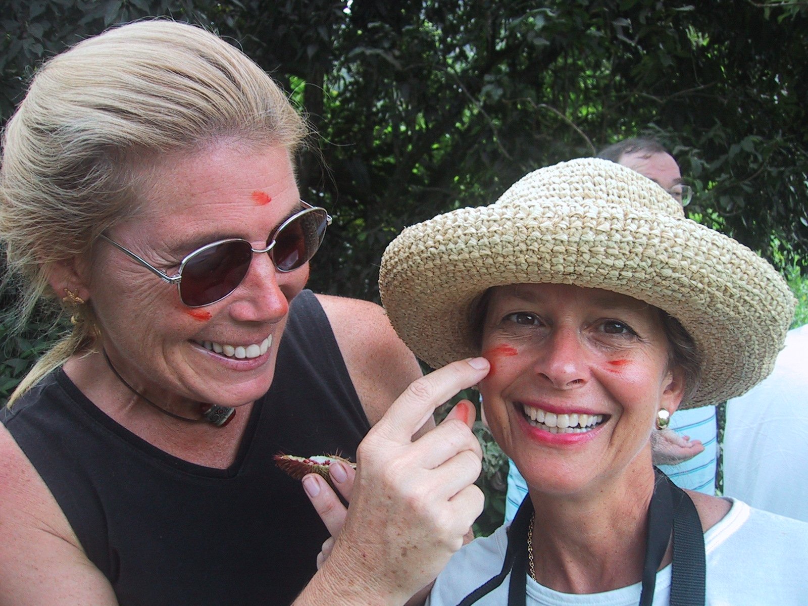
While in Bonaire, we welcomed two sets of guests to Nine of Cups. Their visits allowed us to view life aboard the boat and sailing with new eyes. It also afforded us the chance to explore the island via land vehicle for a change. The northern part of the island is rough, hilly, arid terrain and the location of Washington Slagbaai National Park. The southern part of the island is low-lying with wetlands and mangroves and the location of the saltpans. Lac Bay, on the eastern windward coast, is a premiere windsurfing location.
Washington Slagbaai Park is a 13,500-acre game preserve. Whiptail lizards, with their iridescent turquoise tails, back and feet, provided endless entertainment. There were hundreds of them and they weren’t shy in the least. They seemed to enjoy cookies, but apples were the biggest hit.


Without a doubt, the best part of the park visit was the host of animals and birds we saw. Whiptail lizards, iguanas, goats, pink flamingos, parrots, trupials and more, delighted us throughout the visit. The iguanas are colorful, numerous and big, ~about 4-5’ long from snout to tip of their long, striped tail. They’re herbivores (thank, goodness)and enjoyed our banana peels as a snack.


Gotomeer is a salt lake and the largest pink flamingo sanctuary in the Caribbean, ~40,000 pink flamingos reside in Bonaire’s 135 acres of protected area.

Ceru Bentana Lighthouse was in ruins
In the past, donkeys were used extensively for hauling carts of salt from the pans to the waiting ships. Now they run loose and are part of Bonaire's
heritage. They are EVERYWHERE! Drivers stop frequently to let donkeys cross the street in front of them. Many times the donkeys wait at the
window in hopes of handouts. We learned to save apple cores and banana peels for just such occasions.


The best times for transiting the western Caribbean to Colombia are May and October. Having spent nearly three months in Bonaire, we were anxious to continue moving west to take advantage of available weather windows. Curaçao is only about 40 miles from Bonaire, a good
downwind day sail and on the way. Come on along!
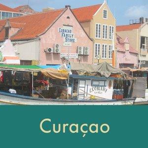
Curaçao
Bon Bini na Korsou (Welcome to Curaçao) in Papiamentu. The largest island of the ABCs, Curaçao is noted for its colorful capital, Willemstad, a UNESCO World Heritage city. Its floating bridge and vibrant floating market, and don’t forget that bright blue-colored liqueur for which the island is famous.

Curaçao (KUR-a-sow)
Capital: Willemstad
Size: 182 square miles
Official language(s): Dutch & Papiamentu
Government: Dutch Territory since 1527
and part of the Netherlands Antilles
Currency: Netherlands Antilles guilder (ANG)
Population: 140,000 (est. 2002)

The main capital of Willemstad is separated into two parts, Punda and Otrobanda, by the waters of St. Anna Bay. The two parts are connected by
Queen Emma Bridge, primarily used for foot and boat traffic, and another large vehicular traffic bridge. Without a doubt, the waterfront street of Handelskade, on the Punda side, is the most memorable sight in Curacao. The Dutch colonial style mansions were originally owned by wealthy merchants in the 1700-1800s. The area is well-preserved and now occupied by restaurants, shops, banks and other commercial properties. Legend has it that a
popular governor some 200 years ago complained that he got headaches from waking up to all the white houses along the waterfront. In deference to the governor, the islanders painted their homes in bright pastels ever since. This panorama is undoubtedly my favorite shot taken in Curacao.

The "Floating Market" in Punda is a delight to the eye. The brightly colored Venezuelan boats line up along the wharf and open stalls for sale of fresh produce and fish. Marcie’s photo appeared on the cover of Carribean Compass in 2004 and was her first published photograph.
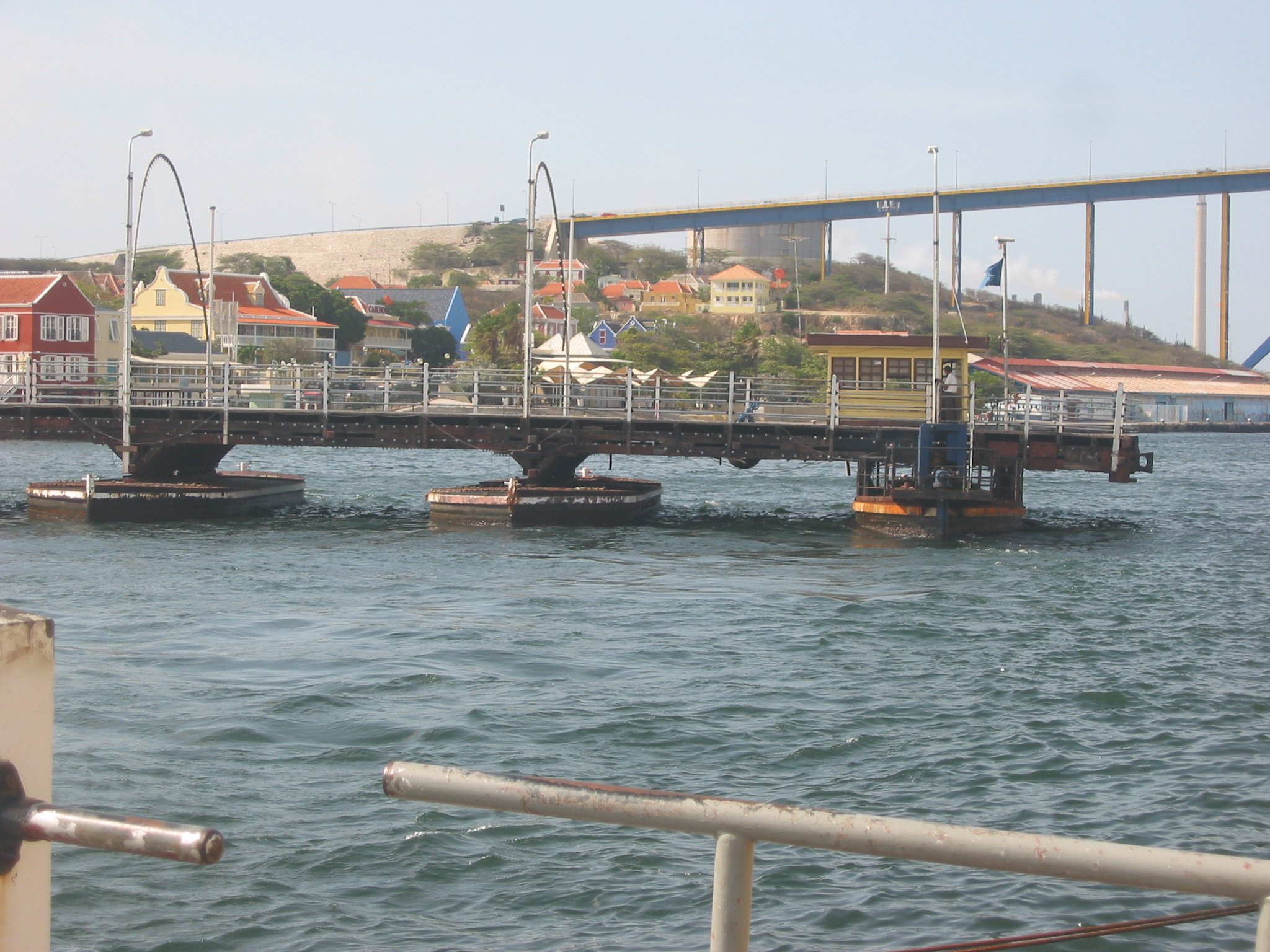
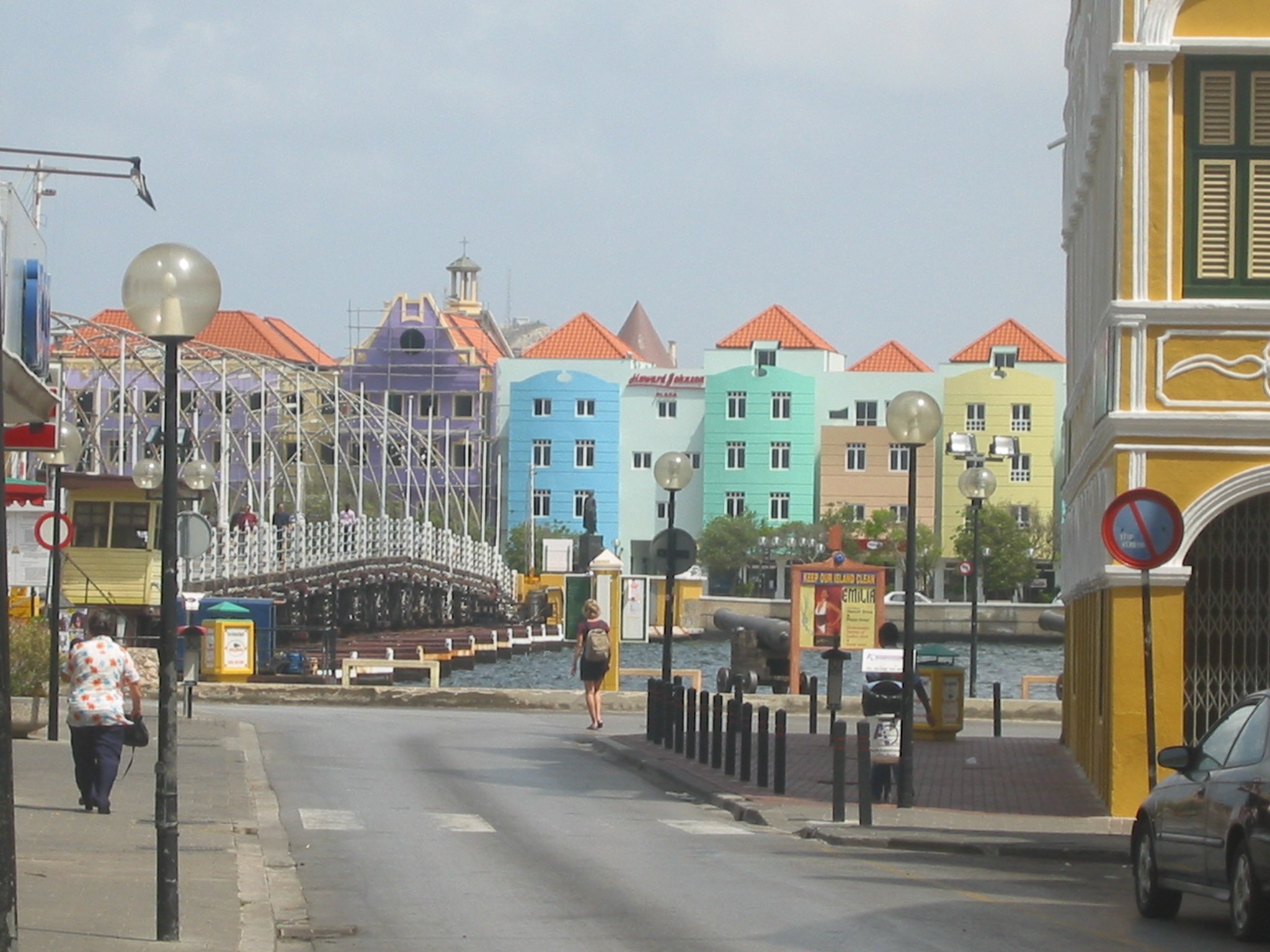


Constructed in 1888 and supported by 16 floating pontoons, the Queen Emma is affectionately known by locals as the “Swinging Lady.”Connecting the two sides of Willemstad, the Queen Emma Pontoon Bridge was originally a toll bridge that charged only those who could afford shoes. Poor folk borrowed shoes and paid the toll so as not to be embarrassed. The rich, too stingy to pay, crossed barefoot. Some things never change! The bridge is now free to cross as are the ferries that also transport people across the 500’ wide bay. The bridge opens up to 30 times a day to allow water traffic to pass. The bridge tender actually starts an engine and “drives” the pontoon bridge to an open position. The process takes about 30 minutes.
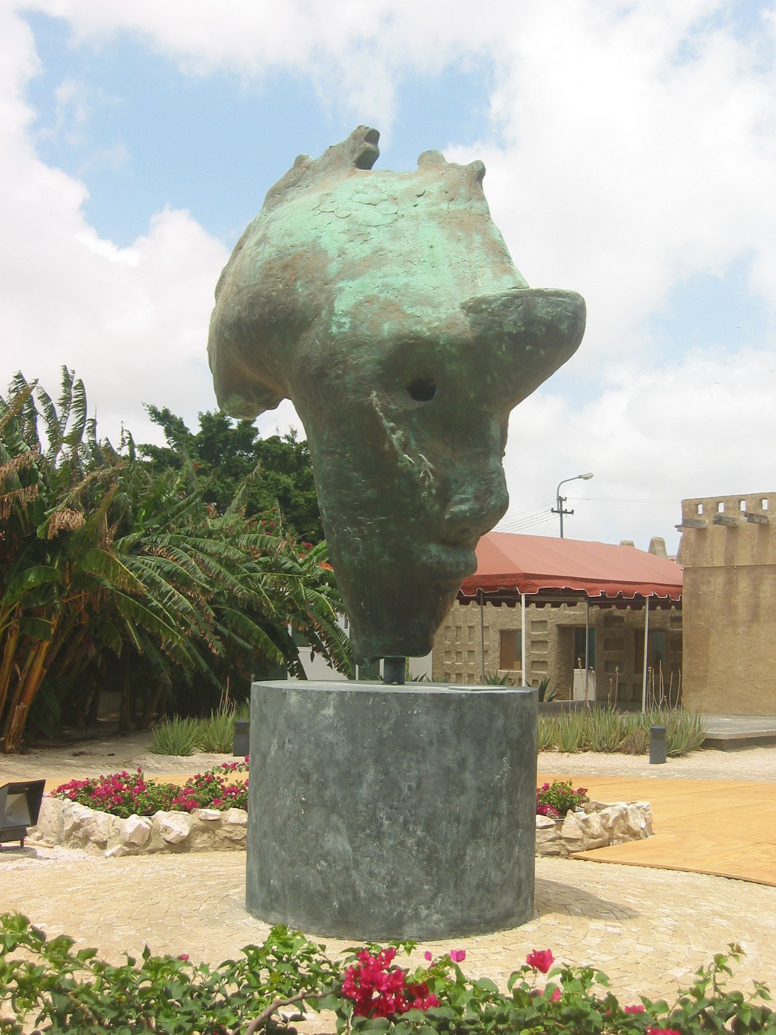
We visited the excellent Kura Hulanda Museum. Touted to have the best African collection in the Caribbean, the museum is dedicated to the history of slavery, slaves and the development of Curaçao through the centuries. The museum which opened in 1999 covers all aspects of slavery and those involved. The "Face of Africa" above, is a huge bronze statue in the center of the courtyard in the museum.


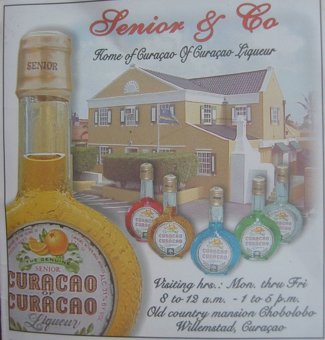
Curacao, the bright blue liqueur, is made here exclusively at a distillery housed in Landhuis Chobolobo, an old country mansion. When the Spaniards arrived on the island in 1499, they brought hundreds of orange trees with them to plant. The poor soil and local climate, however, changed the fruit from sweet to bitter and inedible. So the trees were forgotten and left to grow wild. It wasn’t until decades later that someone accidentally discovered that the peel of the orange when thoroughly dried in the sun contained a delicate oil with a pleasing fragrance that could be distilled into a unique liqueur … hence the Curacao of today which comes, by the way, in a wide array of electric colors.
From Spanish Waters, we headed out to Aruba on our way to Cartagena, Colombia at last. We were within 5 miles of our overnight anchorage in Aruba when an Aruban Coast Guard boat pulled up beside us. They asked all the usual questions…who are you, where are you coming from, where are you heading. We told them we only intended to spend the night in the anchorage in Aruba and not check-in. Hmm…they pondered and finally
answered politely, but firmly, that unless we intended to check in with Immigration and Customs, we could not anchor. Ah…a dilemma. Checking in and out, though free in Aruba, takes time and is a pain since the boat has to be brought to the Customs dock for inspection. Now usually this wouldn’t be a problem, but the wharf is a commercial wharf intended for large freighters and ships and as such is huge and not “sailboat” friendly. We opted to turn to port and head out directly to Cartagena, just another 450+ miles away. So the passage notes on Aruba are pretty slim. You just read them all.
So ends our island-hopping travels in the Caribbean. There’s a big world out there and we’ve only just begun. Return to our Travelogue page to travel along with us as we explore new countries, new cultures and sail new seas.