The Blue View - Pilot Charts
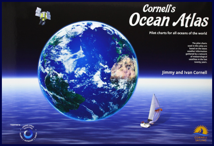
Want to know where the current along the west coast of South America is the strongest?  How about the prevailing winds off St. Helena in April? As we were planning our Atlantic crossing, one of the references we used was the set of pilot charts for the North and South Atlantic. The NGA (National Geospatial-Intelligence Agency) Pilot Charts depict, graphically, weather conditions, sea states, prevailing winds and currents and a host of other information for different times of the year for all the oceans of the world. pilot atlas

We owe their existence to a U.S. Navy officer, Matthew F. Maury, who was an expert in marine meteorology, astronomy, and bathymetry. He developed the first wind and current charts in 1847 by analyzing and compiling data from thousands of ships' logs. From these charts, most of the current sea routes were established, as well as which areas of the oceans should be avoided at different times of the year. His invaluable contributions to meteorology and oceanography gained him international recognition, and he was variously referred to as the “Pathfinder of the Seas”, the “Father of Oceanography” and the “Father of Modern Naval Meteorology”. Quite the guy!

maury

The descendents of Maury's wind and current charts are the NGA Pilot Charts, and there are now five sets – one for each of the oceans. Each set has a separate chart for every month of the year. The charts are divided into 5 degree rectangles, and within each rectangle, it is easy to determine the prevailing wind speed and direction, and the likelihood of gales, storms and calms. Each chart also shows the ocean currents, both direction and strength, average sea and air temperatures, ice limits, barometric pressures, wave heights and visibility. A lot of information is packed into each chart, and every time I use them, I discover something new.

chart

There are a few caveats to their use, however. First, they are not, of course, weather forecasts – only historical averages of weather in a given area. It is little consolation to know there was only a 5% chance of encountering a gale when we are sitting in the middle of one.

The second caveat is a consequence of their very usefulness. For example, if mariners know a particular area is especially prone to hurricanes during the month of September, most vessels, especially any that cannot outrun a hurricane, will avoid that area at that time. Since the data regarding hurricanes is based on actual logs of vessels, and if very few vessels choose to sail through a hurricane, then the frequency and strength of these tropical storms will be underestimated.

The third caveat is that they are based on data collected over decades in the late 1800's and early 1900's. In my research, it's not clear whether data is still being collected and updated. If the earth is truly experiencing global weather changes, the data will become more inaccurate as time passes.

A final caveat is that many parts of the earth are affected by global cycles like the El Niño/La Niña years. Thus, a particular 5 degree rectangle of a pilot chart that indicates a 20% likelihood of a southerly wind may, in reality, be a 95% likelihood in an El Niño year and a 5% likelihood in other years.

Given all these caveats, we find that pilot charts are still very helpful, and they are one tool we use when planning long passages. We also check global weather forecasts to see whether the current year is an El  Niño or La Niña year and what effect that will have on local weather. In addition, we research the predictions for tropical storms … will this be a good year or a bad one?

With all this planning, the conditions we encounter are still a crap shoot and depend on our luck as much as anything. Had we left Cape Town heading for Norfolk in the beginning of April as we had planned, we probably would have run into Tropical Storm Ana – the second earliest tropical storm to ever hit the east coast of the U.S.

Thus, the most important part of every passage may well be the hearty tot of rum we give Neptune on our departure.

The Blue View - Baby Needs a New Bailer

the new bailer Our old dinghy bailer is just about shot. The sun's UV rays have made it brittle and it's starting to crack. No matter – Marcie just finished a jug of laundry detergent, and it is the perfect size and shape for a new bailer. Being the parsimonious sailors that we are, we make use of everything we can.

When there is a lot of water in the dinghy, most anything will work as a bailer. That's not to say that a good bailer wouldn't be preferable, but I've used hats, oars, and even cupped hands quite effectively when there wasn't a real bailer available (although there were times when I wished I had webbed fingers). To move a lot of water quickly, it is more the technique than the tools at hand.

bailing with homemade bailer

When a good bailer is worth its keep is when the water gets down to the last few inches. Then I want a flat bottomed scoop. We've certainly purchased those classy bailers sold at the chandleries in the past, but I don't find that they do any better job of bailing than my homemade jobs. They do last about twice as long in the sun, but twice nothing, which is what mine cost, is a lot less than the cost to buy a bailer.

I find a 2L size laundry detergent jug is perfect … it is flat on the sides, has a handle, and is big enough to bail large quantities of water quickly, but small enough to dip out the last of the water from the small well near the transom of our dinghy. Usually, Marcie finishes up the laundry detergent in the current jug just about the time the old bailer has about had it. Any similarly shaped heavy plastic container with a screw-on lid will work, however -  bleach bottles, milk jugs, etc.  In a pinch, a gallon (4L) size jug will work, but is a bit too large and flimsy for my liking.

marking the bailer

beginning cut

cutting the bailer

When I'm done bailing, I stuff the bailing sponge into it. This weighs it down enough to keep it from blowing away.

The first few times I made a bailer, I simply dug out my box cutter and hacked away. The bailers worked just fine, but were sometimes rather oddly shaped. Now I mark the jug where I intend to cut it. BTW, it took me approximately ten times longer to write the blog about making a bailer than it did to actually make it.

The Blue View - Securing the Fuel Cans

fuel cans We have a lot of fuel cans aboard Nine of Cups – 11 to be exact. We have six 8.7-gallon (33 liter) cans for diesel, another four 5-gallon (20 liter) jugs for gasoline and one small 1-gallon (4 liter) can for mixed gasoline that we sometimes take with us in the dinghy if we are planning a long excursion.

Unless we are about to head off somewhere that fuel will be difficult to come by for a long while, like an ocean crossing or down into Tierra del Fuego and Patagonia, the jugs spend most off their time empty. We usually keep one or two of the gas cans full, but the primary purpose of the diesel cans are  for toting fuel from the local filling station to the boat. For a variety of reasons, over the past 15 years we've refueled using jerry cans far more times than we've used fuel docks. Many times, there is no fuel dock available in whatever port we are in, or when it is available, the fuel pump is often intended for ships and large fishing vessels who buy it by the ton. I prefer to filter the fuel before it goes into the tank, and this is more easily done if I pump it from jerry cans.  And, Cups has suffered far more damage from my banging her into jetties and wharfs than she has in all the storms and rocks we've encountered. I may spend a lot of time toting empty cans ashore, then wrestling them into the dinghy and back aboard Cups, but this is usually preferable to my angst when it is necessary to maneuver the girl up to and away from the typical fuel dock.

dinghy load of fuel

Six diesel fuel cans is a good number. They will usually just fit into the trunk of a taxi if the filling station is too far to walk. They fit snugly into our dinghy. It's also the number of fuel cans that will fit nicely on the aft deck.

Keeping them securely in place is something that requires some thought. When we are taking green water over the sides and Cups is pitching and rolling, the cans, especially if they are full, take a beating. I mentally pictured a 6'8”, 300 lb offensive lineman (for you non-Americans, think a 203cm, 136kg  not-so-gentle giant) trying to rip them loose, and tried to design the lashings to withstand his best efforts.

fuel can u bolts

I started with two fairly large, 2”x12”x72” (50mm x 30cm x 180cm), planks. These were secured to the aft rail on each side using stainless u-bolts. Each can is then secured to the plank using two web straps - I used medium weight 1” (25mm) webbing. One strap goes around the girth of each can and one goes from top to bottom. The straps are secured on the back side of each plank with a small screw to keep them properly positioned. I like having two straps for each can. I think it is quite likely the can may slip out from under a single strap when we are on a significant heel and get hit by a wave.

fuel cans strapped on

Marcie sewed buckles on the ends of the web straps, so the cans can be snapped into place and cinched tightly. Webbing expands and contracts with temperature, so I periodically check each strap for tightness.

straps from the back

Knock on wood and thanks to Neptune, we have never lost a fuel jug overboard, despite having weathered a few storms and a number of gales. It could be because of the well-designed straps – or more likely it's because we never start a passage on a Friday, always give Neptune a hearty tot of rum at the beginning and end of each passage, and never, never kill an albatross.