Walking the Heritage Trail

Direction Island, Cocos Keeling Islands

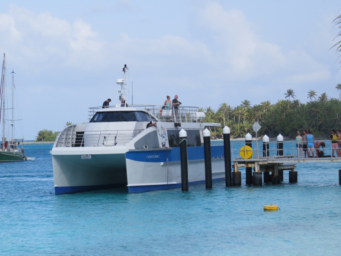
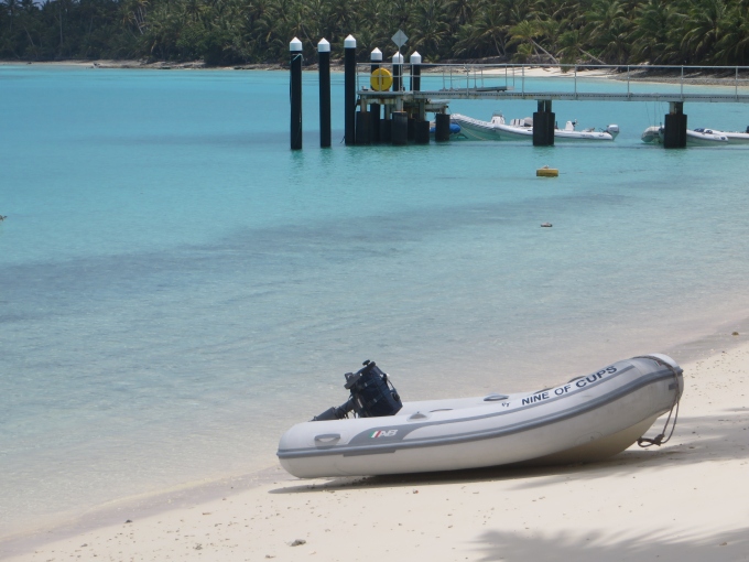
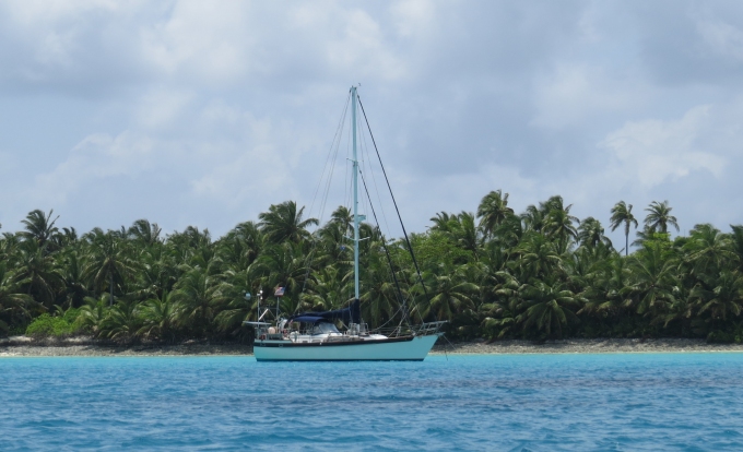
From our new neighborhood, access to shore is pretty easy … almost swimmable. After the initial euphoria of having wifi aboard wore off, we decided to check out Direction Island a bit. We'd only seen the general landing area and ferry dock on our quick trip in earlier, we needed a good walk and some exercise after our captivity.


beached dinghy


The picnic area was busy with other cruisers. Some doing laundry; some typing away on laptops; others just lounging in hammocks, or swimming or chatting amiably. We noticed lots of boat signs had been tacked up to the beams of the picnic enclosure and to nearby palm trees. This was right up David's alley and he noted his intention to carve a Nine of Cups' boat sign to add to the others.


boat signs


We noticed an info sign close by that showed a small map of the island with the Heritage Trail highlighted. Though Cocos Keeling had been primarily noted for its copra production, during both World Wars, these islands were strategic targets due to their location and the communication cable which operated here.


sign and map


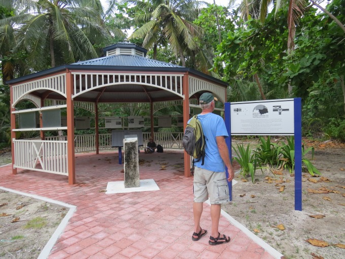
The first stop on the walk was a new gazebo which will be dedicated in 2014, celebrating Australia's first naval victory here when the HMAS Sydney outgunned the German raider Emden, the hulk of which still lies in the waters off North Keeling Island. (Not to be confused with the HMAS Sydney II which was sunk by a German raider in WWII and is remembered by the memorial we saw in Geraldton.) The gazebo will be dedicated in November 2014 with many dignitaries in attendance to mark its 100th anniversary.


emden sydney gazebo


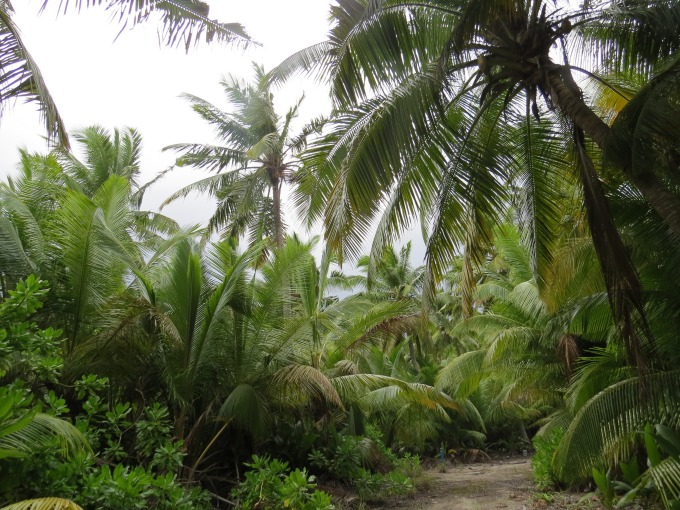
A well-groomed path quickly deteriorated into a palm frond /coconut strewn one that led us along the shore to the west end of the island.


path around the island


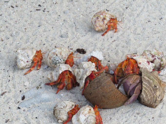
Hundreds of hermit crabs scuttled along all around us, retreating into their shells as soon as we got too close. It appears they're quite fond of coconut and when they were feasting, they seemed oblivious to our presence, foregoing caution in favor of getting more coconut than their neighbor.


crabs feasting


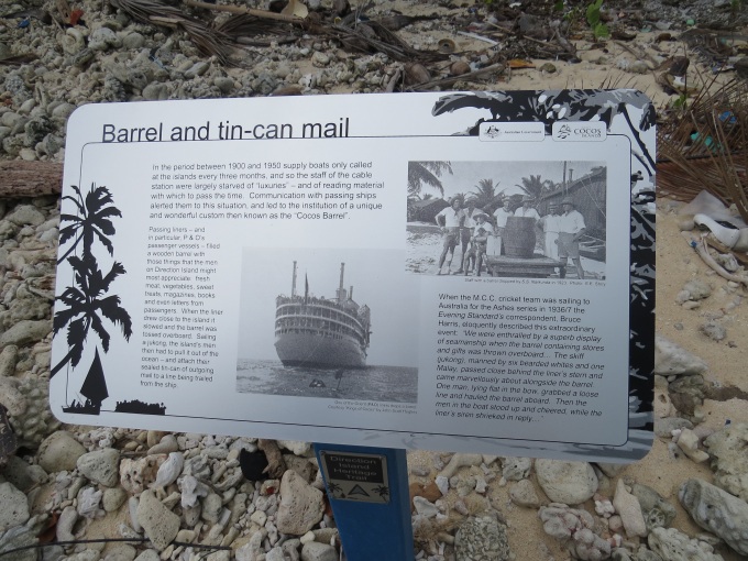
Along the path, informational signs provided historical insight into the communication station at Cocos, the Battle of Cocos (Emden vs Sydney), copra production and general life at an isolated island group. We enjoyed reading about the Cocos Barrel and tin-can mail, a unique way of receiving supplies and sending outgoing mail.


cocos barrel and tin can mail


The path led us along the rugged northern shore, where the waves were high and the surf was up. We curved round to rejoin the main path back to our starting point and followed another to a viewing platform at the southeast end of the crescent-shaped island.


viewing platform


We walked back to the dinghy along the beach. The water felt great on our tired feet. Along the way, we spotted an elusive ghost crab, poking up out of his hole, giving us the once over before diving back for cover.


ghost crab


Hot and sweaty, we launched the dink and headed back to Cups. It took us a nanosecond to change into swim togs and dive into that invitingly cool, aquamarine water. No great whites to worry about … no stinging jellies … no drag-you-away current. Just luscious, refreshing tropical waters washing away all the heat and cares of the day.

Moving to the Inner Lagoon - Direction Island

Cocos Keeling Islands – Indian Ocean

After 10 days at sea and three days captive on Cups, it was time to make a break no matter how windy it was. We heard there was a ferry from Direction Island to West Island twice a week at 0830. We planned for the Thursday ferry and wanted to get to the island in plenty of time to catch it. The night before, we waited for what we thought sounded like a calm period and launched the dinghy which predictably wanted to fly away. David managed to keep it under control as I hoisted and lowered it with the windlass. Plop … splash … it was in the water. The locals, had they had a good view, would have enjoyed watching us try to capture the dingy hoist halyard which flew loose (my bad) in the wind and took several frustrating minutes to snag with the boat hook as it started to rain. One hand for the boat, one hand for yourself … where does the extra hand for holding on to the halyard come from?


cups in outer anchorage


The morning was very windy … how surprising... with a good chop on the water. David bailed remnants of torrential rains during the night from the dinghy and fueled up. We're still in the outer anchorage as no boats have left, so our trip was a 15-minute soaking wet one to the ferry dock. We had a dry bag packed with one of our laptops and a stick with photos to send to Gentry. No internet for two weeks has been a difficult challenge. The things we become accustomed to that soon become “necessities”.


wind and chop on water


Once ashore, we beached the dinghy on a fine sand beach and got our first look at Direction Island. Oh my, the island was a sight to behold. Several covered picnic areas looked inviting. There were hammocks strung between palm trees, a large cistern for catching rainwater, paths in all directions and the familiar tropical sound of a feral rooster crowing somewhere off midst the thick stand of palm trees. We were delighted to discover there was a pay-for-use internet hotspot right on Direction Island. We canned the ferry idea in favor of setting up our internet headquarters right here.


picnic area


As always, things are easier said than done. We were able to access the Cocos Island Wifi system without a hitch. We filled in all the required info on the form and then it transferred us to PayPal to pay. “What's our PayPal password?”, David queried.

“Um, I'm not sure, try ...”, I replied, “it's in my notebook on board. It could be ….”, I offered, wracking my brain.

“Nope, could it be …?”. He entered another password, mistyped it and tried again.

“How about …?”, I suggested once again.

Well, this went on for a few more tries and no luck. We tried creating a new account, but it wouldn't let us with our current e-mail and credit card. Nothing left to do, but return to the boat and get the darned PayPal password and start again.

In the meantime, however, we took a good look at the anchorage area. We counted 28 boats, 18 with ARC burgees waving. We noticed a couple of boats had left … one, in particular, from a primo spot. Maybe it was time to move into the lagoon.


anchorage from the shore


We launched the dinghy and sloshed our way back to the boat … much quicker with wind and waves behind us. We were so wet from the ride in, it made little difference. We had noted a couple of bombies on our way back and made a mental note to avoid them with Cups. As soon as we started the engine and began hoisting the anchor, the Federal Police showed up. They were cool … “Go anchor and we'll catch up with you in awhile.”.

A 10-minute, .6 nm move into the lagoon and what a difference. We anchored in 14' (4m) of the most brilliant turquoise water there ever was with an unadulterated view of palm trees ashore. I watched as the anchor dug in, I let out scope and the chain pulled taut. The friendly Federal Police showed up within a few minutes, apologized for the mix-up and completed paperwork in record time.


cups new anchorage


The best news of all? With our trusty old Alfa antenna, we can pick up the wifi signal on the boat AND I found the PayPal password. Life is good.

About the Cocos Keeling Islands

anchorage  

It's hard having a true appreciation for a place until you learn a little more about its history. I've pulled Joshua Slocum's well-used classic, Sailing Alone Around the World, off the bookshelf once again because we are now following in his wake across the Indian. His visit to the Cocos was a memorable one … “If there is a paradise on this earth, it is Keeling,” he wrote. He visited on July 17, 1897. His writing remains relevant and a most enjoyable read even 117 years later.


Sailing Alone Around the World


The Cocos Keeling Islands are comprised of two atolls and 27 coral islands. The islands have been an Australian territory since 1984.


cocos keeling map


The atoll was discovered in 1609 by Captain William Keeling (East India Company) and named by a British hydrographer in 1805. A Scottish trader, John Clunies-Ross, visited the islands in 1814 and returned with his family and eight “sailor-artisans” in 1825, dug wells and planted coconut palms. Alexander Hare had actually arrived just shortly before Ross with a harem of 40 Malay women, but the women sought Ross' protection and Hare was soon driven out. The Clunies-Ross imported more Malay workers, built up his coconut plantations for copra production and prospered. Queen Victoria granted the islands to the Clunies-Ross descendants in perpetuity until they were purchased from the family by Australia in 1978. The Cocos Keeling flag reflects its history and heritage … a coconut palm, the Australian southern cross plus one star and the Islamic crescent symbol of the Malay people on a field of green.


flag of cocos keeling


Interestingly, Charles Darwin developed his theory of atoll formation when he visited the Cocos aboard the HMS Beagle in 1836. His study of the coral reefs here, led to his theory of reef development and evolution as published in his 1842 scientific paper.

Only two of the islands, West Island and Home Island, are inhabited. A tiny, isolated society of about 500 Cocos Malay people live on Home Island, descendants of the original workers brought to the Cocos by Alexander Hare and John Clunies-Ross. The Cocos Malays also maintain weekend shacks, referred to as pondoks, on most of the larger islands. West Island is primarily inhabited by ex-pat Australians and is the location of a tiny airstrip (with weekly Virgin Australia service), administration, a supermarket, a golf course (which plays across the runway) and basic services (like intermittent internet). A ferry service operates six days a week between Home and West Island and twice a week between Direction and West Island.


cocos ferry


There are reportedly over 1,500 species of marine life in the Cocos waters including the endemic Cocos pygmy angelfish. We've seen dolphins, but there are also turtles, rays and even a resident dugong (manatee), named Kat. Odd species like purple land crabs and horn-eyed ghost crabs are also critters for which we'll be on the lookout. There are several species of birds here, but only one endemic, the Cocos buff-banded rail. Several avian visitors stop here in their migratory flight and the area supports one of the world's largest and most significant breeding colonies for the red-footed booby. We've certainly seen lots of boobies flying around, but haven't had a chance to check out their feet. Much of the native flora was cleared for coconut palms and therefore, endemic plant life is nearly non-existent.


cocos pygmy fish


As you can see, we've got lots of exploring to do … if the wind ever lets up.

Check out the weather at Cocos Keeling Island and see how much wind we've got today.