Weather Windows

Perth 1418 nm  

Didn't I just talk about making plans and how we're going to try to stick to a schedule? Well, we're a day behind schedule already. One thing you can't control on a boat … the weather. You really have to “go with the flow” or stay put. On land, in a car … you plan to go somewhere on Saturday, you go … unless you're in Wisconsin, for instance, and you're up to your eyeballs in snow. There are some no-go situations, but it usually doesn't depend upon the direction the wind is blowing. For the most part, your travel is not limited by weather and wind.

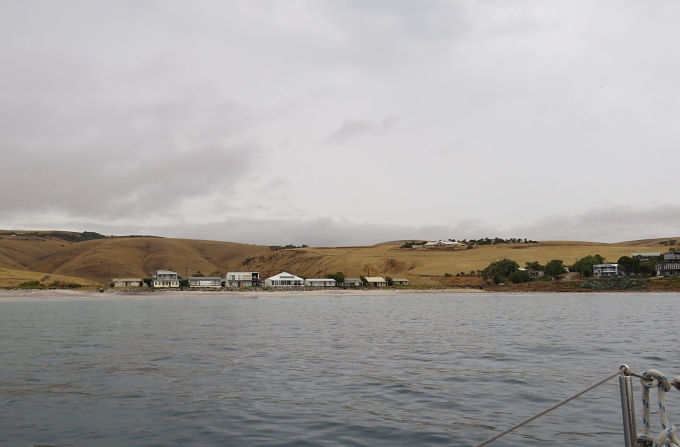
We had planned to leave this morning for Port Lincoln. The sun is shining, but the wind is blowing … from the west … the direction we want to go. So instead, we're spending the day aboard and taking the opportunity to catch up with some writing and reading. Tomorrow looks more promising wind-wise, but then there are the waves to think about. This is the way it goes with sailing. Sometimes you just wait.


grib


We've spent as much as two weeks in some places waiting for a good weather window to appear. It takes patience. Sometimes we wait for storms to pass, but usually it's because the wind is blowing in the wrong direction and close hauled sailing, beating into the wind is not pleasant, nor is it fast. We've had times when we've gone backwards and lost miles during a passage. Tacking angles are flat, especially when the seas are big, and you go north or south or backwards, but never west … the direction you really want to head. How often do you go backwards in your car … unless you're in reverse?


bom forecast


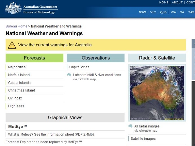
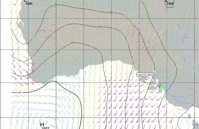
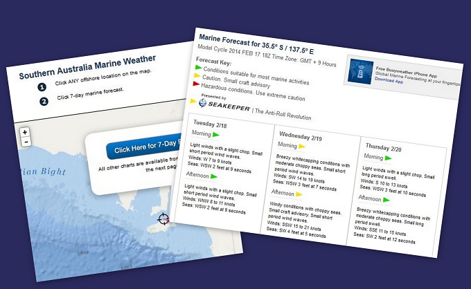
We use several weather predicting tools to help us make our plans. There are the GRIBs which provide a big synoptic picture of what the weather is doing and what we can expect. There's the local weather forecasts … in our case, Australian BOM (Bureau of Meterology) and there's also Willie Weather. We also use BuoyWeather, an annual subscription service that uses “virtual buoys” to predict wind and waves and weather along our travel path. They're all helpful, although sometimes they all disagree. And quite honestly, as good as weather prediction is nowadays, the wind and sea gods always make the final decisions and once you're out there, you get what you get.


buoyweather


So we wait and hopefully, we'll be off tomorrow!

Making Plans...Keeping to Schedules

great australian bight  

Most people think that living on a boat and sailing around the world is a pretty carefree life. Oh sure, there are the maintenance issues, but for the most part, we can come and go as we please. It's really not so. Our passages are most times governed by weather and the season. Currently, our plans include crossing the Great Australian Bight (GAB). It needs to be timed to catch the east winds that will take us across and now's the season for the easterlies.

As much as we'd like to dawdle longer at Kangaroo Island (KI), we need to get a move-on. We put together a schedule which will allow us to stop at a few ports along the way, but we're reluctant to deviate much from the plan. The 600 nm passage across the GAB is not trivial. It's an open Southern Ocean passage with no place to stop in between. This span of the Western Australia southern coast offers no ports and few safe havens. Sailing during a good weather window is crucial. The window extends through March, but if we miss the window, it evaporates quickly into predominant westerlies until next austral Spring.

So, our itinerary after KI? Port Lincoln on the Eyre Peninsular for a week, Streaky Bay for a few days, perhaps Ceduna on the east end of the GAB, and then a crossing at first opportunity. We're hoping to be across to the Recherche Archipelago and Esperance by mid-late March.

Then we start planning all over again for the trip around Cape Leeuwin, one of the Great Southern Capes, and the passage up Australia's west coast and eventually across the Indian Ocean. We're looking at a great year ahead of us!

Arrival at Kangaroo Island

ki guides  

Kangaroo Island (known simply as KI by the locals) is Australia's third-largest island after Tasmania and Melville Island. It's only about 70 nm from Port Adelaide, but we split it into two days with an overnight anchorage in a tiny little inlet beside the golden hills at Myponga … gotta get our sea legs back. The night in Myponga anchorage was calm and pleasant, despite the the rain that continued to fall. A grey, wet morning greeted us and though we were anxious to move on, we had to convince ourselves to get up and get going.


myponga anchorage


The 12-15 knot SE winds that were forecast never materialized and we motor sailed most of the way with light winds and a complaining jib. The few dolphins we saw were working and had no time for playing with us. We watched some sea birds arguing vehemently over a fish. We hugged the coastline, watching the blades of the wind turbines on Salt Creek Hill spin, wishing we had a bit more of the wind they were taking advantage of. Visibility was poor and as we crossed the strait between KI and the mainland, we could still barely see our destination. Fog, mist and a hazy outline of what could potentially be an island lay before us.


wind farm on salt creek hill


We chose the more protected northern coast and anchored in Eastern Cove just outside of American River. The entrance to American River is narrow and shallow with a strong current based on the tide state. Local knowledge (Carol at KI Radio) advised waiting till the top of the high tide to enter. There were, however, no moorings for our size boat available inside and the anchorage was reputedly grassy with poor holding. We opted to stay in calm Eastern Cove where the holding in sand was good. That meant a longer dinghy ride to town, but it was preferable to dragging at anchor in a strong current.


american river at kangaroo island


The timing was not ideal because of the fridge compressor delay. The biggest event on the island is the Kangaroo Island Cup. We do enjoy horse racing, and we knew the event was soon, but lost track of the fact it was happening on this particular weekend. That accounted for no moorings available in American River, lots of tourists (as if we're not), no rental cars available for hire on our inquiry and limited tour availability. Our choices: 1) delay the visit another week, 2) see less, but at least see some of the island or 3) skip KI altogether. Having snagged a KI travel guide from the Visitor's Info in Adelaide, we made up our minds to see what we could see in the time available.

It was the British explorer, Matthew Flinders, who named the island “Kanguroo” in 1802 after the grey kangaroos he and his crew found here and feasted upon when they arrived. American River is neither American nor is it a river. It was named after American sealers who arrived in 1803 and camped along side what they thought was a river, though it's actually an inlet from the sea. Today it's a small fishing village midst native bushland. There are more Tammar wallabies in the area than people (~250), we're told. We're hoping to explore tomorrow and find out for ourselves.

As for our Valentine's Day celebration ... a fine chicken dinner (no fish, no crabs), champers, a movie (Love Actually) and a shared chocolate bar for dessert. Life is good.