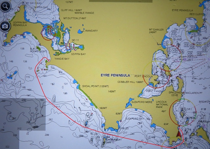
Point Sir Isaac - Coffin Bay

avoid bay to coffin bay  

A drab, grey, windless morning had us motoring from behind the calm waters of Point Avoid back into the Southern Ocean. We were later than usual, perhaps due to the dullness of the day or knowing we had a short run in front of us.

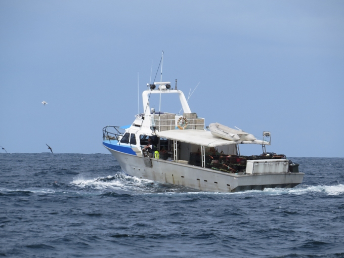
We weren't the only lazy ones. We had shared the anchorage with a cray fisherman and he left just minutes before we did. We saw him later off Whidbey Point, checking and re-baiting his cray pots.


crayfish boat


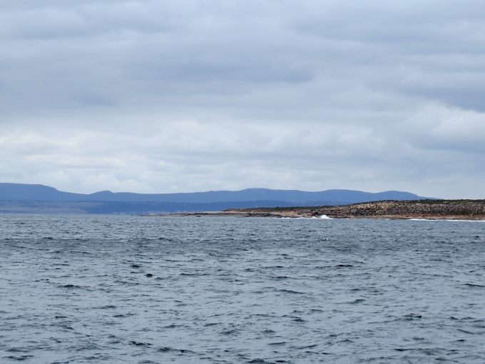
The sun peeked out occasionally along our route, enough to cause a bright glare on the water and warm our backs a bit. The big Southern Ocean SW swells were long period and now gave us a little push as we headed north up the west side of the Eyre Peninsular. Mollymawks, sooties and terns were all doing their morning thing. We could see huge sand dunes on shore.


sand dunes


We needed a little sparkle in this dull day … enter the dolphins. These little bottlenose dolphins are only about 3-4 ft (~1m) long. They're playful and energetic and, lucky for us, they decided Nine of Cups was a perfect place to play today. They entertained us for nearly an hour with their antics beside, below and in front of the boat. Sometimes we think we're getting jaded by “places” we visit. We're not as impressed as we used to be by rock formations, vistas and scenic views. But let a dolphin swim beside the boat and there's nothing like it. They always look cheerful and their spontaneity and seemingly happy mood are contagious. They give you feel-good moments without even trying.


dolphins


The trip from Avoid to Point Sir Isaac at the entrance to Coffin Bay was only about 28 miles. We were wondering about the names of the anchorages we had chosen lately … we went from Memory to Avoid to Coffin. Anchorages in this area are plentiful enough, but few are good for all winds and thus, choosing the right anchorage with protection from the forecast winds, plus distances between them, make the choices sometimes a last minute thing. Laziness and day trips also add to that mix.


point sir isaac


There is actually a little town of Coffin Bay, but the bar at Port Douglas heading down the channel was a bit too skinny for our draft … even at high tide … without local knowledge. We were content to sit on the tip of Point Sir Isaac, also known as Seasick Bay, for the night, all prepped for a longer, trip tomorrow.

Avoid Bay...Really?

memory cove to avoid bay  

You'd think with a name like “Avoid Bay”, we'd maybe try to avoid it, but we didn't. After a calm, pleasant night in Memory Cove, we were up before dawn, making ready to head through the Thorny Passage and another 65 nm west to Avoid Bay. A short-lived, gusty and thoroughly soaking morning squall delayed us 45 minutes, but netted us an extra cuppa before heading out around Cape Catastrophe.


cape catastrophe


Sunrise is after 0700 now, but sunset is not until 2000 (8pm), so we still enjoy a long sailing day. In a car you can easily travel 65 miles (~105 km) in an hour. Depending on our speed, 65 nm (a little longer than a statute mile ~70 mi or 115km) becomes an all day affair … 10 - 12 hours. Getting a really early start was not an option today. With residual raindrops falling on our heads, we hauled anchor closer to 0800.

The Thorny Passage earned its name from the myriad of “thorns” along the way. Rocks, reefs, islands, shoals, whirlpools, currents … our passage was very benign, nothing exciting at all to report. We hit nothing … nothing hit us. (We like it that way!).

As we left the protection of Spencer Gulf, we got a good taste of the Southern Ocean. Big, long period swells of dark grey ocean took their toll and though we weren't feeding the fish, both of us were feeling mighty queasy. The winds ranged from SSE 8 knots to S 25 knots with 32 knot gusts. All in all, though, we made good time.


anchorage mate


Avoid Bay … Looking at the chart, we can guess why the name was chosen. Because of all the natural obstructions … rocks, reefs, shoals, some breaking, some not ... ships of yore would have chosen other bays of refuge. For our purposes, with good charts, GPS and eyeballs, we found it to be adequate, with reasonable holding and some roll. We shared the anchorage with one fishing boat … always a good sign since the fishermen know where to duck in when the winds and seas are rough.

I might add that before we left Port Lincoln, Gentry (our niece and blogmeister) asked for maps for our proposed route and anchorages. After two nights, we haven't been in the “proposed” anchorages at all. So much for preparing in advance and sticking to the plan, huh? We are making progress though.

A Night in Memory Cove

heading out  

The forecast for light southerlies had us anchor up in Port Lincoln and motoring out of the harbor the same way we came in, around the bottom of Boston Island and out past Donington Light. We took this opportunity to motor against light adverse winds to position ourselves for a good sail when the forecast S/SE winds increased tomorrow and we were heading west.


port lincoln to memory cove


We had planned to anchor at Williams Island, but the locals claimed the holding and protection was better at Memory Cove, about 20nm south of Port Lincoln. Sound local knowledge is always solicited and appreciated.

As always, we're interested in the history of the places we anchor. On 21 February 1802, Matthew Flinders' expedition suffered a loss of crew in South Australian waters. Ship master, John Thistle, midshipman William Taylor and six seamen were drowned when their cutter capsized while searching for fresh water. The seamen were J. Little, George Lewis, John Hopkins, William Smith, Thomas Grindall and Robert Williams. Flinders, who had hand-chosen his crew, was deeply affected by this disaster and recorded place names including Thorny Passage, Memory Cove, Cape Catastrophe, and Thistle Island to commemorate the lives lost. He named islands in this area for all of his lost men.

As we passed by and between the islands honoring those lost, traveling the same waters as they had, and as we anchored in Memory Cove, we couldn't help but wonder exactly what happened and how devastated Flinders must have felt to lose competent crew and good mates. How fortunate we are that Flinders did the exploration, surveying and charting he did, much of which is still in use today.

A local yacht, Claire Allen, ran aground on Thistle Island over this past weekend when they snagged a craypot line and fouled their propeller. All three men made it to shore safely and were rescued quickly. The yacht, however, was on the rocks in minutes. A reminder that even now with all of our modern technology and information, it takes only a second for a catastrophe to hit and your whole world to change.


port linconl times photo of claire allen


As for us, we found a suitable, safe anchorage in Memory Cove and remembering the history of this place, we raised a toast to the men lost and thank the gods of wind and sea that they continue to protect this ship and crew. I might add that in an associated article about the grounding of the Claire Allen, a fishing boat hit a catamaran anchored off Memory Cove. We put an extra anchor light on tonight.