Middle Island - An Aussie Pirate's Hideout

daw keyhole  

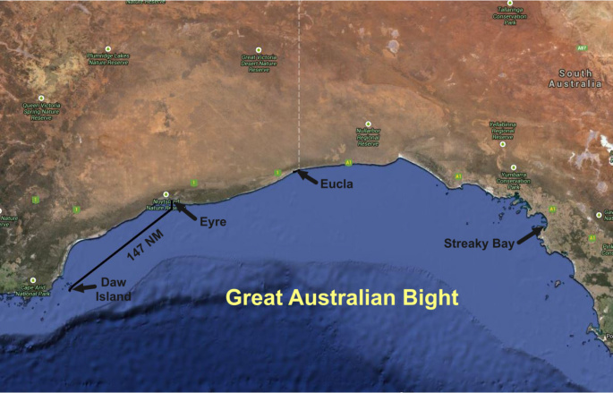
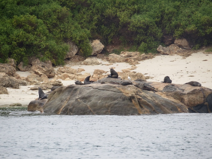
I'd call the run from beautiful Daw Island to Middle Island, a lazy kind of run. We were wing-on-wing, with 5-7 knots apparent wind behind us, doing 4-5 knots and feeling fine about it. It was overcast again … even the sea lions seemed to be sleeping in this morning although they woke up with the sound of the engine and swam over to bid us farewell … probably glad the intruders were leaving.


sea lion says goodbye


Though you Northern Hemisphere folks are celebrating the arrival of Spring, it was just the autumnal equinox here. The days are getting shorter and since Western Australia does not acknowledge Daylight Savings Time, it gets light before 0600 and dark before 1800. Right now, it's a 12-hour day which has me heading to bed around 2000 (8pm for you non-sailors), just because it's dark out. The good news, of course, it's easy to get up at dawn for an early start.

There were lots and lots of birds around today, mostly shearwaters flying low over our wake hoping we'd churn up some breakfast nibbles. One lone mollymawk would soar around for awhile, but she/he was lazy, too, and would land more frequently than fly. She obviously influenced the shearwaters which also landed quite frequently, just enjoying the day, despite its greyness. The western horizon looked promising with light blue skies, but like the end of the rainbow, we never quite got there.

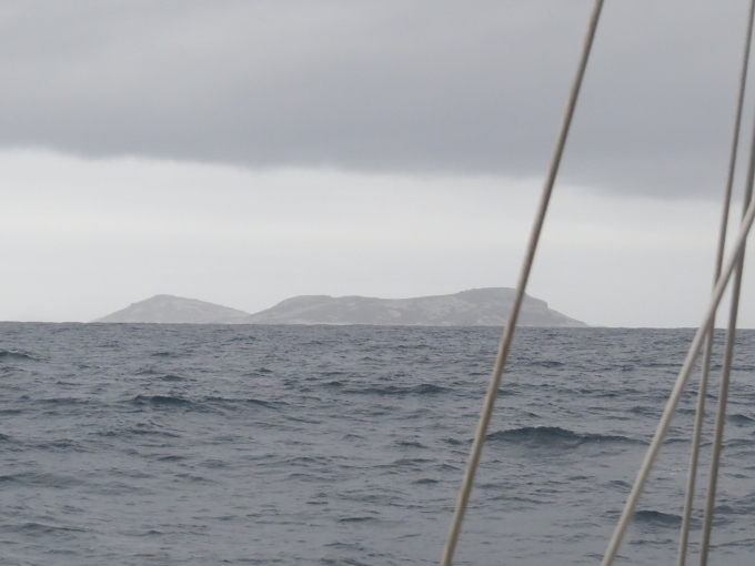
As we passed several small islands, I was thinking about Matthew Flinders whose job it was to chart and name all these places. Every bay, inlet, islet, island, cape, mountain, hill, strait, passage or other topographical descriptor had to have an identifier. The biggies were probably easy because there were enough royals and dignitaries back in Britain to choose from. But the little places must have been difficult as evidenced by some of his name choices. Round Island does look sort of round and Dome Island, well that's the shape of a dome; and Kangaroo Island, they killed lots of kangaroos there and, of course, on Goose Island, yup, they killed lots of geese. We're at Middle Island … which is somewhere in the middle of the Recherche Archipelago. Mt. Belches … a gastric distress day?

We anchored and spent the night in “The Keyhole”, legendary treasure hidey-hole of the infamous (and only notable) Aussie pirate, Black Jack Anderson. Located on the south side of Middle Island, this anchorage is rarely a good anchorage because of the prevailing swell from the Southern Ocean, but because of the week of E/NE winds we'd been having, it was pretty ideal. It's tucked into a deep inlet with an entrance between two rather formidable sets of shoals. Hundred foot high limestone walls, riddled with caves and crevices, towered around us and kept out the ENE winds that we could hear howling, but that wouldn't even turn our wind generator. We bobbed around in flat calm water, while watching white caps and breakers at the entrance only a couple hundred meters away. Late in the evening, when all was calm we could hear thousands of birds peeping, cliff swallows we assumed. Their sound reverberated off the canyon walls until it was nearly deafening. Sometime after midnight, the clamor stopped and not a further peep was heard.


limestone cliff caves


So back to Black Jack Anderson. He was, indeed, black … a black American man, no less ... a whaler/sealer gone bad. Along with his motley crew, he terrified, ravaged and pillaged along the southern coast of Australia from Adelaide to Albany in the 1830s until being murdered by his crew. We're assuming he did not have good leadership skills. He is purportedly buried somewhere on Middle Island.


blackjack anderson


As we looked around the anchorage, we wished the walls could talk. Did he bury his plunder here? Some think so. In fact, they're doing archeological investigations to see what they can find. Do these caves have long-lost tales to tell? Is the anchorage haunted? Will we hear the voice of Black Jack or his mutinous crew mingled with the howling of the wind tonight? Arrrr!

Daw Island - Last of the Bight

eyre to daw  

The run from Eyre to Daw Island was quick and bumpy, 148nm in just over 22 hours. The SW swell coupled with a brisk east wind and corresponding waves, contributed the majority of the bumps. Considering we weren't really sure exactly where Daw Island was, we were keen to approach it in daylight. There were several other low-lying islands and islets about and since Daw was apparently mis-located on the charts, perhaps these were, too?

Other than the bumps, the passage was unremarkable except for a few ill-timed waves that hit us unexpectedly in the cockpit. One such wave caught me full face as I emerged from the galley with a hot cup of tea around 0230 and not only drenched me and the cockpit, but left a gift which we never discovered until it came to light on David's watch several hours later. A rather large squid had been deposited neatly on the bench behind the helm. His discontent with his situation was very evident … he'd inked us. Rigor had already started setting in, so no calamari for dinner, but he got rave reviews from the local muttonbirds as David commended him to the sea. They fought over the goodie and then followed the “breakfast boat” for several miles before giving up on more treats.


passage squid


It was a grey, grey dawn made duller by grey skies and a grey sea, with a kicker of a grey swell. An early morning mist, then rain, kept the suspense heightened since we never saw Daw until we were less than 10 miles away. We had asked Paul, the Eucla fisherman, about Daw, but he had never stopped here. “You can't miss it; it's big”, he assured us. Sticking out of the ocean nearly 500' (147m), we finally spotted it, a shrouded hulk of an island. A multi-hued grey silhouette rose out of the sea, looming ominously, a darker grey cloud hovering over it. It looked like the home of some fairy tale witch or ogre. But a sea eagle soared overhead just then and dolphins joined us. How bad could it be?


grey daw


Despite its current menacing look, it had some interesting appeal: a nice protected anchorage, a landing beach, no people and some wildlife. One guidebook stated: “Ashore there are Cape Barren geese, muttonbirds, penguins and several hundred sea lions and seals.” And almost as a post script, it added ”There is reported to be a few venomous snakes on Daw also. A unique and beautiful island.” Typical Aussie caution … all's good and, oh yeah, watch out for the venomous snakes. They're so casual about their life-threatening fauna.

Just as we'd hoped, the island curved around and enveloped a lovely, millpond-calm anchorage. Bird sounds accentuated by the barks and yips of sea lions along the rocky shore greeted us. Despite the grey skies, sand patches were evident in the clear water and we dropped the pick in 25' off the white sand landing beach and it hooked immediately.


beach view from boat


A welcome, calm, peaceful anchorage with a good night's sleep ahead and some island exploring on the agenda for tomorrow. We have crossed the Great Australian Bight. Life is good.

Arrival at Eucla Roads

sunset through sails  

The night and day passed blissfully calm. The light easterlies were perfect for our downwind sail pace to insure a mid-morning arrival time at Eucla. Once again, the skies were clear for a near full moonrise, a knock-your-socks-off sunset and a star-studded sky.

Just after 0500, a squall (luckily on the tail end of David's watch) gave us an adrenaline rush (mine from my bunk) as the light easterlies became a 35-knot burst from the SW, overwhelming our poled-out jib. David handled it admirably and had all under control before I even awoke from my sleepy stupor and offered help. Gotta love my captain. I was up shortly thereafter for my 0600-0900 watch, but the radar showed all clear. That said, my previously “star-studded” sky was now obscured by heavy clouds and the boat was surrounded by pitch black night. Sunrise wasn't due till 0812. Lazy, lazy sun in this western part of South Australia.


squall on the radar


We are usually prudent when arriving at an unfamiliar port, but in the case of Eucla, we were particularly cautious. Whenever the charts indicate “inadequately surveyed”, it gets our attention. We had a guide book and sketches from a fisherman indicating how to approach Eucla Roads and where the anchorage was. The appealing aspect of this anchorage was that it was behind a huge sand bar which deflected the SW swell and waves and yes, it was off the beaten track. The less appealing aspect was that no depths and little information appeared on our charts. We needed to feel our way in and wanted to do it in good light. The landmark to watch for was “Wilson Bluff, which is 90m high and of dark rock and east of which the lower cliffs are white.” Would we really be able to discern this? Well, yes, it was pretty noticeable actually.


wilson bluff


We followed the notes implicitly, thinking at any minute we might be in the sand up to our through-hulls. We sailed directly to a point ½ mile (.8 km) offshore on the 129º longitude (which incidentally coincides with the state line between South Australia and Western Australia). We were on a rising tide for some extra insurance, but we never saw anything below 16 feet (4.8m) at mid-tide. No rocks, no shoals, just clear water all the way. We paralleled the cliffs and sand dunes for about 6 miles before spotting a derelict old wooden jetty, our landmark for dropping the hook. We settled in behind the sand bar known as Eucla Sands in about 15' (4.2m) of the clearest, most vibrant aquamarine water we've seen in ages.


old jetty


Even before we backed down on the anchor, we had a welcoming committee. Tiny welcome swallows chirped and tweeted, hovered and fluttered, all around the boat before finally lighting on the pole which had yet to be stowed. They seemed quite content to rock in the breeze and observe our tidying up process.


welcome swallows


Our timing was perfect. Within an hour of being settled and tidied up, the promised SW winds piped up … 20-25 kts. By the way, that tower you can see on the bluff behind the old jetty … it's a Telstra tower … five bar internet. Yahoo! Sometimes things work out just right.