Lüderitz to St. Helena - Days 7 & 8

days 7 - 8
days 7 - 8

Day 7

Miles to go:

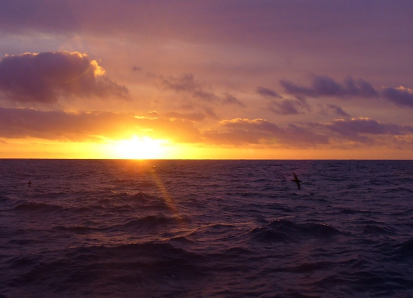
An absolutely gorgeous night. The sky was clear, the moon nearly full, the stars twinkled like fairy lights on a Christmas tree. What a relief to know they're all still there after so many coal black nights without them. This morning's sunrise, in vivid shades of orange and pink, was stupendous, although I envy David's green flash last night. You snooze...you lose.

In case you're keeping track , we're barely making 100 nm a day. If we could walk on water, perhaps it would be quicker, but when the sun's warming your back, the sea is glistening and you've got a 360-degree ocean view, it ain't half bad, even if it is slow. David is hoping that continental drift is moving St. Helena towards us, so we'll get there this century. Not quite that bad, but we've been at sea a week already and we're looking at an ETA of perhaps 5-6 more days ...beats 40 knot winds and 10m seas all to hell.

David worked on the jib furler for a bit...one of the new bolts is causing chafe on the headsail tack strap  and needs addressing. He put a chafe guard on the strap as a jury-rig repair and will fix it properly when we arrive at St. Helena because it will require removing the headsail. The mini-whisker is performing well considering 9 knots was our max gust for the day. I made scones with blueberry preserves which we enjoyed throughout the day.  The sun was so very welcome and we were able to shed another layer of clothes. We read and David finished up another article for publication. I'm working on a book, but it's a rough start, my muse is stubbornly resisting the new project.

Day 8

Miles to go: 529

Another beautiful night, though colder with periods of overcast skies. We're still in fleeces and sweatshirts, but moon glow and star gazing helps take our minds off the chilly temps. This morning's sunrise was a bust ...pretty blah with a thick cloak of clouds hanging heavy on the horizon and overhead. I hoped it would clear, but no such luck. The grey has returned.

The constant light winds have made travel slow, but not unpleasant. The forecast is calling for 15-20 knots in a few days from now. The current wind direction has not allowed as much "northing" as we need and jibing points us too far north and not enough west. We'll work it out, but it's a slow process getting from here to there.

We find we eat much less on passage. I cook pretty regular meals and we're not starving by any means, but our appetites seem suppressed. No alcohol and less eating and snacking make for an unbeatable weight reduction program. Hoping to shed a few pounds by the time we get to the other side of the pond. Not as much exercise as we're  used to. It comes in spurts. We're looking forward to some good walks when we get to St. Helena. I'm not sure we'll tackle Jacob's Ladder though. More on that later.

We're getting close to the Prime Meridian and should cross it tomorrow.
Days 9 & 10 await you.

Crossing the Prime Meridian

This is our third time crossing the Prime Meridian in Nine of Cups. We crossed it twice before when we crossed the Atlantic from Uruguay to South Africa in 2006 and then again, when we crossed back to the USA in 2007. It's not quite as big a deal as crossing the Equator, but it deserves some recognition and a small celebration aboard. gps prime meridian

The Prime Meridian, based at the Royal Observatory, Greenwich, London was established by Sir George Airy 1851. By 1884, over two-thirds of all ships used it as the reference meridian on charts and maps.  At the same time the French also established the Paris Meridian. When the International Meridian Conference was held in 1884 to determine which meridian would become the world “official” meridian, the Greenwich meridian was chosen. The French did not agree and for several decades France was the only country that continued to use the Paris meridian. Go figure.

greenwich prime meridian monument

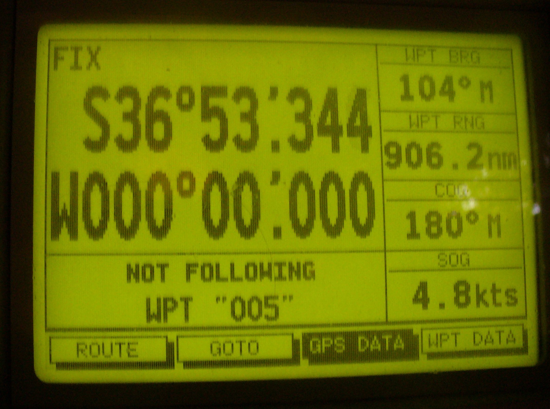
Setting our clocks to GMT (Greenwich Mean Time) or UTC (Coordinated Universal Time) is pretty irrelevant at the moment and has little effect on life aboard. Sunrise and sunset are the two most important times of the day and we probably won't bother to reset our clocks till we arrive some place where it matters. More important for us … we've just moved from the eastern hemisphere to the western hemisphere and the GPS proves it.

The point at which the Equator (0° latitude) and the Prime Meridian (0° longitude) intersect, known by sailors as the Golden X,  is in the Gulf of Guinea off western Africa in the Atlantic. It is nothing more than a point of intersection for two imaginary lines. It has no geographical significance, but if you're a sailor and you sail to the Golden X, you become a Golden Shellback. Sorry, folks. We need to settle for being non-gilded shellbacks. The Golden X is too far off our route for a diversion, I'm afraid.

the golden x

About the Atlantic Ocean

sailing into the sunset Since we're in the process of crossing the Atlantic, I thought it might be interesting to learn a bit more about this particular ocean. It's the second largest ocean (after the Pacific) and covers about 20% of the Earth's surface. Size-wise, it's roughly equivalent to 6.5 times the size of the USA.

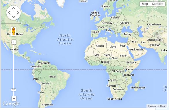
north and south atlantic

The Atlantic Ocean's name derives from Greek mythology referring to Atlas the Titan. The Greeks originally considered any waters beyond the Strait of Gibraltar as Atlantis thalassa, in English, the Sea of Atlas, i.e. the Atlantic. According to Wiki, the oldest recorded reference to the “Atlantic” is mentioned in The Histories of Herodotus c. 450BC. If you remember your Greek myths, Atlas was the fellow who carried the world on his shoulders for eternity. Incidentally, the early Greeks believed that the “ocean” was an enormous river which encircled the world.

atlas the titan

There's a submarine mountain range known as the Mid-Atlantic Ridge which extends from Iceland in the north to South Georgia Island in the south, dividing two major basins, with an average depth of  nearly 11,000' (3,340m) deep. The deepest part of the Atlantic at 28,000' (8600m) is the Milwaukee Deep near Puerto Rico. The jagged light blue line stretching vertically in this satellite image clearly shows the Mid Atlantic Ridge.

mid atlantic ridge

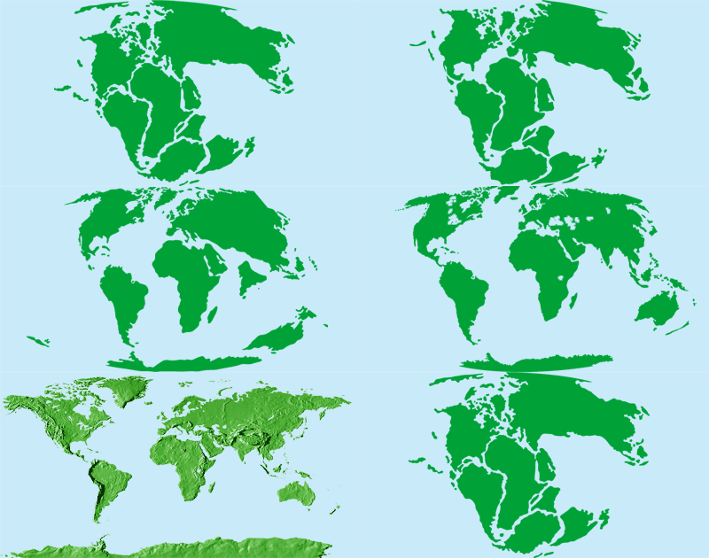
The Atlantic is the second youngest of the five oceans formed when the super-continent Pangea separated and the area between the newly formed continents filled with water … now the mighty Atlantic. You can see how Africa fits so nicely with South America … like a puzzle piece.

pangea gif

Though Leif Erikson is remembered as the first explorer to reach North America more than 500 years before Columbus, it was the crossing of the Atlantic by later European explorers in the Age of Discovery that was key to the development and expansion of Western civilization into the Americas.  After all, it's the Atlantic Ocean that separates the "Old World" from the "New World". Our British cruising friends always refer to crossing the Atlantic as “heading across the pond”. I read that the term “Black Atlantic” referred to the extensive Atlantic slave trade and the term “Green Atlantic” was coined to describe the Irish migration to the USA. Incidentally, it's no surprise that the Atlantic was the first ocean to be crossed by both a ship and an airplane.

So there you have it in a nutshell … all you never wanted nor needed to know about the Atlantic in one short blog post. I've obviously got quite a bit of time on my hands during this passage, huh?