Interesting Caribbean Sea Trivia

You can pronounce it Kar-IB-ean or KARIB-ean, both are correct. We're sailing in the Caribbean Sea at the moment and thought you'd enjoy some trivia about the famous sea. caribbean sea
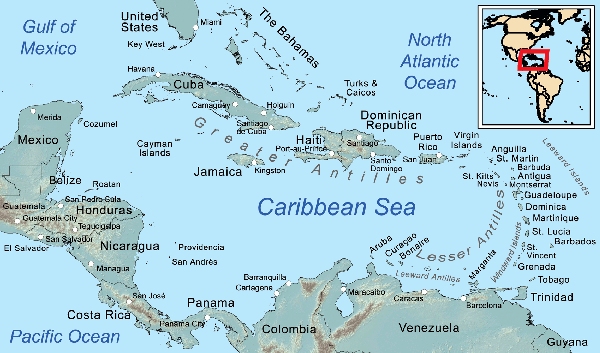
1. The Caribbean is the second largest sea in the world (1,063,000 mi²/754,000 km² ). The South China Sea is #1 and the Mediterranean is #3.

2. The Caribbean region includes more than 7,000 islands, stretching from the Bahamas off the coast of Florida to Trinidad and Tobago off the coast of Venezuela in the south. Of these islands, 13 are independent nations, while others are overseas dependencies or territories of countries including the U.S., U.K., France and the Netherlands.

3. The Caribbean islands are of volcanic origin and there are a number of active volcanoes in the area. We remember watching Montserrat's Soufrière Hills volcano smoldering when we anchored off in 2002. Kick'em Jenny is an underwater volcano near Grenada that rumbles frequently and erupted last in 2001. It's a potential danger to vessels in the area and its location on the charts is marked with warnings.
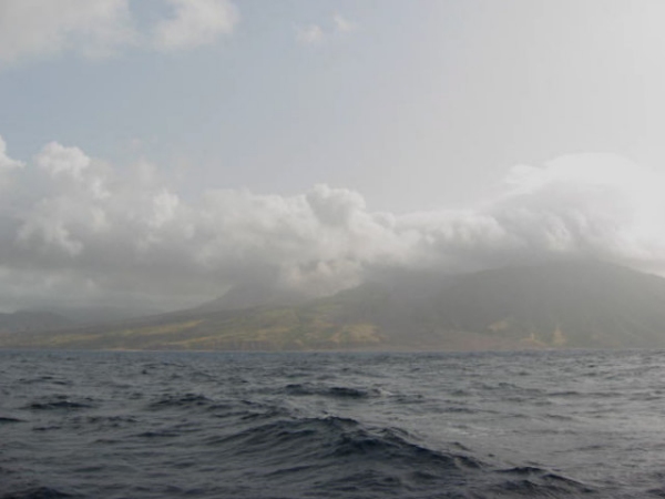
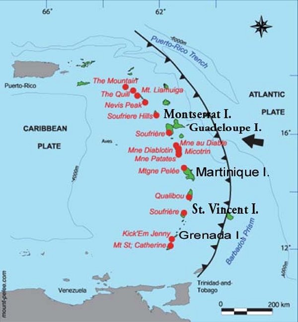
montserrat smouldering in the caribbean sea

volcanos in the caribbean sea

4. When Christopher Columbus landed in the islands of the Caribbean in 1492, he thought he'd landed in India and he named the islands ‘the Indies’ and its inhabitants, “Indians”. When it was discovered that he wasn't in India, the name West Indies was applied to the area. The ‘Caribbean’ was named for its inhabitants, the Amerindian tribe, the Caribs.

5. The Cayman Trench, between Cuba and Jamaica, contains the Caribbean's deepest point (25,220 ft/7,686 m below sea level) making it the 4th deepest sea in the world.

6. The Caribbean Sea has a counterclockwise current. Water enters through the Lesser Antilles, is warmed, and exits via the Yucatán Channel, where it forms the Gulf Stream.

7. The Caribbean's clear waters are warm (75°F/24°C), and less salty than the Atlantic with a very low tidal range (~1 ft/.3 m).

8.Petroleum, iron ore, bauxite, sugar, coffee, and bananas are the main local products traded on the sea. Tourism contributes significantly to the economy.

9. The hurricane season in the Caribbean extends from June 1 through November 30. Up to eleven hurricanes can form during the Caribbean hurricane season each year but normally it's around eight. September and October are the two most active months for hurricanes. The region around the Bahamas has the most frequent hurricane occurrences.
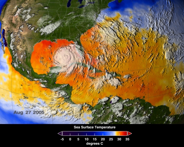
hurricanes in the caribbean sea

10. The Caribbean's beautiful, white sand beaches come from parrotfish. They chew up fragments of coral and poop out sand. One adult parrotfish can generate ~200 lbs/90kg of sand per year! They also help keep reefs healthy by feeding on algae, which can otherwise smother corals.
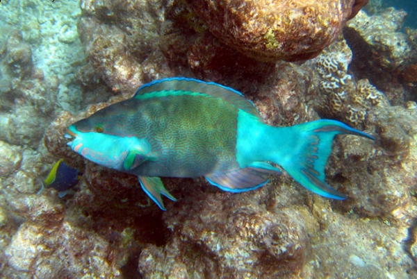
parrotfish

11. The Caribbean islands have a land area of 92,541 square miles, with an approximate population of 36 million. Their sizes range from the largest island, Cuba, which is larger than all the other islands combined, to the tiny islands of Saba and Anguilla.

12. The Caribbean's Mesoamerican Barrier Reef is the fourth longest barrier reef in the world. It runs 585mi/943 km along the coasts of Mexico, Belize, Guatemala, and Honduras.

13. Parts of all four Pirates of the Caribbean movies were filmed in the Caribbean. St. Vincent and the Grenadines was the production base in the southern Caribbean.
pirates of the caribbean

14. The Caribbean is a bio-deverse area with 1,000 documented species of fish, 90 species of mammals, 500 species of reptiles (94% of which are endemic), 170 species of amphibians (all endemic), and 600 species of birds (of which 163 are endemic).

Probably more info than you wanted or needed to know about the Caribbean. Now back to sailing on it.
Puerto Rico, Here We Come!

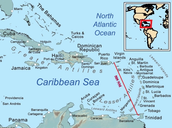
After much consideration and lots of late night and early morning conversations, we decided that Puerto Rico would be our next destination. Our time frame for getting north of Cape Hatteras by June 1st, the official start of hurricane season, limits our stops. Though it might have been nice to linger in the Eastern Caribbean islands, a straight shot north is more in keeping with our schedule. We've visited Puerto Rico before and it's wonderful. Also, since it's a US Territory, it's an easy check-in to the USA. trinidad to culebra puerto rico

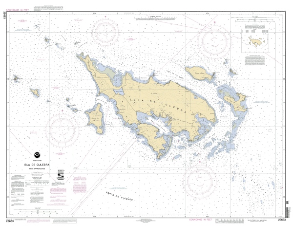
There are several US ports of entry in Puerto Rico, but the one that seemed easiest and most appealing was in the little town of Dewey (aka Culebra) on Isla Culebra. The anchorage in Ensenada Honda has a well-marked entry and the bay is protected from the tradewinds and wave action. By having previously enrolled in the USA's new SVRS programs (Small Vessel Reporting System) and filing a pre-passage float plan with US Customs, we are hoping the check-in procedure will be painless.

Culebra, a little island just east of Puerto Rico's main island, is considered a paradise by some with white sand beaches and a laid-back island attitude, but with enough amenities (food, booze and internet) to keep visitors happy. Its name, “Culebra”, translates to snake, but from my research I ascertained that there aren't many snakes on the island and what few there might be, they're neither venomous nor aggressive. I can live with that. We're interested in judging the “paradise quotient” for ourselves since Culebra is still considered a bit off the beaten path.

culebra nautical chart

If time permits, we'd also like to spend some time in PR's capital city of San Juan. It's a beautiful Spanish colonial city, well-preserved and great to explore. Though we've been to San Juan  in the past, our memories are so bad nowadays, it'll be all new territory.

We expected the usual wait and hassle of the check-out procedure, but there was none. There was only one other person at Immigration and we whizzed through the process, as fast as you can whiz through an official procedure that involves 15 forms, carbon paper and lots of rubber stamps. Customs was the same. We paid our fees and we were legal to leave. We were all psyched up for our departure. We had more $TTs left than we'd planned on, so we caught a maxi-taxi to  Massy's to spend them on non-perishable food and the few freshies we planned to take on board. David had a hankering for a Quarter Pounder at Burger King next door to the supermarket, but when he ordered it, they were all out of beef! We settled for an iced coffee at Rituals and then caught a maxi-taxi back to Chaguaramas and lugged our booty back to the boatyard. While David loaded the dinghy, I spent all but our very last $TT1 at the little Dockside Market. Back aboard, we stowed our purchases, hauled the dinghy and made last minutes checks for an early morning departure. We took our Stugeron … just in case.

The course is all plotted. We've checked weather. We have as many freshies aboard as we think will last in this heat without refrigeration plus plenty of canned goods in the larder. We're off at dawn. We'll update Gentry with passage notes en route, but it's a short trip (~500 nm), so we won't be out of touch for too long.