The Blue View - River Rules Apply

norfolk 771 miles As I write this, we have completed most of the 770+ miles of the ICW from St. Augustine, FL to Norfolk, VA. We went outside into the coastal Atlantic waters for only a short stretch between Charleston and Georgetown, SC, primarily because the tides were wrong and we would have either had to wait most of a day or would have had an almost 100% certainty of running aground in a particular shallow stretch of water.

So far we have enjoyed the trip immensely. The scenery and wildlife have been fantastic, and at 6 knots, we've had the time to see it as we navigated our way along the hundreds of lakes, rivers and canals that make up the ICW. Our only regret is that we were pushed for time (as usual) and couldn't stop as much as we would have liked. Maybe next time – and we're pretty sure there will be a next time.

We've had the opportunity to explore a number of rivers around the world, from South America to Panama to New Zealand to Tasmania, and we've acquired a number of guidelines that help when navigating most rivers. These are usually referred to as 'River Rules', and we've discovered that they also apply to much of the ICW. Here is my list of 'River Rules':
mud map

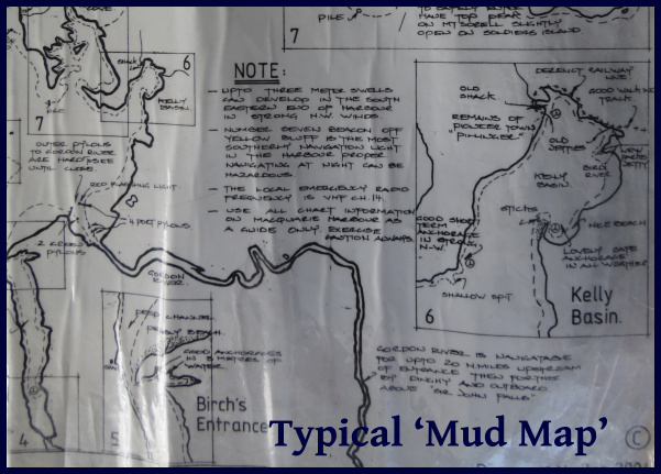
  • Local knowledge. Rivers are forever changing. What was a deep section last year (or when the chart was last updated) might have shoaling due to winter storms or flooding or any number of other reasons, and the local sailors and fishermen who routinely ply these waters will likely be aware of the changes. When possible, we ask around and try to gather whatever local knowledge we can. On several occasions, we've been able to copy the local 'mud maps' - hand drawn sketches with hazards, depths and the best routes for a particular river we were planning to explore – absolute gold! For the ICW, the Active Captain app for our iPad has been our source for local knowledge. It compiles notes from hundreds of other sailors that have traveled the ICW over the past few years, and provides tons of information about uncharted hazards, shoals and other navigational issues.
outside bend

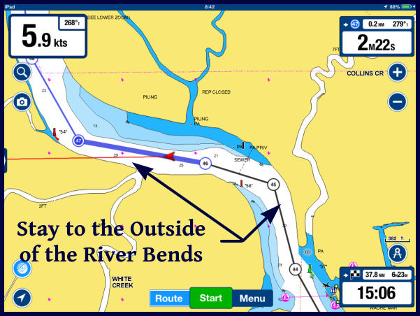
  • Outside curves. As a river goes around a bend, the water flows faster on the outside of the curve and slower on the inside. Because of this, the outside of a curve will usually be deeper than the inside. This isn't always the case – there might be some underwater obstacle that diverts the flow or a rock ledge on the outside curve, but in general, lacking any information to the contrary, we will favor the outside of a bend and avoid the inside.
tide chart

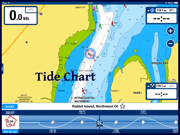
  • Tides. Most of the rivers we have navigated have been tidal, and the tidal changes have been large enough to be a significant factor. We've seen a few tidal swings of as much as 30+ feet, and many that were 15-20 feet. In the ICW, it was common to see 7 foot swings, and so with our 7'2” draft, at high tide, we can pass over any point that isn't awash at low tide. There are a number of spots along the ICW that have only 5-7 feet of depth at low tide, making it important to time our passage at mid tide or higher – preferably on a rising tide.
  • Currents. Along with big tidal swings come big currents. We've seen tidal flows of ten knots or more in our travels – much more than we could possibly motor against – and navigation must be planned around the current. On the ICW, the tidal currents are typically 1-2 knots, though in some narrow channels, up to 5 knots have been noted. We try to plan around the current when we can, but it isn't always possible. The current switches direction every 6 hours, so it often works out that half our day has a current push and half the day we find ourselves fighting it. Sometimes it's not consistent - a stretch of water might have an inlet on both ends, so a rising tide will give us a nice push as we enter one end, but it will be an adverse current as we near the other end. We've also noticed that the tides are slightly later as we work northward. Depending on where we are on the tide table, we sometimes find we have a push almost all day long, and a few days later we have an adverse current most of the day.
  • Winds. The wind direction and strength will often affect water levels. A strong onshore wind can make river levels a foot or two higher than normal, affecting bridge clearances, while a strong offshore wind may reduce the water depth significantly below the charted depths.
  • Reading the water. A number of clues can be gleaned by reading the water. If the current is flowing, an indication of its strength and direction can be seen by watching the flow around posts or how floating markers are leaning. A standing disturbance in the water may indicate a submerged hazard. If the water is still and the sun is high, shoals and bars can often be detected by the water color. In the high latitudes, kelp on the water surface often marks rocks below the surface.

So, with all our navigation electronics, Active Captain providing us with local knowledge, and applying our River Rules, how'd we do? We still ran aground three times! All three times were soft landings in mud or sand with no damage done. Twice, we were able to back off or torque turn our way off the shoal within a couple of minutes. We were stuck pretty well the third time and it took about a half hour to extricate ourselves. We still had a few techniques to try before finding out how good our towing insurance was.
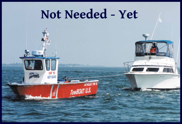
tow boat

I like to look at the positives – we were able to remove all those hard-to-get-at barnacles on the bottom of the keel, and we got to practice our 'extrication' techniques. Plus, three groundings in 600 miles is a big improvement over our last foray on the ICW 15 years ago - I think we had at least that many groundings per hundred miles back then.
Intracoastal Waterway - Day 9

Stuck in Swansboro

Day 9 – 206 nm to go

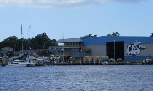
With a forecast of gale force winds offshore and high winds and rainy weather inland, we decided we'd take a day off and stay put in our pleasant little anchorage just off Swansboro Village. Launching the dinghy would have been akin to flying a kite, so we happily stayed aboard for the day. Thanks to nearby Caspers Marina, we enjoyed free wifi all day. Though we didn't get into the village at all, we think it's probably a hopping place as the music went on both nights we were anchored here till well into the wee hours of the morning.

caspers marina on the intracoastal waterway

As it turned out, the day was sunny, but blustery. Not a drop of rain fell, but the wind howled. With good internet, we spent the day writing, catching up on articles and blogs, photo editing, doing some minor chores and just hanging out. It's quite pleasant to just “be” in a place some days with no agenda.

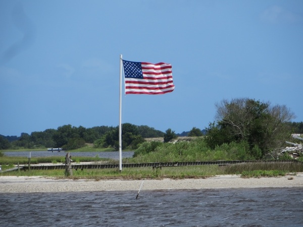
wind blown flag on the intracoastal waterway

This is probably a good day to talk about what we've learned … and re-learned/remembered … while traveling on the  ICW. Granted, our previous experience on the ICW has been extremely limited, but usual navigation skills and rules of the road apply, as well as boating etiquette. It's just that when we're at sea, we don't have the opportunity to use some of these skills much, so this has been a welcome refresher course for us.

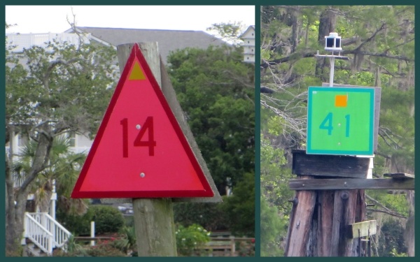
Something new we learned … all ICW navigation markers are marked with a either a yellow rectangle (for green markers) or a yellow triangle (for red markers), so at a waterway intersection, sailors always know which direction the ICW is going. Clever, huh?

markers along the intracoastal waterway

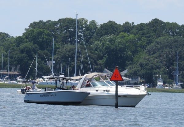
Something we remembered … there are still lots of courteous cruisers out there. Larger motor vessels will hail their intentions to pass us and give us a “slow pass” to minimize their wake as they're going by. If motor vessels are going too fast, especially in no-wake zones in towns, the local marine police stop and ticket them.

marine police on the intracoastal waterway

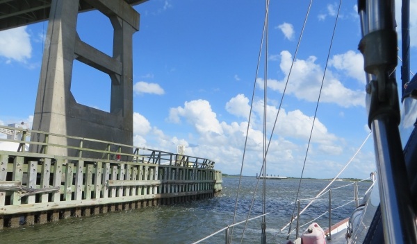
Something we're remembering/relearning … the timing for negotiating transit through opening bridges. We don't pass under or through bridges very frequently on ocean passages. How long does it take the bridge keeper to stop traffic, ring his bell and siren and activate the bridge opening. And then, just how long does it take the bascule leaves to raise or the swing bridge to swing? How does passing under a fixed bridge affect the control of the boat? There is usually a loss of wind, then a gust on the other side and then there's the current and numerous little eddies to contend with. We were a bit rusty, but with  ~70 bridges to transit during this passage, we got it figured out once again. Bridge tenders, by the way, have been courteous, friendly and efficient which has been most appreciated.

a bridge on the intracoastal waterway

Something we forgot … when out of the USA, we rarely have help with lines or docking and tipping is not the usual protocol, nor expected ... even in restaurants. So to the young man at Osprey Marina who was so helpful and accommodating … we didn't mean to stiff you on your tip, we really did forget.

Something I noted … taking pictures from a moving boat is pretty tricky. Taking pictures of moving things from a moving boat … pretty marginal results. That's my story and I'm sticking to it.

Intracoastal Waterway - Day 8

Day 8 – 274 nm to go Today was one of the more challenging days on the ICW. The lengthening days have been working to our advantage. We're up at 0515 and anchor up by 0545. We witness spectacular sunrise after sunrise. The rising tide gave us a good push this morning up the Cape Fear River. All was calm and we were on our way. Despite the shining sun, a long, compact, cigar-shaped roll cloud came into view in front of us, reminiscent of the roll cloud we experienced for the first time in the Great Australian Bight. Within seconds, nearly 30 knots of wind barreled through the rigging and pommeled us for 3-4 minutes, then departed as quickly as it had arrived, apparently planning to harass some other unsuspecting sailor down the river. A good morning, adrenaline rush of a wake-up call to start our day.

roll cloud on the intracoastal waterway

From the Cape Fear River, we transited Snow's Cut to the New River. One of the main bugaboos of today's passage was the number of opening bridges we had to deal with, all with differing schedules. Two bridges opened only on the hour and two opened on the hour and half hour. There wasn't time to coordinate openings from bridge to bridge, so there was a lot of waiting involved. We wasted a significant amount of time treading water waiting at one bridge, then we'd speed up to get to the next, only to be disappointed by missing the opening by a few minutes and waiting until the next opening. Boats don't stop. They float and drift around with the wind, current, wakes and waves and constant maneuvering is required to keep them in place. Staying put for a boat is akin to keeping an impatient toddler in place.

bridge on the intracoastal waterway

There was also constant shoaling along our route today, especially at inlets from the sea. Despite having foreknowledge from the Active Captain comments, we went aground at Masonboro Inlet. We were in the middle of the channel, but obviously got too close to the green side. (For non-sailors, red is the port (left) side and green is the starboard (right) side … at least when we're heading north up the ICW. Red and green markers indicate the position of the channel.) The sand was soft and David worked us free in a matter of minutes and we were on our way.

The second grounding came about an hour later and again at an inlet. This time the Mason Inlet was the culprit and getting off this sand was not as easy, especially since we were on a falling tide. It took us over 30 minutes of working back and forth and side to side before we found enough water to get off the grounding, out of the shallow area and back on track. Again, we were in the channel, but obviously just not in the right spot. Though challenging, time-wasting and frustrating, going aground in sand and mud is not that big a deal. The sand tends to scrape the barnacles off the keel, but not much more than that. If worse came to worse, we could have called Towboat US to which we subscribe. Many folks do, but the captain preferred to hone his “going aground extrication” techniques and this was a good opportunity. Again, no kedging off, no launching of the dinghy, but those ideas were ready if we needed them. We watched a young fellow poling his john boat through the shallows a little while later and we didn't feel so bad. They say “ it's not IF you go aground, it's just WHEN you go aground.”

poling a john boat on the intracoastal waterway

The last of the bridges for the day was the Onslow Beach Swing Bridge. We timed it well for a change and passed through at 5:30pm. The US Marine training facility, Camp LeJeune, is in this area and from time to time live firing exercises are under way. At those times, the bridge is closed until the exercises are completed, usually several hours.

live firing on the intracoastal waterway

Lucky for us, all was calm at Camp LeJeune, though we did see some marines and military equipment on the shore.

military on the intracoastal waterway

The winds increased throughout the day. We saw a steady 20 knots by late afternoon. The forecast is calling for strong north/northeast winds along the coast and inland coastal waters, so we were looking for a protected anchorage in which to hunker down for a day or two, if necessary. At sea, 20-25 knot winds aren't a problem, but inland on narrow waterways with significant shoaling, the wind makes maneuvering a bit trickier.

Swansboro Village was our anchorage of choice. Literally just a few hundred feet off the ICW, we found a 15' spot with good holding just opposite the town dock. By the time we were settled in, the rigging was rattling and the wind was howling in the high 20s from the north. The temperature plummeted nearly 20 degrees to a wonderfully comfortable level. We were in need of a day off to catch up on writing and just relax a bit. We'll take advantage of this opportunity and blame it on the weather.

swansboro village