Lesotho ... Kingdom in the Sky
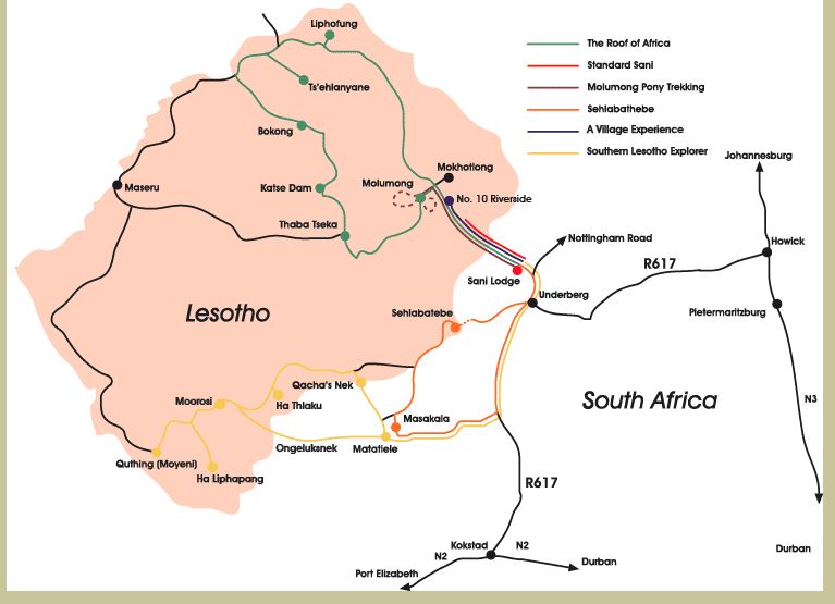
Lesotho (pronounced Leh-soo-too) is a tiny landlocked country surrounded entirely by South Africa. Referred to as the Kingdom in the Sky, Lesotho, about the size of Maryland, is all “up”. In fact, it has the highest low point of any country in the world … 1400m (4550′) at the junction of the Orange and Makhaleng Rivers.
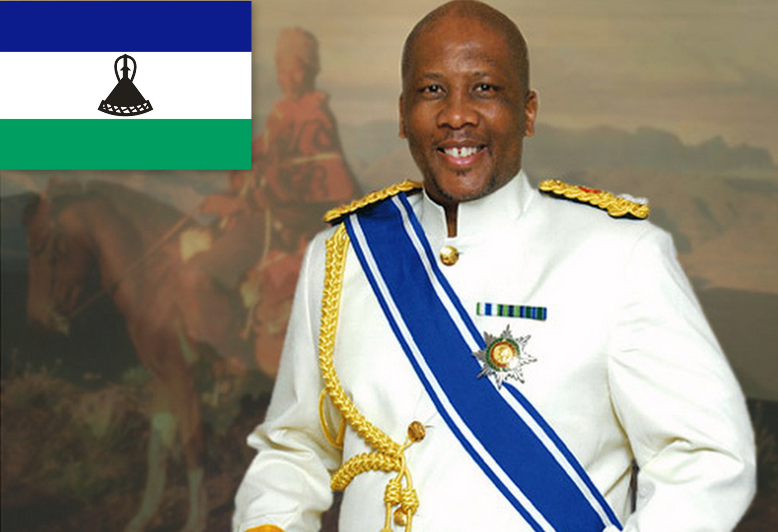
It is, indeed, a tiny kingdom with King Letsie III as its monarch. It’s a poor, poor country (though the king seems to do okay) with an average personal income of ~$2,200/per year. Most Basotho people live at subsistence level and shepherding seems to be the most prevalent occupation outside the capital city of Maseru. People of Lesotho are called Basothos, their language is Sesotho and their currency is the loti, although South African rand are readily accepted.
Brennan & hannah joined us from the usa. We opted to stay at the strategically located Sani lodge at the bottom of the Sani pass.
We had reserved two en-suite rondavels at the Sani Lodge for two nights and we’d booked a Land Rover tour to the top for the next morning. We were particularly impressed with the lodge's Fair Trade views on local tourism and commerce and their mission statement of catering to independent travelers with a conscience.” Trip Advisor had rated them highly. We were pleased with our choice. Each hut was situated in a woodsy setting accessed by little bridges, far enough away from each other to be quite private. They were cozy and comfy with a warm duvet and an extra wool blanket to keep warm on cold mountain nights.
Tour day dawned bright, sunny and cool. We met up with our guide, Tsebo, and hopped into a Land Rover. The entire area is part of the uKhahlamba-Drakensberg World Heritage Site, noted for its unique flora, fauna, geology and culture. The Sani Pass is described as the “mother of all South African passes”. Originally used by the San people (aka Bushmen) as a footpath, the Sani Pass is the only eastern entrance from Kwa-Zulu Natal, South Africa into the Kingdom of Lesotho. It connects Himeville/Underberg, South Africa to the little village of Mokhotlong in Lesotho. It’s referred to as the Roof of Africa and is reputedly the highest pass in South Africa. (Some claim it’s the third highest road in the world, but being from Colorado, we know that’s not true.) The pass peaks at 3200m (10,500′) above sea level. Our route would start at 1544m (5,067′) at the Sani Lodge and climb 1332 vertical meters (4,370′) to an altitude of 2876m (9,436). The road is notoriously dangerous and 4×4 vehicles are required.
The Sani Pass became the main route by mule for the early traders, missionaries, adventurers and travelers from Natal into the highest, coldest and most remote district of the old Crown Colony of Basutoland (now known as the Kingdom of Lesotho). The first person to drive the pass in a vehicle was Godfrey Edmonds in October 1948. This was before the road was built and it was no wider than a donkey track and littered with boulders. It took him five and a half hours to reach the summit in a Willys Jeep, assisted by a team of Basothos with mules and ropes. In 1955, an upgrade was done.
Our first stop was at the remains of the Good Hope Trading Station c. 1920 at the bottom of the Pass. This station provided accommodation for travelers, as well as a general store and trading post for the Basotho shepherds who brought their wool and hides to trade for maize (corn), the local staple, and other basic trade goods. The station closed in 1990 and is in ruins, but still used as the local combi (mini-van taxi) stand.
Tsebo, was remarkably knowledgeable about the Sani Pass, its geology, flora, fauna and history. He pointed out birds and animals along the route, as well as geological features and peppered it all with history and humor.
We passed waterfall after waterfall and drove through many a fast-running stream. We stopped frequently to admire scenic viewpoints of the pass and landmark features like the Giant’s Cup and the Twelve Apostles.
We finally arrived at the South African border post. In the middle of nowhere, this post was neat and tidy with clean restrooms and friendly officials. Up till this point, the road was quite benign … a few rough spots, but nothing overly daunting. The next 8 km, however, would prove to be a bit more hair-raising.
As we climbed higher and higher, the road became rougher and rougher with sharp switchbacks, rock falls and boulders, huge potholes and river crossings, until sometimes it didn’t look like a road at all. The Land Rover and Tsebo, however, seemed to know their way and despite some challenging, gut-rattling maneuvers, we made it … all in one piece. Slowly and cautiously, we continued our climb up, up, up and finally arrived at the Lesotho border post which was very grim comparative to the South African post.
Having entered Lesotho, Tsebo was keen to educate us a bit about the country and its people. We were in the eastern Lesotho Highlands, a harsh, cold, wet environment. The tiny village of Mokhotlong was barren. Thatch and tin-roofed stone huts lined a deeply rutted, muddy road. The landscape was treeless with vast expanses of rocky outcrops and soggy marshes. The mountains rose above and around us.
The tiny village of Mokhotlong was barren.
The Basotho shepherds were all wrapped in traditional blankets. Many wore hats and balaclavas covering their faces, protecting them against the ever-present cold wind, the harsh sun and the dust that blew. Heavy rubber boots were worn to keep their feet dry whilst traversing the wetlands tending their livestock.
The shepherds were wrapped in blankets and hats to protect against the cold winds, harsh sun and blowing sand.
Tsebo knew several of the shepherds and we stopped along the way to chat. They were friendly and welcomed visitors with shy smiles. We offered candy bars and granola bars left over from our lunch and they were gratefully accepted. Sweets are rare commodities, we learned. Some were pleased to show off the sheep they were tending.
The shepherds were proud to show us their sheep.
Others allowed us into their very basic mud-floored, thatch-roofed huts. We crawled into the low entry huts on hands and knees and were packed in tightly as Tsebo elaborated on the life of shepherds … a hard, hard life without many alternatives. For six months at a time, the shepherds remained with their herds, then after a day or two to visit families, they returned to their flocks. I might add that Drakensberg Tours, as part of their Fair Trade tourism philosophy, provides blankets and other basics to the shepherds in trade for sharing a glimpse of their lifestyle with visitors.
Visiting a shepherd's hut
In tiny Skiring village, we visited Me Fitelena. Tsebo instructed us on the formal way to present ourselves as we entered. We said “koo-koo”, (like knock-knock) and after being acknowledged, we entered and sat on a long bench and were served fresh bread and the local maize beer, both of which were delicious. Me Fitelena also had local crafts for sale and, of course, we did our best to help the local economy.
A morning snack and handmade crafts inMe Fitelena's hut.
We had brown bag lunches at Black Mountain with views of Thabane Ntlenyana, 3482m (11,317′), the highest peak in southern Africa, only a few miles away.
The last stop in Lesotho was at Sani Top, the highest pub in Africa. We sampled the local commercially brewed beer, Maluti. As we sipped our beer, we saw a lone young man toiling up the road with a heavy load of thatch roofing material on his back. The villagers who live on the barren, treeless top of the world in Lesotho, must descend and collect roofing materials. This gave us much cause for reflection. There, but for fortune ...
What goes up, must eventually come down. Luckily, our guide was not a drinking man and didn't indulge at the SaniTop Pub because the ride back down Sani Pass was more hair-raising than the ride up. His complete attention and expertise were definitely required as he negotiated tight hairpin turns, steep grades, boulders, rocks, rivers and washouts. He referred to the rough ride as an “African massage”.
Hair-raising descent of Sani pass. Photo credit: Sani Lodge
We cleared out of Lesotho and back into South Africa. Tired, dusty and sufficiently shaken (not stirred), we arrived back at the Sani Lodge. As always, time was too short and the tour left us wanting more. Maybe next time?


