Panama … Crossroads of the World
Home of the famous Panama Canal, Panama is an eclectic mix of indigenous native cultures, jungles and swamps and modern high-rises, luxury hotels and resorts. Connecting two oceans, it truly is the ‘Crossroads of the World’.

Because of the reclining “S” shape and narrowness of Panama, the sun appears to rise on the Pacific Ocean and set in the Atlantic.

Republic of Panama
Capital: Panama City
Currency: Panamanian balboa & US $
Official Language: Spanish
High Point: Volcan Barú, 11,401’ (3475m)
Low Point: Pacific Ocean
Government: Constitutional republic; the country is divided into 9 provinces
Panama has 500 rivers. The Tuira is the longest (125 miles). There are no natural large lakes. Lake Gatun is a manmade lake and part of the Panama Canal.
‘Panama’ derives from a native word meaning “abundance of butterflies and fish”.
Quick history: Native Indians were conquered by the Spanish in the early 1500s; ruled by Spain for 300 years; in 1821 became a province of Colombia which had just won its independence from Spain; in 1903 rebelled against Colombia and won its independence (with a little help from the US and France who wanted to build the Canal!).
We spent a lot of time exploring Panama. Transiting the Panama Canal was certainly a unique experience, but we also had the chance to meet and spend time with several indigenous peoples. Come join us by scrolling down through the page or by clicking on ay of the links below:


San Blas Islands (2003)
Welcome to Kuna Yala - Land of the Kunas
The San Blas Archipelago is comprised of approximately 365 islands and islets, only 50 of which are inhabited. San Blas Indians is a general term for four separate native tribes that live in Panama. The largest tribe is the Kuna or Cuna with a total population of over 55,000. The local language of the archipelago is Kuna but most of the men and many of the children also speak Spanish. The San Blas Reservation was declared an independent state in 1925 after a successful Indian revolution and was legally formed in 1938. Independent villages are headed by “sahilas” (sigh-las) or chiefs.
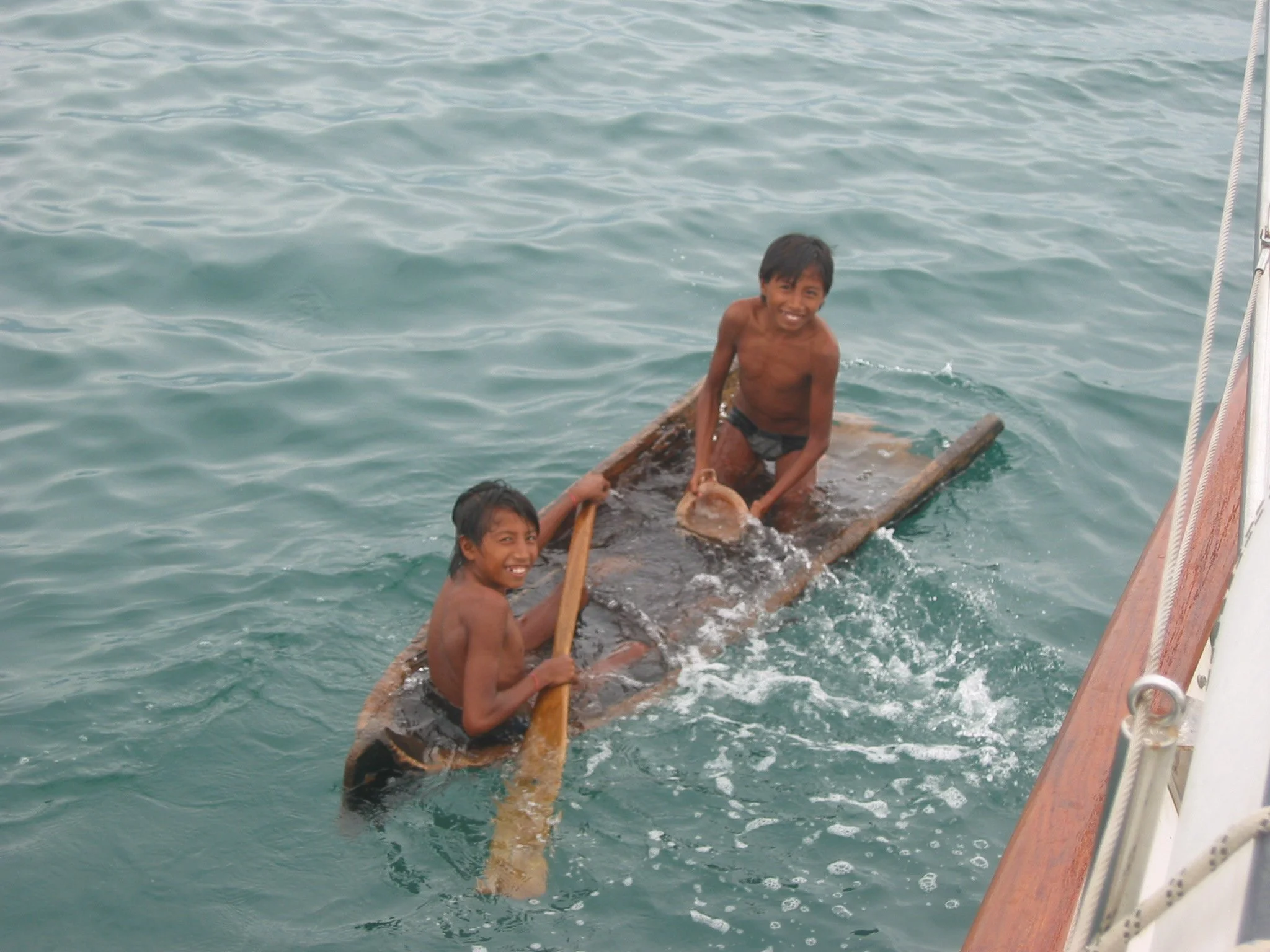
The trip from Colombia to Panama was a pleasant 135-mile overnight passage. The winds were light and we motored all the way with thunder, lightning and heavy rains for about the last 6 hours of the 24-hour trip. Our first port of call was Punta Perme and the Kuna village of Anachucuna with a population of ~300 we were told. We anchored a little west of the Anachucuna and can see the thatched roofs of the village huts. After tidying up the boat, we slept for a couple of hours. The Kunas politely waited until they saw signs of life aboard and paddled out in their ulus (dugout canoes) to collect the “impuesto” or anchoring tax of $10. One of the little girls on the ulu also showed me a mola and David ended up purchasing a hand of bananas from a man on yet another ulu who also had plantains, coconuts and langostas.


The ulus are usually about 15-20 feet long and hold the entire family for outings such as visiting sailing yachts. They usually paddle, but when the wind is right, they raise a sail. Sometimes it’s just a blue tarp. We saw fishermen miles offshore in them.

A Kuna family stopped by to say hello. We invited a Kuna family aboard for a visit. They brought brought limes and pifas (peach palm fruit) as gifts.

An excerpt from a letter home regarding our visit by the Kuna family:
“As we sat, sometimes in silence just looking at each other, Andres’ wife took some red and yellow beads from her arm and began to tie them on my right wrist. She did about seven strands, working each strand around carefully and tying it off nicely. I swear that during those moments as she touched me and slowly wrapped her gift of beads around my wrist, we bonded in the universal way of women. I felt only our mutual womanhood, not the differences in our culture or language. It was a wonderful gift!
After two days in Anachucuna, we managed a 20-mile motor trip to our next designated anchorage off the island of Coetupu near the village of Caledonia or in Kuna, Kanirdup. Unlike Anachucuna, which is on mainland Panama, Kanirdup is an island community and all the huts are built along the water’s edge. The tiny separate enclosures over the water are the toilet facilities. Fresh water is pumped in via PVC pipe from the mainland.


As always, the kids are the best for they are themselves with no hidden agendas (other than candy maybe).They were timid at first, probably because of our color and size. Once it was determined we didn’t bite, they clamored to hold hands as we walked. We felt like Pied Pipers! Marcie told stories and sang songs with them (in Spanish no less) and David did magic tricks and handed out candy.

No one wanted their pictures taken until we printed a couple of the kids and brought them back to the village, then they lined up and wanted a photo.
Kunas are little people. At 5’8”, Marcie towered above these Kuna women dressed in traditional garb. The tallest woman we saw was about 4’8” and the men weren’t much taller.
Let me describe a Kuna woman for you. They all wear lots of jewelry and beads. The beads are very tiny and multicolored. They string the beads themselves on fine line and wrap them in various patterns from the wrist all the way up to the elbow. They do the same from their ankles up their lower legs and it looks as if they are wearing leggings. The designs are intricate and very colorful. They also wear earrings... dangly ones... a beautiful gold filigree. Most wear beaded and gold necklaces and have small gold nose rings as well. Gold rings on the fingers complete the jewelry look. Most also rouge their cheeks in dark red circles about 2" in diameter. The colorful molas are incorporated into their blouses and they wear long wraparound type skirts in varying designs and colors. Many also wear a long scarf around their heads with the ends hanging down their backs or over their shoulders. Some use a black dye to paint themselves with temporary tatoos. The men and kids look pretty dullcompared to the women!
The Fine Art of Molas
Mola is the Kuna word for blouse. Molas are one of the primary expressions of visual art in the Kuna society. It is the product of hand-stitching layers of cotton cloth in the process known as reverse applique. Intricate, very fine stitchery completes the artwork. Each mola is created by a Kuna woman as the focal point of her own dress. The designs are always original and are an important way for a woman to express herself and demonstrate her talent and industry in this politically active and traditionally matriarchal society. Marcie did her share in aiding the Kuna economy by buying several.


We ate well there. Fresh fish, crab and lobsters, coconuts, pineapples, mangoes, limes and very tiny little bananas. We like to try new things and in Anachucuna, we were introduced to pifas. They are the fruit of local peach palm trees and taste like artichoke hearts. We ate them for snacks, we ate them in salads, we ate them till we could eat no more


From Kanirdup, we motor-sailed to Mamitupu, which without a doubt, was our favorite Kuna village. There we met Pablo and his wife, Asinta. Pablo was friendly and spoke excellent English having lived in England for 7 years, and he answered lots of questions for us.


Asinta hands were never idle. As we chatted, she sewed molas or held babies. She and Pablo had two huts, one on the beach and one in “town”. We visited both. The hut on the beach was more for tourists. The “town” hut was traditional with dirt floors, bamboo stake walls and a thatch roof. Hammocks are used for sitting and sleeping as well as part of several cultural ceremonies. We visited Asinta when she was watched her 2-month old grandson. When I held the baby boy, I noticed that his fingernails and toenails were painted black. From Pablo we learned that traditionally the use of the black dye from the saptur tree keeps evil spirits away. Sometimes the women use the same dye to paint designs on their faces.

The idyllic photo above is "Pablo's Beach", the place we would meet with Pablo and Asinta and sit and chat. Pablo was writing a book about Kuna culture and customs.
Our next stop was Snug Harbor, so named by New England schooners that stopped here for coconuts. It is indeed snug, tucked in between the
mainland and several small islands. There were no villages on the island of Marmaraga and we enjoyed the peace and quiet, exploring on our own. The flowers were the most impressive. Red hibiscus blossoms the size of dinner plates peeked out from the dense green foliage. Pink morning glories lined the beach. The beautiful white spider lily was a new one for us, delicate looking and definitely exotic. A little island with a long name, Orduptarboat, was excellent for beachcombing and snorkeling among the reefs surrounding the island. David found huge sea biscuits and sand dollars for our growing shell collection.


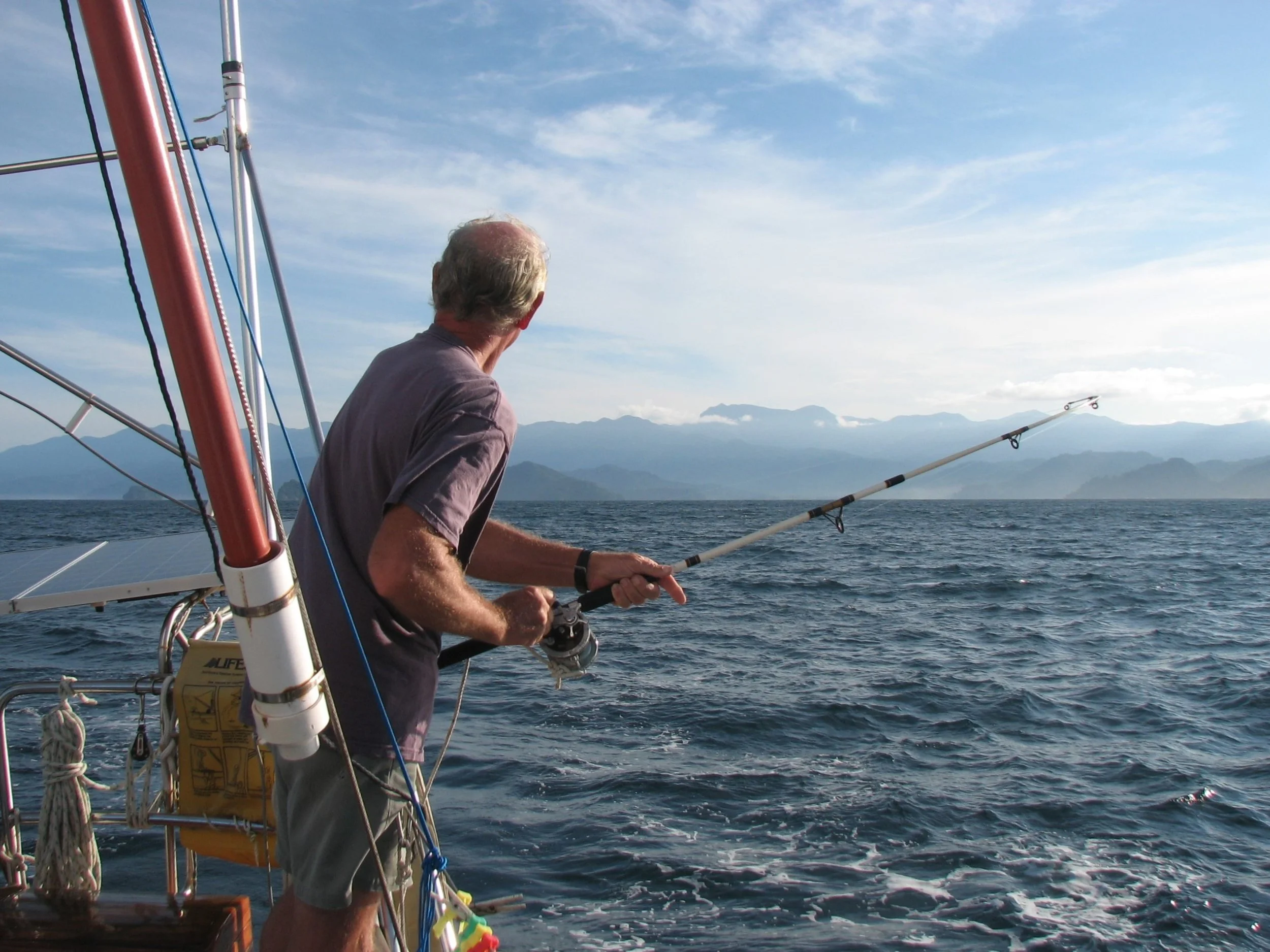
The trip from Snug Harbor to Coco Bandero Cays was about 29 miles. David had the fishing line out and I was hoping he might catch something for dinner. First, he caught a small tuna, then another little tuna bit but he was too small, so we sent him back to Mama. Then another small tuna, but large enough to keep, then a much larger (3 feet+) kingfish, then another slightly larger tuna. Take in the line, David. We’ll never get to the Cocos!
We did, indeed, make it to the Coco Bandero Cays and anchored near a little islet. We enjoyed exploring some of the nearby islets, but of all the anchorages in the San Blas, this one was the most beautiful. The only structure on the islands here is a basic lean-to hut which houses two local fishermen whom we met.


An idyllic anchorage in the Coco Bandero cays
From CocoBanderas we sailed to the Eastern Hollandes Cays, a small group of islands popular with cruisers. They are well-protected by barrier reefs and the favorite anchoring hole is a place called “The Swimming Pool”. After having been the only boat in the anchorage for nearly a month, having 6-8 boats around seemed odd. We even socialized a little! We went for drinks one night aboard "Pogo", went to a trash-burning/potluck hors d’oeuvres get-together another night and had the German folks from “Samana”, whom we had met back in Cartagena, for drinks aboard Cups.
Our last anchorage in Kuna Yala was Chichime. Not unlike the others, it was nestled between two small islands and a large barrier reef. The natives were friendly and Marcie had her last opportunity to buy authentic molas and Kuna crafts and the Kunas were pleased. They arrived in two full ulus and had molas ready to spread on the boat deck before the anchor was set. We kindly asked them to return later which they did. Our collection grew by several molas, molitas, a fish bolsa, a bracelet and a small, stylized “dragon fly” mola. Quite the haul!
Rio Chagres
We left the San Blas Islands with regret. Our time there was wonderful, but it was time to be moving west. We wanted to make one more stop on the Atlantic side before heading through the Canal: Rio Chagres. The Atlantic coast of Panama is resplendent with rivers. A few miles from the commercial jammed-packed city of Colón, lies the entrance to the Rio Chagres, a fresh-water river that meanders about 5-1/2 miles upstream before ending at Gatún Dam used for water flow management of Lake Gatún. The depth ranges from 10-60 feet which renders the river very navigable and a delightful place for cruisers to hang out. The river is part of the Parque Nacional San Lorenzo, one of Panama’s many national parks. San Lorenzo is the name of the fort which sits at the river’s mouth which marks the entrance.


We anchored about halfway up the river around a bend which allowed us seclusion even though there were five other boats anchored further upstream. We took dinghy rides to the dam at the end of the river as well as exploring little side tributaries off the main river. The river is alive with flora and fauna. We drifted close to the shore to be able to photograph the flowers and animals we saw. Though the river supposedly has caimans, we didn’t see any.


Excerpt from the Ship’s Journal….
“We ate dinner in the cockpit last night and tried to identify all the sounds we heard with a verb… chirp, peep, flutter, ker-plonk, buzz, hum, squawk, whoosh, howl, screech, roar, tweet, ping, rustle-rustle, hoot. I’m sure we missed a few, but the jungle symphony was in high form and we were enthralled.”
Despite the jungle noises, it was very quiet. The buzz of the cicadas became a background white noise after awhile and we hardly noticed it. We spoke softly as it seemed that raising our voices would be a sacrilege. The smell was pungent, familiar, earthy, like wet leaves or mulch. A whiff of some sweet blossom would drift by every once in awhile. Jelly was on all-sense cat alert, perched on the top of the dodger, eyes wide. She was on the lookout for caimans, bats, low flying, non-cat-eating birds or maybe a small moth or fly.
There were hundreds of butterflies… huge iridescent blue-winged wonders, lime green and black flutterbys and neon orange and black velvet swallowtails. Most fluttered by in flash, but we caught some on camera.


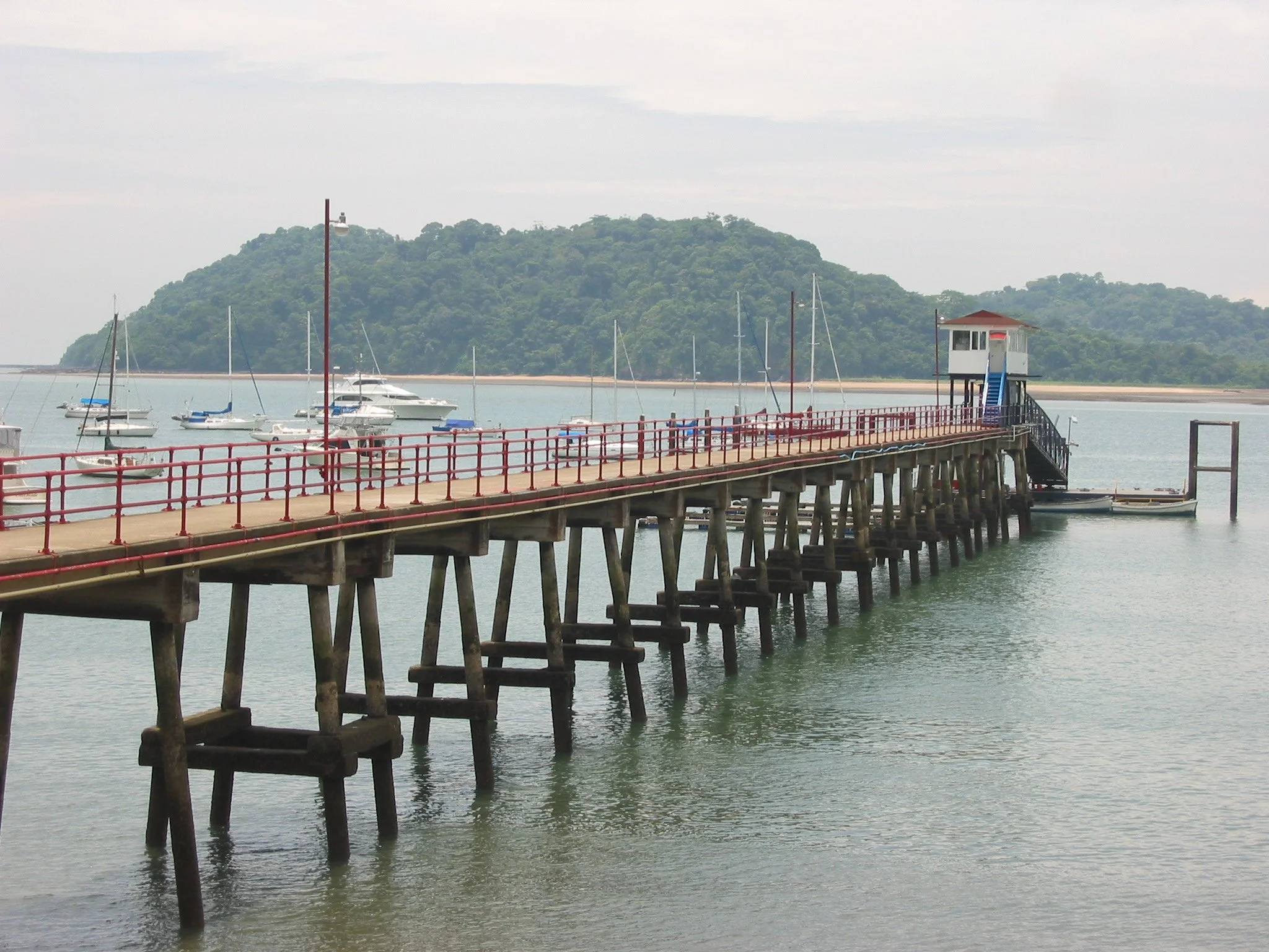
Panama Canal Zone - "The Flats"
Leaving the Rio Chagres, we headed for Colón, the major port on the Atlantic side of the Canal and the embarkation point for the Canal Transit. It was a thrill to radio for clearance to enter the breakwater and receive permission to proceed to the “Flats”, the designated anchorage area for yachts. The 500’ wide entrance to the Panama Canal is marked by two huge markers standing at the ends of two rock breakwaters.
Colón is a commercial port and our view from the Flats was sometimes interesting, but not very scenic with large cranes and offloading equipment, lots of tugs and pilot boats, and ship after ship heading down the channel to transit the canal.
We took the dinghy to the Panama Canal Yacht Club and got all of our Customs and Immigration paperwork and legalities figured out.


Seeing this waterspout in the harbor made us take notice. Usually described as a tornado on water, we watched this one for quite awhile before it dissipated, thankfully before it got too close to us.
Colón is not a very pretty city. It is leftover from the American occupation of the Panama Canal Zone and reflecting on it years later, it tops the list for our least favorite city ever visited. That said, there are some pretty sights in the city including the statue “Cristo del Mar”.


At the Panama Canal Yacht Club, several of the indigenous peoples showed their wares. Just as the Kunas are known for their molas, so the Emberra-Wounaan are known for their fine basketwork. We met Delaluisa, a Wounaan woman weaving a basket.The fronds of the chunga palm are used for making the baskets. The colors are all natural derived from local trees and plants and even some from burying the natural palms in the local mud. Wounaan men, known for their carving expertise, mostly carve cocobola (local hardwood) or tagua. I couldn’t resist a cocobola seahorse, our ship’s logo.


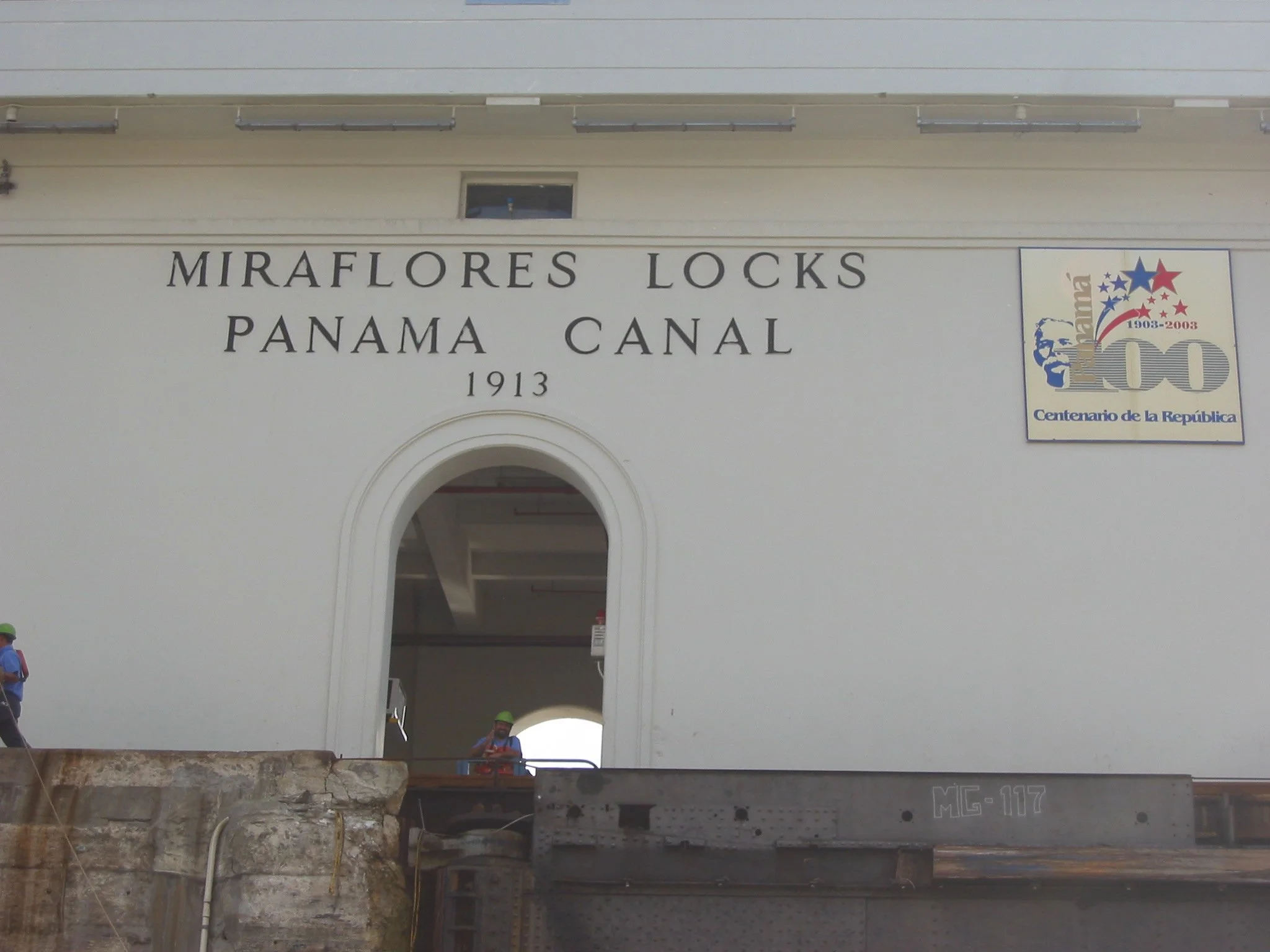
Panama Canal Transit - September 14, 2003
A Quick History of the Panama Canal....

A ship sailing from New York to San Francisco saves about 7,800 miles by going through the Canal versus sailing around Cape Horn.
Among the great peaceful endeavors of mankind that have contributed significantly to progress in the world, the construction of the Panama Canal stands as an awe-inspiring achievement. The unparalleled engineering triumph was made possible by an international workforce under the leadership of U.S. visionaries, who made the centuries-old dream of uniting the two great oceans a reality.
In 1534, Charles I of Spain ordered the first survey of a proposed canal route through the Isthmus of Panama. More than three centuries passed before the first construction was started. The French labored 20 years, beginning in 1880, but disease and financial problems defeated them.
In 1903, Panama and the United States signed a treaty by which the United States undertook to construct an inter-oceanic ship canal across the Isthmus of Panama. The following year, the United States purchased from the French Canal Company its rights and properties for $40 million and began construction. The monumental project was completed in ten years (1914) at a cost of about $387 million. Since 1903 the United States has invested about $3 billion in the Canal enterprise, approximately two-thirds of which has been recovered.
The building of the Panama Canal involved three main problems -- engineering, sanitation, and organization. Its successful completion was due principally to the engineering and administrative skills of such men as John F. Stevens and Col. George W. Goethals, and to the solution of extensive health problems by Col. William C. Gorgas.
The Hay-Bunau-Varilla Treaty of 1903 gave the U.S. the exclusive rights to build and operate the Canal and to establish the Panama Canal Zone, a 10-mile corridor along the length of the Canal, as a U.S. jurisdiction. The original treaty called for a $10 million payment to Panama plus rent of $250,000/year beginning in 1913. By 1955, the rent had increased to $2 million/year. After several years of strained relationship, the USA and Panama signed two treaties in 1977. One treaty gave jurisdiction of the Panama Canal Zone back to Panama in 1979. The other treaty provided for the return of the Canal to Panama on 12/31/99.
Getting Ready
Rules for Yacht Transit (2003)
A yacht (privately owned boat) must have the following equipment aboard which most sailboats do not have and must rent:
8 tires to be used as fenders on the side of your boat to protect it against the walls of the canal and other boats - $3.00 each plus another $1.00 each on the other side to dispose of them!
4 lines – 125’ long, 7/8” thick without knots or splices to tie up to the walls or other boats during the lock transit - $15 each plus deposit until returned to the originating port.
Linehandlers – 4 are required plus the captain. We hired one professional line handler at $55/day plus meals. Another couple from the boat “Gertrude P. Abernathy III” also line- handled for us at no cost other than meals during transit and transportation back to
Colon ($10).
Paying the Toll (2003)
the PaN-Can Transit Authority
For sailboats up to 50’ the fees are as follows: (Note: More than 50’ … a much higher toll!)
$550 Transit fee
$ 25 Security fee
$ 25 TVI Service (???)
$600
$850 Refundable Deposit (in case we hurt
the canal)
TOTAL: $1,450 (This is the biggest toll we’ve ever paid… much worse than the New York bridges or New Jersey Turnpike!
Scheduling the Transit
Lots of paperwork required
The process for scheduling a transit is really not that difficult. In our experience, the Panama Canal Authority was efficient and courteous.
Secure the required lines and fenders.
Call the Admeasurer’s Office to schedule a boat visit usually within a day or two of your call. An agent comes to the boat, measures your boat and confirms that you have the required equipment aboard. He then completes all the paperwork for you and gives you copies of all paperwork as well as lots of other information about the transit.
Pay the toll at the Citibank in town via cash or Visa
Call the scheduling office after 6PM the night the toll is paid to get a transit time.
Call again 24 hours prior to your transit to confirm the time your Advisor will board the boat.
A Little Toll Trivia...
The highest toll ever paid by one boat for transit was $184,114.80 in January 2000 by the cargo vessel “Sister”. (a/o 2003)
The lowest toll ever paid was by Richard Hallburton in 1928, who paid 36 cents to swim the Canal which took him 10 days.
The first ship to transit from the Atlantic to the Pacific through the Canal was the S.S. Ancon on August 25, 1914.

Going through the locks…
The locks were built in pairs to allow ships to pass through in both directions simultaneously. Each lock has a usable length of 1,000' (300m), a width of 110' (34 m), and a depth of about 70' (21m). Lock walls are about 7' thick. Lock chambers fill when 4’ diameter wheels in the floor admit water under great pressure, flooding the chambers in less than 15 minutes.
There are three ways to go through the locks and boats can request the type they prefer although it is not guaranteed.
Center chamber where the boat is alone in the middle of the chamber and held in place by four lines. The boat is moved forward by Canal line handlers.
Sidewall where the boat is tied against the side of the lock wall.
Rafted to another boat or boats or a tugboat which is called “nested”.
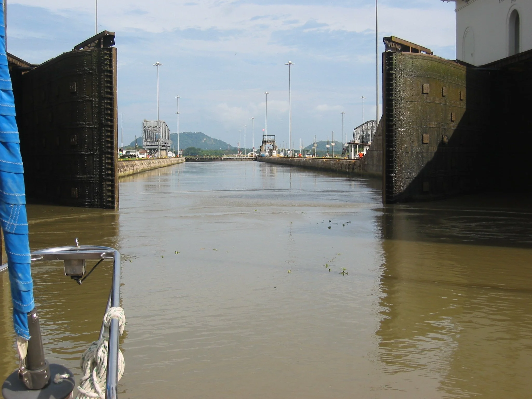
We entered the Gatun Locks at sea level and were raised about 85 feet to the lake level in three separate chambers. This is called “uplocking”. Sailing yachts are “extra baggage” for the Canal. They can only transit in a lock that is already occupied by a “BIG” boat which is somewhat daunting.
We transited the Gatun Locks alone as a center chamber vessel with the huge Greek cargo ship, “St. Nicholas”, in front of us in the lock. How could anything go wrong traveling with Santa Claus? We transited Pedro Miguel and Miraflores Locks rafted to a large catamaran. We handled lines on one side of the Canal and the catamaran crew handled the lines on the other.

How could anything go wrong traveling with Santa Claus?
For smaller vessels, a Canal linehandler throws a “monkey fist”. Linehandlers on the transiting vessel, attach it to their lines and it is hauled in so it can be attached to a bollard and secured during each lock transit. Linehandlers are used for smaller craft, but for large vessels up to four locomotives called “mules” are used to guide the vessels to the next lock chamber.


Marcie enjoyed the view and some relaxation after the initial rush of activity.
Gatún Lake (gah TOON) is an artificial body of water, 85 feet (26 meters) above sea level. It holds 23 million cubic yards of water and is contained by Gatun Dam, one of the largest earthern dams in the world. It was created in 1912 by damming the Chagres River. Since the Gatun Lake is manmade, tops of trees are still visible as are little islands which used to be hilltops. We saw a caiman lazing in the sun along the banks in one spot. On another little island, a Wounaan thatched hut on stilts was visible.
The time spent transiting the Gatun Lake is long and hot. There was all the initial flurry of activity in Colon as we welcomed everyone aboard and hauled anchor. Within an hour we were in sight of the Gatun Locks and the adrenaline was flowing as we headed into the first set. Then, after the locks, I cooked and served breakfast, cleaned up and there were still hours left in making the 28 mile motor trip across the locks. We chatted, some slept, David maintained the helm through the whole trip. After the initial rush calmed down, Marcie enjoyed the view and some relaxation.
The most dramatic scenery was passing through the Gaillard Cut (aka Culebra Cut). It is the point at which the Canal had to cut through the Continental Divide and huge terraced cuts are visible on approach.


From Gatun Lake, we rafted up with a catamaran to travel through Pedro Miguel Locks and the Miraflores Locks. The catamaran handled the starboard lines and the Nine of Cups crew handled the port lines. Watching the heavy lock gates of the Pedro Miguel Lock open is amazing. This emptied us into the Miraflores Lake… only one more set to go!


Snuggled up to a catamaran for the transit through the Pedro Miguel and Miraflores Locks gave David a break. Since the cat was the larger vessel, the cat’s captain was required to steer and propel us through the Pedro Miguel Locks as well as the mile between and through the Miraflores Locks and then cast us free once we were in the Pacific. Photos below are the actual "live" Pan-Can Cam which friends captured for us and later sent.


From our perspective, the Miraflores Locks were the best. First of all, there’s a viewing stand there and I’m not sure who took more photos, the audience or us! We waved, hooted and howled as we passed by and the audience loved it. Most importantly, the two chambers of the Miraflores Locks were the final descent to sea level and the Pacific Ocean.


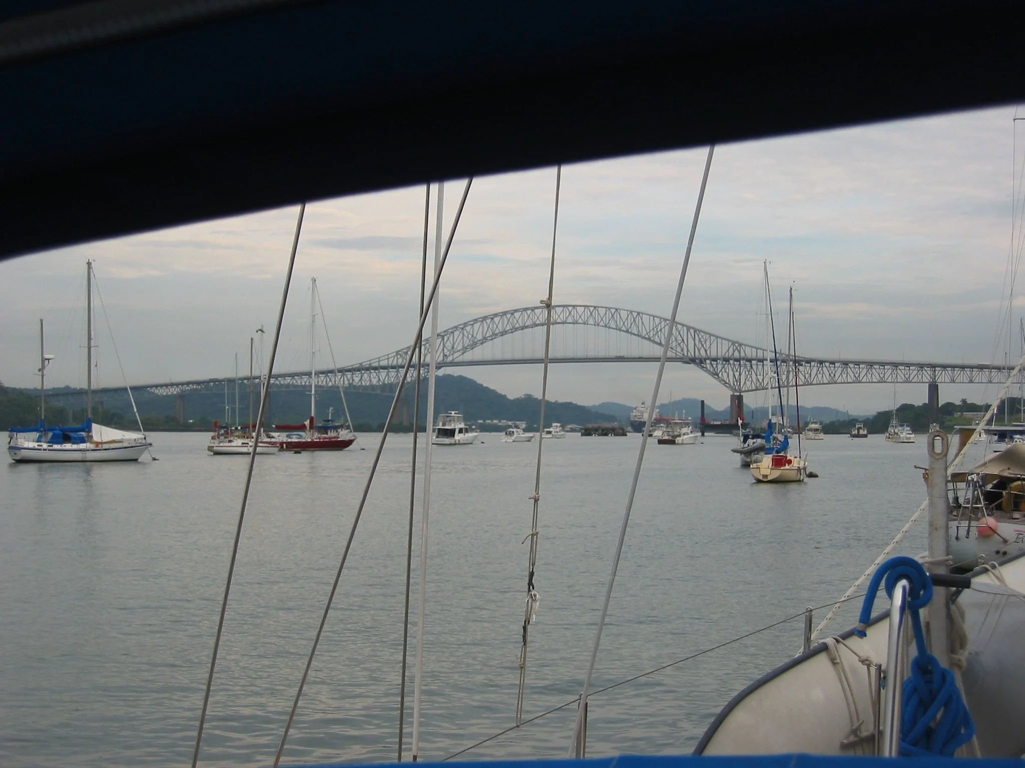
Marcie paid tribute to Neptune as we passed under the Bridge of the Americas, thanking him for protecting ship and crew in the Atlantic and asking for his continued protection in the Pacific. Then champagne toasts and congratulations were in order for Cups and crew. The Bridge of the Americas is considered the connector between North and South America.
Just beyond the bridge is the Balboa Yacht Club. We radioed ahead and a launch met us to direct us to a mooring. We gratefully accepted the mooring lines, bid the pilot and our crew adieu, tidied the boat and
slept our first night in the Pacific!

The crew recommends:
The Path Between the Seas by David McCullough, the definitive book on the history and building of the Panama Canal
Welcome to the Pacific
Balboa - the other side of the canal
Moored at the Balboa Yacht Club after transiting the Canal, we found the tides here to be daunting after the minimal changes in the Caribbean ...a full 20-foot swing between high and low tides. We had great views of transiting ships as they passed under the Bridge of the Americas heading to and from the locks. The tides weren't the only difference between the Atlantic and the Pacific side. Panama City is clean, modern and safe. Skyscrapers line the horizon. There are upscale restaurants and all the amenities offered in a large city. We stayed only long enough to do a bit of provisioning and we were off again

About the Pacific Ocean

Vasco Núñez de Balboa
The Pacific Ocean, the world's largest body of water, represents half of the world's ocean area and more than a third of the surface area of the earth. If all the continents were placed in the Pacific, there would still be room for another the size of Asia.
The word pacific means peaceful. The ocean received this name from the Portuguese explorer Ferdinand Magellan, who sailed its waters for weeks, driven by gentle winds.
The Pacific and its marginal seas cover about 70 million square miles (181 million sq/km). The ocean is about 9,600 miles (15,450 km) long from the Bering Strait to Cape Adare, Antarctica. It is widest near the equator between Panama and the Malay Peninsula. There, it measures about 15,000 miles (24,000 km), about three-fifths of the distance around the world.
On September 25, 1513, the Spanish explorer Vasco Núñez de Balboa led an expedition across what is now Panama from its Atlantic coast to its Pacific coast. He became the first European to see the eastern shore of the Pacific Ocean. His discovery provided additional proof that America was a separate continent between Europe and Asia.
Archipelago Las Perlas - the Pearl Islands


We had enough provisions for several weeks, but I asked David to catch some fish to complete our ship’s stores. "Sure", said he and proceeded to catch a trevally, the first we’d ever caught, but good eating.
We’d heard from other cruisers that there were lots of whales in the area and we were thrilled to see them. A playful pod of about five whales were spouting and sounding nearby and apparently and having a good time. We turned off the engine and drifted towards them. They were so massive, yet so graceful.
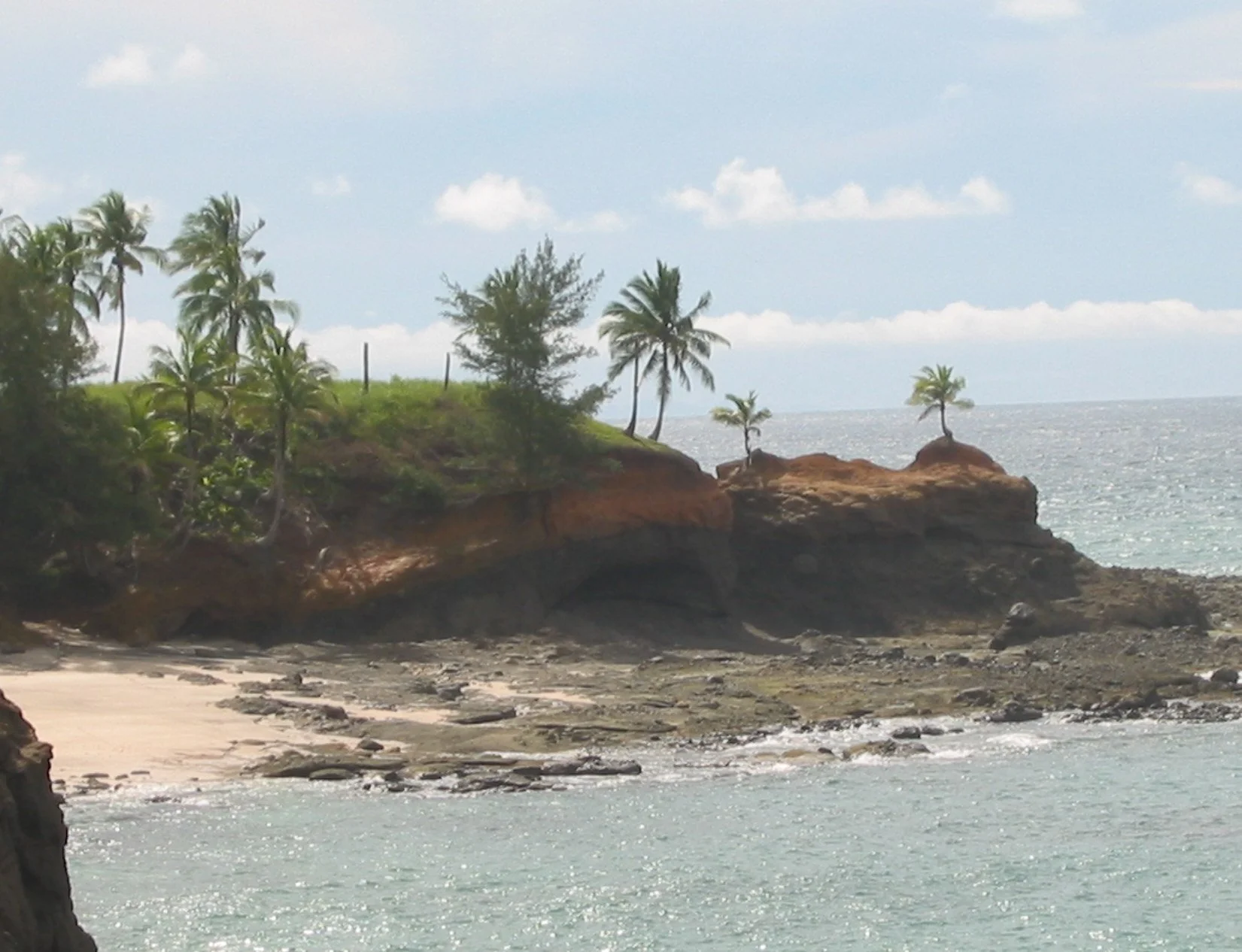
Without a doubt, the prettiest place we visited in Las Perlas was Punta Cocos on Isla del Rey. This is a photographer’s heaven with breathtaking scenery and vivid colors. Near the anchorage is the Servicio Nacional de Panama, an agency comparable to the Coast Guard. They hailed us in to ask to basic boat and crew info. When we asked to walk around the island, one soldier was only too happy to act as a guide for us on a 2-hour hike. He explained the island had lots of wildlife including wild peccaries, boas, parrots, loros, iguanas and caimans. Beyond the fact that scenery doesn’t get much better, this area also provided brightly colored scallop shells and lots of sea beans on the beach!


Next we moved to Espirtu Santo, where the flowers alone could have taken days to photograph. The trimaran, Wind Chaser, hit a reef in August 2003. The captain, with the help of some other cruisers, managed to keep her afloat and got her to land on Espiritu Santo. For two months, they had been camped out on the island and through hard work and the benevolence of other cruisers and Neptune, Nick was able to repair the 8x2 foot hole in her center hull. While we were there, David offered our gasoline generator and we gave him gasoline, epoxy and food. He finally got her afloat again on September 26th while we were there and we celebrated with pizza and beer aboard Nine of Cups that evening.


Up the Tuira to the Darien Jungle
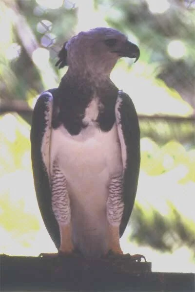
From Las Perlas, we traveled up the Rio Tuira, Panama’s longest navigable river, to La Palma, the capital of the Darien province. The Darién is an ecological bridge between South and North America and it is protected by a national park, the largest in Panama and the second biggest in Central America. Construction of the Pan American Highway as far as Yaviza in the Darién has produced deforestation, but the Darién Gap (as of 2003) still stood untouched between Yaviza and Colombia. With 570,000 hectares, Darien is a very humid, dense, primary rainforest and the home of the famous Harpy Eagle. The indigenous tribes here are the Wounaan and Emberra.
While ashore one day, we met a Canadian who was staying with an Wounaan family. He introduced us to Amelio whose pregnant wife wanted to get to her home village in the jungle to pick up her mother who would soon deliver her baby. We paid for the gasoline for their motorized "panga" (dugout canoe) and went along for the ride. With Amelio and his very pregnant Emberra wife, Diana, we traveled up the Rio Mogue to Diana’s home village of Mogue.

We left the panga on the shore and marveled at the village of thatched huts on stilts we saw. As we pulled up to the village, we saw Diana’s uncle putting the final touches on a panga he had just carved out of one tree.


The river and village are quite a pastoral sight. Several women were washing clothes in the river, kids were swimming, a young mother walked in with her baby in arms and started bathing. The women are mostly bare-breasted and wear brightly colored patterned skirts, which it seems, they rarely remove, even bathing in them.
The Emberra huts are built on stilts about 8’ or so off the ground. There are no exterior walls, nor internal walls. Everything is just open and the breeze blows through. Since there are no walls on which to hang anything, baskets, tools, interesting pieces of wood, etc. are just hung from the ceiling on a piece of cord.
We were invited "up" for lunch. A log with steps notched in it is the “ladder” to ascend into the hut. We watched babies, pregnant women with their arms full and even dogs ascend these ladders, we figured we could, too. It required a bit of balance, but we managed. We sat on low benches and were given a spoon and a plate of rice with onions topped with a piece of the fish we had provided and prepared by Diana’s aunt. Diana sat on the floor, as did Minerva while both their husbands swung in hammocks. The people sleep on the floor as well, we were told.


The women went visiting and Amelio found us a guide to go through the jungle up into the hills in search of the endangered Harpy Eagle. We switched into our hiking boots, crossed the river in a panga and set out along a muddy red clay path. At first the path meandered past some huts, but then the trail became more dense. Our guide had a machete in hand and chopped his way through the thick jungle growth. The trail was quite apparent some times, but the jungle quickly takes over when trail use diminishes. Leaf cutter ants, indomitable and ubiquitous, marched across the trail in long lines. It was fascinating watching the pieces of green leaf, held high above their heads, pass by as if moving on their own.
We walked very quickly, trekking through a couple of streams, across a log over a river, up a gravel riverbed, and scrambling up hills, slippery with red mud. We hiked about 6+ miles in 2 hours, then the guide told us to sit and pointed out an eagle’s nest in the crotch of a very tall tree. We waited patiently for 1½ hours, ants crawling up our legs, and innumerable insects buzzing around our sweaty heads. The guide whistled for the eagles every once in a while, but alas no eagles. A quicker trek led back to the village. In the interest of education, I nicked a harpy eagle photo from the internet.
Now, the plan was to cross the Pacific this year, BUT I read an article about Ecuador and mentioned it to David. His response: "What the heck? We can just hang a left. Let’s go to Ecuador! ". So...we hung a left from Panama and sure enough, there we were in Ecuador. You’re welcome to come along. Just click the link.
BUT, our Panama story does not end here. We returned in 2008 via a rather circuitous route. After Ecuador, we continued down the South American coast through the Patagonian canals and into Tierra del Fuego, around Cape Horn then up the Argentinian coast to Uruguay. From Uruguay, we transited the South Atlantic to South Africa in 2006, then re-crossed the Atlantic back to the USA in 2007. You can check out any of our explorations in these countries by clicking on Travelogue and choosing the country of your choice.
Panama 2008

Five years later in 2008 we returned to Panama directly from Florida. Our trip from the Manatee River (Tampa Bay, Florida) to Panama took us around the western end of Cuba through the Yucatan Straits and almost directly south to Cristobal, the port on the Caribbean side and the north end of the Panama Canal. The trip lasted a fairly pleasant 10 days and we logged a total of 1,258 nautical miles.
We arrived early in the morning after having rudder problems about 8 hours out of port. David was able to fix the problems temporarily and we anchored in the designated "F" anchorage, known by cruisers as "the Flats", just as we had back in 2003. We hoisted the "Q" flag, tidied up Cups and went for a nap. The adrenaline rush of having been amid heavy Canal traffic minutes before did nothing to inhibit our sleeping and we were out in no time.
Things do change. When we returned the procedures for check-in and check-out had changed, the immigration rules for US citizens had changed and there was a new marina (Shelter Bay). Some things were new, some were starting to look worn and others were downright worn out. While in Panama, we did some things again and there was still much more to see, but as usual we didn’t have time for it all.
We completed all the necessary check-in visits and procedures, then contacted Shelter Bay Marina across the Canal in Limon Bay to arrange a haul-out for "Cups" while we left for a couple months to sail our friend's boat, Sadko, from Ushuaia, Argentina to Piriapolis, Uruguay. Shelter Bay didn't even exist the last time we passed through the Panama Canal in 2003.
Located on the grounds of the old Ft. Sherman, a US Army base and Jungle Ops Training Center until 1999, the marina was modern and offered lots of amenities like a restaurant/bar, laundromat, clean, hot showers and a shuttle into the grocery store in Colon. We hauled-out and lived ‘on the hard’ until it was time to fly to Argentina.


Since Shelter Bay is on the opposite side of the Canal from Colon, we wondered how could we get back across the bay for provisions and shopping?
There are no bridges in the area. Unbeknownst to us, there was a single lane swing bridge which spanned the Gatun Locks. When there is no ship traffic, vehicles pass from one side to the other. This was a whole new view of the locks we had never seen before as we traveled on the Shelter Bay mini-bus across the locks several times a week.


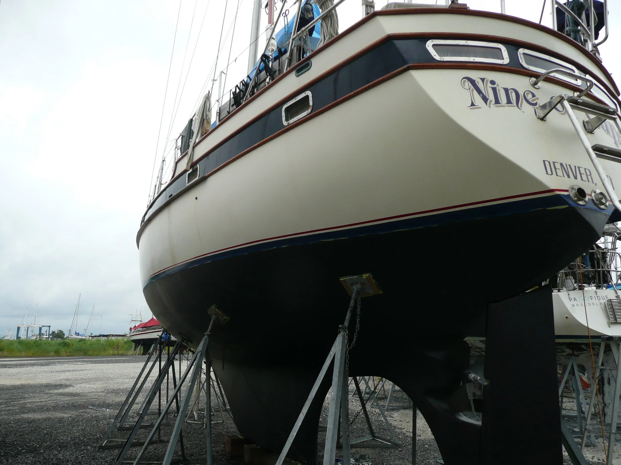
Cups was in need of more than just bottom paint. She needed to have years of bottom paint stripped off and sanded down. We thought we added a bit of abstract artistic flair to the boatyard with her "coat of many colors". (mixed metaphors??) The stripping was done before we left for Ushuaia. However, once we returned our work was cut out for us. It was hot and sweaty and the work was dirty and nasty. Once the hull was properly stripped, repaired, filled and sanded, we gave her two coats of a barrier interface coat. Folks stopped by and asked if we were leaving her
yellow... NOT! Ah, two final coats of black bottom paint and Cups was looking terrific again.


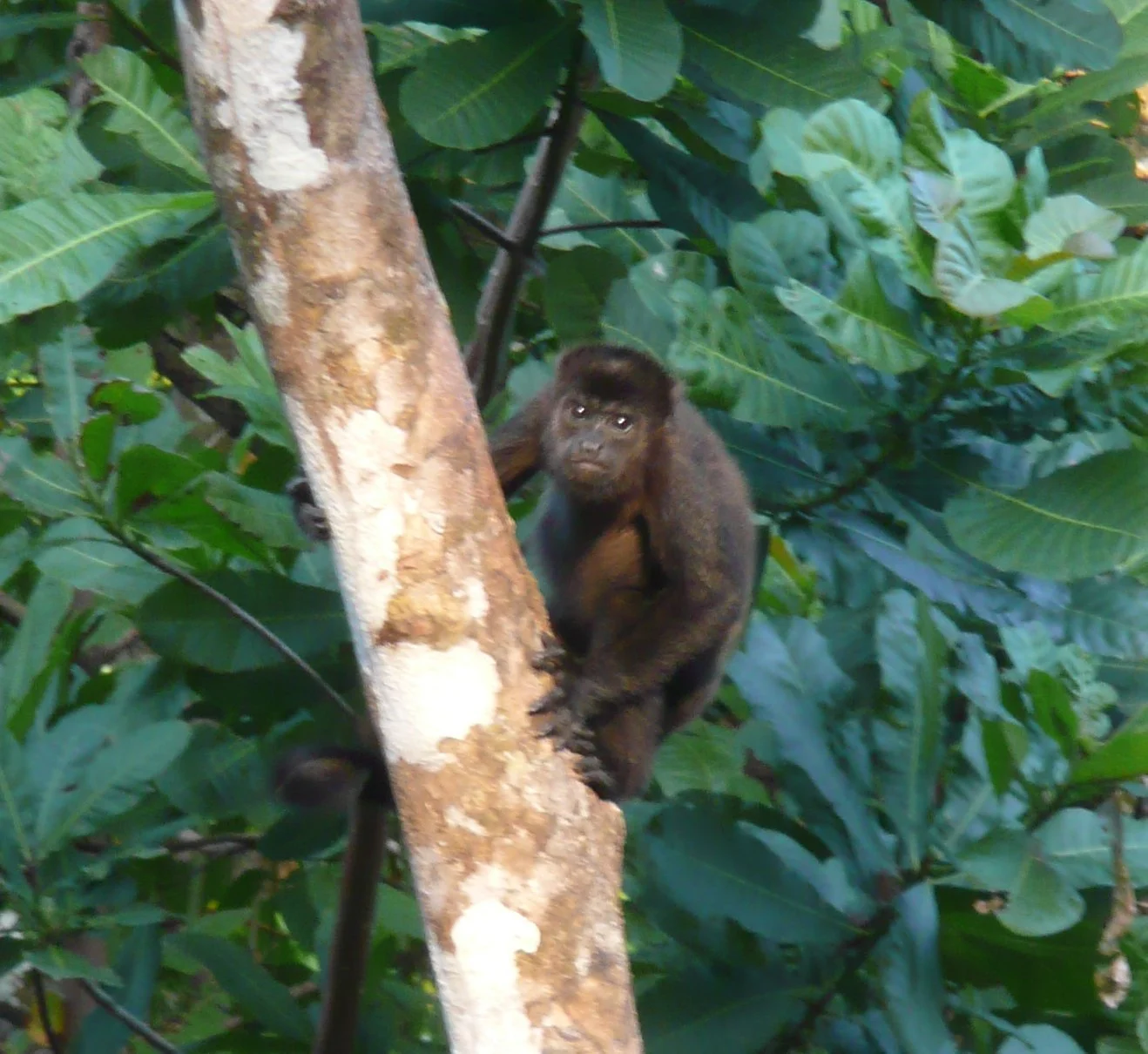
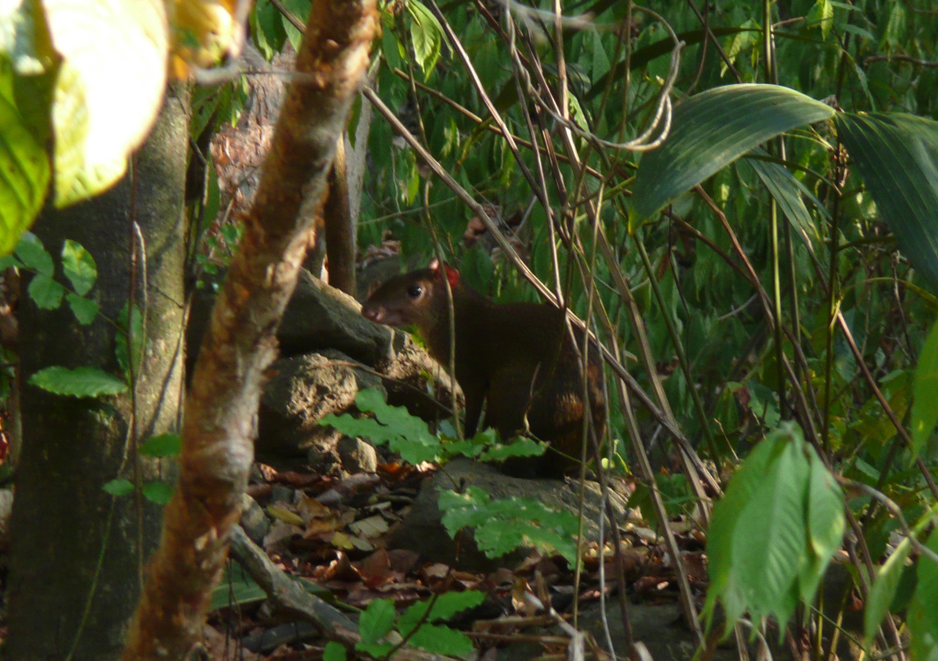
Parque Nacional San Lorenzo was within easy walking distance from the marina. Our favorite time for walks was dawn and dusk. We watched huge troops of howler monkeys cavort in the jungle canopy and when we couldn't see them, we could certainly hear their roars! We saw agoutis and coatimundis. We bought a Panama Wildlife Guide to help us in the identification of those we weren't sure of. Anteaters ambled through the boatyard and sloths hung from trees. We spotted caiman in the swamps while riding in the mini-bus to town and more than once stopped the bus to let a snake or sloth or coatimundi cross the road. Brightly colored birds swooped overhead and we could hear toucans and parrots. Since the area had previously been a US Army base, many abandoned buildings and structures remained, but the jungle had worked quickly to reclaim its own. We wandered along paths and dirt roads close to the marina and found old concrete bunkers. It was eerie roaming through these old buildings wrapped in vines and housing all variety of critters.


Friends from the States had been planning to linehandle with us through the Panama Canal since Fall 2007. Former cruisers themselves, they understood the vagaries of sailing and the changes inherent in trying to schedule. Finally, in June all was a go. Nine of Cups was back in the water and we had a firm transit date. They had only a week, but what a week it was! Midst getting "Cups" ready for the actual transit, we took a day to show them Colon. Now, Colon may not be the prettiest city in the world, but it does have character.
We were lucky to have visited the historic Panama Canal Yacht Club as it was demolished in 2009. It was originally established in 1928 and was considered a must-stop bar for cruisers transiting the Canal.


At last, we were ready to go. "Cups" had ten old tires wrapped in plastic hanging off her topsides and four 110', 1" lines aboard as required . The other requirement: 4 linehandlers plus a captain. We were short one linehandler and Jorge, a local worker at the marina, was contracted to take the fourth spot. We left the marina around 1500... just in case there were any problems and went to anchor in the Flats to wait for our "advisor", the person appointed by the ACP (Canal Authority) to provide direction and instruction during the transit.
We transited the first set of three locks at Gatun at night then spent the rest of the night side-tied to a huge mooring in Gatun Lake. Though everyone was exhausted, nobody slept all that well anticipating the next day's transit completion. We transited side-tied to a catamaran so not all four linehandlers were needed. A monkey fist, a tight knot with a lead weight in the middle in the shape of a ball and a long tether line, is tossed from the lock to transiting yachts and ships. Our linehandlers tied our 110' lines already prepared with huge bowlines, to the tether. The canal workers hauled in the lines, attached them to bollards on the side of the Canal and walked them from one bollard to another as necessary.
Jorge was at the bow when we exited the final lock and entered the Pacific. David was ready with the first toast of champagne given as tribute to Neptune. No moorings were available at the Balboa Yacht Club so we sailed a few miles further and tucked into the Amador Causeway anchorage. The Bridge of the Americas rose behind us in the background.


Once settled into the anchorage and after having a good night's sleep, we set out to explore some of Panama City with our friends. Though we had been here before, we'd missed several things (or forgotten them) so we were happy to be tourists with them. Our first stop was Casco Viejo, the Old City. We wandered along old city streets admiring the architecture. There was a huge restoration project in progress and we could see significant improvements being made. In many cases, only the facade of a building remained and peeking inside rendered only a vacant lot. We strolled, had a cold beer, strolled some more, had lunch, strolled some more and had an ice cream cone and then we strolled some more and shopped for molas and Kuna jewelry. All in all, a full and enjoyable day.


We were looking for something fantastic to do with our guests on their last day in Panama with us. I checked out Trip Advisor's Top 10 Things To Do in Panama City. We had done several of the 10... we’d transited (rather than just saw) the Panama Canal and did a walking tour of Casco Viejo (the old city), but the #1 thing on the list was to take an Embera'Puru village tour. The Embera tribe is one of several indigenous groups in Panama. We voted. All in favor, ‘Say Aye’. Unanimous and off we went!
A Visit with the Embera'Puru
Anne Gordon, our guide, was American and married to an Embera fellow and thus provided a unique perspective of cultural and family life in the village. She was great! When we reached the river pick-up point, we stocked up on water and snacks for the long canoe ride ahead. Our Embera helmsmen were waiting for us by the river. The ride was about 2 hours long up the Rio Juan de Pequini located in the Parque Nacional Chagres. Sometimes the river was so shallow, we all had to jump out to coax the canoe along.


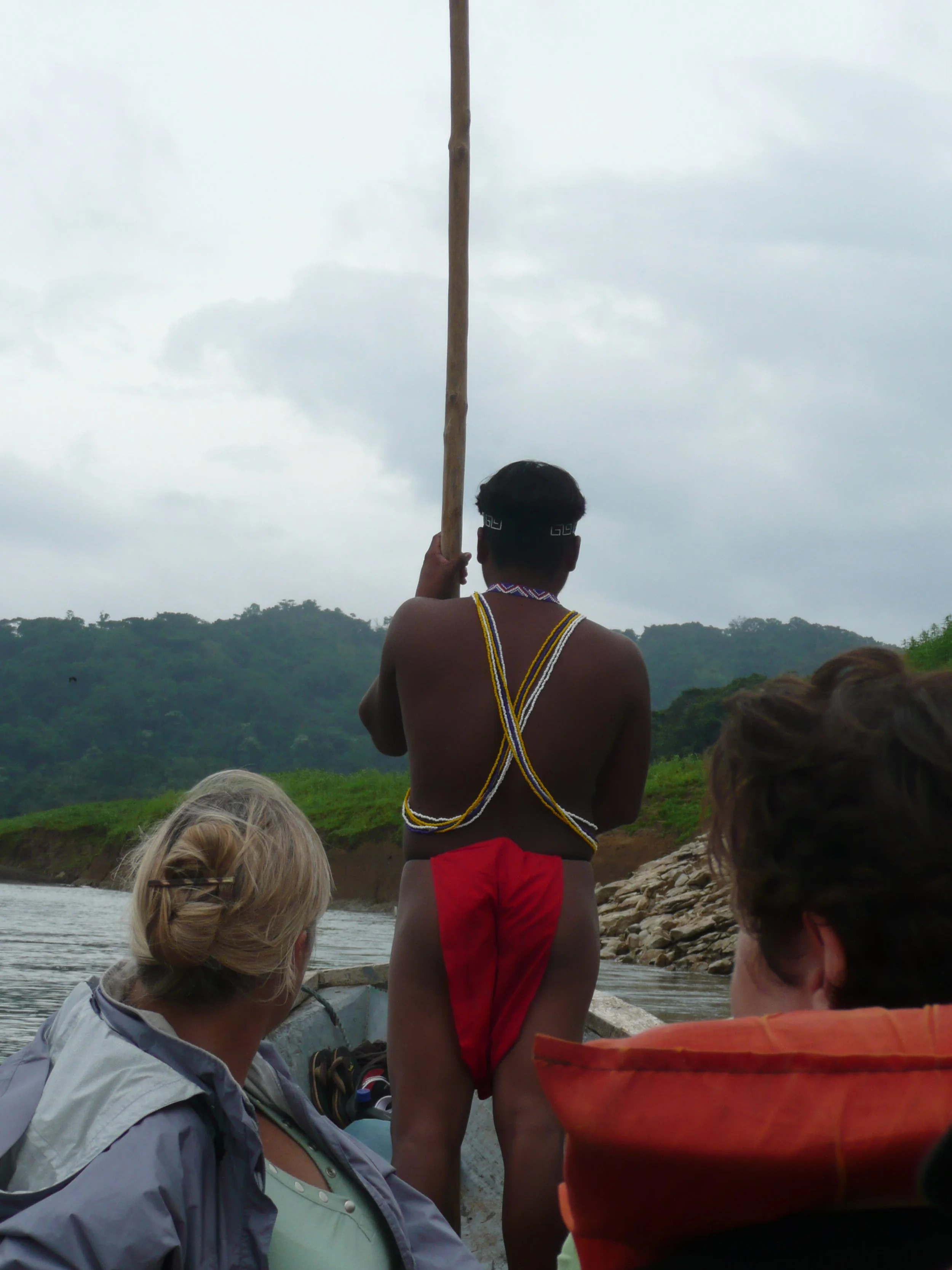
We passed several indigenous villages along the river and finally, we arrived. A warm, musical welcome awaited us as we debarked from the panga. After a round of introductions, we gingerly climbed the notched-log ladder of the meeting hut for a village orientation about the Embera people and their culture.


We learned about the Embera art of basket-weaving, participated in a native dance performance, took a nature walk in the surrounding jungle, had our ankles temporarily tattooed with hagua, and enjoyed a great lunch of patacones (plantain) and fish (tilapia) served in plantain leaves cleverly fashioned into disposable dishes. Before we left, we had the opportunity to buy some of the wares crafted by the villagers. An Embera basket and a ceremonial monkey mask worn by local shamans were my purchases and subsequently adorned Nine of Cups’ salon walls.


So here we were again. We had completed Panama Canal Transit #2 with Nine of Cups and we were in the Pacific with plans to cross, but it was already late June, really too late in the season to cross the Pacific leisurely and enjoy the sights. We decided to wait and make the transit early in the season in 2009, but what would we do till then? Ecuador was always a favorite place of ours and we had missed some sights in Chile that we had wanted to see. So just like that, new plans were formulated. There’s always lots to do before heading out and got busy. We used the facilities at the Flamenco Yacht Club, but we anchored out and dinghied back and forth to shore. Other than provisions, our major purchase ashore was a new dinghy.


The anchorage was calm but quite interesting for wildlife. Birds, especially pelicans, were everywhere and gathered in great numbers around Nine of Cups for some unknown reason. One afternoon when returning to the boat, I saw a stick in the distance and warned David to avoid it. As we neared it, we realized it wasn’t a stick at all but a boa.


Finally, we were ready to leave. We had met some German cruisers and fellow SSCA members, Brit and Axel aboard Hello World. Engine problems had caused their delay for a crossing and they, too, decided to stick around South America until early 2009. We decided to travel in "loose company" from Panama to Ecuador, taking in some of the islands and rivers en route.
Islas Perlas and The Darien
Anxious to get underway, we decided on a quick 10-mile motor sail to Isla Taboga. We used Eric Bauhaus' The Panama Cruising Guide as
our reference. Unfortunately, where the calm anchorage close to the beach used to be was now a mooring field. The anchorage further out was deep and rolly, but certainly acceptable for a night. It poured during the afternoon so we never went ashore. We all agreed to leave the next morning and headed to Islas de las Perlas (Pearl Islands of "Survivor" fame). This archipelago is comprised of 100+ islands located about 30 miles off the Pacific coast in the Gulf of Panama.
The most notable of the islands is Contadora which is built up for the tourist/resort trade. We opted not to visit. Instead we headed to Isla Bayoneta which appeared to have a protected anchorage and promised "an interesting beach with cowries on the west side" of the island. We could see a squall approaching just as we were about to turn into the anchorage at Isla Bayoneta. Waterspouts were dipping from the clouds, but the squall passed quickly and we found the anchorage to be most delightful. A long dinghy ride brought us to the west side where we we walked and beachcombed.


We moved to Punta Cocos and then, anxious to get to the rivers, motor-sailed to La Palma, capital of the Darien province. We left Punta Cocos early and with the help of the rising tide made it into the little anchorage of LaPuntita near La Palma by late afternoon. It didn't take long for the local Embera and Wounaan people to realize they had some sales prospects anchored nearby and several visited in the next couple of days.
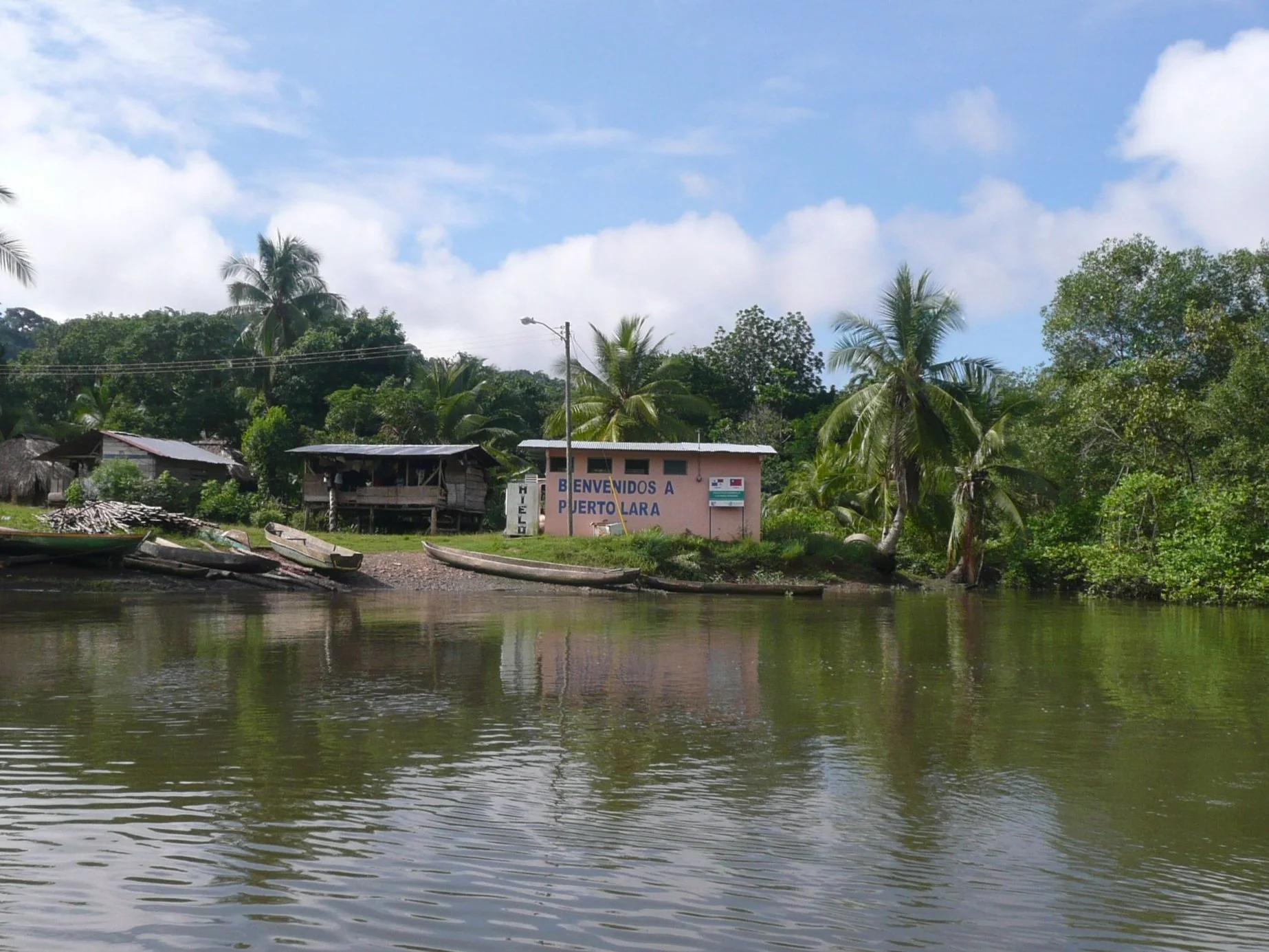
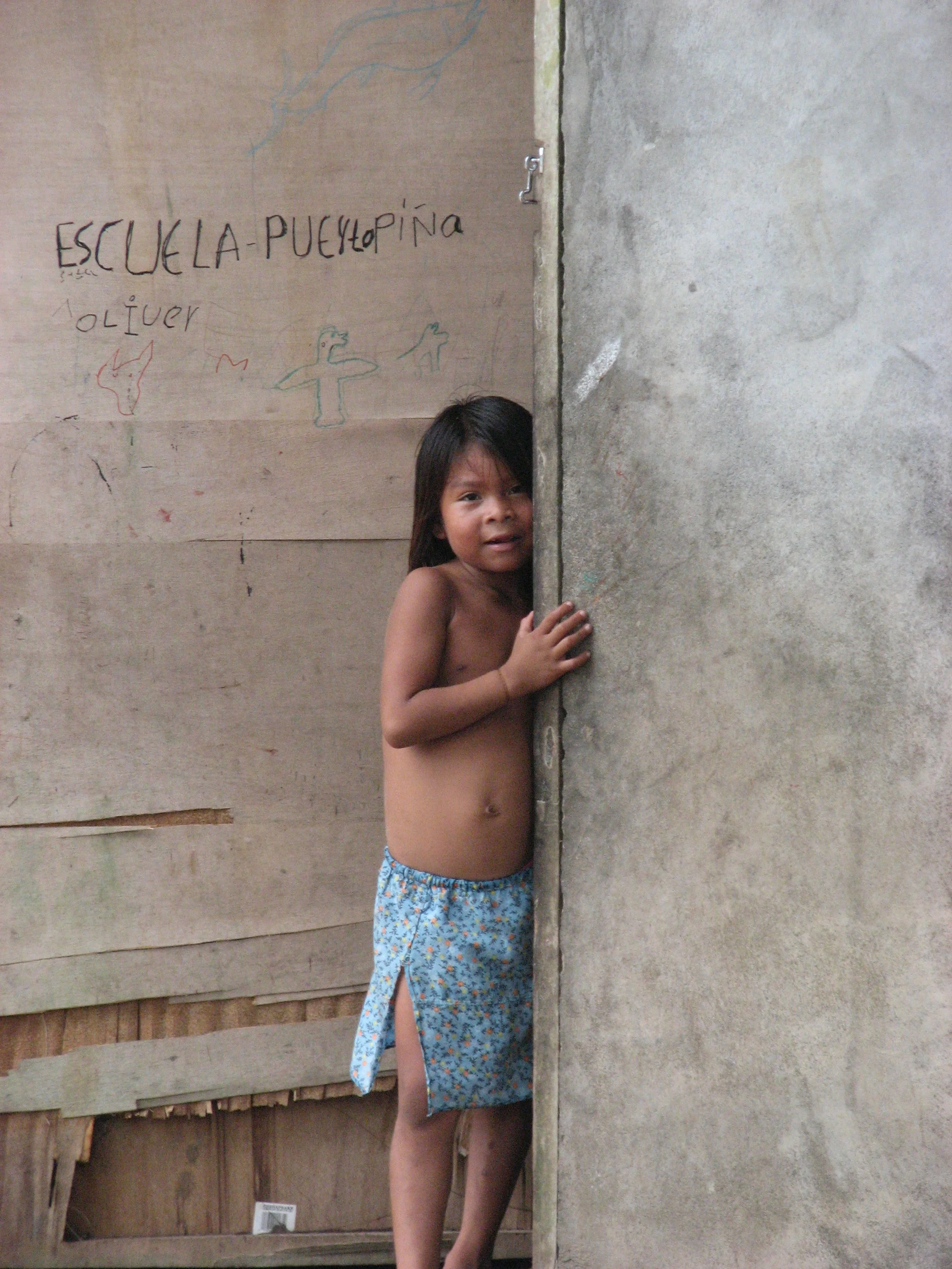
A day in LaPalma town and we were ready to head up the Rio Sabana on the rising tide. The river is a lovely tributary off the Rio Tuira and Bauhaus' guide provided excellent advice and chartlets. We anchored off Islas Bellas in a calm, peaceful setting. Once settled in, we climbed in the dinghy and headed upriver about 5 miles to the tiny Embera village of Puerto Lara. Along the way, we saw lots of birds, but no other wildlife. We were met by local folk as we came ashore and led to the meeting hut. The clanging of hollow log signaled all the villagers that new visitors had arrived and the potential for craft sales was high.


After a couple of days, we moved down the Sabana and up the Rio Iglesia not far away to another calm anchorage. It was hot and humid. We found a small cafe that served very cold beer and relaxed before trudging back to the shore. The tide had receded by the time we returned and it was a very long slog through thick, sticky mud to get back to the dinghies.


Gunkholing in the dinghies was an everyday pasttime and most enjoyable. We saw lots of birds, but no other wildlife.
We returned to La Palma and anchored for the day. We asked where we might find a petrol station… just go up the river and when you see the CocaCola sign, that'll be the place... and it was! It was $5.60/gallon and was a lot of work to dispense the diesel manually. First it was pumped into a pail from the 50-gallon drums with a handpump and then hand poured via a large, leaking funnel into our jerry jugs.


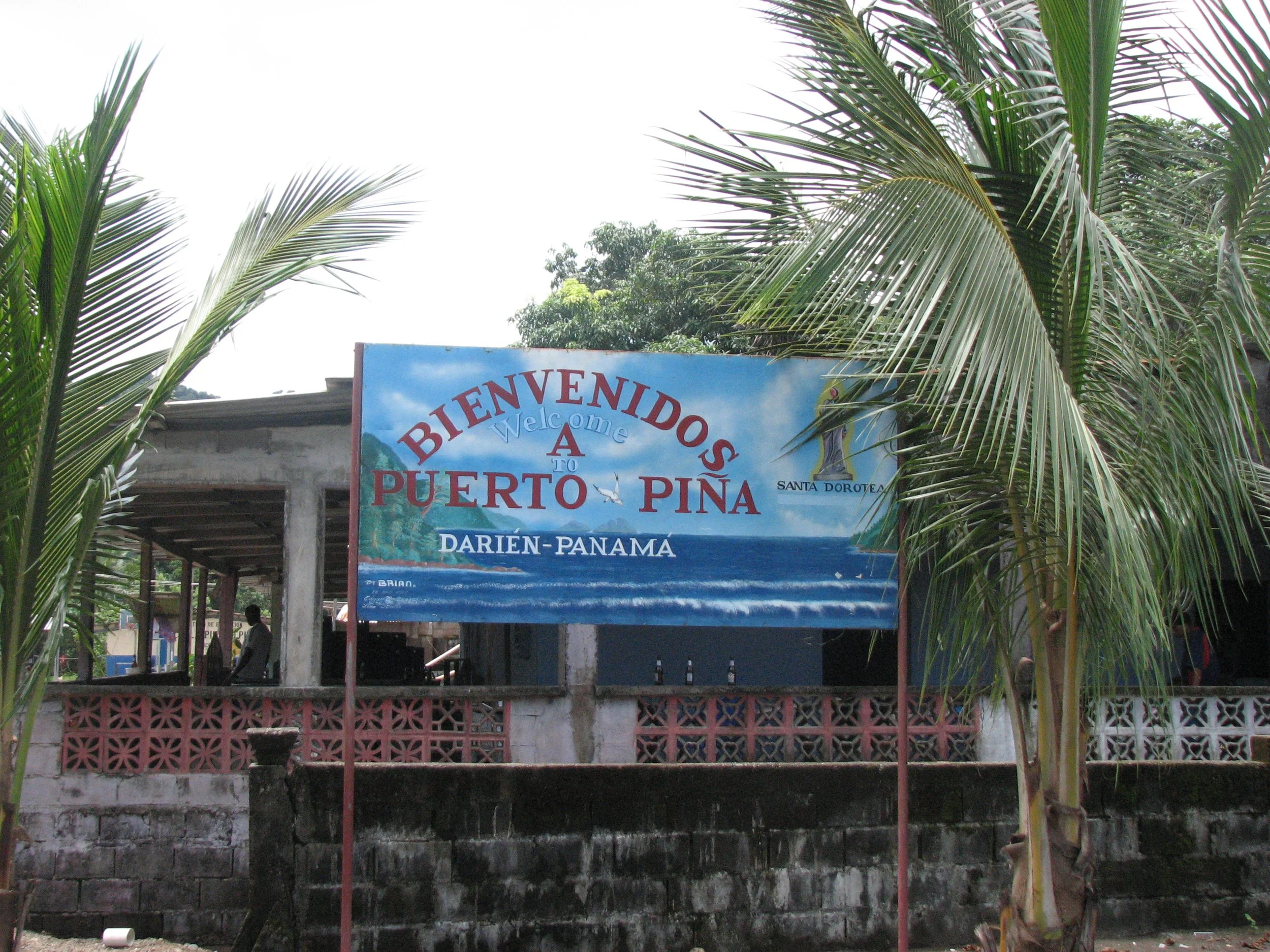
All fueled up, we headed down the river and into Golfo de San Miguel. We anchored the night in a lovely, calm anchorage at Punta Garachine and left very early the next morning (0200) to head to Bahia Pina, close to the Colombian border and the Darien Gap. We arrived at sunrise and were anchored by 0900. The preferred anchorage near the Tropical Star Resort was "full" with fishing and naval vessels, so we anchored across the bay which was rolly and unsettled. The following morning, the naval vessels had left and after a quick reconnoiter by "Hello World", we moved to the calmer anchorage near the Tropical Star. We were not, however, allowed onto the resort grounds and only the captain was allowed ashore to pay for diesel to top off our tanks once again.
Every day a new group of vendors appeared and offered us a great assortment of wares. We never turned anyone away. They always offered something that we liked and we were supporting the local economy! We bought jewelry and the mask to the left from these young girls and then David decided he'd like a locally hand-carved paddle which they gladly sold to him right from their own cayuga.


One evening a group of fellows from the Panamian naval vessel "Alcon" stopped by to chat and had a beer with us. Luis, a lieutenant in the Panamanian Navy offered to act as our guide to the village of Puerto Pina the next day and we took him up on his offer. We hadn't seen how to approach the town since the beach looked rather ominous with large rollers. A hidden river entrance took us inland and gave us quite a rapids ride following heavy rains. We ended up turning around and tying up at a small dock about a mile away from town. The walk into town was quite pleasant and shaded.


We wasted no time the next morning heading back out to sea. A pod of dolphins gave us a beautiful sendoff. David wasted no time getting the fishing lines out and within no time had snagged two tunas for dinner. David paid tribute to Neptune with a tot of rum as we cross the Equator for the fifth time. And then we were in Ecuador once again. Join us!