

Pitcairn Island… HMS Bounty, Mutineers and All Up
The HMS Bounty story in a nutshell… In 1789, the crew of the Royal Navy Vessel, HMS Bounty, took control of the ship and set Captain Bligh and his loyal officers adrift at sea. The mutineers looked for a South Seas island that they could inhabit and not be discovered. They found Pitcairn, scuttled the ship in the harbor and set up their community with crew and some Polynesian men and women they'd picked up along the way. Too few women, local alcoholic drink they learned to brew and major differences of opinion resulted in much lethal infighting and a high suicide rate. The descendants of the those original mutineers who survived still live on the island.

About 1100 nm west of Easter Island is Pitcairn Island. We always thought Pitcairn Island was all by itself out there, but as you can see, there are actually four islands in the Pitcairn Group. Named after Major Pitcairn of the British Marines in 1767, Pitcairn Island itself is the only inhabited island of the group.
We had e-mailed Pitcairn Island in advance to ask permission to stop at Henderson Island. We'd read about it and it was just the kind of off-the-beaten-path place to which we were attracted. Then as long as we were going to try to stop at Henderson, we decided we'd at least aim for Ducie Atoll to see what was there.
We left Easter Island, the day before Easter, with the promise of south/southeast winds to get us on our way. With Easter still a bump on the horizon, David reeled in a small mahi mahi for our Easter dinner feast. The passage from Easter to Ducie Atoll was in a word...SLOW! The slowest passage, in fact, we've ever made. The promised south/southeast winds materialized for only a day or two and then disappeared altogether. The weather was warm and mostly sunny, the seas were calm and the wind... well, there wasn't much wind at all.
Ducie Atoll - 24S42.00 /124W47.50

The paper chart #83225 for Ducie Atoll, taken from a 1937 British aerial survey, didn't show very much.
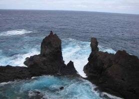
Ducie was named for Lord Ducie and claimed by Edward Edwards in 1791, during his hunt for the Bounty and its mutineers. The paper chart didn’t help much, so we set a waypoint for the south side of the island about one mile out, but stood off about 10 miles until first light to approach. The chart plotter with its Navionics chart software was off by about 1/2 mile. At 2 miles out, the atoll was still not visible to the eye. Easy to see how the Acadia in 1881 was shipwrecked here.
We circumnavigated once around to find the best possible spot for an anchorage. The south side was exposed to huge southwest swells and subsequent breakers. We decided on the north side in about 40 feet of water. Our anchorage coordinates: 24S40.32 / 124W47.51

Ducie is a classic coral atoll. A small island (Acadia) and a few tiny islets are surrounded by a coral reef which encompasses a lagoon. Other than
trees and birds, we read that rats abound... not high on our pets aboard list.
We hadn't had the opportunity to swim off the boat in a long time. The water was crystal clear, about 32C, very refreshing without leaving your body parts numb. I dove in, checked on the chain and anchor while David was doing some chores aboard. Soon after, David went for his dip and said rather casually, "I'm surprised you spent so long in the water with all the sharks!" He had seen at least four of them...3-4 feet long within arm's reach of the swim ladder. No shark photos, but a clear view of the bottom...40 feet below.
After two relaxing days of 0-4 kt winds anchored at Ducie, the forecast called for north and east winds and we hauled anchor for a pleasant sail to Henderson Island, some 200 miles west.

Henderson Island - 24S18.12 / 128W18.77
Henderson Island, the largest island of the Pitcairn group, is an example of a makatea or raised coral island believed to have been lifted up by three underseas volcanoes. The north shore is primarily beach, but the rest of the island is edged by steep 50' cliffs. The black gray cliffs were all undercut through erosion and there were hundreds of huge caves and grottoes riddled with holes. As the surf came up, there would be a dull thud then "whoosh" and the water would burst out of blowholes, some rising as high as the cliffs themselves. We could see beaches, but they were not accessible with the northerly swell.
Ah, the vagaries of the winds and weather. When we were looking for a breath of wind to sail, we were becalmed for days. Now, when we looked for calm to go ashore at Henderson, 20 knot northerly winds prevailed and were forecast for days. After two days of being hove-to, we reluctantly headed southwest... disappointed to miss the chance to explore Henderson, but excited about our impending visit to Pitcairn.

You have to admit that these Pitcairn Islanders have a great sense of humor. Take a close look at the names of some of the locations: Break Im Hip, Tom Off, Oh Dear, Bitey Bitey and Bop Bop. Some of the names not on this map, but on the local map are John's Catch-a-cow, Down the God, Where Dan Fall, Johnny Fall and Little George Coc'nuts.
Pitcairn Facts:
*A British Overseas Territory
administered by New Zealand. It’s the only BOT left in the Pacific Ocean.
*Population: 67 (a/o Apr 2009)
*Capital: Adamstown (only town
on the island)
*Language: English & Pitkern
*Currency: NZ $ (but US$ OK)
*Area: 5 sq km
*Time: -8 GMT
Pitkern is spoken by the Pitcairn
Islanders amongst themselves.
It is a blend of 18th-century
seafaring English spiced with
Polynesian words. Islanders pronounce Pitcairn as
Pitkern, which is therefore, the
correct pronunciation.

Just a bump on the horizon, but land ho! Pitcairn
Island ahead ... 1,455 nm and 16 days after leaving
Easter Island.

We radioed ahead to Pitcairn and were told that
Bounty Bay was fine for anchoring, so we went straight
in and anchored in sand, about 40' with good holding.
Bounty Bay, Pitcairn Island - 25S03.98 / 130W05.70
We arrived late in the afternoon and so waited till the next morning to request permission to come ashore. Though we could have requested pick-up
by the government boat ($50US/roundtrip), we opted to take our own dinghy in. We were met at the dock, given help disembarking and hauled the
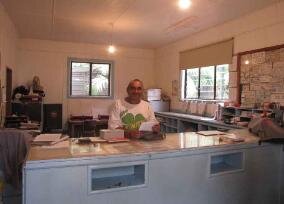
dink up the longboat slipway. Work was underway in the little harbor enlarging the breakwater, but everyone stopped long enough to welcome us and provide a helping hand. Health forms were completed right at the boat house. Brenda Christian, with whom we'd been in contact via email since leaving Chile, is also the Immigration Officer. We went to her home for coffee and Immigration check-in. $30 US/per person, in and out, 14 day visa.
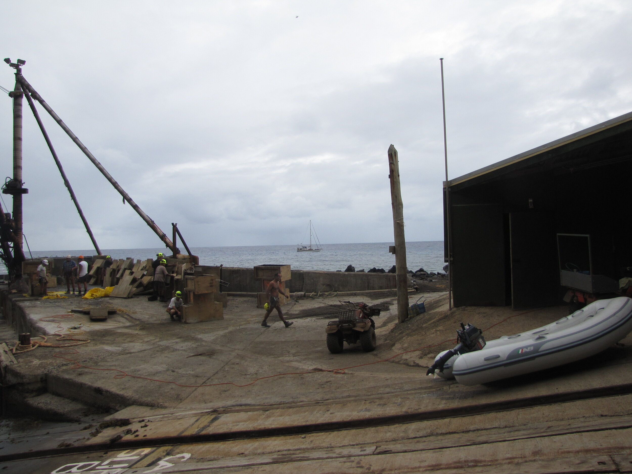
Workers were busy in the harbor boatyard, but stopped to welcome us and haul the dinghy up on the wharf.

Welcome to pitcairn island!

A small sign on the boathouse points the way to the remains of the HMS Bounty, scuttled by the mutinous crew in about 40-50 feet of water in the harbor just off the landing place.

A Pitcairn Warbler endemic to Pitcairn Island.
Transportation on the island is almost exclusively via Quads (ATVs). Everyone has one (or two or three) and "nobody walks on Pitcairn!" As we left the
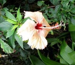
harbor and headed up, up, up via a switchbacked road to Brenda's house, we were immediately impressed with the green lushness of the place. Palm trees and huge Norfolk pines (a gift from Norfolk Island). A profusion of flowers bloomed everywhere... striking in color, fragrance and variety. Hands of bananas hung from the trees. Oranges and grapefruits were heavy on the branches, just waiting to be picked. Mangos, pawpaws (papayas), coconuts and so much more we didn't recognize... all in a 15 minute ride. Though telephone and internet are both available on Pitcairn, all islanders have a VHF at hand because of the importance of ship traffic. It also serves as a PA system to all households and we heard many "general announcements" on Channel 16 while we were there.
There’s so much to see, learn and explore here on this little 5 sq km chunk of land peeking out of the South Pacific Ocean.

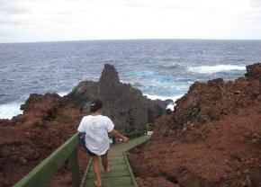
If I look uncomfortable, it's because I was. Check out "Cups" below down in Bounty Bay as we edged out on this little ledge for a photo op. (Photo Bren Christian)

Bren Christian, our gracious host on Pitcairn Island is the great-great-
great-great granddaughter of Fletcher Christian and is a ball of sweet energy.
She's as agile and nimble as a mountain goat and graceful as a deer.
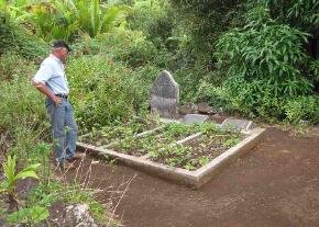
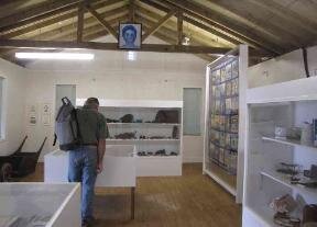
For two wonderful days, Bren and her husband, Mike, escorted us all over the island, showing us as much of what the island had to offer in just a few short hours. We visited the grave of the last surviving mutineer, John Adams, where his wife and daughter are also buried. We tramped and trekked and ATV’ed up, down and all around, taking in stunning views and local sights. The museum was opened especially for us as was the post office where we were able to purchase some unusual and rare Pitcairn postage stamps. Mail from the island is dependent on visiting ships. The postcards we mailed did arrive at their destinations, albeit several months after we mailed them in Pitcairn.

When we returned to the boat on the second day, the wind had picked up considerably and was switching more easterly, making Bounty Bay an untenable anchorage. We moved around the corner to Ted's Side on the lee of the island (25S03.69/130W07.17) We met Bren and mike there with the dinghy the next day. Mike is subject to seasickness and stayed on shore, but Bren, laden with fresh fruit and Pitcairn souvenirs, came aboard Nine of Cups aboard for a visit and coffee.
We were ready to leave, but couldn't start a new passage on a Friday... an old sailor's superstition. The anchorage was becoming untenable, however, so we hove-to till midnight and at 12:03am, set the sails, gave a tot of rum to Neptune and headed to our first landfall in French Polynesia, the Gambiers.