

Chile - Deserts, Mountains, Sea and Wine
We coast-hopped down long and skinny Chile extends 2,700 miles down the southwest coast of South America. It boasts the driest desert in the world, tall mountains, fascinating archipelagoes, gorgeous scenery, charming cities and outposts at the bottom of the world. Add to that friendly people, outstanding wine and seafood and it’s an outstanding place to visit.


Republica de Chile
Capital: Santiago
Population: ~16 million (2005 estimate)
Land Area: ~292,260 sq mi (about 2x the size of Montana)
Highest Peak: Nevado Ojos del Salado (22,572')
Political units: 13 regions
Language: Spanish (Castellano)
Currency: Peso...currently ~530 pesos = $1USD
Exports: Copper and minerals; seafood, wine and fresh produce.
Interesting Chile facts...
The country is long and skinny with nearly 2,700 miles of coastline but is only about 265 miles wide at its widest point.
Copper is the most valuable resource and export and ranks as the world's leading copper-producing nation.
Chile's name probably comes from chilli, an indigenous word meaning “where the land ends”.
About 250,000 Araucanians form the largest indigenous group in Chile
Chile lies along a major earthquake belt and is frequently struck by earthquakes and huge destructive tsunamis. The largest earthquakes were in 1922 – Central Chile 8.5 on the Richter scale and in 1960 Southern Chile, 9.5 on the Richter scale.
There’s lots to see in Chile. Click on a particular destination below, or just scroll down to see it all…


Coast-hopping in Chile
Our first visit to Chile was a two-month stay from December 2005- February 2006. We coast-hopped from Arica in the north at the Peruvian border, through the Patagonian canals to Tierra del Fuego. Marcie keeps a daily journal and that, along with our ship's log, reminds us of exactly what we did for the 40 days and nights it took to sail the 4,000 nautical mile offshore passage from Paracas, Peru. Columbus Day, Halloween and Marcie's birthday were celebrated en route. All required special desserts to note the days. Of course, sometimes we celebrated Tuesdays and weekly egg-turning day as well. But we finally arrived and began our long journey south along Chile’s extensive coast.
Arica...Chile's First Port
Arica is the northernmost seaport in Chile. Founded as Villa de San Marcos de Arica in 1541 on the site of a pre-Columbian settlement, this port city formerly belonged to Peru. During the War of the Pacific, Chile seized the city from Peru (1880) and gained control under the Treaty of Ancón (1883).
The prominent headland named El Morro is one of the first things you spot from the sea and figures predominantly into the view ashore. A large colony of sea lions barked us into the harbor and the anchorage and continued to entertain us throughout our visit.


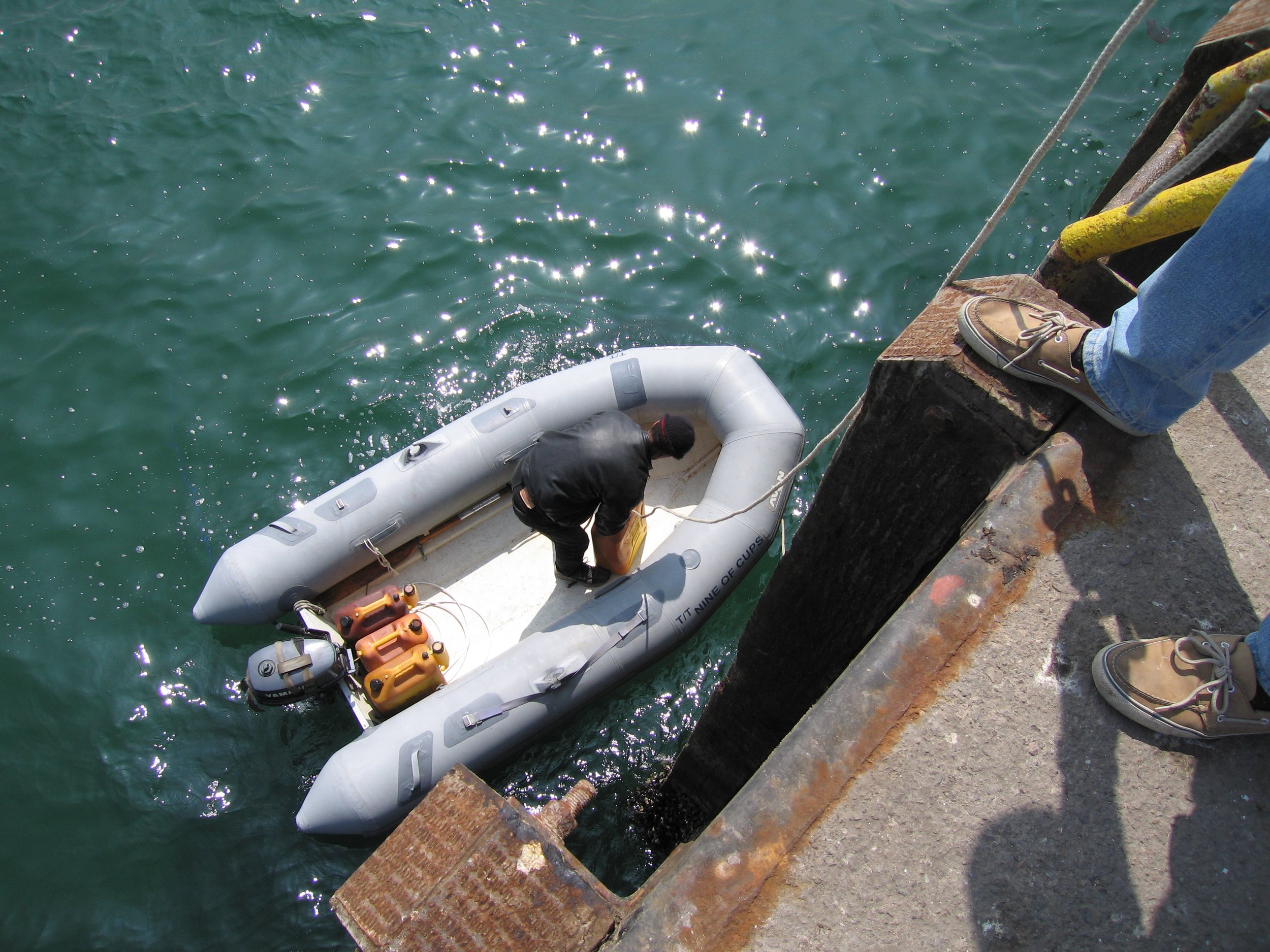
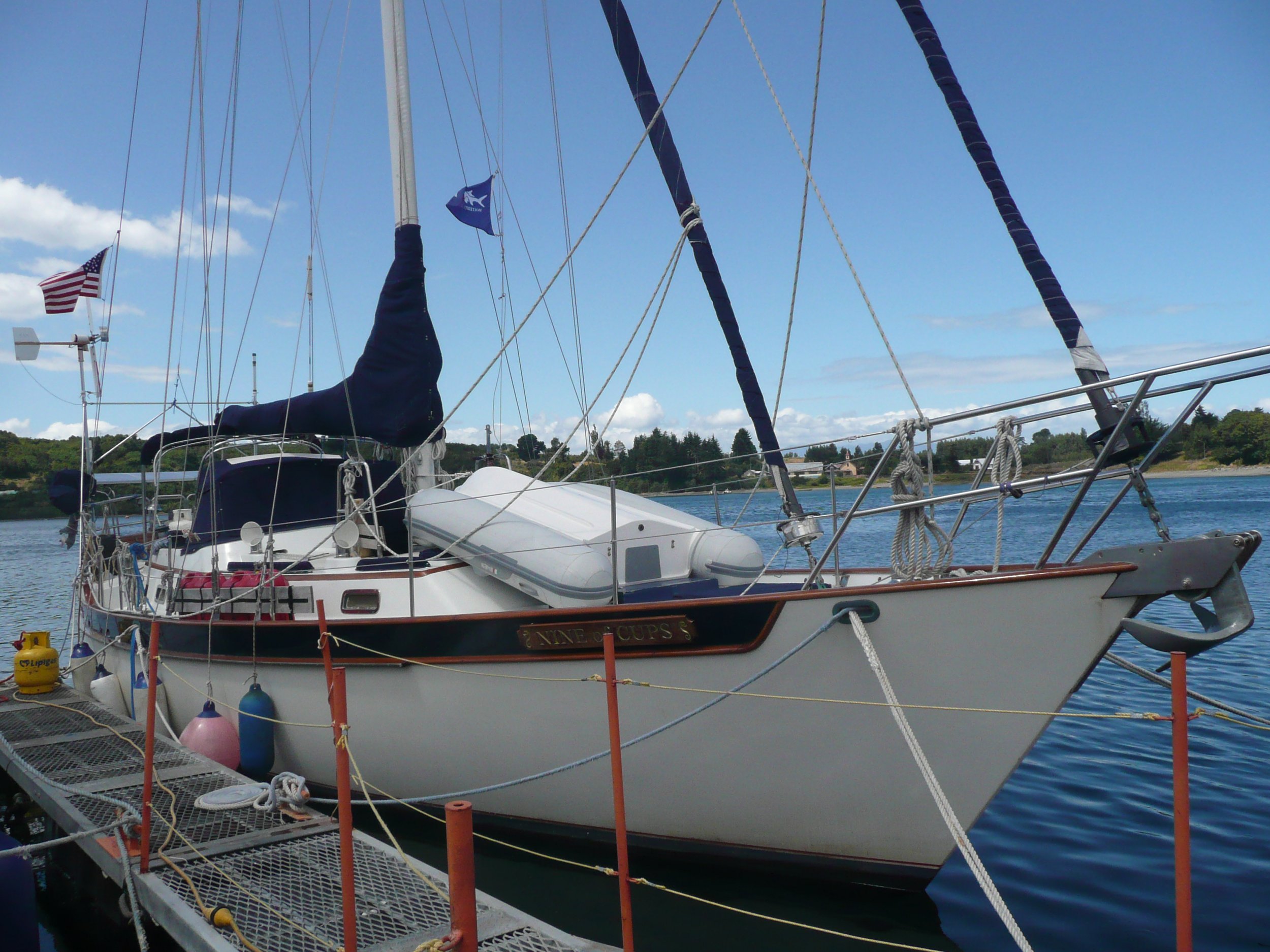
After a good night’s rest, we climbed to the top of El Morro, now home to a historical monument with a wonderful lookout, park and museum. From the top of El Morro, we photographed the anchorage comprised primarily of fishing boats, Nine of Cups was the only sailboat in the harbor and one of few visiting yachts in 2005.

From the top of El Morro, we could see Nine of Cups anchored with the fishing fleet.
We spent a couple of days enjoying forays into the city. We chanced to meet Jorge Delgado, a member of the Chilean Coast Guard. Jorge was a most gracious host, showing us the city of Arica and sharing both his home and family with us.


Lago Chungara - Lauca National Park
With Jorge offering to keep an eye on Nine of Cups, we took a day trip to Lago Chungara in Lauca National Park ... from sea level to 15,000' in a matter of a few hours. The scenery was fantastic. The altiplano region differed greatly from the arid desert coastline we had become accustomed to. It snowed while we were there and Marcie made good use of a scarf purchased from a local artisan. Lago Chungara lies at an elevation of 14,820 ft and is one of the highest lakes in the world.


Iquique
Continuing down the coast, we stopped at Iquique. This was an interesting town to visit. We anchored out at first, but soon found an available visitor’s slip in the local yacht club. We strolled through the town, enjoying the morning sun and cups of coffee at sidewalk cafes. Iquique has the dubious honor of shipping more fishmeal than any other port in the world.


San Pedro de Atacama
With Nine of Cups secure at the yacht club, we took a land trip for a couple of days via bus to San Pedro de Atacama, a small, dusty (touristy) oasis town in the middle of the Atacama Desert, notably the driest (non-polar) desert in the world. Some areas of this desert have not had any recorded rainfall in the past 400 years! It was a dispute over the heavy deposits of valuable nitrates in the desert that caused the War of the Pacific (1879-1883).


We continued south stopping a few days here and a few days there depending on the weather, the wind and our whims. We visited Antofagasta, Mejillones, Taltal and Cifuncho. Each town has something unique to offer, something interesting to see. Without exception, the Chilean people were warm, friendly and helpful. We were sometimes overwhelmed by their generous hospitality.


Isla Damas
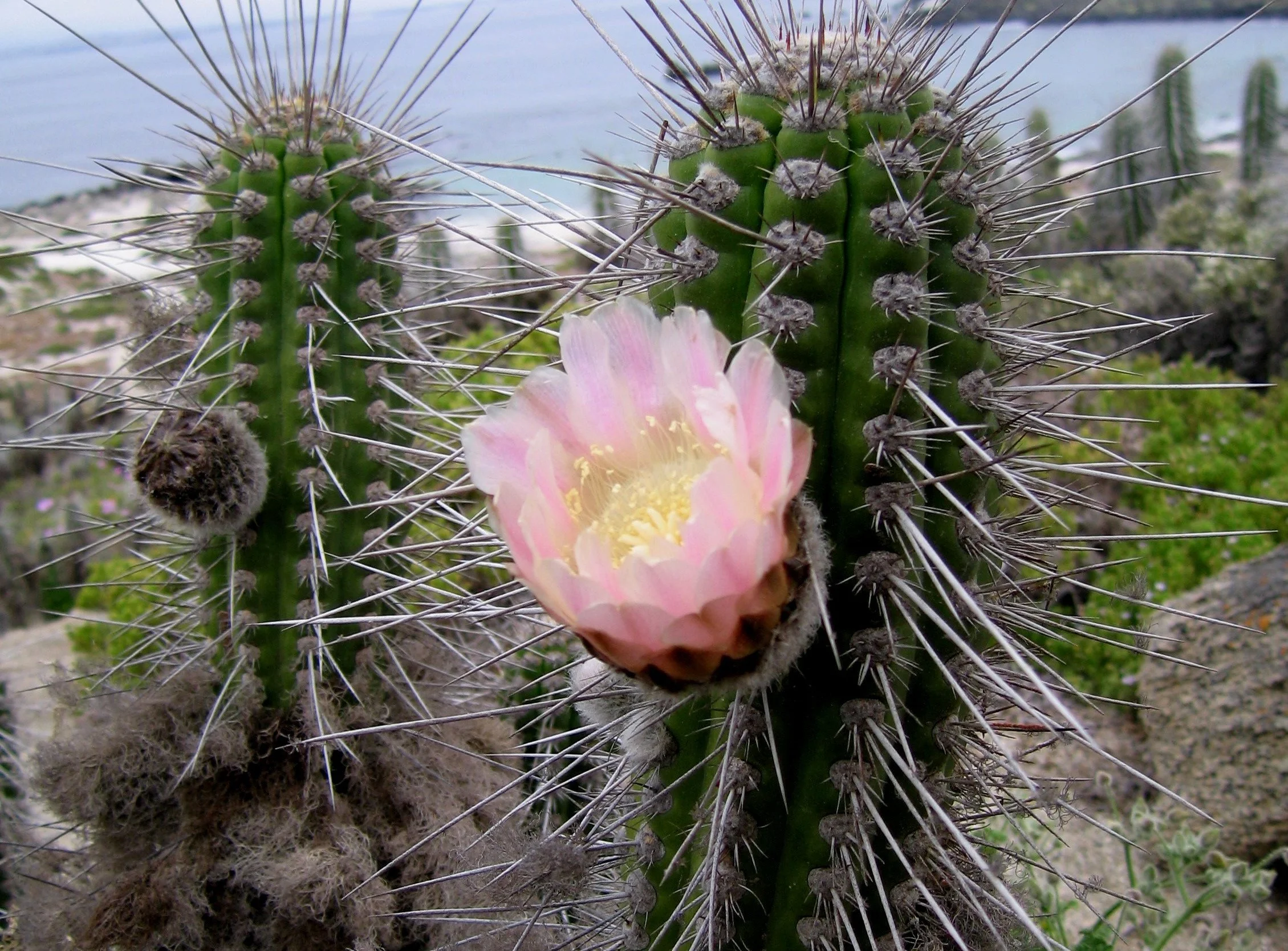
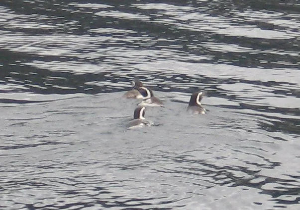
Located only a few miles offshore, Isla Damas is a 60 hectare metamorphic outcrop and part of Chile's Humboldt Penguin National Reserve. We anchored off the beach and dinghied ashore. There was a small network of well-defined trails lined in shells crisscrossing the island. The desert was in bloom when we arrived and the flowers were astounding in colors of pink, yellow, red, orange and purples. Birds were abundant and we did get to see a Humboldt penguins.

Nine of Cups anchored off Isla Damas


Coquimbo
We stayed several weeks at anchor at the Yacht Club in LaHerradura, Coquimbo. It wasn't the plan, but then cruising plans are always written in the sand at low tide. David had some emergency medical issues that needed to be handled. Incidentally, we found Chilean medical care to be excellent and, as always, the Chilean people to be helpful and caring.


Talcahuano / Concepcion
We left Coquimbo in early December hoping to make it to Puerto Montt for Christmas. Adverse current and stubborn southerly winds worked against us. When we knew we couldn't make Puerto Montt, we thought, then maybe Valdivia ... after heaving-to for several days in our fruitless attempt to make some southerly progress, we finally pulled into Talcahuano 2 days before Christmas.
We anchored the first night among the fishing boats and enjoyed a spectacular sunset. Talcahuano is the headquarters of the Chilean Armada and they hailed us early the next morning and invited us to stay at their Naval Yacht Club. Quite the holiday present, but how would we enter and leave the naval base? They issued us passes and we came and go without a hassle.
Christmas Eve was spent in the neighboring city of Concepcion, gathering provisions for Christmas dinner ... a small smoked turkey and all the trimmings including cranberry sauce from our ship’s larder. We didn't have a Christmas tree, but found a lovely bouquet of bright red gladioli to add some color to the holiday ... and according to Jelly, some really good smells. Christmas Day was quiet but lovely. With difficulty, we found a phone and called home. Two days after Christmas, we headed south once again.


On to Patagonia - Puerto Montt to Puerto Williams

We finally got a reasonable weather window to head south from Concepcion. Though we still motor-sailed, we made progress. We intended to spend New Year's Eve in Valdivia, but the weather held and instead pushed on to Puerto Montt in five days, arriving in time to spend New Year's Eve with fellow cruisers at the home of a most hospitable Chilean couple, Cristian & Laura. We remained in Puerto Montt until mid-January which allowed time for us to prepare for the trip through Chile’s Patagonian canals and do a little sightseeing.
The most spectacular sight on the trip was traveling through Canal Chacao, the narrow waterway that separates the island of Chiloe from mainland Chile. Aided by a strong current, we sped along at 12 knots and the land seemed to whiz by. The weather was calm. We were escorted by innumerable Peale's dolphins who performed their fantastic tailwalks on the mirror-smooth water.

Puerto Montt -41S28 / 72W56
Puerto Montt is the "Gateway to Patagonia". Though we spent some time sightseeing and celebrating, we were also concerned about making ready for the long cruise through the Chilean canals. We purchased lots of extra fuel jugs from another cruiser and filled up on diesel. We provisioned heavily, especially on smoked salmon, a specialty in the area. Two reels with 100 meters each of poly-line were mounted on the stern, a necessity for anchoring in the canals. The aft deck was never so cluttered.


We met up with Jack and Jo Cooley from "Mystic Adventure" who happened to be land traveling in southern Chile. We rented a car with them and drove north to Puerto Varas and Valdivia for a day of sightseeing and inland travel.


The Chilean Canals - Patagonia
The name Patagonia comes from the word patagón used by Magellan to describe the native people whom his expedition thought to be giants with enormous feet. He stated that the people were huge and that their feet were 13 feet long. It is now believed the Patagons were actually Tehuelches with an average height of 5′11″ compared to 5′1″ average for Spaniards of the time.
We left Puerto Montt early on 15 January, a cool, gray overcast morning and headed down the Seno Reloncavi. We had made the decision that we would fast-track down the canals with the idea that we would have a more leisurely time on the return trip since our goal was still to head west to New Zealand in the late spring. In retrospect, this was not a good plan as we never returned north through the canals, but at the time, it seemed a good idea.
With the current plan in mind, we negotiated Golfo de Ancud the first day and crossed the wide, unencumbered Golfo Corcovado at night entering Canal Moraleda and our first anchorage, Estero Altracadera. The Chilean Armada required a zarpe (zahr-pay), authorized written permission to navigate the canals. The route had to be approved in advance of departure and twice-daily we needed to contact the Armada via email and/or radio.
Finding the tiny, narrow and well-camouflaged entrances to the published anchorages proved to be a challenge at times. We used the Guide to Patagonia and Tierra del Fuego by Ardrizzi and referred to by cruisers as the Italian Guide, which proved to be the best cruising guide we've ever seen or used. Other resources were the Chilean Hydrographic charts and the Guide to Chile: Arica to Tierra del Fuego by Staples and Gooch. Anchoring in tight quarters requires lines ashore to keep from swinging into rocks and land. It took us over an hour to get settled in the first time and we figured we'd have to improve drastically if we wanted to survive in the canals.


The night crossings of the wide open waters of Golfo Corcorvado and Golfo de Penas were the only transits made at night. Otherwise, we took advantage of the long summer daylight hours and made way from 6 am to 9 pm, taking laydays only for weather. The Golfo de Penas (Gulf of Sorrows or Pains) can be a particularly rough stretch of unprotected water and we waited at anchor for three days in anticipation of a reasonable weather window. Our crossing was storybook-perfect perfect with little wind and calm seas. We reached the entrance to Canal Messier at dawn, the sky ablaze with a glorious sunrise.

Crossing the Golfo de Penas was calm and uneventful. We were greeted at the entrance to Canal Messier with a glorious sunrise.


Caleta Connor boasted an arbol famosa, a tree to which many cruisers had affixed a sign showing they had visited. David quickly carved and painted a signboard on a scrap of wood and midst a heavy downpour, we rowed ashore andadded our name to the pack.


Sometimes we were able to snug into a tiny ‘caleta’ (cove) and from a distance it looked as if we were landlocked like this anchorage at Caleta Connor.
Negotiating the Angostura Inglesa made us more cognizant than ever of how primeval the area was and how fortunate we were to be experiencing it. All of our senses were attuned to our surroundings. Entering the narrows required waiting for the proper tide and strict attention to channel markers. The views all around us were phenomenal.

Negotiating the Angostura Inglesas
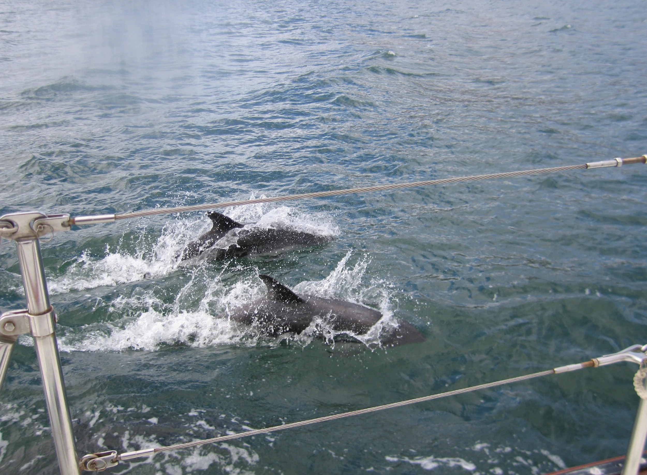
Dolphins were a common sight and always welcome. Sailors consider them good luck and we enjoyed their company and the entertainment they provided. Penguins were shy and hard to photograph. We saw albatross frequently. They’re majestic birds with huge wingspans in full view as they soar through the air and then gracefully land on the water. An interesting note about albatross: Of the 21 species of albatrosses recognized by the IUCN, 19 are threatened with extinction.

Every large vessel met en route contacted us and according to Chilean Maritime Authority law requested our pertinent information and position. We were on a first-name basis with the Navimag Ferry communications officer by the time we reached the Strait of Magellan. Also amazing to us was the fact that we were sighted no less than three times by people who knew us and were transiting on the Navimag Ferry while we were in the canals. Several sent us photos.


Puerto Eden
Puerto Eden is a tiny town tucked under the shadow of snow-covered mountains. It provided one of the few places along the entire 1200 mile route to buy basic provisions and top off our diesel supply.

Beautiful Puerto Eden


At the Islote Fairway we "turned the corner" from Canal Smyth and entered into the legendary Strait of Magellan. This is the southernmost point of Patagonia and now we entered Tierra del Fuego. Leaving Canal Smyth and turning the corner into the Strait of Magellan seemed like a monumental waypoint. We had begun reading Joshua Slocum’s Sailing Alone Around the World aloud to each other in the evenings. His description of the bays in which he had anchored seemed all the more real as we were transiting the same waters and anchoring in the same bays. We were never forced, however, to salt the deck with thumbtacks to ward off unwelcome guests.

an ominous sky over Islote Fairway as we "turned the corner" and left Patagonia and entered Tierra del Fuego via the Strait of Magellan
Tierra del Fuego
Tierra del Fuego is comprised of one large island, Grand Tierra del Fuego and several smaller islands and is shared by Chile and Argentina. The islands are quite remote and are separated from mainland South America. Magellan named the area "Land of Fire" because of the fires he saw burning ashore when he first viewed the area. It's a toss-up as to whether the fires were lit to keep the locals warm or to warn their neighbors of the approaching foreigners. Note that part of Tierra del Fuego belongs to Chile and part belongs to Argentina which required us to check into and out of the two countries several times.

We wended our way along a circuitous route from the Straits of Magellan to the Beagle Channel through narrow canals finding snug anchorages each night. Sometimes we endured ‘williwaws’, winds with gusts to 60 knots that burst forth out of nowhere, calmed to nothing then burst out again with renewed force all the night through. Other times the anchorages were smooth, calm and idyllic. The motor-sail through Canal Brecknock was splendid. Whales sounded and dolphins played as we moved along. Magellanic penguins were abundant and every once in a while, we saw ice floe aka ‘bergy bits’ with sea terns hitching a ride aboard.

Brazo Noroeste has to be one of the most beautiful areas of the entire canal system. Lined in blue glaciers that swirl from the heavens to the canal before you, this part of the “Ruta Ventisquero” is idyllic. We made our way past glacier after glacier in awe of their cold majesty


Because we had come from northern Chile through the canals, it was necessary to stop at Puerto Williams, Chile to clear out of Chile before heading on to Argentina even though we’d passed Ushuaia 25 miles up the Beagle Channel before we reached Puerto Williams. Touted as “the southernmost city in the world”, Puerto Williams is a very small town on the island of Navarino, mostly occupied by a Chilean naval base.
Puerto Williams’ "yacht club" is an old Chilean munitions transport vessel, the Micalvi, that was intentionally grounded. Yachts tie up to the sides of the Micalvi until there is no more room and then arriving yachts "raft up" to the nearest sailboat until there are 4-5 yachts deep which adds an interesting twist when the outer boat needs to tote fuel jugs to his boat or the innermost boat decides to leave.


Puerto Williams makes up in charm and beauty what it lacks in amenities. We relaxed for several days in relatively warm weather, did laundry, socialized and enjoyed the local hikes and scenery. Its location on the Beagle Channel adds to its allure.


My favorite picture of the Beagle Channel.

Rounding Cape Horn
While we were in Puerto Williams, it only made sense to "Round the Horn". Cape Horn, one of the Great Capes, is the southernmost point of the South American continent and the point at which the Pacific and Atlantic Oceans meet. It’s known for wild seas, changeable weather and big waves. Nowadays with good weather forecasts, sailors can choose their weather windows and the trip is not as treacherous as in days of old.
A special zarpe (official permission) was required to sail around Cape Horn. We thought it would be a quick trip. We waited for a reasonable weather window and headed out to Puerto Toro, the southernmost "town" on the planet, where we docked next to the fishing boats for the evening. High winds closed the port and we stayed an extra day waiting for the wind to subside.
When the weather cleared, we headed out again and had every intention of anchoring a night in Puerto Maxwell and then heading around the Horn the next day, but fairwinds and an extraordinary dolphin escort urged us on.


On February 12, 2006, at 5 pm, we snapped these photos above as we rounded the Horn west to east in fairly calm seas and light winds. Shortly after the pictures were taken, the wind increased to 40 knots and we fought our way into Caleta Martial and anchored for the night.


Winds increased in Caleta Martial and continued through the night. We clocked just under 60 knots for three straight days. The anchor held but there was little sleep for the crew. On the morning of Day 4, we were finally rewarded with a respite in the wind and a gorgeous sunrise. Heading back to Puerto Williams, we tied up for the night at Puerto Toro once again. Once back in Puerto Williams, we remained only a day before checking out of Chile and heading 25 miles back up the Beagle Channel for Ushuaia, Argentina. Come with us to Argentina and the southern most city on the planet or continue exploring Chile below.
Chile Revisited (November 2008 - February 2009)
Having changed our plans for crossing the Pacific in 2006, we decided 2009 would be the year to cross. On our last voyage down the west coast of South America, we’d coast-hopped. This time we departed from the Puerto Lucia Yacht Club in LaLibertad, Ecuador and sailed in a big semi-circle off the South American coast taking advantage of prevailing winds and avoiding the Humboldt Current arriving in Puerto Montt in November 2008.
After celebrating Christmas back in the USA with family and lugging back an inordinate amount of supplies, boat parts and gear, we welcomed the New Year 2009 back in Puerto Montt with cruising friends and local friends.
Club Nautico Reloncavi is fairly small, but boasts lots of neat amenities for this part of the world like wifi, wonderful hot showers and a great clubhouse for yachties. The club flies a national flag for each of its international visitors. Though it primarily caters to Chilean sailors, and there are lots of them, since Puerto Montt is the gateway to Patagonia for cruisers going south and the entrance to the Pacific for those heading west, yachties flock here as well. All are warmly welcomed.


The club is not actually in the city of Puerto Montt, but rather in a small suburb along the Seno Reloncavi at Kilometer 7 on the way to Chinquihue (Cheen-kee-way). Access to Puerto Montt was via local bus or collectivo (a shared cab with a specific route) and relatively inexpensive (400CP/pp = .65US each way). We passed through the scenic little port of Angelmo each time we went to town. Angelmo is the home port of the Navimag Ferry which regularly travels the Chilean canals between Puerto Montt and Puerto Natales stopping to drop off supplies to little ports along the way.
The absolute best part of Angelmo though is the fish market. It's wonderful. Chile is known for its fish and seafood, especially salmon and shellfish. We visited this market regularly to take advantage of its freshness and excellent prices. A large package of freshly smoked salmon for $4??? Oh, yes!


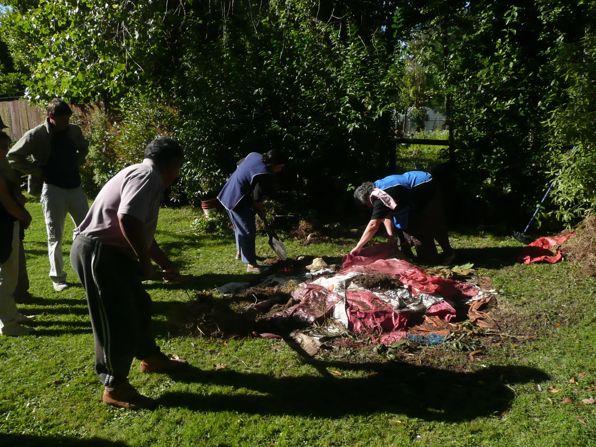
One of the things I had read about in our Lonely Planet Chile was a "curanto". This is a traditional meal consisting of all local foods cooked in a pit in the ground and served sometimes to the whole community after a house-raising or large community project. Today, the meal is usually prepared in a large pot and served to tourists as a taste of Chile. We, however, were lucky enough to have been invited to a Chileano home on Isla Tenglo across the bay from the yacht club where a traditional "curanto" was being prepared. It was not only fascinating to watch the preparation, but the result was outstandingly delicious.
The pit had already been dug when we arrived and the wood fire had been started. Layers of sausage, chicken, shellfish, potatoes, beans, pork and beef were put on the fire. The final addition was a potato bread called miclao which was delicious. Once all the food was put in place, it was covered with huge leaves, then grass sod and dirt and tarps were placed on top for the whole thing to steam cook. It only took about 40 minutes total for everything to cook and the result was wonderful. Huge platters of meat, shellfish
and veggies served to hungry cruisers.


It wasn't all play though. Many things broke on our passage from Ecuador plus all those parts and gear we brought back from the USA had to be installed. Midst all the fun and socializing at the yacht club, we put in many hours and long days to get Nine of Cups shipshape and back into sailing condition so we could leave for our Pacific transit. The list seemed endless, but finally we were ready to head out.


Isla Grande de Chiloé - February 2009

Isla Grande de Chiloé is Chile's second-largest island (3241 sq mi) and South America's 5th largest island. It is 118 miles long and averages ~35-40 miles wide. The scattered islands of the Chiloé archipelago are sheltered from Pacific storms and thus very attractive for sailors.
Local folklore. myths and legends involving trolls, sea monsters, and ghost ships accentuate Chiloé's unique history. The island’s traditional culture coupled with its impressive natural beauty made it a must-see place before we left Chile.
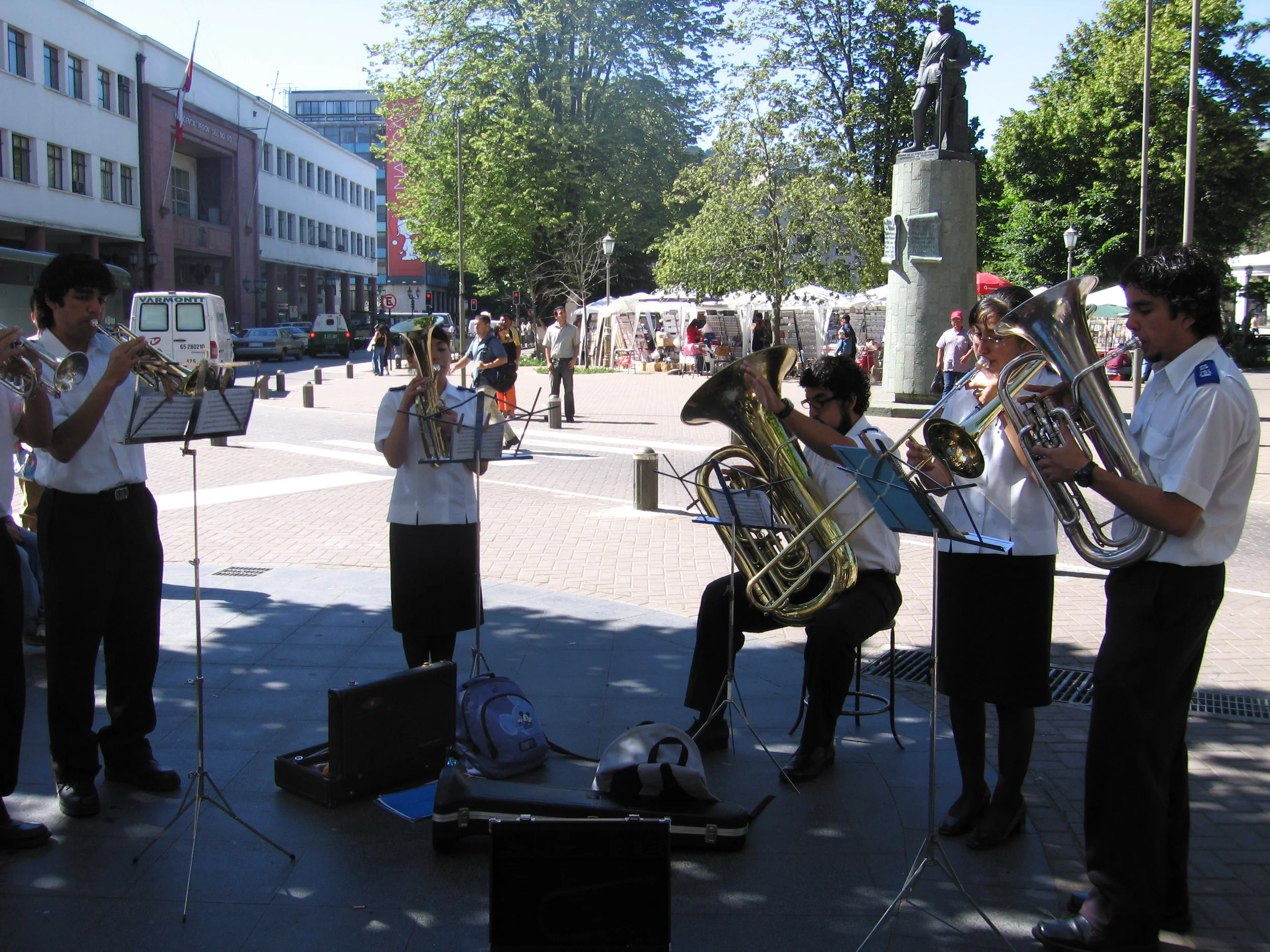
Our first exposure to Chiloé was coming through the Canal Chacao on our way to Puerto Montt. Later, we took a bus ride there to belatedly celebrate Marcie's birthday. We took the ferry across the Canal the last time and a long bus ride down Ruta 5 as far as Castro where we walked around, had lunch and generally got the feel of the place.
One can only get to Chiloé via boat/ferry ... no bridges connect it to mainland Chile or the South American continent. It was pretty obvious to us that we'd need to do more exploring by boat to really get to appreciate Chiloé and experience its people and culture.
The area is absolutely beautiful and, as always, we could have spent more time.
One of the local landmarks of Chiloé is its "palafitos" or houses on stilts that line the coast in certain areas. Due to the high tidal range (6+M), these houses make a lot of sense. In the 1960 earthquake and resulting tsunami, many were washed away, but here they either survived or were rebuilt and provide shelter as well as "eye candy" for tourists and photographers.

We left Puerto Montt in mid-February 2009 and headed to the archipelago of Chiloé once again, this time on Nine of Cups, a much better way to travel in our opinion. We left on an afternoon high tide and motored about 12 miles to an anchorage off the tiny island of Huelmo. We anchored in Caleta Huelmo for the night and never went ashore. It was good to just relax and decompress after the final hectic days in Puerto Montt.
We motor-sailed the next day taking advantage of the current and a 10-knot breeze and made the 50 miles to Caleta Añihue in a quick 7 hours midst fog and rain. For three days we waited and for three days, the high winds and heavy rain continued. By the fourth day, rather disappointed, we opted to leave without having gone ashore.
Thirty miles and about 4-1/2 hours away was Estero Pindo, a bay surrounded by the island of Quehui and protected on all sides from the wind. We arrived in the afternoon, having traveled through more wind and rain. However, a ray of hope emerged as the sun peeked through the clouds very late in the day. Our patience (or lack thereof) was finally rewarded with a spectacularly sunny day. We launched the dink and went ashore at the tiny village of Los Angeles.

The focal point of every village and island inChiloe is its ancient wooden church, usually painted in bright colors and dating back to its Jesuit founders.
It was good to finally get ashore, stretch our legs and do some exploring. A yellow house was marked "Cafe", but was also locked. Not a problem though when a few moments later, the owner, Ruth, appeared and along with her son, Ignacio, we were served coffee (read that Nescafe), some "murta", a local liqueur made from wild berries, and a torta which resembled a doughnut. While in the cafe, Marcie noticed a homemade knitted patch doll, a style unique to Chiloe, and ended up buying it as a souvenir.
After our snack, we leisurely walked around the village, visited the church and its tiny cemetery and enjoyed every minute of it. While walking, David noticed that blackberries were in season and abundant. Marcie clicked while David picked. We had Blackberry Crumble for three days in a row and refrigerated more berries for another day. Our red-stained hands and mouths lasted for days ... lots longer than the blackberries did.


We motor-sailed about 30 miles in fog and mist to Estero Pailad. According to the cruising guide, this is one of the more beautiful anchorages in the Chiloe archipelago. It is serene, beautiful and teeming with birdlife. Though misty throughout the day, the sight of black necked swans off the stern provided all the incentive we needed to launch the dinghy and go exploring. Birdwatching was outstanding!

A typical scene in Chiloe ... an old wooden church with animals calmly grazing nearby.


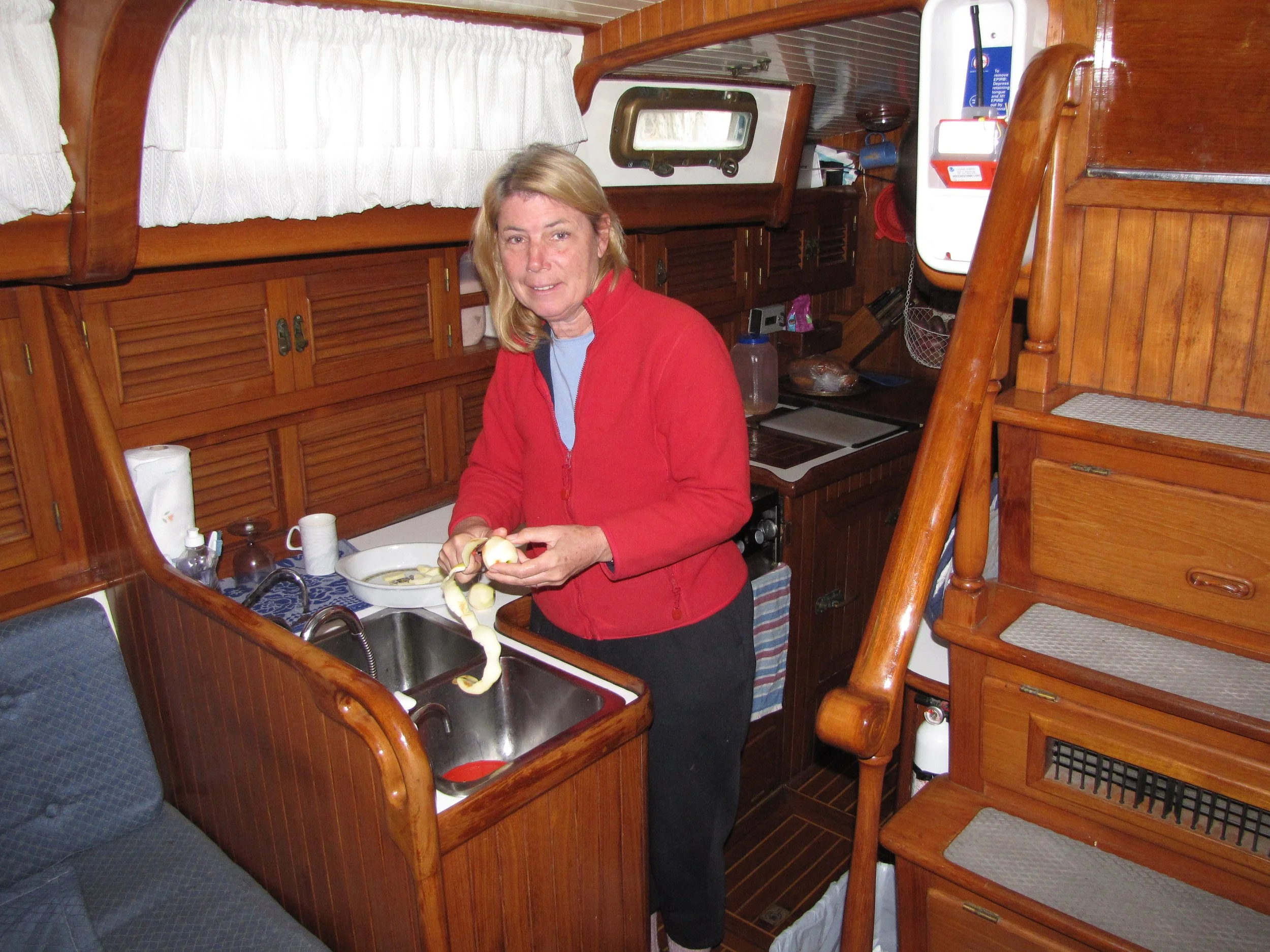
It was also apple season in Chile. A local fellow pulled up to the boat asking if we liked apples and produced a huge bag full. We couldn’t refuse and Marcie pared apples in preparation for the apple crumble, apple pancakes and apple cake.

We intended to leave Estero Pailad and sail directly to Castro. As so often happens on a boat, things do not go as planned. Motoring up the anal de Yal on mirror calm water, the engine quit suddenly. David bled the lines and we tried to restart, and he bled the lines and we tried to restart, and, well, you guessed it. The engine would not restart. We found an anchorage within a few miles away at Estero Ichuac put out the jib to take advantage of what little wind there was and launched the dinghy. The initial diagnosis: the injector pump ... it was only putting out fuel to two injectors.
We didn't go ashore although it did look appealing. Instead, we spent the evening discussing alternatives and possibilities. We had heard about a marina in the area from friends, but had no idea exactly where it was. An addendum to the cruising guide provided its location (only 2.5 miles away across the bay) and contact information. Owner, William Bannister, answered our email within an hour and we had a plan. Just for grins, we tried to start the engine again but no go. On a slack tide with no wind at all, we hip-towed Cups across the bay with our dinghy. As we neared the marina, William came out to meet us and gave us a tow the rest of the way to the end of a T-dock. We were warmly welcomed to Marina Quinched.


Marina Quinched was awesome. The marina offered hot showers (wonderful!), use of a free washer (very wonderful), free wifi (the most wonderful), and all the blackberries and apples we could eat (beyond wonderful)! Marcie did laundry, boat chores, updated the website and canned fruit while David worked on the engine.
An amazing story ... William contacted a mechanic who recommended a fuel injector pump repair shop in Castro. In the meantime, however, David disconnected the injector pipes from the pump and discovered first that fuel was being pumped to only two of the injectors. After further investigation, he discovered an air bubble in the cold start reservoir. He disconnected the overflow line to the reservoir and ran the fuel pump until the reservoir was full. The output of the injector pump was now providing fuel to all four injectors. He reassembled the works and the engine miraculously started. Now the issue...why air in the system? In the end, David engineered and constructed a diesel daytank that automatically fed the engine and overcame the air-in-the-line problem. It turned out to be a permanent fix to the problem.
William took us to Castro for a huge provisioning at Supermercado Beckna and then again for a visit to the Saturday "feria" (fresh market) and crafts market. We topped up our provisions and did a bit of souvenir shopping.


Laundry caught up and fresh provisions aboard, it was time to go.It’s always bittersweet to part with friends, but always exciting to be heading towards a new adventure. We hugged friends goodbye on the dock and William bid us farewell.
Minutes later Nine of Cups was underway heading to Juan Fernandez Islands and points west. Come along with us!