

More Lake Mead Hiking – 7 Falls Canyon Trail
/
All Trails map of Seven Falls Canyon Trail
We chose the Seven Falls Canyon Trail for our next trek in the Lake Mead National Recreation Area, hoping that the trail name was due to waterfalls and not the number of tumbles taken by the hikers who foolishly chose to walk here.
It was still chilly (high 50s) when we set out, but sunny and a pleasant temperature for walking. Our All Trails app described the trail as moderate difficulty, lightly trafficked, for hiking and rock climbing. We envisioned it was comparable to the Red Rock Canyon trails we’d just tackled last week with some ups and downs … with maybe a little bouldering and scrambling.

Big horn sheep on the Seven Falls Canyon Trail
I grumbled and griped the first couple of miles as we trudged along a rough, dry, desolate, boring gravel road which seemed to continue forever. As we drew closer to the hills, however, and veered off the road onto the hiking trail, we spotted some big horn sheep on a steep escarpment which improved my mood tremendously.

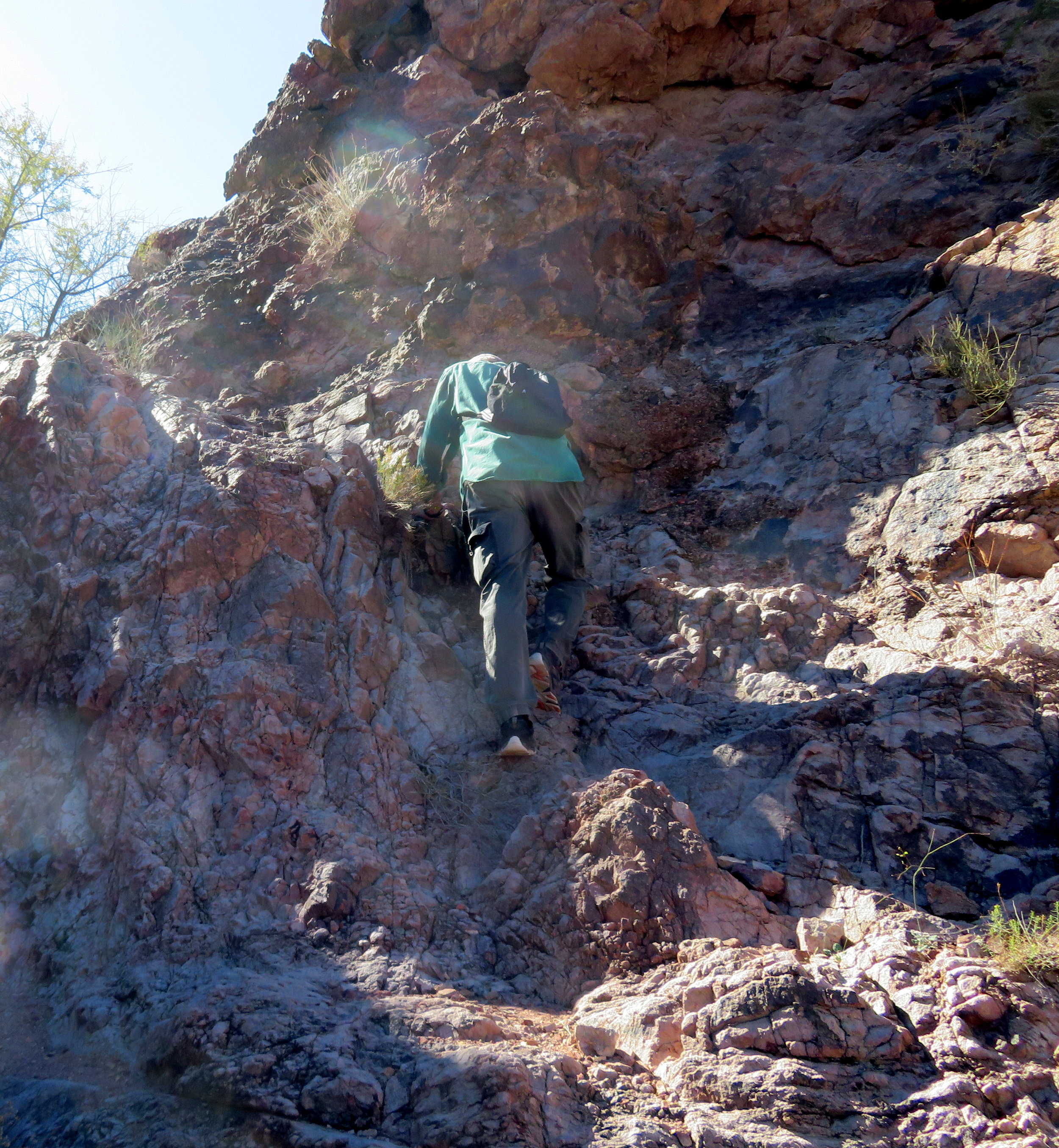
Where’s the trail?
The trail was not well-marked. In fact, we figured we were perhaps on a game trail for the first ¼ mile or so, but a well-placed cairn confirmed that we’d finally joined the actual path. We climbed steadily … up, up, up … through rocky, rough terrain. I find the steep scrambling on scree and loose gravel a challenge. David scampers up and then lends me a hand when necessary.

Views from the top were awesome
Once on the top of the escarpment, the views were great. The wind, however, was strong and brisk and it took a concerted effort to keep our hats on our heads and our balance at the same time. In my defense, I was also chewing gum … so that would have been three activities at one time. About three miles in, we began our descent. The trail was nowhere to be seen, but with the help of All trails and some reconnaissance, we managed to regain it again.
What the All Trails app didn’t tell us
What the All Trails app did not indicate was that the descent was not ‘near’ or ‘around’ the falls, but rather down the chutes of the falls themselves. This time of year there are no waterfalls, but this would definitely be a no-go area during flash flood season. As we approached the first fall, I leaned over, looked down. Really? It was about a 10’ vertical drop. David maneuvered down easily, remembering and utilizing his old rock climbing techniques. I scooted down from rock to rock on my butt without too much difficulty. One chute down … six to go. If they were all like this, it wouldn’t be a problem.
But, of course, they weren’t all like the first one and, in fact, the falls became progressively harder, steeper and higher as we went on. Usually, there was a butt-sized shelf or nook to position myself from rock to rock. On occasion, David would secure my foot placement and once I even stood on his shoulder to step down. Not easy, but still manageable. I wondered how easy it would be to climb back up the waterfalls if it was necessary to retrace our steps.
I think frequently of the ramifications of falling and breaking something. A friend recently broke her hip and has had a long road to recovery. Both our moms broke hips and struggled to regain their mobility. The effect of any broken bone or injury on our current travel/life plans would be abysmal. Of course, I could also trip on my shoelace and fall and break something. Back to reality...here we were and I dismissed all the negative thoughts in favor of a more optimistic plan for getting through the rest of the waterfalls safely.
We maneuvered through Falls 3 through 5 with some difficulty, but no noted injuries. Then we approached Falls #6 … about a 15-20’ sheer vertical drop with no notable butt-shelves for my descent. With ropes, it would have been quite doable, but otherwise, it posed a problem. We discussed the possibility of tying our clothes together like a rope … long-sleeved shirts and jeans … to belay ourselves down.

Did we just come down that?
We looked for an alternate route which meant scrambling up the steep canyon wall, maneuvering along a narrow rock ridge, then descending on the opposite side, down a very steep grade to the canyon floor. There were too many obstacles to glissade, so we picked our way slowly and carefully down … me, mostly on my ass. I sighed in relieve when we were finally down and regained a somewhat even terrain on the trail and discovered that we’d circumvented both Falls 6 and 7! Whew!

There’s Blue in the distance … waiting patiently for our return.
I thanked my lucky stars that I was wearing thick Levi jeans because thinner jeans would have chafed through and worn my bottom raw. As it was, our hands and arms were cut and scratched, but we were down, uninjured and still among the living. Within another mile we spotted Blue in the distance, patiently waiting for us right where we’d left him.
As always, now that the ordeal is over, we view it as a good adventure … one to share. Don’t count on me tackling the Seven Falls Canyon Trail again. Well, maybe with ropes. I think, however, there are plenty of other great trails around that pose less wear and tear on my bottom.