

Back to Las Vegas – Slowly – Part 2
/North Platte, Nebraska to Grand Junction, Colorado – 264 miles
It was sunny but below freezing (31F) when we left North Platte, a definite indication that we should get a move-on. We made good time on I-80 at 75 mph and planned a stop in Ogallala, Nebraska. If you’ve ever read or seen Lonesome Dove, you’ll remember Gus’s old love, Laurie, settled there and he visits her towards the end of the book/movie. We were there, however, to visit Boot Hill so-named because wayward and/or unlucky cowboys were buried with their boots on. The bodies, placed in canvas sacks, were lowered into shallow graves and marked with a wooden headboard.

Ogallala had quite a reputation back then, as a lawless, ruthless place. According to the Boot Hill website, “In his book “Log of a Cowboy”, trail driver Andy Adams wrote, “We finally scaled the last divide and there below us in the valley of the South Platte River nestled Ogallala, the Gomorrah of the cattle trail. From amongst its half hundred buildings, no church spire pointed upward, but instead, ¾ of its business houses were dance halls, gambling houses, and saloons.” One trail boss, who let his trail drivers go into Dodge City for recreation when they arrived there, refused to let his cowhands come into Ogallala because of its wild and unsavory reputation – thus giving rise to the phrase that Ogallala was the “town too tough for Texans.”’ It’s not too tough for old Nevadans these days, so we headed to the cemetery.
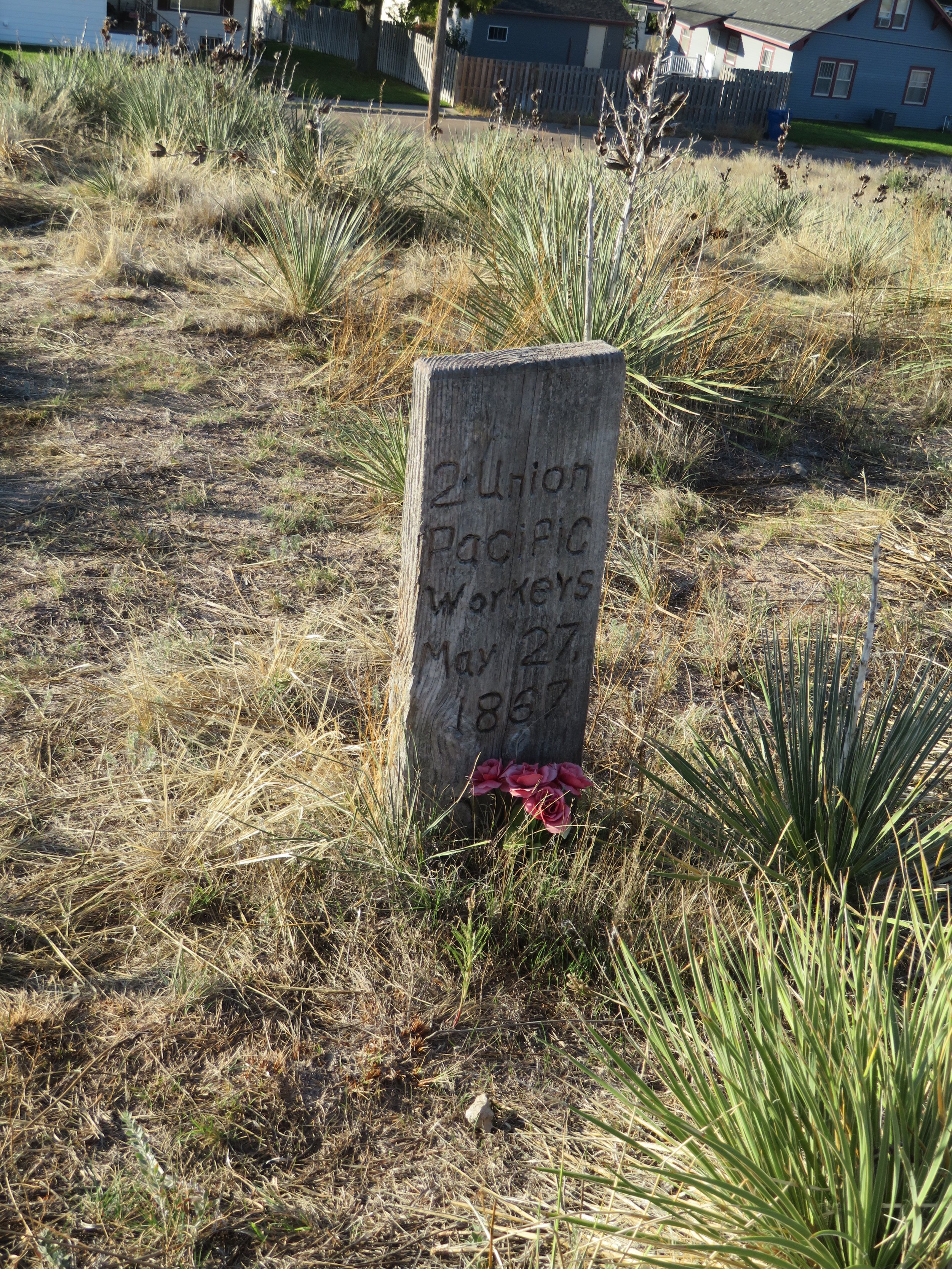
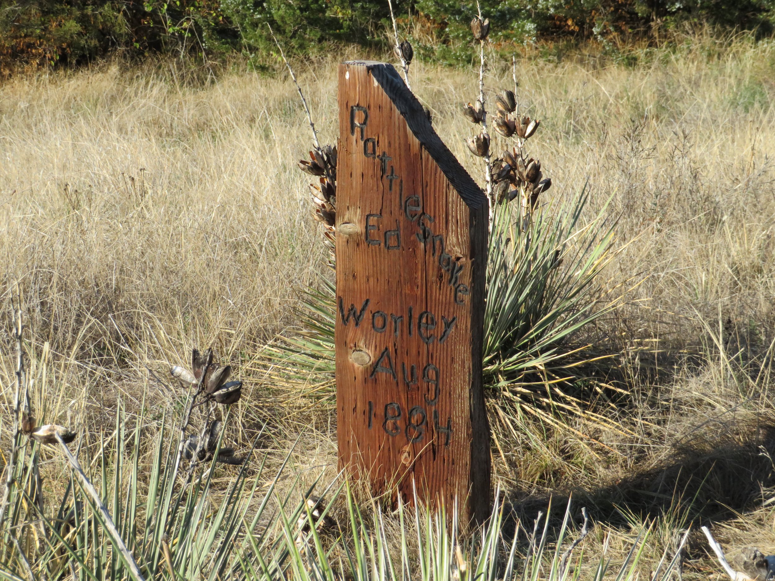
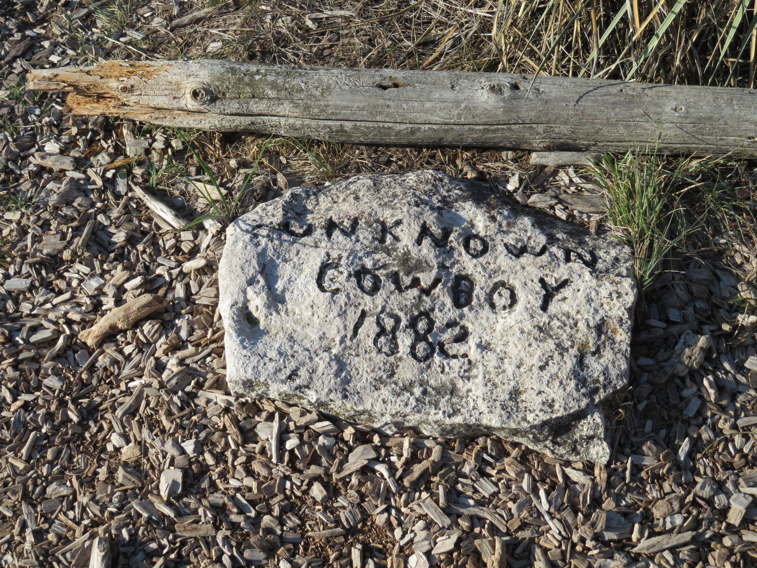
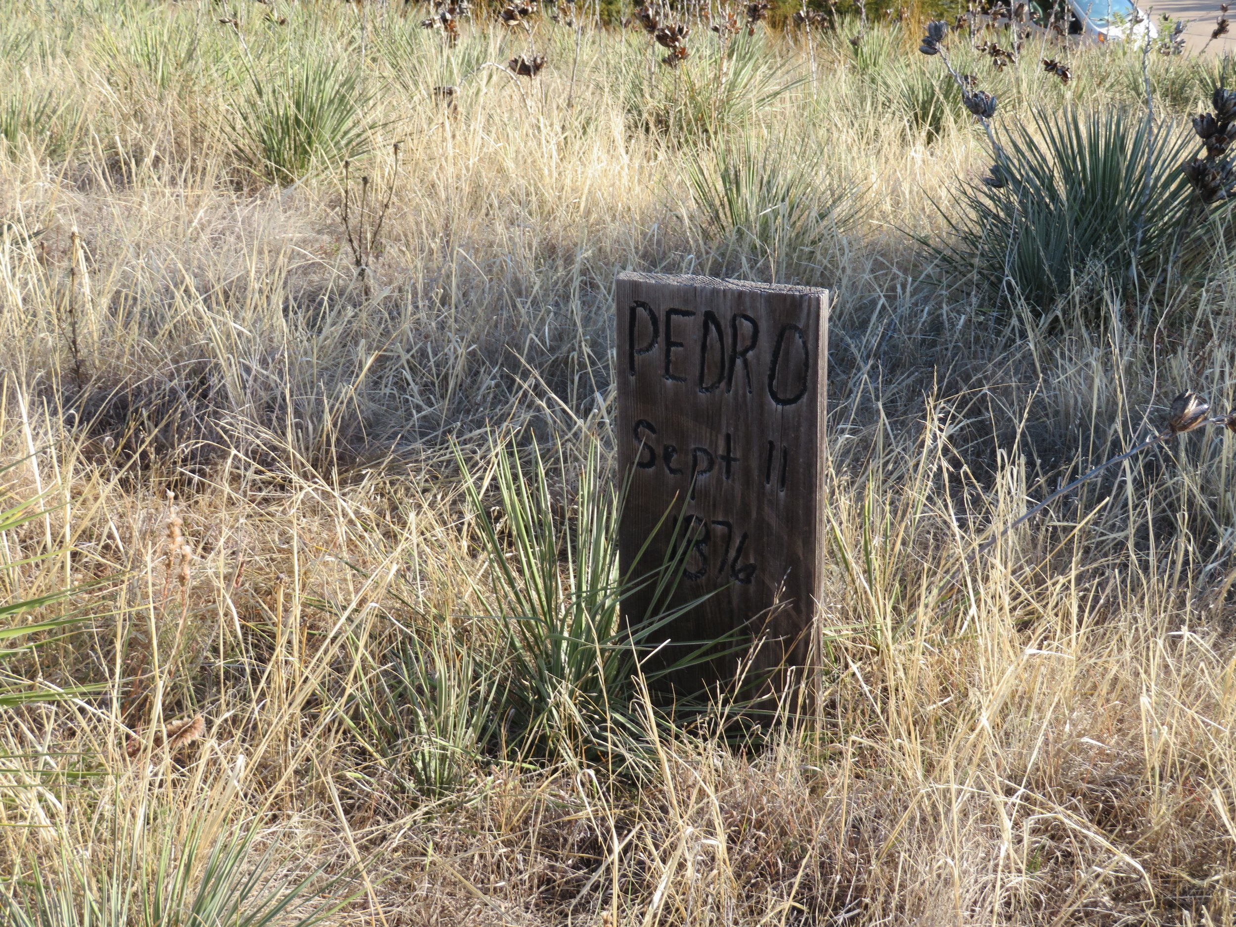
There’s no record of when the cemetery on the bluff overlooking town first came into use, but it was abandoned in 1885 when another cemetery was established. It’s estimated that at least 48 bodies were interred there

We took a self-guided walking tour of the cemetery. It was cold and windy on the top of the bluff, but the sky was clear and blue. Most of the wooden markers have been replaced over the years, but the cemetery remains a historical landmark.
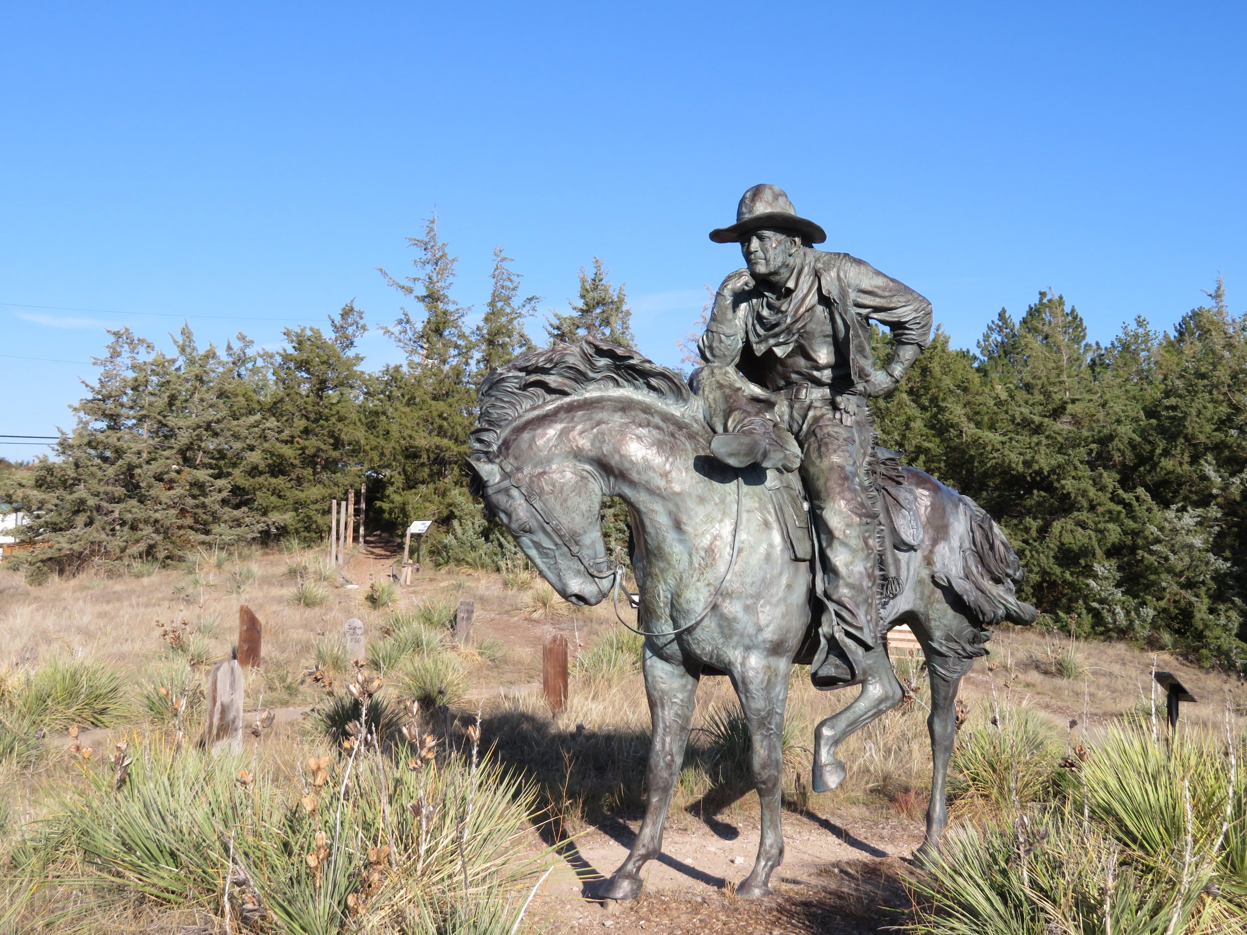
“Trail Boss” by Robert Summer stands midst the graves on Boot Hill.
Back on the interstate, we soon connected to I-76 and headed to Denver across Colorado’s Eastern Plains. We were in more familiar territory now. When it was time for another break (which are quite frequent for us as you might have guessed), we stopped in Fort Morgan and found a pleasant 2-mile walk along the South Platte River on the Riverside Park Trail.

After below freezing temps this morning, it was downright hot in the Colorado sun walking on the gravel trail. At 70+F, we were sweating by the time we walked In the AFTERNOON

Deer browsing along the riverside trail

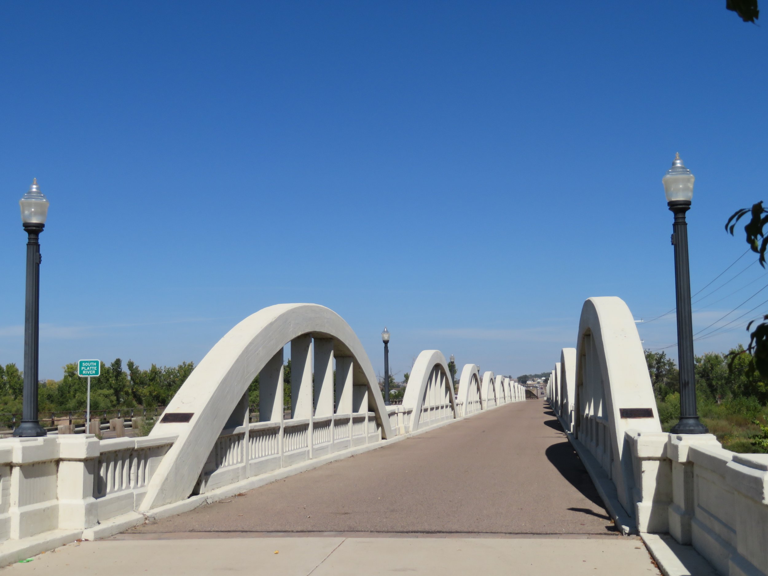
The highlight of the walk was the Rainbow Bridge aka Marsh Arch Bridge. Built in 1922, it has withstood weather, time, and three massive floods for the past century with only minor damage.
Though the trail and surroundings were enjoyable, the foul, acrid smell in the air was disgusting. Between the stench of sugarbeet processing, compliments of the Great Western Sugar Corporation, the refinery, and the feedlots on the outskirts of town, the air was offensive and nearly stifling. Evidently local residents have complained and filed suits and apparently the air quality has improved, but there’s still a long way to go, based on our experience.

Trains transporting coal extended for what seemed like miles on the flat plains. Open coal cars brimming with chunks of coal snaked along the highway.
We connected to I-70 and made our way to Denver for the evening, all primed for tackling the Rockies on the morrow. We were fortunate to have free hotel night points for our return trip because the cost of hotels has skyrocketed. Ouch for travelers!
Denver, Colorado to Grand Junction, Colorado – 244 miles
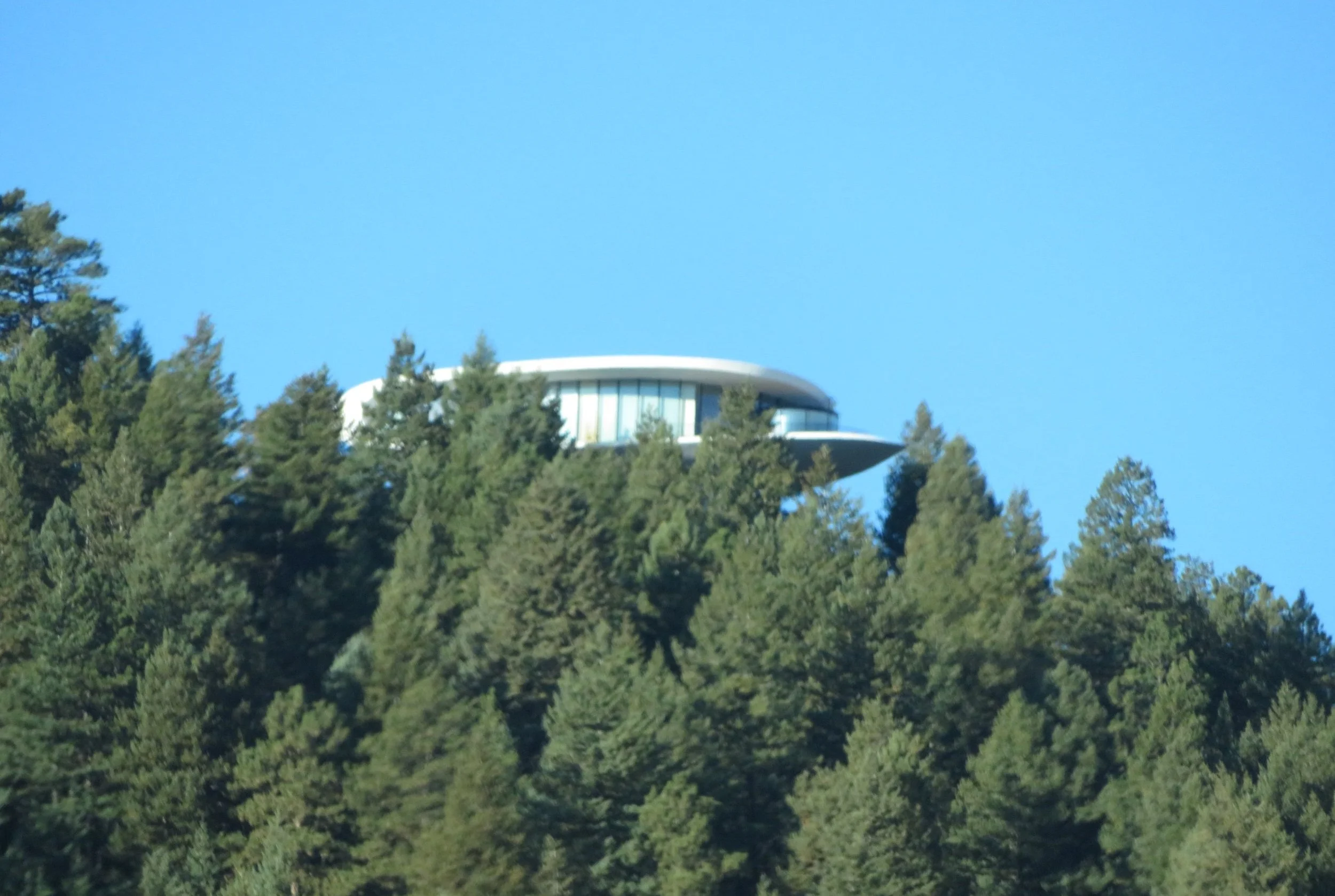
It was in the mid-40s when we returned to I-70 and headed west up into the mountains. The temperature dropped as we climbed. We’ve driven this route innumerable times and you’d think some of its majestic beauty would be lost on us because of its familiarity, but it really hasn’t. We passed by the ‘Sleeper House’. Built on Genesee Mountain, it “is a distinctive elliptical curved house built … in 1963 by architect, Charles Deaton...[and] featured prominently in the 1973 Woody Allen, sci-fi comedy, Sleeper”, a classic if you’ve never seen it.
Bison were visible near Lookout Mountain. Part of Golden’s Buffalo Herd Nature Preserve, the herd of 2-3 dozen animals are direct descendants of the last wild herd of bison in the U.S. They all came from a herd of 7 bison brought from Yellowstone National Park in 1914.
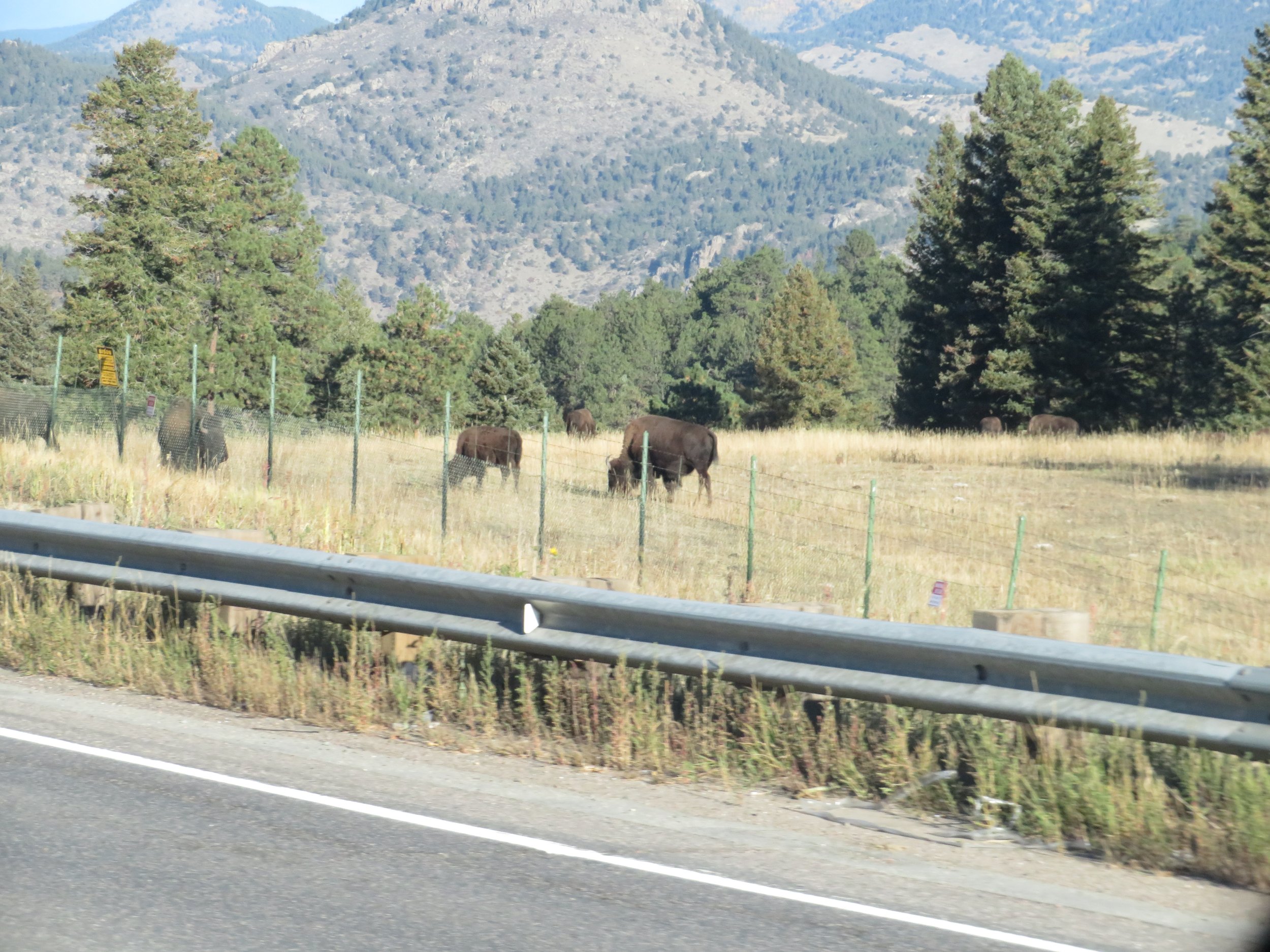

The sight of the Rockies stretching before us as we crested the highway near Lookout Mountain is always inspiring. You can see the bison herd grazing on the Right.
Whenever we travel this road, mining is forefront in our minds. First, the Argo Mines in Idaho Springs come into view. Once a gold mining and milling facility, it closed permanently in 1943 and is now a tourist attraction.

The tailings which scar the land nearby remind us of the damage done by mining when no laws were in effect to prevent it.

Aspen trees were in full fall color, glistening gold midst the evergreens under a cloudy Colorado sky.

According to Wiki, the Eisenhower Tunnel, first opened in 1973, travels through the Continental Divide at ~11,000’ above sea level and is 1.7 miles long. Definitely makes your ears plug up. When it was originally opened, “ it was the highest vehicular tunnel in the world. Since then, higher tunnels have been built across the globe.” It remains, however, the longest vehicular mountain tunnel and the highest point in the United States' interstate network.

Whenever we pass through the tunnel, Stephen King’s ‘The Stand’ comes to mind. Imagine treading your way through this tunnel in the dark with cars bumper to bumper, their inhabitants either dead and decaying within or hiding or having fled. It’s the stuff nightmares are made of, exactly the imagery King intended when he wrote it.
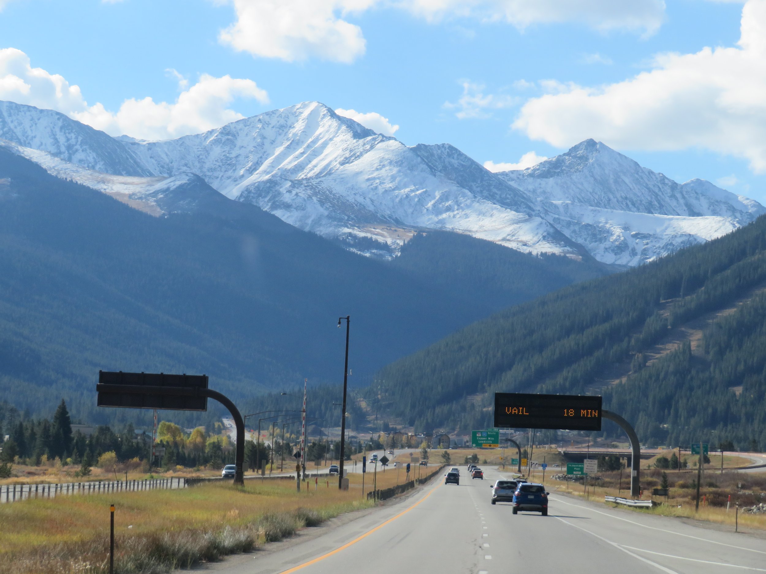
Once through the Tunnel, signs for the ski resorts began… Keystone, A-Basin, Steamboat, Breckenridge. We passed through Vail and viewed the dry ski runs at Copper. Judging from the snow on the mountaintops, they’ll be skiing in another month or two.

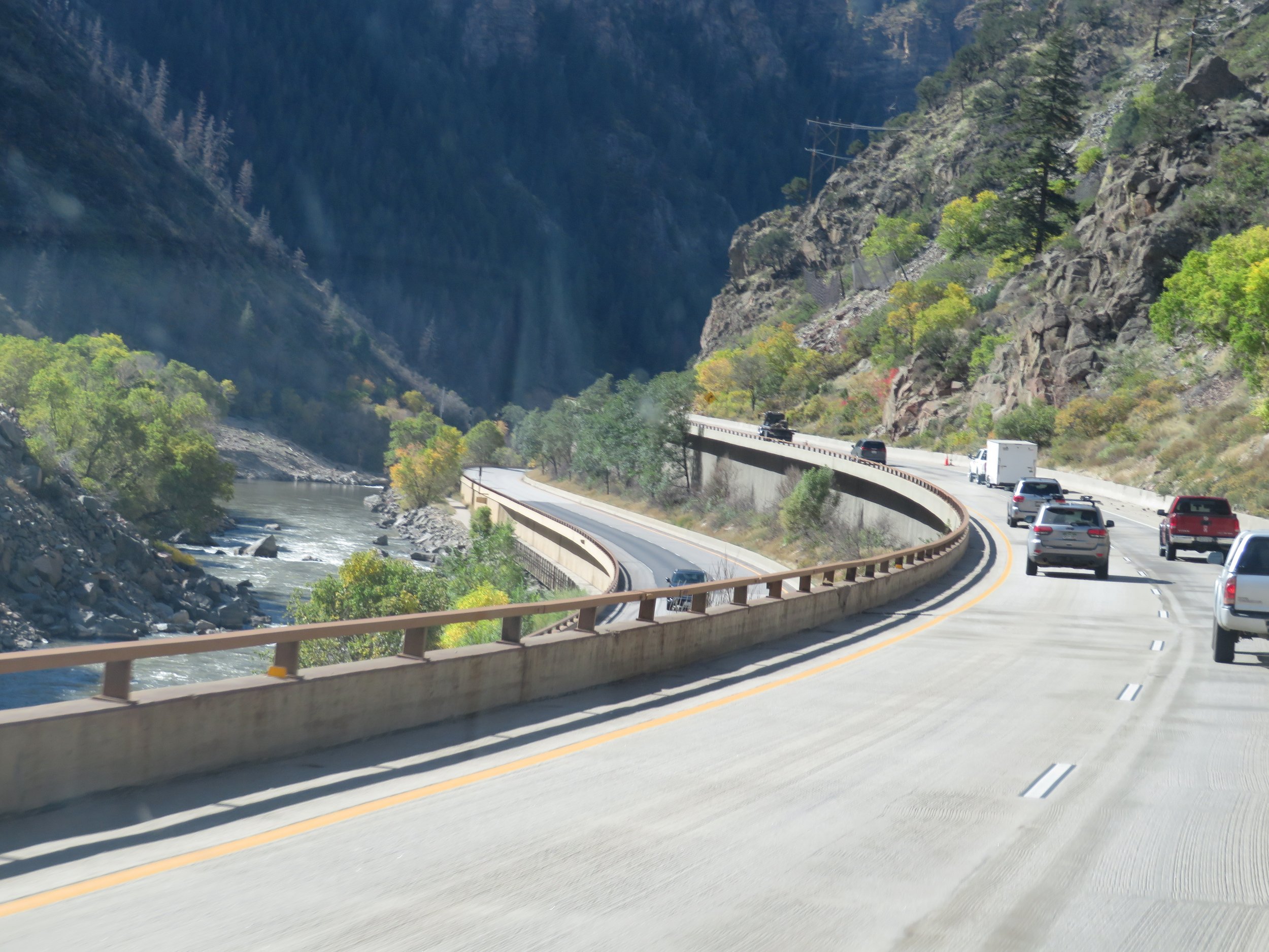
Glenwood Canyon, still recovering from massive rock and mudslides, is a wonder to pass through. The highway splits into two, with upper and lower decks. The canyon walls close in on you as you speed along.
We stopped in Glenwood Springs to pay our respects to Doc Holliday. The half-mile, steep, rocky gravel path to Linwood Cemetery climbs upward with a 230’ elevation gain. We’ve been flatlanders for the past few months and we were huffing by the time we reached the top at nearly 5,800’.

John Henry Holliday (1851–1887), aka Doc Holliday, was an American gambler, gunfighter, and dentist. He maintained a fierce persona as a friend of Wyatt Earp’s participating in the Gunfight at the OK Corral in Tombstone Arizona. He died of tuberculosis in Glenwood Springs, addicted to laudanum to ease his pain, and totally destitute.

Also residing in the same cemetery was Kid Curry and we paid his grave a quick visit. We weren’t familiar with Harvey Alexander Logan, aka Kid Curry, but soon learned that he was an American outlaw and gunman who rode with Butch Cassidy and the Sundance Kid's infamous Wild Bunch gang during the late 19th and early 20th centuries.

Kid curry’s grave at Linwood Cemetery in Glenwood Springs, Co.

The Wild Bunch Gang… Sundance sitting left, butch cassidy is sitting far right Kid Curry is standing far right.
Just before we reached Grand Junction for our overnight stay, we stopped in Palisades, CO for a quick walk at the Riverbend Park along the Colorado River. Palisade is mostly known for its fruit production, especially Palisade peaches, and more recently for its vineyards.

Colorado River view as we walked along the Riverbend Trail in Palisades, CO.
Grand Junction, Colorado to Beaver, Utah – 285 miles
Though parts of this section of I-70 are scenic, most of the distance between Colorado and the Utah state line is a non-descript, parched stretch of land studded with scrub, sage, and rabbit brush. Signs warn there are no services for 70 miles. The high point just after the Utah border is a “Watch for eagles on the road” sign. We always look but as yet we’ve never seen an eagle in the air in this area and certainly never on the road.

In Utah, the scenery begins to change and we look for familiar landmarks. This time we stopped for a break at Black Dragon Canyon and admired the view.

Black Dragon Canyon along I-70 in Utah.

Utah’s landscape is dramatic.
At the 80 mph speed limit, we covered the miles quickly arriving in Beaver, Utah late afternoon. Beaver, Utah? Named in 1858 for the many beaver dams found there, two famous folks hail from this little town… Philo T. Farnsworth, the inventor of television, and Butch Cassidy, the notorious western outlaw. I have no more to say.
Beaver, Utah – Las Vegas – 227 miles
No more exploring. Though the ride through the Virgin River Gorge is outstanding, we were in get-home mode and didn’t dawdle. For nearly five months, we’ve been on the road and we were on the final leg back to Las Vegas. Our total trip driving mileage will be ~15,000 miles and our bicycle mileage 1500+ miles. From driving the US-2, the high road from Washington to Maine, to a circle trip around Lake Superior, to a lobster dinner in Maine, a bicycle trip from D.C. to the outskirts of Chicago, and everything in between, it’s been one fabulous summer.
Are we glad to be home? It’s always a bittersweet time for us like the end of a long passage. Getting home will be good, but completing a trip is always a bit of a letdown. Over… already? Never fear, we’re already planning our trips for next year and the year after. We’ll let you in on our plans once we figure them out for ourselves.