

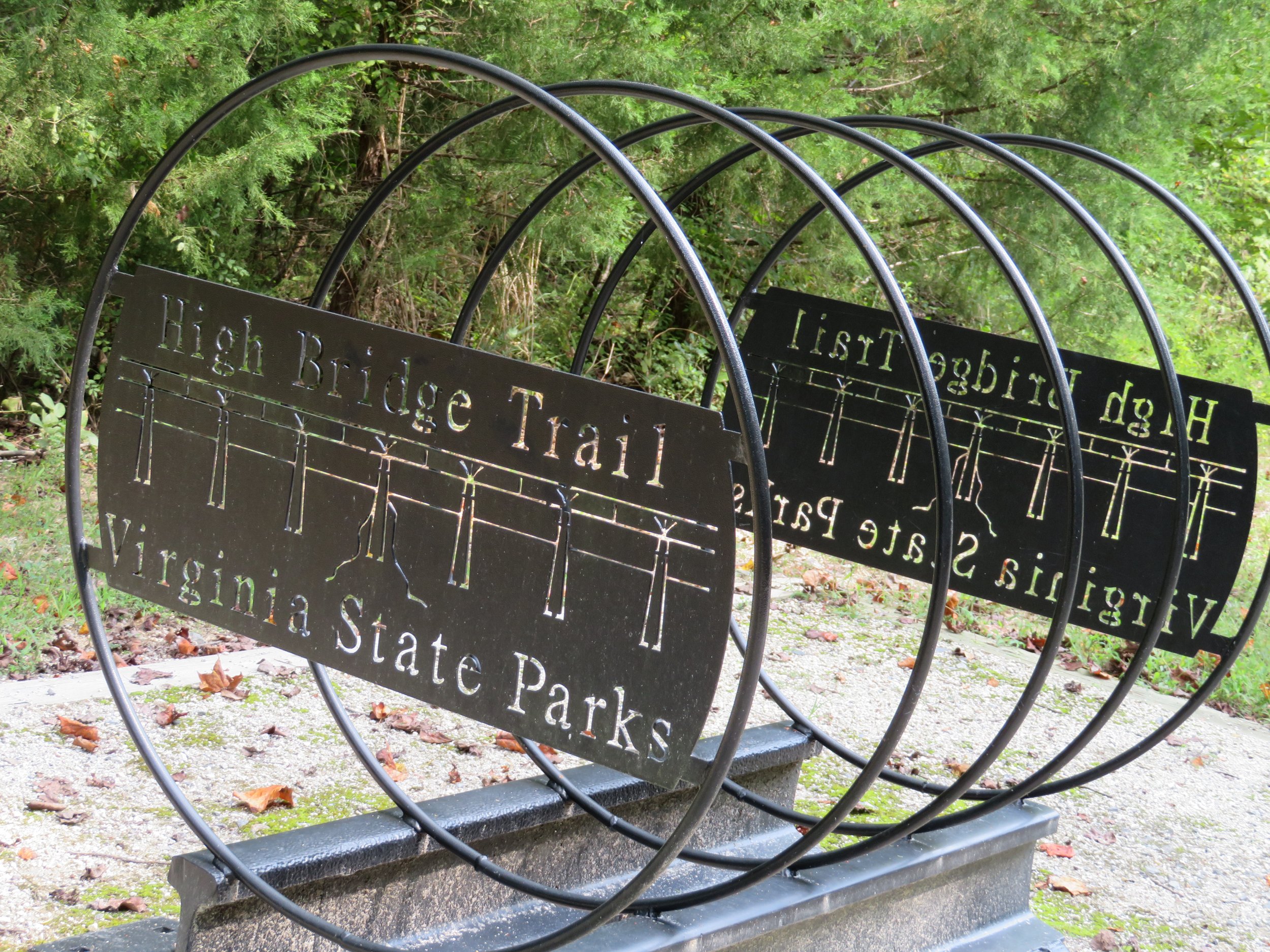
Riding the High Bridge State Park Trail
/“There have been higher bridges not so long, and longer bridges not so high, but taking the length and height together, this is, perhaps the largest bridge in the world.”
-C. O. Sanford - High Bridge engineer
High Bridge State Park Trail - 31 miles RT
Brennan and Hannah are avid bicyclists and before leaving Richmond, Brennan enthusiastically recommended riding the High Bridge State Park Trail near Farmville, Virginia. Since it is only 65 miles southwest of Richmond and we hadn’t ridden in a couple of weeks, we decided to give it a go.

Farmville, established in 1798, is a charming town with lots of history. Downtown touts a myriad of restaurants, shops and lots of historic old buildings. The trail crosses Main Street and we easily found a free public parking lot for Blanche close by.
The day was sunny and beautiful. The 31 mile long trail is a mix of paved and crushed limestone, level and easy riding. It was good to be back in the saddle again, although our butts weren’t all that keen about it and complained a bit at the end of the day. After a nearly 3 week hiatus, all of our cycling body parts evidently needed to toughen up again.
The High Bridge is the centerpiece of High Bridge Trail State Park. Built by the Southside Railroad in 1854 across the Appomattox River, the rail trail follows the path of the old connector line between Petersburg and Lynchburg. During the U.S. Civil War, Confederate forces attempted to destroy the bridge in the Battle of High Bridge, but were unsuccessful, leading to Lee’s surrender in Appomattox.
According to Wikipedia, Norfolk Southern’s last train crossed High Bridge on October 26, 2004… and [the railroad subsequently] donated 31 miles of abandoned track to the Virginia State Park system, intending it as a park with the High Bridge as its centerpiece. Virginia has done a great job of renovating the bridge and repurposing the railbed into a multi-use recreational trail.
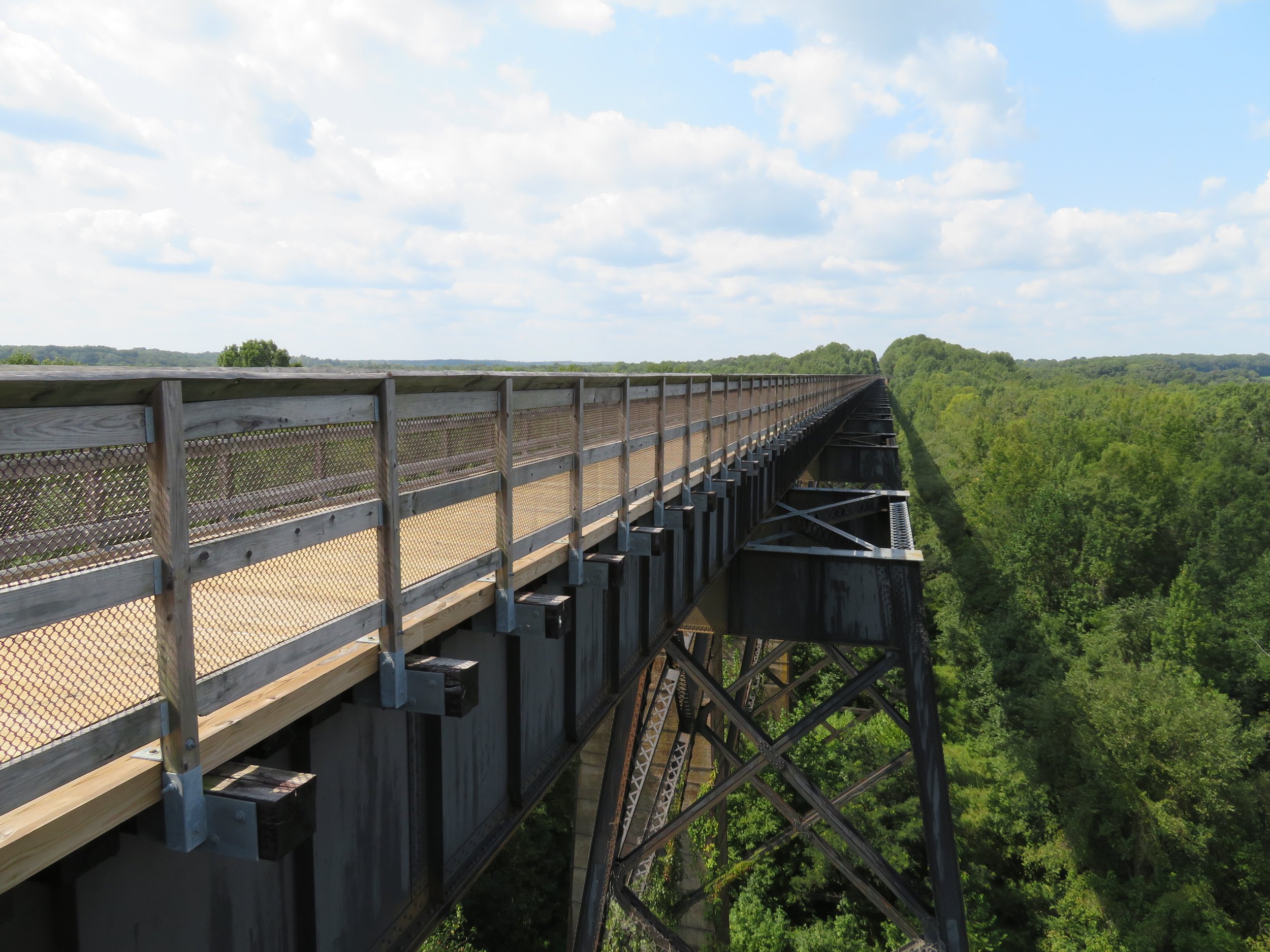
The bridge is approximately 2,400 feet (730 m) long and ranges from 60-125 feet (18 to 38m) high. It’s all planked and our bikes rumbled and shook as we rode across.

We were above tree line and there were plenty of spots to stop and check out the Appomattox River and the sights far below.

The Mile Marker 00 is located in the middle of the bridge and the trail runs east-west from this point.

The High Bridge is not only an historical bridge and architectural achievement for its time, it is considered a Virginia Landmark.


We anticipated something grand at the east end of the trail when we reached it, but alas, the trail just stopped. A picnic table provided a place for a quick snack before reversing our direction and heading back to Farmville,

A milestone was reached on this ride. We’ve ridden 1000 miles on our new bikes since we started our first day on the Great Allegheny Passage (GAP) heading to Pittsburgh.

After our ride, we headed back toward Pennsylvania, bound for the Flight 93 National Memorial. We found ourselves on Route US-30 West, aka the Lincoln Highway.
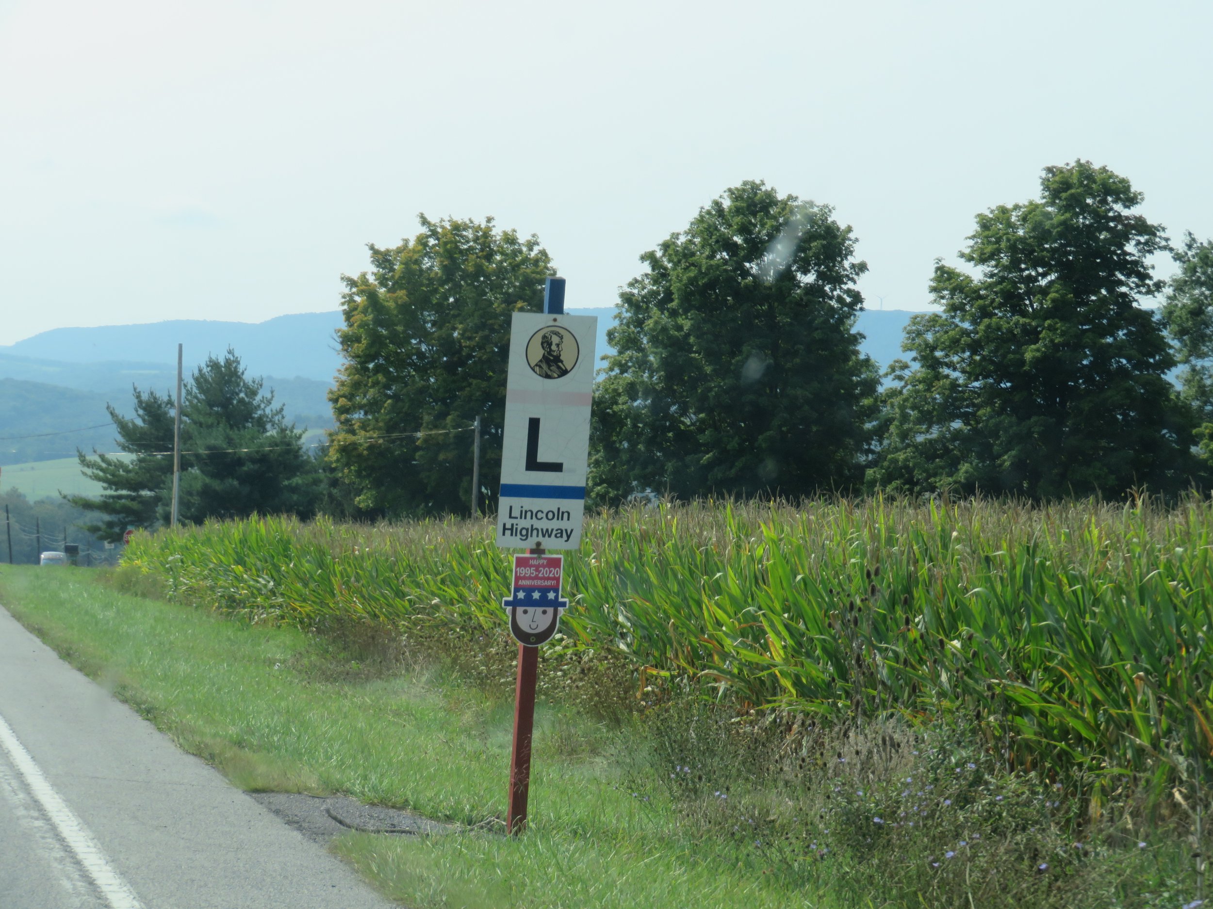
According to Wikipedia, the Lincoln Highway, first conceived in 1912 and dedicated in 1913, is the first road for automobiles across the United States. It runs coast-to-coast from Times Square in New York City west to Lincoln Park in San Francisco. Due to highway realignment, it’s all in bits and pieces now, but we picked up a section of it on our route to the National Memorial.
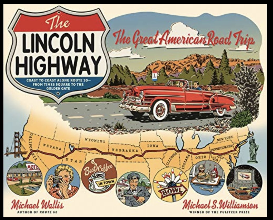

There are several books about the highway and its impact on early road travel in the USA. Additionally, we recently read a novel, The Lincoln Highway by Amor Towles. It’s excellent if you’re looking for a good read.
We’ve been away from Las Vegas and pretty much ‘on the road’ since the end of May. Las Vegas has begun to cool down and within the next few weeks we’ll consider heading back home. Until then, we still have much to explore and Ohio trails to ride.
In my next blog, we’ll be visiting the Flight 93 National Memorial. It’s an emotional experience. Join us.