

Valdez… More Than an Oil Spill
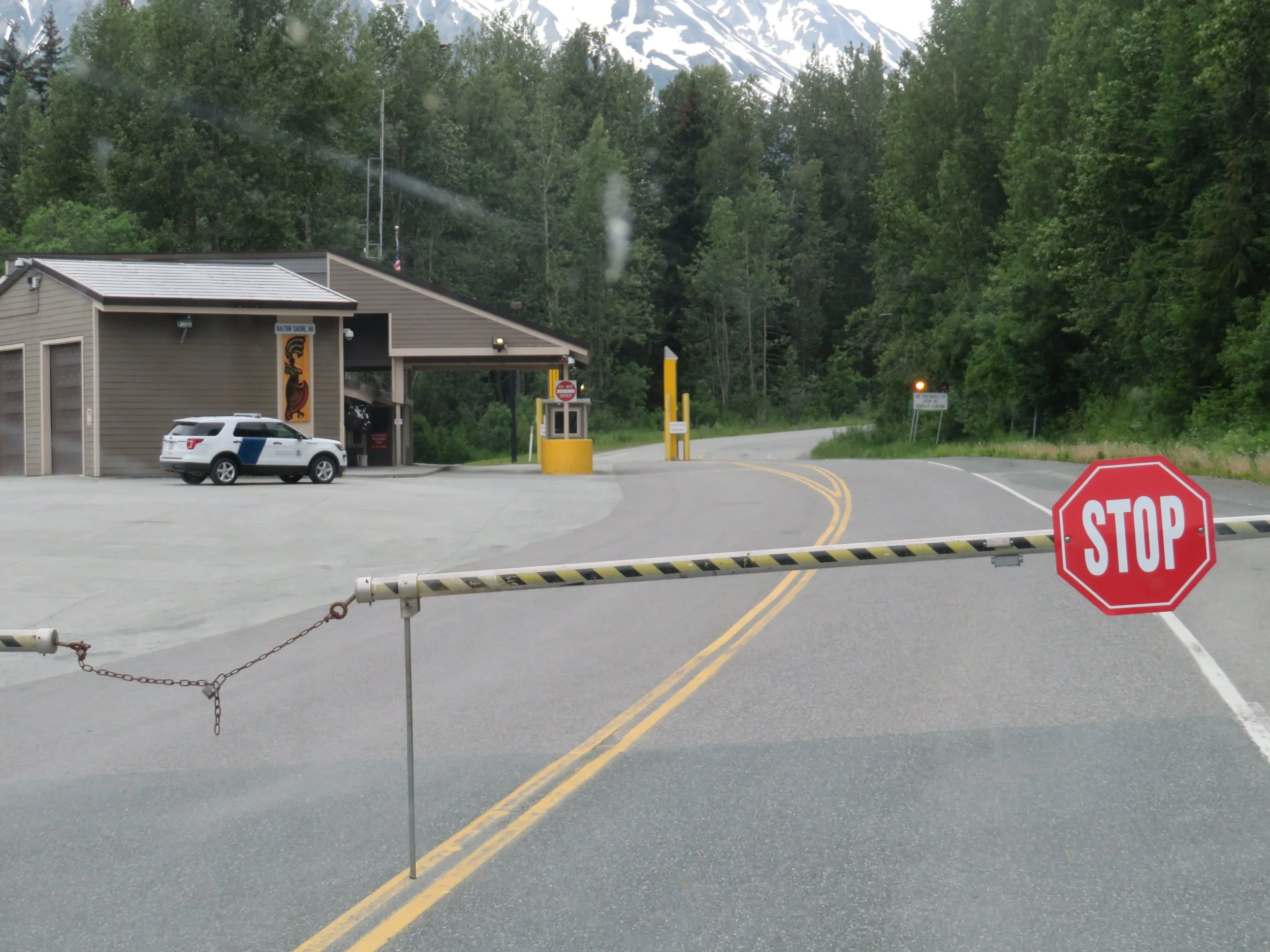
/We were up early, awakened by the Chilkat River rushing past our little overnight off-road turnout area. Haines was behind us and we were heading north back to Tok, but first there was a long trip up the Haines Highway in front of us. We forgot that the border crossing from the USA back into B.C., Canada had limited hours. We waited at the closed barriers until the border crossings opened. At least it was only 45 minutes, not 39 hours… long enough for breakfast.
The morning was beautiful and we appreciated the same natural beauty on the return trip up the highway as we did coming down. Once again, the roadside wildflowers were stupendous.

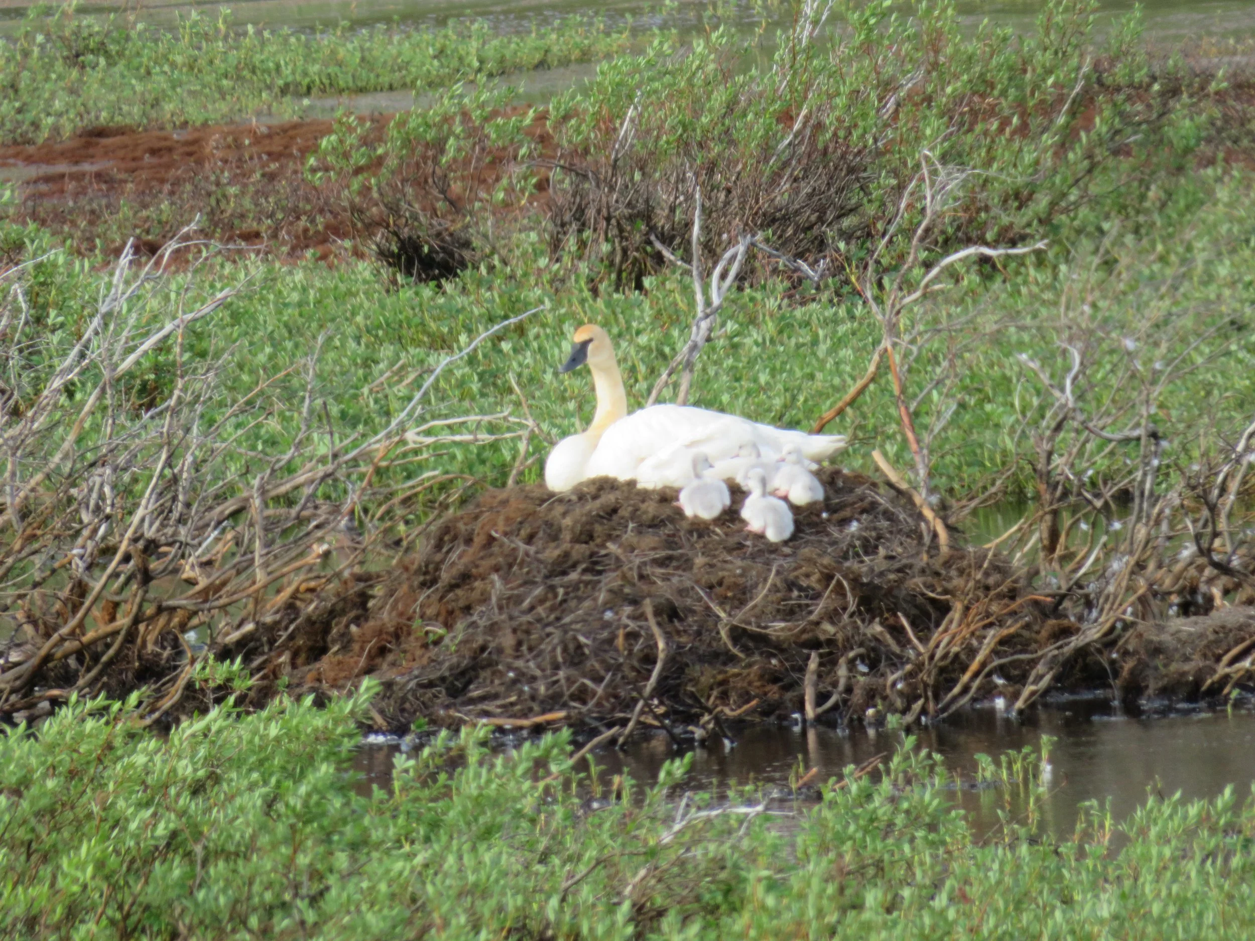
We stopped to admire a nesting trumpeter swan and her cygnets.
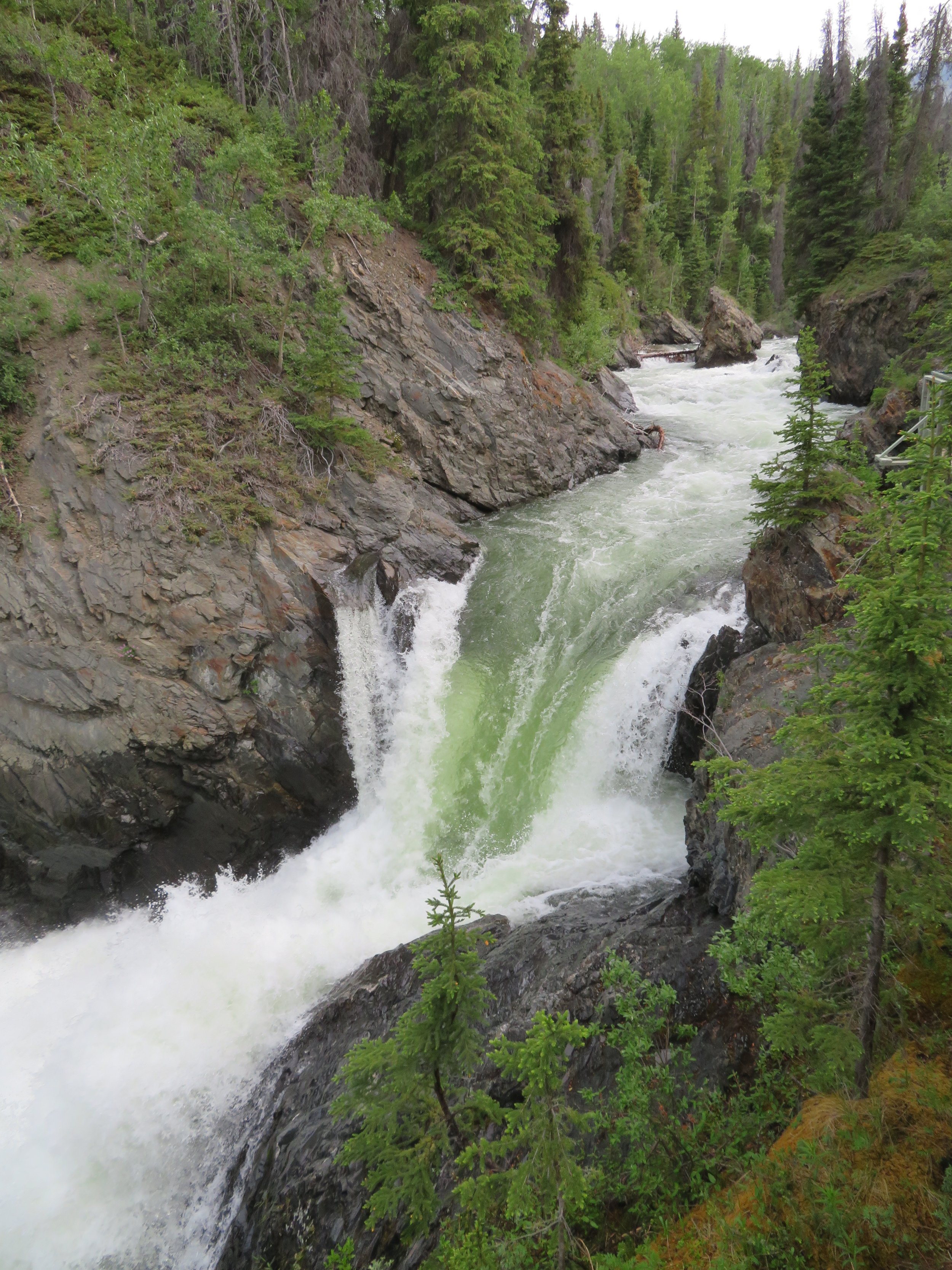
Before we knew it, we were once again in the Yukon Territory. We took a quick jaunt on the boardwalk at Million Dollar Falls and checked out the 200’ cascades on the Takhanne River.
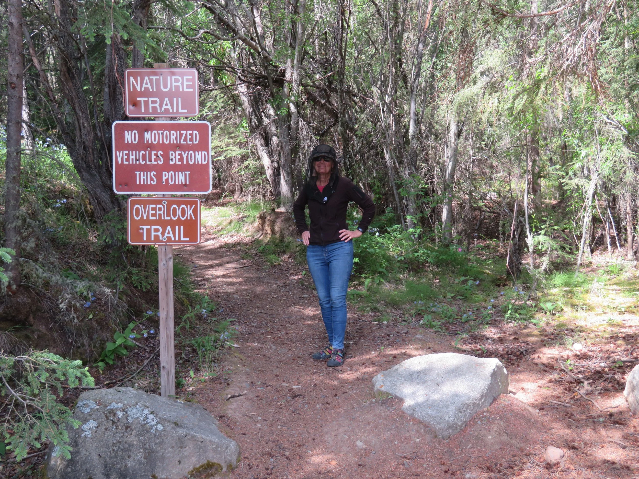
We rejoined the Alaska Highway in Haines Junction to head back to Tok. Though we weren’t interested in spruce beetles, we did take a walk on the Spruce Beetle Trail, a heavily rooted trail through the woods and a good leg stretcher. The mozzies were vicious and David commented he’d never seen me walk a trail quite this fast. I did spot a Canada anemone and stopped long enough for a photo and a bloodletting before hustling back to Blanche.

We were dreading all the construction areas that had delayed us on the way down to Haines and we were pleasantly surprised when we encountered only two pilot cars with only a 10 minute wait at each. Hallelujah! We crossed the US border and we were back in the USA once again, being welcomed back into Alaska.

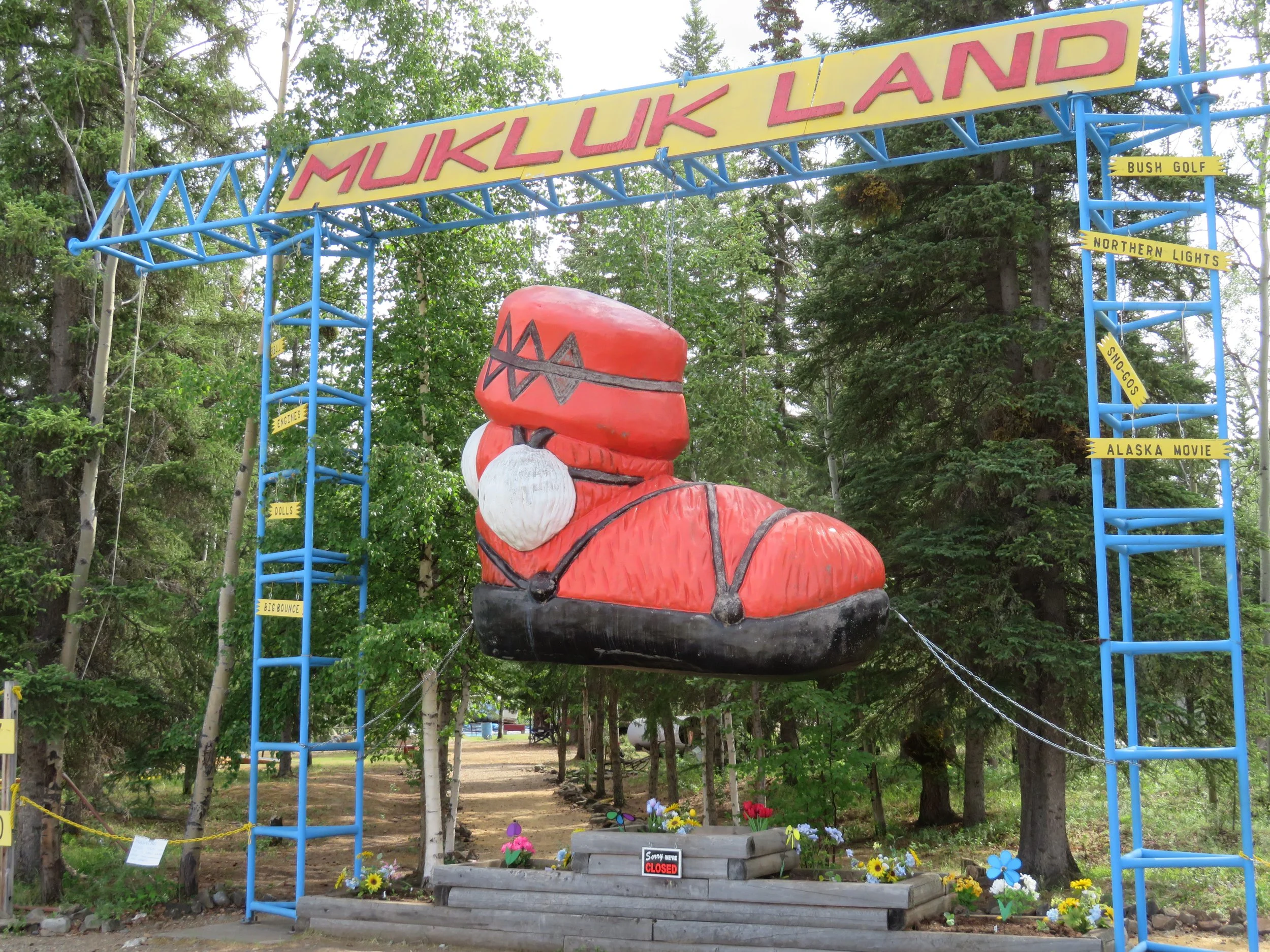
It was a long day for us… 400 miles is not our usual daily mileage. We arrived late at the Tok RV Village ($40/night)… it was time once more for showers, laundry and a car wash for Blanche, inside and out. After spending the next day doing chores, we opted to spend another night in Tok because I’d read about visiting Muklukland and it quickly became a must-see. As described by Atlas Obscura “This junkyard made over as a theme park is the most Alaskan place in Alaska.’ Really, how could we miss it, plus we’d have the opportunity to see the world’s largest mukluk.
To make a long story short, we waited until it opened at 2pm, drove down the highway to see it only to find a handwritten sign on the gate… ‘Muklukland is closed today due to family illnesses. Check Facebook for updates.’ Major disappointment although I did get a photo of the giant mukluk so it wasn’t a total loss. No more dawdling in Tok though… time to move on.
We were off early the next morning driving the Tok Cutoff heading west toward Glennallen. A stop at Eagle Trail State Recreation Area for an easy one-mile nature trail walk had me wearing my mosquito headnet for the first time. I looked like a goober wearing it, but it worked like a charm. The only problem was trying to remove my sunglasses to take photos. Think I’ll need to practiced this skill.
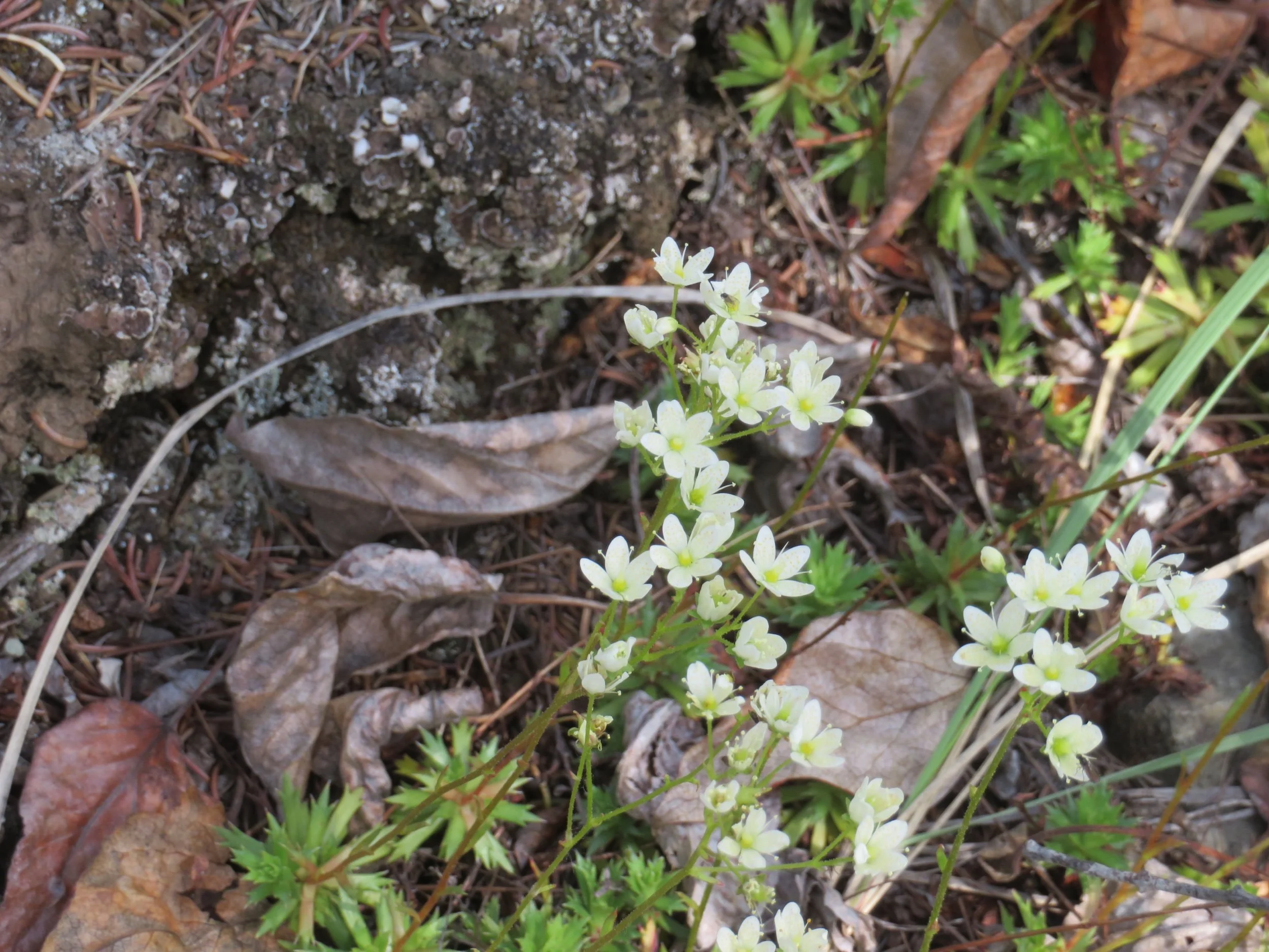
Flowers along the trail and boardwalk included prickly saxifrage and fly-speckled orchids.

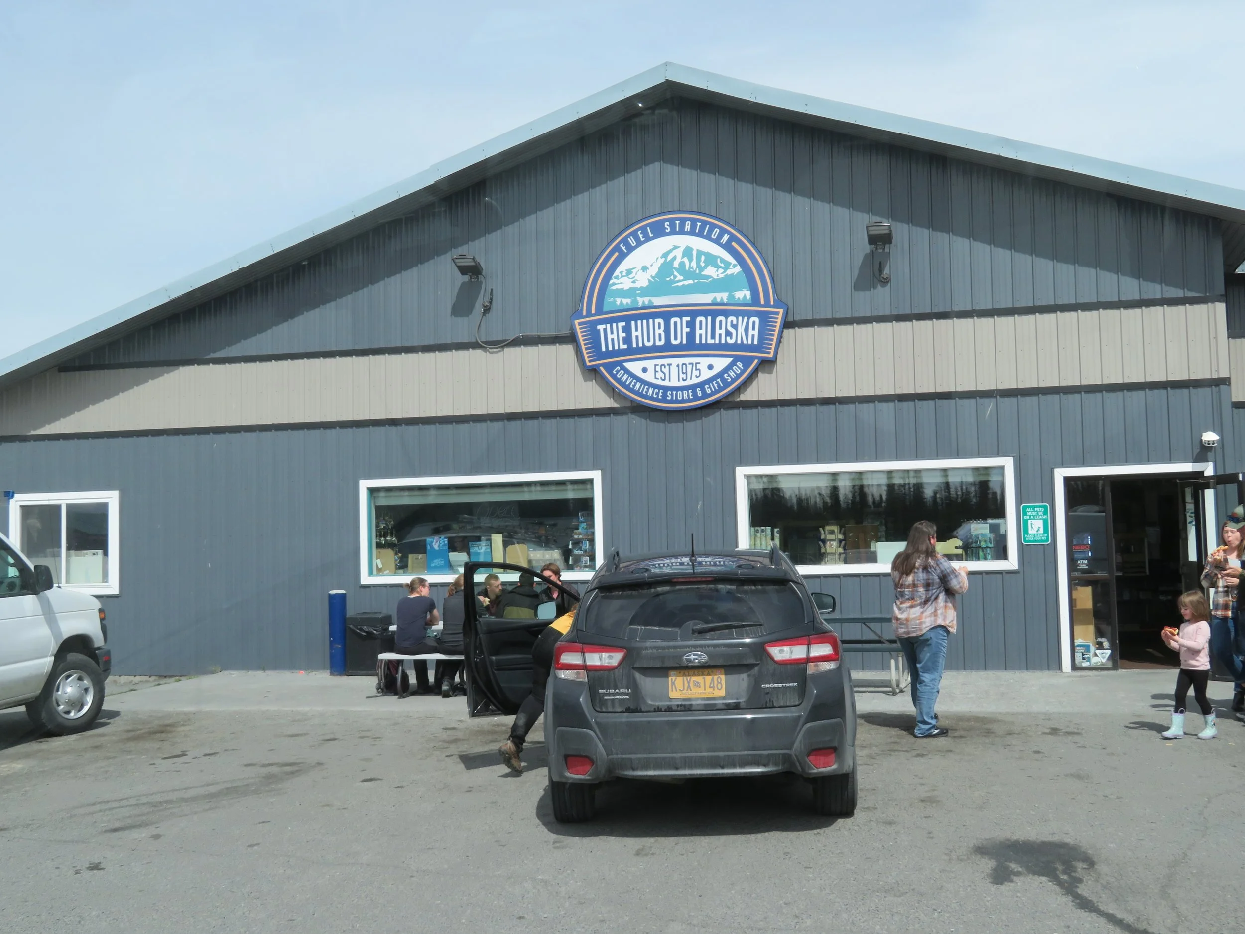
At Glenn Highway Junction, touted as the Hub of Alaska, we stopped at the Visitors Center for yet another leg stretch and a look-see. The ‘Hub of Alaska’ includes a gas station, souvenir shops, a small restaurant/food truck and a convenience store. It was bustling with business. We drove a couple of miles further to the local IGA supermarket to find picked-over, nearly empty shelves. The weekly supply truck was due in today, but hadn’t yet arrived. We left empty-handed.
The brakes had been squealing a bit and though David was pretty certain it was caused by road dust and grit, we stopped by a local mechanic’s shop to have them checked just in case. The friendly mechanic came out immediately and visually checked the thickness of the pads and pronounced them in good shape. Off we went and the brakes, evidently knowing they were okay, soon stopped squealing. Go figure.
Our plan up until last night had been to head west directly to Anchorage, but after conferring with The Milepost, David suggested that perhaps we should detour slightly south to Valdez first. It was ‘kind of’ on the way, only 128 miles down the Richardson Highway (Alaska-4). It didn’t take much convincing. When I mentioned to a few folks that we were heading to Valdez, their first response was “oh, the town with the oil spill… the Exxon Valdez”. We were hoping to discover that Valdez was much more than that.
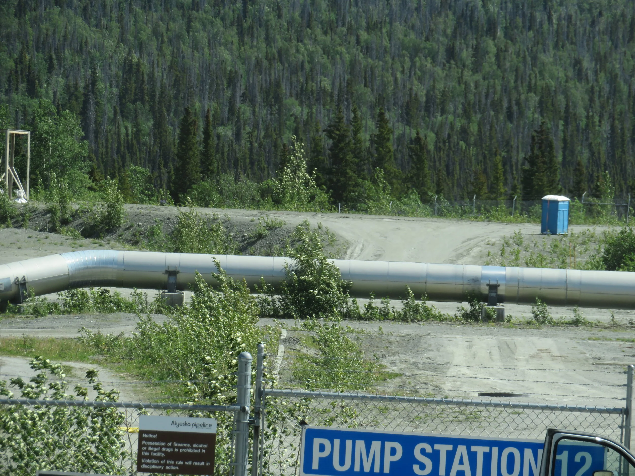
We caught glimpses of the Alaska Pipeline through the trees as we headed down the highway.
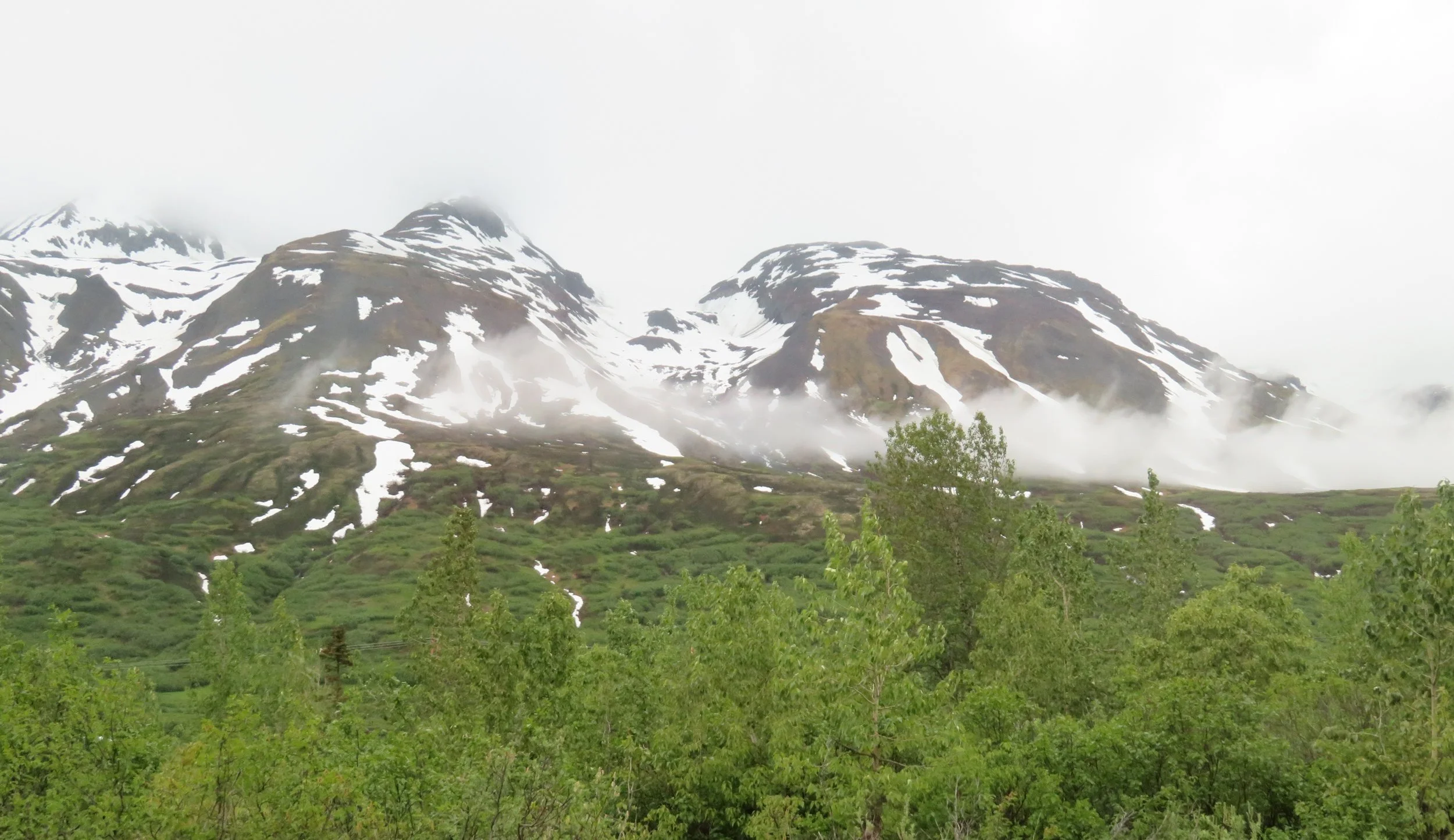
According to the NPS site, “Wrangell-St. Elias is a vast national park that rises from the ocean all the way up to 18,008 ft. [It holds nine of the USA’s 16 tallest peaks.] At 13.2 million acres, the park is the same size as Yellowstone National Park, Yosemite National Park, and Switzerland combined!.” Unfortunately, there is limited access to the park although we could appreciate its majestic beauty along our route.
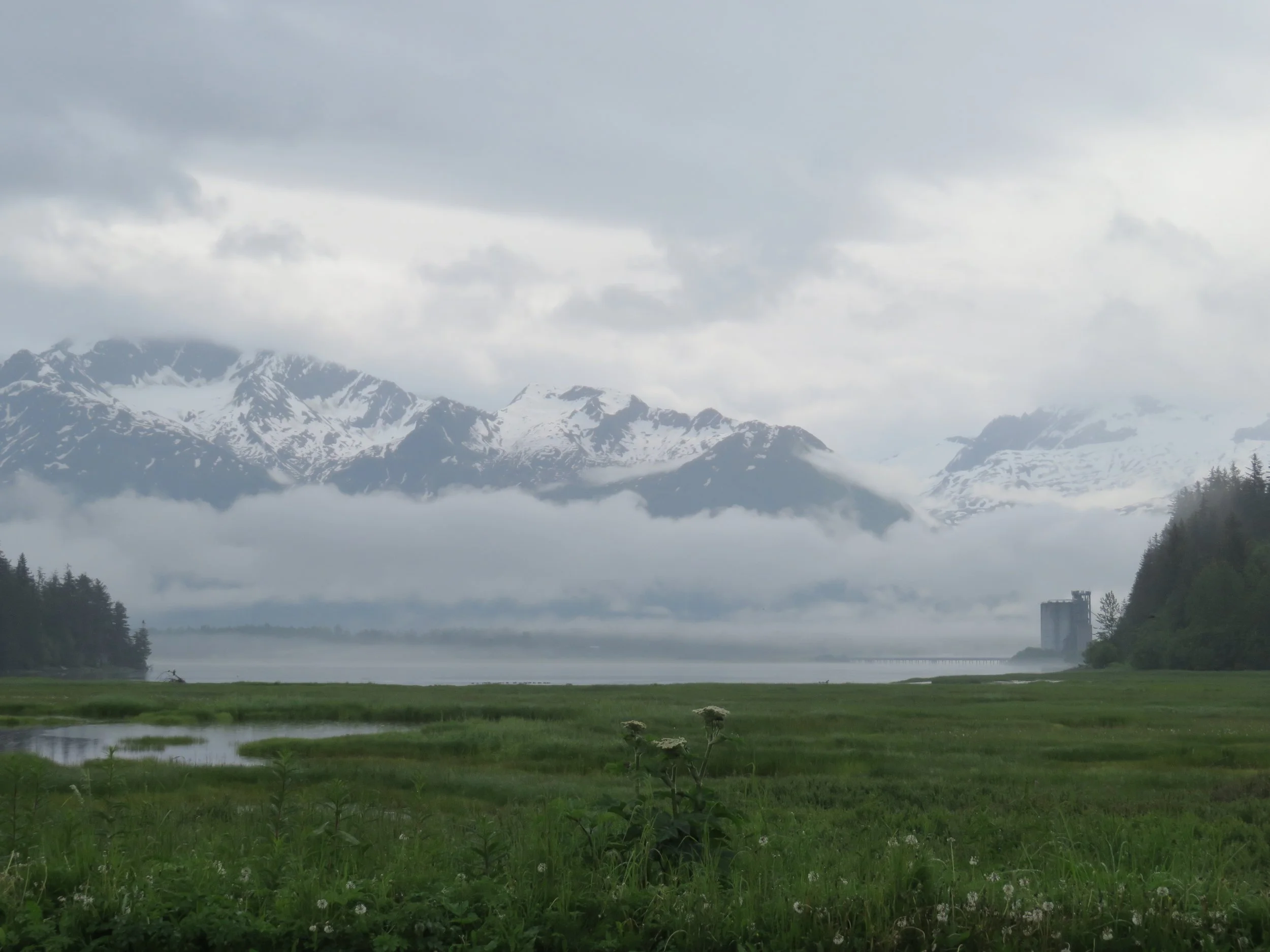
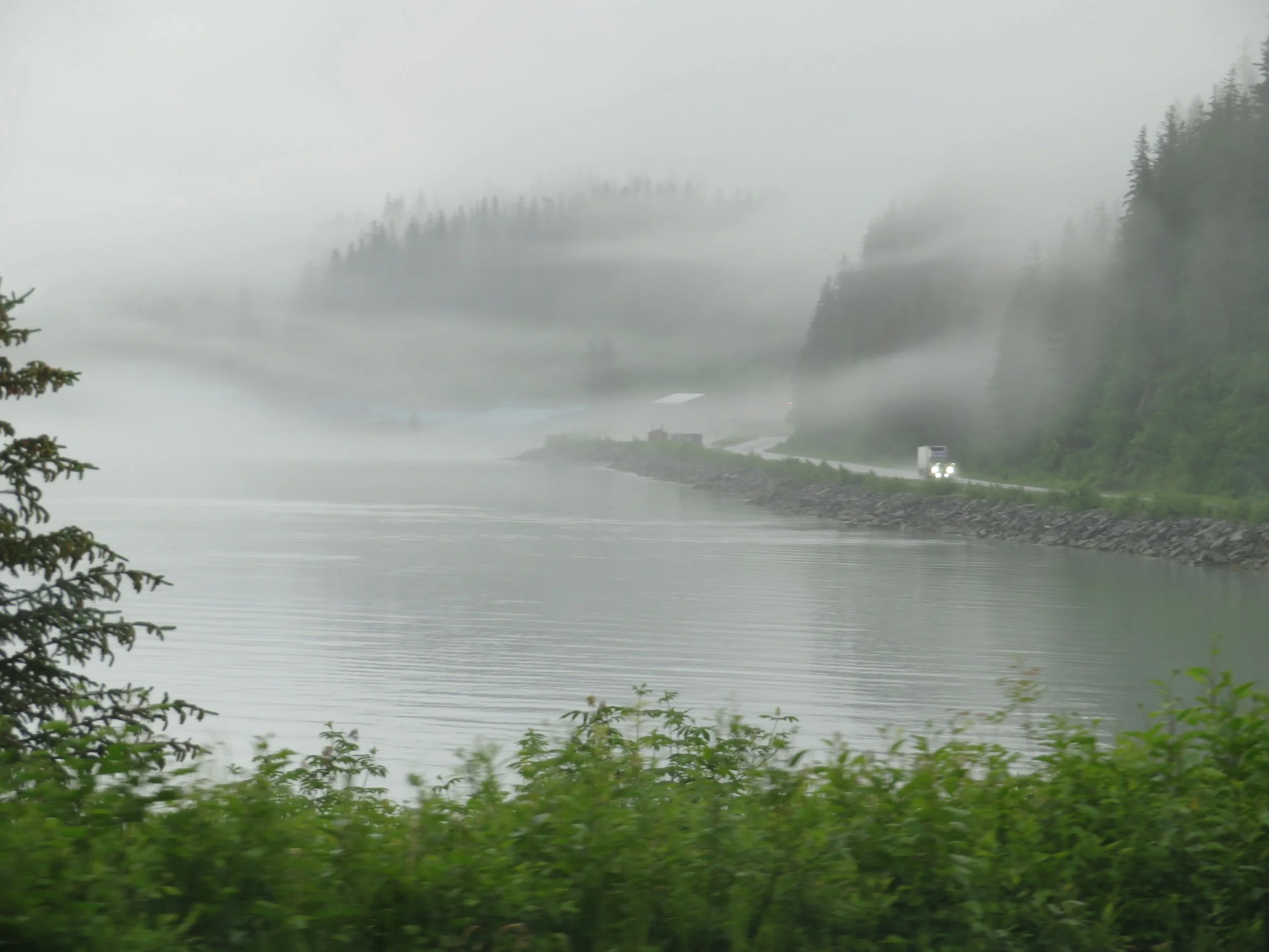
About 30 miles from Valdez with gorgeous views of the Chugach Mountains all around us, we pulled into a large off-the-road turnout for the night.
It rained during the night and the morning was cold and raw, but the sun was attempting to peek through. We’ve had so much good weather, we can hardly complain about a rainy day or two. And one positive of the rain… the windshield was clean again… no bug guts.
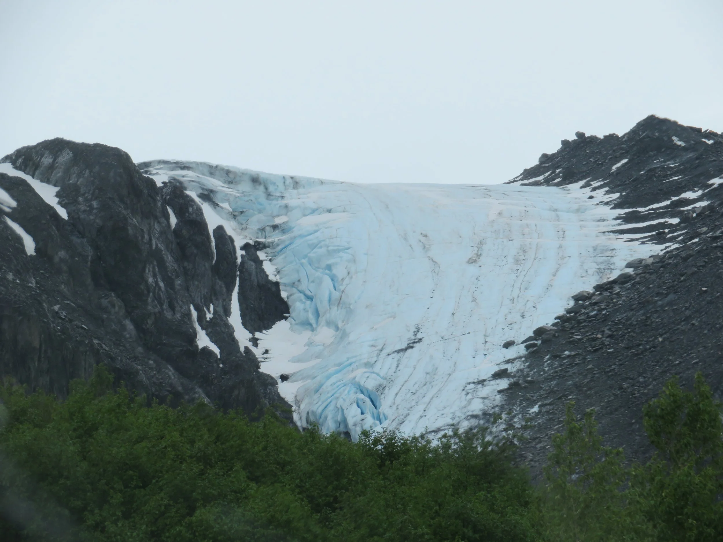
The Worthington Glacier was just off the highway and definitely worth a stop. Although the trail was closed due to a landslide, the views from the park were beautiful.
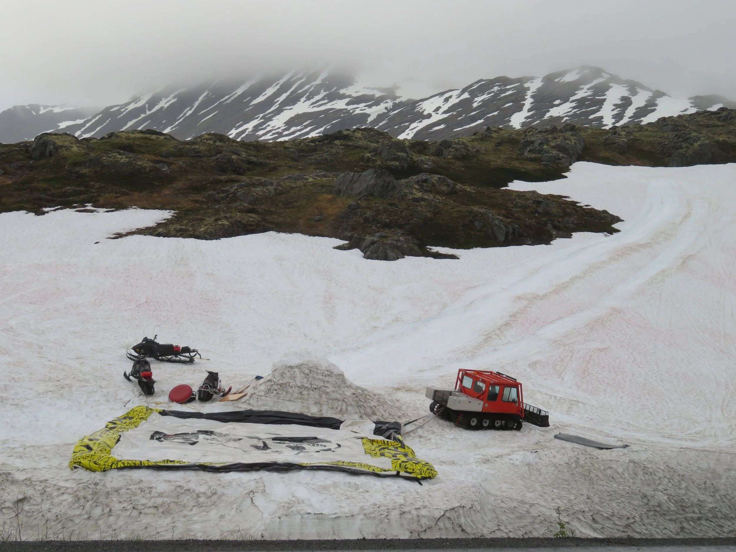
Valdez is known for several things, probably most notable the Exxon Valdez Oil Spill as David discussed in his last Blue View. It is also the terminus of the Alaska Pipeline and was also close to the epicenter of the great Good Friday earthquake of 1964, topics to be discussed in upcoming blogs. The town is also the snowiest winter town in Alaska. According to The Milepost, average annual snowfall in Valdez is 326” (~27 feet), however the town set records in 1990 with a one-day snowfall of 47.5”. Its record monthly snowfall is 180” in February, 1996. Not to worry - we won’t be around here this winter. We were reminded of that fact as we climbed to Thompson Pass and saw these ‘snow machines’ (and in Alaska they are NOT called snowmobiles!) on a huge snow field… in July.
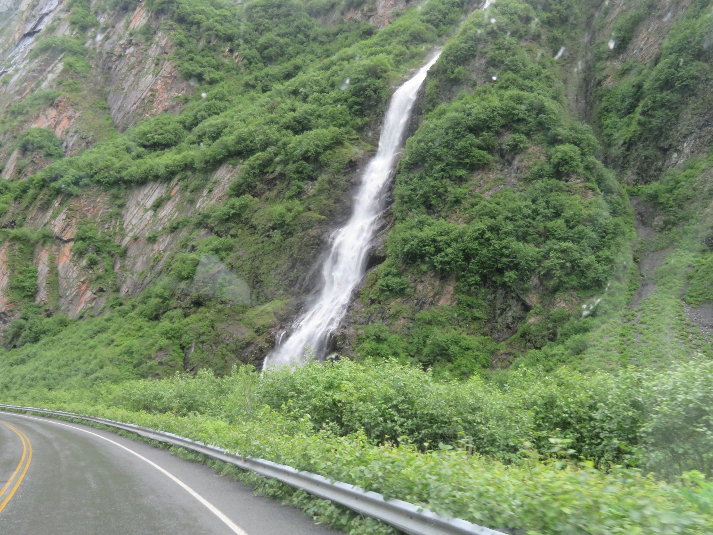
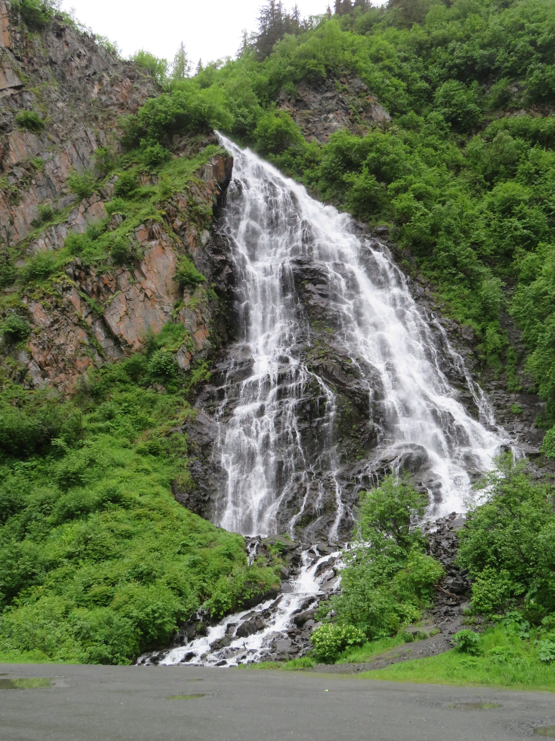
Passing through Keystone Canyon was gorgeous. Bridal Veil Falls and Horse Tail Falls, fueled by melting mountain snow and ice, were cascading with gusto. In February, these falls serve as the venue for the Valdez annual ice climbing festival.
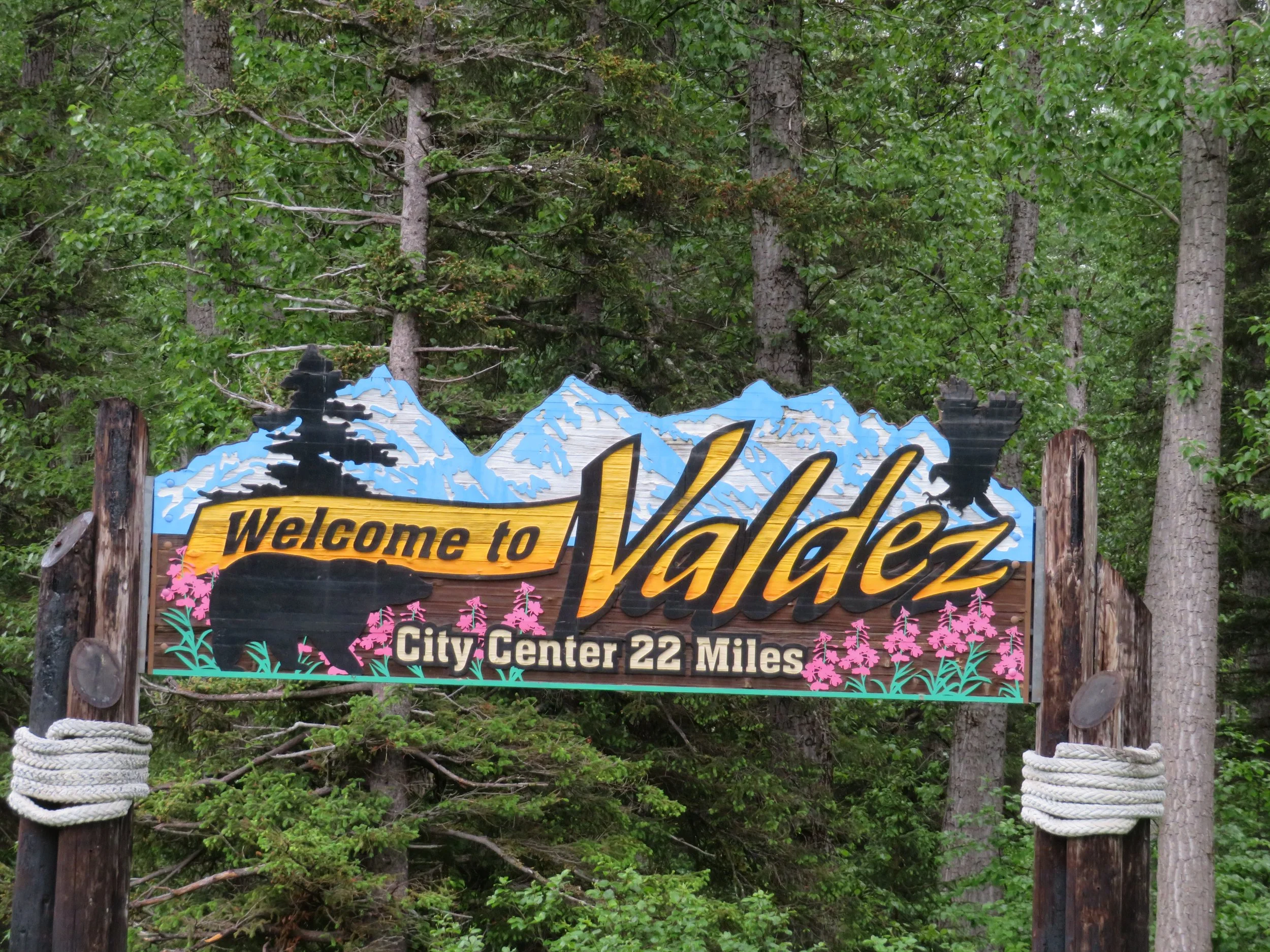
The colorful sign welcoming us to Valdez indicated we were still 22 miles from the downtown area.
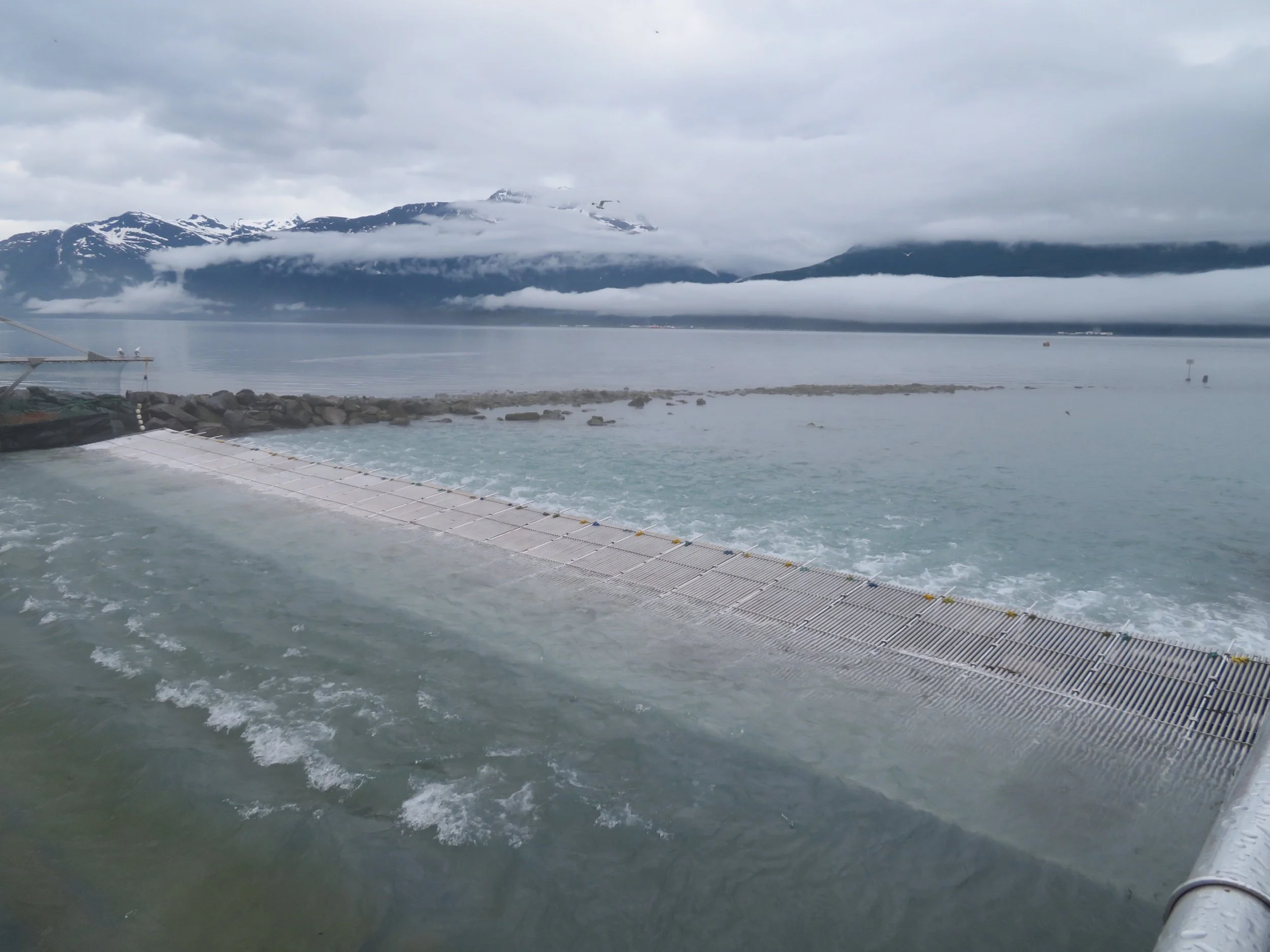
Other than the petroleum industry, fishing and tourism are key industries in Valdez. We contemplated taking another boat tour into the fjords for glacier and wildlife viewing. We saw the tour boats tied up in the harbor, but the recent memory of the crowded Juneau boat trip was still fresh in our minds and we gave it a pass.
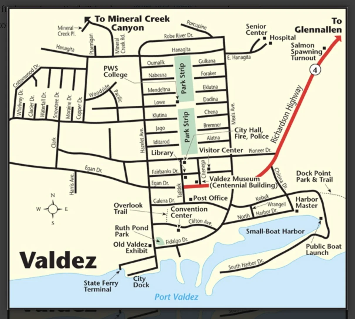
Instead we were quite content to wander around town. Here’s a map so you can wander around with us.

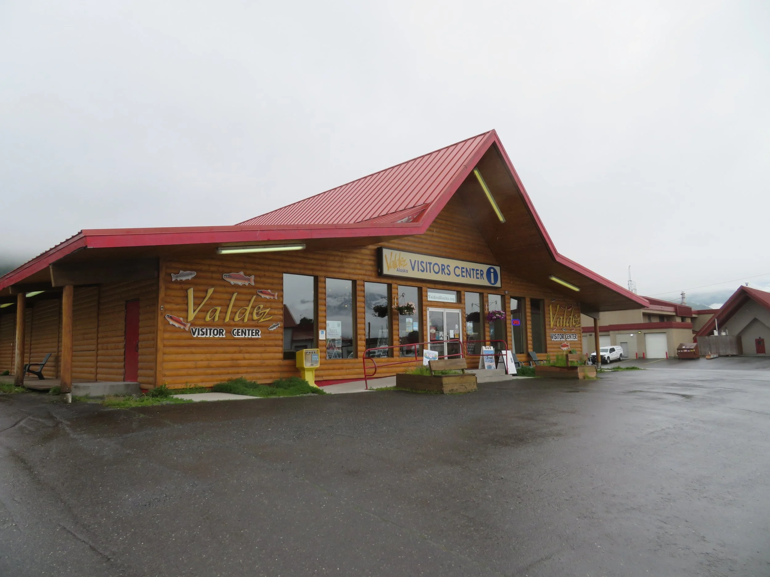
We found the visitor center and the library immediately and made use of their resources.
We checked out the RV parks and settled on the Valdez RV Park. They’re all gravel parking lots with similar amenities and all, in our humble opinions, quite expensive. The one we chose offered a veteran’s discount and was within walking distance to the downtown area including a nearby well-stocked Safeway. The view from the RV park wasn’t bad!
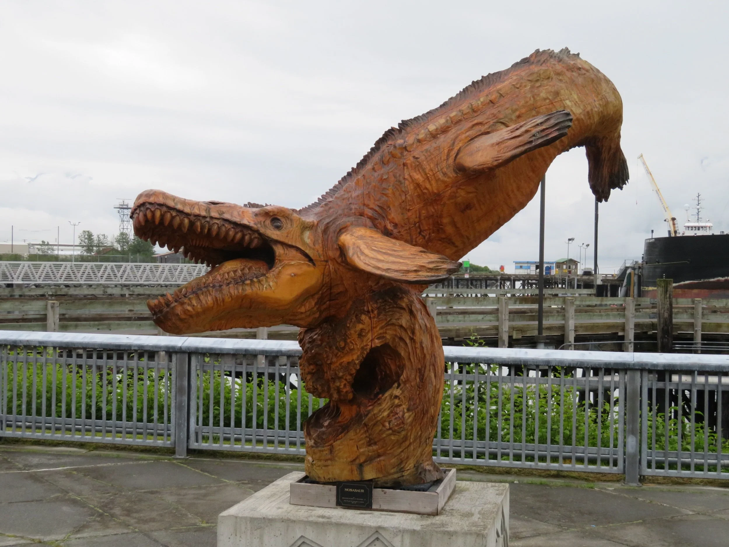
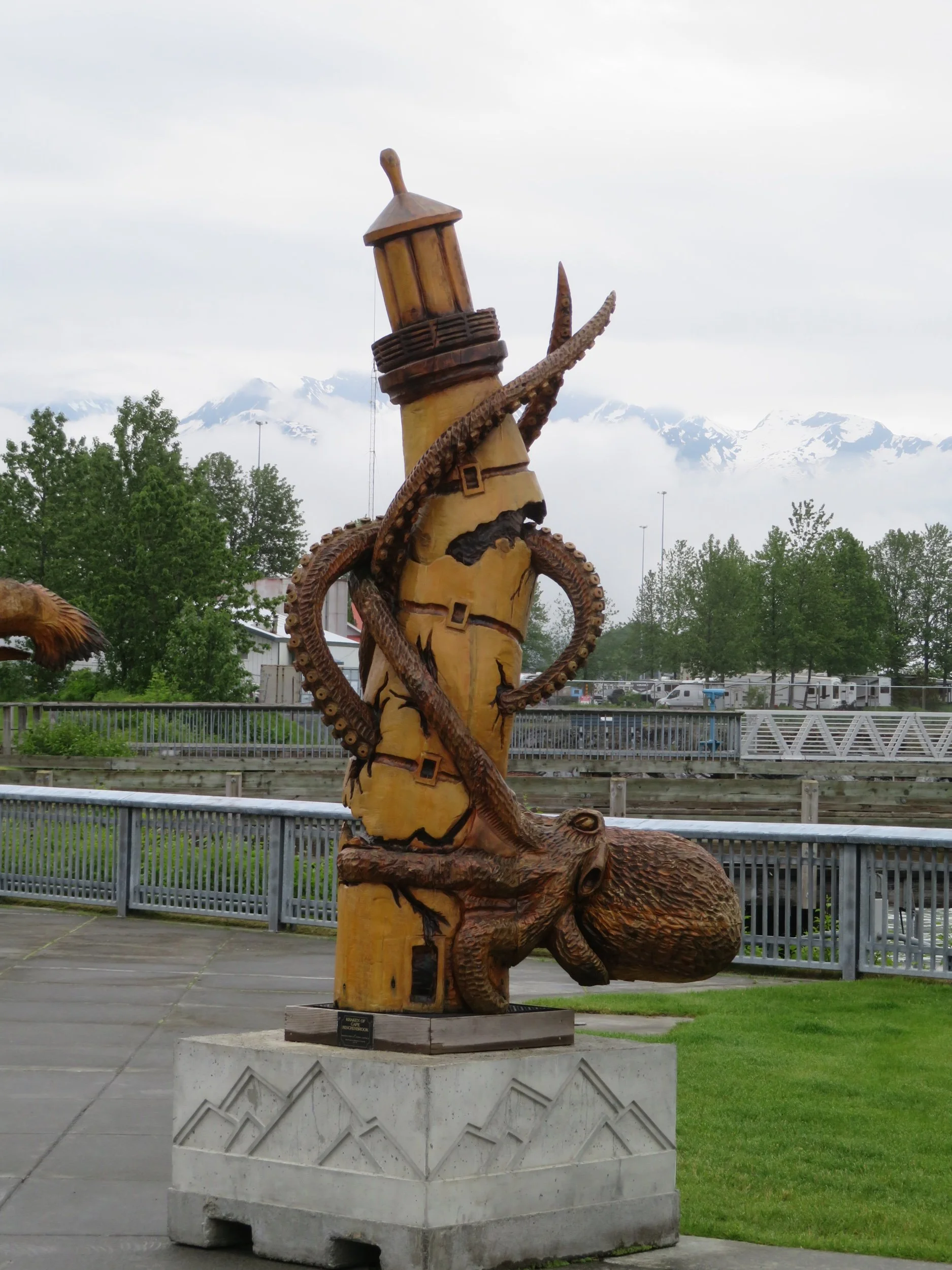
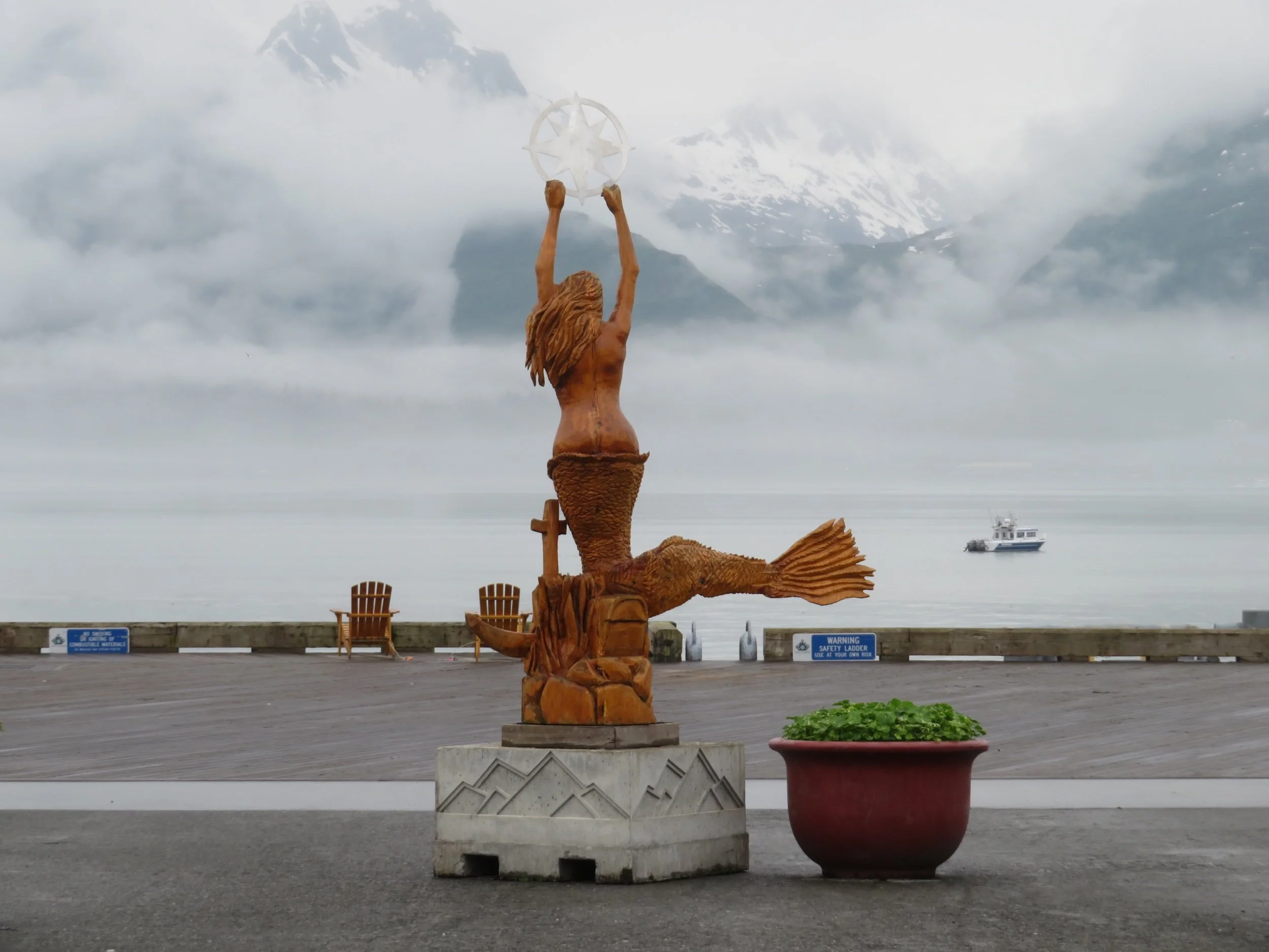
We walked the wharf and docks and checked out the Alaska Marine Highway (ferry) terminal. Evidently, the Alaska Cup Carving Championship was held in Valdez in 2018 and several of the carvings are still on display in the harbor area.
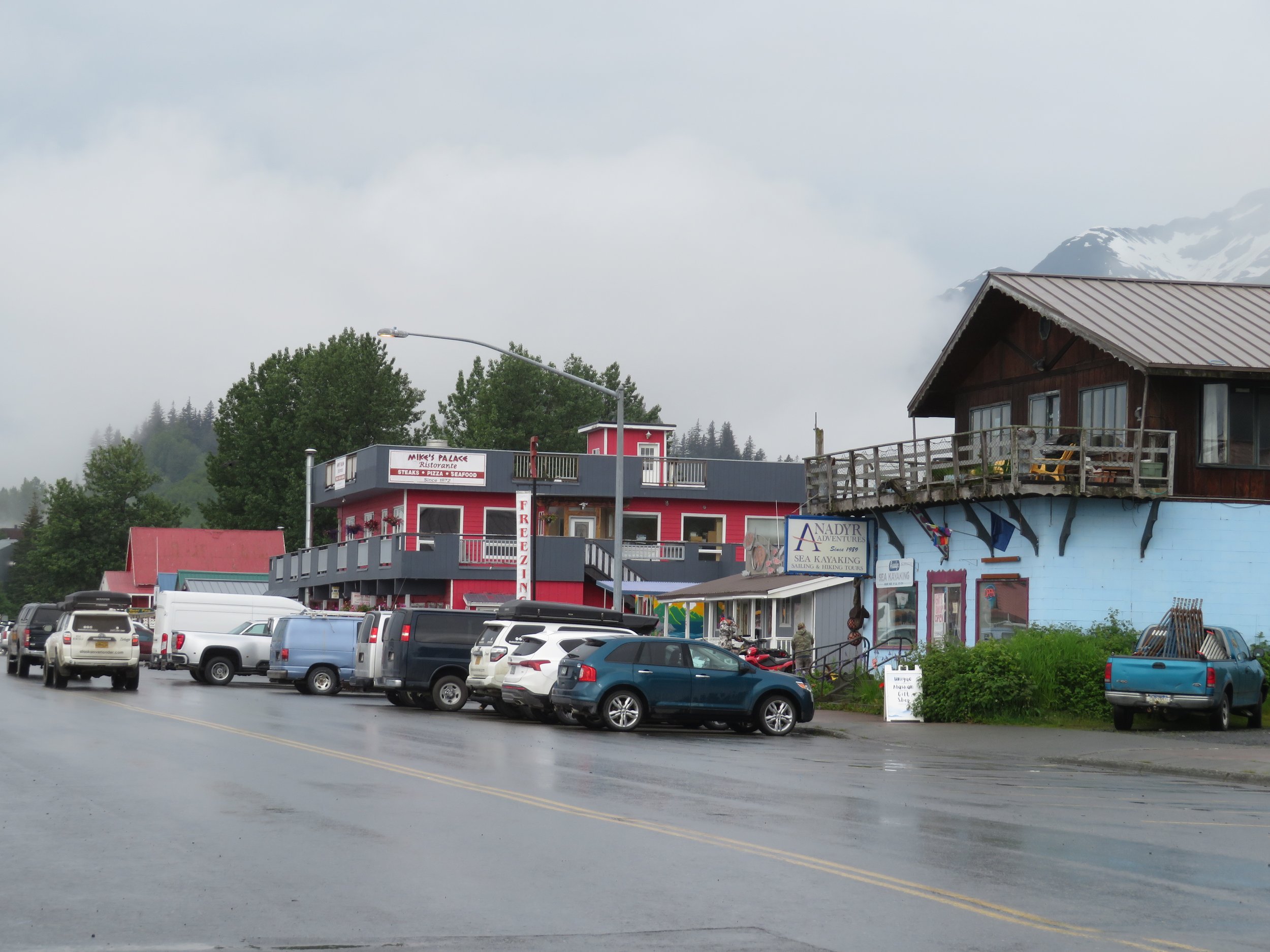
Opposite the downtown small boat harbor, there are a multitude of shops and restaurants, all very picturesque with snow-covered mountains as a backdrop.
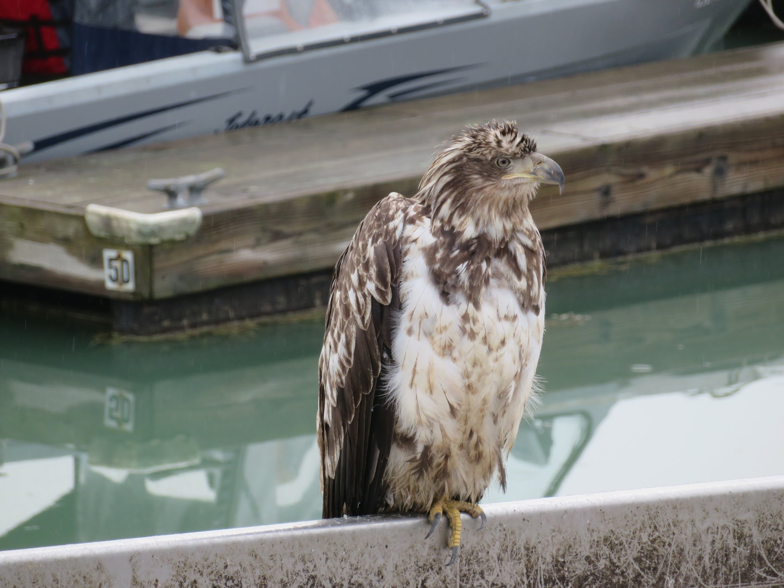
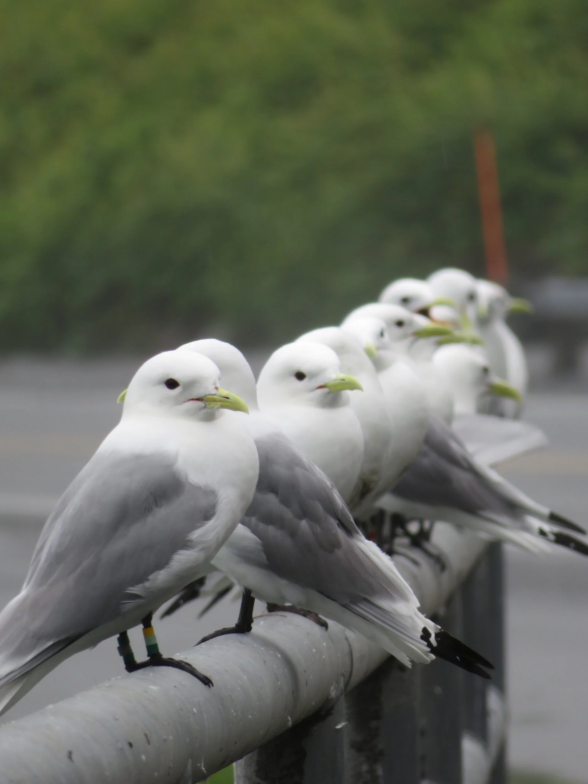
Gulls line up near the fish cleaning stations on the wharf waiting for the fishermen’s discards. We happened to catch a golden eagle bullying his way in to get his share.
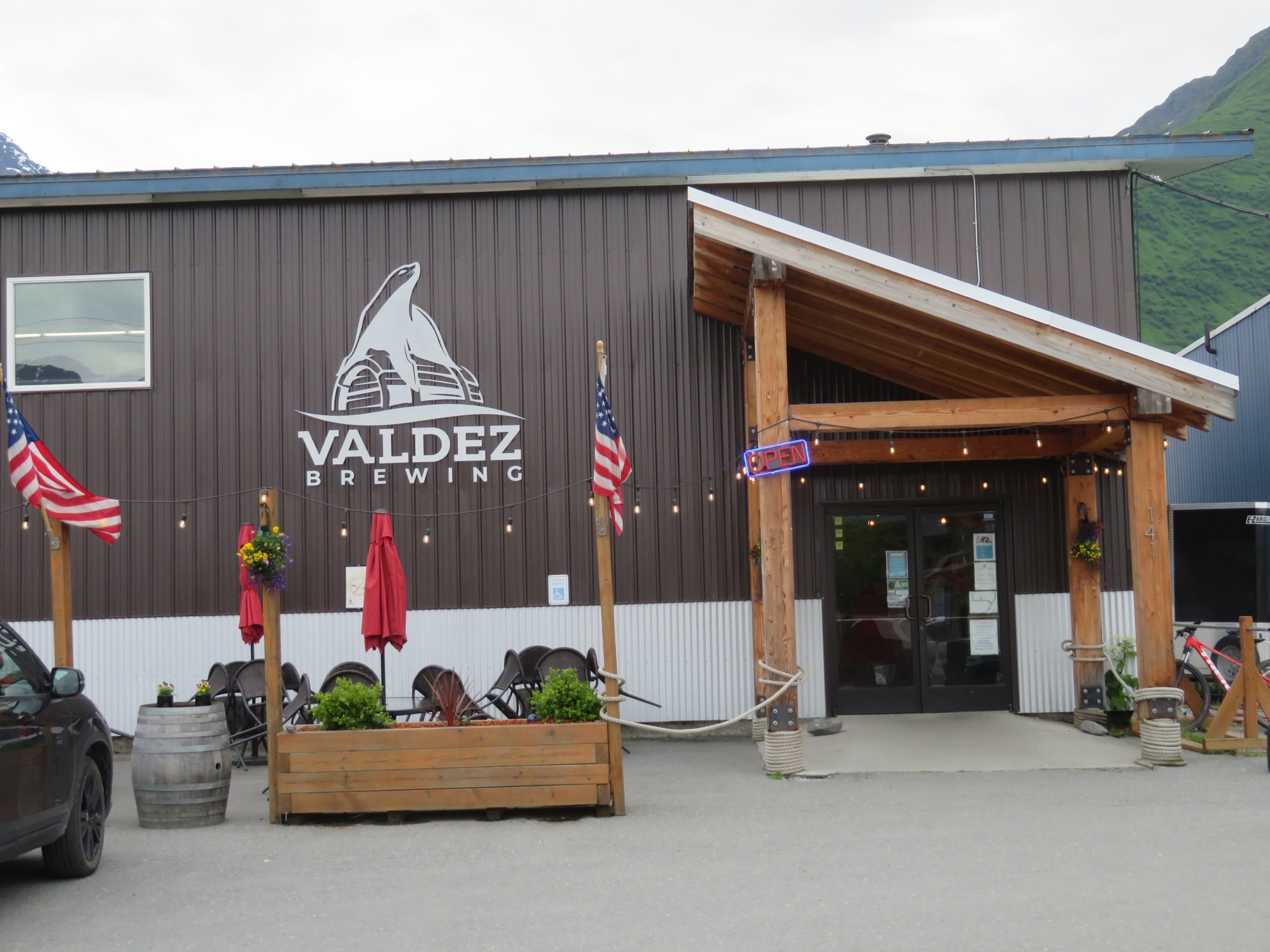
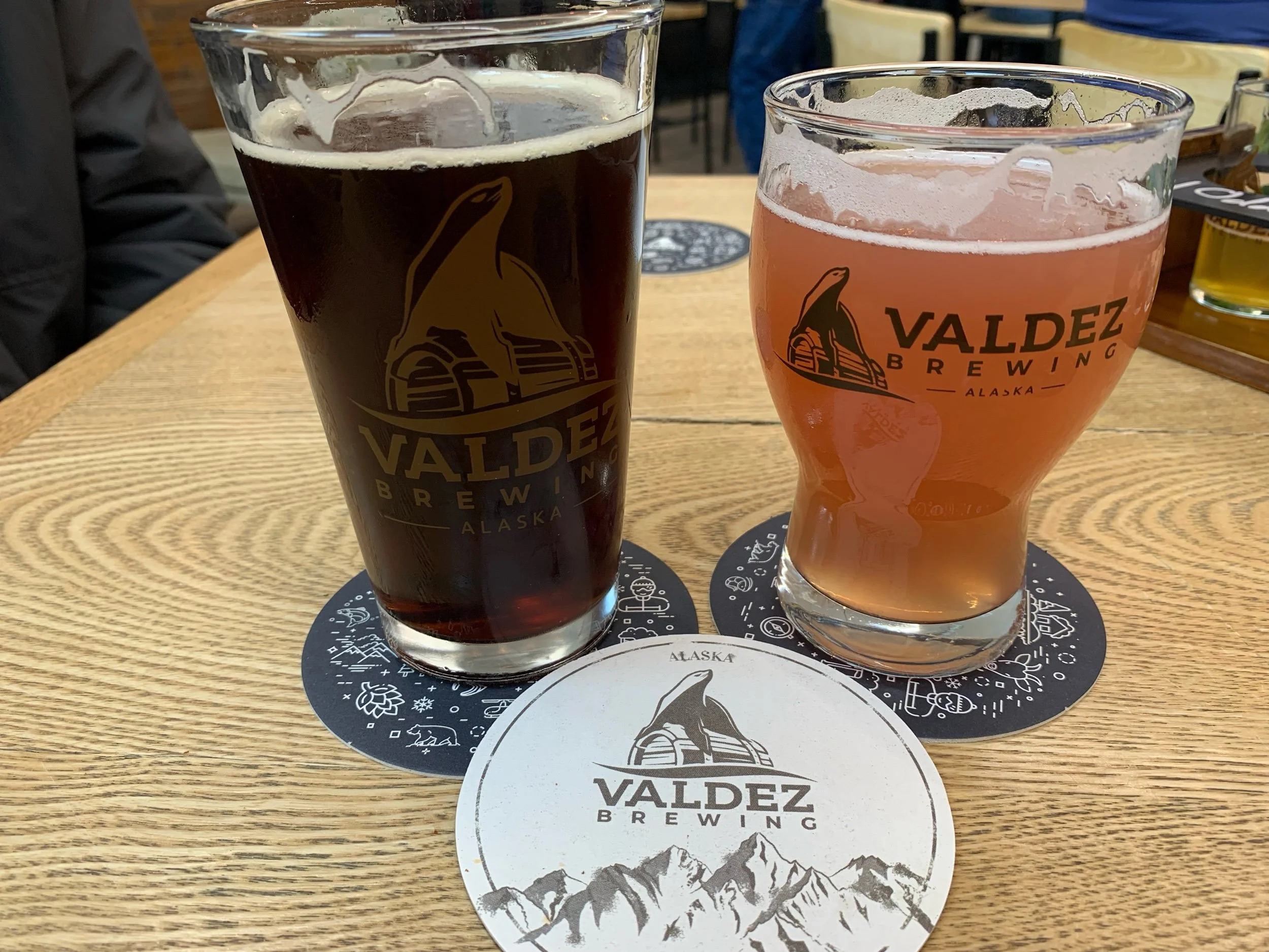
It sprinkled on and off most of the day, but we managed a walk at day’s end to the Valdez Brewery for a couple of craft drafts, then back to Blanche for dinner.
It rained again all night and most of the morning. We supposed that if we had only a two week vacation and it rained for several days, it would be most disappointing. Luckily for us, time is not much of an issue and rain isn’t much of a deterrent to our enjoyment.
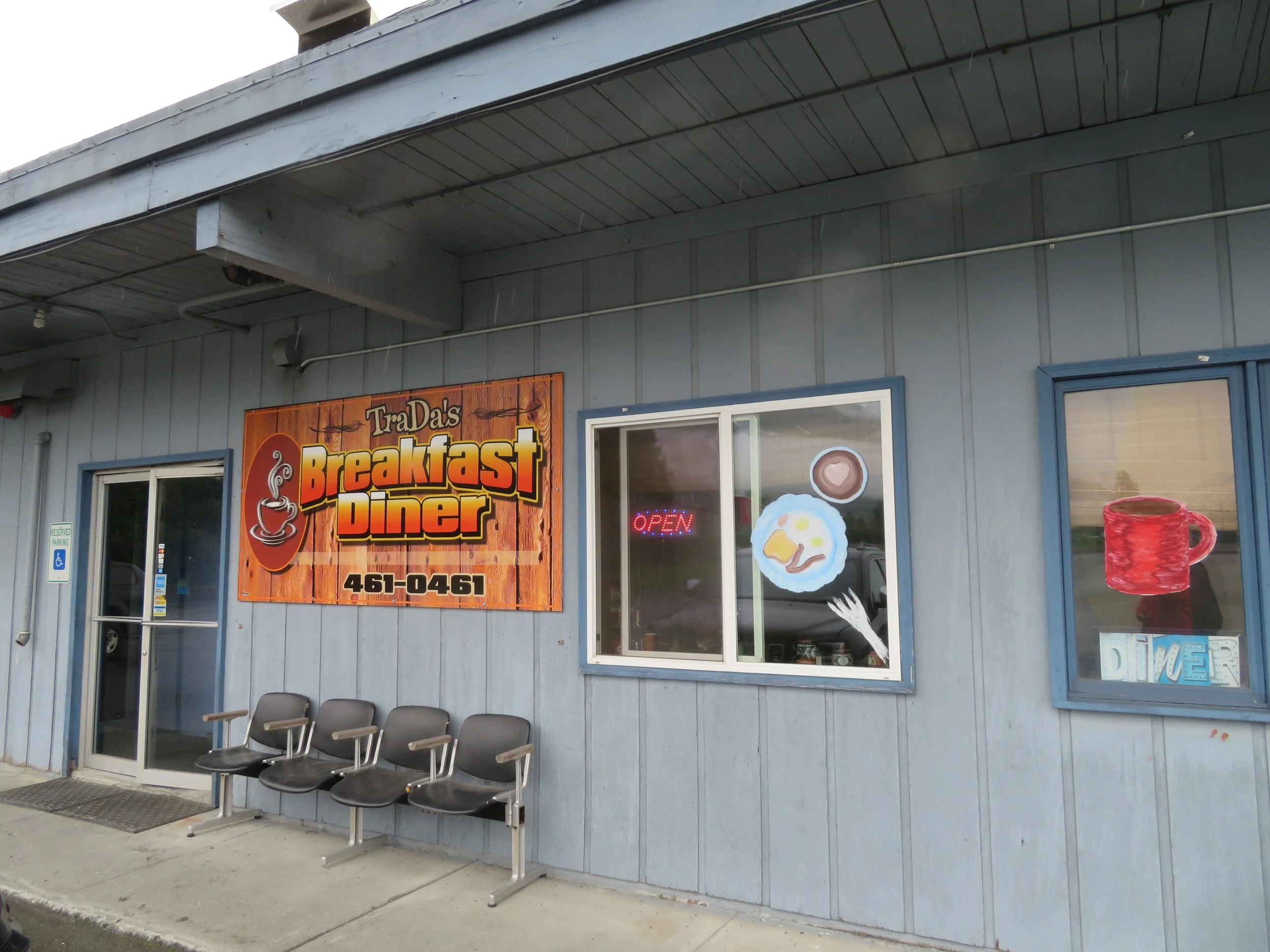
We walked in the mist and the rain and the sprinkles and found the local post office to mail some postcards. As we wandered, we happened across TraDa’s, a little hole in the wall, out of the way local place behind the Visitor Center. With 8-9 tables and good menu options, it seemed that the place was mostly frequented by locals and served up a terrific breakfast. Tracy, the Tra of TraDa’s, the owner and cook, came out to say hi and make sure we were enjoying our meal.
With the drizzle comes a pleasant quiet… sounds are muffled. As we continued our walk along the dockside’s, the harbor water was a milky green and smooth as glass, not a ripple or wave to be seen. Low fog clouds drifted lazily over the water. Until…
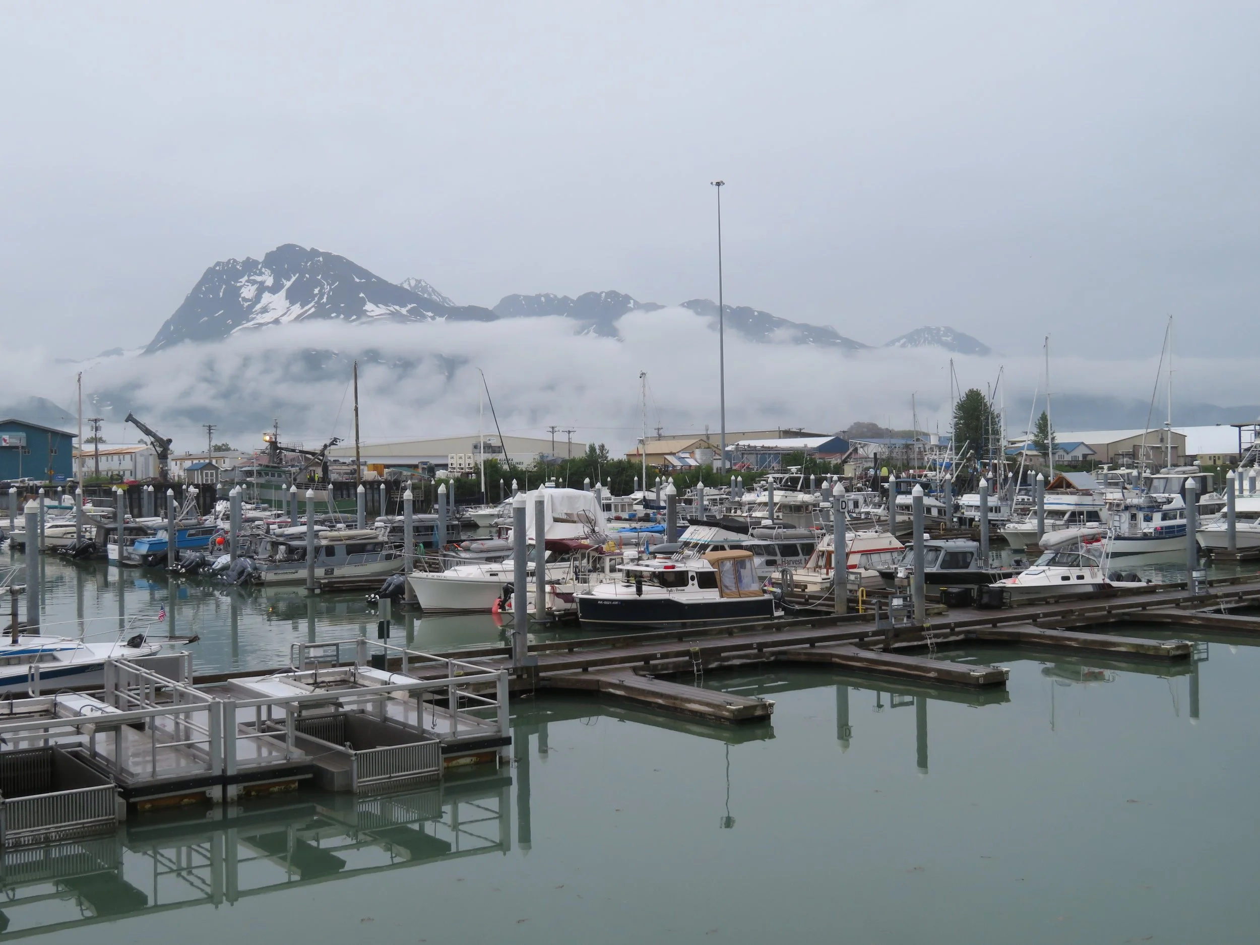
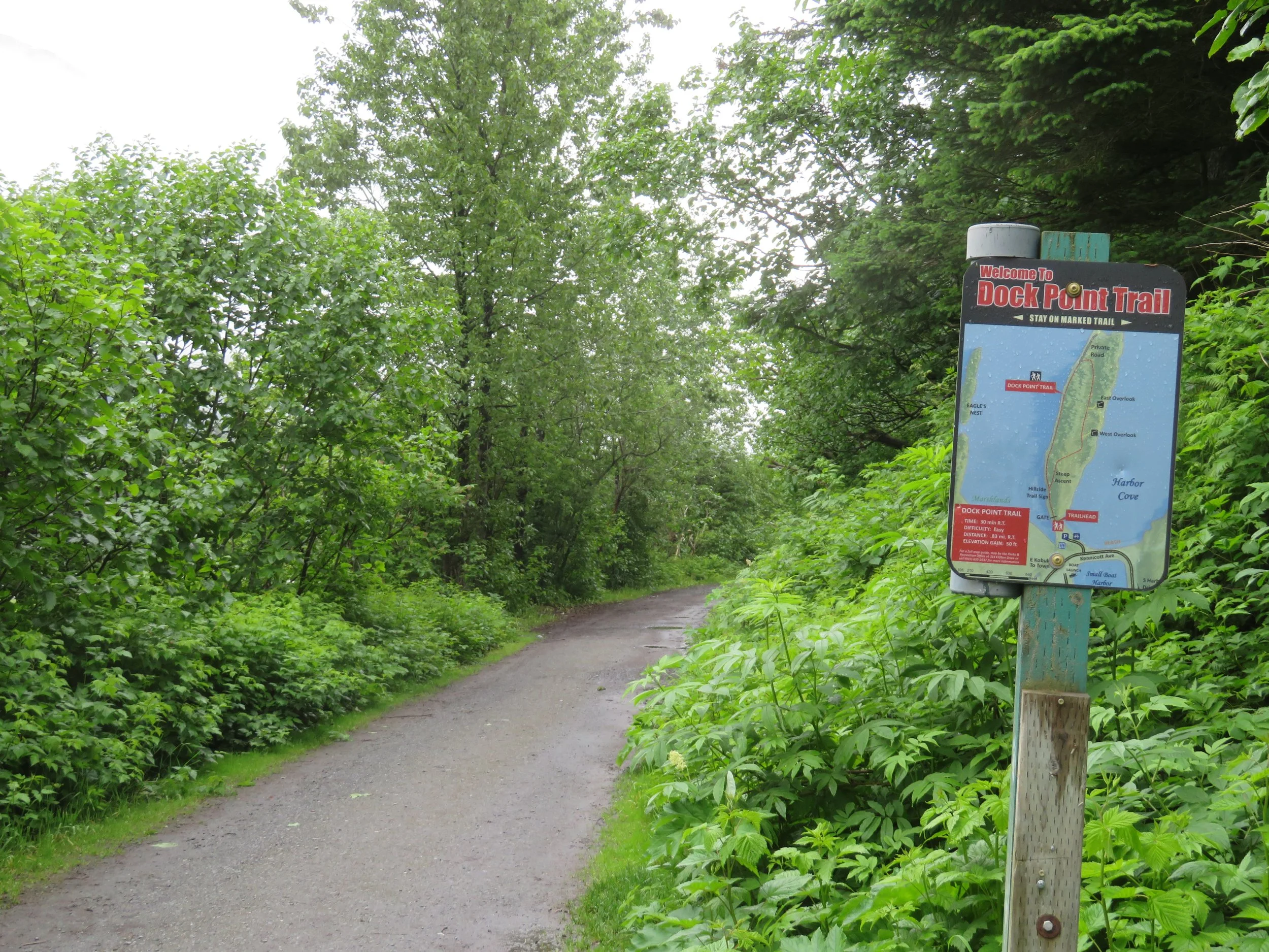
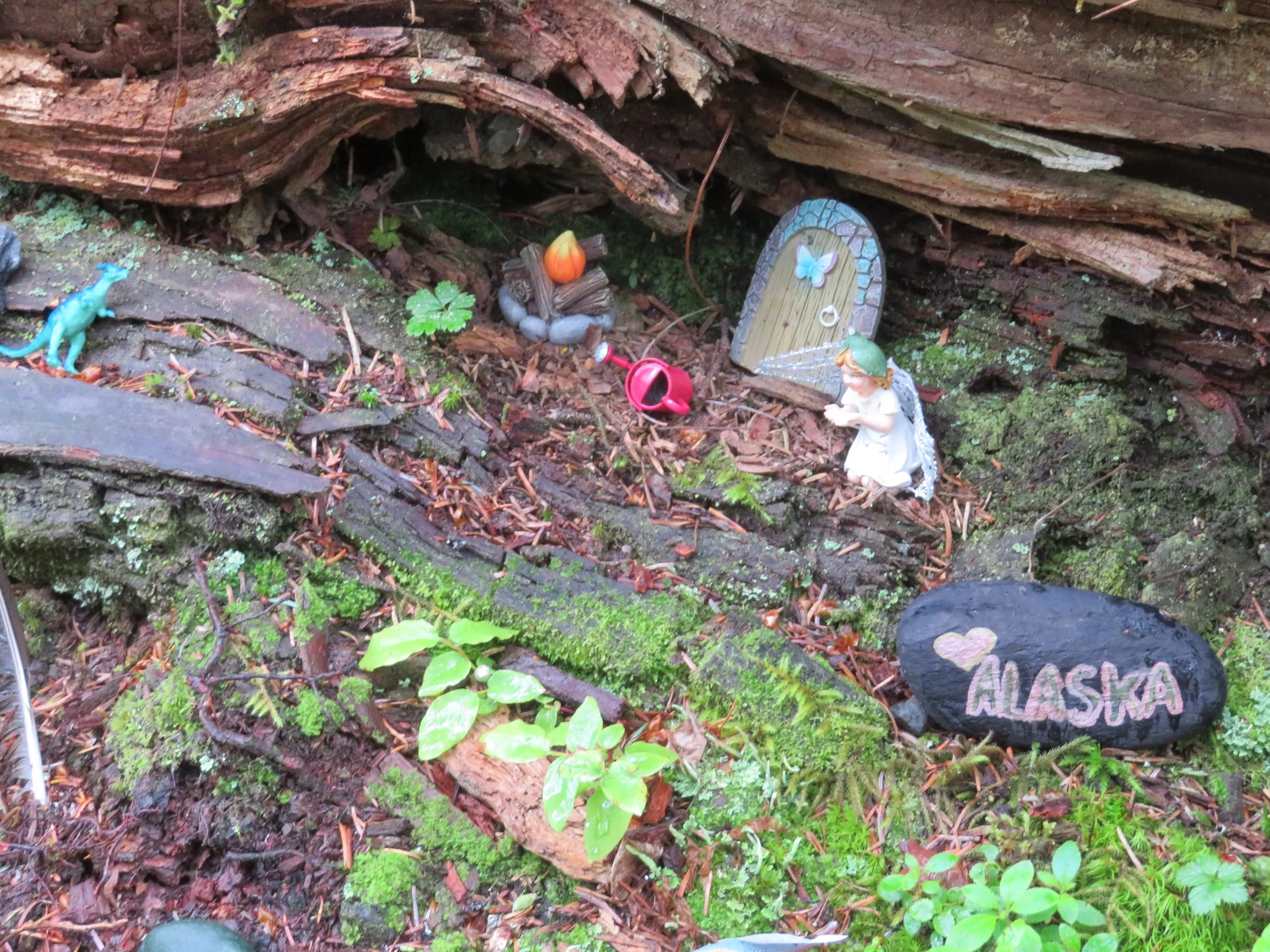
A cruise ship docked and disrupted the calm and charm of the port. Dock Point provided a pleasant, albeit sometimes muddy, respite and nature walk up over a headland and then down along the shore of Duck Flats (no ducks seen). Other than crows, the only other critters we saw were in miniature fairy gardens nestled in some tree roots.
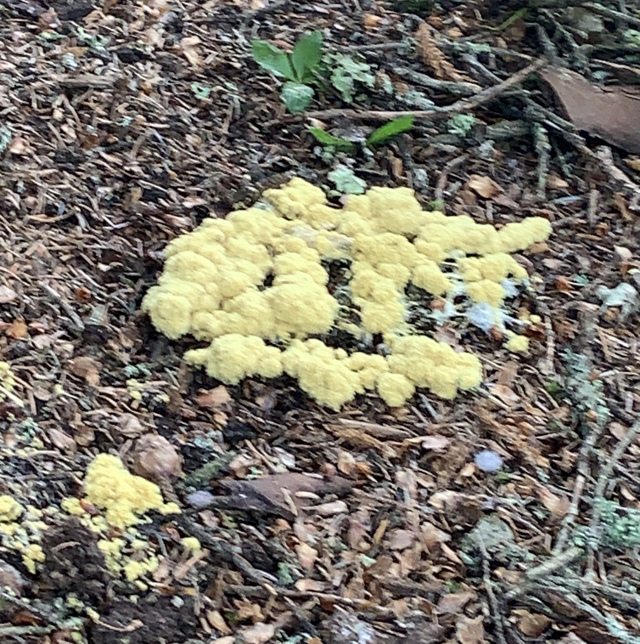
We did, however, spot a new species… dog vomit slime mold. I kid you not! Our Seek app identified it and we later checked it out to make sure Seek wasn’t messing with us. Nope, it’s a legit species.
We packed up the next morning and headed back up the Richardson Highway. We missed a few sights on the way down to Valdez, so we remedied these oversights on the way out of town.
Dayville Road, referred to by locals as ‘across the bay’, is a 5 mile long road across the estuary of the Valdez Arm. We checked out the camping there when we first arrived, but it was pretty basic for $20/night with minimal facilities and opted for the RV ‘parking lot’ instead. It’d be great for fishing though. Watch out for bear signs are everywhere there, but we didn’t see any.
We returned this morning to check out the Solomon Gulch Fish Hatchery. There’s a weir that directs the salmon into the hatchery to spawn and then lets them back out when they’ve done their duty. They die shortly thereafter… it’s how it goes for salmons. The eggs hatch and young salmon fry stay in the hatchery under careful supervision until they’re old enough to release. We took the self-guided tour, but the salmon weren’t running yet in Valdez, so there wasn’t much to see.
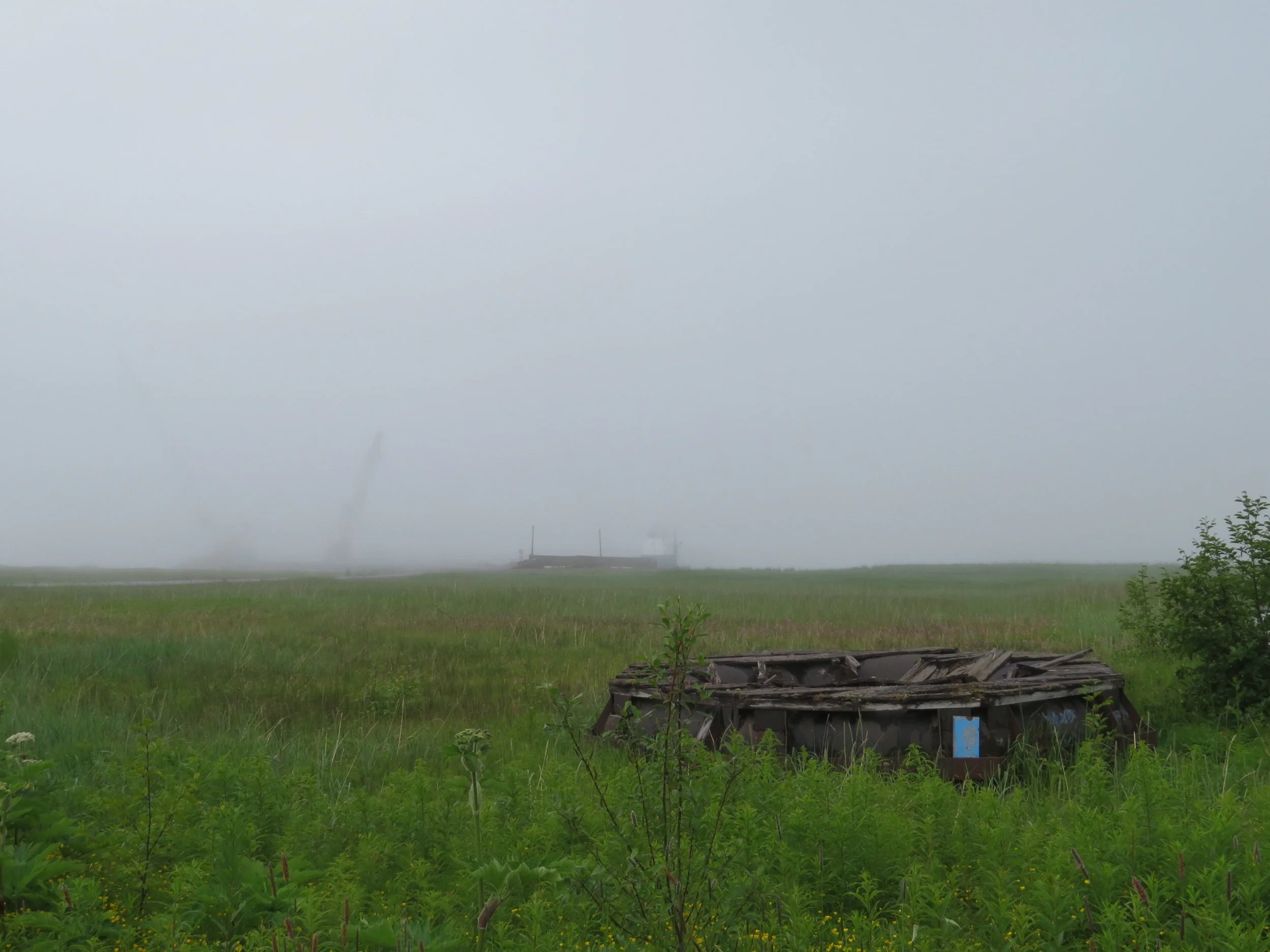
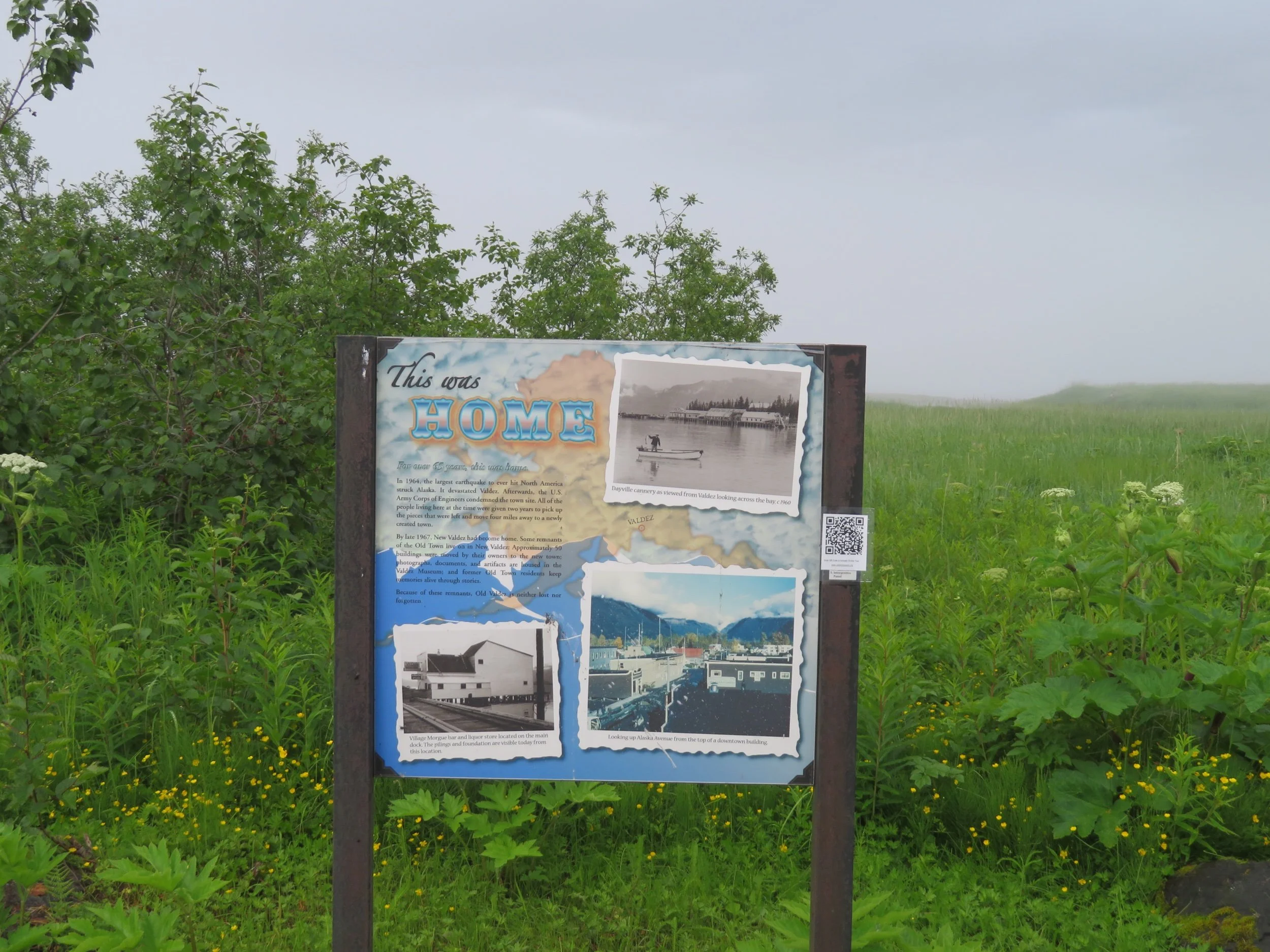
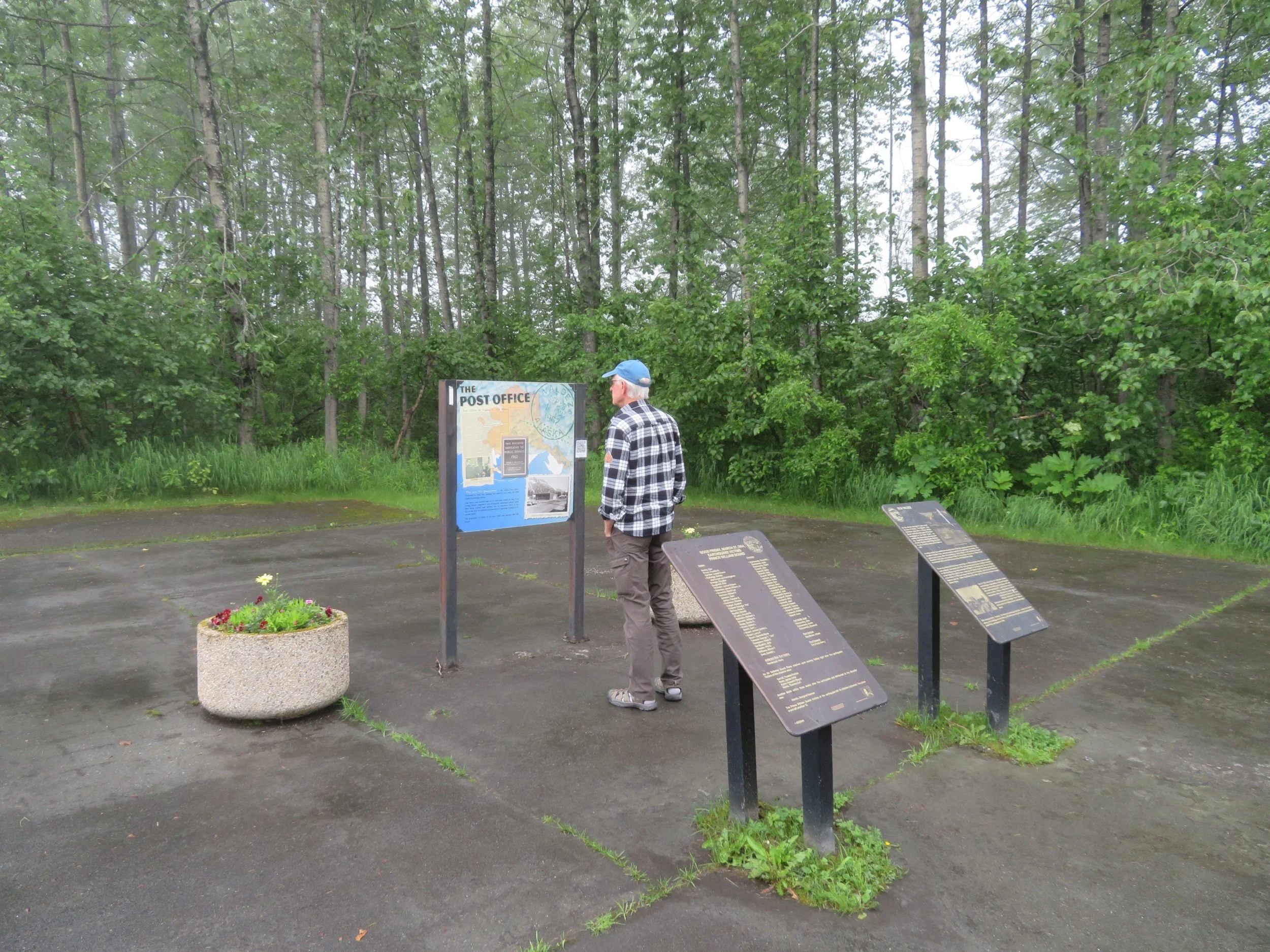
We also stopped at Old Valdez, the original townsite that was destroyed by the Good Friday Earthquake of 1964 and the subsequent tsunamis that followed the quake. There’s not much left… some foundations and rusting equipment. A memorial with the names of those who died in the earthquake is a solemn reminder of this natural disaster. What a tough time this little port town has had … the earthquake and tsunami, the oil spill which remains problematic… and how very resilient the people are.
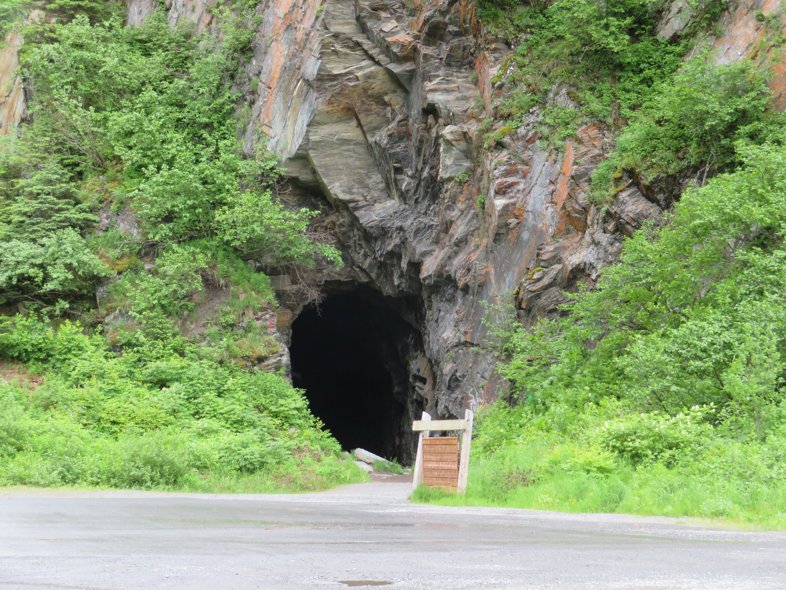
We’d read about a disputed railroad tunnel in the Keystone Canyon area, but didn’t spot it on the trip down. It was very evident heading north. The tunnel was hand cut from the rock and nine companies were vying for rights to it to shorten the trip from the coast to the copper mines to the north. The ‘vying’ turned into violent feuds and gun battles ensued. In the end, the project was abandoned and the tunnel never completed. We took a look inside where graffiti and trash now marks the area.
We covered what we’d missed in the Valdez area and headed north back to the Glenn Junction and onto the Alaska Highway heading west once again. Next stop? Anchorage… maybe. Come along and find out!