

Nine of Cups' Indian Ocean Crossing Route
/We're all geared up for our Indian Ocean crossing. We had originally planned to port-hop up the Western Australia coast, but the clock is ticking and with our delayed departure, we've regretfully opted to skip this coast in favor of perhaps stopping at islands along our route. We've consulted all the guides and internet articles we can get our hands on and determined what our route should be. Deciding on a route has lots to do with predicted weather patterns, currents, prevailing winds and, of course, what there is along the way to entice the crew to stop. During a long passage, it doesn't take much.
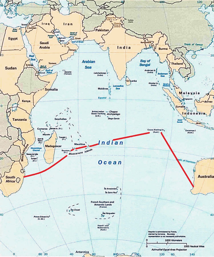
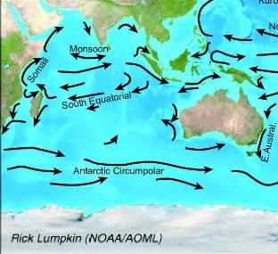
No matter how well we plan a route, we're still at the mercy of the wind and weather. We strive for the most direct approach, but it's not always possible. For instance, if you notice the map, you'll see that we go considerably north before heading west. That's because we're bucking the south-setting Leeuwin Current and trying to get far enough north to pick up the easterly tradewinds. In other words, we may be tacking a lot, doing zigzags as it were, in which case the 6,100 nm (nautical miles) planned may be significantly more by the time we reach the other side. We'll compare actual to optimal mileage when we arrive in South Africa.
Our plan includes stops at Cocos Keeling, an Australian island territory; the islands of Rodrigues and Mauritius, both former British territories and now an independent island nation; and the island of Reunion, a French Indian Ocean Territory. The distances between stops varies between overnights, a few days and weeks. We anticipate the whole trip to take several months, with hopes of arriving in Richards Bay, South Africa in time to celebrate the holiday season.
Fremantle/Perth to Cocos Keeling – 1,500 nm
Cocos to Rodrigues - 2,500 nm
Rodrigues to Mauritius - 350 nm
Mauritius to Reunion - 120 nm
Reunion to Richards Bay, RSA - 1,550 nm
Total - 6,100nm