Sailing the Recherche Archipelago
/L'Archipel de la Recherche (aka Recherche Archipelago), known by the locals as the Bay of Isles, is an extraordinarily beautiful cruising area, but chock-a-block full of islands, islets, reefs, shoals, rocks (some submerged, some not) and other natural obstructions that make the sailing here a challenge. There are 105 islands in the group and over 1500 islets, most of which are designated as part of a 24,000-acre nature reserve. According to our Western Australian Cruising Guide, there exists “over 1200 obstacles to shipping”. Matthew Flinders, who charted the area in 1802, described the archipelago as “an extensive mass of dangers”.
Francois Thijssen, the same Dutch navigator that discovered and named St. Francis Island, passed through the area in 1627. It was the French explorer, Bruni d'Entrecasteaux, who named the group of islands L’Archipel de la Recherche in 1792 after one of the Rear Admiral's ships, La Recherche. The nearby port of Esperance, our next port of call, is named for the other ship in the same expedition.
There have been, not surprisingly, quite a few shipwrecks in the area, the largest of which was the Sanko Harvest in 1991, a bulk carrier that sank to become the second largest vessel in the world that can be dived on. And of course, as previously reported, these islands, Middle Island, in particular, was the hangout for Black Jack Anderson.
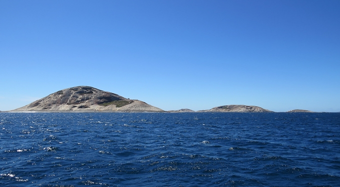
Many of the islands are steep-to granite outcrops, while other islets are limestone and coral barely rising above sea level. Most larger islands are vegetated similarly to Daw Island with low bush and shrubs and all seem to support animals and birdlife. Some have small marsupials like bandicoots and tammars, others have sea lion and penguin colonies, but snakes and rats seem to be the most prevalent species.
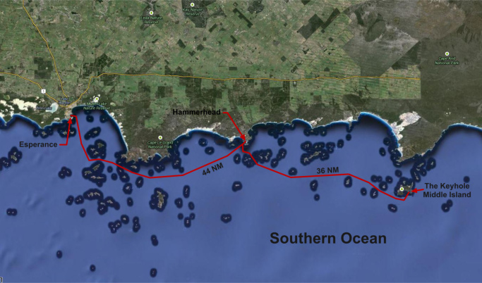
I tell you all this because that's where we are … threading our way, betwixt, between and around islands and islets, reefs and shoals, rocks and other hard spots in the Recherche Archipelago, as we make our way west to the port of Esperance. It's hard to imagine negotiating all these hazards without the aid of GPS and charts that we have available to us today. It's a slalom course even with all of our fine navigational aids, gadgets and electronics.
We left The Keyhole around 0700 this morning heading into the Recherche melange. A pretty day, but we didn't have much wind. The RayMarine GPS died on start-up this morning. Yes, we have several more GPS's aboard … not to worry ... just another repair or replacement on the growing to-do list.
We wended our way ~40nm west and anchored in 30 knots of wind (really? just when we start anchoring?) at Hammer Head anchorage. It's brisk and breezy and we're boat-bound for the rest of the day and evening. Esperance tomorrow? Maybe … we'll see what the weather looks like.


