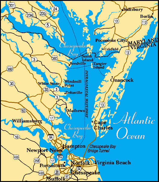
Mobjack Bay to Fishing Bay

Day 3 - 31 nm (passage total: 80 nm) The guys were up at 0530 removing the old impeller and replacing it with a new one. We hauled anchor by 0715. We were thankful for the thick, black river mud that had held us firmly during the night, but now spent 30 minutes cleaning the muck off the chain and anchor before getting underway.

mobjack bay to fishing bay

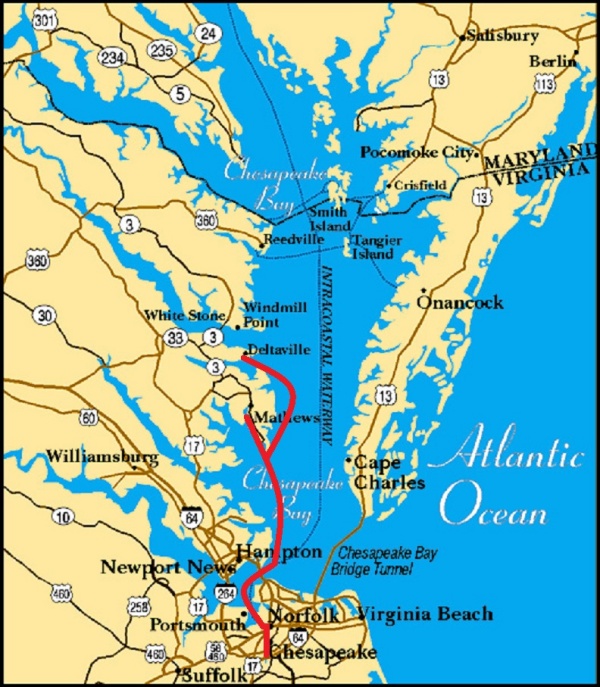
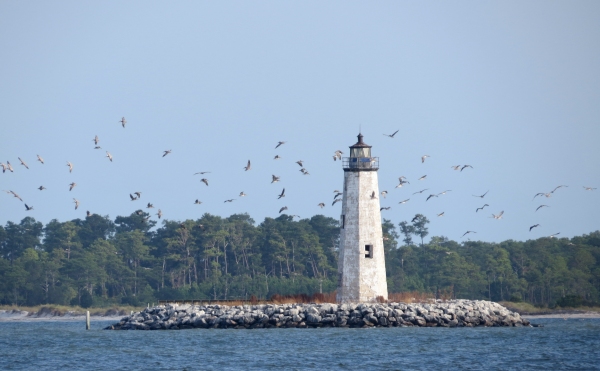
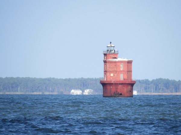
The new impeller did the trick and the engine temp stayed steady in its normal range. Cups' speed was greatly enhanced without all the barnacles on her prop. All was good. We passed by New Point Comfort Light as we left Mobjack Bay and re-entered the Chesapeake.

new pointe comfort lite

It was right about that time that David announced the the forward head pump was broken. Really?

Paul went below and the two guys spent several hours trying to fix it. We had an older spare pump aboard, but when it was installed, it didn't work either. They finally exchanged the aft head pump for the forward pump and all was well … until it was determined that the hose from the head to the holding tank was clogged and the head was still unusable. David tried using muriatic acid, but to no avail. Sigh!

We passed Wolf Trap Light, then headed to port up the Piankatank River. Our destination for the evening was Fishing Bay, a lovely wide open, deep water bay, perfect for an overnight stay. We anchored and the guys got to work on the forward head again. They removed the connecting hose between the head and the holding tank … a mighty effort. It was clogged with thick, hard calcium deposits. Evidently all his regular treatments with muriatic acid along the way had not been all that successful.

wolf trap lite

They worked for several hours and finally reassembled the whole works with excellent results. Whew! Traveling without a working head would have been a bummer. We have an aft head, but we rarely use it unless we're at sea because it is not connected to a holding tank.

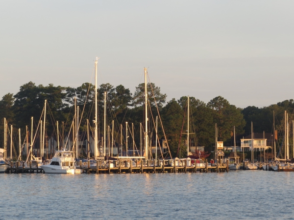
The area was scenic with a lovely little marina and Deltaville, with its shops and museum, was just a short walk across the peninsula. By the time the job was complete, however, it was too late to launch the dinghy and head into shore. We settled for a glass of wine, dinner and a game or two of cards aboard. By 9pm (aka cruiser midnight), we were all ready for our bunks.

fishing bay marina

Two things to note here: 1) We're not traveling very far each day by choice; and 2) we haven't been off the boat since we left AYB. Tomorrow we're hoping for some shore time to stretch our legs and see what we can see and, please, no more hissy-fits from the sulking Nine of Cups.

10 Fun Facts About Chesapeake Bay

As we start exploring the Chesapeake, I thought I'd share some facts and trivia with you. chesapeake map

  1. Chesapeake Bay is the largest estuary in the USA. An “estuary” is an area of brackish water where fresh water, from rivers and streams, meet with the ocean. Chesapeake Bay and its network of streams, creeks, and rivers, encompasses over 64,000 square miles throughout Pennsylvania, Maryland, New York, Virginia, Delaware, and Washington DC. According to internet sources, it is the third largest estuary in the world. The St. Lawrence River is the largest and the Rio de la Plata in Uruguay/Argentina is number two.
  2. According to NOAA, “more than 250 fish species use the Bay and tributaries for some portion of their life cycles, including American and hickory shad, river herring, striped bass, eel, weakfish, bluefish, flounder, oysters, and blue crabs. More than 300 migratory bird species can also be found in the watershed. During the fall, the skies come alive as one million ducks, geese, and swans return to overwinter on the Chesapeake.
  3. The Bay itself is about 200 miles long, stretching from Havre de Grace, Maryland, to Virginia Beach, Virginia. Its width ranges from four miles near Aberdeen, Maryland, to 30 miles near cape Charles, Virginia. The mouth of the Chesapeake Bay is about 12 miles wide between its northern point near Cape Charles, Virginia, and its southern point close to Cape Henry, Virginia. The Bay and its tidal tributaries have 11,684 miles of shoreline—more than the entire U.S. west coast. The Chesapeake Bay watershed has 150 major rivers and streams, but contains more than 100,000 smaller tributaries.
  4. The Bay is surprisingly shallow. Its average depth, including all tidal tributaries, is about 21 feet. A person who is six feet tall could wade through more than 700,000 acres of the Bay and never get his or her hat wet.
  5. The Chesapeake Bay holds more than 18 trillion gallons of water. Approximately 51 billion gallons of water flow into the Bay each day from its freshwater tributaries. The Bay receives about half its water volume from the Atlantic Ocean in the form of saltwater. The other half (freshwater) drains into the Bay from the enormous 64,000-square-mile watershed, the Susquehanna River being the largest tributary, and contributing about 19 million gallons per minute.
  6. The Bay supports more than 3,600 species of plants and animals, including 348 species of finfish, 173 species of shellfish, over 2,700 plant species and more than 16 species of underwater grasses.
  7. During the winter, the Bay supports 87 species of waterbirds. Nearly one million waterfowl winter on the Bay–approximately one-third of the Atlantic coast’s migratory population. The birds stop to feed and rest on the Bay during their annual migration along the Atlantic Migratory Bird Flyway including more than 500,000 Canada geese.
  8. The Bay produces about 500 million pounds of seafood per year. Since 1990, commercial watermen have harvested more than 1.6 billion pounds of blue crabs from the Bay. Data show commercial harvest has experienced a steady decline, and in 2014 hit the lowest level recorded in 25 years: 35 million pounds.10-fun-facts-graphic
  9. The word Chesepiooc is an Algonquian word referring to a village "at a big river." In 2005, Algonquin historian, Blair Rudes, helped dispel the widely-held belief that the name meant “great shellfish bay.”
  10. Historically, there were many different Native American tribes in the region before Europeans arrived, but the dominant group were Algonquin speakers known collectively as the Powhatan tribes. In 1524, Italian Captain Giovanni da Verrazano became the first recorded European to enter the Chesapeake Bay. In 1608, Captain John Smith set off on the first of two voyages where he charted the land and waterways, and later drew an elaborate and remarkably accurate map of the Chesapeake Bay.

And there you have it, more than you'll ever want or need to know about the Chesapeake Bay. Let's get on with the exploring.