

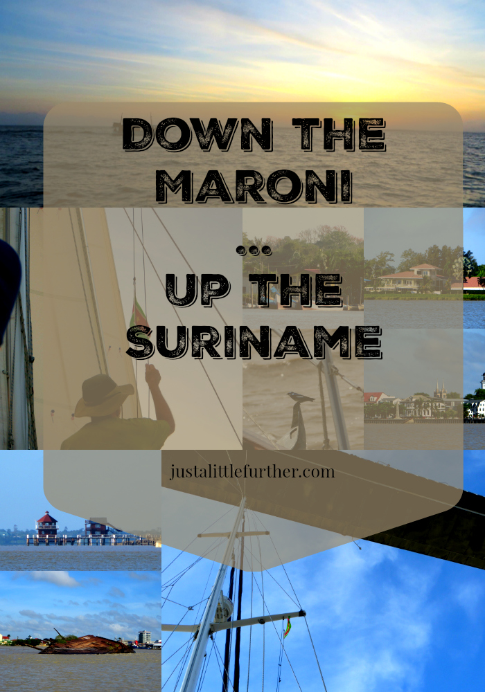
Down the Maroni...Up the Suriname
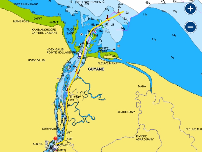
/ Suriname is either 1.5nm directly across the Maroni River from us (Albina) or ~150nm to a safe anchorage at Domburg, about 35 miles up the Suriname River, and 8 miles north of Paramaribo, the country's capital city. After three weeks in French Guiana (my, how time flies), we're heading back down the Maroni River.

The tides dictate boat movement on the river. We needed to wait for an ebbing tide in daylight to carry us down the Maroni back to the Atlantic, and then wait for a flood tide on the Suriname River, to get us upriver to Domburg. Luckily, the total distance is only about 150 nm and there are a few spots to anchor in the rivers while waiting for the proper tides if need be. The tide tables provided on our Navionics charting software are reliable and good indicators for planning departures and arrivals.

The tide wasn't changing till near 1100, so we had plenty of time to do morning chores. We wrote and did final internet. David cleaned the dinghy on the shore while I walked into town for our last French baguettes and croissants. We paid our last week's bill at the marina (13 beers, really?), hauled the dinghy, got everything stowed. The tide was just turning as we slipped our lines off the mooring. As we passed through the mooring field, we waved goodbye to new and old friends, wondering which of them we might see again in some other anchorage.
We followed our inbound track 27 nm down the circuitous Maroni, making the outbound trip a bit less stressful than the upriver trip had been. The wind picked up to 20-25 knots on the nose about half way down, causing short, square muddy brown waves to smash against the bow… wind against current and a bumpy ride. With the ebbing tide to carry us, however, we were spit back into the Atlantic just 3.5 hours later.
A toast to Neptune and we were headed west towards Suriname on a beam reach. David lowered the French courtesy flag and raised the Suriname flag.

The winds petered out before midnight and we made the decision to motor when our speed dropped to less than 4 knots. Though we were 8-10 miles offshore, the water is still quite shallow at 25-35' (10m). Fishermen were out in great numbers. Some boats were lit, some not. They laid out great nets with a strobe to mark the end of the net, then waited downwind a mile or more stretching out the net. Knowing which side of the net to pass was the challenge. If we could spot their boat, just a tiny point of light in the vast darkness, it wasn't difficult. If their boat was unlit or too far away, it was a crap shoot. Neptune was looking out for us and we managed the 80nm avoiding all the fishing boats and nets.
We were at the mouth of the Suriname by 0530. It was still dark, but the flashing channel markers and the light of the gibbous moon guided us up the channel entrance. The fishing fleet was just returning to port as well, and we followed along in good company, waving at the homecoming crews. The sun rose at 0615 and we began to see river sights.

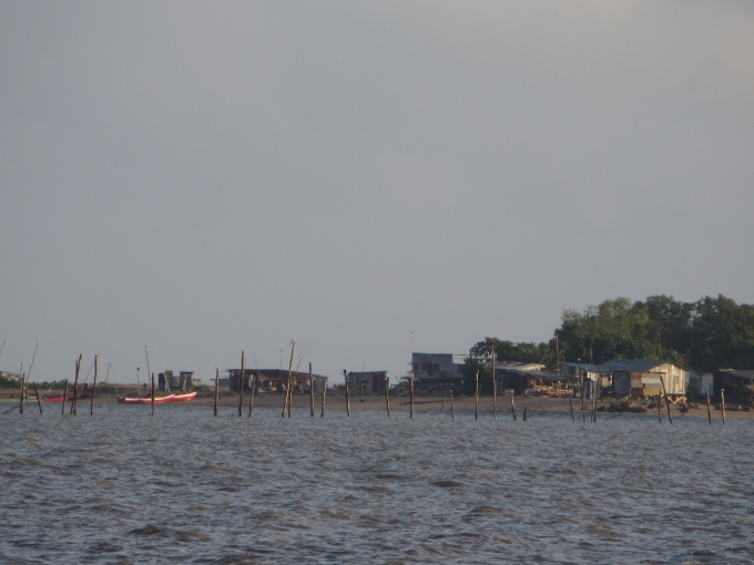
The Suriname River was just as muddy and brown as the Maroni, but it was wider and deeper. The channel markers were more frequent; the coastline less wild and forbidding. There were lots of small settlements and we saw fishing stakes laid out close to shore.
We reached the confluence of the Suriname and Commewijne Rivers when the current was at its peak and felt the conflicting pull of the current... eddies and whirlpools... as we veered to starboard up the Suriname. Yellow butterflies flew over the the aft deck. We heard the high-pitched chirp of welcome swallows as they fluttered around the boat. One fellow landed on our anchor and bummed a ride upriver.

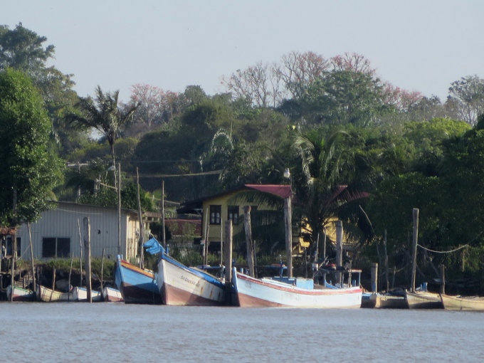
As we motored further and further up the river, more industry and towns appear on the riverside. Fishing boats were lined up on wharves and piers.
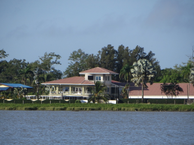
Beautiful riverfront homes sprawled along the banks.
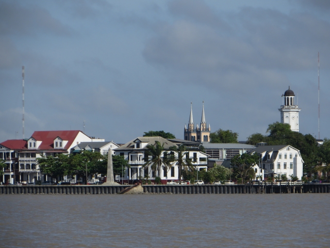
We approached Paramaribo, Suriname's capital city. It stretched scenically along the foreshore, the spires of its cathedral and a stately clock tower dominating the skyline.
An old wreck marked NDP and noted as “Goslar” on the charts lay just outside the channel. It reminded us of the Edith Cavell off Saint-Laurent,

The Brug Surinamerivier (Suriname River Bridge) lay before us, spanning the river, connecting Paramaribo with the town of Meerzorg and points east. It was plenty high enough, but as we slid under, there's always a bit of a catch in our throats as wait to clear.

The shores became less busy as we progressed up the river; the channel markers disappeared. About eight miles up from the bridge, we spotted some masts and knew we'd arrived at Domburg and the Marina Suriname. We headed for a mooring, lassoed it on our first try (no one was watching, of course), tied up and sighed. It was 24 hours from anchorage to anchorage and about 142 nm. Life is good … a new river and a new country.