The Blue View - Our Daily Bread

finished bread One of the first things we run out of when on a long passage is fresh bread. It is also one of the easiest problems to remedy. My night watches are the perfect time for making bread. It helps pass the time, and I can still pop my head up and take a look around every five minutes or so. I make the dough during my 9PM to midnight watch, let it rise while I'm sleeping, then try to time it so that it is hot and just out of the oven at the end of my 3AM to 6AM watch. The smell of the freshly baked bread greets Marcie when she gets up, and we enjoy a slice or two over our morning cuppas while discussing whatever happened (or broke) during the night.

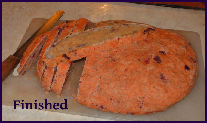
Kalamata olive bread is one of our favorites. This recipe makes one large loaf.


Kalamata Bread
Recipe Type: Bread
Author: David Lynn
Ingredients
  • ½ cup (100 ml) warm water
  • 1 tsp (3g) dry yeast
  • ½ cup (75g) flour
  • 1/3 cup (66 ml) warm water
  • 1 Tbs (20ml) honey or ½ Tbs (6g) brown sugar
  • 2 tsp (6g) dry yeast
  • 1 Tbs (5g) rosemary
  • 1 Tbs (5g) oregano
  • 1/8 cup (30ml) olive oil
  • 2-1/2 cup (375g) flour
  • 1 cup (200g) kalamata olives, pitted and sliced lengthwise
  • 1 tsp (15g) salt
  • optional: ½ cup (125g) sunflower and/or pumpkin seeds
  • cornmeal as needed
Instructions
  1. Starter: Water should be just warm to the touch. If it is too hot, it will kill the yeast. Dissolve the yeast in the warm water, then add the flour and stir until thoroughly mixed. Cover and let it stand 30 minutes.
  2. Dough: Combine water, honey or sugar, and yeast, and mix until yeast is dissolved. Add herbs, oil, flour, the starter, olives, and seeds, and mix well. Move to a floured surface, and sprinkle salt over dough. Knead for 5 minutes, adding flour as needed. Put the dough in a greased bowl, cover and let rise until doubled, about 1 hour. Transfer to a floured surface, punch it down to get rid of air bubbles, and shape (don't knead again). Grease a cookie sheet and dust with cornmeal, then transfer the dough to the cookie sheet. Let rise in a warm place for two hours. (On my night watch, I let it rise for 3 hours during my off-watch).
  3. Preheat oven to 450F (230C). Raise the upper oven rack to the second level above the flame and slide an oven proof pan onto the lower rack. About 5 minutes before putting the bread in the oven, add about 1 cup (250ml) of water to the pan. This produces steam for the first 5-10 minutes of baking. The steam keeps the outer layer of dough soft and flexible for a few more minutes, allowing the yeast to continue rising. The result will be a slightly lighter loaf with a brown crust. Score the top of the loaf with a sharp knife or razor and slide the bread into the oven. Bake at 450 (230C) for 10 minutes, then reduce heat to 400F (200C) and continue baking for another 20-30 minutes. Bread is done when you get a slightly hollow sound when the loaf is rapped with a knuckle.


The Blue View - Methane Bubbles

When we are at sea, there are any number of things to worry about. Storms, freak waves, partially  submerged containers, cranky whales, lightning, ships, pirates, and serious boat malfunctions top the list, and have been the cause of many a lost vessel. We've had a few close calls over the years. We've also had several friends and a number of acquaintances who have lost their boats, and in some cases their lives, from such calamities. Sometimes these things are due to an error in judgment; sometimes the daily routine lulls the crew into a false sense of security and complacency; but often, it is purely bad luck. As if the list wasn't already long enough, I just read of a new menace for mariners to worry about ... the dreaded methane bubbles. When we were parked in Puerto Lucia Marina in La Libertad, Ecuador a few years ago, we were fascinated by all the bubbles that continually percolated their way to the surface of the water. It turns out that there are methane gas and other petroleum deposits just under the earth's surface there, and the methane continually bubbled to the surface. They had built an elaborate catchment system to try to  harvest the gas, but for whatever reason, it hadn't proved viable.

methane bubbles at libertad

While the La Libertad methane bubbles were an interesting, but innocuous, phenomenon, apparently methane bubbles in a much higher quantity could conceivably sink a vessel - even a large ship. It has long been known that large concentrations of frozen methane hydrates exist just below the sediment on the ocean floor. University researchers in both Great Britain and Australia have proposed a theory that portions of these concentrations could break free due to seismic tremors and earthquakes. As it floated towards the water's surface, the methane would change from ice to gas, forming bubbles which would then reduce the buoyancy of the water. If there was enough methane, any vessel caught in the cloud of bubbles would sink within seconds.

methane deposits chart

Proponents suggest that this might be the reason any number of vessels have disappeared without even a distress call. They show, as evidence, the presence of a sunken vessel in the center of a large methane hydrate eruption site in the North Sea.

methane bubbles sink a ship

Critics claim that such eruptions occur only rarely - maybe once every 400 years - and the odds of a ship being in that precise location at the exact time of the eruption are infinitesimally small. On the other hand, I remember reading that the early designers of offshore drilling rigs designed them to withstand a 50 foot wave, because it was estimated such huge rogue waves only occurred somewhere in the world every decade or so, and the odds of any one drilling rig getting clobbered by a wave bigger than that were minute. Now that satellite imagery can track such things, however, it seems there are actually something like 100 rogue waves that size or larger somewhere in the world's oceans at any given time. It's still quite unlikely an oil rig will get hit by such a wave, but the odds are much higher than the designers thought.

As for us, we aren't going to worry too much about the "Ocean Flatulence" theory - it's one of those things we can't do a thing about. If it is a real phenomenon, we can only hope that Neptune enjoys his tot of rum enough to keep us clear of that particular type of night wind.

Note: Despite Marcie's encouragement to the contrary, notice how I avoided incorporating any sophomoric 'fart' humor in this Blue View, like "we have enough flatulence aboard without worrying about Neptune's farts". I am much too sophisticated for that.

The Blue View - The Great Circle Route

If you were planning a long sea voyage and wanted to take the shortest, most direct route, one way to determine the course would be to take a globe and put a string between the start and end points. Assuming there weren't any landmasses or other obstacles on the route, the string would mark the shortest route. string

The string would lie along the great circle joining the two points, which, as defined by Wikipedia, is “a circle on the surface of a sphere that lies in a plane passing through the sphere's center. As it represents the shortest distance between any two points on a sphere, a great circle of the earth is the preferred route taken by a ship or aircraft.”

Few sailors, however, rely on a globe and string for navigation. Instead, routes are planned and plotted using flat paper charts (or, more likely, flat chartplotter screens). A straight line drawn between the start and destination on a traditional Mercator projection chart is called the rhumb line and is not necessarily the shortest route, however. So how is the great circle route determined?

If your math skills are good, the great circle route between any two points on the globe can be calculated using spherical trigonometry. A simpler method is to use another type of chartset, called the Great Circle Sailing Charts. These use a gnomonic projection as opposed to the usual Mercator projection of the world. On a gnomonic projection, the lines of latitude are drawn as arcs. A straight line drawn between any two points on these charts lies along the great circle between the points, and is the shortest possible route. The great circle charts cannot be used for navigation, however, so the route must be transferred to the usual navigational charts.

Not that many years ago, to create a great circle route, I would plot the route on the gnomonic charts. Then I would create and measure waypoints along the great circle route a few hundred miles apart, and transfer them to the Mercator charts. If I connected the dots, I would then have a close approximation to the great circle route on our regular paper charts. The route would then have to be closely checked to make sure we weren't going to sail through a reef or island. It took a lot of time and it was quite easy to make errors, so Marcie would always check my work.

great circle chart

Now, of course, chartplotters do all the work for us. For example, when plotting a course on OpenCPN, a PC-based navigation program that we use, when the correct options are set, the program will display the difference in nautical miles between the rhumb line route and the great circle route and will then plot the route either way. A nice feature!

Some rules of thumb regarding great circle routes:

Since lines of longitude are great circles of the earth, the rhumb line for a route that runs north-south will also be a great circle route. The only latitude line that is also a great circle is the equator. The further an east-west route is from the equator, the more the rhumb line distance will vary from the great circle distance. For example, if sailing from Cape Town to Melbourne, the rhumb line is more than 600 nm longer than the great circle route, while the difference between the rhumb line and great circle distances for a route between Ecuador and New Guinea is only about 85 nm.

east west

east west

On long passages that run both east-west and north-south, the difference between the rhumb line and great circle distances is often very small. An example is the route from Cape Town to New York, which varies only about 50 nm between the rhumb line and the great circle distances.


north south