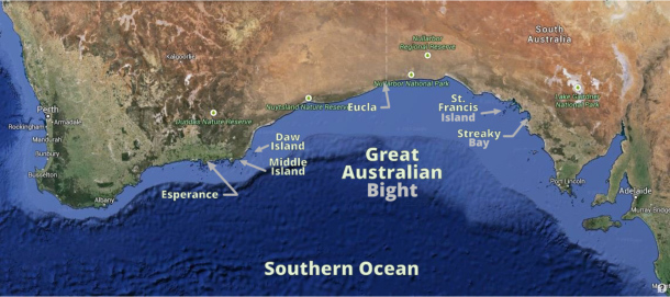
Streaky Bay to St. Francis Island
/A Day of Small Catastrophes
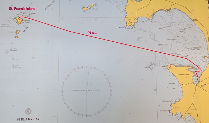
We thought we were starting off this passage on the right foot. A 50nm daytrip to St. Francis Island is just the thing we needed to dip our toes into the Great Australian Bight without being totally immersed.
We prepped last night, so all was ready. We checked the weather one more time before we left. It had changed a bit. The long term (5-day) forecast up until yesterday had been S/SE 15-20 for the foreseeable future, but now light northerlies followed by strong SW/W winds were showing up on the grid … not good. What to do?
We decided we'd go for it while the winds were good and hide out in St. Francis or Eucla to wait out the adverse winds and be that much ahead when the desired S/SE showed up again. In the process of getting ready to leave, Marcie managed to tangle with the wind generator blade. The wind gen won and sliced Marcie's finger and nail. Blood on the deck … not a good way to start the day, but all part of the tribute we pay for the privilege of living aboard.
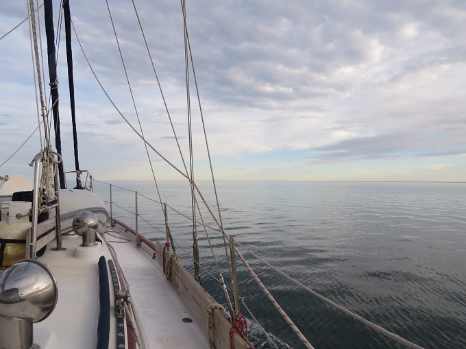
The sunrise was gorgeous … pinks, oranges, purples. Within minutes, the clouds took over, leaving us a rather drab, grey day. Dolphins saw us out of Streaky Bay. A cape effect had us thinking we'd motor all the way, then we passed the cape and good south winds 10-18 knots took over. A pleasant day for sailing and we made good time until …
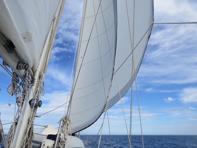
Boom – thunk … what was that? It took us a minute to figure out that the clew had pulled out of the foresail! There lay the limp jib sheets on the deck while the jib threatened to tatter itself to death. David furled the sail quickly, surprised it had no candy stripes, and a postage stamp size jib still fluttered in the breeze, no sheets to secure it.
The wind increased a bit (of course, it did) and it was no time to try to take it down. It would have to wait till we anchored. We were only 12 miles from St. Francis. The main and staysail were working hard, but we could only manage 4 knots with the seas building. It was nearing 5pm; we got the iron jenny (the engine) fired up. We wanted to get in, anchored and the jib sorted out before nightfall.
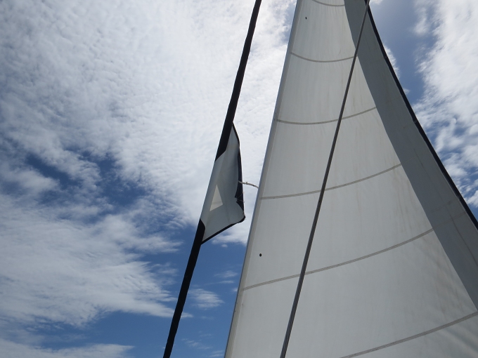
I might add, this is not an old sail. It was custom made for us three years ago in New Zealand and you'll remember we barely even sailed last year. Was it poor workmanship? W doubt it. We know the sailmaker and his work well. Was it bad UV thread? All the stitching broke around the clew, even the hand-stitching. Was it just too much strong UV in the southern hemisphere? We checked out all the sails before leaving Adelaide, they appeared in good condition. Obviously, they were not.
Right about this time, we noticed an odd phenomenon in the sky before us. A long, dense cloud resembling a tightly rolled cigar stretched out ominously. We'd never seen anything quite like it before. David growled “white squall” half in jest. Before we knew it, we had 35 kts battering us and as quickly as it had come, it moved on … a total of maybe 5-6 minutes.

We saw another approaching and one beyond that and one beyond that. Bands of low-lying solid white horizontal cylinders that moved swiftly. When directly overhead, they appeared tan in color and pommeled us with huge gusts of wind. Are any of you Aussies out there familiar with this? Does it have a name? We've seen squall lines before, but none that looked like this.

We were approaching our entrance to the anchorage between Dog Island and St. Francis. The jib continued to flog and complain, but the seas abated as we moved into the lea of the island. The cigar clouds had passed and we saw no more. There was a sense of relief as I walked forward to drop the anchor, but not for long. The wind increased to 20-25 knots and we dragged on our first attempt. We tried again ... no good. We moved to another part of the wide bay. We increased scope and David held the boat in position to allow the anchor to set … still we dragged. He'd written the anchor evaluation too soon and the anchor gods knew it! We looked for a sand patch, but we ended up too close to shore … 20' to 12' and less and still we were not close enough to the sand.
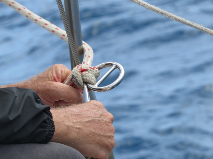
We tried again in yet another place … our sixth try. Though dragging slowly, we had plenty of room and decided we had to get the jib down. No easy feat in these winds. I released the halyard and lowered the sail while David tried to keep it on deck. In the end, we won the battle, but not without pain and suffering. Marcie's injured finger got nicked again and blood smears were all over the white sail as we wrestled it along the side deck around shrouds and fender boards and dorades into the cockpit and down below. David cleverly deployed the lee cloth and contained the jib on the port settee.

Now back to anchoring. It was getting dark by now (though I stopped for two seconds earlier to take a pic of the sunset which was deceptively beautiful). Two more attempts at anchoring failed. We'd never had a situation where it was totally impossible to anchor. The guidebook, local knowledge and other yachties reported “good holding”. I guess all things are relative. The bottom was thick grass as evidenced by the field of grass on the anchor each time we pulled it up and the fact that the foredeck looked like it needed mowing. One last attempt … miracle of miracles ... it held tentatively. We didn't trust it, but it allowed us time to recoup, have something to eat and think about the alternatives.

What would you do? Check back tomorrow.