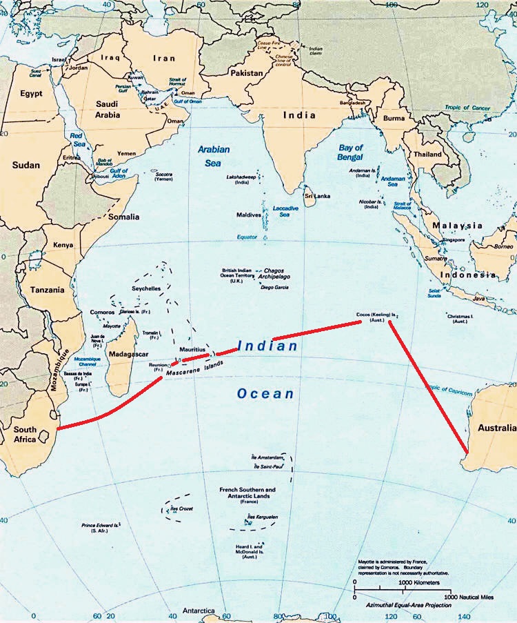
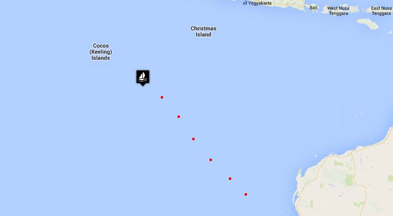
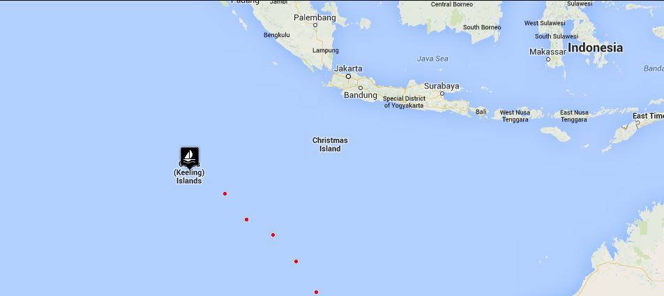
Crossing the Indian Ocean - Day 10

day 10 map

day 10 map

Indian Ocean Crossing - Update 4

Geraldton, Western Australia to Cocos Keeling

Day 10

Remember I talked about how idyllic this trip has been? Well, we're making up for it ...all in one day. The tenth day of our passage was rather action-packed and deserves a separate blog unto itself.

The day started out well enough, the light breezes of the past two days disappeared and Neptune graced us with the trade winds once again. We picked up speed and of course, as the winds increased, so did the seas. We rigged the port settee with lee cloths as our sea berth.

Just after Noon, the AIS alarm went off. A ship, 15 nautical miles away, had a CPA  (closest point of approach) of under one mile. We had a visual on him 6 miles out. His CPA was getting closer - .75nm. We hailed the freighter, Berge Manaslu, a Panamanian registered vessel en route from Brazil to China, to make sure they could see us and asked their intentions. We got a quick response in good English that indicated yes, we were on their radar and they had adjusted their course to port to allow us more clearance room. We chatted for a moment, exchanging pleasantries. Though we would have guessed he would have crossed behind our stern, it appeared he was crossing our bow. He certainly had access to more sophisticated equipment and probably more experience, so we went with his decision.

As he came closer and closer and the CPA showed an imminent collision, we took evasive action. We needed to jibe. Since we were poled out, this meant taking in the jib in record time, jibing, and cutting hard to port to pass behind his stern. We came within .2nm of either being t-boned or hitting him broadside. Huge ocean out there and not enough room for a tanker and a tiny sailboat. We hailed again to ask him what he was thinking, but this time no response to our hails. Whew!

Shortly after resuming our course, we got a solid hit on the fishing line. Hooray ... Fish for dinner. But, alas, we had hooked a white fairy tern known by the locals as the "pilot of the Cocos". Oh, no! I went to grab a towel in hopes we could somehow catch and release him, but David gave me the "kaput" sign, index finger across the throat. He'd been dragged under for quite awhile. He was a goner. Then, like a Phoenix rising from the ashes, he darted out of the water like a shot and flew away. This would have been tantamount to killing an albatross in my book and, oh, the consequences of that!

The winds continued to increase, the seas building, but we were moving along nicely wing on wing until a rogue wave, an untimely gust and an accidental jibe and ...CRASH! The whisker pole snapped in half, leaving two halves with ragged aluminum shards on their ends falling to the deck. David assessed the damage. The mast-end of the pole could not be lifted back into place, so we lashed it to the mast pulpit. After much coaxing, the sheared-off extender tube was freed and lashed to the lifelines above the fender boards.

With the 30 knot wind still behind us and significant weather helm, we wrestled down the mainsail and flew the jib alone, sacrificing no speed and getting a marginally better ride.

Each afternoon, we customarily have a cuppa and two TimTams each, carefully doled out so they'll last as long as possible. TimTams are Australia's favorite sweet biscuits (cookies), so the ads tell us. They come in several varieties. David prefers Original (chocolate) and I prefer white chocolate. After our adrenaline-rich afternoon, we felt most deserving of this treat. I noted with dismay that I only had two left in my package while David had four. At first we attributed it to my being a tad piggy one afternoon, but a closer look revealed David's package contained 11 cookies per package while mine had only 9... 200g vs. 165 g. A grievous difference! How could I have known? Same price, same size package on the outside. How could they expect me to read the fine print? This was grounds for a mutiny until the captain generously offered to give me one cookie from his package, evening out the cookie allotment to 10 each. Mutiny avoided.

The night was a wild ride. We stood two hour watches. It was unpleasant on deck with the boat knocking around in the waves. Salt spray flew off breaking waves and stung our faces. Below, there was no comfortable place to be. The sea berth, though confining, allowed little rest and added to the already mounting list of aches and pains. It was a toss-up which was worse, standing watch or trying to sleep.

And then morning came and, though I wish I could tell you all was calm and fine, it was more of the same. The good news? 62 miles to go to Cocos Keeling.

Today's catch: 6 flying fish, 1 bird, 1 whisker pole, many bumps and bruises, no edible fish, equal amounts of TimTams. That's my story and I'm sticking to it.

Continue on to our arrival in Cocos Keeling.

Nine of Cups' Indian Ocean Crossing Route

We're all geared up for our Indian Ocean crossing. We had originally planned to port-hop up the Western Australia coast, but the clock is ticking and with our delayed departure, we've regretfully opted to skip this coast in favor of perhaps stopping at islands along our route. We've consulted all the guides and internet articles we can get our hands on and determined what our route should be. Deciding on a route has lots to do with predicted weather patterns, currents, prevailing winds and, of course, what there is along the way to entice the crew to stop. During a long passage, it doesn't take much.  

planned route across indian ocean


No matter how well we plan a route, we're still at the mercy of the wind and weather. We strive for the most direct approach, but it's not always possible. For instance, if you notice the map, you'll see that we go considerably north before heading west. That's because we're bucking the south-setting Leeuwin Current and trying to get far enough north to pick up the easterly tradewinds. In other words, we may be tacking a lot, doing zigzags as it were, in which case the 6,100 nm (nautical miles) planned may be significantly more by the time we reach the other side. We'll compare actual to optimal mileage when we arrive in South Africa.


ocean currents


Our plan includes stops at Cocos Keeling, an Australian island territory; the islands of Rodrigues and Mauritius, both former British territories and now an independent island nation; and the island of Reunion, a French Indian Ocean Territory. The distances between stops varies between overnights, a few days and weeks. We anticipate the whole trip to take several months, with hopes of arriving in Richards Bay, South Africa in time to celebrate the holiday season.

Fremantle/Perth to Cocos Keeling – 1,500 nm

Cocos to Rodrigues - 2,500 nm

Rodrigues to Mauritius - 350 nm

Mauritius to Reunion - 120 nm

Reunion to Richards Bay, RSA - 1,550 nm

Total - 6,100nm

Crossing the Indian Ocean - Days 7-9

IO days 7-9

IO days 7-9

Indian Ocean Crossing - Update 3

Geraldton, Western Australia to Cocos Keeling

Day 7Begin:  566nm    Miles to go:  433nm

Day 7...already a week at sea. We've shut down the freezer now and are just maintaining the fridge. The freezer's a power hog especially as we climb into the lower latitudes. Even with our solar panels and wind generator, we still have to run the engine a couple of hours each day to keep the batteries charged. All those electronics certainly do suck down the power.

All of our fresh chicken and turkey mince have been eaten now and we're relying on our canned provisions and David to catch fish for dinners. No luck yet in the fishing department, but we are trolling two lines. No chance of us starving ...plenty of food in the larder. We also try to have at least one or two meatless dinners a week ..like Half Way Alfredo, for instance.

The fishing lines get lots of attention from the passing birds. After a couple of fly-overs, they're smart enough to  figure out it's nothing they're interested in. Not all birds are this smart. Boobies are pretty dumb (hence their name) and we've had to unhook many of them along the way...sometimes more than once. They're not fast learners.

The moon rises later and later now. This morning, a lemon wedge of a moon rose just before 0300. Soon her cycle will be complete and we'll sail moonless for a few nights.

Today's on-deck count:     Squid -  2    Flying fish - 0

Day 8Begin: 433    Miles to go: 316nm A circle of dark clouds surrounded us this morning and, for the first time in a week, it rained. We witnessed a good tropical downpour for all of 20 minutes, just enough to rinse the squid ink off the deck, and then it cleared and the day turned beautiful once more. We're becoming quite spoiled with this weather.

No luck fishing although it appears the big wad of plastic debris caught on the end of the line might have accounted for some of the problem. Once cleared, we got one solid hit which even left bite marks on the lure, but no fish for supper.

What a contrast to a week ago! We're barefoot and in t-shirts now and...sweating.  We've definitely found the warm. Do not in any way  construe this as a complaint.

The winds were light today and dead downwind which had us tacking to maintain a reasonable course. It's reflected in our low mileage today. Fresher winds from the SSE are forecast for tomorrow. We're nearing the Cocos now and, like horses getting close to the barn, we're keen on getting there.

Only one flying fish in the scuppers this morning ...slow night.

Day 9Begin: 316 nm  Miles to go: 207nm

As we move further west on our route, the sun rises and sets later. We're sailing into a new time zone: GMT +6-1/2 hours - a 1-1/2 hour difference from Western Australia. The time of day makes little difference to us at sea and since the change is minimal, we'll wait until we arrive in the Cocos to collect our extra hour and a half.

Neptune is teasing us big time these last two days with light, fickle winds. As we get closer to the Cocos and excited about our arrival, he's been holding back the southeast trade winds and sending 3 knot breezes from the ENE and E in their place. We had thought to make landfall in two days, but two slow days in a row might necessitate an extra day at sea. Much depends on the winds over the next two days. So much for plans.

The nights have been as sweet and beautiful as only tropical nights can be. Other than a few errant sprinkles, the sky has been clear and star-studded ...absolutely mesmerizing. Warm breezes play on your face and though we're not moving very fast, it's so very pleasant. The wisp of a crescent moon waits till nearly dawn to rise, allowing the stars to have the night sky to themselves for a change and they take advantage of this monthly opportunity. What a show!

David loaded a new app on the iPad before we left called StarMap 3D. It uses GPS to figure out where we are and the current time and  displays the constellations, stars and planets in the night sky. A compass heading provides the orientation and there's an artificial horizon. We hold the tablet up to the sky and compare it to the real thing ...voila ...all the heavens on display. We're still playing with it to learn more about the southern skies.

Deck count: 3 flying fish; 1 squid or least parts of one and lots of ink.

Continue with us on our Indian Ocean Crossing.