Mosselbaai to Simon's Town
Yes, I know we're supposed to be heading to CAPE Town and we are, but SIMON'S Town is on the way … kind of … and we've heard such good things about this little seaside town and … you know how we are about making plans and sticking to them. We're easily distracted.

We stayed an extra night in Mosselbaai because the promised easterlies were really southeasterlies and very light which would have meant motoring for most of the day. Plus, (this is the real reason) it was rainy and drizzly and raw, and let's face it … we're wimps. Sun was promised for a few days and the weatherman was good on his word. It's always easier leaving port on a sunny day after a good night's sleep. We rigged the whisker pole to port, hauled anchor, hoisted the mainsail and set off mid-morning under a glorious blue sky with a cold easterly wind.
Dolphins jumped. A seal poked his head out of the water. White-breasted cormorants dove for their breakfasts. We were a bit miffed at the local fishermen who had laid out fishing floats in our path, requiring us to slalom through the maze. Then, one of the floats flew off and we realized it was pairs of gannets strategically resting along our route. Oops … never mind, fishermen.

The day was mostly uneventful. We were anxious about rounding Cape Agulhas and, as you already know, other than the tot of rum to Neptune at 0400, it, too was quite uneventful. That is in no way a complaint! We hailed the rising of the sun, portending another sunny day ahead. The sun never seemed so big.

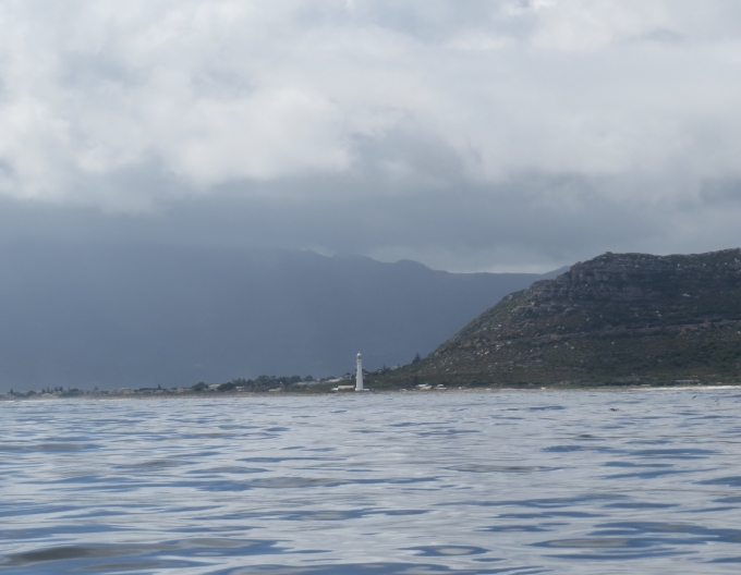
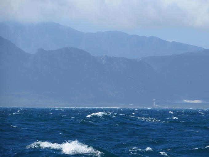
We knew we couldn't make Simon's Town before dark, though we were making 7 knots. Rather than spending another night at sea and wait until light to enter the marina, we opted to tuck into Pringle Bay about 25 nm away. David had noticed it on the charts, a little indentation on the coast on the west side of Cape Hangklip and it looked as if it would protect us from the building southeasterlies. The forecast was calling for 15-20 knots, but by late afternoon, we were seeing sustained 30-35 knot winds and gusts near 50. We have two cruising guides aboard and both agreed that in case of strong southeasterlies, little Pringle was the choice of local fishermen.
Rounding Cape Hangklip proved to be more difficult than Cape Agulhas. With a double-reefed main, we were motor-sailing with only a few miles to go. Though we anticipated some cape effect as we rounded Hangklip, we weren't expecting quite as much as we got … near 50 knots. We could see little Pringle Bay, but getting there was another story. We clawed our way at 1.5-2 knots up the coast, eased our way in and doused the main. As we headed into the bay, the waves subsided and we noticed the notch in the mountains, just above the quaint little town of Pringle. Not a good sign.
We'd seen notches like this before at Erith Island in the Bass Strait and many times in the Patagonian canals. Our experience was that a notch like this tends to funnel the wind through like a locomotive. Yet both guides seemed to indicate the fishermen found it a safe heaven in southeasterlies. Maybe something about this particular anchorage and notch was different. NOT! We noted there were NO fishermen in this bay at the moment.

Our alternatives were to set an anchor alarm and tough it out for the night, or heave-to in the middle of False Bay and wait overnight for light to enter the marina. The weather forecast, by the way, was still calling for strong southeasterlies throughout the area, just not quite as strong as we were seeing. We opted to drop the hook in Pringle. That in itself proved to be a challenge. With all the bouncing around, the anchor chain had fallen on top of itself in the anchor locker and fouled, so that when David gave me the sign to drop anchor, the chain jammed. We worked for five minutes or so unjamming it, the gale force winds pommeling us as we worked. Finally, it was free. David re-positioned us for anchoring and thankfully the hook caught and held almost immediately. There was no need to back down on it with a 40-knot wind blowing. The chain was out straight and taut in seconds and Cups was swinging around and pitching gently at its end.
Yes, we did tidy up the decks and stow the whisker pole, but nearly blew off deck in the process. No, we did not launch the dinghy and go ashore. We went below and had a cuppa. Whew! The wind howled the whole night long, “shivered our timbers”, shrieked through the rigging like a banshee. No anchor alarm went off, but we checked regularly, just to make sure we were still in the same spot … and we were.

We waited till dawn to up-anchor. We checked the local AcuWeather and found that Simon's Town was experiencing 9-12 knots of wind, while the notch was till providing us with 30 knots and all the noise we could we handle. Moral of the story: Beware the notch.