Intracoastal Waterway - Day 3
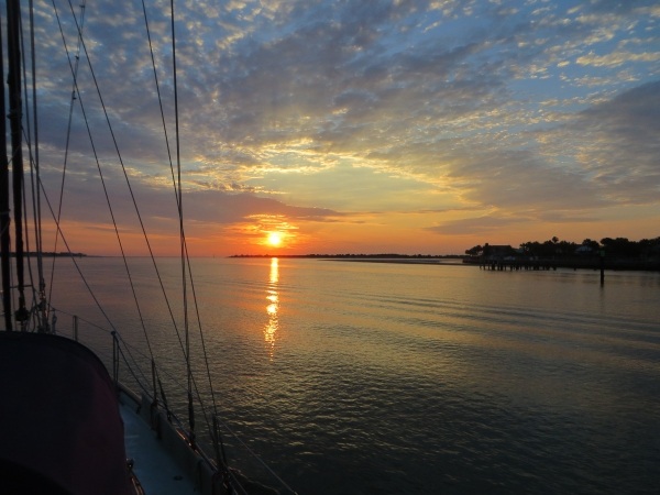
Day 3 – 575 nm to go We were up with the sun for an early start. All was calm on the Crescent River and the sunrise was spectacular. What a way to start the day.

sunrise on the crescent river

We are working towards at least 60nm per day and early starts, when the day is cool, are advantageous to the plan. Tides are an issues here. The tidal swing is 6-7 feet. If we enter a river on a rising tide, we have a push, but by time we're half way up the river, of course, the tide is pushing against us from the other side. On occasion, we've timed it right (through no fault of our own) and we get a push and a pull to help us along. Usually, however we don't have it both ways, so we've been averaging 5-6 knots and 60 nm miles requires 10-12 hour days.

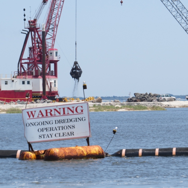
It's not as unpleasant as we imagined, however. It requires us to be alert and someone, usually David, is at the helm all the time. Active Captain, especially a contributor known as Bob423, has provided invaluable local knowledge for negotiating the trouble spots and we've avoided most problems. I monitor the Active Captain site and provide input as to upcoming shoals and hazards. That said, we did have our first soft grounding today at Johnson Creek. Cups glided to a slow, but definite stop in the mud though we thought we were where we were supposed to be. David was able to back up, torque turn in the mud and we were off and on our way in a matter of minutes … no kedging, cursing or towing involved.

We see dolphins daily and frequently in the rivers. We identified them as common Atlantic bottlenose dolphins, but thought they were particularly small. I learned that the dolphins here plying these protected inland waters are indeed smaller than their offshore counterparts. They're seldom very playful. They surface and dive in an effortless, undulating fashion. They're curious, but their visits are brief and then they're back to the work of feeding.

dolphin fin

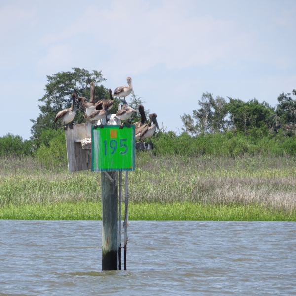
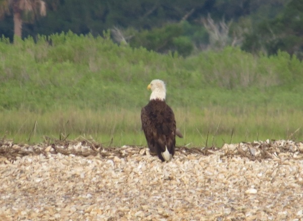
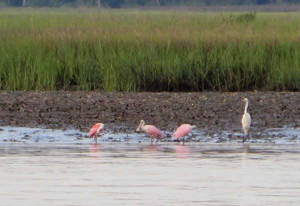
As the day heats up, the sound of cicadas is so loud, we can hear their droning buzz over the engine noise. Ospreys are a common sight. Their huge, unwieldy nests are easily spotted and most that we've seen are occupied.

osprey nest

We're still in Georgia. The marshland grass here is thick and very uniform in height as if a barber services the area regularly and gives it a flattop cut.

flat even grass


Sometimes the waterway is quite wide. Other times, it seems as if we could touch the shore.

marshland grass

We noted that there are lots of saints in the area. We left Saint Augustine and passed St. John's Inlet and St. Mary's and Saint Simon's and probably more. I'm sure Matthew and Luke and probably more are around somewhere, we just haven't found them.

Today's adrenaline rush was passing through Hell Gate and then Fields Cut. Both are actually “cuts”, man-made, dredged channels connecting the waterways. We've been through Hell Gate, the narrow tidal strait on New York City's East River. We've passed through Hell's Gate on Tasmania's west coast heading into Macquarie Harbour. Comparatively speaking, this Hell Gate was neither as exciting nor as as treacherous as the other two. We did have the benefit of the right tides and a little local knowledge, and found the anticipation much worse than the actual passage. Thank goodness!

We anchored the night between Jones Island and Turtle Island. Neither Joneses nor turtles made an appearance and we spent a comfortable night conveniently located just off the ICW ready to resume our trip at tomorrow's first light.

Along the Intracoastal Waterway

Day 2 – 637 nm to go We woke to a glorious, clear-skied morning on the ICW. We could really get into this. We were anchored just off the National Parks dock and Cumberland Island begged exploration, but we said no this time. We were anchor up by 0630 and on our way heading up the Cumberland River. David had plotted the day's course the night before while I prepared dinner, so we were ready to go. The water was flat calm, nary a ripple to be seen. The Little Cumberland Island Lighthouse poked its head into view as passed the north end of the island.

little cumberland island lighthouse

We pass by clusters of home from time to time along the canals. Some are palatial and others just river shacks. Some of the owners have a sense of humor.

ronald mcdonald waves at us

Mostly though, the scenery has been pastoral and pleasantly ever-changing. Bright green grassy banks line the rivers of these Georgia marshlands. The day turned hot and sultry by 10am and we were thankful for light cloud cover and a slight breeze. Herons and egrets, just a couple boat lengths away wading along the muddy shores, ignored us as we passed, more interested in their morning's breakfast.

wading birds on a grassy shore

Dragonflies, butterflies, bees and huge horseflies hitched rides with us throughout the day. One dragonfly, the size of a hummingbird, lighted on the lifelines. I snatched my camera for a picture, but the “change battery” light came on. Figures. I scampered down below, got a new battery, changed it and came back up. Believe it or not, that vain dragonfly was still there, just waiting for his photo to be taken.

dragonfly

Each day presents a minor adrenaline rush with its shallows and narrow canals. These are not life-threatening nor boat-wrecking events. The worst that would happen is we would be probably be grounded in mud and sand. Still, we're used to traveling on the ocean where the depth meter seldom registers. Watching the depth meter plunge below 10, then 9, then 8 feet is unsettling with our 7.2' draft. Day 1 the major bugaboo was the Fernandina Shallows where we saw (and felt) a 7' spot under the keel. We plowed through the few feet of mud and felt as if we had done a bit of dredging for sailors in our wake.

Today's tough spot was the Jekyll Creek along the west coast of Jekyll Island. Once again, the depth meter plunged and we were close enough to the dock at the Jekyll Island Marina to nod hello and say a few words to the folks moored there without raising our voices. Because of the ongoing movement of the river waters, silting and shoaling are constant issues and though we see dredging operations regularly, it never seems to be quite enough.

dredging in progress

Around 3 pm, the VHF wailed a violent storm warning for the local inland waters. Though there was some cloud build-up, we never saw a drop of rain nor an increase in winds. We counted ourselves lucky for dodging yet another weather bullet.

We're fascinated by the names of some of bodies of water we're passing through like the Little Mud River (hmm!), Buttermilk Sound, Old Teakettle Creek and DoBoy Sound. We wind and wend our way through this maze of waterways. Thank goodness for GPS.

Pelicans were out in force today. They'd careen past us at top speed, dive into the water, swallow their catch (or perhaps just a lot of river water) and then fly off again. When they weren't fishing, they congregated wherever they could for some socializing. We wondered just how many more pelicans could have fit on the top of this marker.

how many pelicans can fit on a marker

It was nearly 5:30 pm when we quit for the day. We found ourselves a pleasant little anchorage out of the current in the Crescent River just off the main channel. With the engine off, the quiet was nearly palpable. It was hot and humid below, but sitting in the cockpit after a long day, enjoying a cold beer (yes, there's still some ice left) was heaven.

Breaking Free from St. Augustine

St. Augustine to Chesapeake We enjoyed our time in St. Augustine just a little too much. Our one week layover became two weeks without a thought. There's so much to see and do here and we've hardly touched the surface. We never made it to the main fort, Castillo de San Marcos. We'd still like to check out some of the beaches. There are more walks we'd like to take and more museums to visit. Maybe next time.

Departure plan delays haven't just been our fault. Tropical Storm Bonnie kept us in port for a couple of days, waiting her out to see what she'd do along the Carolina coast. Then we waited a couple of days for southerly winds again. We made plans to leave one day, then thought better of it and postponed till the next. Then the next morning came and we didn't feel like leaving. We finally pulled ourselves together, gave ourselves a stern talking to and managed to prepare for a timely departure. Then Tropical Storm Colin came along.

Weather forecasts differ. We always wonder  if the weather forecasters and the news broadcasters just hype it a bit too much (duh!), providing all the worst scenarios to catch the headlines and not providing more realistic forecasts. Still … we prefer to be prudent, so we stayed put and in retrospect, glad we did. We've been in storms and cyclones before and it's not pretty. We'd begun to think of St. Augustine as something of a magnet, keeping us here. We were having problems breaking away.

IMG_0002

Tropical Storm Colin arrived and departed and we were no worse for the wear, but he left heavy seas and northerly winds in his wake. We waited for two more days and then … finally … a reasonable weather window appeared. We got up, checked the weather and our southerly winds had vanished during the night. The heck with it … we'll motor up the Intracoastal Waterway (ICW) for awhile then we can head out an inlet when the winds were favorable.  Enough waiting. Let's get on with it. The sunrise was outstanding.

Day 1 – 635 nm to go (outside) or 706 nm on the ICW

IMG_0003

We headed out through the Bridge of Lions at 0630 towards the end of a low tide. The friendly bridge keeper waved and wished us a safe trip. As we sailed past the city and the fort, we felt the tiniest tug. This is an endearing city. We'll be back. The near slack tide gave us no resistance as we traversed the inlet and headed up the Tolomato River, the course of the ICW headed north. Instead of searching for the Gulf Stream, we were trying to stay between the lines in the channel.

IMG_0005

Our experience with the ICW was admittedly limited, but we were a bit negative about it. It was slow and circuitous; we were motoring, not sailing; all that fuel, etc., etc. Just a few miles up the river, I spotted a bald eagle sitting on the shore. My negativity faded quickly.

IMG_0001

Further up, I spotted roseate spoonbills. There were egrets and herons everywhere … pelicans, terns and black-headed gulls. The traffic we feared was minimal. It was late in the season for folks heading north. We found ourselves pretty much alone with  a trawler or two politely notifying us before they passed.

The scenery was beautiful for the most part … tall grass marshes, bright green grassy banks, sea oats swaying in the breeze. Dolphins worked the river and we saw them frequently. A ray jumped up several feet out of the water. Turtles poked their heads up, then submerged again. Manatees lumbered along close to the grassy shores. We agreed … this really isn't so bad.

Thanks to our new friends Cheryl  and Doug on Renaissance, we discovered Active Captain, a free download for sailors with lots of local knowledge and specifics on transiting the ICW … everything from shoaling and strategies to marinas, restaurants and points of interest along the way. It saved our bacon on a couple of occasions and though we disliked some aspects of the program, overall, we found it quite helpful.

We found a fine anchorage in Cumberland Sound South, just off Cumberland Island, Georgia for the night. (Thanks, Benjamin, for that suggestion). This is a National Seashore Reserve and beckons more time which we didn't have. We didn't get to go ashore at all, but it's on the wish list for our next trip down.

So we've stopped whinging about the ICW and actually, we're starting to like it. We plan to spend at least another day or two on this circuitous route north … maybe even go all the way. Who knows?