Venturing into Jamestown, St. Helena

view of wharf After a rolly, but somewhat restful night on our St. Helena mooring, we received a radio hail from Port Control at around 0830. The ferry was on its way with the Customs, Immigration and Harbourmaster officials to check us in. How convenient … they were coming to us and at a most civilzed hour! Paperwork was completed in record time and we were legal to head ashore. We headed back on the ferry with the friendly officials.

Portugese explorer, Joao da Nova commanding four caravels on his return from India sighted St. Helena for the first time and landed on 21 May 1502. It was Emperor Constantine's mother's (Helena) birthday, and thus, the island was named St. Helena. The Portugese lost interest and the Dutch and English vied for the island. In 1659, the English East India Company annexed the island, a castle was built and Captain Dutton was commissioned “to settle, fortify and plant”. I found an old engraved map of the “Sancta Helena” from Petrus Bertius' Tabularum Geographicarum dated Amsterdam 1616. Luckily, we had better charts for our passage, but considering it was drawn in 1616, this wasn't bad.

It's a step back in time when you land on St. Helena Island. The ferry lands at the 19th century waterfront. Passengers are required to leap off the ferry to the cement wharf with the aid of a Tarzan-like rope. It's a trip unto itself.

We walked along the vintage wharf. Historic blue and white-washed limestone buildings are built into the side of massive cliffs and still used today. We saw pics of the wharf in 1902 and other than more advanced equipment, the physical aspects of the wharf and buildings had changed little. The wharf was bustling with men loading and unloading containers. The island's only supply ship, the RMS St. Helena, was due the next day and there was much to do to prepare for her arrival, according to Steve, the harbourmaster.

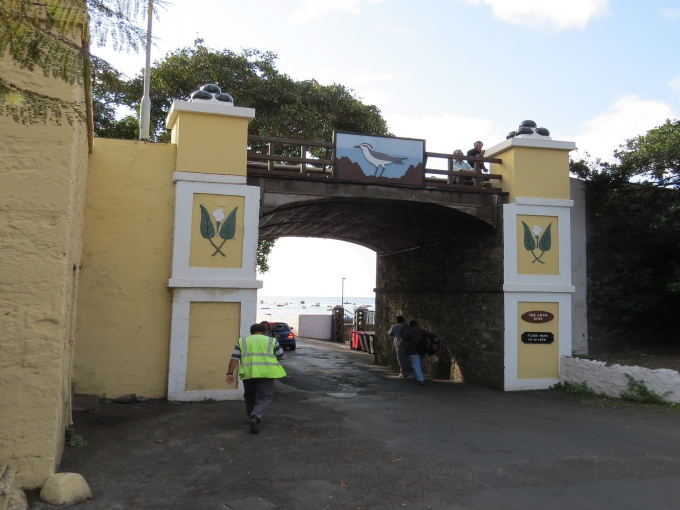
The cliffs provide the backdrop for the island's capital and only town, Jamestown. One enters Jamestown from the waterfront along a single road, across a narrow bridge and via an archway through a 25' thick, fortified wall built in 1832.

archway in st. helena island

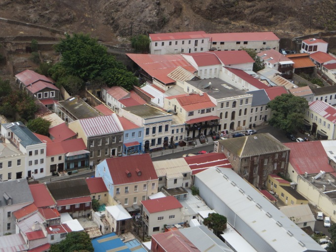
You can see Jamestown's main street rising before you as soon as you pass through the archway. It's a most pleasant scene with 18th and 19th century buildings lining the wide boulevard. For a small island, there are lots of cars which were parked along the streets and in a designated parking island in the middle of the street that separates the one way traffic flow on each side. It's British … people drive on the left. We love the architecture and feel of the place and decided we needed an entire day for just wandering along side streets and into alleys to see what we could see.

jamestown st. helena island

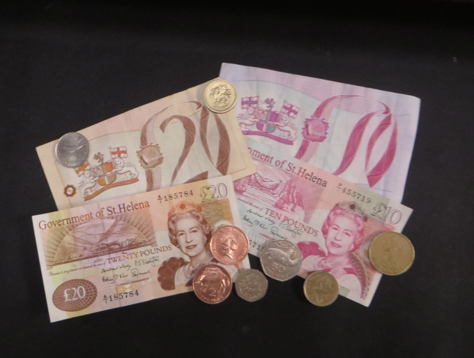
Our main objectives of the day were to get local cash (St. Helena Pounds - £), find our friends Gilbert and Joan to let them know we'd arrived, figure out communication options and pay our landing fees. We found Joan at work and received a warm welcome, but there was little time to tarry. The bank was closing at Noon. There are no ATMs on the island and credit cards are not usually accepted. The line at the bank was long … queuing out the door and down the street. After nearly an hour, it was our turn. We were successful in withdrawing funds and, feeling flush, immediately headed to the local markets, Thorpes and The Star, to see what was available. Fresh bread and some locally grown broccoli topped the list of purchases, but the stores were actually quite well stocked. Things are available, but quite understandably expensive. It was a mighty change from a 12:1 exchange rate in Namibia to a .69:1 exchange rate here. Ouch!

st. helena pounds

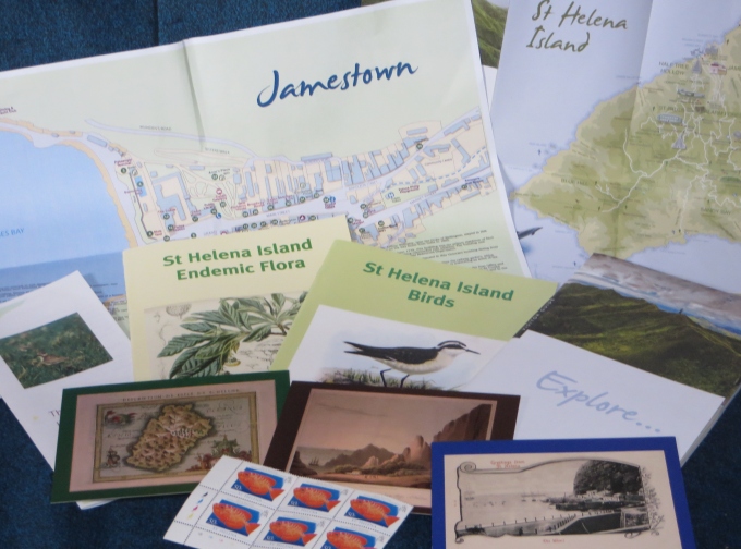
We stopped at the friendly Tourist Info Office and met Val. We picked up brochures and island maps and asked Val abour hire cars. They were more reasonable than we expected so we booked one for a couple of days allowing us to roam around the island independently over the next few days. Val also explained our limited options for internet communications. There are several wifi hotspots around town at £6.60/hour (~US$10). We could also buy a phone card from the local phone company for international calls at £1/minute. We spotted several “phone booths” around town … talk about a step back in time.

st. helena island brochures

We settled on paying for internet by the hour at Anne's Place, a well-known yachtie and local hangout, where we had lunch and picked up email. In the future. this meant hauling our laptop into town on the days we wanted to do internet in order to send pics and do any amount of internet research. The iPads just don't cut it for that. It wasn't particularly convenient, but better than nothing. We're definitely spoiled.

We paid our Immigration fees (£17/pp) and then our port fees (£40). There would also be £2/pp/per day for the ferry and £2/day for the mooring fees due before leaving. The cost of visiting St. Helena has gone up significantly since our last visit, but no complaints. The pleasure of being here far outweighs the cost.

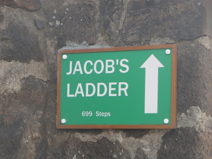
We walked through the Castle Gardens and then checked out the hours for the island museum across the street. We got a good look at Jacob's Ladder. Yikes … 699 steps! David's intent on climbing it. I don't mind watching … we'll see how that goes.

jacobs ladder

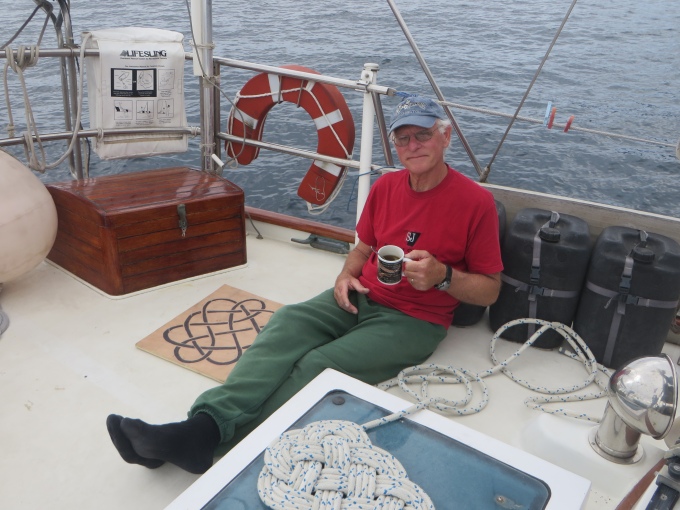
It was mid-afternoon when we caught the hourly ferry back to Cups. It was a pleasure sitting in the cockpit in shirt sleeves (yes, it's finally warm) and sipping our afternoon cuppas.

cuppa on the deck

With lots to see and do here, the evening was spent reading brochures and making our island plans. We're all going to enjoy this adventure … guaranteed!

Namibia's Skeleton Coast

We had originally planned to head north to Walvis Bay before leaving Namibia, but as you know, plans change. We dawdled just a bit too long in lovely Lüderitz and now it's time to get out of Dodge and head across the pond. The coast between Lüderitz north up to Angola is referred to as the Skeleton Coast and though we're only traveling a short distance along it, I thought you might be interested in learning more about this infamous stretch of water. map of skeleton coast namibia

The San people (aka the Bushmen) called the interior desert area "The land the gods made in anger”. The Portuguese explorers sometimes referred to it as "The Gates of Hell". The actual reference to  Skeleton Coast was popularized by the title of a 1944 chronicle by John Henry Marsh which described the wreck of Dunedin Star. The name stuck and most maps use this name today and, in fact, Skeleton Coast National Park runs along the Namibian coast nearly up to the Angolan border.

When the cold Benguela current air mixes with the hot, dry desert air, dense fog frequently occurs. We've seen this in Lüderitz a number of times. You can barely seen the bow of the boat sometimes.  Further north, the climate becomes more and more inhospitable. There's heavy surf and surge and few places to land. Before engine-power, if a boat did manage to get ashore, it would be near impossible to launch it again. Shipwrecks were frequent and when we visited the coast by land back in 2007, we saw several of them. There are reputedly thousands of shipwrecks along this coast. Probably the most famous is the Edward Bohlen, a German freighter that sank in 1907. It's not accessible by car. The desert has slowly merged with the sea and now the ship appears to have foundered  in the desert sands.

edward bohlen skeleton coast namibia

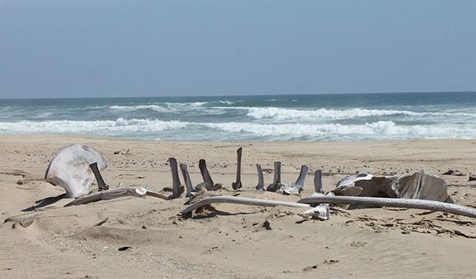
The Skeleton Coast derives its name not only from shipwrecks, however. In the whaling days, the coast was littered with whale and seal bones.

whale bones on the skeleton coast namibia

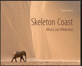
Inland, desert lions and elephants and other animals that have adapted to this dry, hot environment still roam wild. The Safari shop in Luderitz has an extensive book collection on offer and one in particular was amazing... Skeleton Coast by Thorsten Milse. The photography was out of this world.

skeleton coast np namibia

If you were aboard a shipwrecked vessel and were fortunate enough to make it ashore, your ordeal was just beginning. You would have to get through hundreds of miles of lion infested desert to get to the nearest town -  not a pleasant prospect. Perhaps this was another reason it was called the Skeleton Coast.

There's a 1965 National Geographic documentary "Survivors Of The Skeleton Coast" that might be worth a watch if you're interested.

I know we can't go everywhere, every time … but I can wish, can't I?

Goodbye, Lüderitz...St. Helena Beckons

The day before leaving is always a mad scramble ... as if we didn't know we were planning to depart. So many things have to wait till the very last minute … official check-out , final freshies provisioning, scrubbing down the dinghy bottom and stowing it on the foredeck, engine checks, propane top-up, final showers and laundry … the list goes on. We were up early and tried to be as efficient as possible and set up an orderly progress of chores for the day. David had the engine checks done and I had the laundry on the line before 0800. We had to revive ourselves with a cuppa … too much energy expended, too early in the morning. It was blowing 30 knots, but the forecast insisted it would be calming soon. We headed into shore by 0900. David wanted to scrub the dinghy bottom on the beach and I had last minute shopping to do … bread, chicken and freshies.

cleaning the dinghy
cleaning the dinghy

I had the last of our Namibian cash and was intent on spending it all before we left. I did well … only N$6 left ... about US 48¢. The only problem? There were no fresh carrots to be had in either of the supermarkets in town. Freshies only arrive once a week and evidently there'd been a run on carrots. Who would have guessed it?  I phoned Liz with my tale of woe. “Any carrots?”, I asked.  “I've got a fresh, unopened package in the fridge and you're welcome to them.” Gotta love, Liz!

six namibian bucks left

We made the rounds of the officials in the afternoon. They were closed between 1-2pm. We returned to each office … Immigration, Customs and Port Authority. Immigration would not check us out until the next morning. Really? We wanted to leave extra early. “Sorry, but you need to check out on the day you depart.” She was firm. We stopped in Customs … same response. Port Authority issued our clearance papers, but we'd have to do the rest the next day which would delay our departure. Does it really matter? Nah! Go with the flow. We'd head back in the morning. The wind still hadn't calmed in the least. Maybe this checkout delay was for the good.

We headed to Pupkewitz's Hardware for a propane fill … a bargain here at about US$10! We gave the guy who filled the tank our last N$6 and he was pleased. Then to Ian's for a final hot shower and a farewell hug. We showered, had coffee with him and said our goodbyes. And then to the Safari shop to say goodbye to Liz.. She had our carrots waiting, plus a small remembrance gift of Luderitz. We hugged and promised to stay in touch and then we headed back to Nine of Cups.

The wind was still howling, though the sun shone brightly. There was a definite chop in the bay … whitecaps all around. The birds were all hunkered down, their heads tucked under their wings. It was a wet, cold ride back to Nine of Cups. We reviewed the weather forecast once more. It still insisted the winds had calmed down. We're sure they had calmed somewhere … just not here! We spent a quiet evening aboard … except for the howling winds.

hunkered down birds in namibia

During the night we woke … no wind! We rose early to check the weather. It was a go! The wind had calmed to a manageable 20-25 knots and the seas were subsiding. Now the mad rush began once again. I began preparing the passage soup and made a coffee cake and some sandwiches for the first days of the trip. David prepped and stowed and lashed. We headed into shore at 0800, checked out with Immigration and Customs without a hitch (or any fees … hooray!). We were back aboard by 0830 and hoisted the dinghy for stowing on the foredeck.

filling our immigration forms in namibia

While David did the dinghy stowing, removed the sail cover and washed down the deck one final time, I finished up down below. We were on a roll. We had a final cuppa, threw off the mooring lines and we sailed off into the sunny, cold day. St. Helena Island beckons.

leaving luderitz
leaving luderitz

Saying goodbye to our friends in Lüderitz has been especially difficult. It's amazing how quickly friends bond and though we've said goodbye many, many times before, it's never easy. So … to sweet Liz, Doris and Ian, JC and Carol, Evaldine and all the many other wonderful people we've met and with whom we've interacted … thanks … you'll be remembered most fondly.

Come along on this passage with us ... Days 1-2