
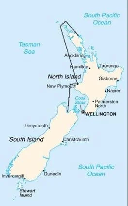
New Zealand … Land of the Long, White Cloud
An island nation, New Zealand is a land of diversity and contrast. Unique animals and a unique Maori culture combined with miles of coastline, snow-capped peaks, fjords, intriguing national parks and friendly Kiwis. It’s like no other place we visited.


New Zealand
Capital: Wellington, southernmost capital in the world
Population: 3,890,000 (est 2009)
Area: 104,454 sq mi
High Point: Aoraki / Mt. Cook (12,316 ft - 3,754m)
Low Point: Pacific Ocean
Government: Constitutional Monarchy
Languages: English, Maori & Sign
Time: +12 UTC (+13 UTC during Daylight Savings Time)
Currency: NZ dollar aka "the Kiwi" (NZ$1 - US$ 0.72 in 2009)
*First country with universal suffrage; women got the vote in 1893!
*There are more sheep in New Zealand than people by 10:1
*The kiwi is a fruit, the name of an endemic bird, a nickname for New Zealanders and a nickname for their $1 coin.
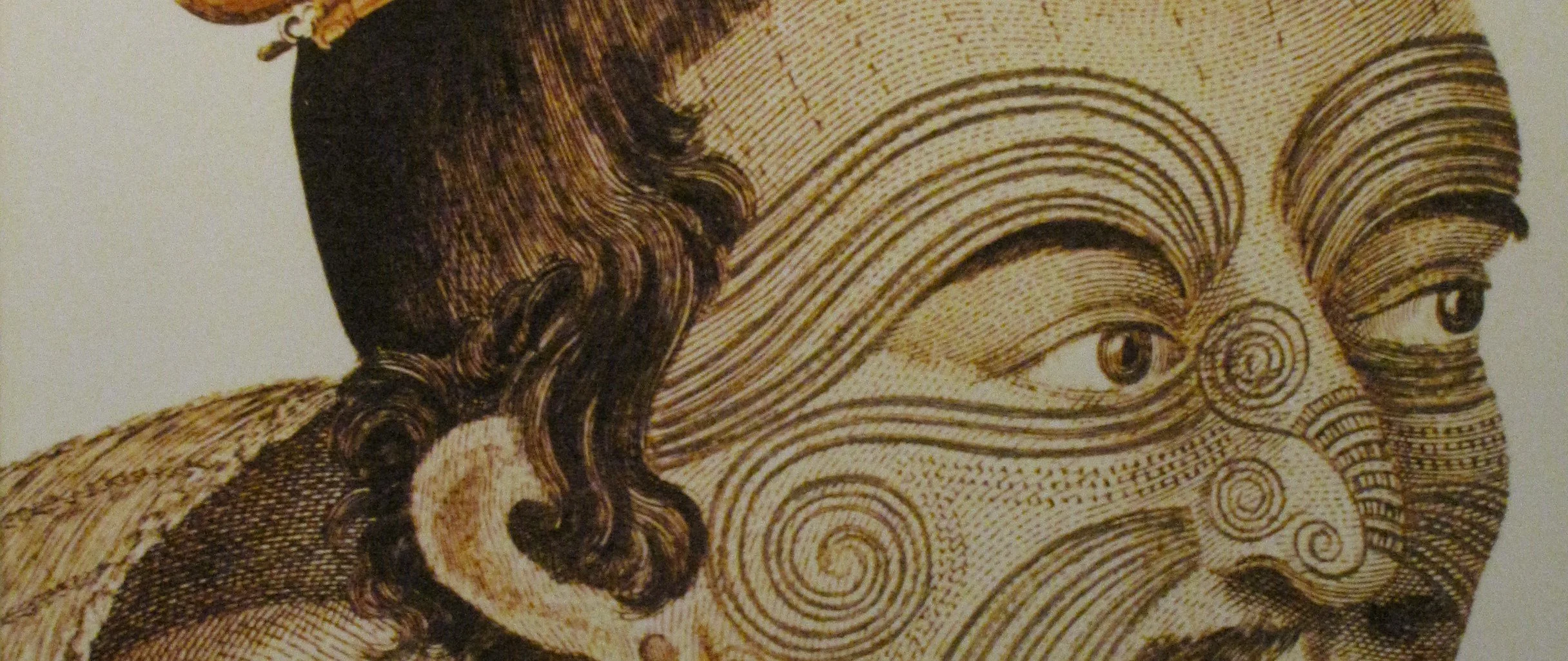
Many oral histories tell of the discovery of NZ by the great Polynesian navigator Kupe in about 800AD. Kupe sailed to Aoteoroa (Maori for NZ) from Hawaiki (not Hawaii, but rather Ra'iatea in French Polynesia). It was Kupe's wife who named the new land Aotearoa which means "Land of the Long White Cloud".

Kupe discovers Aotearoa Artist unknown
In 1642, Dutch explorer Abel Tasman (Tasmania, Tasman Sea) sailed up the west coast and christened the land Niuew Zeeland after the Netherlands province of Zeeland. The Dutch subsequently lost interest and when Captain James Cook arrived in 1769, he circumnavigated and charted NZ, then claimed the entire land for the British Crown. Many of the places still bear the names he gave them.
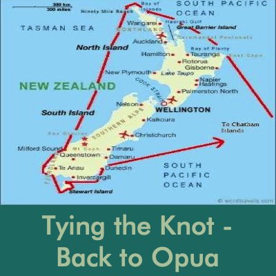
We ended our Pacific Ocean crossing in Opua, New Zealand. We would spend nearly 18 months in New Zealand with a trip back to the States for a family emergency in between. During our time in New Zealand, we managed lots of land trips as well as two long sails - one circumnavigating the North Island and the following year circumnavigating the whole country with a side trip to New Zealand’s offshore Chathams Islands. It was fantastic!

Nine of Cups Route Nov 2009 - April 2010
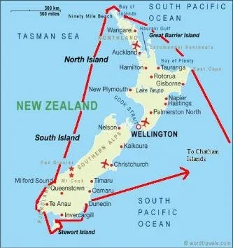
Nine of Cups Route - Sept 2010 - April 2011
There’s a lot to see. Click on the links below to join us as we explore this great country…
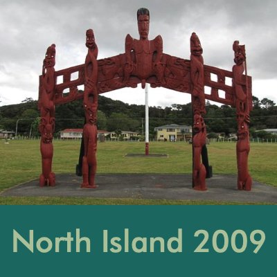
North Island 2009
We left Big Mama's anchorage and Tonga on 1 November, 2009, a beautiful, bright Spring day in the southern hemisphere. We were heading for Opua and the Bay of Islands, about 1,100 nautical miles away. Minerva Reef was en route, but with fine weather in store, we opted to take a miss on Minerva and continue on to Opua. As luck would have it, Murphy's Law prevailed. Having passed up Minerva some miles back, David discovered a rather significant oil leak in the engine. We had consumed well over a gallon of oil in less than 15 hours of motoring over three days. Since we only carried enough spare oil for an oil change (2-1/2 gallons), we would not have enough to motor for very long, especially since we needed to charge the batteries for 1-2 hours each day. We were in the proverbial pickle. We had been calling in daily with our position to the "Big Mama Net" which was established and maintained by the cruisers heading to Opua. When we called in and announced our problem, several boats offered aid and oil within minutes. That’s the cruising community for you.
David determined the most likely diagnosis at this point was a broken piston ring or a burned piston. Several boats offered excellent ideas including the construction of an "oil catchment container" which reduced the crankcase pressure and the oil consumption significantly. Our days were spent busily monitoring the engine oil leak, completing our 2009 Christmas letter, updating the website, polishing stainless (yuck!), completing the replacement of the lifelines and completing the coachwhipping of the wheel. We did our share of reading, jewelry making, and of course, planning. Planning what we would do about the engine and the mainsail. What we would see and do in New Zealand and what might be our itinerary for 2010.
Never a dull moment on this boat! Read David’s article on coachwhipping the wheel here and Marcie’s article on making courtesy flags is just a click away.

In calm waters with no wind, we drifted in rather the right direction. Our "oil delivery" came unexpectedly from Happy Spirit who dropped off 3-1/2 gallons of used oil (still perfectly fine for our use). He wrapped the oil jugs in big plastic bags, dropped them close to us, and we retrieved them with the boat hook.

En route, Marcie put the final touches on the New Zealand courtesy flag which we flew as soon as we cleared NZ Customs/Immigration.
Opua, Bay of Islands, New Zealand - 35S18.81 / 174E07.35

We arrived and tied up at the "Q" dock (quarantine) in Opua, New Zealand on 11 November at about 2130 and spent a restful night ... 11 days and 1205 nm, not bad considering the state of both the mainsail and the engine. Customs, Immigration and Biosecurity arrived around 0900 the next morning. Efficient, friendly and professional, the check-in was nowhere as bad as we had heard or anticipated.
We had made a reservation at the Opua Marina and once freed of NZ incoming formalities, we settled into dock life at the marina. Hot water, showers, laundry facilities, real supermarkets nearby restaurants. It was nearly overwhelming!
The waterfront at the Opua Marina is lined with chandleries, services and tradesmen. The closest supermarket and gas station is in nearby Paihia.
Remember, you can enlarge the photos for a closer look just by clicking on the thumbnails.


Though David was intent on completing the engine work as soon as possible, I convinced him to take a day off every once in a while. "All work and no play...."
Soon after we arrived, we were invited to go to the Waimate North show, one of the longest-running county fairs in New Zealand. There were lots of displays of local crafts, tractors, baked goods, agricultural products and wines. It was not very different from a US county fair, with farm animals competing for blue ribbons. Bulls, horses, pigs, sheep, cows, chickens ... the whole farm.
One "interesting" display was dead rodent pests, previously frozen and thawing as the day progressed. Evidently, possums are a major pest eating vegetation, while stoats, weasels and rats tend to eat the local bird population. One major consideration though, possum fur is used to make mittens, socks, slippers, scarves and gloves AND it's quite expensive. An advert from a local paper indicated killing possum pests had several benefits.


There was always something to do in Opua. We managed a trip to the nearby town of Kerikeri and visited The Stone Store on the banks of the Kerikeri River, the oldest stone building in New Zealand c.1836. Though shallow, the river is navigable and we watched a steam ferry make its way along a regular route with a stop at the Stone Store. There is an anchorage here, but too shallow for Cups. New Zealand is a land of many rivers. The longest is the Waikato River in the North (425 km). The longest navigable river is the Whanganui.
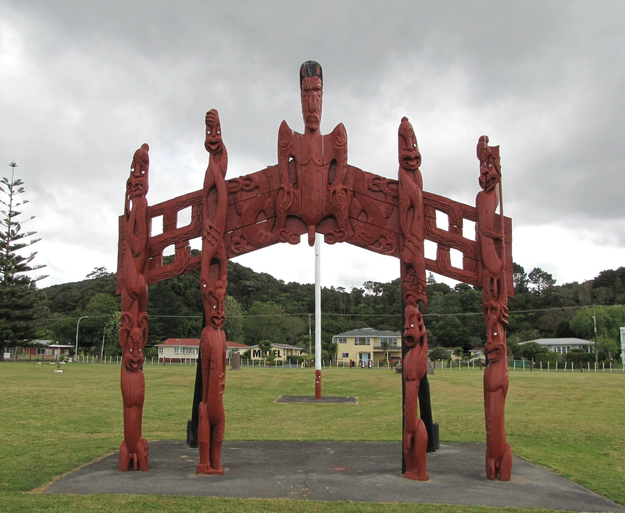
We visited the Waitangi Treaty Grounds. Signed in 1840, the controversial treaty signed by over 500 Maori chiefs ceded sovereignty to the British Crown in exchange for protection and the granting to Maori all the citizenship rights afforded to all British citizens. A traditional Maori arch is found at the entrance to the Waitangi Treaty Grounds.
There were wine tastings and potluck dinners, walks along the coastal track, ferry rides to nearby Russell across the bay, but always boat work to be completed.


Replacing the engine...yikes!
The major oil leak on the way from Tonga in conjunction with poor compression test results, got us to thinking about a major engine overhaul. David located a rebuilt Ford Lehman 90HP engine exactly like ours in Auckland for less money than the rebuild would cost and so began a huge project of exchanging out the engines. Along with help from friends, David opted to do all the labor himself. The first step was removing our engine. It barely fit through the cockpit sole, but "barely" was enough. The half-ton engine was lifted out of the engine room with a chain hoist.
Once the engine was out, oh my, what a mess! Not only inside the engine room, but parts were everywhere ... on deck and down below. We loaded the engine on a heavy-duty trolley, moved it slowly up the dock, waiting for high tide to make the trip as easy as possible. It fell off the trolley in the parking lot! No blood, no foul. Lowe's Marine used their crane to lift it and load it onto the bed of a rented pickup truck (a ‘ute) for the trip to Auckland.


A long, slow, hilly and curvy 2-lane road leads from Opua to Whangarei and then a highway into Auckland, about a 4-1/2 hour ride. Once at Moon Engine, the old engine was unloaded and compared to the new one to make sure we had all the bits we needed off the old one and there would be no surprises. Convinced the engine was what it was supposed to be and we had all the miscellaneous bits we needed, it was loaded onto the ute for the return trip. We stayed overnight in Auckland and arrived back in Opua in time for Lowe's to unload the truck and stow the engine in their garage where David began to prep it for installation.
Projects expand exponentially on a boat. As long as the engine was out, David figured he might as well paint the engine compartment, get the transmission checked and reworked as necessary, replace all the old wiring, all the hoses and clamps, etc, etc. etc. It’s hard to gauge how long a project will take when the project is ever-expanding.
The most difficult part was moving the engine back down the dock and up the narrow pier beside the boat. Thoughts of the engine falling off the trolley were on everyone's mind. Luckily, thank Neptune, no mishaps! The new engine went into place as planned with only a few issues to be addressed. A week and a tremendous amount of concentrated effort later, David said the magic words..."Let's start the engine!". Marcie turned the key, the engine sputtered and voilà ... a working engine in the boat! Hooray!


A Trip to the Kauri Coast & the Waipoua Forest
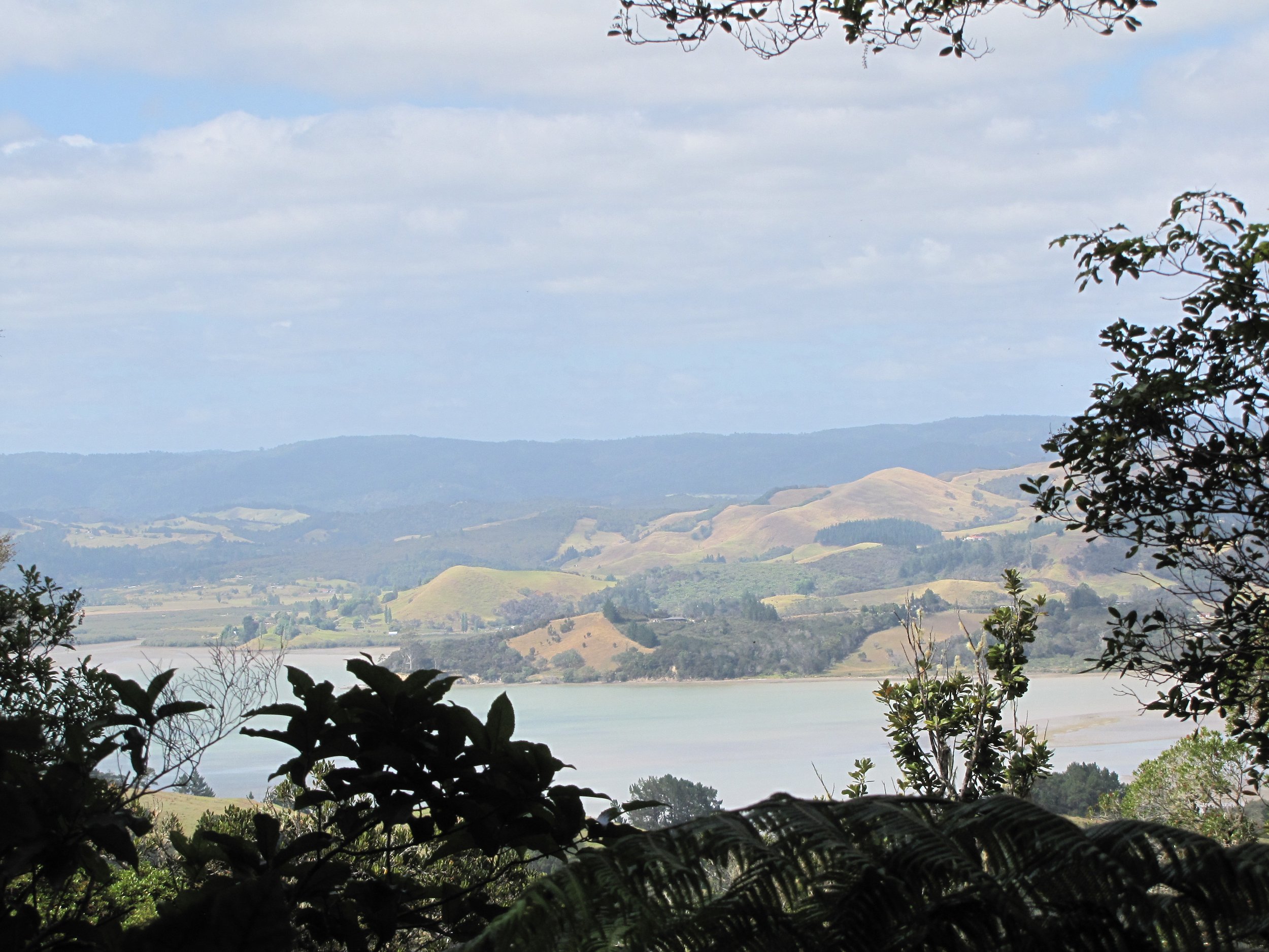
A friend loaned us his car one day and we decided to head to New Zealand's west coast. In this Northland region, the country is pretty skinny, and in less than 100 km we were there! We drove along narrow country roads from Opua/Paihia through several little towns to Rawene, NZ's third oldest European settlement on Hokianga Harbour. Along the way, we stopped as usual to view the scenery and the birdlife.

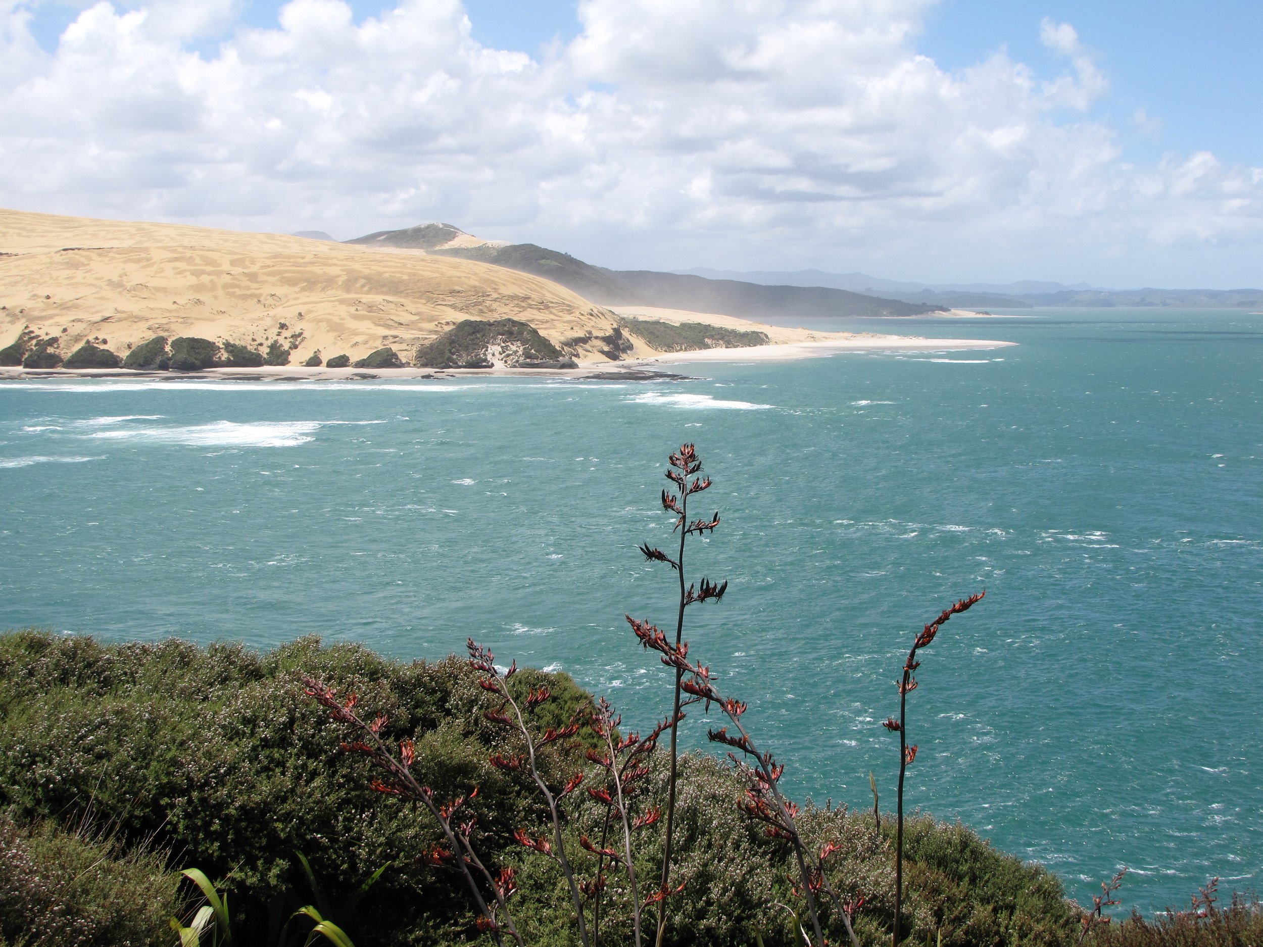

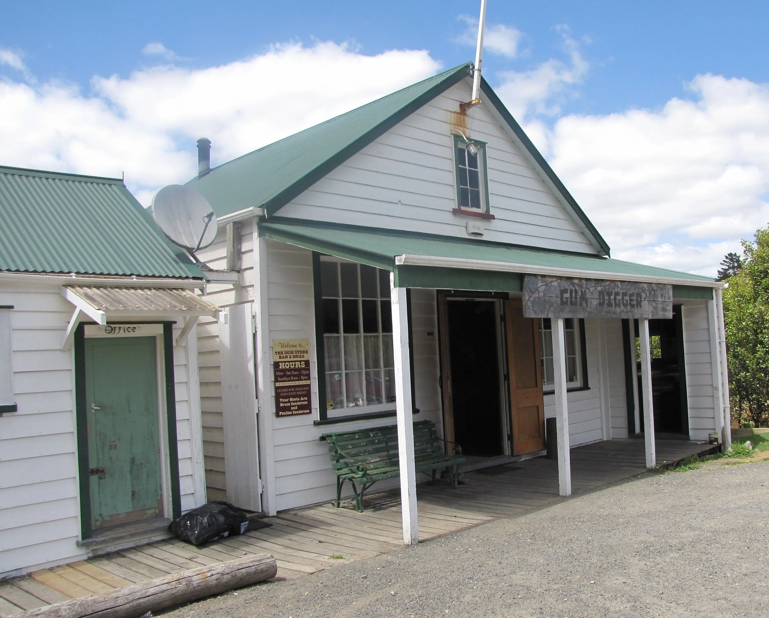
Our ultimate destination for the day was the Waipoua Forest, home of the giant Kauri trees. This area, now under DOC (Dept of Conservation) protection, was once noted for logging and gum-digging. So much logging took place that this is one of the few remnants of native kauri forest still found in New Zealand. We stopped in the DOC park office headquarters for a good informational overview of the kauri forests and logging industry of the past.
According to Wikipedia, “Gum-diggers were men and women who dug for kauri gum, a fossilised resin, in the old kauri fields of New Zealand at the end of the 19th and early 20th centuries. The gum was used mainly for varnish. The term may be a source for the nickname "Digger" given to New Zealand soldiers in World War I.”


Te Mahuta Ngahere, "Father of the Forest", isn't very tall, but has a trunk over 5m (16’) in diameter. It is thought to have the widest girth of any kauri tree in NZ and to be the oldest estimated at ~4,000 years old.
Tane Mahuta "Lord of the Forest" is named for the Maori god of the forests. It's estimated to be 2,000 years old and stands 51m (166') tall. We tromped through the forests on well-marked trails brimming with lush vegetation, especially ferns.
In addition to 14 national parks, New Zealand boasts 19 forests, three maritime parks, two marine parks and three World Heritage areas. We hoped to visit as many as possible during our stay.


Kiwi- speak ... We may be in an English-speaking country, but it doesn't necessarily equate to American English by a long shot. One difference is the pronunciation of the first short "e" sound in a word. They pronounce it as a long "ee", so seven is pronounced "see-ven", eleven is "elee-ven" and so on. Here's a sample of some different vocabulary Kiwi-isms...
Ute - (yute) - a pick-up truck; short for utility vehicle Jandals - sandals
Capsicum - green, yellow or red bell peppers Chilly bin - a cooler
Flat white - coffee with milk (latte) Long black -black coffee
Track - path or trail Tramping - hiking
Panel Beaters - auto body shop Trundler or trolley - shopping cart
Dairy - convenience store Bush - wooded/forested areas
Wee - small, tiny Crikey - an exclamation like Geez
Russell, Bay of Islands - 35S16.49 / 174E07.61
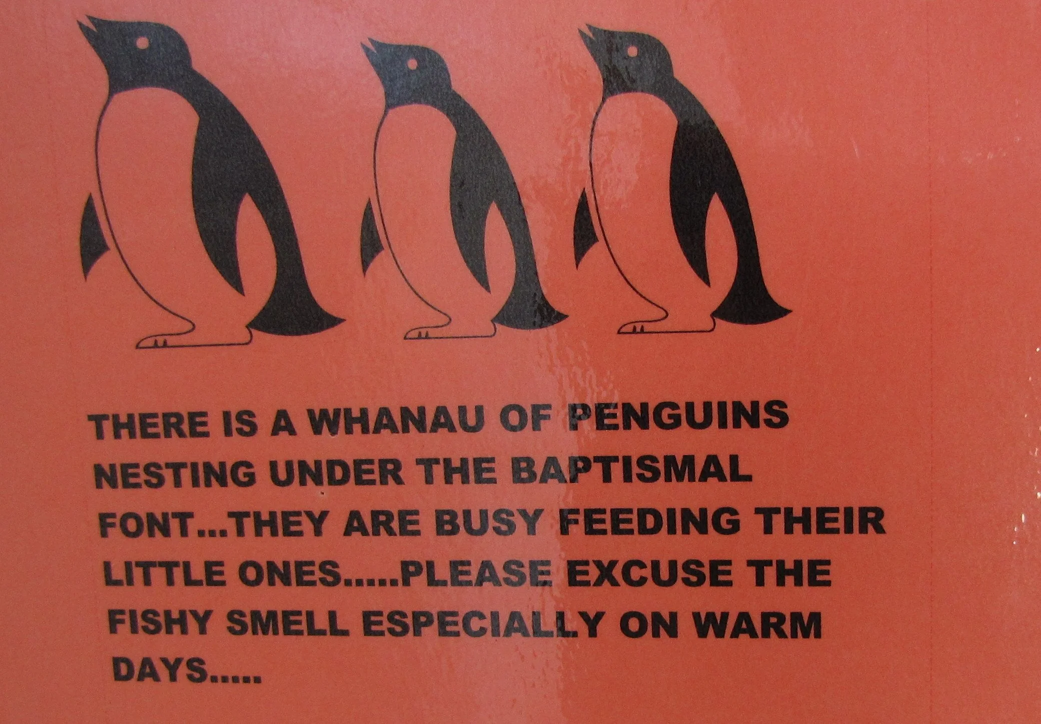
We had been at the Opua Marina for nearly 1-1/2 months, and we were keen to get away and do a little sailing. Though all of our boat chores were not complete, we headed out into the Bay of Islands, only 5 miles but a world away. Though we had visited Russell before via the ferry, we opted to anchor near the Russell Boating Club in Matauwhi Bay to finish up necessary boat tasks and decompress a bit. We didn't go ashore for three days and didn't mind it in the least. Russell was originally a fortified Maori settlement which spread over the entire valley, then known as Kororareka ('sweet penguin').


Waitepipi Bay, Whangaroa Harbour - 35S00.34 / 173E44.20
We returned to Opua and anchored out for a few days to replenish the larder, take hot showers and get rid of trash. Then we headed north about 35 miles to Whangaroa Harbour for some hiking and, believe it or not, more boat work. Working on your boat in exotic places ... the definition of cruising.
Whangaroa Harbour is quite large with lots of nooks, crannies and coves that provide protection for whichever way the winds might blow. Constant fronts passed while we were anchored there and though the wind gens hummed, we nary felt a ripple. We alternated days for work and play. The best hike was from Lane Cove near the Duke's Nose to Totara North.
Like Ireland, there are no snakes in New Zealand, but they certainly have a lot of weird insects and spiders!


Mangonui Harbour - 34S59.17 / 173E31.93
We moved from Waitepipi to Waitapu Bay (35S02.33 / 173E45.41) and varnished a little more. On a foggy, misty day when varnishing wasn't possible, we left Whangaroa Harbour and headed about 20 miles further north to Doubtless Bay and Mangonui Harbour. We saw lots of birds along the way including blue penguins, the smallest of the penguin family also known as little penguins or fairy penguins.
Entering Doubtless Bay, we came across a large pod of bottlenose dolphins who entertained us royally. These guys have boundless energy. They played and frolicked for the sheer joy of it.


Mangonui Harbour was a pleasant place to anchor and the little fishing town of Mangonui was quite picturesque. The entertainment once anchored was watching the gannets dive from aloft at breakneck speed into the water for fish. Australasian gannets were everywhere in this harbor. The fishing must have been good.
We anchored right off the town in Mill Bay. This fishing town's claim to fame is the Mangonui Fish Shop, allegedly the "best fish & chip shop in New Zealand". We don't have lots to compare it to, but we tried it. Good, but definitely not our cup of tea. Too greasy and heavy for our taste.


Tokaroa Island at Houhora Harbour - 34S49.24 / 173E08.98
With settled weather promised, we headed to Karikari Beach, a wide expanse of beach and dunes in Rangaunu Bay. Unfortunately, the weatherman and the weather did not agree and the wind became strong from the west shortly after we anchored, putting us on a lee shore. We hauled anchor before even being able to explore the beach and headed to a more protected spot about 10 miles away at Houhoura Harbour where we swung peacefully in front of tiny Tokaroa Island while a front with strong north/northeast winds passed by. Tiny Tokaroa Island isn't much more than a big rock, but it provided the windbreak and current break we needed for a peaceful anchorage. The entrance to Houhora is a fairly narrow channel that encircles a shallow lagoon. We found great clamming (tuatua) at low tide on the beach just before the entrance.


Cavalli Islands - North Bay, Motukawanui Island 34S59.26/ 173E56.66
When the wind changed, we headed out of Houhora and back to Waitepipi Bay in Whangaroa for a night and then worked our way to the Cavallis via a night's anchorage at Whangaihe Bay (34S59.68/173E48.96). There seems to be a pleasant anchorage with protection from the wind almost anywhere you look. We anchored at North Beach with south winds predicted, but the wind changed once again and we sought a more protected anchorage at Matauri Bay (35S01.99/173E55.13) where we spent a lovely, calm night watching the campers on the shore as they watched us. The next day with north winds now predicted, we headed into Papatara Bay (Horseshoe Bay) on the south side of the island where we stayed for several days.
The views from the hill above the north beach at Motukawanui were great and the beach was wonderful for beachcombing, thick with Cook's turbans, paua and austral abalone shells. We weren’t alone though. We shared the beach with a myriad of birds.


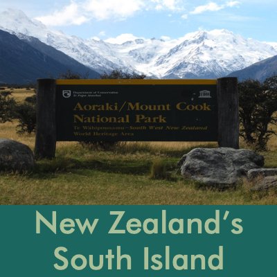
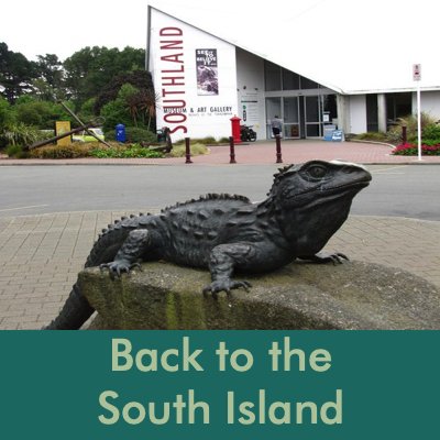
New Zealand’s South Island
Over the Top
It had always been our plan to visit the South Island. We finished up some housekeeping chores, fueled up, watered up and off we went "over the top" to Nelson on the South Island. Traditional wisdom indicates that going north to go south is the easiest and fastest way to go.
We had lots of entertainment en route: dolphin shows daily and lots of angling success. David caught four good-sized tuna which we dined on for throughout the trip.


Taranaki Harbour, New Plymouth City - 39S03.45 / 174E02.59
We had great weather except for one gale which we sat out with relative calm and comfort in the anchorage at Taranaki Harbour in New Plymouth. When we arrived the place looked grim, but with further exploration, we found New Plymouth to be a delight. Once the sun came out and some of the clouds cleared, Mt. Taranaki came into view.
The anchorage at New Plymouth didn’t offered much room for visitors, but we managed a spot at the rear of the mooring field. We motored more than expected and needed fuel. A very friendly, trusting fellow named Pat offered us the use of his car to jerry jug some diesel. Such is the hospitality and trusting nature of Kiwis.


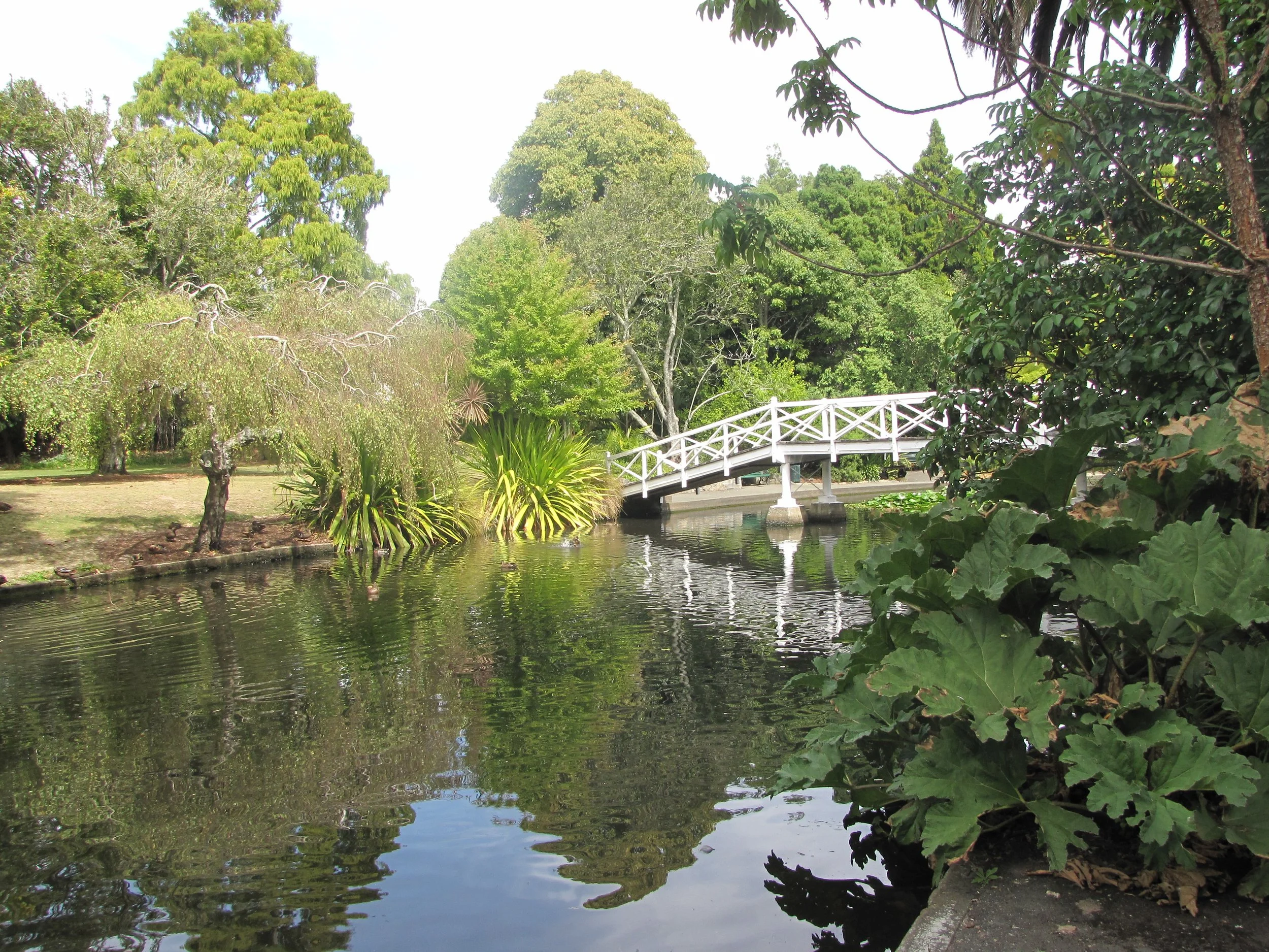
The coastal walk was beautiful and in 2km, took us from the port to downtown New Plymouth. The city has abundant parks and walks. We followed the Huatoki Walkway to the top of Marsland Hill for a spectacular view of Mt. Taranaki. Marsland Hill was once a Maori pa (fortified village). Pukekura Park offered a maze of paths and walkways through lush foliage and flowers with a small zoo and aviary, lily ponds, lakes and superb views. An elegant teahouse in the center of the park allowed us to sit and relax and lick an ice cream cone. The "fernery" tunnel entrance was unique and the interior was nearly overwhelming with local and exotic flowers and plants. There was even a glowworm cave next door.
The Taranaki Cathedral Church of St Mary (aka St Mary's Church) is an Anglican cathedral church with the original part built between 1845 and 1846 in the Gothic Revival style. Designed by Frederick Thatcher, a London-trained architect and one of the first settlers in New Plymouth, it is the oldest stone church in New Zealand.


The wind and seas finally subsided and we headed out of the anchorage into the Tasman Sea again anticipating with a modicum of concern the crossing of the Cook Strait. Though light, variable winds were predicted, you just never know. The winds were definitely variable to start ... anywhere from 5 to 20 kts with no committed direction. As we passed Cape Egmont, 25+kt winds greeted us from the west which made it a boisterous, but fast passage.
Nelson Marina - 41S15.68 / 173E16.89
The overnight trip from New Plymouth to Nelson across the Cook Strait was boisterous, but uneventful. We saw 30 knots of wind coming across and when we mentioned this to a local, they laughed and said "just like a mill pond". We had met the Holmes family on Manaroa III in Puerto Montt, Chile and saw them several times across the Pacific. In fact, it was Clare who had helped me repair the mainsail at Suwarrow Atoll.
Nelson is home for Pat and Clare and we were pleased to be able to see them again. We could not have had more generous hosts. They provided us with their berth at the marina, a car, veggies from their garden, meals, lots of local information and hospitality that was unsurpassed. Needless to say, we loved Nelson!


Nelson
Nelson is small and easy to get around. There are several parks like the Queens Gardens and lots of walkways and paths. Trafalgar Street, the city's pleasant main street, is lined with shops and cafes.


An American friend and former colleague whom we hadn't seen in over a decade, stopped by to visit us on his way from Singapore to Sydney. We had a perfect excuse to explore instead of doing boat chores. With the loan of a car from Pat & Clare, we drove as far west and north as we could one day along the coast towards Cape Farewell Spit, stopping at every opportunity to enjoy the view and the walkways. There is no accessible public road all the way to the end of the spit, so we "settled for" beautiful Wharariki Beach on the Tasman Sea.
We stopped at Kahurangi National Park. The area was mountainous as we made our way up, up, up and then back to the coast at Takaka along the boundaries of Abel Tasman Park heading for Cape Farewell.
A carved tiki arch marks the entrance to one of many walkways in Kahurangi NP. The signs throughout explained the "resurgence of the Riwaka", an underground river. We hiked along the river then continued on to Abel Tasman, New Zealand’s smallest national park.


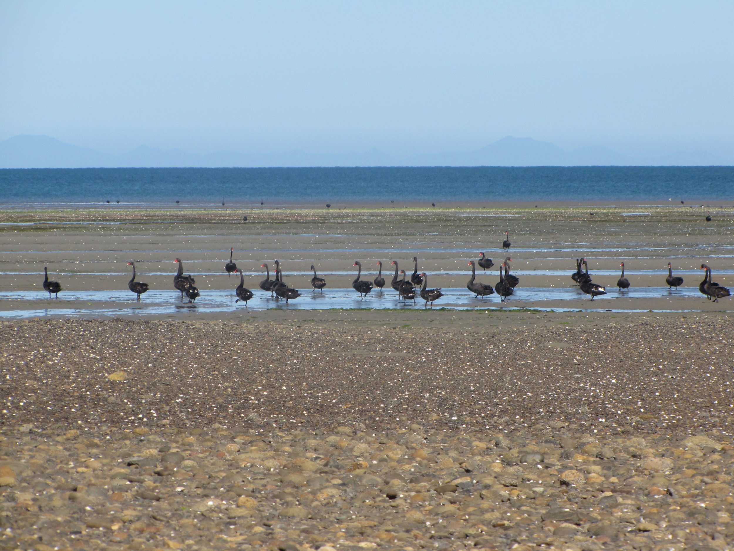
Wharariki Beach offered a fun hike, dunes and fantastic views of the Tasman Sea. The flatland expanses of Golden Bay at low tide were a mecca for black swans and gray teals. There was also a large colony of fur seals. Fur seals aka kekeno or sea bears were hunted to near extinction until NZ gave them full protection in 1894. Birdwatching and seal and sea lion watching provided fine entertainment.


On our second day of touring, we headed east and stopped for coffee in Havelock, the ‘Greenshell Mussel Capital of the World’ then continued our travel along the Queen Charlotte Drive for panoramic views of the Marlborough & Queen Charlotte Sounds. The road was up, up, up then down, down, down around countless switchbacks and finally to Picton. Downtown Picton was scenic and afforded us a chance for a walk around and some lunch.


We took a sidetrip into the Sound to Te Mahia just for the views, but found that mussels were so plentiful, we harvested enough for dinner.
Abel Tasman (1603-1659), a Dutch navigator was employed by the Dutch East India Company to explore the South Pacific. In 1642, he sailed southeast from Batavia, Java (now Jakarta, Indonesia) and became the first European to reach the island now called Tasmania and to sight New Zealand. On the same voyage, Tasman explored the Tonga and Fiji Island groups and sailed completely around Australia without sighting it! Thus, the question of whether Australia or New Zealand were parts of a great southern continent remained unanswered until the voyages of Captain James Cook.
Torrent Bay, Abel Tasman National Park - 40S57.24 / 173E03.48
Peter left and all too soon, it was time to leave Nelson if we were to see any more of the South Island. The original plan was to visit Fjordland on the South Island's west coast, but our visit to Picton via the Queen Charlotte Drive made us reconsider our route. The beauty of Marlborough & Queen Charlotte Sounds beckoned us. So once again, a change in plans as we headed to Torrent Bay in the Abel Tasman National Park.
After a calm night at anchor, we headed to shore for a walk. The campsite ashore, called "The Anchorage", offered a lovely beach to land the dink and a well-illustrated map of the area walks. We chose the Pitt Head Track which afforded a lookout over the bay. The track wound its way up through dense, sweet-smelling forest and tunnels of thick ferns including silver fern. Bird songs, seemingly hundreds of them, entertained us with melodic trilling as we climbed up towards the high point for promised Tasman Bay views.


D'Urville Island - Greville Harbour, Mill Arm - 40S50.60 / 173S50.31
We departed the Torrent Bay anchorage early morning with nary a cloud in the sky nor a ripple on the water, heading east across the Tasman Bay to D'Urville Island. By mid-morning, the wind had freshened from the north and we were sailing on lumpy seas at 6 kts making good progress towards our destination. Approaching Greville Harbour (on D'Urville Island), the entrance was not as daunting as the guidebook had warned.
The passing of the natural boulder bank which separates the outer from the inner harbor, however, did get the adrenaline flowing a bit. We approached just after low tide. With a push from the incoming tide and lots of the boulder bank exposed, we hugged the port marker and saw least depths of 11' and had no difficulties. Interestingly enough, the local guidebook mentions this natural boulder bank iin great detail, but neither the chart plotter (Navionics software) nor C-Map showed its existence. Thank goodness for local knowledge!
After the boulder bank, a rather tortuous route led us to our final anchorage in the Mill Arm. Except for the NZ courtesy flag, we could easily have been anchored in the Patagonian canals once again.


Pied shags were our only neighbors in the Mill Arm anchorage.
The Marlborough Sounds and French Pass
The Marlborough Sounds are described by geologists as "drowned valleys" formed millions of years ago by the mountains sinking and allowing the ocean to flood into the low-lying areas. A maze of deep coves and secluded bays, these fjords are fringed by native forest. The Sounds encompass 1/6 of New Zealand's total coastline and are comprised of four main waterways: Queen Charlotte Sound, Pelorus Sound, Kenepuru Sound and Mahau Sound. The Maori have a different variation on the creation of the Sounds. Legend tells of Kupe's struggle with a giant octopus, and how he grabbed onto the South Island for support, carving out waterways and inlets with his fingers.
French Pass or Te Aumiti, a narrow pass between the mainland South Island and D'Urville Island, leads into the heart of the Marlborough Sounds and avoids going over the top of D'Urville around Stephens Island. Its passage known for its eddies, >8 kt current and a big whirlpool named Jacob's Pool, can be tricky. We followed the advice of the New Zealand Nautical Almanac to negotiate the pass as safely and easily as possible. Timing was crucial since we also needed to consider the passing of the boulder bank once again when leaving our anchorage and exiting Greville Harbour. French Pass certainly lived up to its reputation. We approached just before slack water with light winds and the current in our favor. Approaching the narrows from the Current Basin, there was no problem. As we neared the narrows, however, the water on the other side of the markers looked alive. It was roiling and boiling with huge eddies and whirlpools everywhere, a sheer tumult. "Cups" rocked and rolled her way through the mess, but we couldn't help think what it would be like to transit this pass with winds, waves and/or current against us.

The water was like a mirror until we reached the middle of the narrows, and then it started roiling and swirling with eddies and whirlpools everywhere.
Homestead Bay, Port Ligar/Pelorus Sound - 40S55.69 / 173E57.75
We entered Pelorus Sound and exited from the Sound into Port Ligar. Mussel pens lined both sides of the wide bay entrance. Homestead Anchorage was just a mile or so from tiny Port Ligar. The anchorage is quite deep, 50+ feet close to shore, however, there was a mooring available which we gladly picked up. We dinghied over to close by Waterfall Bay and climbed the steep gravel road to top for a great view of Homestead Bay below and Cups content on her mooring.


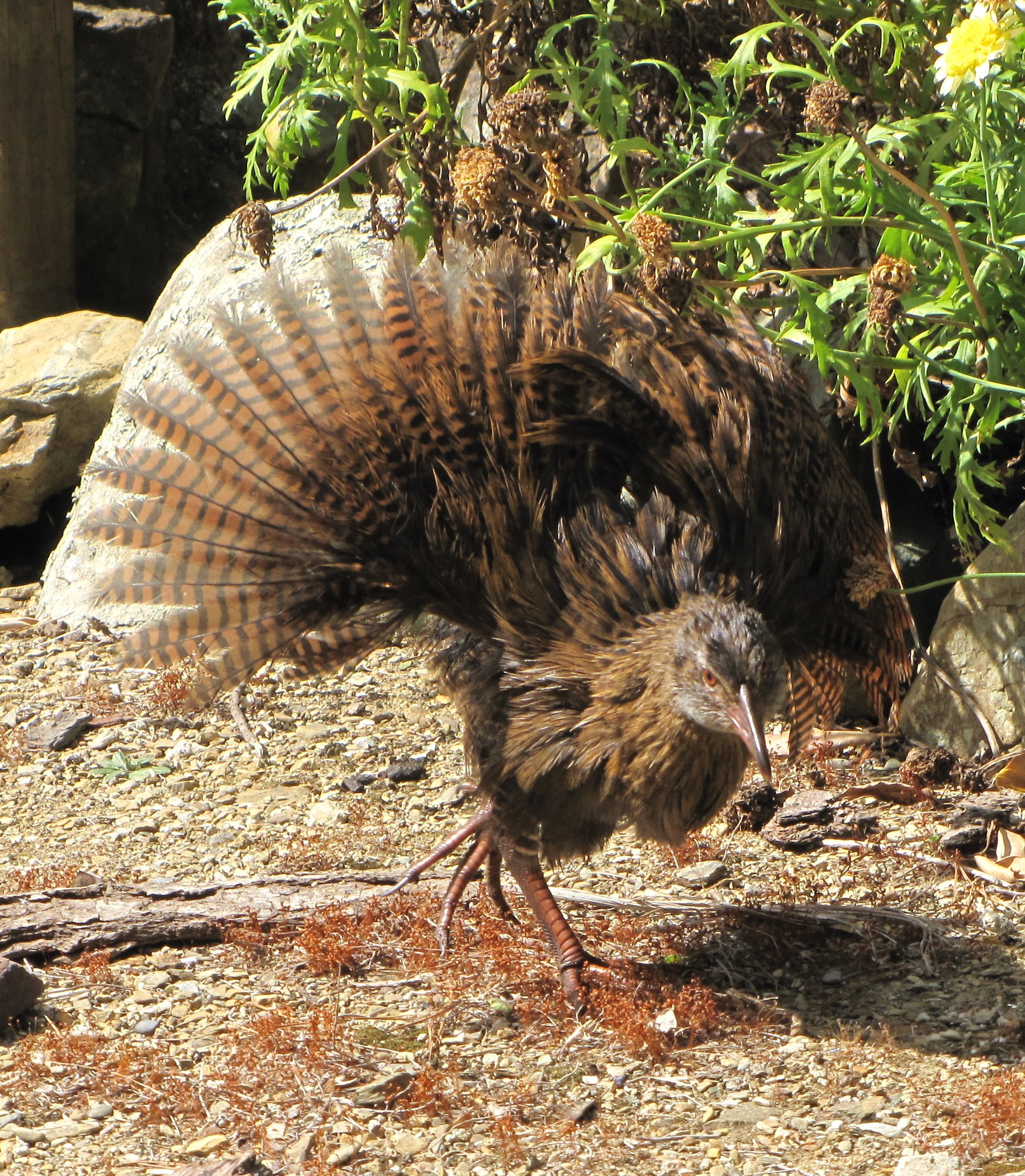
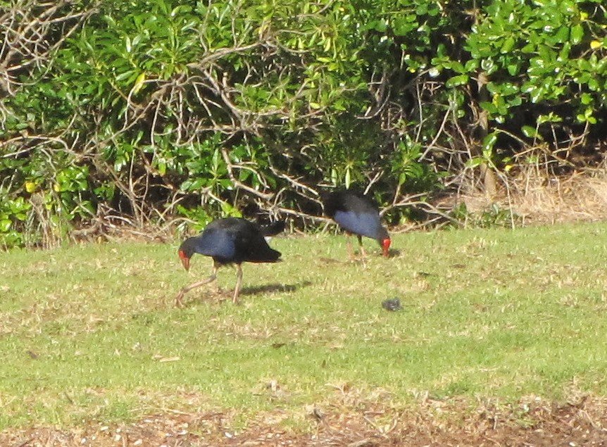
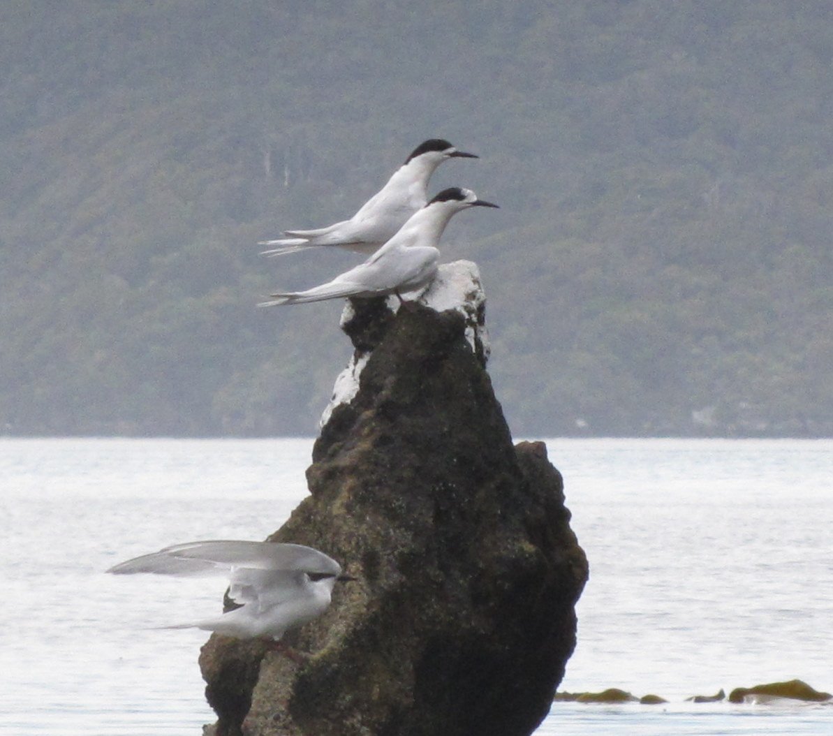
There was lots of active birdlife here. We saw shags, gannets, shearwaters, gulls terns and shelducks in the bays and bellbirds, pukekos, lapwings and our first weka ashore. The weka is an odd-looking flightless bird about the size of a chicken with long reddish-brown tail feathers which he fanned like a peacock when he posed for photos.
The bay was also teeming with stingrays, huge ones that evidently come here to seek refuge from the orcas in the Sounds that seem to find them tasty treats. A fellow from the local lodge told us that many a stingray in the bay is without a tail having been just a bit quicker than the orca chasing it, but not quite quick enough.


We had visited the Queen Charlotte Sound by car a few weeks before and were so impressed with its beauty, we felt we had to return with Nine of Cups. We left Homestead Bay and had a great sail to the well-protected anchorage of Schoolhouse Cove in Resolution Bay. With glorious weather abounding, we walked parts of the Queen Charlotte Track. Stretching 71km, the Queen Charlotte Track is renowned for its stunning views and contrasting landscape, historical landmarks and wonderful variety of native bush and wildlife.
We tramped from Schoolhouse Cove to Ship Cove and back (9km return) and then Schoolhouse Cove to the Furneaux Lodge in Endeavor Inlet (~20 km return...whew!). There was something new in each direction and on each day. Outstanding!

James Cook named the Queen Charlotte Sound in 1770 after Queen Charlotte, wife of King George III, and claimed the new territory for Great Britain.
Resolution Bay - 41S06.80 / 174E13.33
Captain James Cook and his crew stopped here five times between 1770-1777. In all, Cook's ships spent over 168 days in Ship Cove over seven years. In fact, Cook spent more time here than anywhere else in New Zealand and it was here that the first sustained contacts between Maori and Europeans were made.


Picton - 41S17.27 / 174E00.59
With a mainsail repair to be handled, we opted to head into Picton Marina, only 10 miles away, to find a sailmaker. It was a breezy Sunday and Kiwis are always keen to sail. Luckily, the Picton Marina had a berth available for us. It provides all the amenities and as usual, a hot shower was high on the list. It was only a 5-minute walk from downtown Picton. We discovered that The Coathanger Bridge was a shortcut for pedestrians from the marina to downtown. The water was clear enough to see sea stars on the rocky bottom.


Road Trip - Akaroa and the Banks Peninsula
We were able to locate a most efficient and accommodating sailmaker immediately and arranged for the sail repair. We were also able to locate a galvanizer in Christchurch who could turn around galvanizing of our chain and anchor within 3-4 days. This presented an opportunity for a short, but fun ROAD TRIP! We rented a car, loaded the chain and our 50K anchor into its trunk and proceeded to Christchurch the next morning. Having dropped off the chain and anchor, we headed to the Banks Peninsula and Akaroa for stop #1 of our mini-road trip. The Banks Peninsula was first sighted by James Cooks in 1770 aboard the Endeavor and named after Joseph Banks, the naturalist.
Almost a French colony - In 1838, Jean Francois Langlois, captain of a whaling ship, purchased what he thought was the entire Banks Peninsula from the Maori for ~1000 francs, then returned to France to bring settlers for a colony. While he was gone, the British entered into the Waitangi Treaty with the Maori and quickly went to Akaroa and raised the British flag just 6 days before Langlois returned with 57 French settlers. The French settlers remained, but relinquished rights to the land and were placed under British rule.
The terrain varied greatly as we headed south from Picton . We passed through miles and miles of vineyards in the Marlborough region with vineyard names we recognized like Montana and Mount Riley. The dun-colored foothills were dotted with grazing black cattle and white sheep. The road snaked its way over, under, around and through (yup, tunnels). There were lots of switchbacks and steep hills until we arrived at the Pacific Ocean. The rocky shore was home to seal colonies and varied sea birds. Black swans swam peacefully in the harbor. Crayfish shacks offered live and steamed crayfish to passersby. The town of Akaroa is small and quaint with a myriad of old wooden buildings tucked between restaurants, cafes and boutiques.


Mount Cook / Aoraki National Park
From Akaroa, we headed west to Mt. Cook/Aoraki National Park. We drove along the Inland Scenic Route (Rte 72) watching the mountains come closer and closer. The area surrounding Mt. Cook is called Mackenzie Country named after a 19th-century sheep rustler, James Mackenzie. This was definitely sheep country and the rugged, steep hillsides and fields were thick with grazing sheep. A little trivia here… New Zealand has about 60 million sheep and only about 4 million people.
Each little town along the way had an information center and something it deemed special to offer. We stopped in Geraldine for coffee and a quick look-see and Lake Tekapo to photograph the famous Church of the Good Shepherd and a statue dedicated to its hardworking sheepdogs. A lookout on the edge of Lake Pukaki offered a superb view of Mt. Cook (if he had not been sulking behind a huge cloud).


Black stilts (kakis) are an endemic wading bird considered to be the rarest wading bird in the world. Unique to New Zealand, the black stilt was once common in New Zealand rivers and wetlands. As settlers appeared, habitat changed. Foreign plants and animals were introduced and wetlands were drained for development until only 23 birds were left in existence. NZ's Department of Conservation (DOC) began an intensive management system of the black stilt population in 1981. They captured several healthy breeding pairs, artificially incubated the eggs and raised the young chicks in captivity until they had a better chance of surviving in the wild (~3-9 months) with a result of more than 300 birds now surviving. We visited the Black Stilt DOC center in Twizel for an outstanding tour.


Dubbed "Southern Alps" by Captain Cook, Mt. Cook/Aoraki at 3,754 meters (12,316’) is the highest mountain in New Zealand, however, there are 27 other peaks in the Southern Alps over 3,050 meters/ 10,000’.

It was Captain J. L. Stokes who sighted New Zealand’s highest peak in 1851 and named it in honor of Captain James Cook. The Maori, however, already had a name for this mountain, Aoraki, the most sacred of all ancestors, signifying the strong link between the supernatural and the natural world.
First, we visited the Mt. Cook Info Center that featured a photographic gallery of all things mountain. Tributes to Sir Edmund Hillary abounded at the Hillary Alpine Center. We took several short walks in the park including to Kea Point with views of Huddleston Glacier and then another walk to the Tasman Glacier. The gravel road to the head of the track led over a single-lane, scenic bridge. We appreciated the shelter at Tasman Glacier which provided a great respite from showers and the cutting wind. The Tasman Glacier is a glacial milk river with icebergs floating by. Quite the sight.


Christchurch
The South Island's largest city is Christchurch, an oh-so-English city complete with the Anglican Christchurch Cathedral at its central square. The city was founded in 1850 as a Church of England endeavor aspiring to be a model of class-structured England in the South Pacific We visited in March 2010 and were lucky enough to have visited the city before the disastrous February 2011 earthquake and subsequent mudslides that devastated the city. Timing is everything.
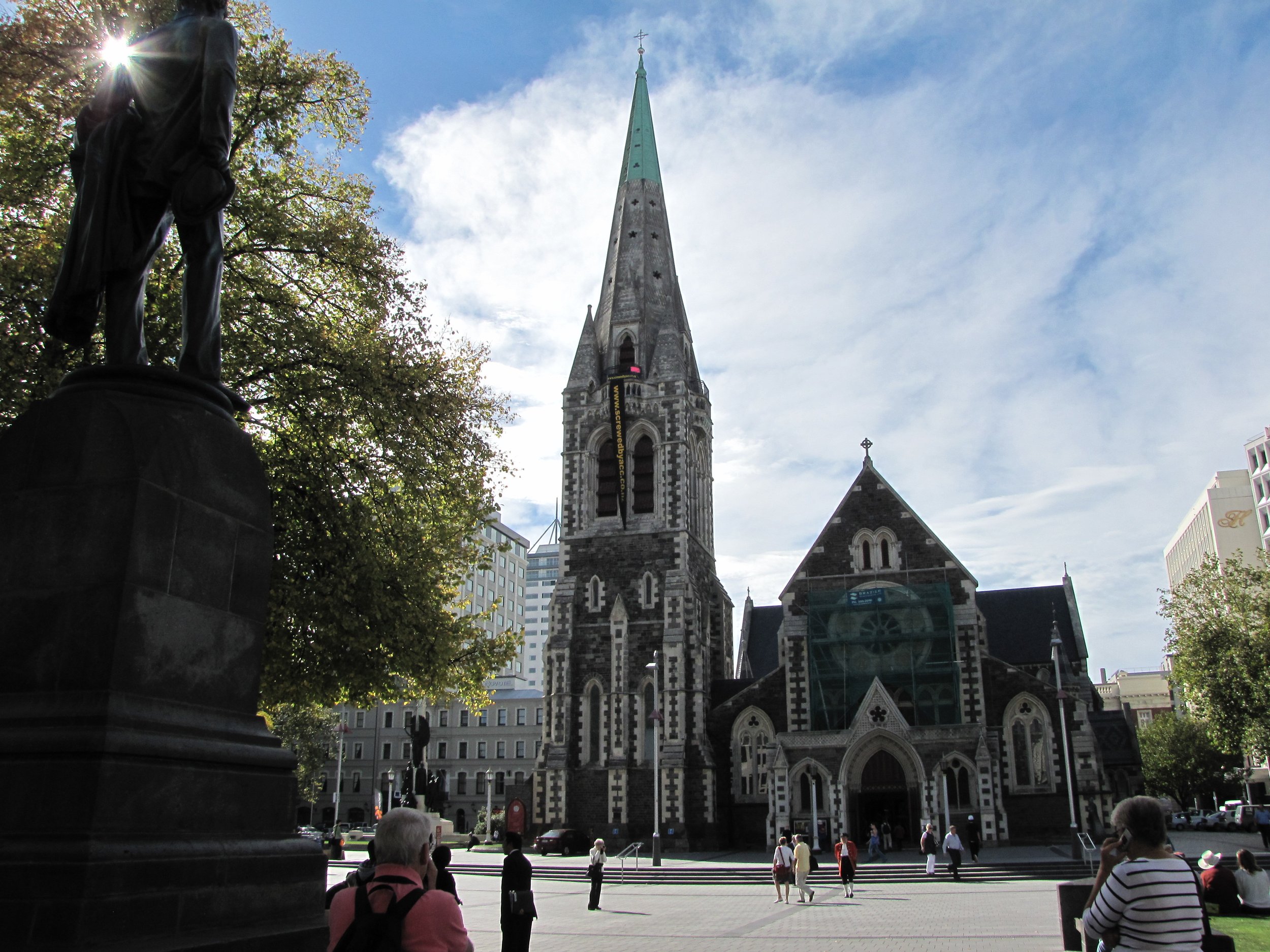


Looking up at the stately Christchurch Cathedral spire which was severely damaged in the earthquake.
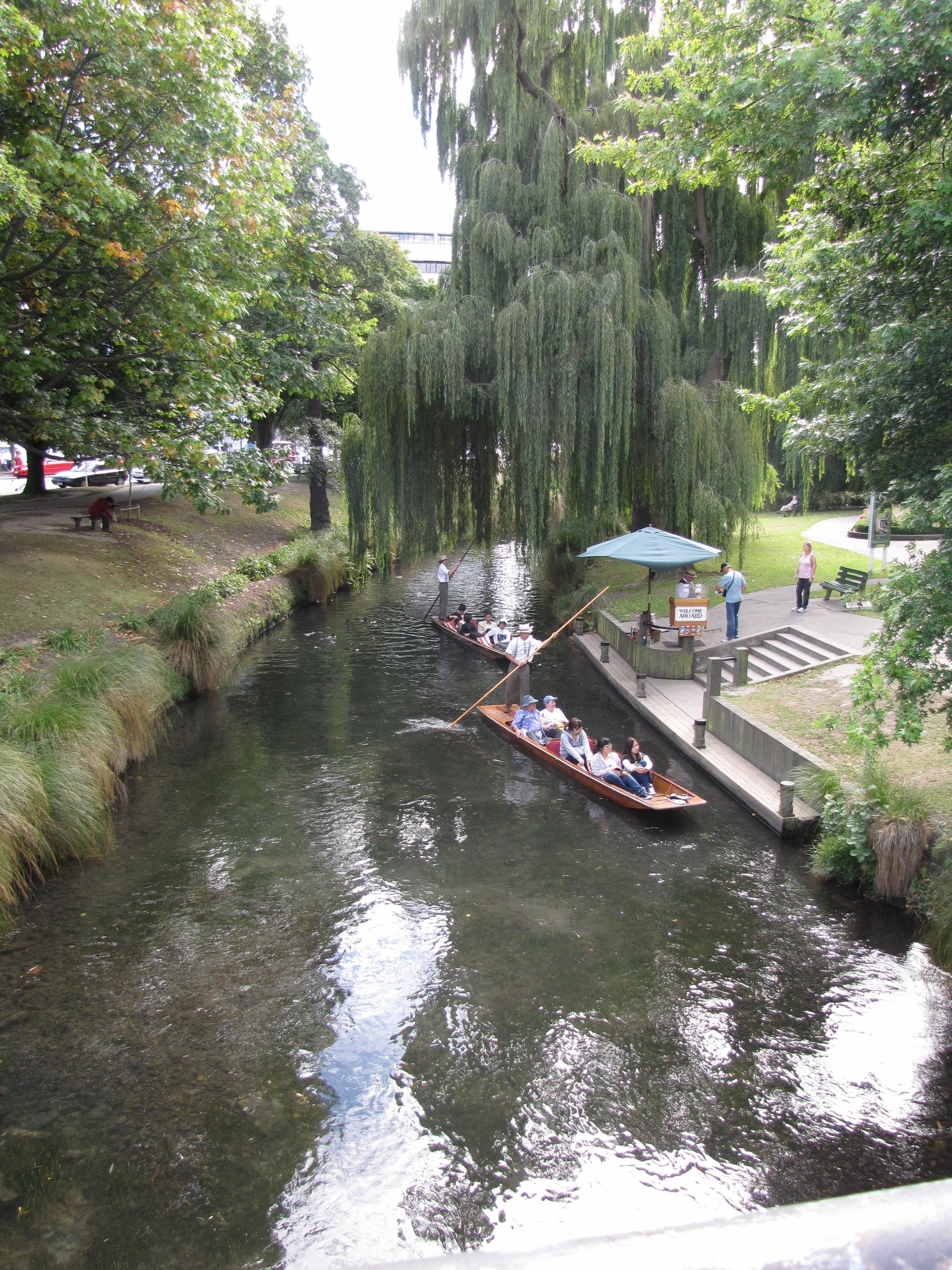
We walked, explored and later took a city tour on a streetcar tram that allowed on/off privileges. Take a wander with us and check out the sights in this lovely city.


Plans change, especially aboard this boat! Plans to go south to visit Fjordland, Stewart Island and the Chatham Islands were unfortunately not realized this year! Too much to see and do and too little time before our visas would expire on 12 May. Instead we've opted to coast/port hop up the east coast of NZ and see what we could see before it was time to leave New Zealand. We picked up the newly galvanized chain and anchor and headed back to Nine of Cups waiting patiently for us in Picton.
We waited for a weather window to cross the infamous Cook Strait for a visit to Wellington. After a wild, windy trip, we arrived in NZ's capital city of Wellington and tied up at Chaffer's Marina, right downtown at the center of this vibrant, delightful city. For some insight into our trip, take a look at our blog for that day.
Wellington
Wellington City is just beautiful. There's something to see every place you look. We simply couldn’t have left New Zealand without a visit here.

Kupe, legendary Maori explorer and his wife’s first sighting of Aotearoa (New Zealand), Land of the Long White Cloud.
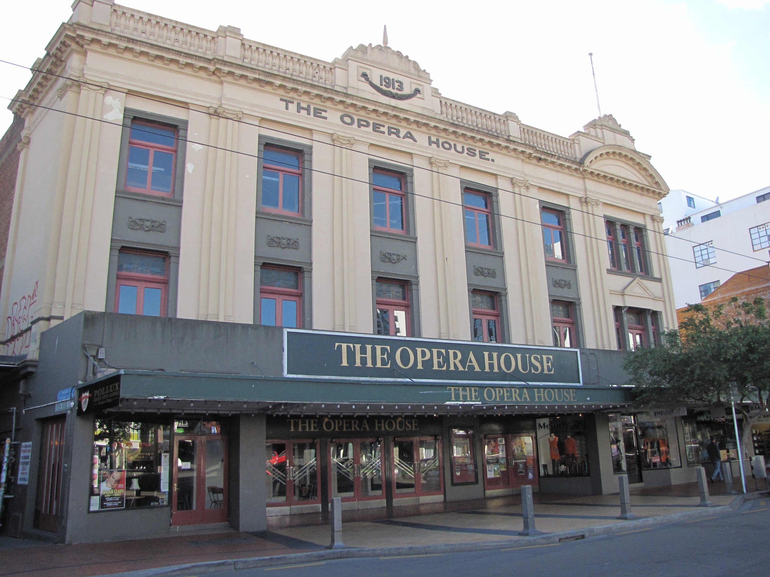
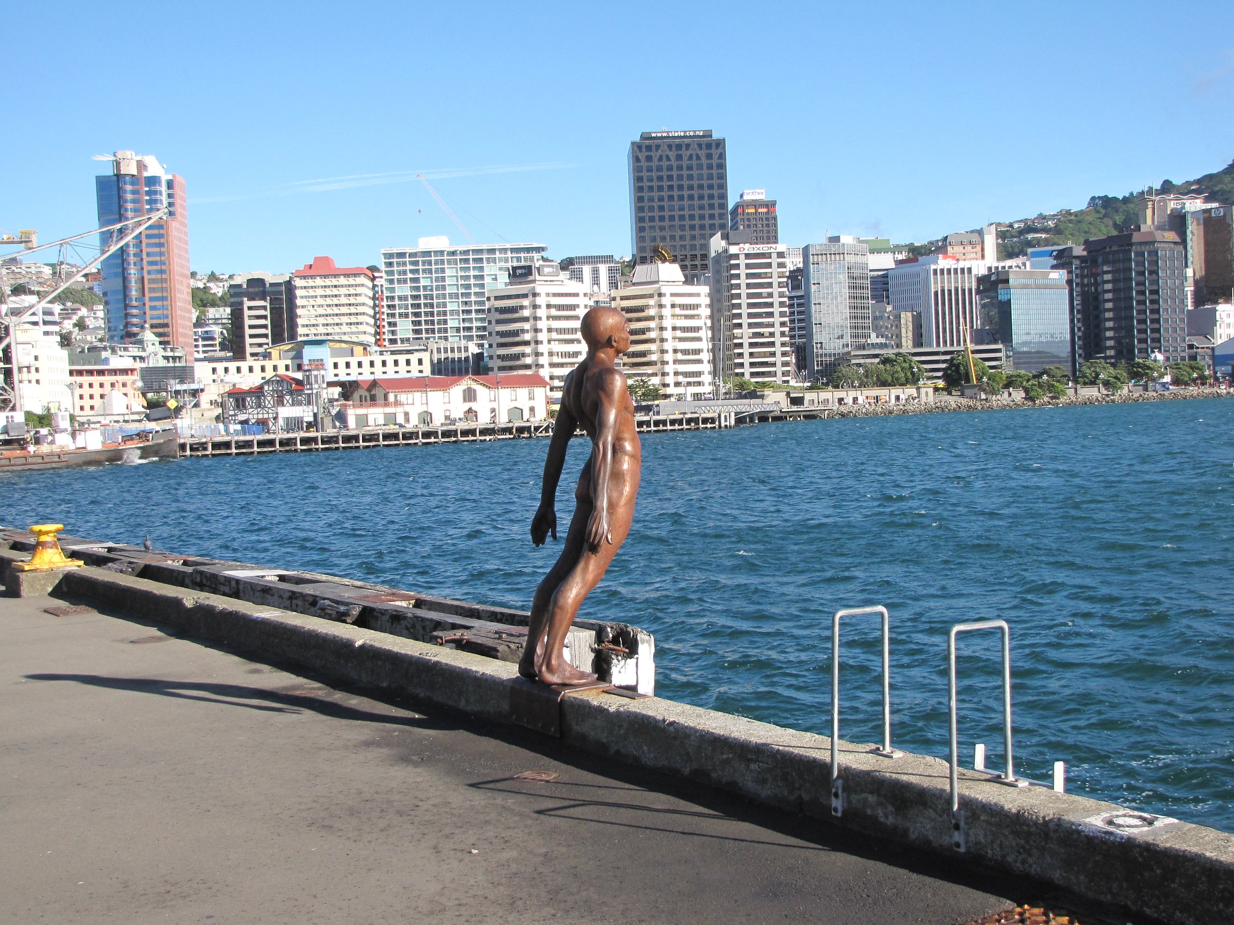
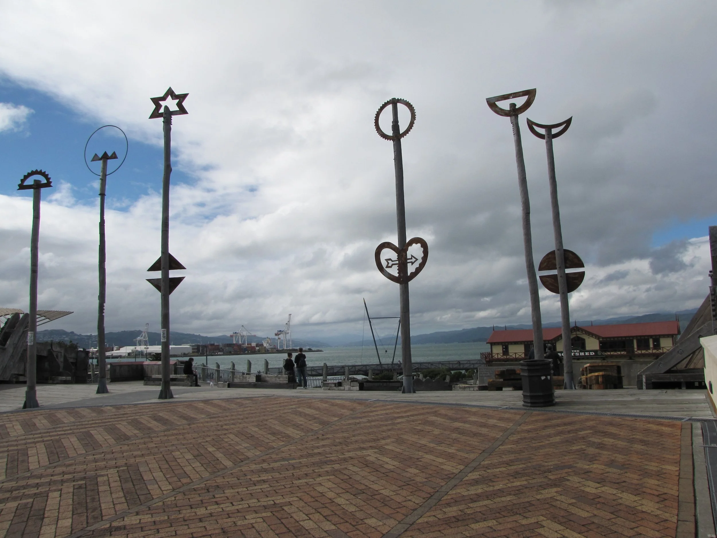
The Taranaki Street Wharf and lagoon are reclaimed wetlands and renovated old wharf sheds, all connected to the city by pedestrian bridges. Cool! We walked and walked and walked and then walked some more. We took a cable car ride up to Kilbourn for view of the city below, then descended on a well-marked path through the Botanical Gardens and a graveyard as old as the city. We sought out the Beehive, New Zealand Parliament’s uniquely shaped building and checked out the Opera House. Sculptures and street art are everywhere, a wonderful blend of Kiwi and Maori cultures. Parks and gardens abound.
The Te Papa Museum was outstanding. Te Papa first opened its doors in 1998 and quickly became the country's pride and joy. It's affectionately known as "Our Place". We made three separate trips to TePapa (admission is free/donation only). In addition to natural history, cultural history, excellent interactive displays and so much more, the Maori section included an actual full-scale reconstructed meeting place (Te Hau ki Turanga) dating from 1842. There was also a full-size waka (canoe) and a typical hut. We had a few hours there; we could have spent weeks.


Napier - 39S29.02 / 176E53.52
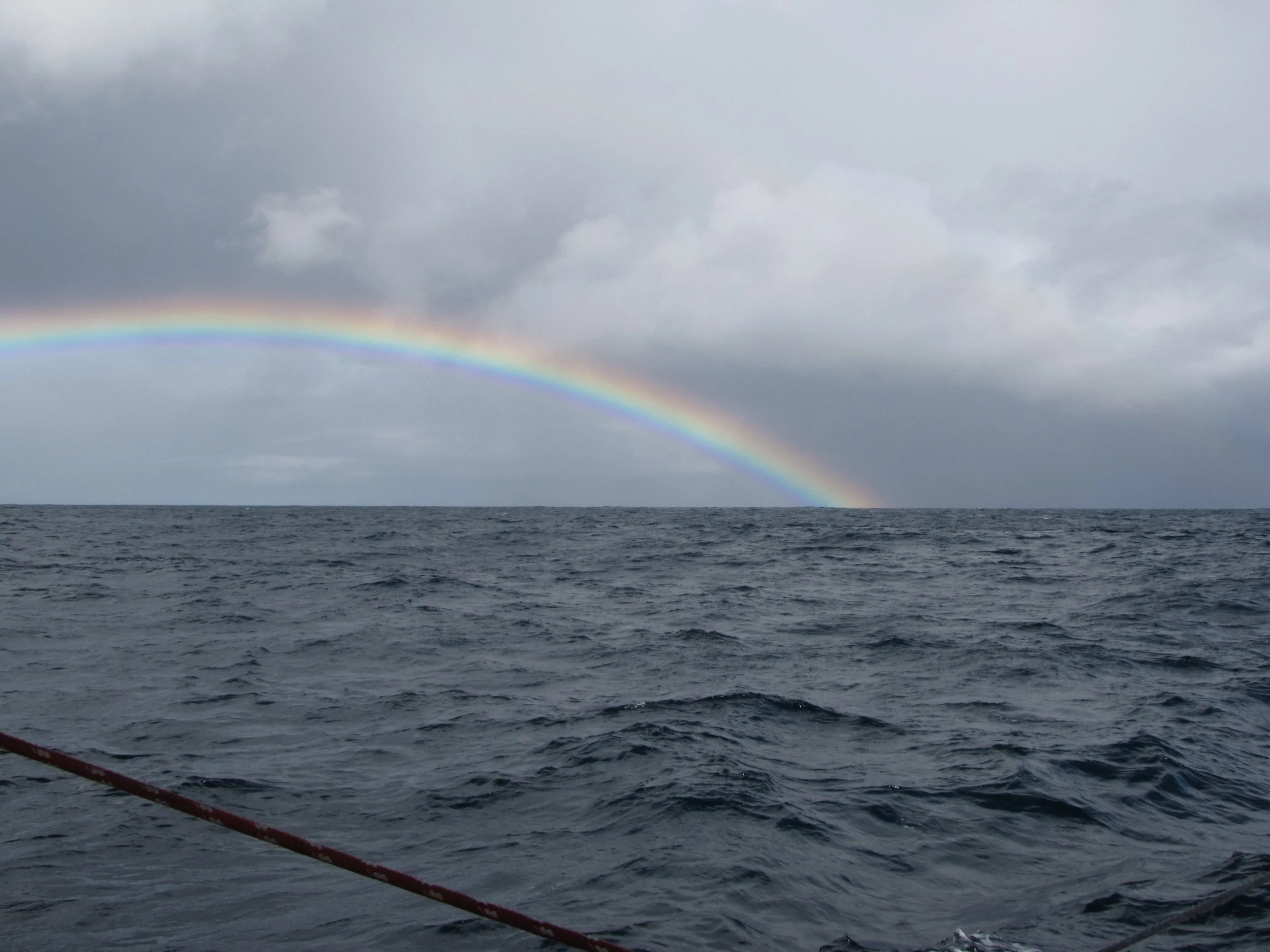
The short 200-mile, 2-night passage from Wellington to Napier wasn't all rainbows. Big winds and waves made for a bumpy, lumpy trip for the first half. Once out of the Cook Strait and past Cape Palliser, around NZ's southeast corner, things lightened up. The entrance to the Napier Harbour was quite narrow and shallow in parts, but the range markers kept us in the channel.

The Napier Sailing Club was our friendly host. The Sailing Club/Marina offered about 100 berths. We, however, were berthed against the wharf just off the clubhouse and everyone who walked by stopped to chat and say hello.
At a book swap, we had picked up a copy of "Napier's Art Deco Walk", a self-guided walk through town identifying all the buildings, statues, structures and providing information about them and their history. We put the booklet to good use.
What exactly is Art Deco? Interesting that you should ask. We were certainly curious. Art Deco is the name given to the decorative style which burst on the world at the International Expo of Modern Decorative and Industrial Arts held in Paris in 1925. It symbolized the new spirit of the 20th century, a period characterized by scientific and technological advancements, increasing independence of women and the overthrow of old conventions, the epitome of the Jazz Age. These new beliefs were embodied in favorite motifs, primarily geometric using angular patterns and shapes, symbols of power and speed (e.g. lightning bolts), symbols of freedom (leaping deer, dancing women) and the rising sun. Architecturally, Frank Lloyd Wright was a great influence and so along with Art Deco, we saw Spanish Mission and Prairie style.
On February 3, 1931, an earthquake (7.8 magnitude) devastated central Napier and many surrounding towns. Subsequent fires destroyed the buildings that survived the tremors, and 157 people lost their lives. Instead of throwing up new buildings haphazardly after the disaster, the town fathers put together a well-conceived rebuilding plan that included underground power and telephone lines and well-laid out streets. Within 2 years the city center was rebuilt and much of it remains today.


Dedicated to NZ's #1 pest, we took a quick side trip tour of Opossum World. It was a hoot! Opossum fur, combined with merino wool, is used in lots of clothing and woven items in NZ.


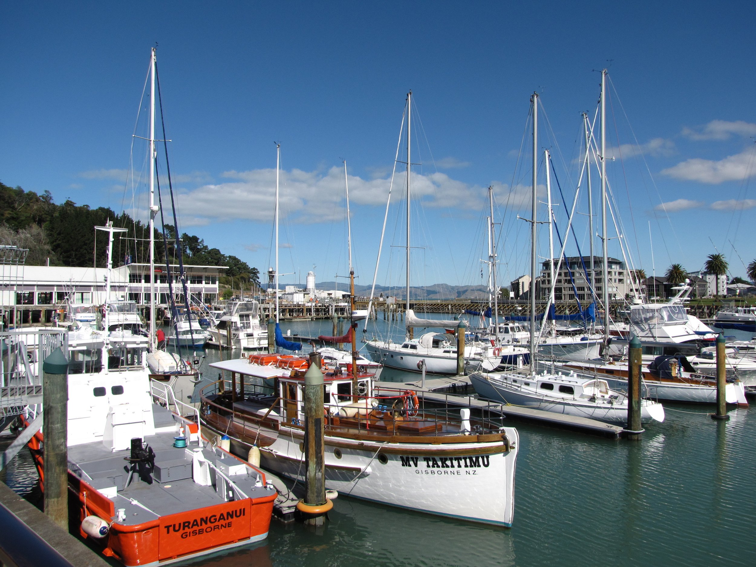
Gisborne - 38S40.22 / 178E01.75
The "plan" was to stay in Napier for a few days and then head north. The weather forecast, however, called for one day of "variables" before strong northerlies moved in. We took advantage of the one-day lull and moved 100 miles further north to Gisborne, the easternmost city in the world... first to see the sun... according to the local travel brochures.
Leaving Napier, we transited beautiful Hawke's Bay. Pania of the Reef is a bronze statue in Napier that celebrates the Maori legend of Pania who was lured to the sea by siren voices and transformed into a the reef in Hawkes Bay.


At the confluence of three rivers, Gisborne is called the "Bridge City" for the number of bridges across the rivers. It's also known for its fine chardonnay wines. Captain Cook first stepped ashore in New Zealand here at Kaiti Beach in 1769.


East Cape Road Trip
Northerly winds were forecast for several days. We did a few chores aboard and then did the only reasonable thing we could do under the circumstances ... Road Trip! Several cruising friends were berthed in Tauranga, ~300km north on the Bay of Plenty. Local info gave us a scenic circuit route to follow and we were off on a scenic route through the Waioeka Gorge Scenic Reserve, NZ's largest scenic reserve. We took in all the sights along the way, had a great visit with friends, then made our way back to East Cape via another scenic route.


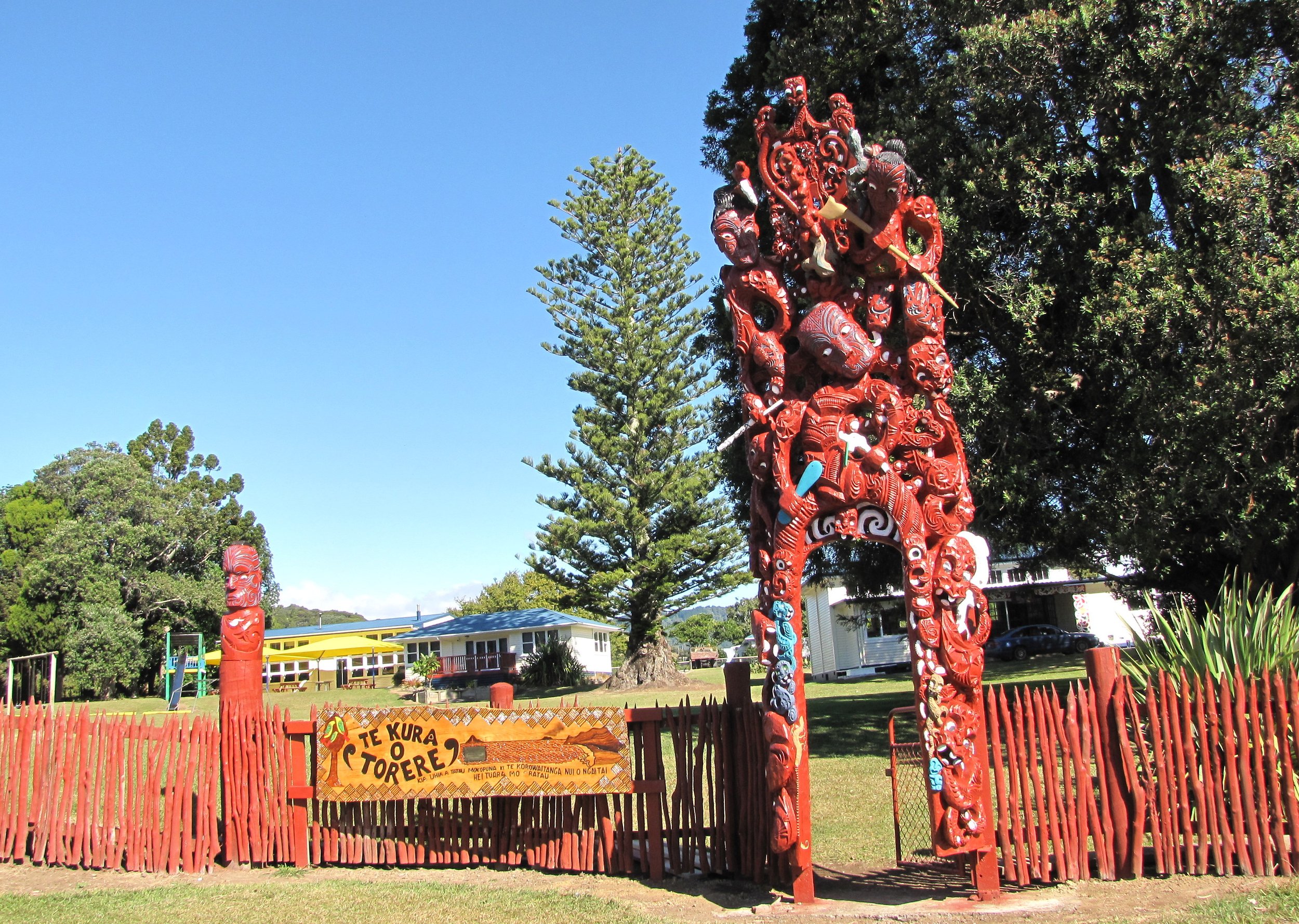


St. Mary's Church in Tikitiki is considered one of the finest Maori churches in NZ with intricate Maori carvings inside and out. The interior has lavish carvings throughout... ceilings, pews, nave, altar, pulpit. Even the stained glass windows contain Maori traditional design. Tutktuku, woven panels in unique designs, cover the walls of the church.


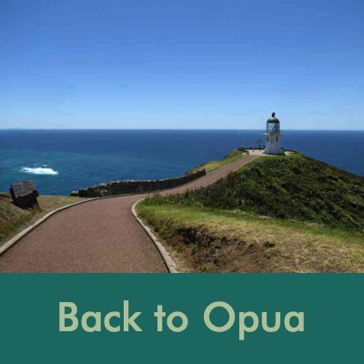
Back to Opua
The trip back to Opua around East Cape was easier than expected. Waters were calm when we rounded the Cape, but the winds just wouldn't cooperate. We easily made our way north, but westerly mileage to Opua was difficult. In the end, the passage was longer than anticipated by a day as we sailed an extra 100 miles north and then tacked back to Opua. It was like coming home as we entered the Bay of Islands. We were familiar with the landmarks and the route. We arrived around 0100, dropped the hook just off Russell in an easy-access anchorage, then headed to the Opua anchorage next morning.

A friend took this photo of Cups from her boat during one of the many winter storms that Cups endured.
Plans to leave for Fiji were canceled on our return. Nine of Cups was left on a mooring in Opua, NZ and the crew flew to Las Vegas, Nevada, USA for several months for a family emergency.
We returned to New Zealand in mid-September to find Nine of Cups a bit forlorn, but waiting patiently for us on her mooring. We were glad to be home. Folks told us that she'd survived 100+ km/hr winds and torrential downpours. She was dry inside and there was no trace of mold or mildew. We were pleased to move back aboard and brought her into a marina berth for a well-deserved bath and some rest.
Having left Cups abandoned for several months, she needed lots of attention. We asked NZ Customs for yet another 6-month extension to get some boat work done and lo and behold, it was granted... no grovelling required. And so it began the long list of boat chores which we hoped to have all completed by Christmas to take advantage of NZ's wonderful summer season. In addition to the usual boat chores, David redesigned and installed a new fridge/freezer controller that worked like a charm. He also designed and installed a digital chain counter for the windlass which helped tremendously in the anchoring department.
There were some large boat projects, too. The mast unstepped for repainting and refurbing which David opted to prep himself. The deckwork done in Ecuador five years ago was not holding up and the deck was delaminating again. An evaluation indicated that a good portion of the foredeck and side decks needed significant repair work. Again, David opted to do most of the work himself. Midst everything else, the brightwork needed sanding and varnishing, and of course, there was the bottom job to consider. Maintaining a boat is hard work.


Cape Reinga (Te Reinga or Te Rerenga Wairua) - 34.43S / 172.68E

Despite the growing list of boat chores and projects, Marcie always insists on celebrating her November birthday and David always complies. This year's present was a weekend trip to Cape Reinga at the very tip of New Zealand's North Island. Located about 100 km north of the nearest small town of Kaitaia, State Highway 1 extends all the way up the Aupouri Peninsula to the Cape. Until 2010, the road was unsealed gravel for the last 19km. Lucky us!
The name of the cape comes from the Māori word 'Reinga', meaning the underworld. Another Māori name is 'Te Rerenga Wairua', meaning the leaping-off place of spirits. Both refer to the Māori belief that the cape is the point where the spirits of the dead enter the underworld. According to Maori mythology, the spirits of the dead travel to Cape Reinga on their journey to the afterlife to leap off the headland, climb the roots of an 800-year-old pohutukawa tree and descend to the underworld on their return to their traditional homeland of Hawaiiki-a-nui.
The day was warm, bright and sunny and we headed to the Cape Reinga Light. Built and first lit in 1941, the lighthouse was fully automated in 1987 and the lighthouse keepers were withdrawn. Cape Reinga is generally considered the separation marker between the Tasman Sea to the west and the Pacific Ocean to the east. From the lighthouse, it is possible to watch the tidal race, as the two seas clash to create unsettled waters just off the coast.
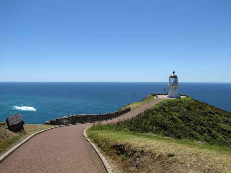


In actuality, Cape Reinga is neither the most northern nor the most western point of New Zealand. The most western point is Cape Maria van Diemen The most northern is Surville Cliffs about 30 km to the east and inaccessible by car.

The Aupouri Peninsula is rugged and desolate with huge sand dunes. Along its west coast is the Ninety Mile Beach, a beautiful stretch of white sand beach. We watched the sand surfers glide down the dunes.


Celebrating the Holidays
We celebrated our American Thanksgiving 2010 in New Zealand by taking out a small mortgage to buy a turkey ($55 on sale for 8# turkey!). Marcie took a tape measure to the grocery store to determine the prospective turkey's dimensions to make absolutely sure it would fit in our little oven. Despite curious stares from other shoppers, she determined it would fit and the results were delicious. We had roast turkey, stuffing and all the traditional T-Day fixin's including cranberry sauce and cranberry pudding for dessert.


Christmas is a summer holiday in the southern hemisphere… BBQs and beach time, but we were opting for a more traditional celebration. Marcie added to David’s fishhook collection, choosing paua, bone and greenstone (nephrite jade) hooks as representative of New Zealand. Marcie made aprons and baked goodies to give as gifts. Having recently replaced the sheets and halyards, David used the old line to make ocean plait rugs for Christmas gifts to other cruisers. If you’re interested in making ocean plait rugs, check out David’s instructions here.
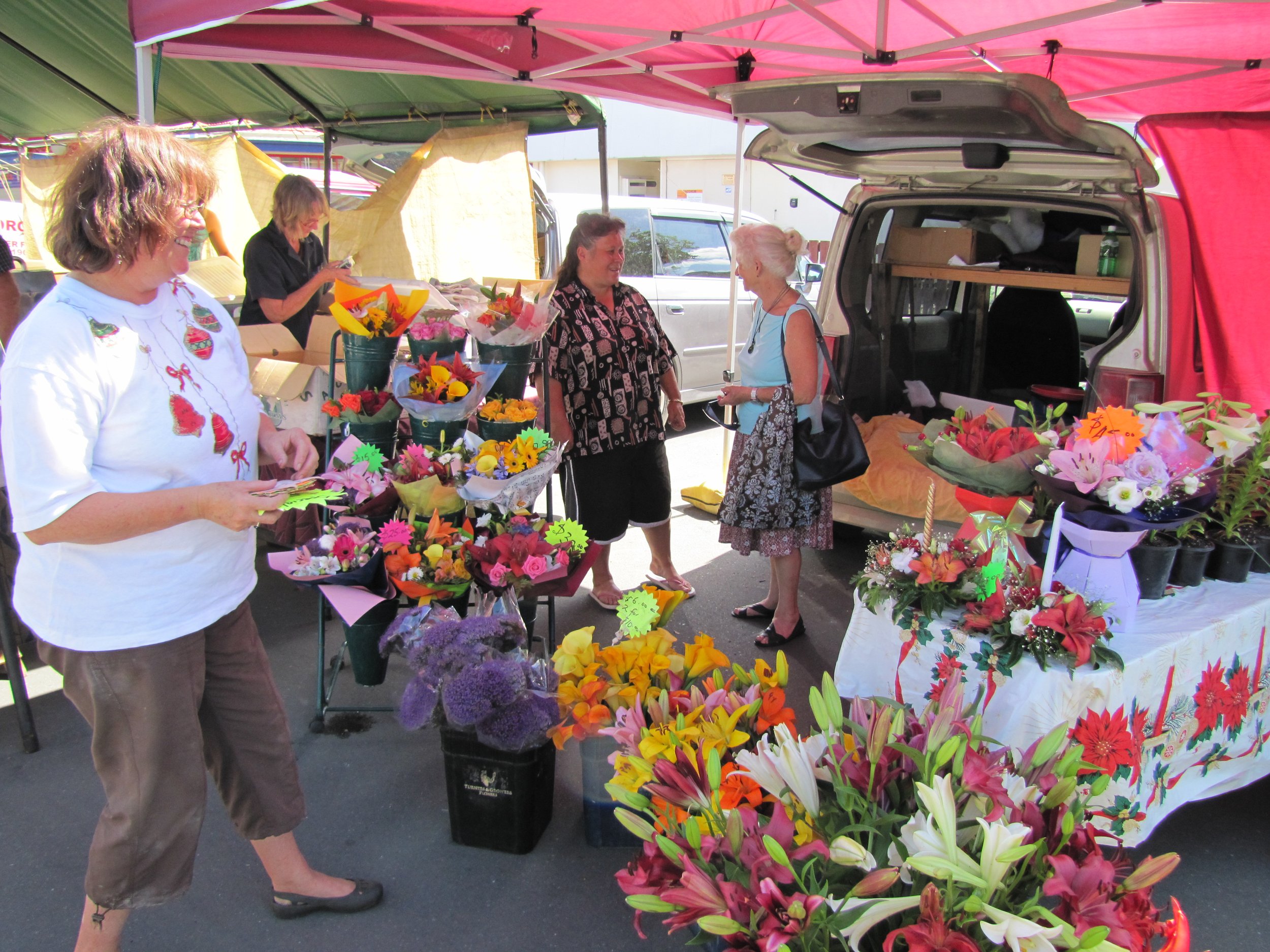
We visited Russell for a Christmas carol presentation including traditional New Zealand songs accompanied by ukeleles. We visited local Christmas markets and had a feast aboard Nine of Cups with cruising friends. Then it was back to work!


After Christmas found us in a flurry of activity, frantically trying to get as many chores done as possible to get away from the work dock by year end. We opted to stay on the dock for New Year's Eve. It was a Friday and sailors' superstition dictates that one never departs or starts anything major on a Friday. We managed to stay awake till midnight and welcomed 2011 with a quiet New Year's Eve celebration on board, just the two of us and a bottle of champagne.
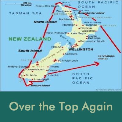
Over the Top Again
We were off Ashby's work dock on January 1, 2011, and anchored off the little town of Russell in Matawhi Bay. A good way to start the New Year! New Year's Day was spent lazing around and back to work on Sunday with a long list of "to-do's" before we could depart for the South Island. How could there possibly be more to do, we wondered. We'd been working on the boat ever since we returned in September and yet there was more: cleaning the prop and bottom, installing new jacklines and so many items on the list for checking, cleaning, prepping, repairing, modifying, caulking, completing. But we were in countdown mode and the list was getting shorter as the days flew by.
January 9, 2011 - Chores were mostly done and we finally got a clear shot at the fuel dock which had been queued up for days. A gray, overcast day with 25 kt S/SE winds forecast, just right for a quick 40nm trip north to Whangaroa. Though it seems illogical, it's easier, because of winds/currents, to sail north up the NZ North Island east coast and then down the west coast to the South Island. It's called "going over the top". This was the route we took to the South Island last year and we intended to do the same this year. Instead of spending time in Nelson and the Marlborough Sounds, we planned to continue down the west coast to Fiordland for some exploration, go around Southwest Cape to Stewart Island, and then work our way back up the east coast.
And we're off... Owhatanga Bay, Whangaroa - 35S01.36 / 173E45,08
We waited two days anchored in Owhatanga Bay timing our approach to the North Cape with winds that would carry us over the top and down the west coast. As is many times the case, though we were ready, the weather was not. While waiting for a weather window there were still plenty of chores to do. One "C" list chore still undone was to secure the fiddles that hold the books/gear in place on the shelves. Sometimes during a rough passage, the fiddles work their way out of place and all the books (or flour or rice) escape. Click here for How-To directions for making a lanyard.
The winds finally obliged and we left Whangaroa through its narrow entrance pass and headed north... to go south. As we got underway, David toasted Neptune with a tot of rum. We pulled into Houhoura Harbour and anchored for the night close to the entrance so David could repair the alternator that failed during the passage. We had a spare which he installed. The repair was saved for another time. One positive of stopping in Houhoura for the repair was being able to round NZ's northern capes in the daylight. They certainly looked different from the our vantage point than they had when we’d previously visited by land.


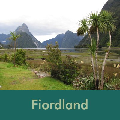
Welcome to Fiordland
Milford Sound (Piopiotahi) Deep Water Basin - 44S40.61/167E55.14

The red line on the Fiordland map above shows our route through Fiordland.
After one overnight stop to repair the alternator, two days of no wind, two days of light winds in the wrong direction and heaving-to for 15 hours to ride out a gale, we managed to arrive in Milford Sound, Fiordland, 785 nm from Whangaroa in less than record time of one week. But we were there and happy to be there and no worse for the wear.
Maori legend has it that the demi-god, Tu-te-raki-whanoa, with the aid of his magical adze, Te Hamo, began in the south and sculpted the rugged coastline. When he reached Milford Sound, he had perfected his art. Hine-nui-te-po, goddess of the underworld, admired his work, but was concerned that it was so beautiful, everyone would want to stay and never leave. So, in her wisdom, she let loose the sandfly which insured humans wouldn't linger too long.
According to scientists, the fiords were created by massive glacial activity through the millennia and sounds are actually river valleys flooded as the land sank below sea level. Though the early Europeans named them Sounds, in actuality, all of the rugged inlets are glacially carved fiords. Several of the glaciers still exist, but unlike Patagonia and Tierra Fuego, none wend their way down to the sea. New Zealand opted to maintain the misnamed "Sounds", but renamed the area Fiordland. In 1986, the UN recognized the beauty and unique nature of this nearly untouched wilderness and named it a World Heritage Site.
Though several explorers visited the west coast of New Zealand's South Island, no organized charting of the area took place until 1851. The HMS Acheron, a paddle- wheeler steamship, undertook a systematic coastal survey of Fiordland and its "sounds" which was used well into the 20th century.
Milford Sound (Piopiotahi) is the most visited fiord because it is the only one with direct road access AND because it is the culmination of the world-famous walk, the Milford Track. As we wended our way through the circuitous inlet, surrounded by high granite cliffs, we saw boats of every size, shape and description filled with tourists, fishermen and lobstermen. There were dive boats; there were kayakers; there were planes and helicopters overhead. For some odd reason, whenever we sail into a new port, we never think of ourselves as tourists, but we'll be mingling with them all in no time.
We used our charts and the cruising guide for the area, "A Boatie's Guide to Fiordland" by the Mana Cruising Club to navigate, but the way in is fairly straightforward. We could have easily followed the other boats. It's a busy place!


Waterfalls spilled over the granite cliffs of Milford Sound. The deep water close to the cliffs allowed us to venture very near the falls and I could feel the mist on my face as we passed by. Annual rainfall in the Milford Sound averages 5.5m / 18'. They've experienced rainfalls of 24" in 24 hours. Hence the reason for so many waterfalls, rivers and rivulets.
New Zealand fur seals sunned themselves on rocks as we passed through the Sound to the inner harbor. The Fiordland Lobster Company allowed us to tie up in an unoccupied lobsterman's berth. Unfortunately, though they thought there would be plenty of water, we were in the mud by low tide with a definite list to starboard. We were offered a mooring the next morning and took advantage of it. No sandflies here and plenty of water!


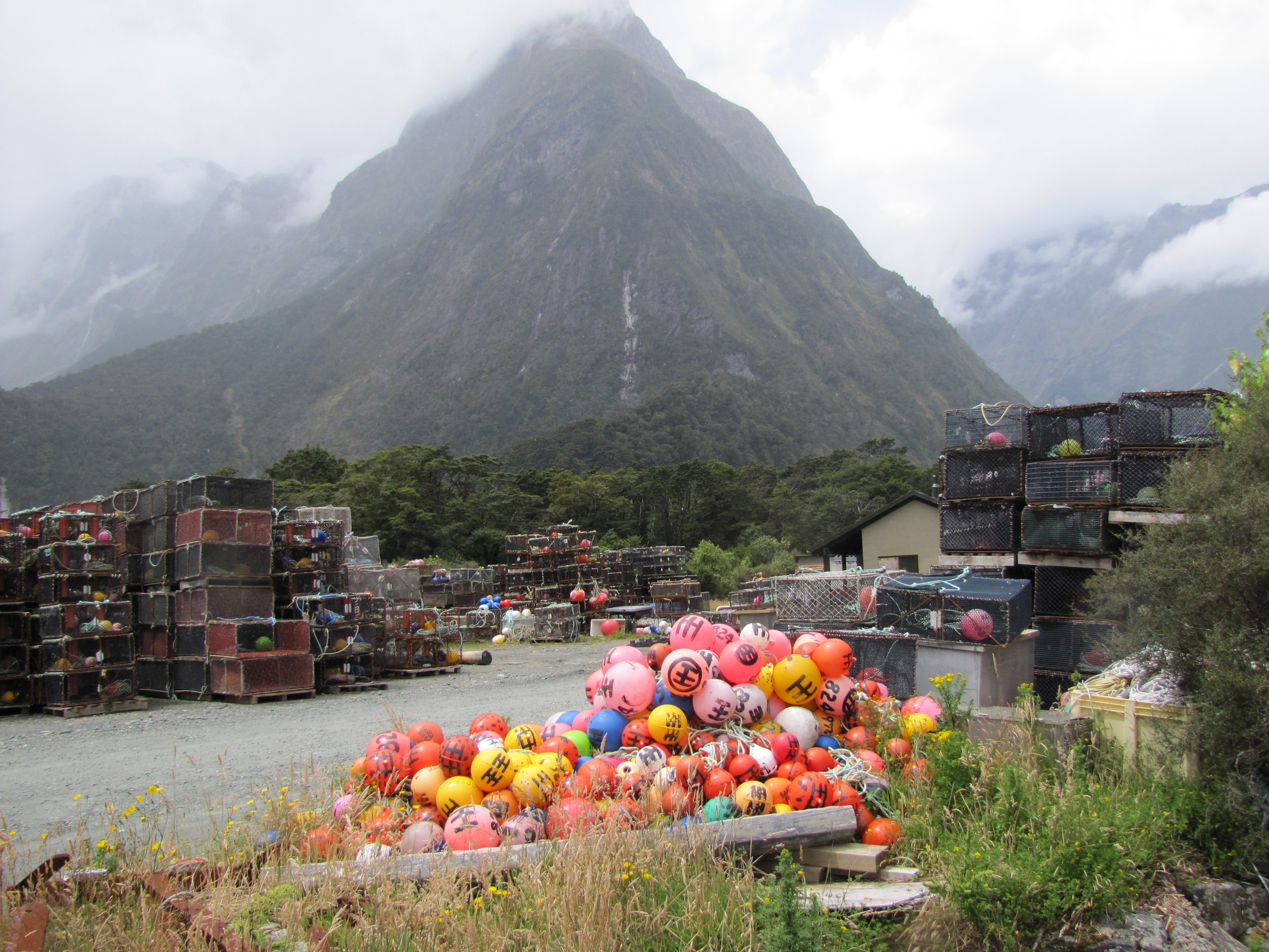
Other than tourism, lobstering and fishing are the major industries in Fiordland. Colorful fishing floats and lobster traps were stacked high in the yard. Fishermen and lobstermen work on a government issued quota to prevent overfishing.

We were anxious to get ashore and do some walking after our passage. We walked the dirt road to the Milford Road (Rt 94) and walked the 2km to "town". Actually, there is no "town" as such, just a few services/ amenities catering to hikers and those wishing to take a tour of the Sound. There are two hotels, a cafe which becomes a pub after 4PM, the boat terminal and a small airport.


We took several short walks, but the flies were relentless. We walked in the drizzle along the pleasant Foreshore Walk. Views of Mitre Peak from the Milford Overlook were beautiful even in the drizzle. The peak was so-named because it resembled a bishop's hat. The dirt road to Deep Water Basin was lined with a bright array of wildflowers. We could have stayed for weeks, but all too soon, it was time to move on.


My favorite photo with the iconic Mitre Peak in the background and torbay palms or cabbage trees in the foreground.
George Sound (Te Hou Hou) - Alice Falls - 44S58.91 / 167E26.44 - 75'
We left Milford Sound, passed by Poison Bay, Sutherland Sound and Bligh Sound and headed into George Sound for the evening. We took advantage of the fair, settled weather and just dropped the hook in the deep bay... about 65'. Less sandflies! We were alone in the anchorage which was millpond calm and decided to dinghy ashore. We couldn't identify this shrub/bush which lined the shores and displayed very showy, white, daisy-like flowers. Once we found an abundance of mussels, all thoughts of flowers vanished and thoughts of dinner prevailed.


Thompson Sound (Te Moenu) - Neck Cove - 45S11.36 / 166E58.63 - 32'
Bradshaw Sound (Kai Kiekie) - Precipice Cove - 45S15.78 / 167E08.47 - 40'
After a 35-nm trip from George Sound with 35-knot unforecast winds from the South, we gratefully dropped the hook in Neck Cove, Thompson Sound where there was no wind, no waves and lots of sandflies. Thompson is one of four fiords that connects from the sea with other fiords, in this case, Bradshaw and Doubtful Sounds. From Neck Cove we motored 13 nm to Precipice Cove in Bradshaw Sound which was peaceful and scenic ... except for the part where the engine died. Densely forested slopes replaced the granite cliffs of Milford Sound. Expecting a 35-kt NE blow, we hunkered down in Precipice Cove. David tied a stern line to shore as a precaution.
After several days of bright sunshine and clear skies, the rain was bound to come and boy, did it ever pour. We stayed in Precipice Cove for three days awaiting a weather window to head out. We bailed the dink intermittently as it was constantly full of rainwater. Bailing while it was raining never quite made sense, but we did it anyway. Finally a short-term clear window and we prepared to move on.


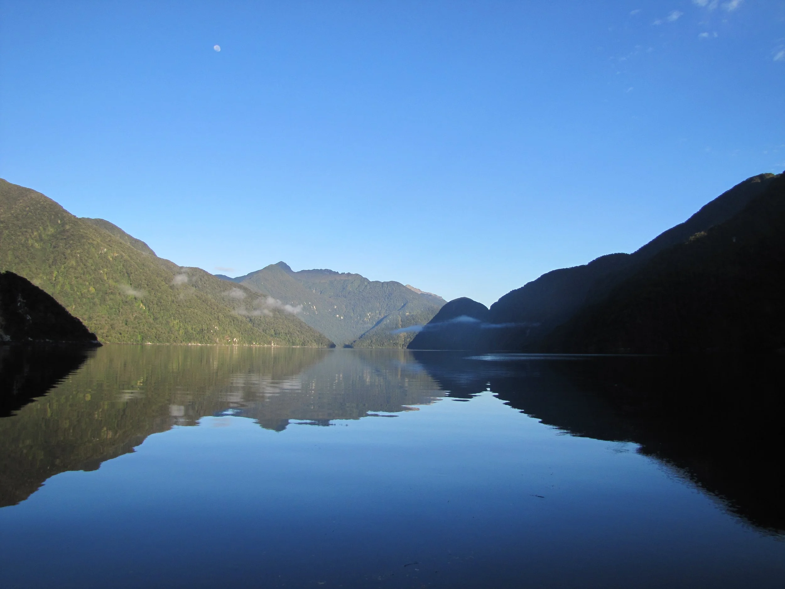
Doubtful Sound (Patea) - Blanket Bay - 45S17.95 /167E58.83 - 83'
With a short weather window, we motored the eight miles to Blanket Bay in Doubtful Sound. As luck would have it, a Fiordland Expedition vessel offered us the use of their mooring for our stay there. Blanket Bay, purchased from the Maori for one blanket and hence its name, has a tiny islet in the middle of it with the Blanket Bay "hotel", a meeting place for fishermen. Unfortunately, no one was in residence. We climbed onto the dock to explore a bit, but the place was locked up tight.


Dagg Sound (Te Ra) - Southern Arm - 45S25.92 / 166E54.27 - 24'
Dagg Sound was named after Captain William Dagg, commander of the HMS Scorpion, a whaler that reached Fiordland in 1804. Dagg Sound is not a very popular stopping place evidently; even the guidebook gave it short shrift. We found it just right for sitting out a blow but ended up staying six nights here awaiting the next weather window to head south. We entered the Sound with clouds of mists settled into the valleys. The weather which had been glorious for our first week in Fiordland became fearsome with daily gale and storm warnings, big seas and adverse winds. We sat tight, held on and finally made a break for it to Breaksea/Dusky Sounds, a bit further south. Our worst night, we recorded 60+ knots of wind with heavy, heavy rain. Cups did fine, but the crew was more than a bit concerned and spent a sleepless night on anchor watch.


Breaksea Sound (Matuku-Waitai) & Dusky Sound (Tamatea)
Wet Jacket Arm - Stick Cove 45S39.63 /166E44.12 - 77'
Captain Cook and crew were the first Europeans to explore the area and spent five weeks in Dusky Sound in 1773. He named it dusky because he arrived just before dark and couldn't make the entrance. Dusky is the longest fiord in Fiordland at 24 miles in length.
The anchorage in Stick Cove (aka Muscle Cove on the charts) in Wet Jacket Arm was tucked behind tiny Stick Island. A permanent stern line was moored on a tiny yellow float and made it easy to tie ashore. According to the Fiordland Boatie's Guide, Wet Jacket Arm, just off Acheron Passage, received its name from Captain Cook when Lt. Pickersgill got caught in a storm while exploring the area and "returned in no good plight". Cups sat comfortably in Stick Cove on anchor in 77' and her stern line tied to a line to shore'. The forecast for 35-40 kt winds never touched us being tucked so tightly into this little cove.

The forecast for 35-40 kt winds never touched us being tucked so tightly into little Stick Cove.
Preservation Inlet (Rakiturua)- Cuttle Cove - 46S03.92 / 166E39.52 - 42'
A continued weather window presented itself and rather than stick around in Dusky, we opted to take advantage of it and continue south to Chalky and Preservation Inlets. Listening to the weather forecast, we opted to give Chalky a pass and head straight to Preservation Inlet. We were feeling pressed for time all of a sudden. Spending a week in one location waiting for the weather made a dent in our previously loose schedule. We were intent on spending the bulk of our time at Stewart Island and still had a ways to go to get there. Always a compromise, it seems.
We passed the white cliffs of Chalky Inlet and easily figured out how it got its name. The chart marks the area with seabird, seal and penguin icons. Though we saw no penguins or seals, we were amazed at the number of birds... rafts and rafts of them. Dozens of albatross circled above, gulls, terns, petrels and shearwaters. We gave Balleny Reef a wide berth and headed into Preservation Inlet, the southernmost of the fiords and about 20 miles in length. It was named Preservation Harbour by Captain Eber Bunker on his 1809 map of the area, but the locals just call it "Pressy".
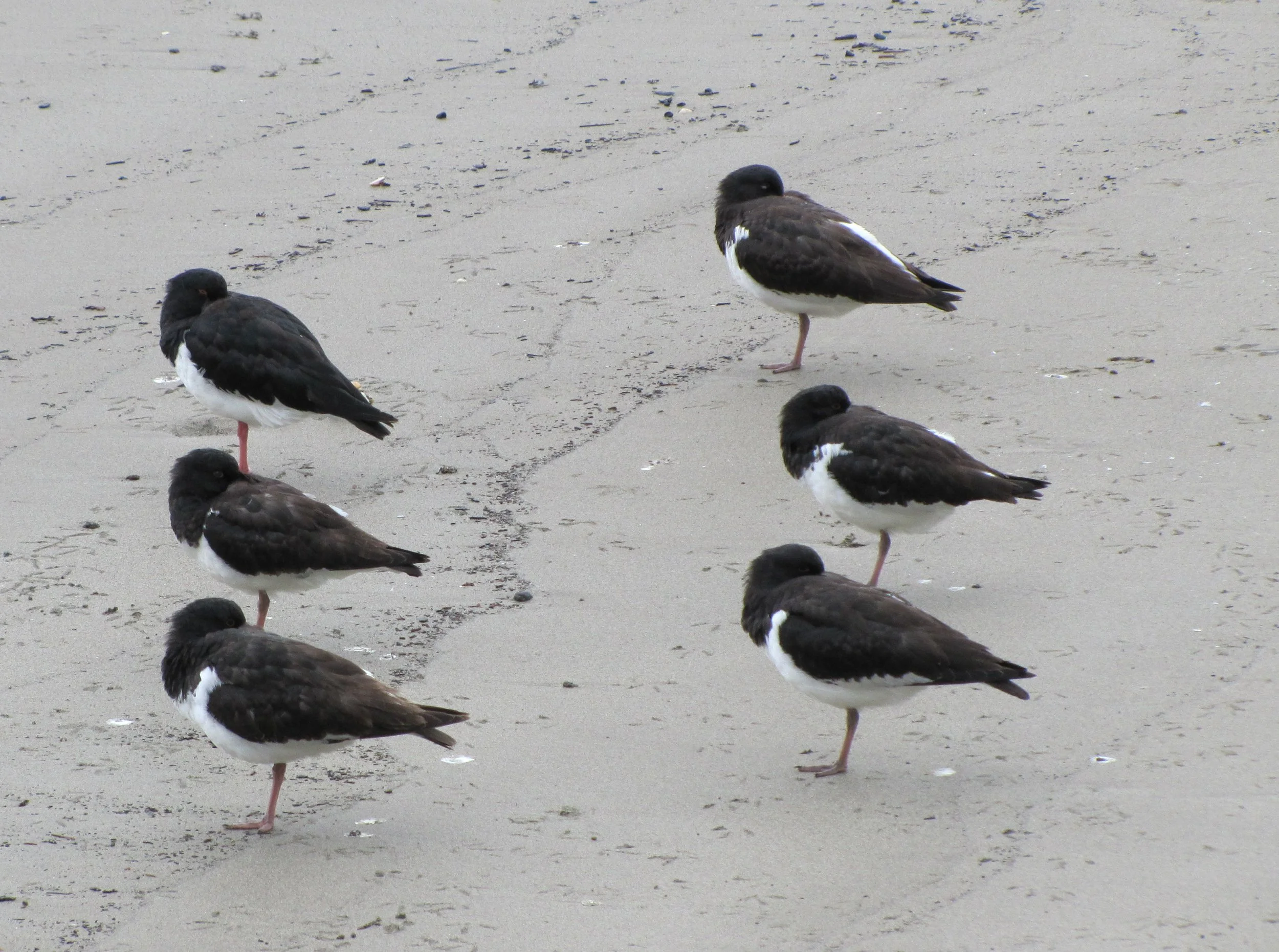
We anchored first in Cuttle Cove, a swing anchorage just behind SingleTree Island. We went ashore for a look-see. The area has a history of sealing and whaling stations as well as coal, gold and tin mining sites. A plaque on the beach at Cuttle Cove commemorated the whaling station 1829-1836. A colony of oystercatchers nearby squawked us away when we got a bit too close. Their brilliant orange bills and eyes were a sharp contrast to the gray rocky beach.


With a storm warning in effect for the area, we stayed only for the afternoon then moved on opting to snug close to shore at Isthmus Sound. We dropped the anchor and then ran two warp lines to sturdy trees ashore. David found mussels in the process which provided dinner that evening and chowder the next day.
The Birds! A strange occurrence...
Several days of rain and high winds kept us in the Ishtmus Sound anchorage for nearly a week. While watching a movie late one night, we heard a strange noise in the rigging. The wind or perhaps a loose halyard? On checking it out, we found a bird, a fairy prion, sitting on the coach roof. David thought he had might have flown into the rigging and was stunned. He carefully wrapped the docile bird in a towel and put him back into the water. Two minutes later, more commotion in the rigging and then a tapping on the portlight. Same bird? Looking out the portlight, there was a little bird face staring back at us pecking away with a "let me in!" look on his face.

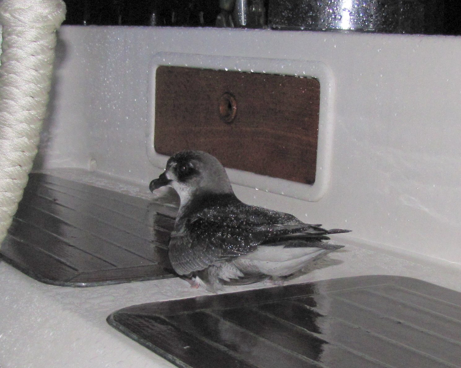
It was pouring rain, but I wanted to get a photo of the little fellow on the side deck. As I poked my head out of the companionway, another bird flew up and into the cockpit all of a sudden and startled me and then another bird and another. We could hear them several of them now pecking at the portlights, the washboards and the screens on the portholes. They were talking in a strange "petrel-ese" dialect and cooing in a way similar to a roosting hen. Around 2am, David armed with an LED flashlight, climbed into the cockpit in an attempt to shoo them away. Four were there pacing around on their little webbed feet. It appeared that once they landed there, they were not able to get out because of the confined space and lack of traction of their webbed feet on the teak. After a very brief discussion of their possible food value for our diminishing larder, David wrapped each of the four in turn in a towel and carefully let them go over the water. Docile and not seeming to mind photos, they seemed okay with our plan.


We weren't sure if it was mating season which accounts for animals doing strange, strange things in which case Cups had become a veritable "love nest" OR if we were playing our roles in a remake of an Alfred Hitchcock thriller. We did a little research in our bird books aboard. They were definitely fairy prions, a type of petrel. Discussion of their behavior confirmed that they are night feeders, breed on small islands in the Southern Ocean, utter soft cooing calls and walk clumsily on weak webbed feet. They disappeared by morning and though we heard a few of them on subsequent nights, we never saw quite the number of them again.

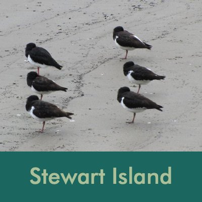
Stewart Island (Rakiura)
February-March 2011
A weather window finally appeared and we left Preservation Inlet mid-day on 10 February for the 100+ mile run around the South Cape to Stewart Island. Just before sunset, rugged Solander Island came into view. Sitting out in the Tasman Sea, alone and isolated, it is a NZ wildlife refuge and looked like a good place for seabirds to take a rest.
The Maori call this island, Rakiura, loosely translated "the great and deep blushing of Te Rakitamau". Maori legend has it that a young Maori chief was embarrassed when his proposal of marriage to the daughter of a high-ranking family was turned down. His embarrassed blush is immortalized forever in the exquisite sunrises and sunsets of the island.

Solander Island
The sun was just coming up over the Mutton Bird Islands on our port side with Stewart Island in the distance when Marcie came on watch at 0600. Silhouettes of albatross glided by Cups in the barely-lit dawn. The Mutton Bird Islands, wildlife refuge, are low-lying, rounded islets which are home to some of the millions of sooty shearwaters that inhabit NZ. On 11 February, we rounded NZ's South and Southwest Capes, west to east, and headed to the protected anchorages on the southeast end of the island. There were so many birds ... mollymawks, albatross, gulls, terns, petrels, shearwaters. Our destination was Port Pegasus on the southeast coast of Stewart Island.


Port Pegasus, Disappointment Cove - 47S14.61 / 167E37.12 - 19'
Port Pegasus... the name would make you think that there was a town of some sort here and at one point there was some activity, but now it’s remote and unpopulated... save the birds and sea lions we saw. It got its name from the vessel "Pegasus" which was on a sealing expedition in 1809. Its first officer, William Stewart, began charting the southern coast of the island and his work is acknowledged by the island's name.
Our cruising notes indicated that when entering Disappointment Cove, we would see a white sign on which to sight to avoid the reefs and rocks. We saw the sign immediately. It read "All vehicles must STOP!" A permanent mooring line was strung across the head of the cove. We dropped the anchor and tied bow and stern to the line to keep ourselves from swinging onto the reef.
Disappointment Bay was anything but disappointing. A well-marked trail led over the ridge to two sand beaches on the ocean side. On the bay side, the sand beaches at low tide provided clams and blue mussels in abundance. Kelp lying on the beach conjured up all sorts of sea monster/ giant squid-octopus images.


Port Pegasus, Evening Cove - 47S12.40 / 167E36.99 - 15'
Once again, a permanent mooring line was strung across the cove allowing us to drop the anchor and tie two stern lines to the mooring line preventing us from swinging into nearby reefs and rocks. Also once again, the chartplotter wasn't quite correct. The anchorage was a bit shallow (15'), but not THAT shallow. For non-chartplotter readers, this shows Cups anchored on land.
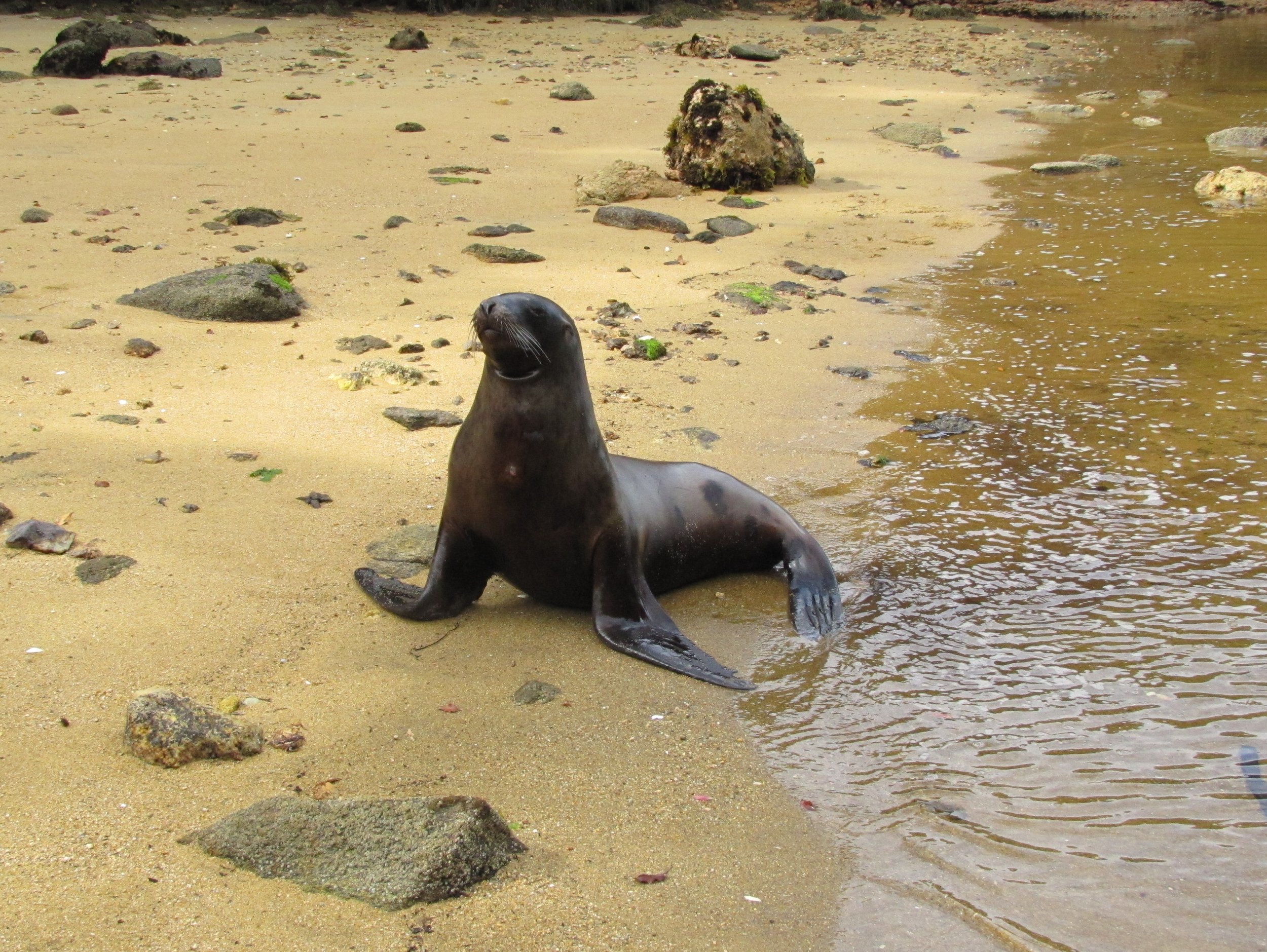
As we entered the cove, two NZ sea lions barked a greeting. They were apparently in a playful mood. They swam under and around Cups as we were anchoring, jumped out of the water, slapped their flippers on the water and then kept nudging the dinghy as if asking us to play. Unfortunately, anchoring took precedence over play at that moment. Unlike most of the other anchorages we'd visited in New Zealand, the water here was clear, clean and green. Starfish at 15' below us look like they'd be easy to snatch right up.


Port Pegasus, Waterlily Bay - 47S10.41 / 167E40.32 - 15'
Waterlily anchorage was beautiful...tucked in and calm with a sturdy hawser across to the bay to which we could tie stern lines. Alas, no waterlilies. After settling in we launched the dinghy for a little exploration. While digging clams in Basin Creek at low tide, we could hear roaring up the bay. It sounded like a pride of lions at the head of the creek, but we could see nothing. Clam digging complete, we walked further up the creek, the rocky sides now exposed by the low tide. Lolling on the beach before us were about eight large sea lions. Some were sleeping; some rolling in the sand; others were apparently at play. A huge bull spotted us and took his responsibility to protect the harem very seriously. With an ear-shattering roar, he charged in our direction, moving amazingly fast for such a large creature. David raised his arms and began clapping, a trick we learned in Antarctica to keep the sea lions at bay. This worked for about a minute. Actually, the bull looked somewhat confused (maybe a-mused). He quickly resumed his charge. David repeated the clapping and the bull stopped once again. We weren't that close actually and didn't feel all that threatened since we thought we could probably outrun a half-ton sea lion on land... even at our age. As we slowly backed away, the bull would charge, David would clap and finally we passed an invisible territorial border. The bull gave another roar and a snort and pretty much swaggered, as well as sea lions can, back to his harem, shouting his own praises all the way. He's probably still regaling his harem with his brave acts of courage to this very day.
We originally had mistakenly identified these as NZ fur seals, but learned later (thanks to NAS Guide to Marine Mammals of the World) they were NZ sea lions. They are also known as Hooker's sea lions, named after Sir Joseph Hooker, the British botanist who collected the first specimens of this species in the early 1800s. What we thought was an unusual white male seal was instead a female sea lion which are in fact, normally yellow to creamy white. Just how wrong can you get? It appears that Port Pegasus is a normal place for them to haul out and rest for a while especially in autumn and winter.


From our base at Waterlily Bay, we could dinghy up the inlet to The Settlement developed first for the short-term "tin rush" in the early 1890s and subsequently used for fish refrigeration. The remnants of the old cement wharf and rusting machinery parts are all that remains. Just beyond The Settlement, at the head of the inlet, was Belltopper Falls were pretty, but certainly no Niagara.


We scooted into tiny Diprose Bay large enough only for the dinghy and found clear, clear water and a sea bottom covered with spiny starfish. While heading to the beach at the head of Diprose Bay, we heard a splash and saw a sea lion following behind us. He swam around and under the dinghy and continued as we got into shallower and shallower water. When we beached the dinghy, he walked right up onto the beach with us, totally fearless. We, on the other hand, were a bit concerned as he kept coming closer and closer... sometimes tentatively, but mostly at a sea-lion gallop. We'd clap and shout, which would stop him for a second and then he'd continue coming towards us. Perhaps this was "his" beach, we're not sure, but we finally shouted him down enough for us to get back in the dinghy and launch it. The noise from the starting of the engine finally frightened him enough that he backed off and we made our hasty departure. Up close, they have a really large set of sharp teeth.


For a couple of nights, we had two motor launches (power boats) as company in the bay. We shared sundowners and they gave us some pointers on blue cod fishing. The fishing tips worked evidently as we fished from the dinghy the next day and caught blue cod which became dinner for two nights. Chattering Caspian terns perched on a rock near the boat also provided company in the bay.


Paterson Inlet, Golden Bay - 46S54.29 / 168E07.27 - 37'
A weather window finally presented itself for the 40nm day trip up the coast to Paterson Inlet. The day was rainy and foggy and though favorable winds were forecast, we saw no wind at all until entering Paterson Inlet and then it blew 35 knots on the nose. We motor-sailed right into lovely Golden Bay where the water was calm and the anchor dug in well. We could barely wait to get the boat tidied and settled in, so we could walk into Oban, our first real "town" since leaving Opua back in January.

Lovely Golden Bay
Oban - Halfmoon Bay

Halfmoon Bay is Oban's harbor for passenger ferry, tourist and supply boats arriving from Bluff, South Island. Since it's a rather crowded harbor, we opted to leave Cups anchored in Golden Bay and walk to and from Oban, about 2km each way. From Oban and other anchorages, there were several tracks to walk in the area and we planned to take advantage of every one we could. But first things first! We hadn't been in a town nor seen a supermarket since early January and we were looking forward to both.
Our first stop in town was the DOC (Dept of Conservation aka national park service) office for some local maps and info.
Oban is quite a small town (pop ~400), but the only town on Stewart Island. Located on Halfmoon Bay, it mainly services tourists and fishermen. The people were helpful and welcoming and we were happy to be here. We made sure we located the small Four Square "Ship to Shore" supermarket immediately so we could browse and shop later. Once we found that they delivered to the wharf at Golden Bay, we shopped with vigor. Small store, but great stock and variety. Then we found the South Sea Hotel which seemed to be "the" place to meet, have a meal and a beer. We felt obligated to take advantage of this opportunity. We hadn't had a meal off the boat since January and we were definitely ready to splurge.


We visited the tiny, but interesting Rakiura museum which seemed to concentrate on Stewart Island's pioneering history. A huge chess set dominated the shore facing the ferry terminal and seemed to get lots of use. Six little oystercatchers standing in a row catching a birdnap caught our attention. All aligned and standing on one foot, their long orange beaks were tucked under their wings.


Paterson Inlet - Little Glory Cove - 46S58.32 / 168E09.41 - 26'
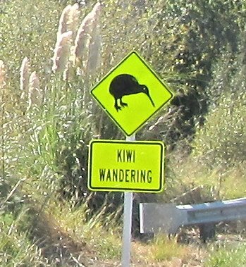
From our anchorage in Little Glory, we could dinghy to the Ocean Beach Track where we were hoping to see brown kiwi on the beach. The fern-lined track above, was well-marked and pretty soggy. Our first trip to Ocean Beach during the day netted only glimpses of oystercatchers. Since kiwi are usually nocturnal, we went back at 0600 next day while it was still dark and spotted a kiwi as soon as we walked on the beach. No flash photos allowed, just dimmed flashlight, so you need to use your imagination.
There's really never a dull moment aboard. When weighing anchor, a rather large octopus attached itself to the kelp on our anchor chain. He held on long enough for Marcie to snap this photo then finally let go. We hadn't quite figured out how we'd remove him if he didn't go of his own volition, but we were pretty sure we didn’t want an octopus for a pet.


Paterson Inlet - Ulva Island - Sydney Cove - 46S55.72 / 168E08.29 - 36'
Sydney Cove at Ulva Island is only a day anchorage, but affords access to one of NZ's few open island sanctuaries. The 600+ acre national park area offers native plants and birds the opportunity to thrive in a Several trails lead around and through the island. A booklet from the DOC office at Stewart Island provided historical perspective as well as conservation efforts in force. Though we saw and heard many, many birds, we didn't photograph many due to poor lighting under the forest canopy.
Paterson Inlet - Kaipipi Bay - 46S54.13 / 168E04.14
All of the anchorages in Paterson Inlet are close to each other and are swing anchorages which allowed us to move back and forth between them on a whim (or a weather change). Kaipipi Bay was not only a very well-protected anchorage, it also provided access to several tracks and places of interest. The Kaipipi Bay track began a short dinghy ride away and wandered up and down along an old logging road. The muddy, fern-lined trail connects with the Rakiura Track (one of New Zealand's Great Walks) for a stretch and ends up in Oban, about 5.5 km away. Filtered sunlight through a dense forest canopy plays on the undergrowth. We had no idea just how many species of ferns could exist in one small area nor how many shades of green could be distinguished. Despite the mud and muck, the trail is well-marked and quite pleasant to walk. There were fewer birds than we had anticipated although we did hear the complex, melodic songs of saddlebacks, tuis and bellbirds enroute.


Just a mile across Price's Inlet from Kaipipi Bay was Whaler's Base with a good landing wharf at Millar's Beach for the dinghy. Another dinghy was tied up when we arrived and we heard some loud "whooping" from the direction of the refuge hut there when we first arrived. Shortly after, we saw a rather sedate couple walking away from the hut. We couldn't imagine the cause of the whoops until we got there ourselves. In front of the refuge hut was a long, sturdy rope swing that soared way out over the water. We each took a turn and whooping was definitely called for.


The 20-minute track to Whaler's Base seemed all up, then all down. Muddy in spots, there were the remains of large tree sections and trunks from logging efforts in days past, now all blanketed in thick moss. The station, in operation between 1925-1931, was responsible for repairing and maintaining the Norwegian whaling ships and small whale chasers that worked in the Southern Ocean. Interpretive signs described various aspects of the facility and life at the station. At its peak, the Rosshavet Whaling Company killed about 1,000 whales per year. The only reason the whaling stopped was due to the glut of whale oil on the market which drove prices down and made this station unprofitable.
Not much remained at the whaler's station except the concrete foundation of one large work building and the front steps of the manager's residence. The beach was littered with old rusting propellers of varying sizes that had been damaged by ice floe in the Antarctic.


Below find a hodgepodge of things that caught our attention enough to photograph and share.
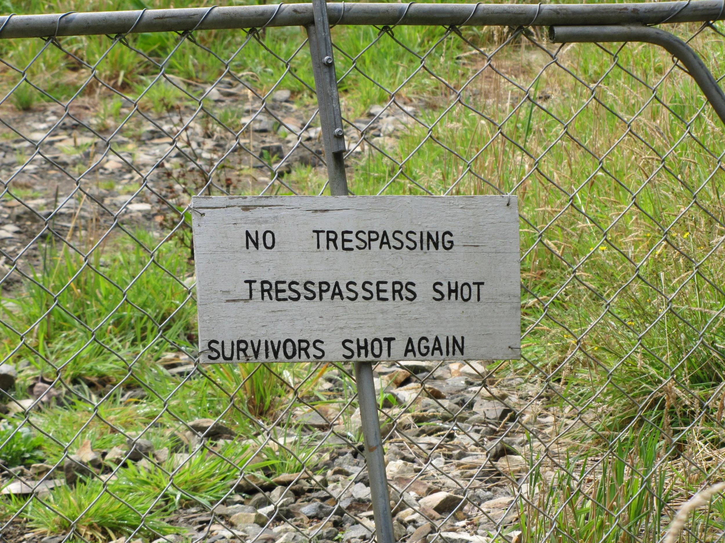

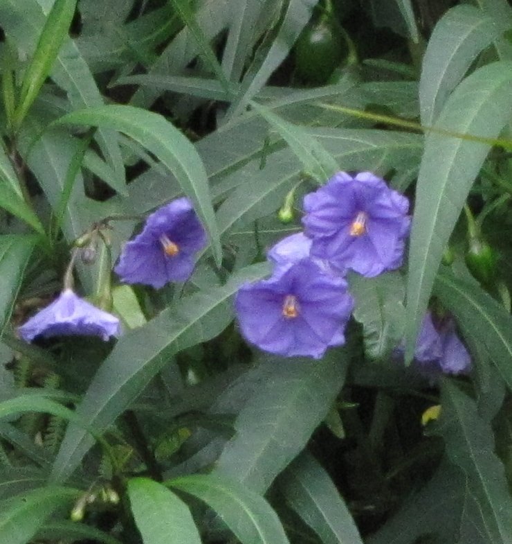


Ferns, ferns, and more ferns! New Zealand boasts more than 200 species of different ferns.


Back to the South Island

Dunedin and the Otago Peninsula - March 2011
The trip from Stewart Island to Dunedin was a 152nm overnight... very cold and very fast. The channel leading past Port Chalmers and into downtown Dunedin is narrow and about 12 miles long. As we glided past the photogenic lighthouse at the entrance and then past green, rolling hills dotted with grazing sheep, we wondered if we were really approaching the South Island's second-largest city.

Tairoa Heads Lighthouse

The Otago Peninsula, stretching along the southern edge of the Otago Harbour, is one of the most beautiful and renowned areas of New Zealand. Wildlife abounds... yellow-eyed penguins, blue penguins, seals, sea lions and the world's only mainland breeding colony of northern royal albatross.
Our home while in Dunedin, the very friendly Otago Yacht Club. From their website “The Otago Yacht Club is one of the leading yacht clubs in Otago with its origin dating back to 1869, making it also one of the oldest yacht clubs in the region.”

Dunedin is dubbed the "Edinburgh of the South". Founded by Scottish settlers in 1848, the name Dunedin in Celtic translates to Edinburgh. Besides the statue of Robert Burns' in the town center and bagpipers galore, there's a Scottish store that claims to sell not only tartans and crests, but haggis as well! Rich in Victorian architecture and history, this university city owes its historic wealth and ostentation to the Otago gold rush of 1861. A significant portion of the city's population is made up of students.


Wandering through the University of Otago campus, admiring the old buildings, we appreciated the occupational characters molded into the building's motif reminding us of similarities at Oxford University.
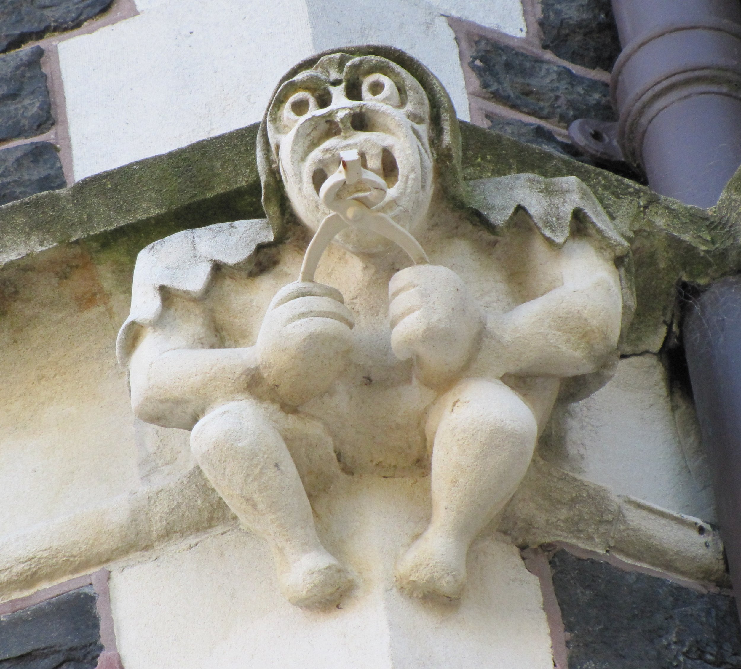
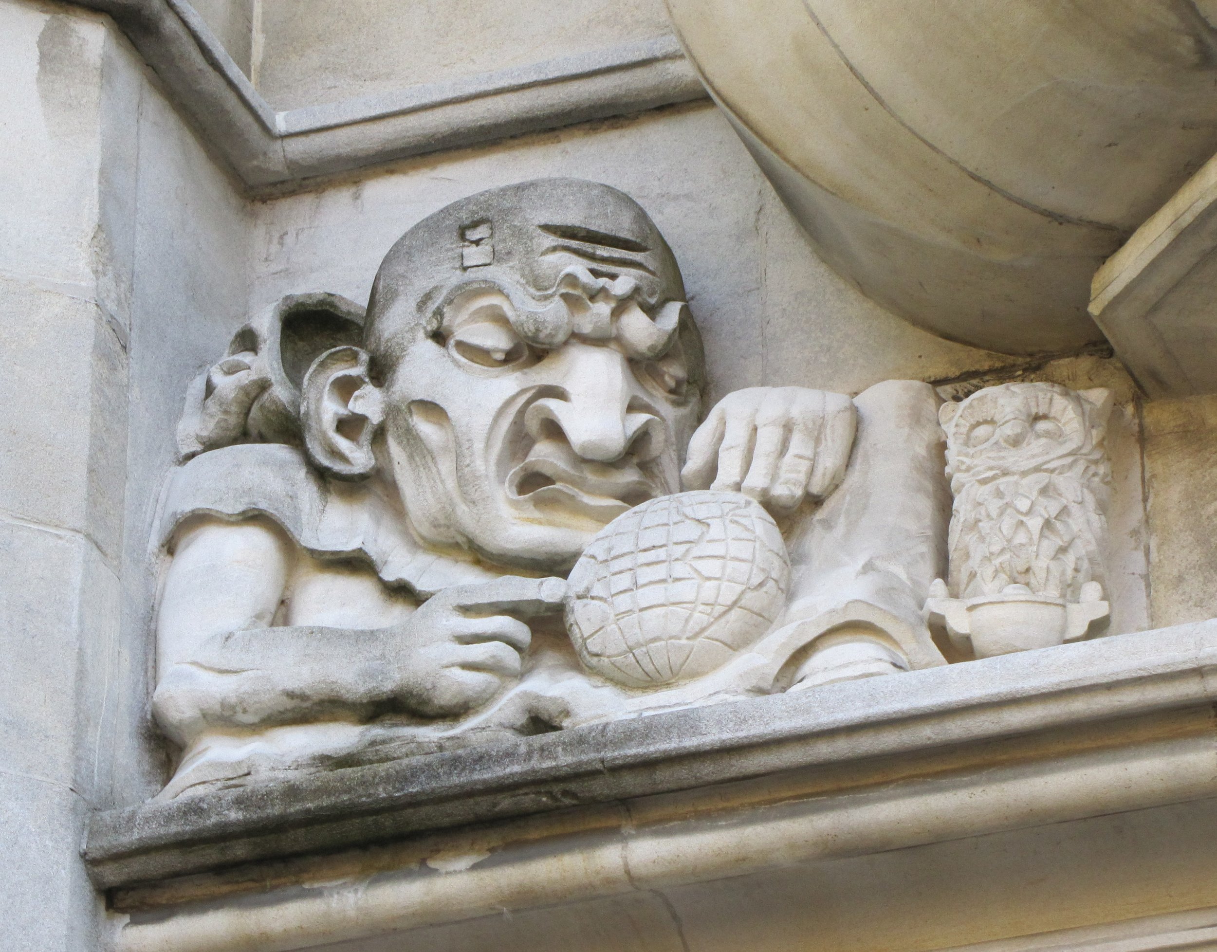
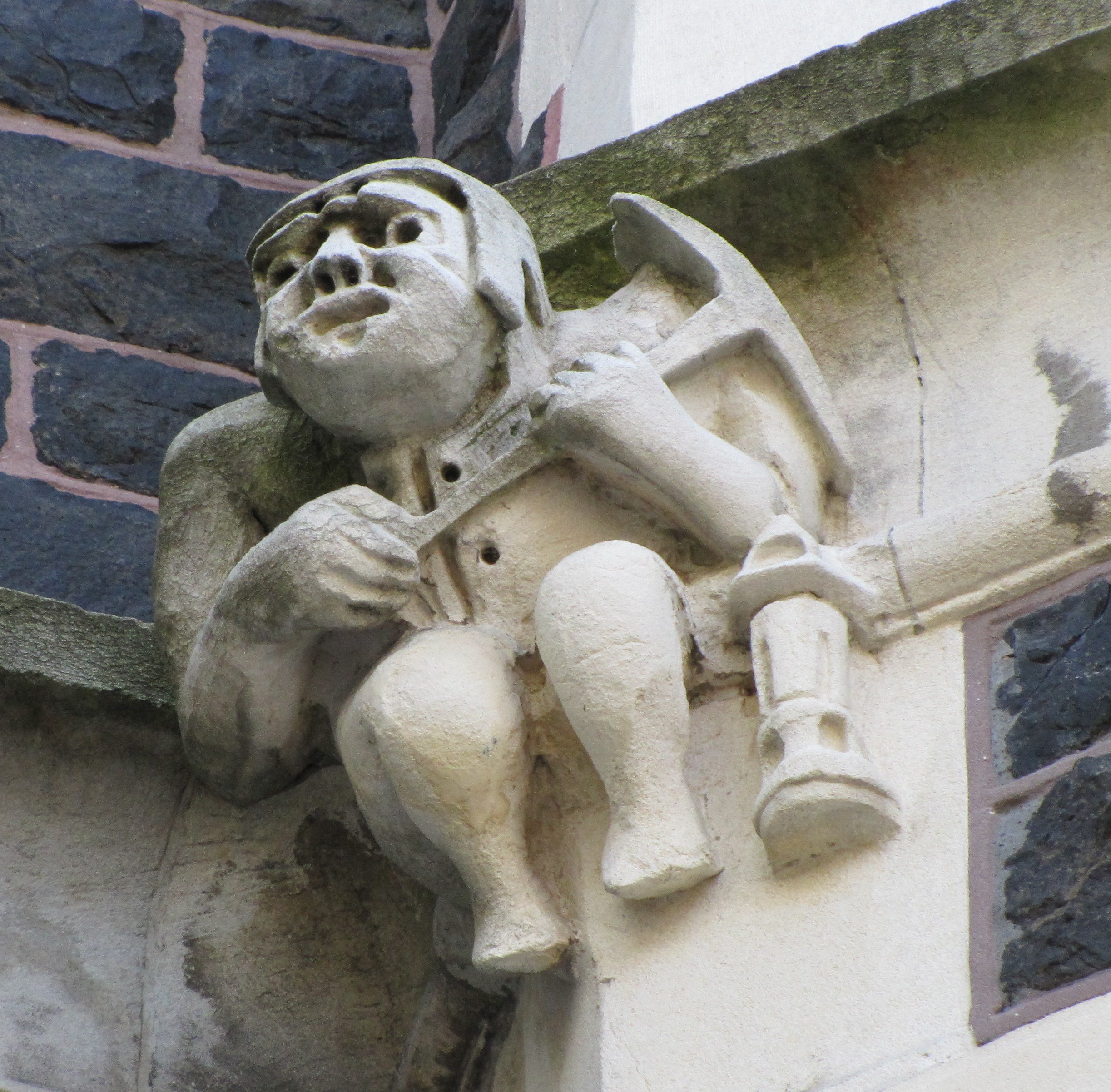
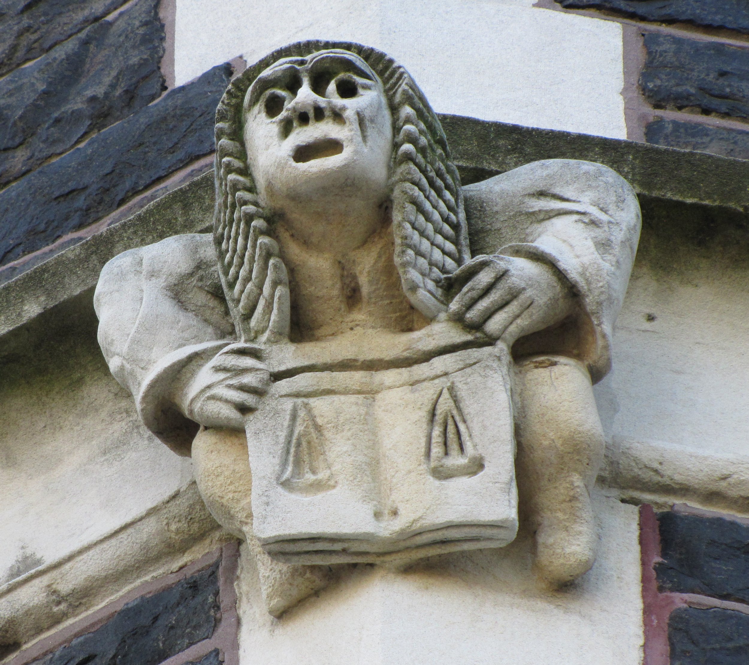
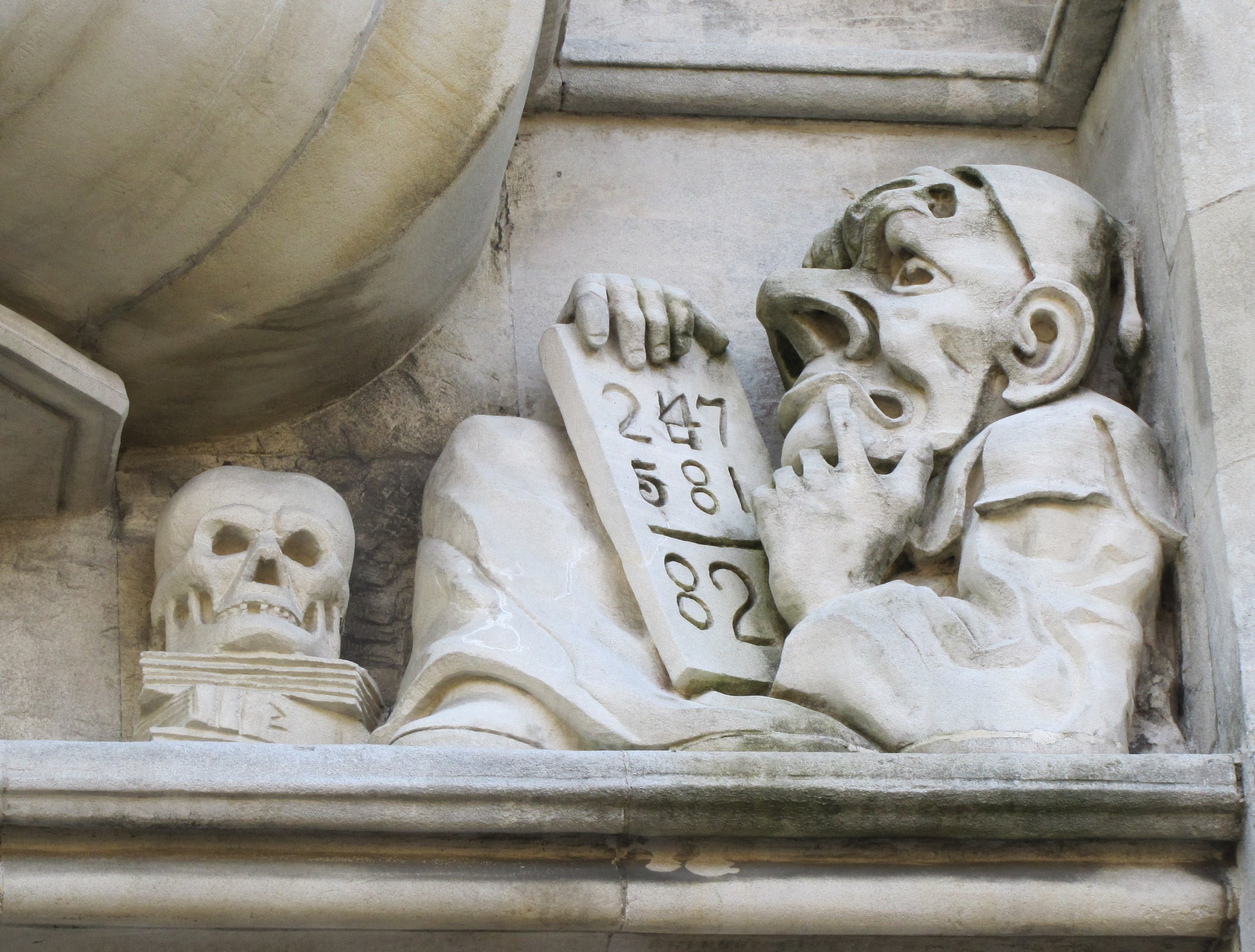
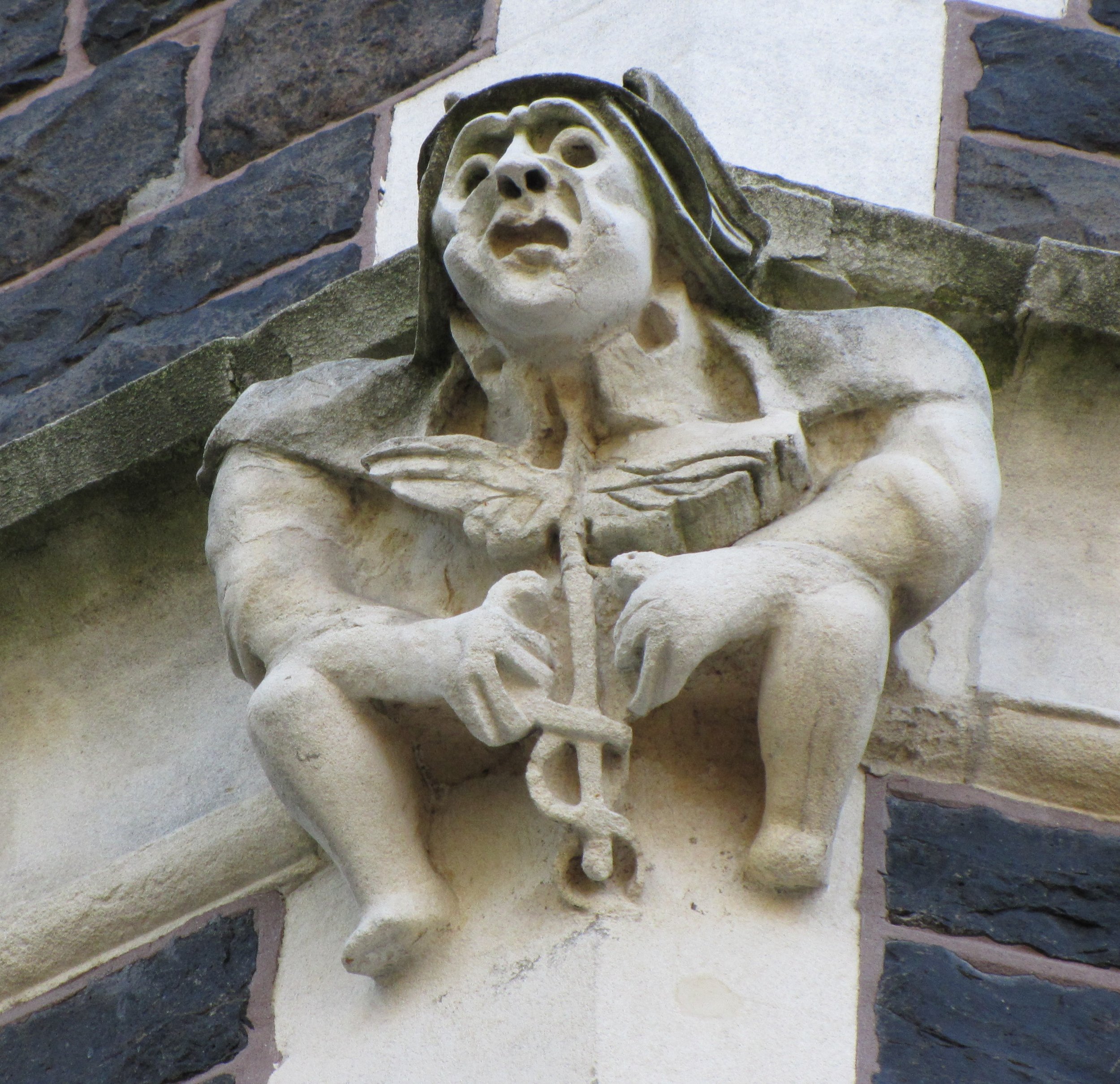
According to the Guinness Book of World Records, Baldwin Street is the steepest street in the world. We huffed a bit, but made it to the top without cardiac arrest. Tricks with my photo editing program allowed me to play with the horizon emphasizing the degree of incline in the street. Over the 161.2m length, it climbs a vertical height of 47.22m which is an average gradient of 1 in 3.41. On its steepest section, the gradient is 1 in 2.86. Every year a Dunedin Festival foot race called "Baldwin Street Gutbuster" is run up and down the hill. Click on any image to enlarge it for better viewing.

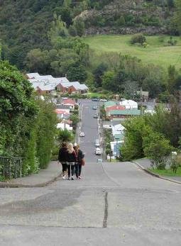


Dunedin's Botanic Garden, established in 1863, was New Zealand’s first botanic garden and encompasses ~70 acres. The garden was moved to its present site in 1867 and is now internationally recognized for its excellence as both a public garden and its botanical collections. We admired rose gardens, rock gardens, herb gardens, rhododendron dells, formal borders and forested slopes.
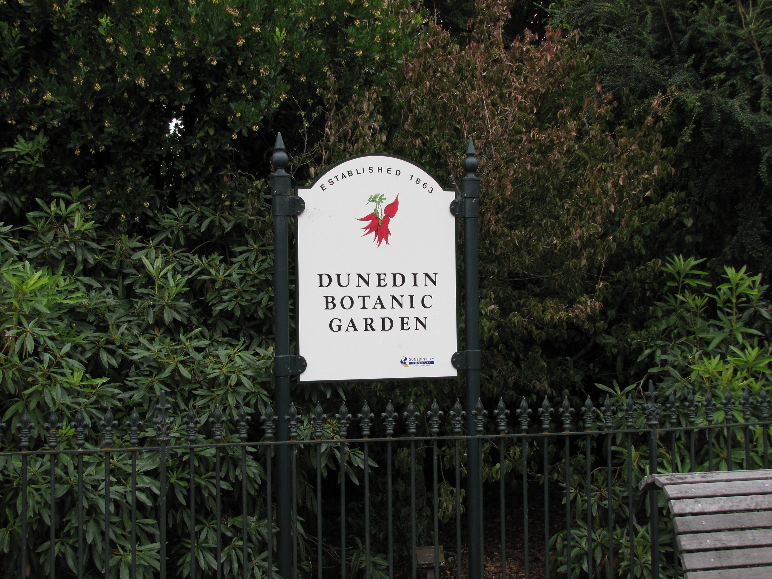
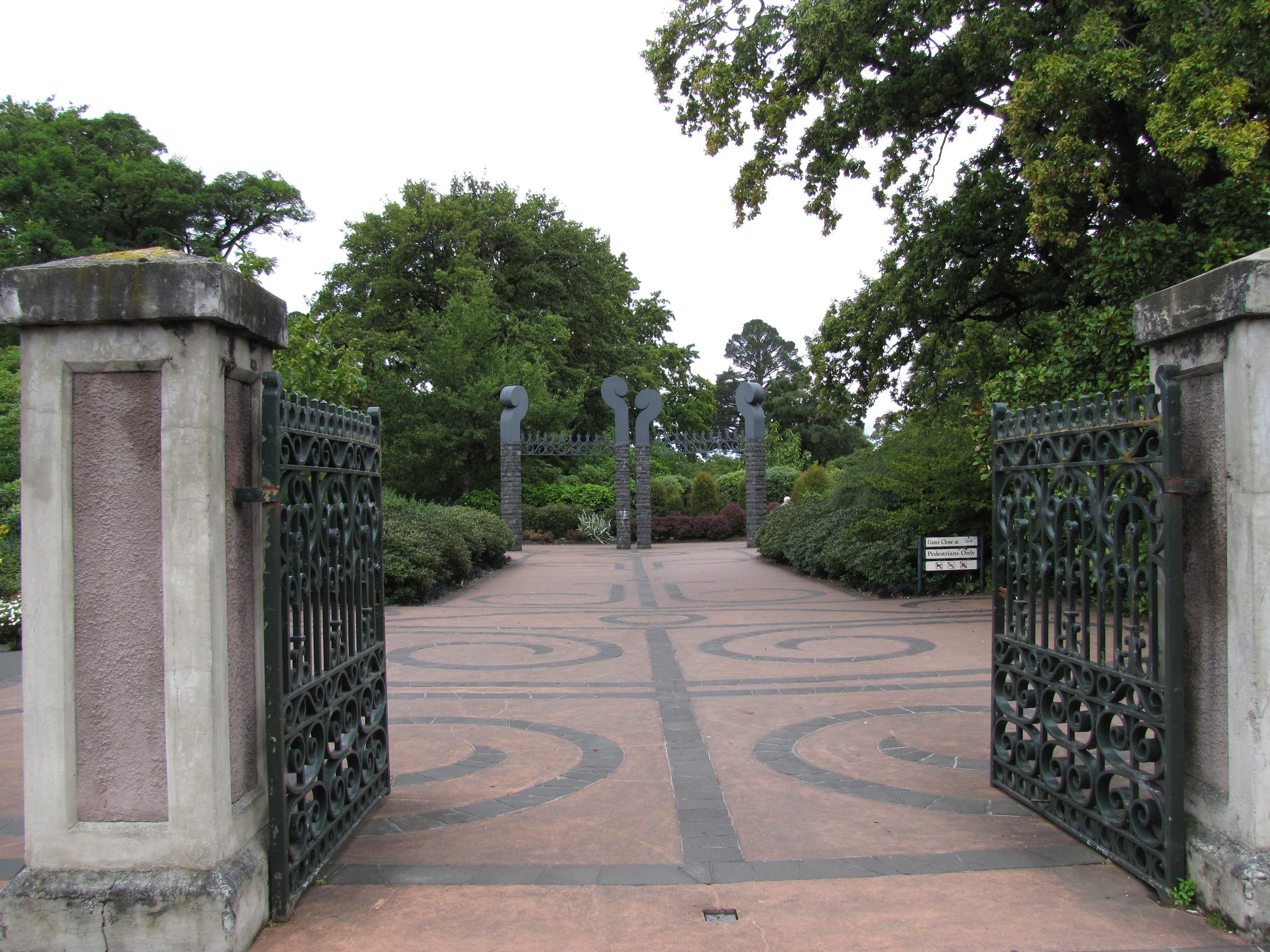
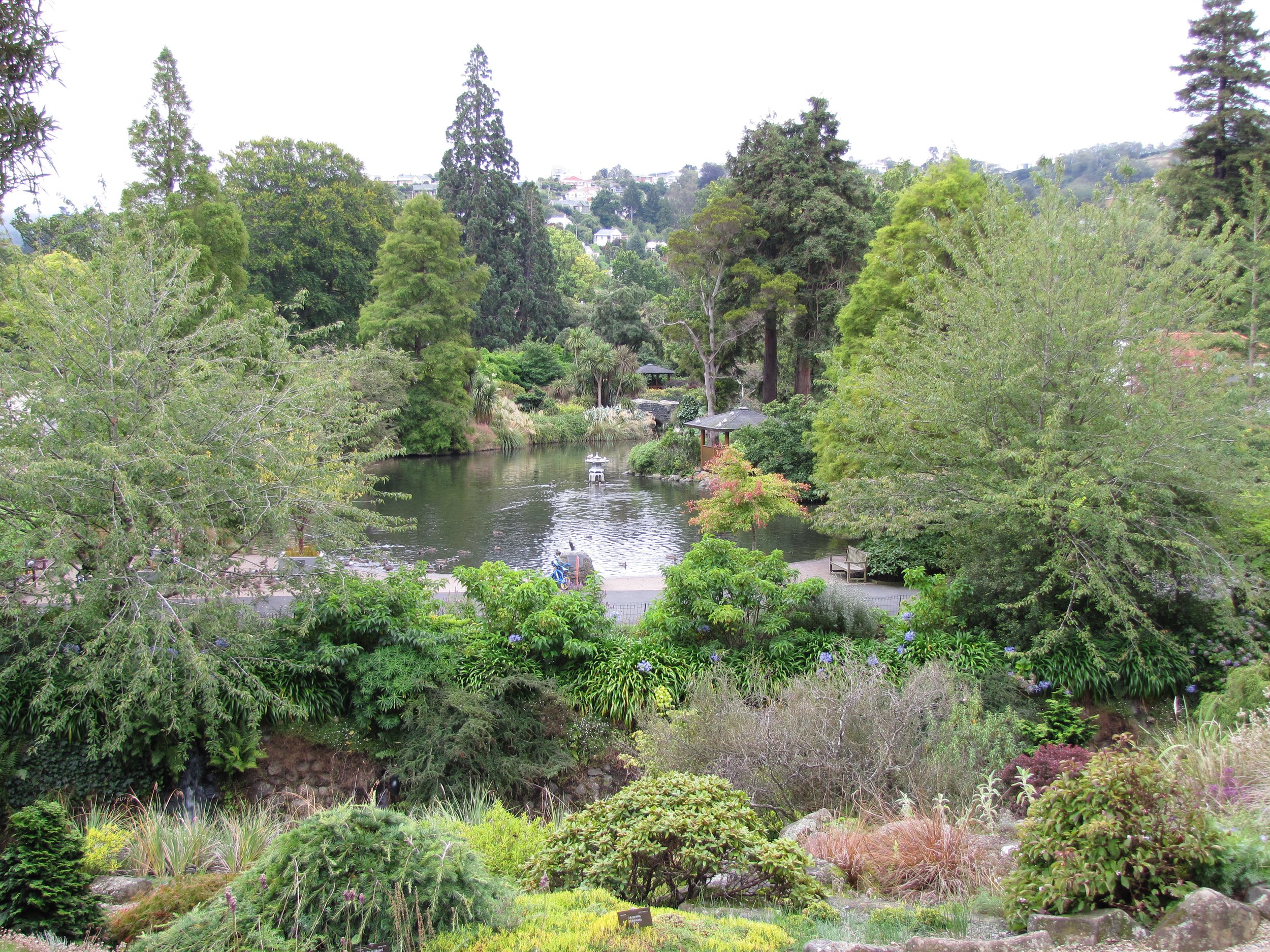
The Dunedin Railway Station is purported to be the most photographed building in NZ. It’s a most impressive building. The station's interior boasts Royal Doulton floor tiles, train-motif stained glass windows and ornate Edwardian fixtures.


We boarded at the station for a ride on the Taieri Gorge Railway which travels 58 km through 12 tunnels and over several bridges and viaducts to Pukerangi and then returns. The Taieri Gorge Railway touted by some to be one of the "great train rides".
The sights and views along the way were stunning as the train passed through an amazing variety of landscapes from city to farmland to rugged river gorge. At 197m long, the Wingatui Viaduct is one of the largest wrought iron structures in the southern hemisphere. We spent most of the trip standing in the open viewing platform between railroad cars.
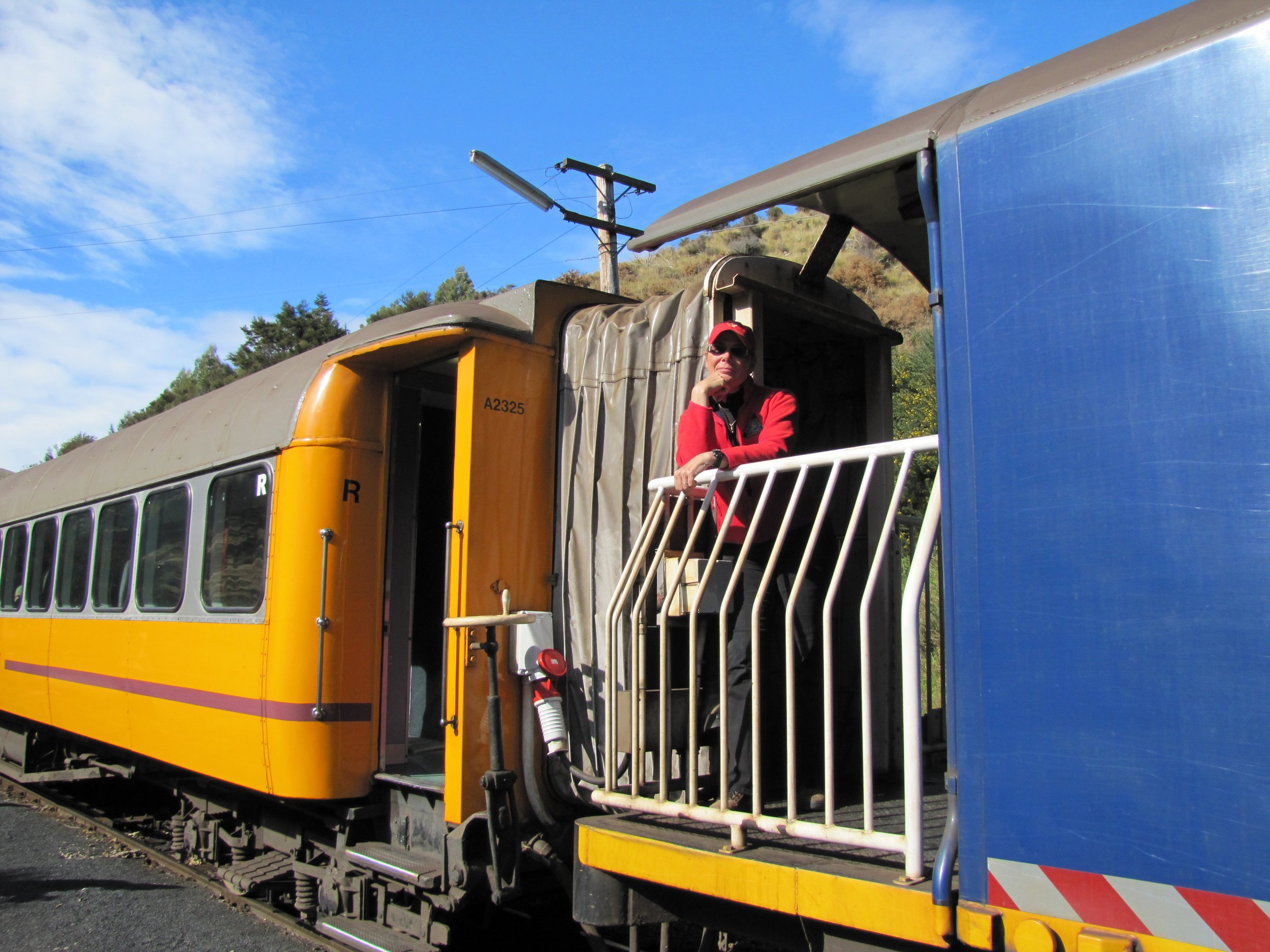
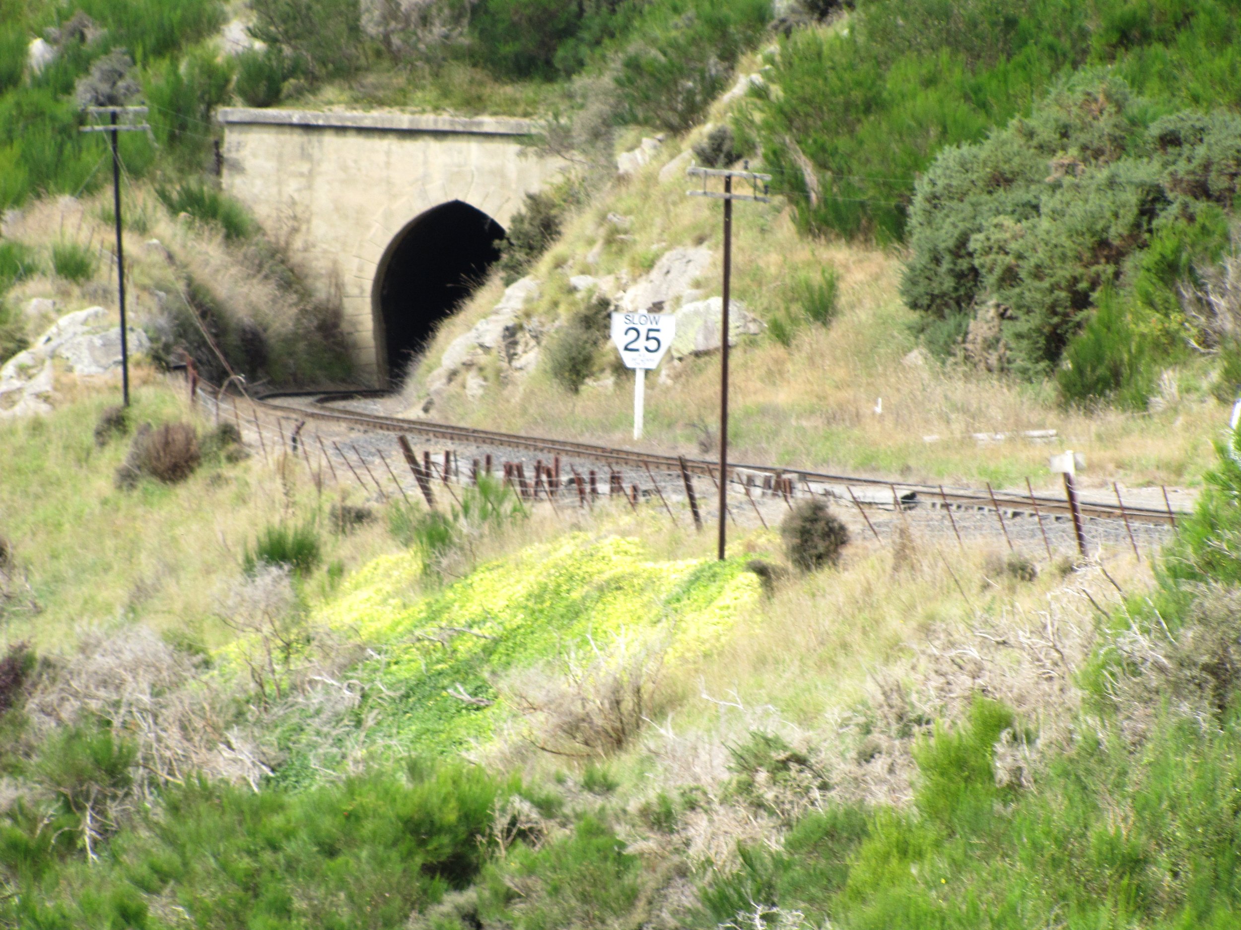
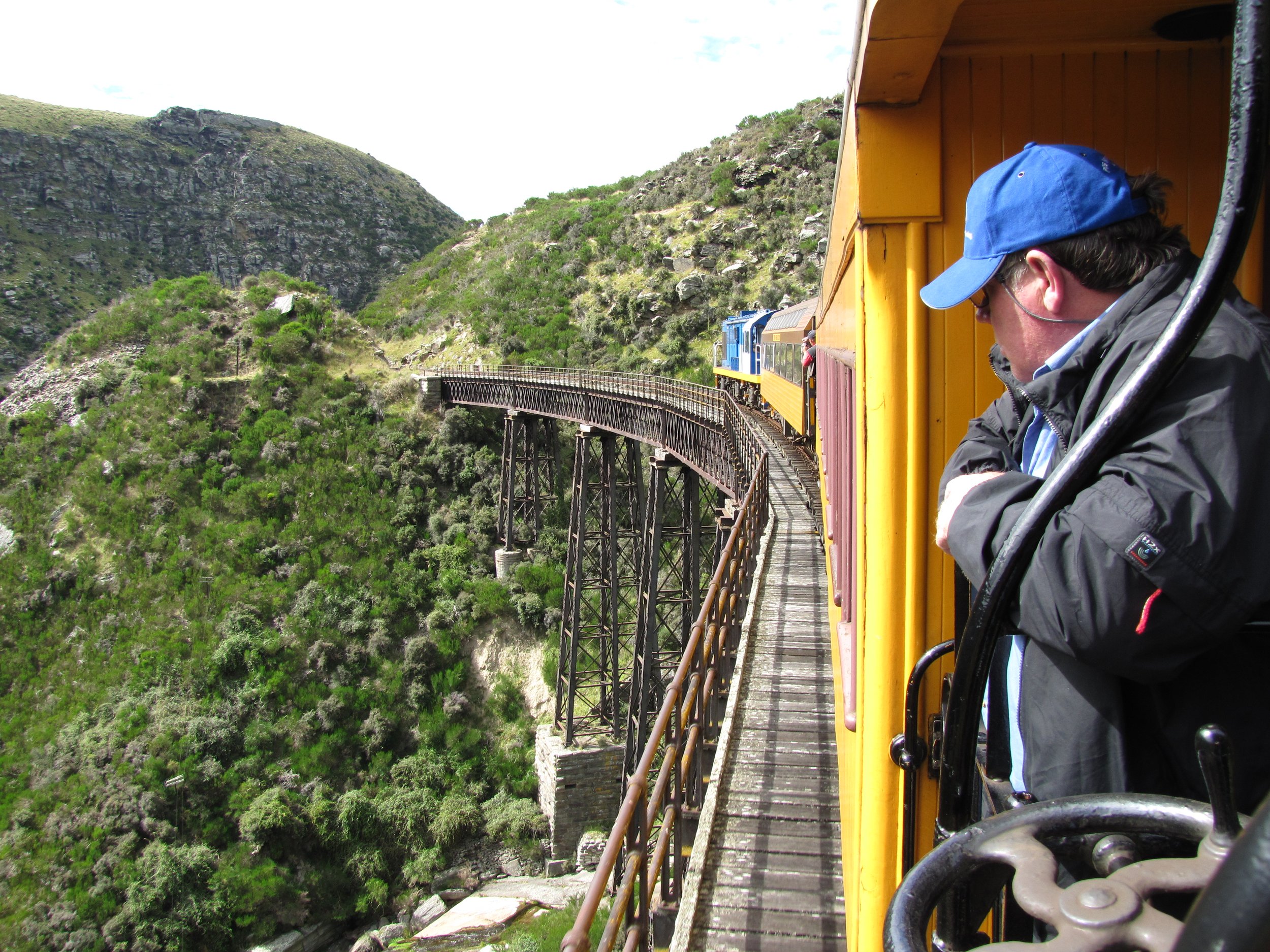
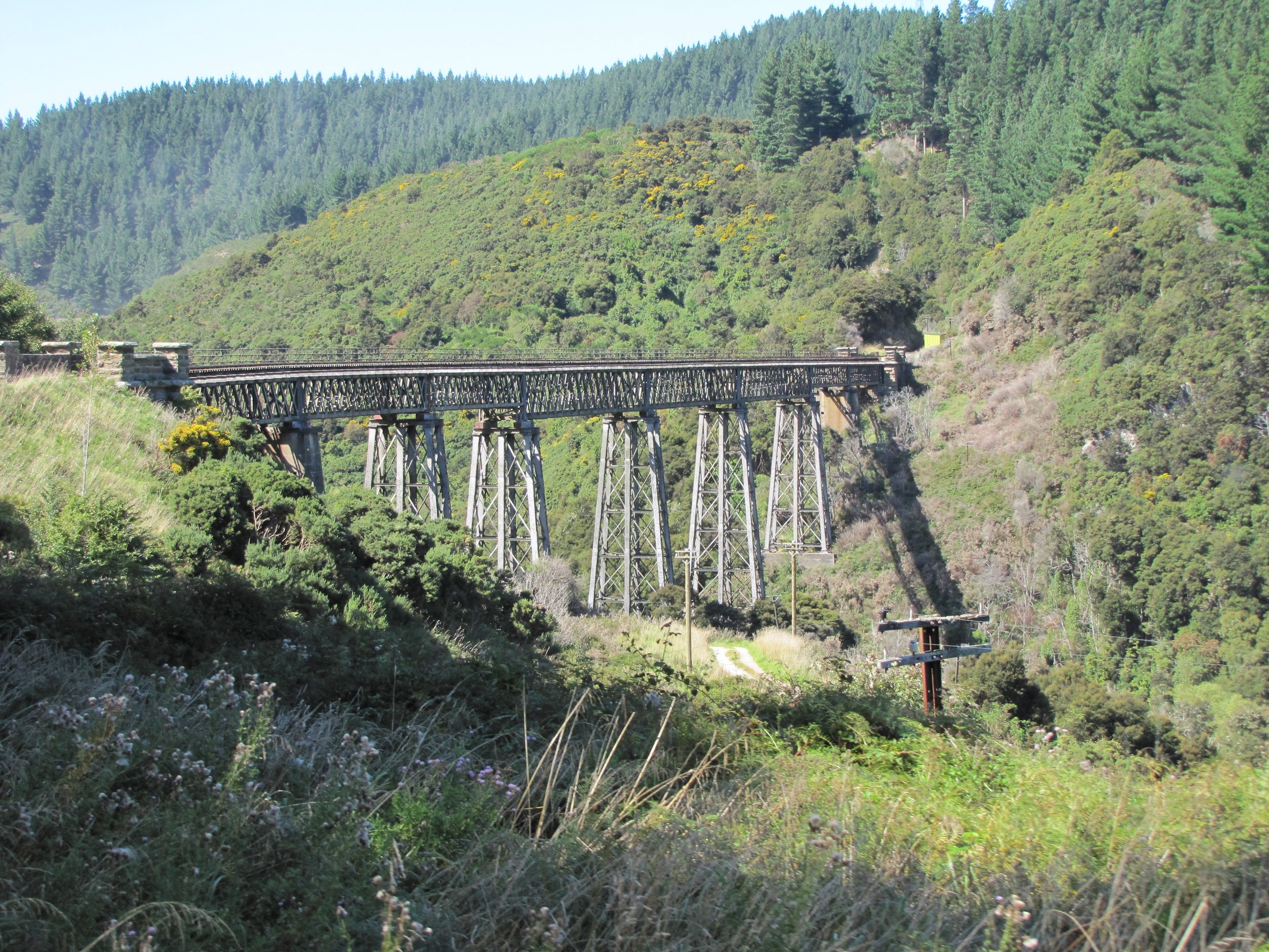
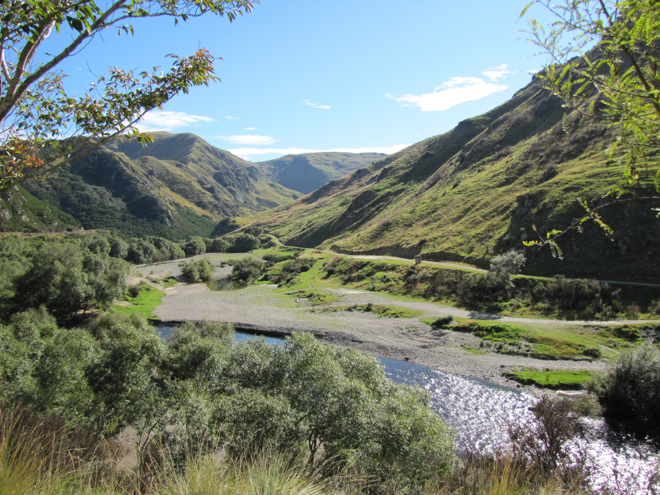
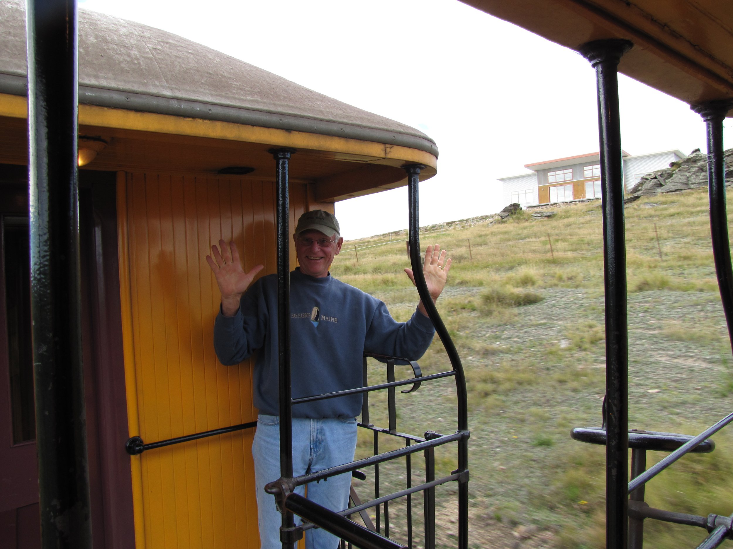
The Otago Museum was pretty impressive. A big moa (extinct NZ bird) greets you at the door. Entry is free, but the moa likes to eat $5 notes to help support the museum. Far be it from us to starve a moa! We wandered from gallery to gallery. An authentic Maori waka (war canoe) was on display in the Tangata Whenua Gallery (Maori culture). In the Pacific Culture gallery, we were "gob-smacked" at the number of island cultures of which we were totally unaware. of. A 58-foot fin whale skeleton dominated the Maritime Gallery. Other exhibits included Nature Galleries, an Animal Attic, Southern Land-Southern People and People of the World exhibits. All in all, an excellent museum and most enjoyable, edifying day.


EXTRA! EXTRA! Read all about it! Check out what the Otago Daily Times had to say about Nine of Cups' visit to Dunedin.
Dunedin will have to rate right up there with one of our favorite NZ cities. While we were at the Otago Yacht Club, we were invited to give a talk on our travels. We had expected 15-20 people max and were astounded by 65 people in attendance, all friendly, welcoming and interested. We heard no evident snoring and no one threw any rotten tomatoes, so we figured we did okay. We stayed in Dunedin for nearly two weeks and seemed busy every minute. Lots to see and do here, but time was now running short and there were still some places we wanted to visit.
Invercargill and Bluff - ROAD TRIP!
As usual, when we have the opportunity, we rent a car for a few days to explore inland areas or ports we’re unable to visit with the boat. The first trip on the itinerary was to Invercargill and Bluff at the very bottom of the South Island. There were two objectives in mind other than experiencing the Southland: see a live tuatara and eat world-famous Bluff oysters in Bluff. We accomplished both and saw so much more along the way. On the way to Invercargill, we took the inland Southern Scenic Route through lots of small towns and rural areas. It wasn't far, only about 300 km, but took the better part of a day. First stop, Invercargill's Southland Museum.
The tuatara statue outside the Southland Museum whetted our anticipation. The fascination with tuataras started when we first read a book on NZ animals and discovered that these critters have a fossil history dating back 225 million years and have no surviving relatives. They are native to NZ, but now only exist in the wild on islands that are protected and predator-free. These unique animals have no external ears, but they do have three eyes! The third eye in the middle of the forehead is hidden by scales. They have a very long life span and in fact, Henry, pictured below is about 110 years old. He has his own blog if you're interested... henrythetuatara.blogspot.com.
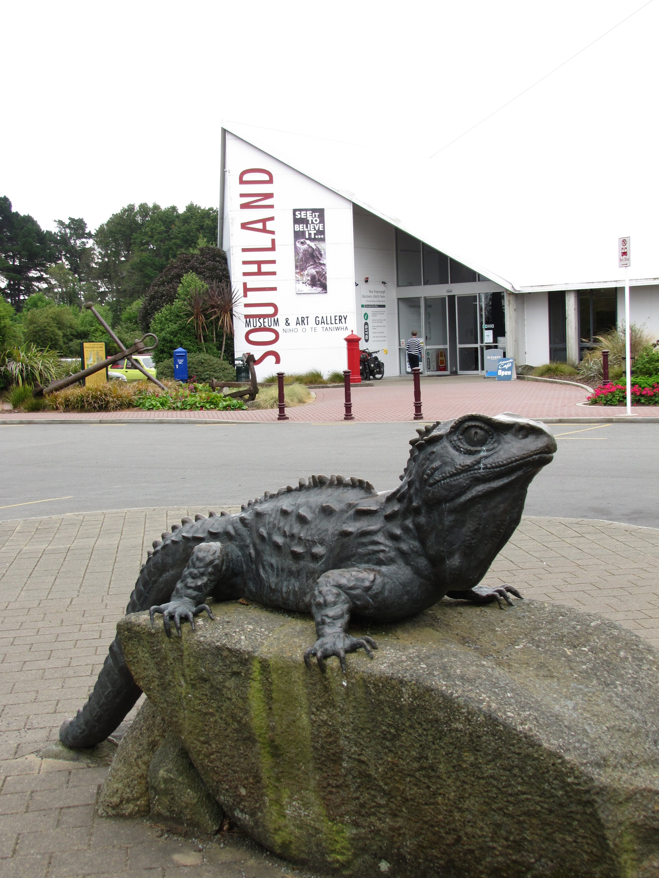
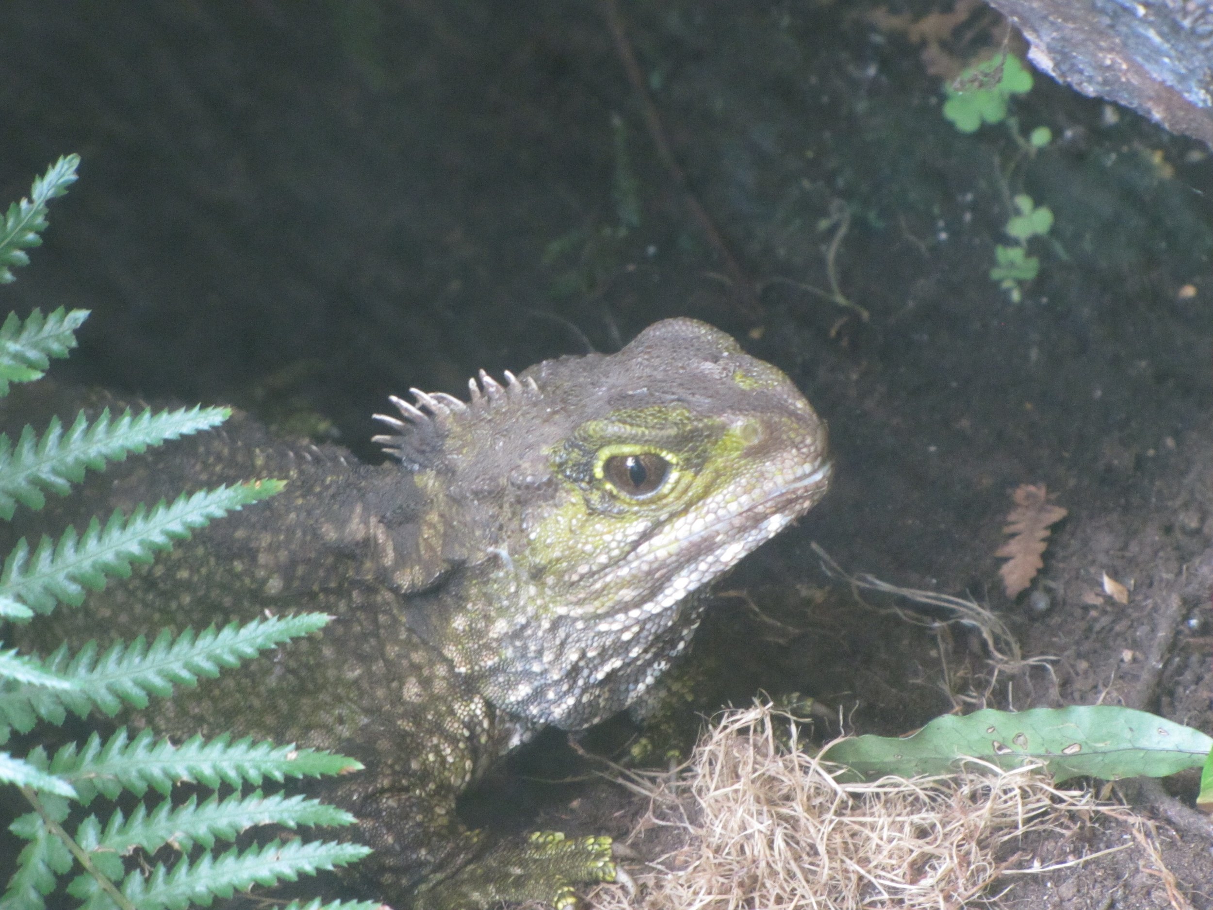
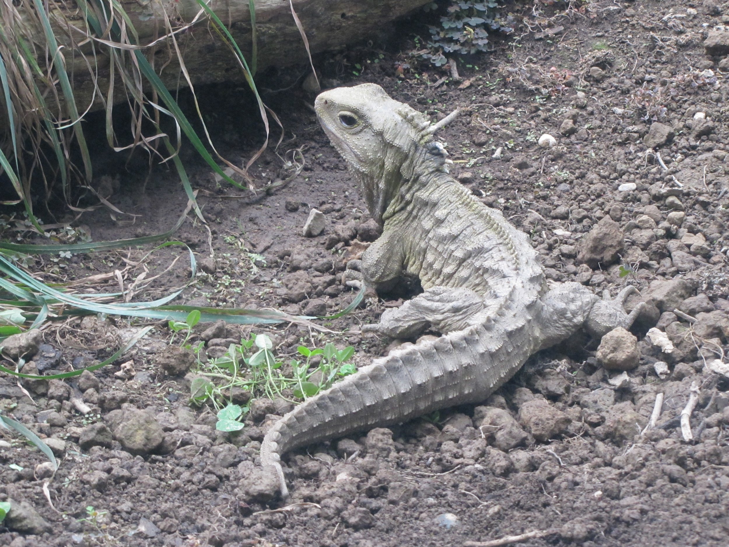
One of NZ's earliest settlements, Bluff is located on a peninsula about 27 km south on Route 1. "From Cape Reinga to Bluff", a popular saying here, means you've travelled the length of NZ. The Bluff lighthouse sits on a rocky shore standing sentry at the harbor's entrance. It rained torrents while we were there. Bluff is Invercargill's port, but is suited primarily for large freighters or fishing vessels and has few amenities for yachts. The signpost at Stirling Point is quite famous here. New York is about 15,000 km away! We did eat Bluff oysters here and they were great! We were too busy slurping them down to take photos.


The local Hammer Hardware store in Invercargill is home to "The World's Fastest Indian". If you haven't seen the movie with Anthony Hopkins, it's about an Invercargill resident, Burt Munro, and his dream to race his Indian motorcycle on the Bonneville Flats to beat the world's speed record for an Indian. What a lure to get a guy into a hardware store (as if they really need one!). After inspecting and handling every tool in Hammer Hardware and looking at a zillion other antique motorcycles on display, we headed back towards Dunedin along the coastal route through an area called the Catlins.

The World’s Fastest Indian
The Catlins
The coast road took us through very rural areas. The road was unsealed for several kilometers and sheep were driven down the middle of the road with the help of sheep dogs while we watched and waited.
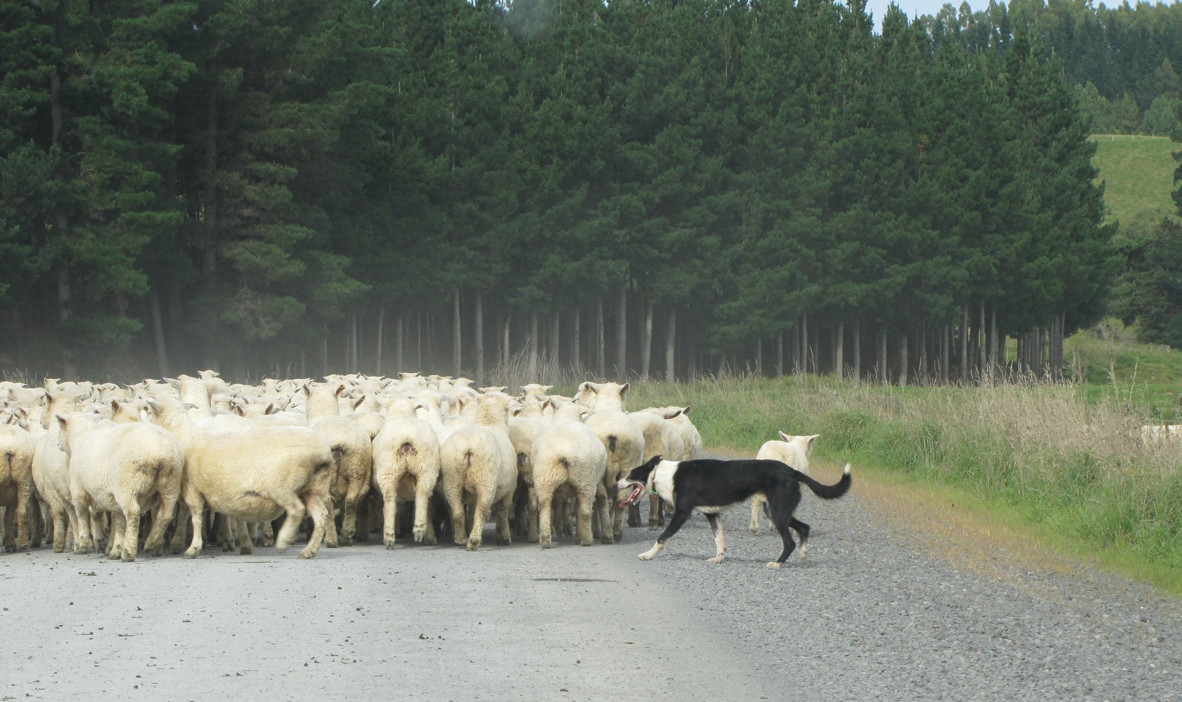
New Zealand Traffic Jam
The Waipapa Point Light is particularly photogenic. The sheep graze almost down to the seashore as the lighthouse pops into view. The lighthouse
is 44' tall and was originally constructed of kauri and totara, local hardwoods, with rock in its base as ballast against the terrific storms and winds
which occur here. The light first shone on New Year's Day 1884. In 1976, the light was fully automated removing the need for the light keeper.
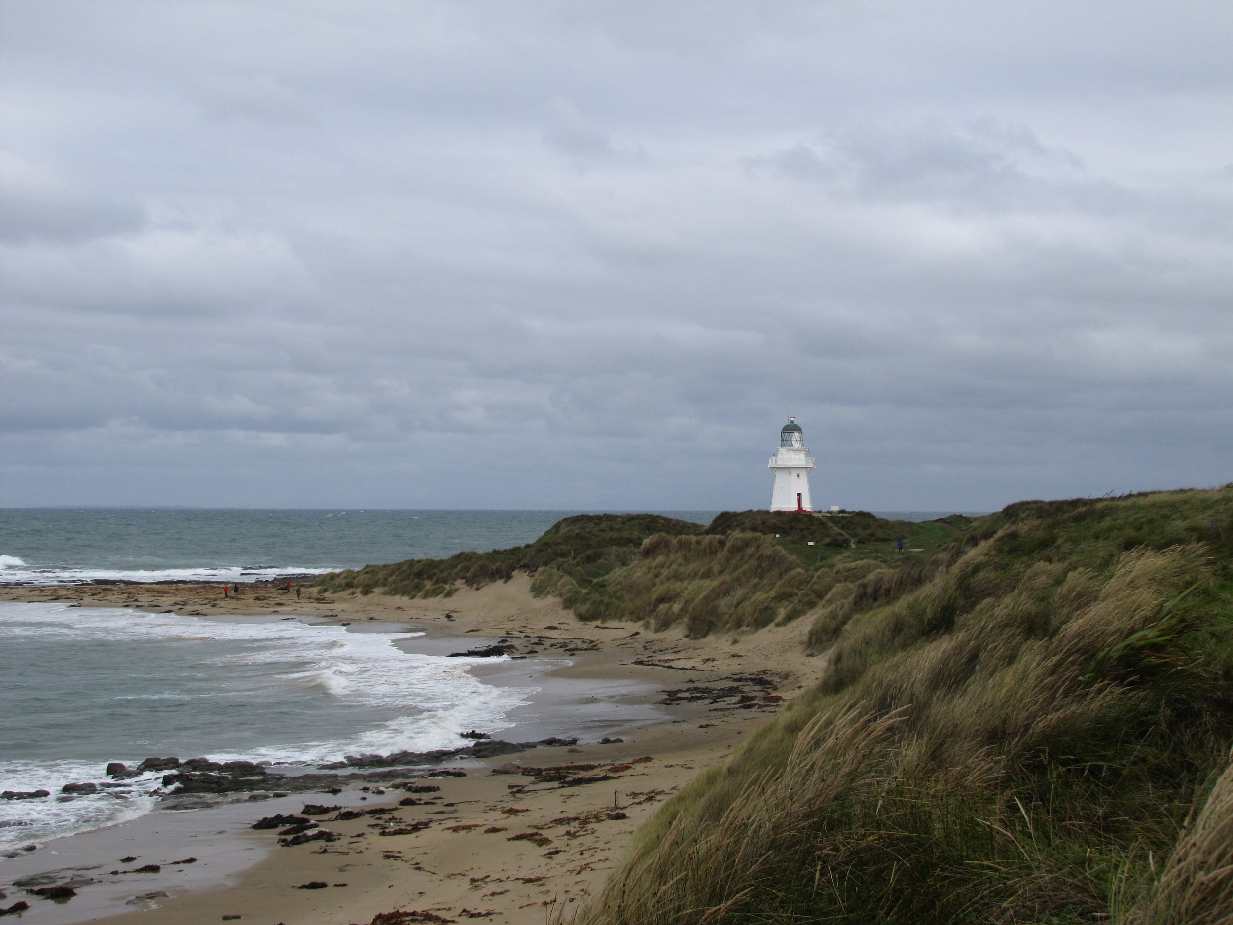
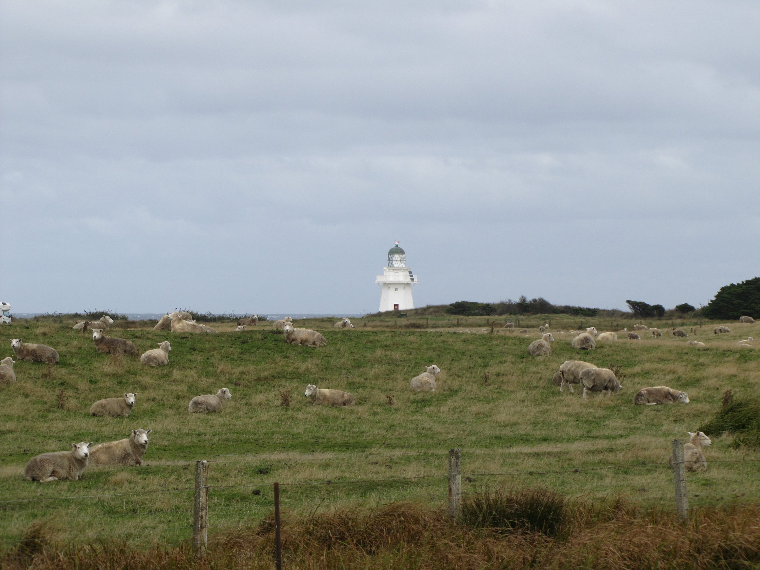
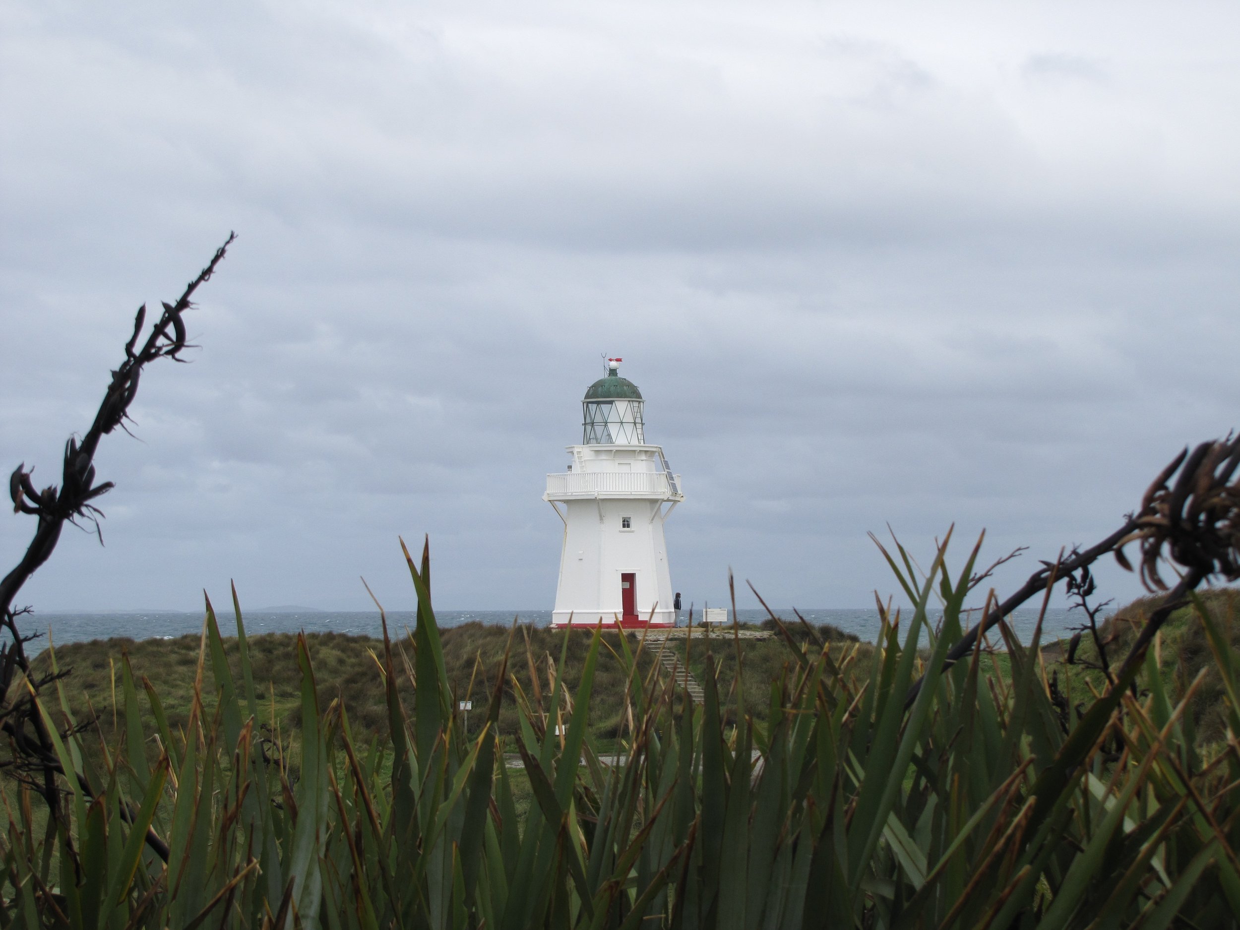

Though Bluff is many times considered to be land's end in NZ, in actuality, the southernmost point is Slope Point, about 7 km further south. We stopped here on a cold, blustery, wet day.
Oamaru
About 115km north of Dunedin lies the picturesque town of Oamaru. American cruising friends, Betsy and Richard ("Qayak") had spent a year here. Betsy is a physician and was practicing at the local hospital as a pro tem physician. The town's limestone quarry has provided (and still provides) "whitestone" for its many Victorian buildings. Walking through the historic district was absolutely delightful.


Oamaru is noted for its blue and yellow-eyed penguin colonies. It poured the night we were there and thus...once again...no penguins. Though we saw no penguins, we did make a visit to Bushey Beach. No penguins, but we did see spoonbills. The views at Bushey Beach were gorgeous, but the wrong time of day for penguins. Darn!


The Moeraki Boulders are a big draw here. Formed in the mudstone cliffs behind them, they are septarian concretions over 60 million years old that lie on the beach as if haphazardly strewn. Maori legend has it that a waka (war canoe) capsized nearby and the crew was lost. The boulders are the petrified remains of the supplies the crew carried aboard that were washed ashore. Have you ever watched the movie Cocoon? Some boulders looked like alien eggs about to hatch.


The Chatham Islands

We returned to the Otago Yacht Club and readied Nine of Cups for our departure. We planned to visit the Chatham Islands about 500 nm off the coast of Christchurch, but much depended on weather and the winds to get us there.
Why visit the Chatham Islands? Described by Lonely Planet as "an isolated, mysterious, wild group of islands, very much off the beaten track", need we say more?
Of New Zealand’s several out-island groups, the volcanic upthrusts known as the Chatham Islands are the most accessible. Chatham Island is the largest island of the 10-island group and is almost (but not quite) "halfway between the equator and the South Pole, and right on the International Date Line". Covering an area of ~ 347 square miles and with a population of ~700 (est 2010), Chatham Island was named after the survey ship HMS Chatham, the first European ship to locate the island in 1791. The island is also known by two other names, the Maori name of Wharekauri and the Moriori (original inhabitants of New Zealand) name of Rekohu (meaning misty skies).
We headed for the Chathams leaving Dunedin behind. Birds were abundant en route as were storms and subsequent rainbows. Typical for long, rough passages, we had an engine issue. The engine oil cooler

After five days and 600 NM, Land Ho! Chatham Islands in sight.
Waitangi Bay, Chatham Island - 43S56.88 / 176W33.40 - 19'
We anchored after dark. We had to wait until morning for our first sight of Waitangi town, the view obscured by rain and 30 knot winds. Day 2 dawned rainy and windy, but the sun shone later allowing a photo of the Waitangi wharf. Unfortunately, 40-50 knot winds kept us on the boat. We were in the Roaring 40s and the wind wouldn’t let us forget it. Meanwhile, as we were waiting for a weather window to launch our dinghy for a trip to shore, Cyclone Bune (mm-boo-nay) was heading our way according to NZ's Meteorological Service. The red arrow on the chart below shows the location of Chatham Island with the approaching storm.


Finally, a sunny day with reasonable winds and we made it to shore after our 3-day wait. We met John immediately who helped us tie up the dinghy safely. John is a crayfish/lobster trap fabricator and was hard at work, but stopped to chat, give us directions AND lend the use of his truck to go get parts for our ailing engine cooler. Terry, the owner of the garage and David sorted through bins of fittings and parts until finally “Eureka!” David found just the right fitting which Terry gave us gratis! The garage also provided a needed fuel filter and the local petrol station had the diesel engine oil we needed.


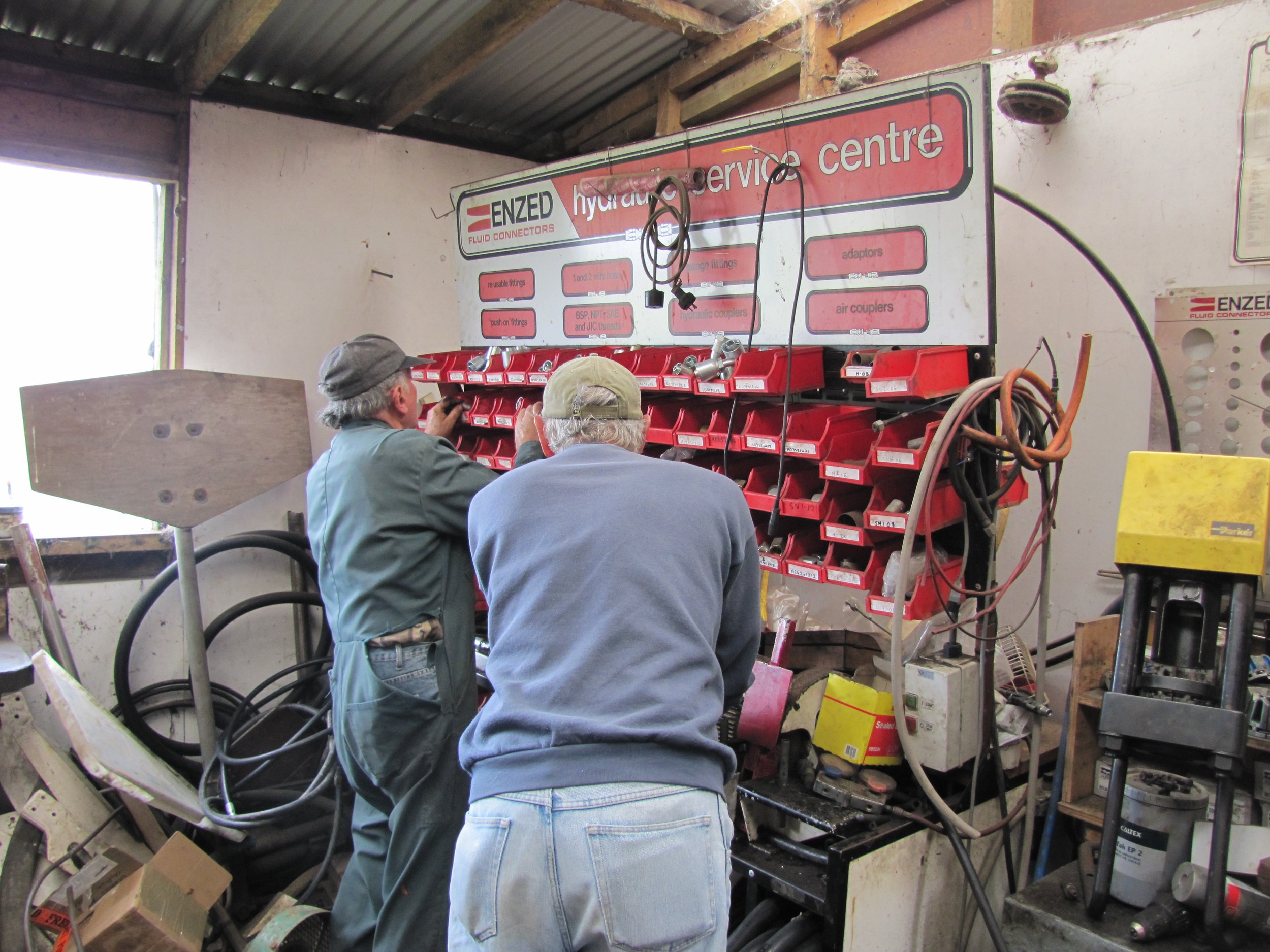
All set on boat supplies and parts for the engine oil cooler repair, we returned the truck to John and walked back into town... a slow trip since we
found ripe blackberries along the road on the way. We had lunch at the Hotel Chatham and met Pete who introduced himself as the Commodore of the Chatham Islands YC. He was quite a character. Pete offered to take us for a ride to Owenga on the east coast and we accepted his offer. We visited the Kopinga Marae which offered outstanding views of the Pacific and Lake Huro.


One of the most interesting aspects of the Chathams is the cultural legacy of Moriori. Chatham Island is known as the home of the Moriori tribe, who settled these islands more than 1000 years ago. Probably descended from NZ Maori, the Moriori maintained a more ancient Polynesian culture than the Maori because of their isolation. When the HMS Chatham visited in 1791, they estimate about 2000 Moriori lived here. Groups of Maori began arriving ~1835 from mainland NZ, overcame the Moriori, took their land and enslaved them. Their language, customs and people died until by 1900, only 12 full-blooded Moriori remained. The last full-blooded Moriori, Tommy Solomon (Tame Horomona Rehe) died in 1933 and is immortalized in a statue in a park near Manukau Point.
Near Tommy's statue, we spotted a couple of weka. Surprisingly, these birds which are protected on the mainland are on the menu and can be hunted here as can pukeko, black swans and ducks.
A little trivia: Chatham Islanders are called "wekas" akin to New Zealanders being called "kiwis".


A Nickel Tour of Waitangi
Since most people never get here, we thought we'd provide a photographic "nickel-tour" of the town. Cups is anchored at the red "X"
We picked up a book at the Info office called Discover the Chatham Islands...First to See the Sun by Cherry Lawrie and Jocelyn Powell (ISBN 097509919-1) which was quite informative and provided lots of social and natural history about the island as well as interesting sights to see. We
also picked up a copy of the March issue of The Chatham Islander to get a feel for island happenings.


Food for Thought from Wikipedia... "The Chatham Islands may be the only undisturbed remnant of the lost continent of Zealandia, a vast tract of the continental thrust of which modern New Zealand is only the emergent tip. And the whole of Zealandia, including New Zealand, may have been underwater until 23 million years ago. This theory, developed by geologists Hamish Campbell and Chuck Landis, rocks received wisdom that while New Zealand was once mostly submerged, some areas always remained above water, allowing the continuation of species from the ancient mega-continent Gondwanaland, from which Zealandia split 83 million years ago. If Campbell and Landis are right, it could explain why NZ has no indigenous mammals - they drowned."
We decided to walk/hitchhike to Te One and perhaps to the Te Whanga Lagoon. Walking allows us to observe the area more closely and discover little things we might have missed whizzing by in a car. We stopped at the DOC office in Te One and decided with so many unique birds resident here, we just "had" to have a CI bird book. Sure enough, after buying the book we spotted a Chatham Island pipit in a field. In the same field, we spotted a Red Admiral butterfly. Pastoral views of the rolling hills and grazing livestock were common sights. We wandered by St. Augustine Anglican Church, the oldest church on the Island.

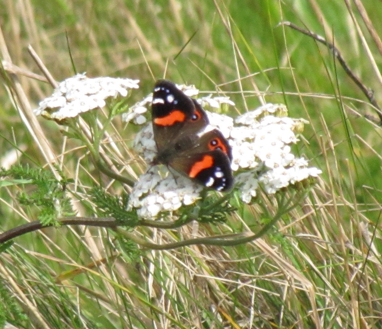


There is a pattern of serendipity that seems to follow us. About every 3-4 months, we meet someone or something out of the ordinary happens that really impresses us. We call it the 90-Day Rule.
We walked and walked towards Te Whanga Lagoon, but no rides materialized UNTIL a truck stopped. Pat Smith introduced himself and when we told him we were heading towards the lagoon, he asked if we'd rather visit his farm and take a bush walk along the Te Whake Lagoon which bordered his property. Oh my!
Pat's farm was just beautiful with livestock grazing peacefully as we drove across the paddock to his home. Pat showed us some of his carving work
incorporating traditional Maori designs. He also had a collection of 30 million-year-old fossilized shark teeth, which were apparently highly prized by the Moriori and used as gifts on important occasions.
As a token of friendship, Pat gave us two first-day covers from New Year's Eve 1999 and New Year's Day 2000. Chatham Islands... First to see the sun, first to see the new millennium. Also, four shark teeth. Wonderful mementos of Chatham Island.


Black swans, seemingly hundreds of them, swam gracefully all the Te Whanga shores. Pat called to them and they answered immediately. He's been farming this land for over 40 years and designated a portion of the farm as a reserve. The reserve area has been cleared of introduced species and weeds as much as possible and mostly native plants grow here now. The close proximity and lack of fear in the black swans was absolutely thrilling.


Back aboard Nine of Cups, Mollymawks came by and paid us a visit. We took a look at the shells we’d netted from our beachcombing on the Waitangi Beach. Of special note, the silver paua which were plentiful here.


Port Hutt, Chatham Island - 43S48.71 / 176W42.36 -28'
With northerly winds predicted, we moved to Port Hutt, 10nm across Petre Bay. "Silver Lining", whom we'd met back in the Bay of Islands, arrived in Waitangi and joined us in Port Hutt to wait out the winds. Port Hutt is privately owned and there's not much there: a few houses, a pier and a small seafood processing factory. The Thomas Currell was used in WWII as a minesweeper and later moved to Port Hutt as a fish freezer. Now she lies rusting with trees and greenery growing from her bow.


Waihere Bay, Pitt Island - 44S15.76 / 176W14.97 - 38'

the Horns" at Cape L'eveque on the southwest point of Chatham Island
From Port Hutt, we took advantage of some northerly winds and headed southeast to Pitt Island. Above, "the Horns" at Cape L'eveque on the southwest point of Chatham Island. Pitt Island was first sighted by Europeans when the crew of William R. Broughton's ship HMS Chatham spotted it in 1791. It was named for William Pitt, 1st Earl of Chatham. Pitt lies 12 miles (20 km) to the southeast of Chatham Island.
Pitt Island or Rangiauria is the second-largest island in the
Chathams, originally known as Rekohu. Pitt Island's Kahuitara Point is the first populated location on earth to observe a sunrise in each new year, based on local time zone.
The island has a population of ~45 people and is very hilly. Its highest point, Waihere Head, rises to 241 m (791 ft) above sea level. Several prominent rocks peek out from the sea. The many rock formations around Pitt Island jut out of the sea in interesting shapes and are aptly named. The crenelated towers of the Castle, Sail Rock which definitely looks like a wind-filled spinnaker when viewed from afar and the Pyramid, named back in 1809.


Our route Around Pitt island
Tying the Knot - Back to OpuaCanister Cove, Pitt Island - 44S20.19 / 176W13.43- 44'
Tupangi Anchorage, Pitt Island - 44S15.46 / 176W09.80 - 55'
Strong winds hit us from all sides during our stay at Pitt and it was necessary to keep on the move. NE35, then NW35 switching to SW45+. The ride from Waihere Bay on Pitt's west coast around the bottom and up to Canister Cove was the worst bit with winds gusting to 50+ knots and high seas bashing us from all sides. A sleepless night in Canister Cove and fearsome swells had us moving again further north to the Tupangi anchorage. We never made it to Flower Pot, the largest town on the island.
Our time at Chatham Island had come to an end. As always, our time was too short and we couldn't stay as long as we wanted, but the clock was ticking and it was time to head back to New Zealand and get ready for our passage to Fiji. So much to do, so little time. We waited and waited, and finally, a weather window appeared that allowed us to leave Pitt and head back to NZ. Local dolphins gave us a lovely farewell send-off.
The passage back to New Zealand was a challenge. We had no wind (0-5 knots), too much wind (50+ knots), rarely the right amount of wind (15-20...lovely) and mostly "on the nose" wind (NW). We anticipated 4-5 days to get back but it seemed to take us forever moving at a sea slug's pace and many times in the wrong direction.
We suffered a knockdown in a storm just off East Cape which blew out our mainsail, tore our bimini to shreds, knocked out deck stanchions and generally took our breaths away. Additionally, we had watermaker and transmission problems which thankfullly, David was able to fix enroute. We hove-to one night and after the mainsail blew, we lay ahull another. The projected 750-mile trip was 1,140 nm by the time we reached Opua and took 12 days.


Tying the Knot - Back to Opua

New Zealand Circumnavigation
Entering the Bay of Islands and returning to Opua from the Chatham Islands was like coming home. We arrived 2330 on a moonlit, calm night and anchored in Matawhi Bay, just off Russell. After a sleepless night... too calm, too quiet and our body clocks still on our 3-hour watch cycle...we moved the boat to a mooring off the Opua Marina.
We were right back where we started from! On our return to Opua, we "tied the knot" for our NZ circumnavigation.
We were excited to be back and raring to get going on the ever-lengthening "to-do" list. Everything needed to be completed by the end of May for our scheduled departure to Fiji.

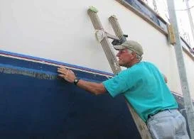

The list of repairs seemed endless. We ordered a new mainsail after the blowout at East Cape. David rebuilt the forward hatches. We hauled out for a bottom job. I painted the bottom and David repainted the boot stripes. The prop was cleaned and polished. David repaired another section of the deck. He repaired the gooseneck and the jib furler and replaced burned-out lights and lines. We recertified the dinghy and our ditch bag. We varnished, polished stainless and the topsides, cleaned and tidied. At last, ready or not, it was time to go.
Kiwiana
Before we leave New Zealand, we thought we’d treat you to a bit of Kiwiana. I first discovered "Kiwiana", those things that are unique to New Zealand, when I was doing my research on visiting this beautiful country. It was fun and interesting and well worth sharing. So as we traveled in New Zealand, we tried to capture as much Kiwana as possible. Take a look.


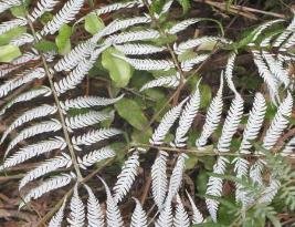

A good weather window appeared at the end of May and we took advantage of it. We were off to Fiji. Come on aboard, you'll love the ride!