

Tasmania - Down Under, Down Under
Originally called Van Diemen’s Land, the locals call it Tassie. We call it outstanding! Geographically and culturally apart from Australia to the north, Tasmania is a world of its own. Tasmanian devils, white wallabies, wild rivers, rugged coastline, a Great Cape to round, nooks and crannies to explore, friendly people to meet. It’s an incredible place to visit and explore.

An island and one of Australia's six states, Tasmania's capital and largest city is Hobart. The island is separated from mainland Australia by the Bass Strait. It’s the 26th largest island in the world.
With a population of just over half million ( est. 2010), the island is a bit larger than West Virginia, USA (68,401 km² or 26,410 mi²) .
The locals are called Taswegians (among other things).
Tasmania became a notorious British penal colony in 1803, but today over a third of Tasmania lies in reserves, national
parks and World Heritage Sites.

Named after Dutch explorer Abel Tasman who made the first reported European sighting of the island in November 1642. Tasman originally named the island "Anthony van Diemen's Land" after his sponsor. The name was shortened to Van Diemen's Land then officially renamed Tasmania in honor of Tasman in 1856.
Tasmania boasts...
*The oldest bridge still in use in Australia...The Richmond Bridge.
The oldest Brewery...The Cascade Brewery in Hobart.
*The oldest living thing on earth: the Huon Pine Tree estimated 4,000+ years old.
*The oldest golf course in Australia at Bothwell.
*Anglesea Barracks (Hobart), the oldest military establishment in Australia still occupied by the Army.
*The Theatre Royal in Hobart, Australia's oldest operating live theatre.
“Tasmania is the most thoroughly mountainous island on the globe.”

A greater percentage of land is allocated to national parks or reserves in Tasmania than in any other Australian state. The Tasmanian Parks &
Wildlife Service manages 423 reserves including 19 national parks.
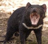
Tasmania's state animal is the Tasmanian devil, forever demonized by the Looney Tunes "Taz" character.
The Bass Strait islands are part of Tasmania. Don't forget to visit the Kent Group National Park, Deal Island, with us for great views, close encounters with wallabies and little penguins, a tour of the lighthouse and a meet-up with the island's caretakers.
We spent about a year, off and on, in Tasmania and loved it. We did a complete circumnavigation of the island, and visited almost every port, harbor and town. You can travel with us as we explore this fabulous, remote island by scrolling down, or make it a hop-on, hop-off kind of trip by clicking on any of the buttons below. Hope you enjoy the trip!


Tasmania's Wild West Coast - Back to the Roaring 40s
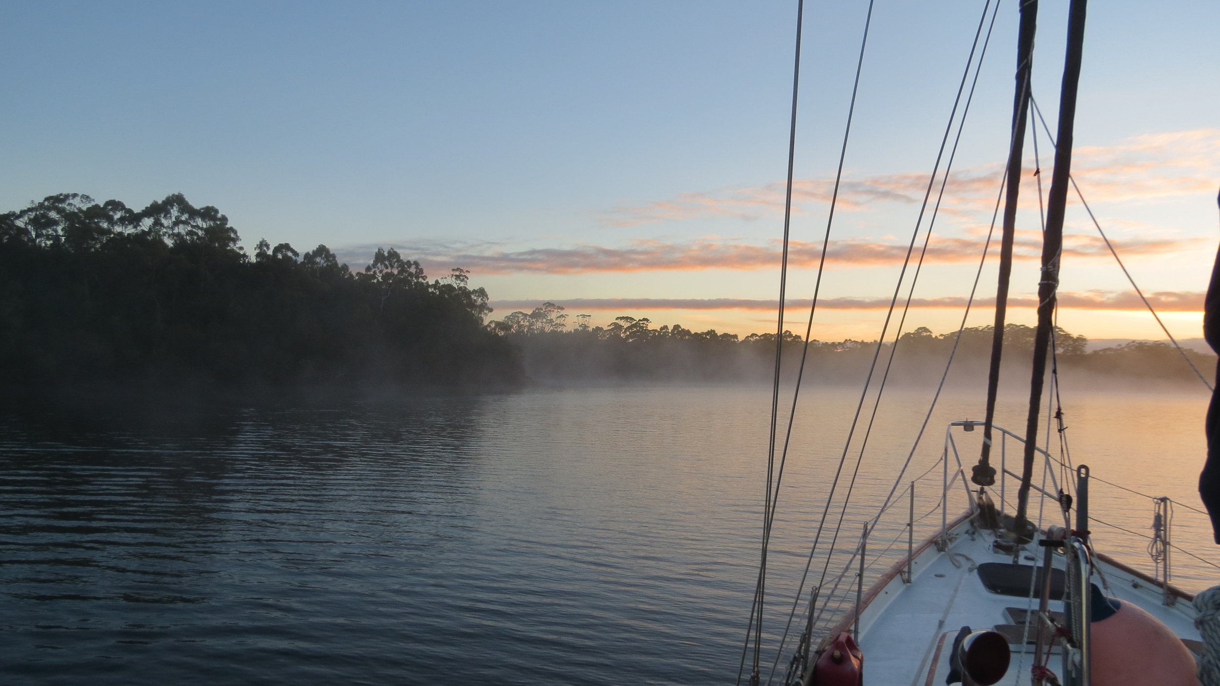
Green Point, Ann Bay - 40S54.11 / 144E40.39 - 34'
We left Deal Island to cross the other half of the Bass Strait. With 3 days of easterly winds forecast, we were hoping to make it around the northwest cape of Tasmania and down the coast to Strahan in Macquarie Harbour. So much for forecasts and plans. We made it as far as Green Point before a strong wind warning from the SE got our attention. Just a reminder that we were back in the Roaring 40s!


Sandy Cape - Kenneth Bay - 41S24.42 / 144E45.67 - 50'
A day trip and we stopped for a quick overnight anchorage at Sandy Cape in the shelter of Kenneth Bay, The night was rolly, but tenable. A beautiful west coast sunrise and views of the Sandy Cape Light as we continued on our on passage south.


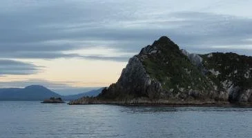
Entering Macquarie Harbour
Macquarie Harbour is the second largest natural harbor in the southern hemisphere after Sydney. A panoramic shot below shows the entrance to Macquarie Harbour. It looks wide and benign, but in actuality, it is notoriously shallow and tortuous. It was probably one of the more challenging, entrances we'd ever negotiated with breakwaters, rocks, islets, shoals, eddies, current, reefs and training walls with which to contend. Convicts heading into Macquarie Harbor called this entrance ‘Hell’s Gate’, knowing that escape was nearly impossible and imprisonment at the Macquarie Harbour Penal Station on Sarah Island was probably a death sentence.

The entrance to Macquarie Harbor looks benign, but it can be treacherous.
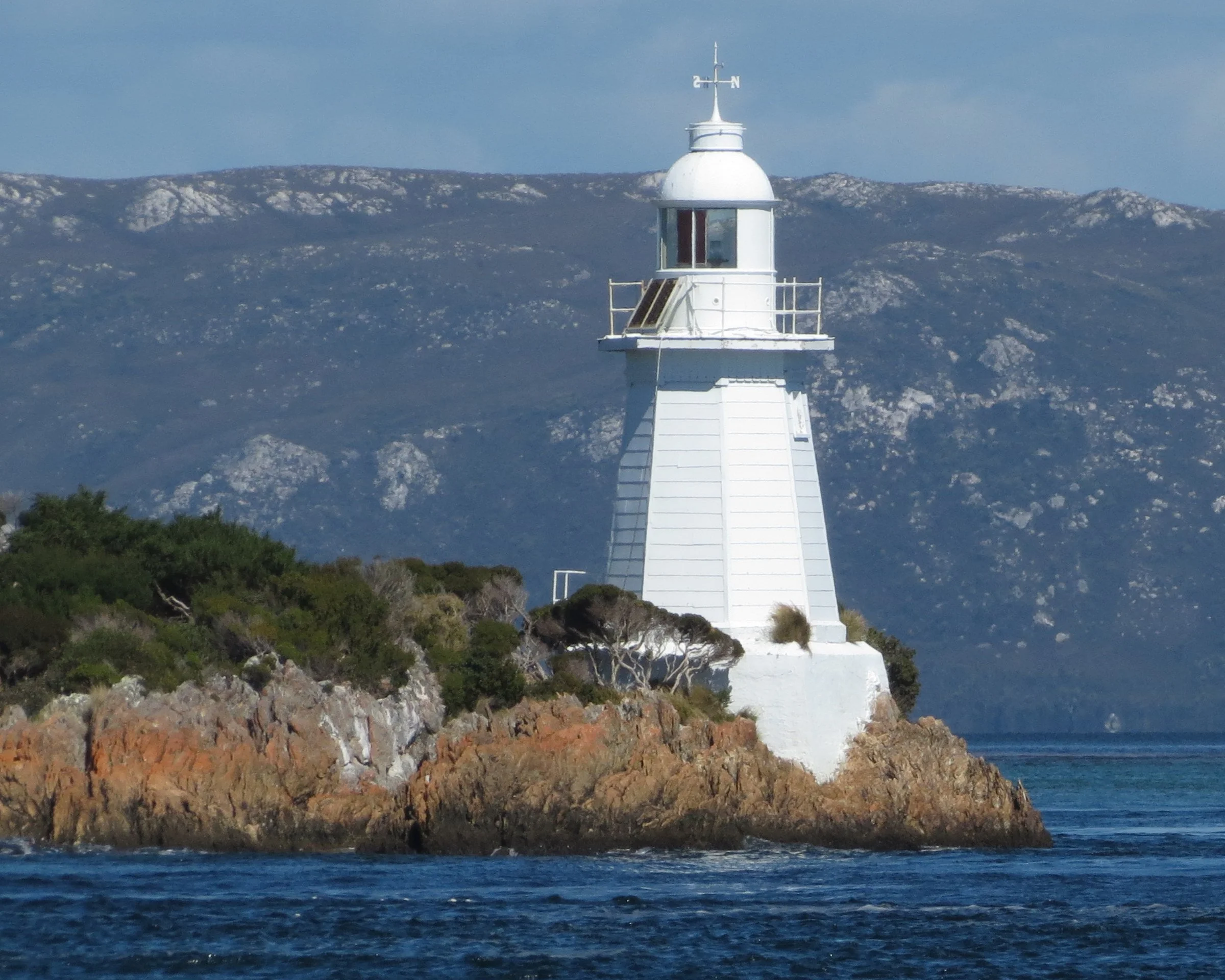
Entrance Island Light at Macquarie Harbor

Once through ‘Hell’s Gate’, the bay opened up and the path was clear to our anchorage in Strahan.
Strahan - Risby Cove - 42S09.43 / 145E19.74
Strahan (Strah-HAHN) is a small town on Tasmania’s wild west coast. Known historically as a mining and lumbering center, it’s now more a launching base for tourists. Boat trips depart from Strahan for Sarah Island, location of the notoriously harsh penal settlement. According to Wiki, “It is the home of the Round Earth Theatre Company, which conducts explanatory tours of Sarah Island and also has produced a daily enactment/play about Sarah Island, The Ship That Never Was” It has been performed in Strahan since 1994, and is Australia's longest running play. Strahan also provides the good access to the Franklin-Gordon Rivers National Park.

View of the Strahan foreshore from Nine of Cups’ deck
Our usual first stop in any new port is the Tourist Info Center and Strahan had a good one. It was a rustic construction and attached to it was a small, interesting, very different museum called West Coast Reflections. The museum's focus was on Strahan and the Macquarie Harbour area from original Aborigine inhabitants, the infamous penal colony on Sarah Island, the saga of the "piners", lumbermen who harvested the huge Huon pines in the area to the Franklin Blockade, a successful blockade by conservationists to forestall the building of a hydroelectric dam on the Franklin River. This area is now a World Heritage Site since 1982 and is referred to as the West Coast Wilderness.


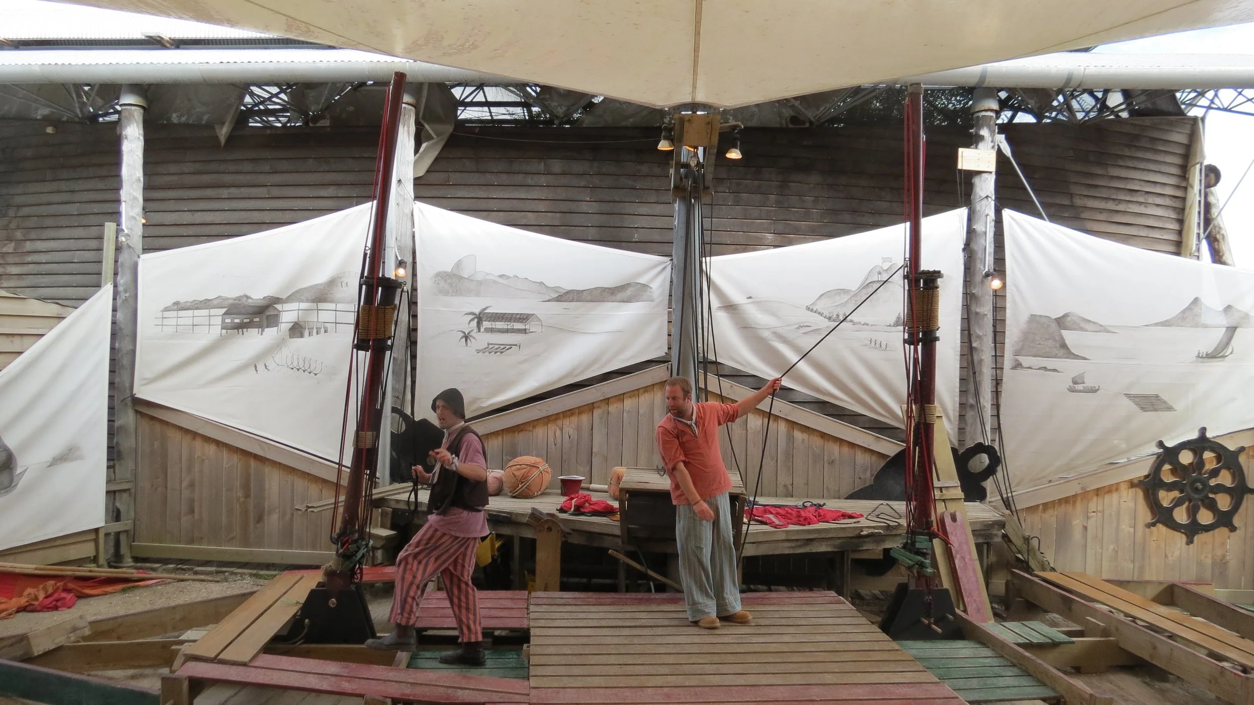
"The Ship That Never Was" is the longest continuously running production in Australia's history. It's offered daily in the amphitheater adjacent to the Info Center. It tells the story of 10 Sarah Island convicts who hijacked a newly built ship and escaped to Chile. During the 70-minute production, two actors with the help of much audience participation, actually constructed a ship on stage. The production was well done, fun and most informative, and definitely prepared us for our subsequent visit to Sarah Island.


People's Park is the gateway to Hogarth Falls, one of Tasmania 's 60 Great Short Walks. About 3km return, the walk took us along the Botanic Creek inhabited by platypus which unfortunately we didn't see, but had fun looking for.


We found the climate as well as flora here to be comparable to Patagonia. So we weren’t surprised nor disappointed to find lots of ripe blackberries along our walking path.


Sarah Island - 42S23.37 / 145E27.12 - 10' (Stormbreaker's mooring)
Sarah Island is now Sarah Island Historic Site, part of the larger Tasmanian Wilderness World Heritage Area. Trevor, the captain of Stormbreaker, the local tour boat that transported folks to Sarah Island, allowed us to use his mooring while we visited the historic site.

The Macquarie Harbour Penal Station was a notorious British penal settlement established on Sarah Island in what was Van Diemen's Land in (Tasmania), Australia. Built in 1822, the prison housed mainly male convicts, although some women were also sent to the island. The penal colony was closed in 1833. Sarah Island was established as a place of banishment within the Australian colonies. It took the worst convicts and those who had escaped from other settlements. The isolated land was ideally suited for its purpose. It was separated from the mainland by treacherous seas, surrounded by a mountainous wilderness and was hundreds of miles away from the colony's other settled areas. As Sarah Island could not produce food, malnutrition, dysentery, and scurvy were often rampant among the convict population. The penal colony had to be supplied by sea. Living conditions were particularly bad in the early years of the settlement. Conditions were so crowded, convicts were unable to sleep on their backs in the communal barracks. Punishment involved solitary confinement and regular floggings; 9,100 lashes were given in 1823. (Wikipedia)
For further reading about Sarah Island...
Marcus Clarke's For the Term of His Natural Life
Richard Flanagan's Gould's Book of Fish
Robert Hughes's The Fatal Shore


Hawk's Nest Cove/Birch's Inlet - 42S26.44 / 145E28.01 - 20'
Birch's Inlet is a narrow inlet on the southwestern side of Macquarie Harbour named after Thomas William Birch (1774-1821), a surgeon, whaler, merchant and shipowner who settled in Tasmania in 1808. Hawk's Nest Cove, our anchorage just inside the inlet, was tranquil and utterly beautiful.


Gordon River - Warner's Landing - 42S34.10 / 145E41.44 - 14'
The Gordon River, one of Tasmania's major rivers, flows westward from Lake Richmond for about 193km (120 mi) where it empties into Macquarie Harbour. The entire course of the river is an uninhabited wilderness area. The Gordon Splits, impassable gorges, divide the Upper from the Lower Gordon. The Lower is part of a World Heritage area and contains a cold-climate rainforest and rare trees. The water is fresh and drinkable but has the color of weak tea due to the absorption of tannin from button grass growing in the area.
The Franklin Dam was proposed just downstream of the junction of the Gordon and Franklin Rivers and would have flooded much of both rivers. It was a major political and environmental issue in the 1980s and the plans were finally abandoned due to public outcry and persistence.
River rules apply here for navigation... stay to the outside, deeper, fast-flowing areas of the river bends. We obtained hand-drawn "mud charts" and local knowledge from Trevor on Stormbreaker.


Nine of Cups tied up at historic Warner's Landing.
A warning sign advises that float planes take off and land just upstream of the wharf. Sure enough, a float plane landed later in the afternoon.


We had the pleasure of sharing a dinner with Bob. A kayaker whose dream was to kayak the Franklin River solo when he was 80, he succeeded on that very day and celebrated his feat with us aboard Nine of Cups.

Across the river from Warner's Landing is the Lower Gordon Falls Camp where Bob overnighted. He told us that several tiger snakes lived in the area and invited us to take a look. We saw three in just a few minutes. Tiger snakes are the most venomous of Tasmania's three endemic snakes. They were in the grass, in the cabin and one slithered up between concrete slabs just in front of us. Chances of me ever overnighting there were nil!


Kelly Basin - 42S21.42 / 145E17.33 - 26'
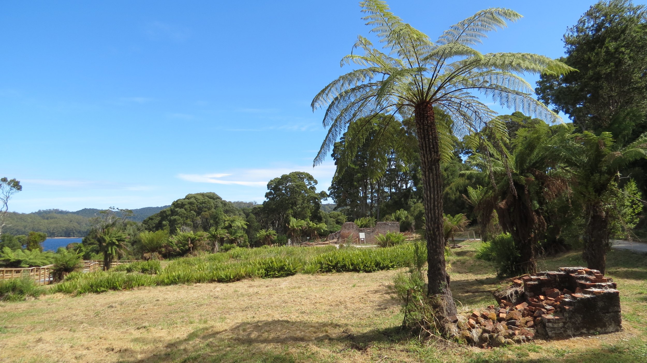
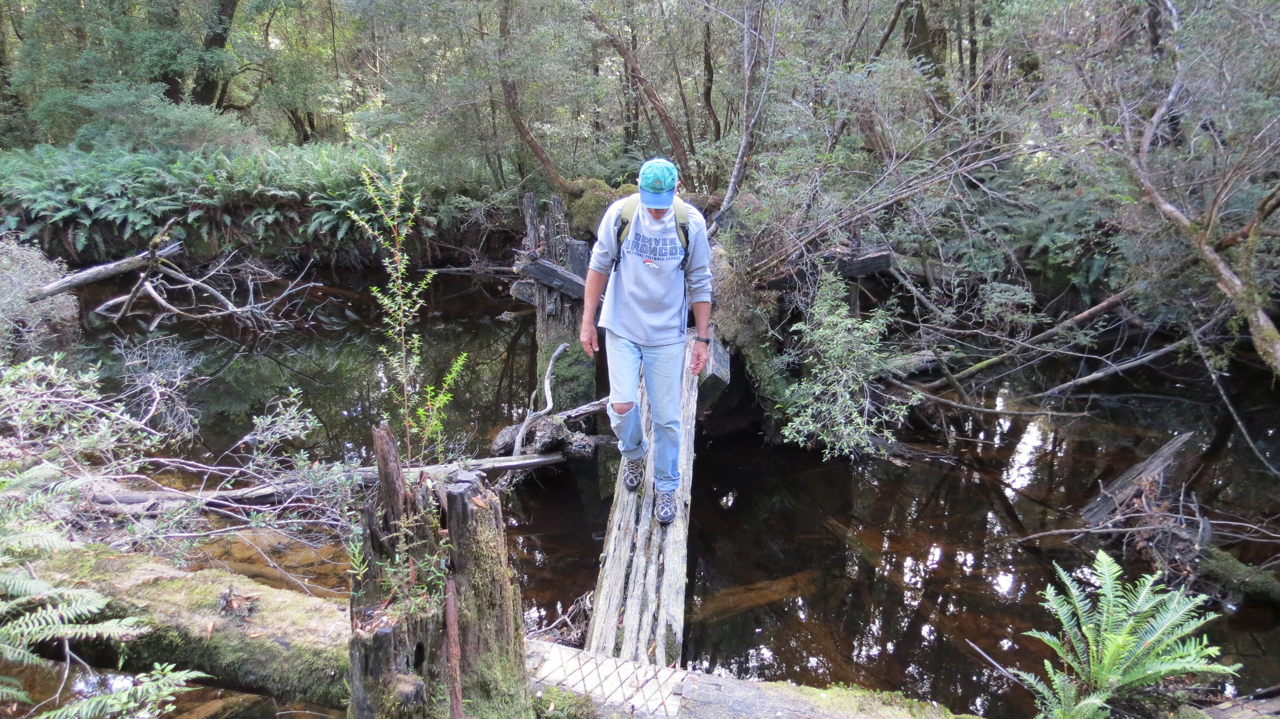
James Kelly wrote in his narrative "First Discovery of Port Davey and Macquarie Harbour" how he sailed from Hobart in a small, open, five-oared whaleboat to discover Macquarie Harbour on 28 December 1815. Kelly Basin, on the southeast side of Macquarie Harbour, was the location of the terminus of the Lyell Railway and the abandoned town of Pillinger which smelted and shipped zinc and copper ore. When the mines closed, so did the town. We enjoyed exploring this ghost town, but the overgrown tracks and preponderance of snakes discouraged us from doing any longer bushwalks. The ruins of the brickworks, extant buildings and remnants of the town were very interesting.
As we wandered the paths amongst the tree ferns and heavy vegetation, we thought how difficult clearing this land more than 100 years ago must have been. Interpretive signs along the paths provided significant insight into this ghost town. Relics like and old boiler and a dilapidated, but still recognizable railway car, reminded us that this was a working town, created to support the mining industry that once thrived here. A pleasant picnic area under huge fern trees provided a good spot for eating our apples and enjoying our surroundings.


South to Port Davey
A quick trip back to Strahan had us all re-provisioned and heading back out through Hells Gates. Having our own inbound track to follow, the exit wasn't nearly as challenging as the entrance had been. We knew we'd have a good trip south as soon as the dolphins showed up to wish us fair passage. Mount Sorrel Light stands tall on the promontory leaving Macquarie Harbour.


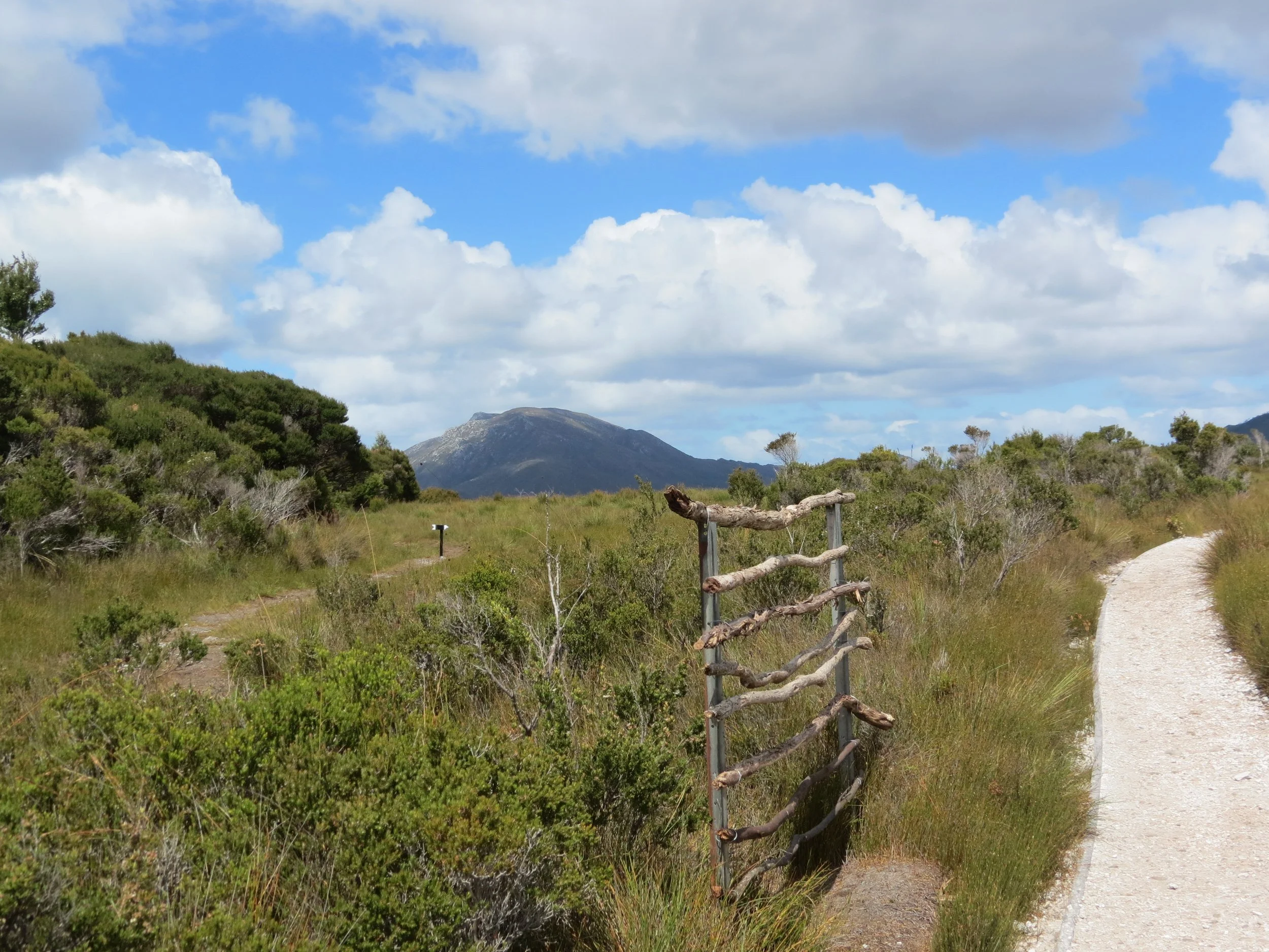
Port Davey/Bathurst Harbour Anchorages
Schooner Cove - 43S20.50 / 146E00.29 - 30'
Ila Bay - 43S20. 2/ 146E06.22 - 26'
King's Point - 43S21.91/ 146E07.90 - 18'
Unpopulated, Port Davey is an inlet on the southwest coast of Tasmania that lies next to Bathurst Harbour and is sheltered from the Roaring Forties by the Breaksea Islands. The French navigator Marion du Fresne was the first European to record the inlet now called Port Davey in March 1772. It was James Kelly in 1815 who named it after the Tasmanian Lieutenant Governor Thomas Davey (1813–17).
The entrance into Port Davey looked dark and ominous with a squall approaching. Heading behind the Breaksea Islands provided protection from the battering winds and the SW swell. It was like a different world once we were inside. The Bathurst Channel offered even more protection and lots of nooks and crannies for good anchorages.


Nine of Cups ata anchor is beautiful, peaceful Schooner Cove.
Clayton's Corner was easily accessible from our anchorage in King's Point. The Claytons, Win & Clyde, were the ultimate self-reliant couple. They lived at Clayton's Corner for most of their adult lives. Their house and property are now part of Tasmania's Southwest Wilderness National Park. The long pier at Clayton's Corner afforded a tie-up for shallower draft boats than Cups. A collapsed building with a warning sign indicating the building was not stable and might collapse warranted a chuckle. The Clayton's cabin now accommodates bushwalkers (hikers) and was a comfortable, dry spot to wait out a rain shower and have a snack.


Wildflowers bloomed midst the long-abandoned flowers from Win’s garden. We wandered up the hill behind the cabin for a good view of Cups sitting patiently at anchor below waiting for our return. We spotted a white-bellied sea eagle sitting in a tree near the shore. Super fairy wrens were entertaining as they danced around looking for a snack.


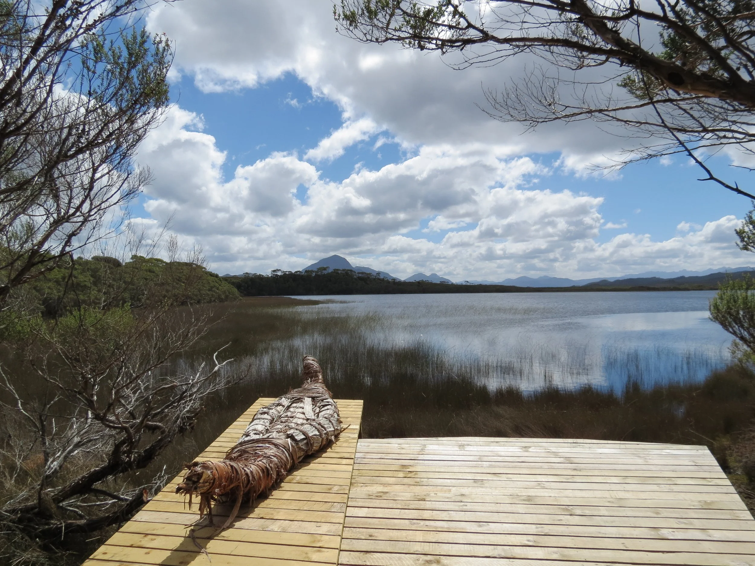
Melaleuca Inlet
Because we were not sure of depths with our 7' draft, we dinghied the 4 miles up the Melaleuca Inlet keeping the rudimentary markers to port. There are three ways to get to Melaleuca… by boat, by plane (Par Avion Air) or on foot. This tin-mining complex was once operated by the legendary Deny King (another good read) and is still owned by the family.


The entire area was scenic. Everywhere we turned, there was something to see or photograph. This area is sacred to the Needwonnee, one of four bands of Aboriginals that comprise the Southwest Nation and originally lived here. We walked along a well-marked pathway that provided views of the Melaleuca lagoon as well as Aboriginal artifacts. We were enchanted with the forest figures along the way made of the same vines used to make their huts and baskets.


Clytie Cove - 43S20.91/ 146E05.64 - 20'
Despite the tea-brown, tannic water, a bright orange jellyfish was unmistakable floating near the surface. A view of Cups anchored in Clytie Cove with Mt. Rugby in the background. The Narrows looked even narrower from our vantage point on the ridge above Clytie Cove.


Bramble Cove - 43S19.35/ 146E00.20 - 21'
We positioned ourselves at Bramble Cove for an early morning exit. We departed at dawn. The sun was just coming up and the moon was just setting on mirror-calm water. As we exited the Bathurst Channel back into Port Davey, the Breaksea Islands looked less intimidating than when we arrived. We sailed back into the Southern Ocean in anticipation of rounding another Great Cape… Tasmania’s Southeast Cape.
We passed Maatsukyer Island Lighthouse... Australia's southernmost lighthouse. The light has been active since 1891 and though it is no longer manned by a lighthouse keeper, volunteers take turns acting as caretakers for the lighthouse and the surrounding area. Though more isolated, this is a similar situation to the caretakers we met on Deal Island in the Bass Strait.


Rounding a Great Southern Cape warranted a tot of rum to Neptune. We don't take any chances when it comes to keeping the god of the sea happy.


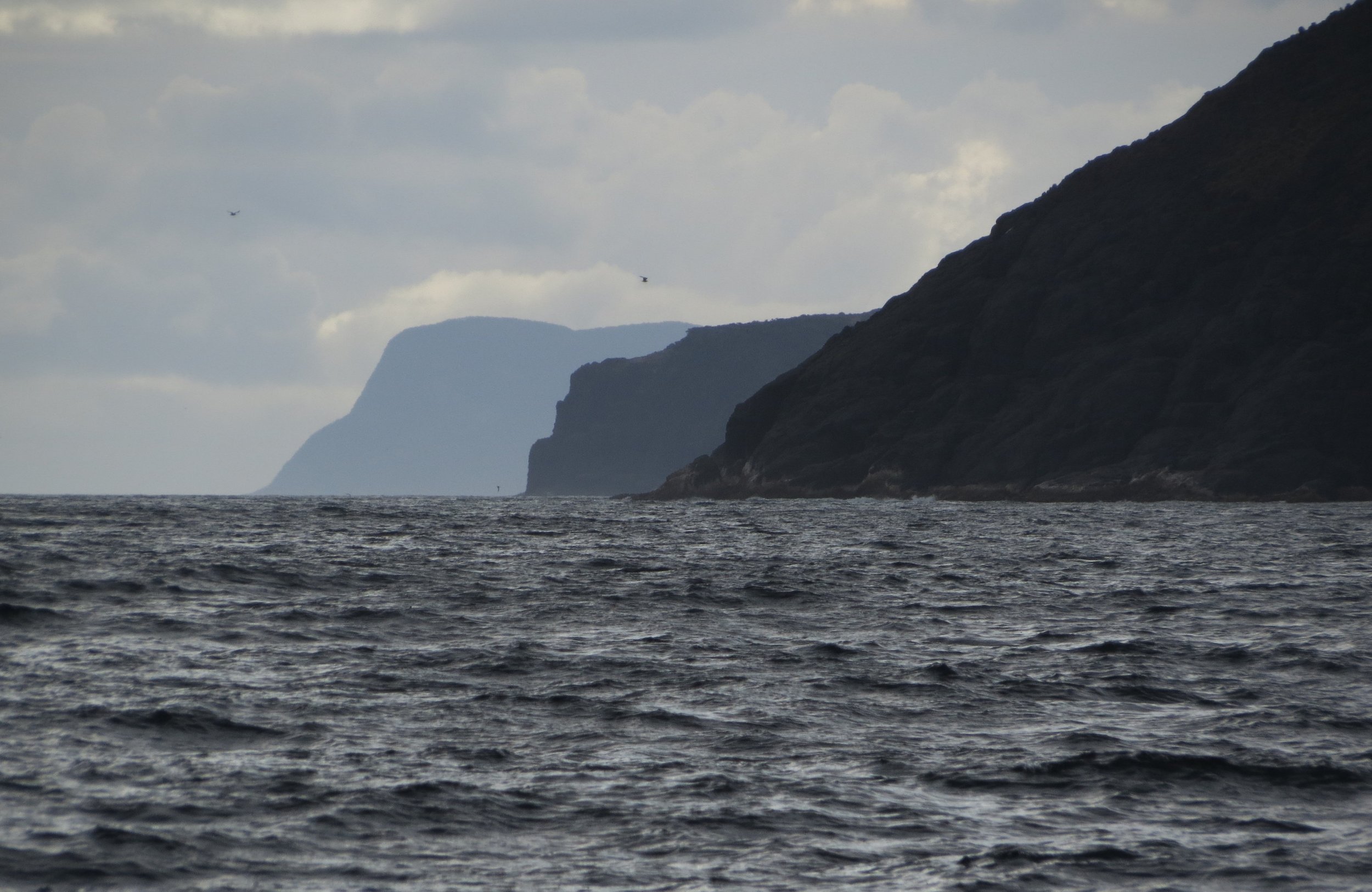
A great view of three southern Tasmanian capes... Southwest Cape, Southeast Cape and Whale Head
Whale Head Lighthouse sitting atop Whale Head promontory signalled our turn north into D'Entrecasteaux Channel. Our first view of the channel were simply beautiful. Actaeon Island is a game reserve at the southern entrance to the channel.


D'Entrecasteaux Channel anchorages:
Recherche Bay/the Pigsties - 43S32.09 / 146E54.23 - 23'
Southport - 43S26.37 / 246E58.20- 20'
The entrance to the Pigsties anchorage is guarded by the shags of Shag Island. The next overnight stop was in Southport... convenient, but unremarkable.

Port Esperance/Dover - 43S19.05 / 147E01.78 - 29'
Port Esperance offered a bit more activity. Several lobster boats aka crayfish boats were tied up at the Port Esperance wharf and we were intrigued by the distinctive crayfish pots used throughout Tasmania. We passed the tiny 19th-century Dover Community Church which was very photogenic with its old graveyard in the front yard. The King George III was a British penal transportation convict ship that was shipwrecked with heavy loss of life during its last voyage when she was transporting convicts from England to the Australian Colonies. The anchor from the King George III sits by the shore in Port Esperance, a reminder of the shipwreck and 122 lives lost, mostly convicts.


Cygnet - 43S10.60 / 147E05.16 - 21'
The channel between Dover and Cygnet was dotted with fish farms. From a distance, they looked more like suspension bridges. Cygnet was a great little town. Picturesque and friendly, it offered lots of shops and a great anchorage. Tasmanian apples were in season and we contributed to the "honesty box" daily for the best apples ever. One innovative, imaginative local transformed his sailboat into the town's iconic black swan complete with articulated wings. We collected mussels one evening for dinner and were surprised by the number of large, colorful starfish.


Autumn arrived all too soon. From Cygnet, we made our way north to Kettering and the Oyster Cove Marina. Nine of Cups wintered in Tasmania while the crew enjoyed a northern hemisphere spring/summer respite in the USA.


Oyster Cove Marina - Kettering - 43S07.68 / 147E 15.06
We returned to Tassie in September 2012 to begin a whole new season. After six months of abandonment, Cups was a sight for sore eyes, but in
pretty good shape considering so many months of neglect. So many projects awaited us, BUT Spring was busting out all over in Tasmania and we just couldn’t ignore it.
A Trip to the Midlands
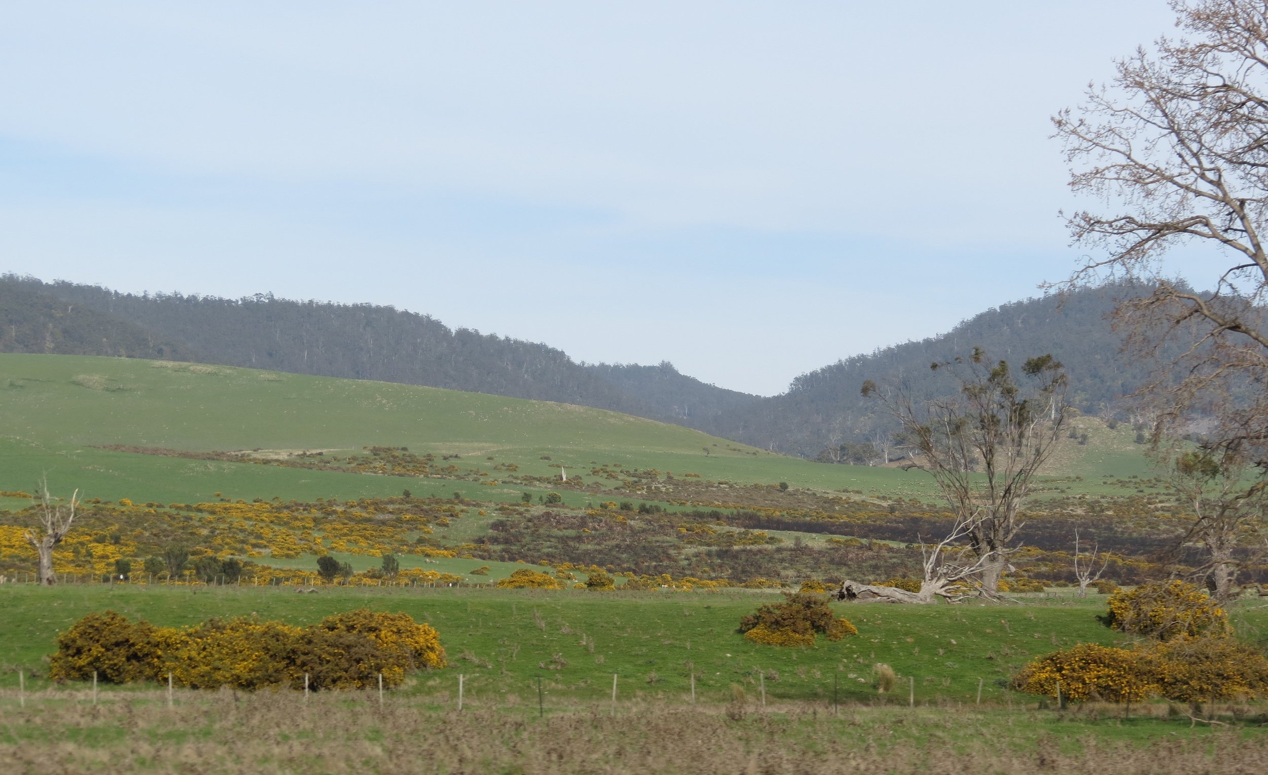
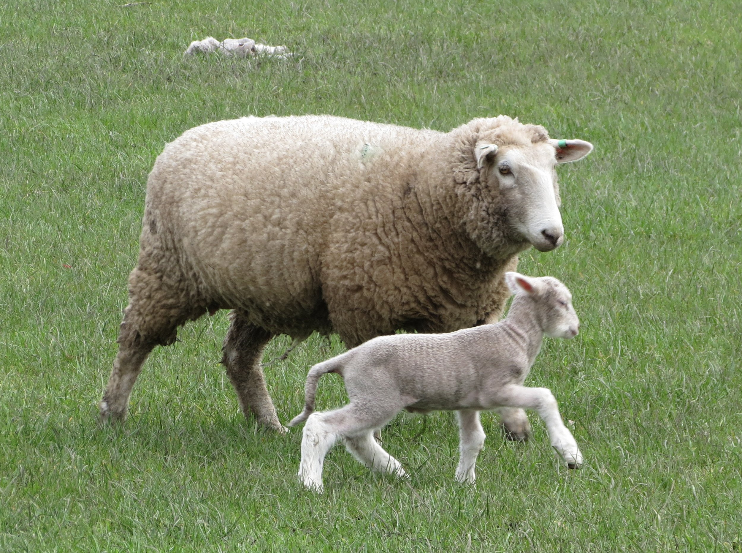
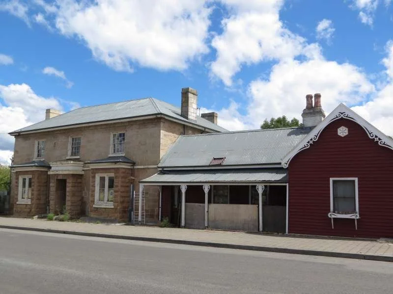
We took a road trip to Launceston ostensibly to visit the "best" chandlery in Tasmania, but really just because we wanted to do a little land exploring. The Tasmanian countryside is not much different than a New England countryside... except many more sheep.
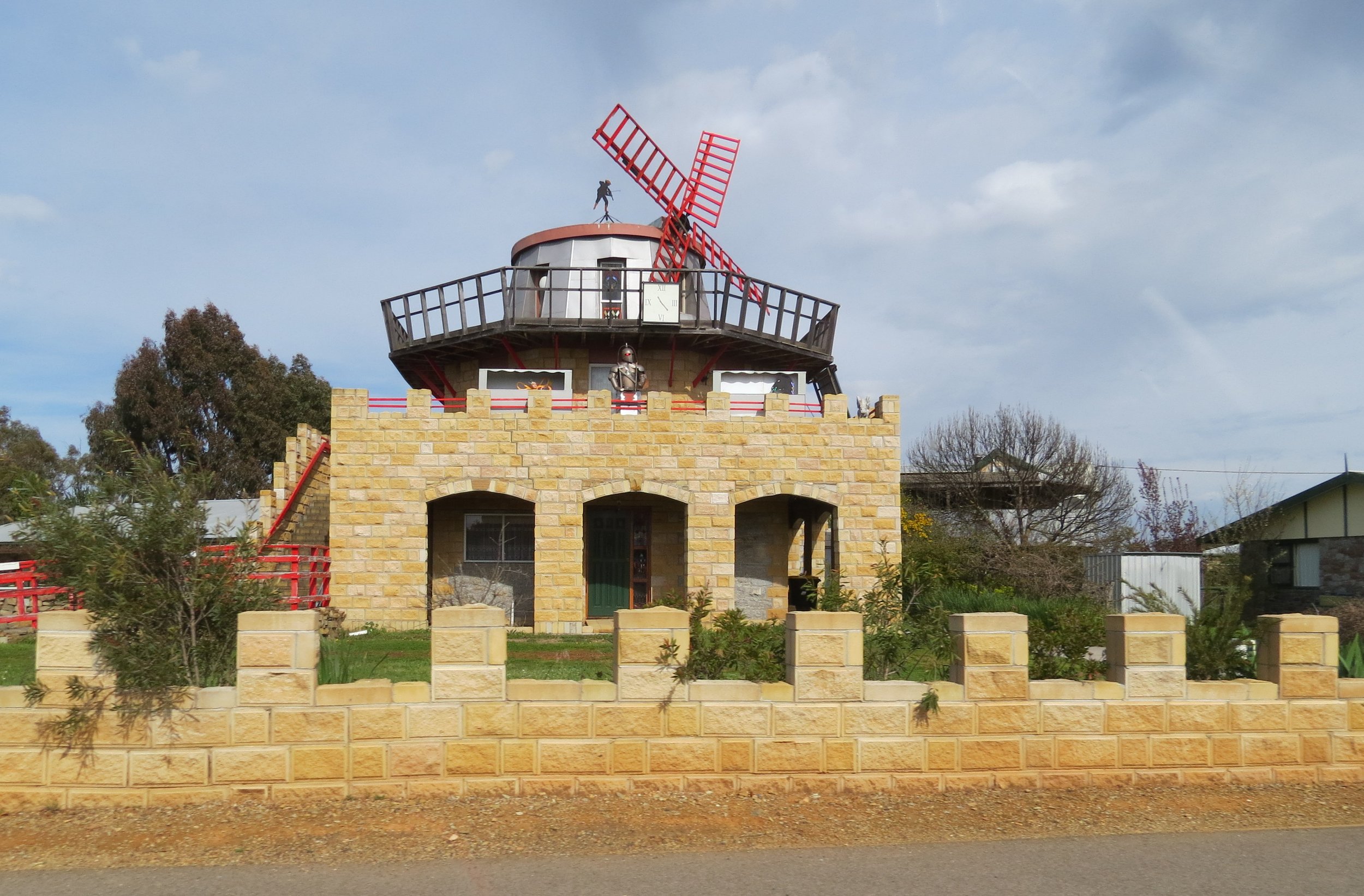
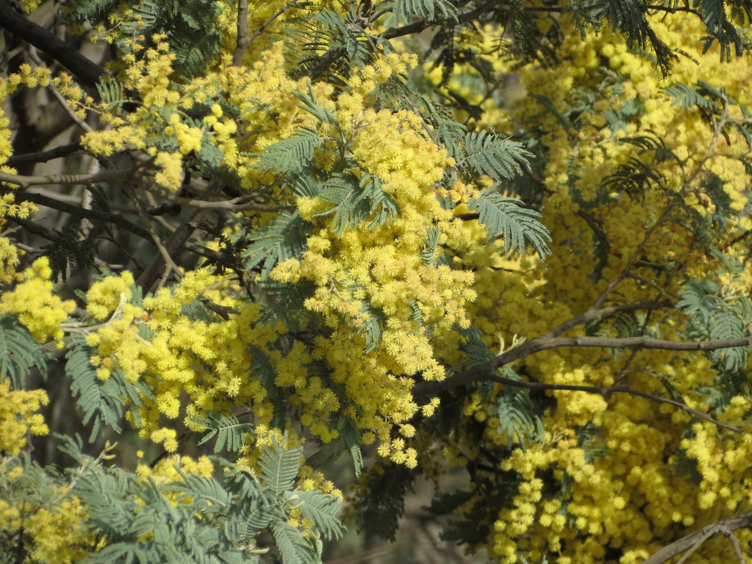
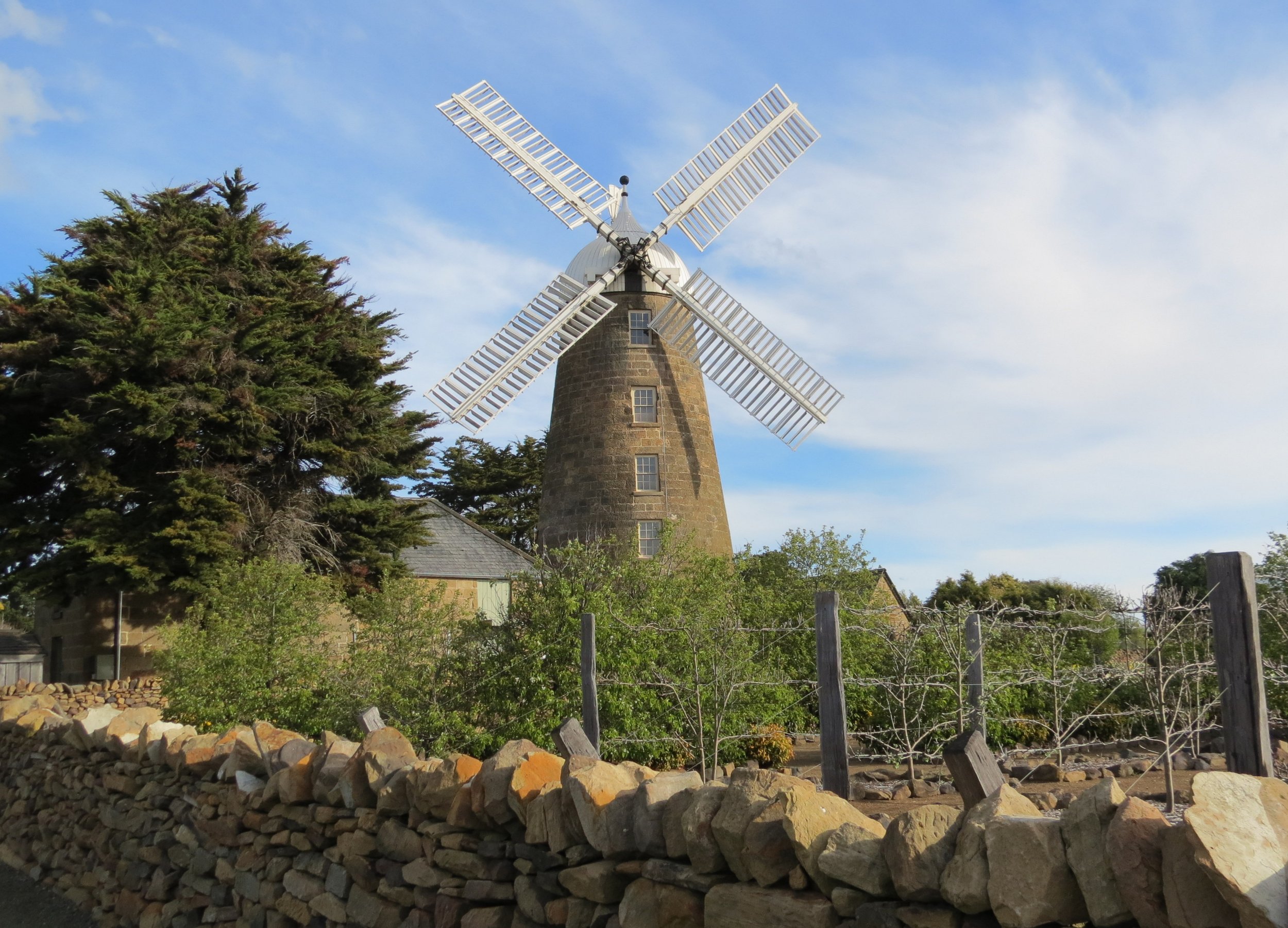
Tasmania has its share of oddities to observe like the windmill house below with an armored knight standing on the ramparts. His eyes glow red! Yellow wattle, the national flowering tree of Australia, was blooming along the Midlands Highway as we passed. The small town of Oatlands boasts the largest extant collection of sandstone Georgian buildings in Australia. The Callington Mill (1837) has recently been restored and is the only working example of a Lincolnshire-style windmill in the Southern Hemisphere. Flour from the gristmill was for sale in the gift shop.
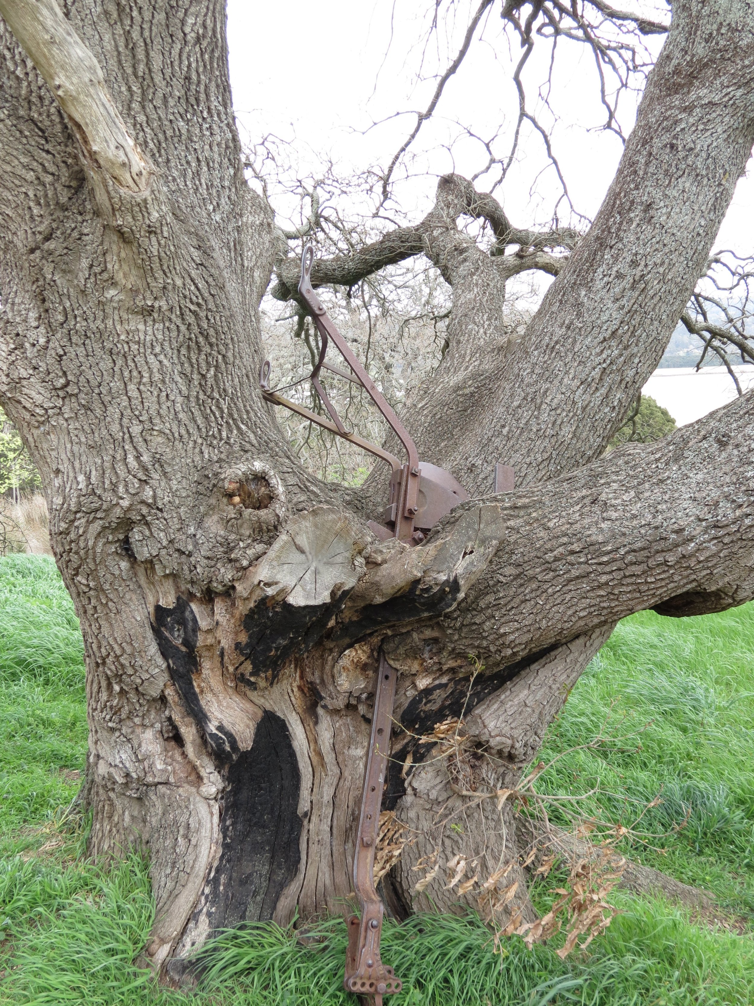
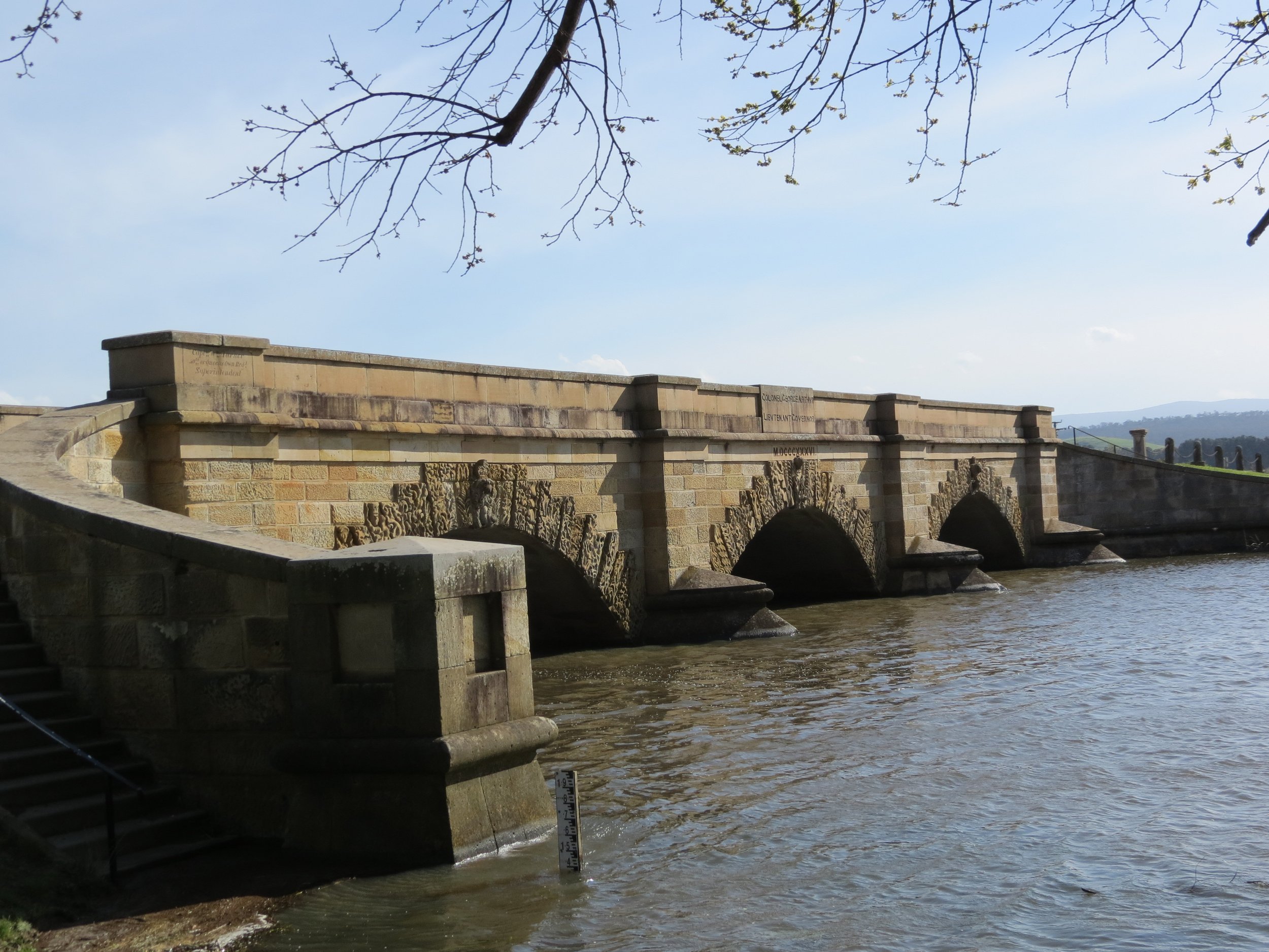
Then, of course, there’s a plow embedded in an old English oak tree. Legend has it that a local farmer thrust the plow into the tree upon the death of his wife, where it remains today. The well-known Ross sandstone bridge was constructed by convict labor in 1836 and is the third oldest bridge still in use in Australia. The architect and workers were freed from prison when the work was completed.
The best part of the whole trip was meeting an echidna on the highway. It was trying to get to the other side of the road and we stopped to observe him. (Yup, it beckons the age-old question… why did the echidna cross the road?) Several cars and trucks narrowly missed him until he found respite underneath our parked car on the side of the road. He could not be coaxed out. Instead he dug in with only his quills exposed and blended in with the surroundings. We were able to inch the car around him to make our departure.

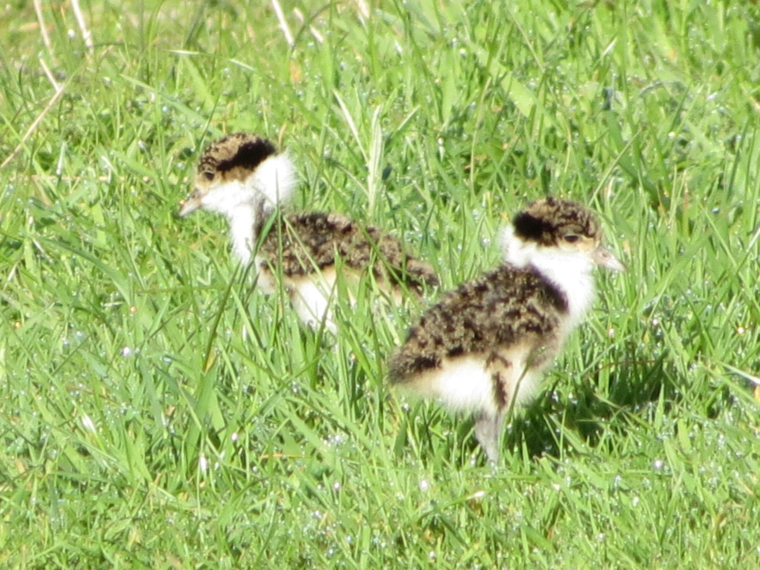
an echidna, just One of many odd critters in Tasmania that delighted us.
In our backyard... the Oyster Cove Inn
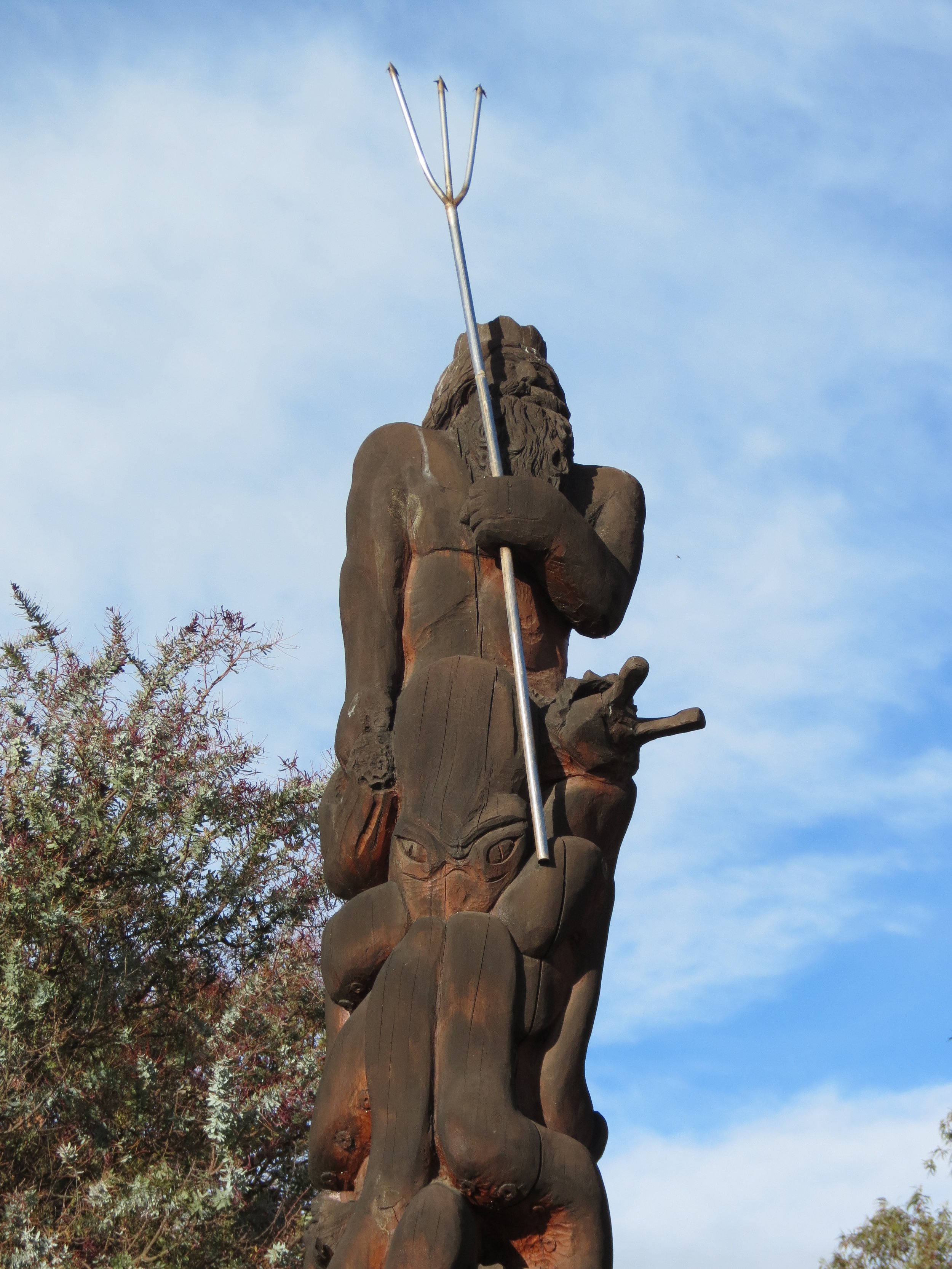
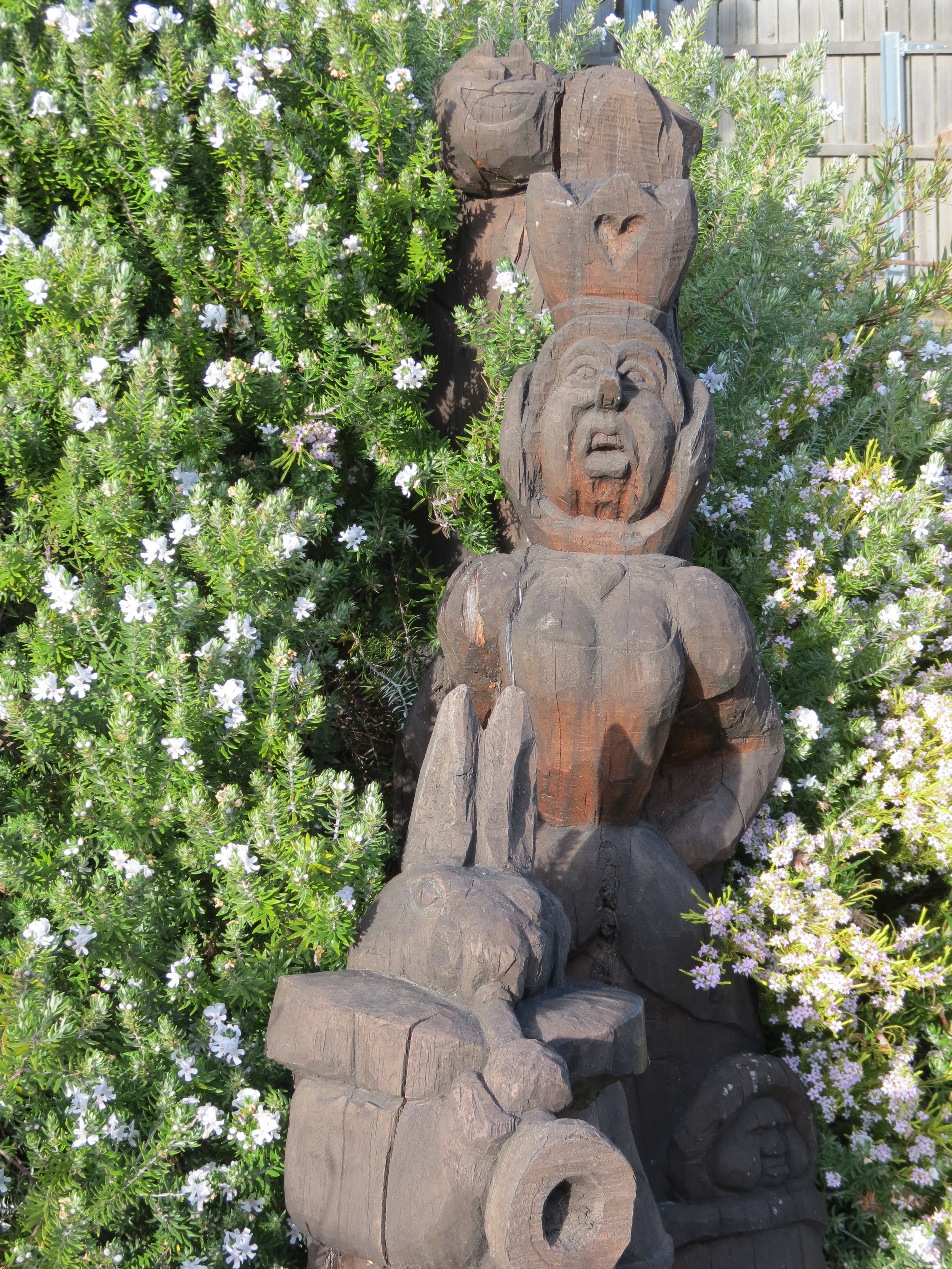
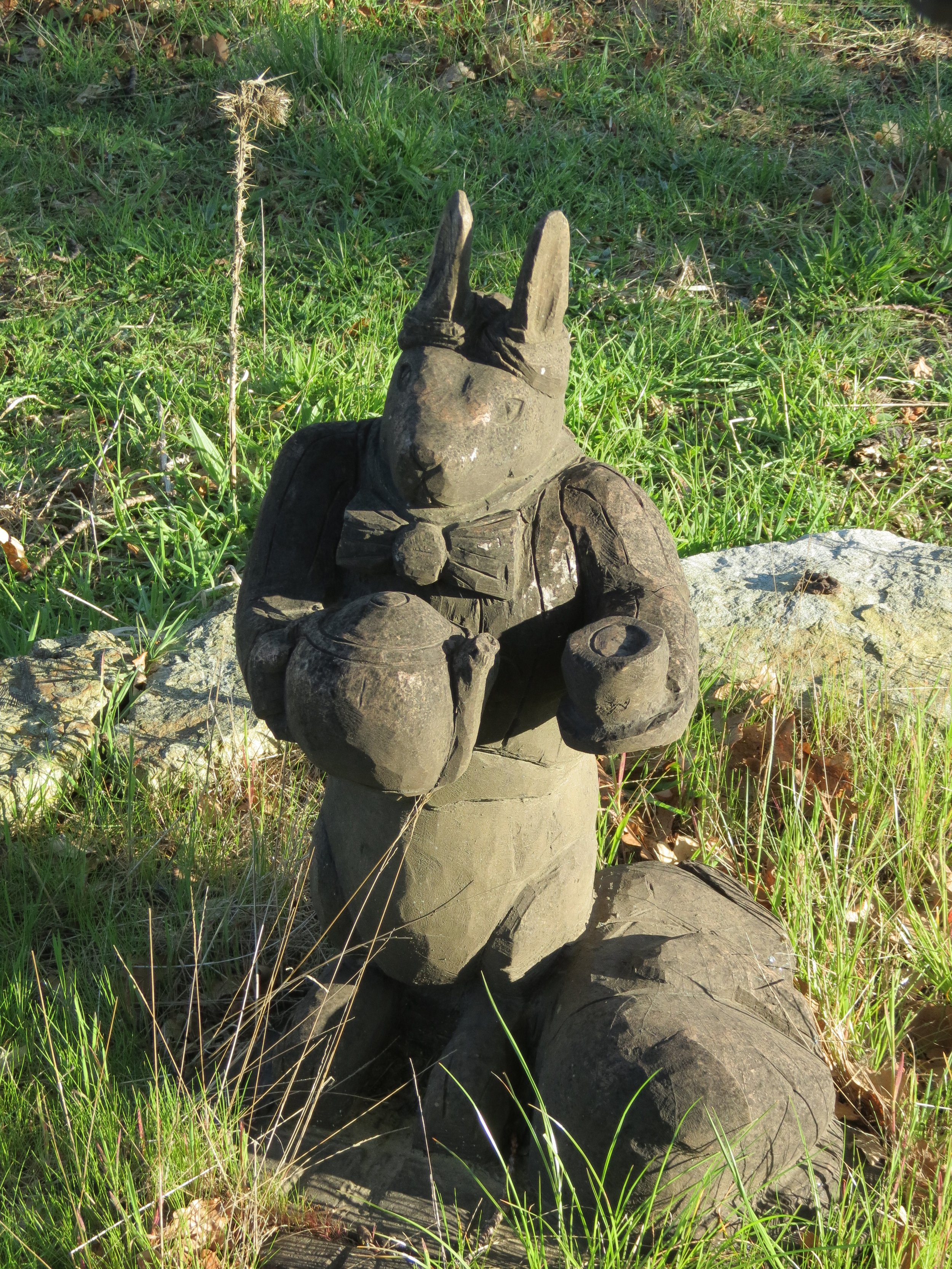
Just behind the marina is the Oyster Cove Inn, a fascinating place to explore especially when we needed a respite from a day of boat chores. The history of the inn is quite interesting. Built c.1890 as a family vacation home by British plantation owner, Alfred Cotton, it was originally called Mintoburn. Cotton's son, Sydney Cotton, was the archetype for the Ian Fleming James Bond character. Sydney is credited as being the world's first triple agent (MI5, French Security and German intelligence). He was also a personal friend of Ian Fleming. The inn sits high on the hill above the marina and offered quite a few fun discoveries especially the Lewis Carroll figures. Roland Garbatel designed and carved the Alice in Wonderland wood sculptures that are found around the grounds. The Cheshire cat must have been his favorite character because the cat and his iconic smile seem to be ubiquitous.

Cheshire Cat
Chocolate John
Just up the hill from us, behind the marina was an old, defunct gas station. There's always a pick-up truck across the street from it with a sign for "Handmade Fine Chocolate". After passing it many times and at the recommendation of several folks in the area, we finally stopped in. Oh my, what an absolute delight. The sweet smell of chocolate caresses you and lures you into the shop with your first step inside the door. I visited Chocolate John many times during our stay in Kettering. Read our blog about John and the Nutpatch Nougat shop, just click.


The Annual Haul-Out & Lots of Projects
This is probably the tenth or eleventh time we'd hauled Cups out of the water and it's never happened at the same location. Oyster Cove Marina had just acquired a 50-ton TraveLift which will eventually replace their slipway. Funny, but we felt uncomfortable thinking about using the slipway and the locals were uncomfortable with the thoughts of the TraveLift hauling them out of the water. It's all what you're used to. We hauled and then David borrowed the marina's power wash to get off the accumulation of slime that Cups had on her bottom. Nothing more than slime though... not many barnacles, no seaweed forest, no reef formations. I guess the last anti-fouling paint job was a good one. We sanded the hull the same afternoon we were hauled and David masked in preparation for three coats of anti-fouling paint. David does all the hard stuff and Marcie paints the bottom, though in her Pillsbury Dough Girl Tyvec suit and respirator, you really can't tell who's doing the painting.


David washed, waxed and polished Cups. He repainted her bootstripes. The prop got an application of PropSpeed to keep it barnacle-free till our next haulout. After four days on the hard, we were boarding Cups to sail her back to her berth, but the projects continued. Marcie replaced the side windows in the dodger along with several other sewing repairs.


The batteries had been a problem for quite some time. We had an old bank on the port side that didn't charge well and a newer bank of Lifelines that we'd had shipped to us when we were in Tahiti a couple of years ago. We had a problem equalizing them for one thing and we had no idea if that was the problem or if they were all shot. David designed and built a battery checking and equalizing system with existing parts on the boat. He determined that the port side bank was indeed shot and we removed them from the boat. He then decided that the four on the starboard side should be moved to the port side to put the boat in trim. We bought one new starter battery which resided on the starboard side.


Lots of minor repairs have been handled. A hydraulic hose for the steering was replaced after many trips to Hobart for the proper adapters. A stopcock was replaced while we were on the hard as well as new transducer. Leaking hatches were repaired. A couple of other leaks were identified and repaired. The windlass chain counter was repaired. The list goes on and on. We'd noted for a long time that the portlights were beginning to craze and each time we mentioned it to each other, they seemed to be getting worse. David located a place in Hobart to buy acrylic replacements and thus began a major boat project. Because… once he started replacing the portlights, he noticed that the screens really needed replacing. A few mozzies had snuck in the night before and upon checking the screens, it appeared they were only a minor deterrent. So the screening needed replacing. But wait... the bronze portholes on which the screens resided were all cloudy and the bronze had verdigrised to an ugly shade of green with corrosion. Nothing's ever easy on a boat, BUT we now have new portlight acrylic, new porthole acrylic and new screens and they're all shiny and beautiful. Wait a minute... were these chores even on the list???
We'd been sleeping on the same old lumpy, saggy mattress for as long as we'd been aboard Cups and our aching bones attested to the fact it was time for a change. We evaluated several options and came up with a pocket spring type that would allow us to modify it to fit our berth because nothing's ever easy on a boat. We toted it back to the boat in the marina courtesy van and waited for a sunny day to begin multiple surgical procedures. We called it the ‘Franken-mattress’. Read all about it here.


Exploring More Tasmania
Bonorong Wildlife Center and Sanctuary
Enough work… now some play. Our friends on "Active Transport" had highly recommended the Bonorong Wildlife Sanctuary as a "must see". Tasmanian devils really do exist, but they're highly endangered, primarily due to a contagious cancerous disease that has spread throughout their population. They're ferocious little beasts to which their claws and teeth can attest. We figured this might be our only chance to see them other than a zoo. Bonorong is a special place designed for helping and protecting sick and injured animals until they're ready, if ever, to be released into the wild again. It's not a ritzy place, but the animals seem to be healthy and thriving.


We'd also never seen a wombat up close and this was our chance. "Digger" was young and quite docile cuddling in the staff woman's arms. Once he reached maturity, she told us, he would be impossible to snuggle to. They refer to them as "teenage wombats" for a reason! Though we'd seen many koalas at Raymond Island, we never had the chance to pet one. I got my chance. They're just as soft and fluffy as they look.


We had the chance to observe and learn about several other animals with which we were unfamiliar. An odd-looking bird called a tawny frogmouth. A large terrarium teemed with blue-tongued lizards all intertwined and crawling around on top of each other. You couldn't tell where one began and one left off ... except when they opened their mouths. Spotted quolls? We'd never heard of a quoll before, so learning about Australian animals like quolls, potoroos and bettongs, animals that we'd never known existed, was quite the education. Read our blog about Bonorong here.


MONA - Museum of Old and New Art
MONA was also recommended by John on "Active Transport". We were fortunate to have the use of the marina courtesy van for the day and off we went. MONA is, without a doubt, the most bizarre, evocative, provocative museum we've ever visited. The largest privately owned museum in Australia, MONA was built by native Tasmanian David Walsh, gambler-extraordinaire and businessman. It was intended to house his enormous and eclectic (eccentric?) art collection. He opened it to the public in January 2011 to mixed reviews. The first year charged no admission. Though there was now an admission charge now ($20/pp) for visitors, Tasmanians still get in for free. There is a vineyard, brewery, restaurant and hotel on the premises as well.
We entered through a vineyard, past a brewery and over a full-size tennis court to get to the unassuming front entrance. Upon entrance, we were given iPods and headphones. The "O" program allowed us to click a button and locate every piece of art near us with commentary and description. It was phenomenal. The collection is so eclectic, it's hard to know where to begin or end. Everything from Egyptian mummies (coffin of Anklh-Pefy-Hery), to caged ballerinas (The Mice and Me), to the Fat Car and a 3-story digital waterfall called bit.fall. Read our blog about MONA here.


This huge head laying on its side has view holes to peek inside where a mechanical action figures continually moved under a strobe light. Weird, but definitely cool.


The Death Gallery caution is the only sign within the museum. The Death Gallery allowed only two people to enter at a time. It was very dark except for white paving stones surrounded by water which led to the coffin and mummy of Pausiris. It was an eerily quiet place. Remember you can enlarge the images by clicking on them.


Australia's Antarctic Division
Australia's interest in Antarctica is probably more pronounced than any other country, probably because it's Australia's southern neighbor. Australia's weather and climate is influenced significantly by the ice continent to the south. It shares the same Southern Ocean. Australia's Antarctic Division headquarters are close by in Kingston and since we’d been to Antarctica, we were interested in seeing what there was to see. They have a small museum/exhibit area. What was there was interesting to see: science exhibits, some history and even an emperor penguin skin and feathers to feel and examine closely.


Tasmanian Wine Tasting
We didn't even know that Tasmania produced wines until we happened to find a whole Tasmanian wine section in the local bottle shop. Then local friends invited us to go on a wine tasting tour with them one Sunday afternoon. What a treat and an eye-opener. Tasmania produces some quality cool climate wines and there are beaucoup vineyards in the area, including one in the next town of Margate. My favorite wines were at Lubiana, but the Pooley Vineyard was by far the most picturesque. We visited three vineyards during the afternoon and felt rather mellow by the end of the day. For a more detailed story about our wine tasting experience see our blog on Tasmanian Winetasting Tour .


Bruny Island - In search of the white wallaby ... and other stuff
We'd taken free passage as pedestrians on the Bruny Island Ferry from Kettering to the Island, but there's not much within walking distance of the ferry dock on the other side. For my birthday, we borrowed the marina's courtesy van once again and took the ferry back to Bruny... this time in search of the elusive white wallaby mob known to inhabit this island. As you can see in the map below, the island is split into two, North & South Bruny, separated by a very narrow isthmus which is called The Neck.


We headed to South Bruny and stopped at The Neck first. The white wallabies travel around but are known to be in Adventure Bay so we were headed in that direction. The Neck is home to a blue (aka fairy) penguin rookery and there are blinds constructed for optimal viewing without bothering the penguins in their daily pilgrimages to and from the sea at dawn and dusk. It was the wrong time of day for blues, so we climbed the steep wooden stairs to the top of the hill for stupendous views of both sides of the Neck: D'Entrecasteaux to the west and the Tasman Sea to the east. At the top was a monument to Truganini, the last remaining full-blooded Aborigine in Tasmania who lived a miserable life at the hands of the white settlers.


We continued down the east side of South Bruny and stopped at the Mavista Walk just north of Adventure Bay. This is a rainforest area and true to its name, it showered about every 10 minutes. The forest is thick with ferns and eucalyptus trees. The forest smells were clean and fragrant. The rain, however, made for a wet, slippery, muddy paths... some nearly impossible to negotiate. Native laurel and fronds dripped with rain. Signs, like the one below, were posted everywhere. There's lots of wildlife here and roadkill is a keen issue.


We were disappointed in the plain, brush-ridden memorial to Captain Cook, but the Bligh Museum perked us up. It's tiny, but packed with information and memorabilia about all the great navigators that have stopped in Adventure Bay during their explorations including Tasman, Cook, Furneaux, Flinders, D'Entrecasteaux and of course, Bligh who put in at Bligh's Creek to get water and collect wood.


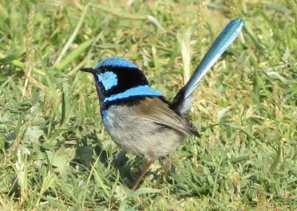
We drove along the coast road past "The Whale and the World", a monument to the whalers and the whales that account for much of the early history on the island. The sun came out for a bit and we spotted a superb fairy wren.

We drove up a side road and there, in a farmer's paddock, was a white wallaby and his brown buddy. At first we thought they were fenced in, but no, they had jumped in to munch some lunch inside the enclosure. We watched for awhile, took pics and then drove on. When we passed by again, all the wallabies were gone... to greener paddocks, we suppose.

An encounter with The white wallabies of Bruny Island. What an awesome birthday gift!

Wallaby Bros!
The east coast road ended at Adventure Bay, so we backtracked a bit, crossed the island and headed to South Bruny Island National Park and Cape Bruny. The views from Mabel Bay across Cloudy Bay were superb. Cape Bruny with its lighthouse was barely discernible. The Cape Bruny Light looked photographically inviting, but weather toyed with us allowing beautiful photos one moment and then pommeling us with rain, hail and 40-knot winds the next. We never made it up the hill to the lighthouse, but we did sneak a peek at the little museum which gave some history of the lighthouse built in 1838 and the third oldest in the Australia.


Once again, the road ended at the lighthouse and we backtracked and then headed along the west coast road up to North Bruny. We saw lots of native flowers like pigface and common teatree. Up north, there seemed to be more farms and vast grassy fields where sheep and cattle grazed. We checked out possible anchorages, enjoyed the views then headed back to the ferry dock. It was the end of the day, but not quite the end of my birthday celebration. There was more to come.


66th Annual Huon Show
Part II of my birthday included attending the Huon Show aka a county fair near Huonville. Once again, we used the marina courtesy van. For a one-day fair, people really went to a lot of effort for set-up. There was a carnival and a midway typical of American fairs and lots of concession booths selling food. We visited all the usual animal displays (goats, cows, pigs, llamas) and a tent marked "cavy club" intrigued us, but it turned out to be just guinea pigs.
The most exciting, interesting and very best part of the show in our estimation, however, was the axemen and sawyers’ competitions. An enclosed section of field was condoned off, bleachers were erected and the competition continued throughout the day. There was cross-sawing (far left) and vertical block axing, doubles cross-saw, jack and jill events, relays. The amount of energy expended was amazing. It appears axemen's competitions originated in Tasmania and they even have an Axemen's Hall of Fame.


The competition that was the most thrilling was the three board tree-felling. Men scarfed (notched) tall poles and wedged in boards to climb the pole, then chopped the block at the top. Then climbed down and did the same on the other side.

Raptor & Wildlife Refuge
While at the Oyster Cove Marina, we had the opportunity to meet Craig Webb who also had a boat at the marina. We became friendly and found out later that Craig was the founder of the Raptor & Wildlife Refuge in Kettering. Craig is a native of Tasmania but spent many years in Kimberly working as a veterinary nurse and was registered as a licensed wildlife carer. Initially, he worked with all sorts of animals, but his passion is the care and rehabilitation of raptors. He invited us to the refuge one day and it was both awesome and educational. Read our blog about our visit to the Raptor & Wildlife Refuge here.


Thanksgiving 2012
Thanksgiving Dinner with Aussie friends
We almost missed celebrating a traditional Thanksgiving. It was earlier than usual and snuck up on us. We managed to find ourselves a turkey and a pumpkin for pie and invited some Aussie friends for their first traditional American Thanksgiving dinner. The pumpkin pie for dessert was unusual for the Aussies and not a hit. The cranberry pudding, however, was quite delish. That’s Craig Webb from the Raptor & Wildlife Refuge seated next to Marcie at our Thanksgiving feast.
Finally... all the boat work was done (at least for the moment) and we headed to Tasmania's capital city of Hobart to enjoy a festive Christmas holiday season.
Heading to Hobart
We said our goodbyes to the folks at the Oyster Cove Marina and headed into the D'Entrecasteaux Channel. We spent a night in the calm "Duckpond" off Bruny Island, then made our way up the channel towards Hobart. We saw sea lions, blue penguins, lots of birds and one whale on our way. At the entrance to the Derwent Estuary, we could see Iron Pot Light in the distance.
Cornelian Bay - 42S51.27 / 147E19.55 - 23'
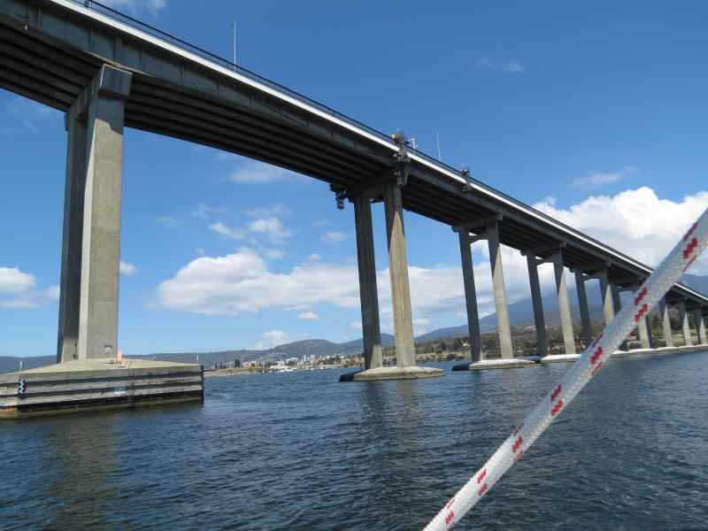
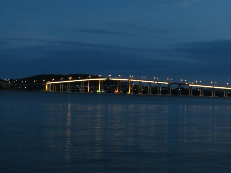
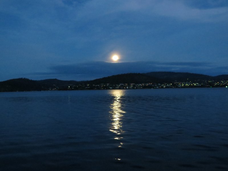
Before heading into Hobart to spend a month in the city, we opted to head further up the Derwent Estuary, just north of the Tasman Bridge and anchor in the very pleasant. albeit very windy, Cornelian Bay. We passed by the regal Government House as we headed up the Derwent. As always, the bridges seem very low when we're sailing under them despite having oodles of room to spare. It was a full moon and the view of Lindisfarne on the far shore and the Tasman Bridge, all alight, were beautiful.
Cornelian Bay is known for its colorful boatsheds / shacks that line the shore. It's also known for the wind that passes through the notch in the hills and whips into the bay. On pleasant days we explored and on windy days, we stayed aboard. The Cornelian Bay Foreshore Walk is a beautiful 3km pathway into Hobart. The first stretch parallels the railroad tracks. It passes by the Royal Botanical Garden and through the Queen's Domain before depositing us into downtown Hobart. Wild flowers were in bloom and birdlife was abundant. After a week, it was time to head into Hobart Town.


Elizabeth Street Pier, Hobart - 42S53.05 / 147E20.12
Typically, visiting boats tie up at Constitution Dock (ConDock), but it was too shallow for Nine of Cups’ draft, so we were allowed to tie up at the Elizabeth Street Pier. We had only one neighbor, a regal lady, the Lady Nelson. A replica of this 18th century brig which participated in the founding of Hobart, the Lady is now a training vessel and earns her keep by taking visitors out on harbor cruises.


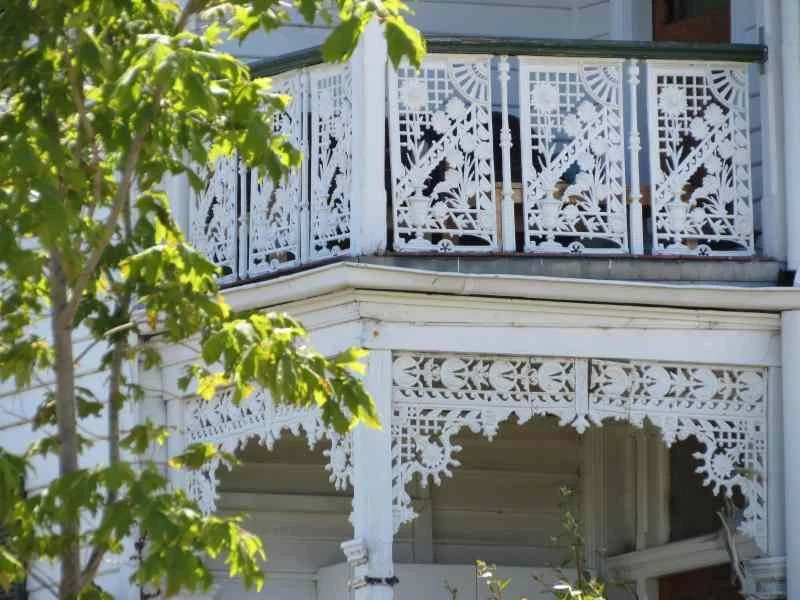
Hobart is a wonderful combination of old and new. Originally begun as a penal colony settlement, the town retains much of its convict-labor-built older buildings. Constitution Dock allows visitors to tie up to the wharf just as in the olden days. Huge government buildings and mansions of local sandstone stand tall among more modern buildings. Fancy ironwork on the local houses gives the buildings a Victorian air which mixes and mingles with the more austere Georgian sandstone.


Hobart is a walking town and several self-guided walks are available on line and we took advantage of them. Our first walk took us through Salamanca Place, an old warehouse district with 19th century sandstone buildings now converted into trendy boutiques, pubs and sidewalk cafes. Imagine our surprise when we returned the following Saturday for the Salamanca market and found the once-deserted walkways and streets filled chock-a-block with people and vendors. The Salamanca Market is wonderful and everyone turns out for it. The place was mobbed. You could barely walk without bumping into someone.
There was a vast array of offerings. Fresh flowers and produce, Tasmanian crafts, wool, honey, bakery items, souvenirs, doll clothes, lavender, wooden carvings, sculptures... you name it, it was probably there on offer. Then there was the food... fairy floss (cotton candy), mid-Eastern food, sizzling sausage, gourmet coffees and teas. We ended up returning each Saturday that we were in Hobart and it was a new experience each week. The 2-headed gingerbread man shown below, by the way, is a Tassie joke. Native-born Taswegians are reputedly born with two heads and one is pinched off at birth. If you wish to prove you are a native of Tasmania, you can just show your scar!


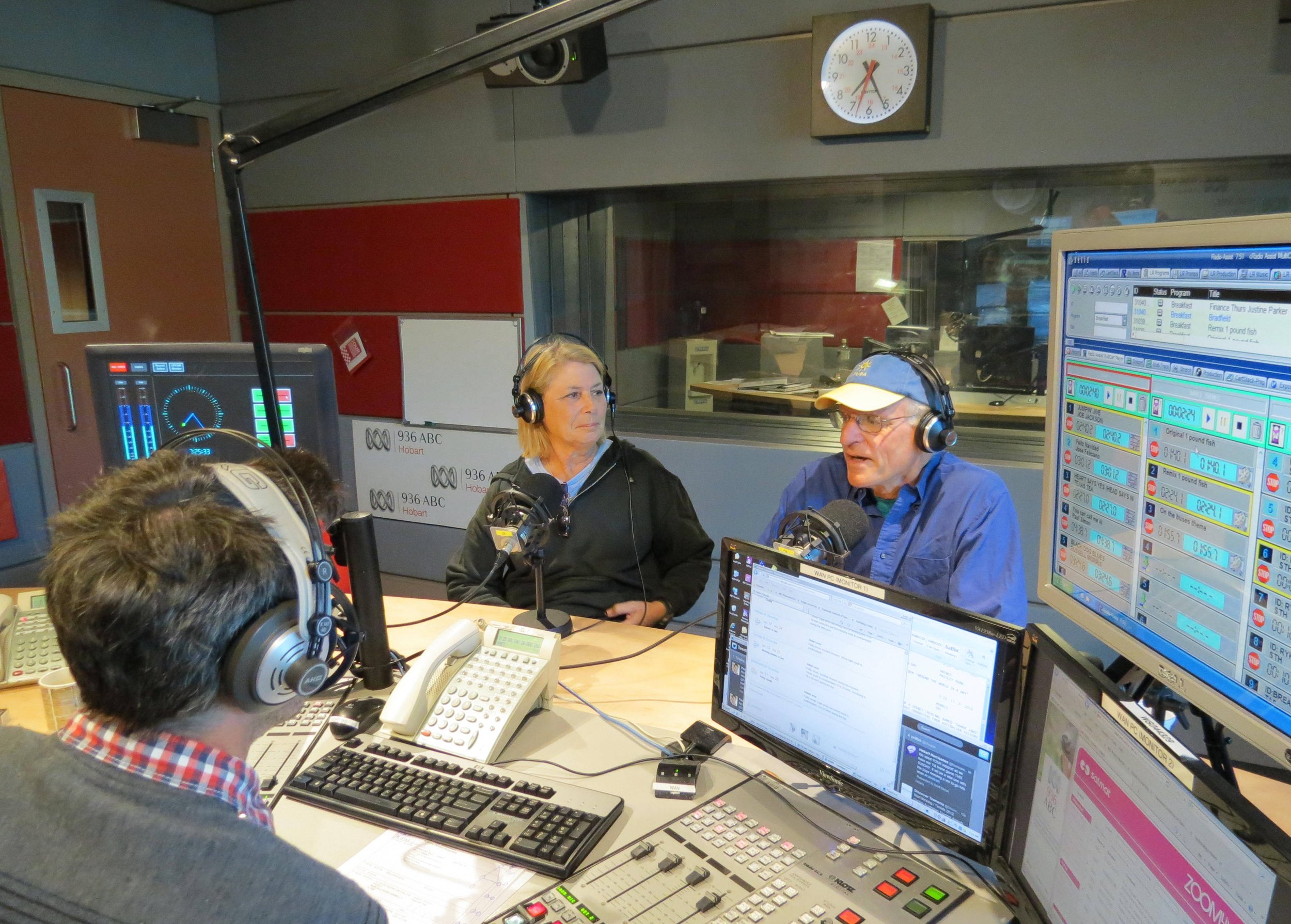
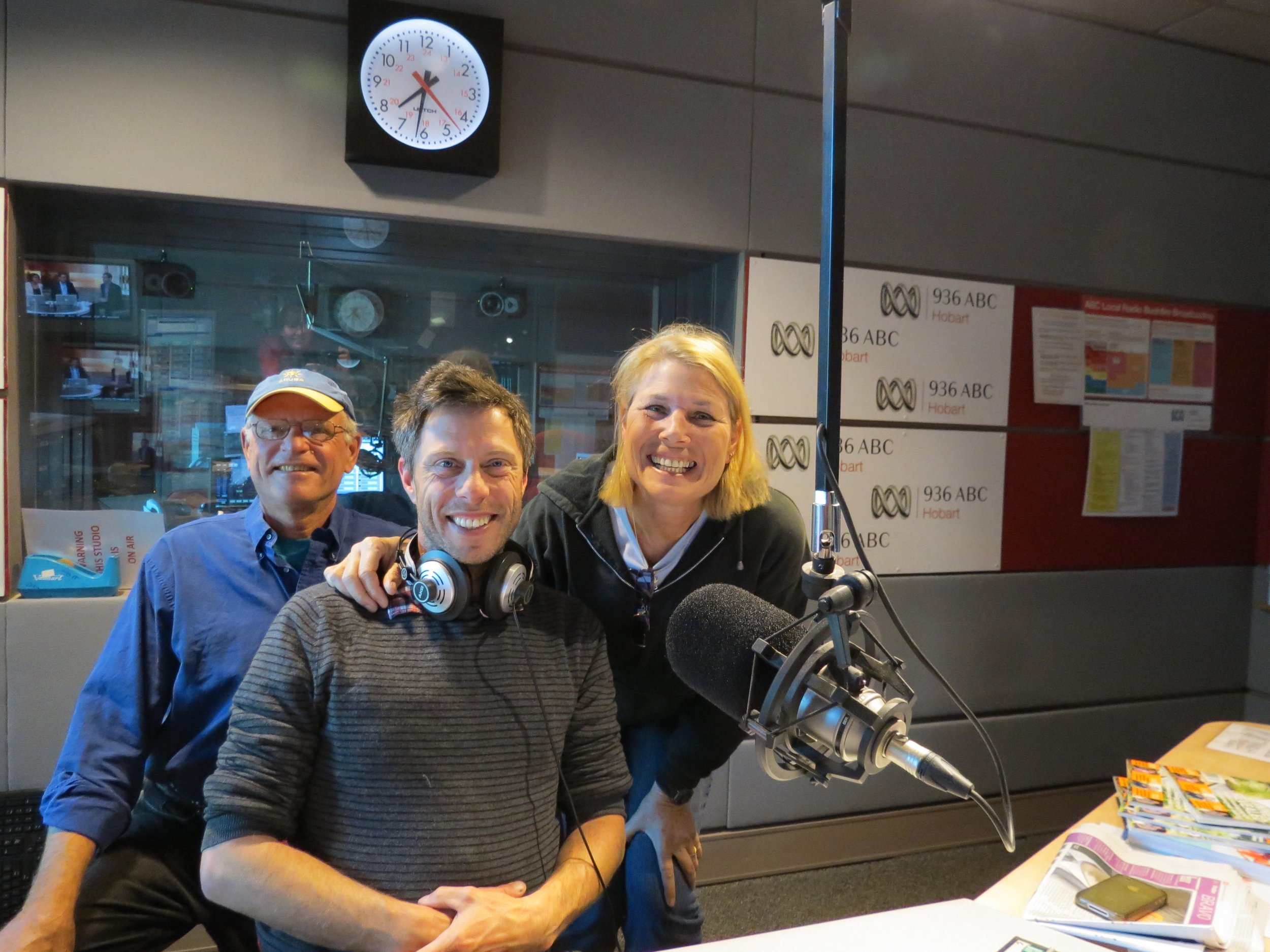
While in Hobart, we received an invitation from ABC Radio to do a live interview in their studio. Absolutely! Read about the interview here.
We got into the spirit of the season by attending the Carols by Candlelight program in St. David's Park.


We opted for a just-the-two-of-us Christmas. We exchanged our small gifts, drank mimosas, prepared an outstanding roast turkey dinner and just enjoyed ourselves and each other.


We left Hobart on Boxing Day (26 Dec) to make room for the arriving Sydney-Hobart racing yachts. We walked from Cornelian Bay into town and watched as Ambersail and crew backed into "our" berth. The winner "Wild Oats" was awarded the prestigious trophy and broke all sorts of records including its own record for best time ever. If you’ll remember, we watched the start of the race last year in Sydney Harbour, so seeing this year’s finish was particularly fun.

“Wild Oats” winner of the 2012 Sydney-Hobart Race
Exploring Tasmania’s East Coast
Soon after the New Year we headed down the D'Entrecasteaux Channel for further exploration of Tasmania’s east coast. It might seem odd that we headed south down the D'Entrecasteaux Channel in order to head north up the Tasmanian coast BUT ... we wanted a good point of sail to head north and we had some goodbyes to say.
Cygnet - 43S10.69 / 147E05.15 - 29'
A hazy sunrise due the bushfires which were raging west of Cygnet greeted us. Cups sat comfortably in Cygnet's millpond of an anchorage. We stopped in for a coffee at the Red Velvet Lounge and met some new friends who offered us their hospitality in Western Australia when we got there. The last time we were in Cygnet, blackberries and apples were in season. This time it was cherries. They were more like crab apples in size than cherries and, oh man, were they ever delicious. We love this little town. We enjoy the Saturday market, the ambiance and the nearby birdwatching at the Wildlife Sanctuary.


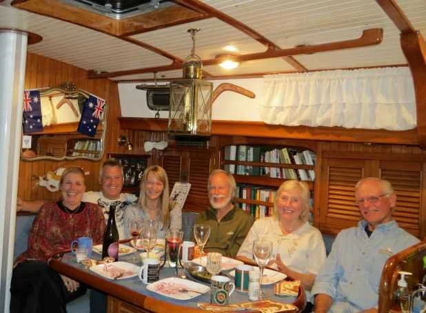
Port Huon - 43S09.55 / 146E58.21 - 23'
We sailed 10 miles up the Huon River to Port Huon and Kermandie to meet up with friends, Mary Anne and Tony Purkiss. We visited the Wooden Boat Centre at Franklin and the Esperance Forest and Heritage Center in Geeveston with Mary Anne as our guide. The best part of being up the river was seeing good friends. We’ve known Tony and Mary Anne since Sydney and kept in frequent touch.


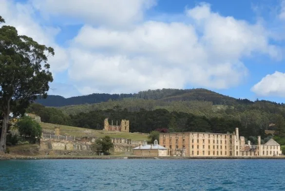
Port Arthur - 43S09.45 / 147E51.58 - 40'
Port Arthur is the most significant of the 11 sites that comprise the Australia Convict Properties World Heritage Site. We were amazed by its size and the enormity of the buildings. We observed a picture-perfect expanse of golden sandstone buildings laying peacefully on a green hillside surrounded by thick dense forest… a virtual artist's pallet. Everything appeared so very beautiful, grand and pastoral from our vantage point … a castle or a huge estate ... until one realizes that this was once considered the harshest penal institution in the British Empire.


The Separate Prison was an isolation facility which deprived prisoners of all sensory stimulation. Prisoners were required to wear hoods over their heads. There were no visitors allowed, no talking, no reading except the Bible. The prevalent thought at the time was that if prisoners had to contemplate their crimes, they would repent. Instead, many went insane. We watched a play in this eerie venue and it was quite poignant.


Puer Point was a boys' reformatory facility. Boys from ages of 7 could tried as adults and transported to a penal colony at age 9. Not much is left of the facility save its infamous history, bricks and sandstone. Across the way, the small Isle of the Dead was the cemetery for Port Arthur. Only a few gravestones mark the dead buried here. Prisoners' graves were not marked. Read more about Port Arthur here in our blog.


In 1996, 35 people were killed by a lone gunman at Port Arthur. The mass shooting later known as the Port Arthur Massacre brought about major changes in Australia’s gun ownership laws. Within weeks of the massacre, strict gun legislation was passed with bipartisan state, territory and Commonwealth support.
Chinamans Bay, Maria Island National Park - 42S40.60 / 148E03.54
Maria Island National Park offers both natural beauty as well as a historic venue. We anchored in Chinamans Bay, named after the Chinese abalone fishermen who plied these waters in the mid-19th century. The island is divided into two halves by a "tombolo", a thin, sandy bar that connects the north and south sections. We crossed the narrow strip on a sandy path for views of Riedle Bay on the other side


Darlington township on Maria Island is another convict site that was built and used in the 1800s. The island has also been used for mining limestone for cement works, farming and sheep raising. Man has left visible remnants of all of his sojourns here like the Commissariat, the island's store and oldest extant building on the island. The Painted Cliffs, eroded limestone cliffs permeated with iron oxide were fabulous to observe with their stunning striated, pink color. Read more about Darlington here.


Triabunna - 42S31.36 / 147E55.09
Across the Mercury Passage from Maria Island is Triabunna, a tired, tiny little town that calls itself the "Gateway to Maria Island" since the Maria Island Ferry departs from its docks. In the 1800s and early 1900s, Triabunna was the supply depot for the Darlington township and was quite a thriving little community. Though many historic houses still existed when we visited, most seemed to be in disrepair. The channel to enter the harbor is narrow and shallow, so we opted to anchor out in Spring Bay with a fine view of the wood chip plant. The main industry of the town beyond the ferry and minimal tourism is crayfishing, Crayfish pots and floats were crammed onto boats tied up in the marina.


We had hoped to visit more of Tasmania’s east coast, but weather and wind worked against us. We headed from Triabunna, straight up the east coast back into the Bass Strait. We caught only a quick glimpse of the Furneaux Group, but had a chance to stop at the Kent Group - Deal Island and Erith Island for another visit. Come on along with us to the Bass Strait Islands here.