

Vanuatu
Originally known as the New Hebrides, Vanuatu is a Y-shaped archipelago comprised of 80+ islands. This Melanesian island nation boasts 113 different languages, a diverse, rich culture steeped in tradition and elaborate ceremony, a live volcano available for tours, lovely villages and warm and friendly people.

Our route through Vanuatu

Republic of Vanuatu (Ripablik blong Vanuatu)
(VAH-noo-AH-too)
Capital: Port Vila (Efate Island)
Population: ~212,000 (est 2007)
Language(s): English, French and Bislama
Area: 12,200 sq km (slightly larger than Connecticut) includes 83 islands,
about 65 of which are inhabited
Currency: Vatu (VUV) - $1US = 84.5 vatu (2007)
High Point: Tabwemasana 1,877 m
Time Zone: UTC+11 hours
According to Wikipedia, multiple waves of colonizers, each speaking a distinct language, migrated to the New Hebrides in the millennia preceding European exploration in the 18th century. This settlement pattern accounts for the complex linguistic diversity found on the archipelago to this day. The British and French, who settled the New Hebrides in the 19th century, agreed in 1906 to an Anglo-French Condominium, which administered the islands until independence in 1980, when the new name of Vanuatu was adopted. Vanuatu translates into English as “Our Land” and the country's inhabitants call themselves Ni-Vanuatu meaning "of Vanuatu".
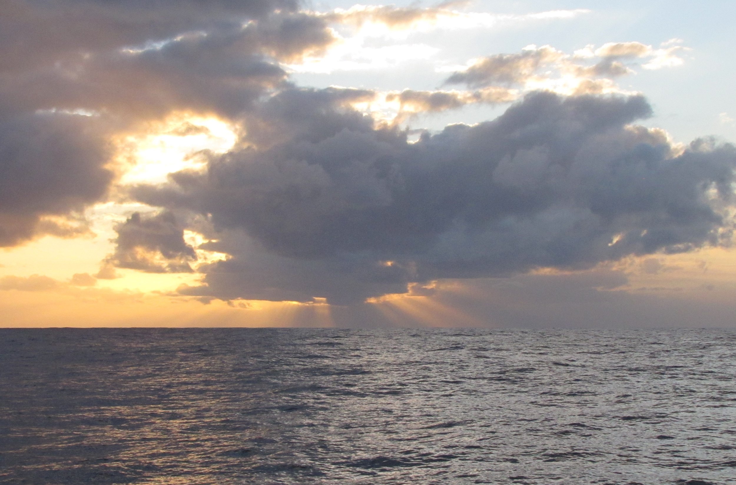
The route from Suva, Fiji to the island of Aneityum (aka Anatom), Vanuatu took us southwest about 550 nm. The going was slow and it took us 5 days to make the passage. We had some good days and some bad days. Our first sight of Anatom was at dawn. The full moon was just setting in the
west silhouetting the island and the sun was rising in the east. Nature's perfect balance.
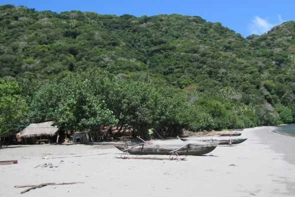
Anelgawat, Anatom (Aneityum) Island - 20S14.35 / 169E16.70 - 42' in sand
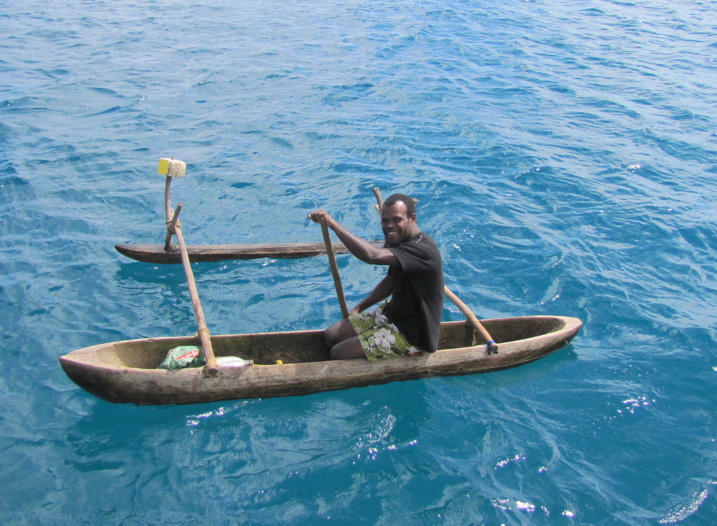
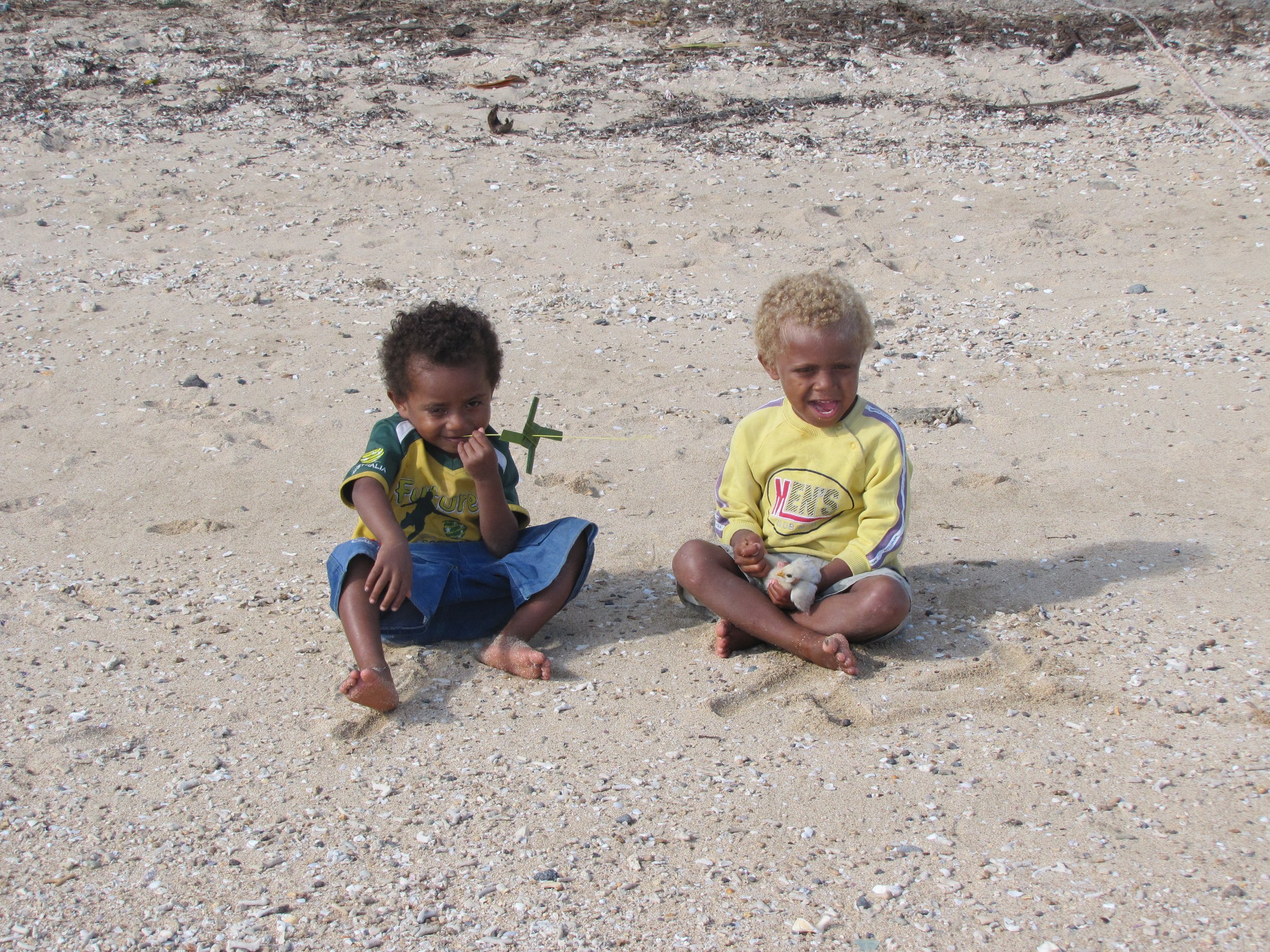
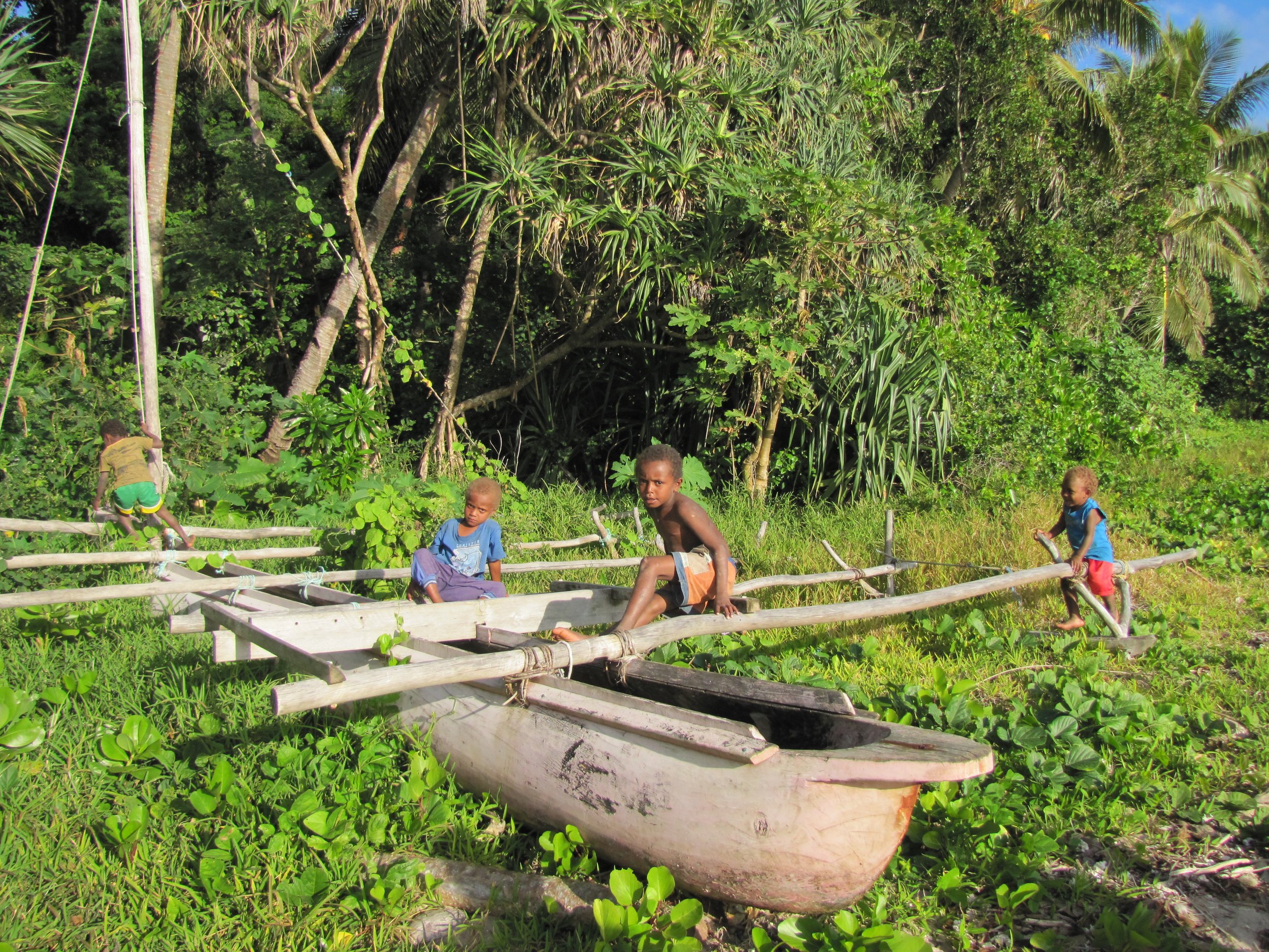
Anatom is the French name for the island and the one used on our charts. Aneityum is an adaption of the French name and Anajom is what the locals call their home island. We were still tidying up Cups when Jesse paddled up in his dugout canoe. He had been out fishing, but offered to show us around the village when we came to shore. As we beached the dinghy, two little kids were sitting on the beach enjoying themselves, one held a handmade pinwheel and the other held a baby chick.
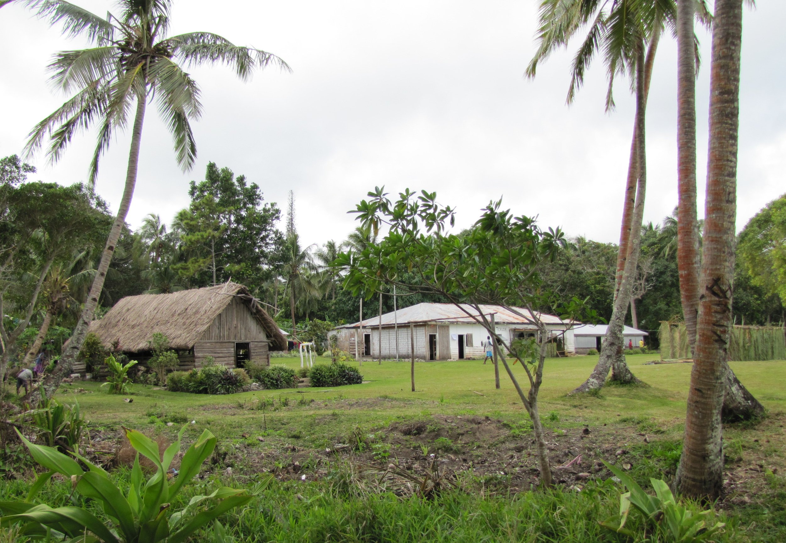
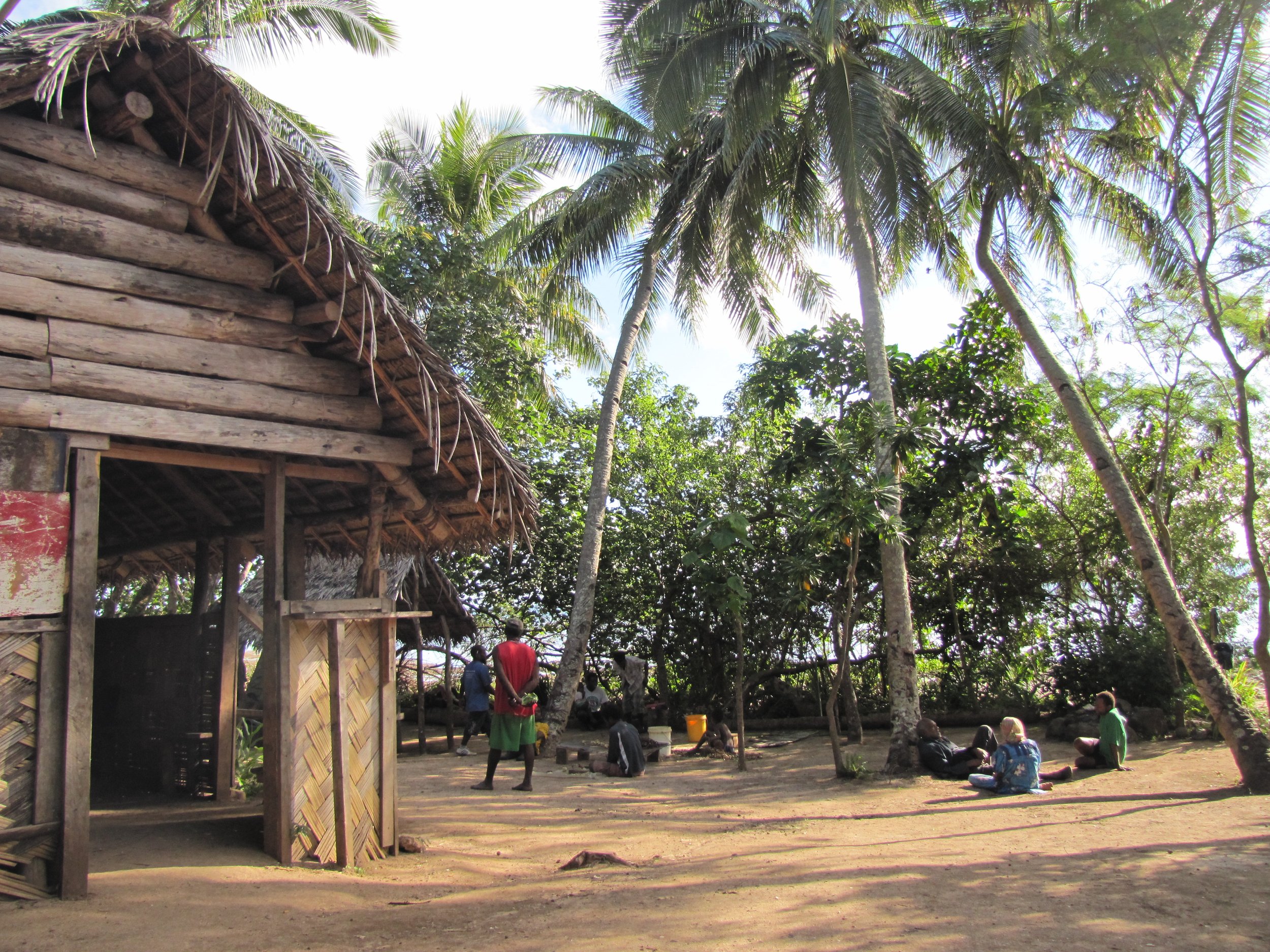
The village of Anelgawat is one of three on the island. The community center meeting place, built cooperatively by the locals has a fresh market and a kava hut. There are no roads and no vehicles on Anatom. Streets are well-worn, hard-packed dirt paths that seem to lead everywhere throughout the town. Outrigger canoes are the primary mode of transportation here although there are some small boats with outboard motors.
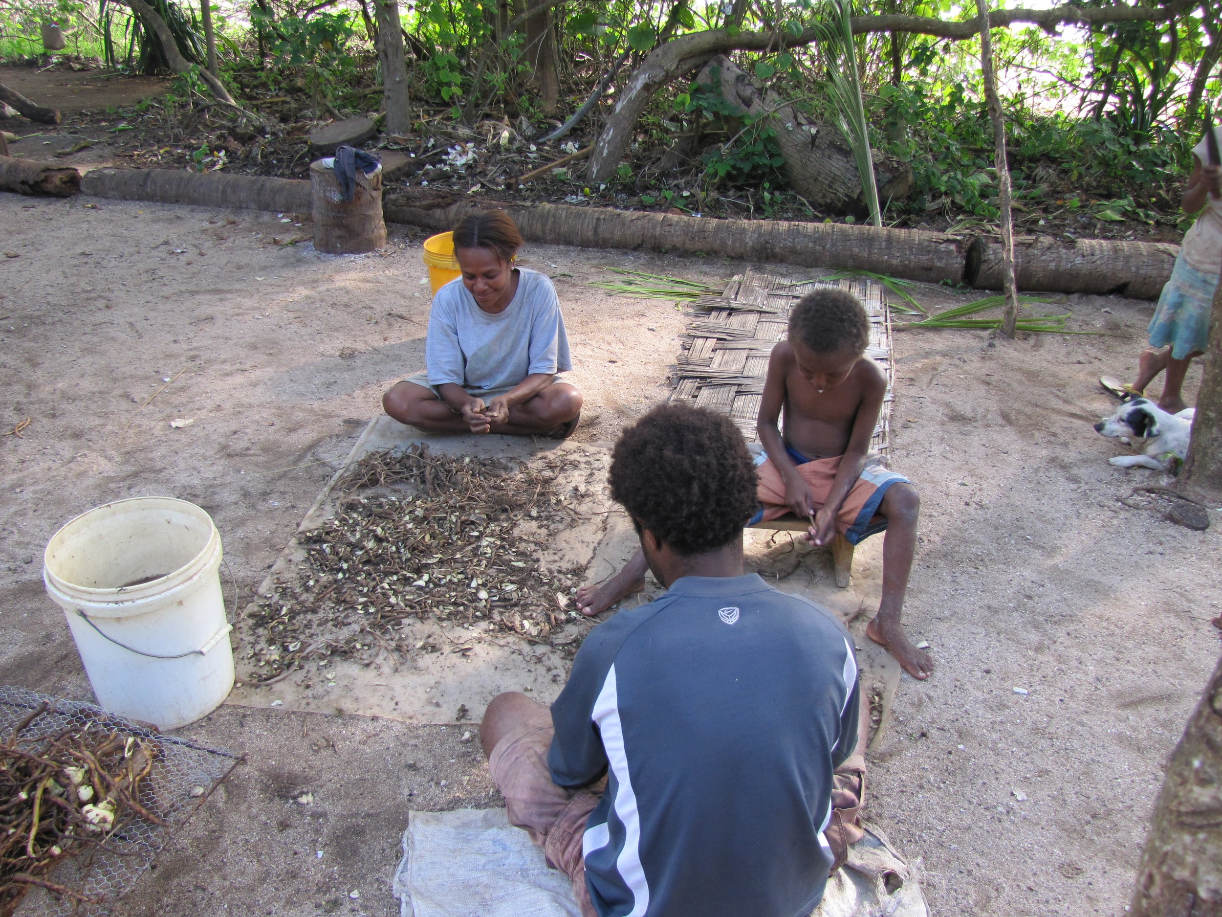
We watched as villagers cut, sliced and ground up kava root for making the mouth-numbing national drink. Preparing kava is a community effort and the kava hut was a popular place. Kava is a gray, dirty dishwater colored liquid served in coconut shell halves and has a bitter, peppery taste. Marcie's lips, tongue and throat were immediately numb. Any amount of dental work could have been performed at this point without complaint.
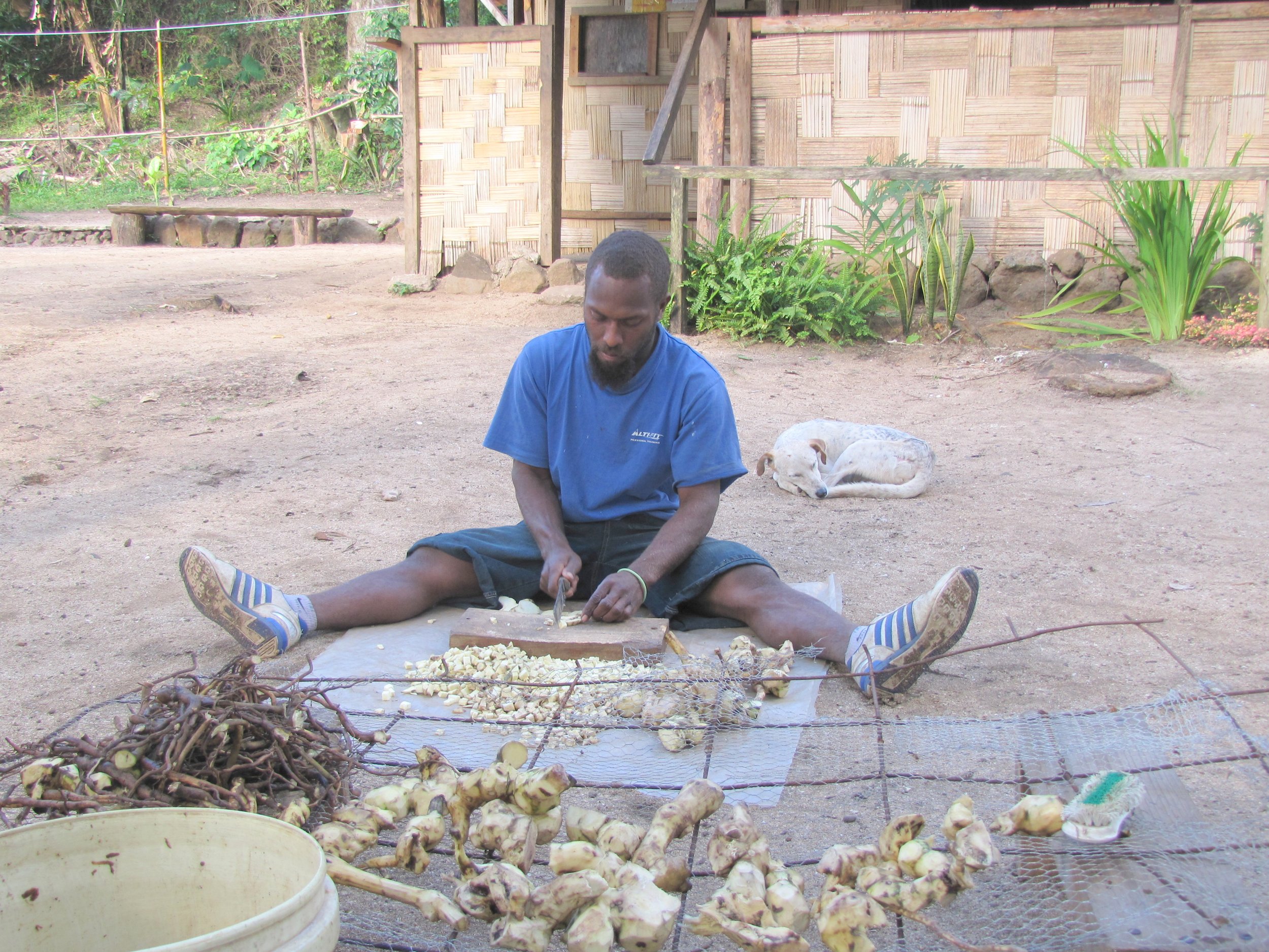
During our visit, the village got together at the community center for a fundraising event that featured laplap, the national food. Laplap is primarily comprised of thinly sliced, layered taro, a starchy root crop. It is cooked in an earthen oven lined with volcanic rocks and thick layers of green palm leaves which are then covered with dirt. The finished product is removed after several hours and while hot, cut and served on fresh palm leaves as plates. We tried some. It's quite tasty!


More so than other island groups we've visited, we've had to be aware of possible health/safety issues in Vanuatu. It's a malaria, dengue fever area so we've had to keep slathered up with insect repellent. There's a particular cone shell whose occupant can give a near-death sting as well as rockfish and lion fish which sting. Salt water crocs some time arrive in the northern islands from the Solomons and sharks can be a problem in some of the bays. There are frequent volcano eruptions. Add to that the usual bad water and food-bourne amoeba, worms and parasites and we had a lot to watch out for!
David became quite a popular guy on the island when they found out he was an engineer and could "fix" stuff. He was 4 for 4 on generators, but didn't do as well with DVD players or inverters. Whenever he came ashore and fixed equipment, it was an occasion for an audience. We got to know several villagers quite well. Though we didn’t expect it, they always "paid" us in vegetables, fruit and eggs.


Mystery Island (Inyeug Island)
Just across the bay from Anatom is tiny Mystery Island. Owned by the community, it is maintained and carefully cultivated for tourists. While we were there, the Pacific Jewel anchored nearby, the 62nd cruise ship of the season to stop here. Nearly 2,000 passengers were disgorged upon the tiny island. Tenders ran back and forth constantly during the morning and afternoon and just as quickly as they arrived, they were gone. The locals derive most of their income from the cruise boats that stop at Mystery Island. Tours and entertainment were offered from fishing and snorkeling to crafts and hair plaiting.


Once the cruise ship and its passengers left, we received permission to visit on our own. What a difference! We found the island much more appealing without the crowds. White beach sand walking paths crisscrossed the island offering superb views of the reef.


Our favorite picture from Mystery island
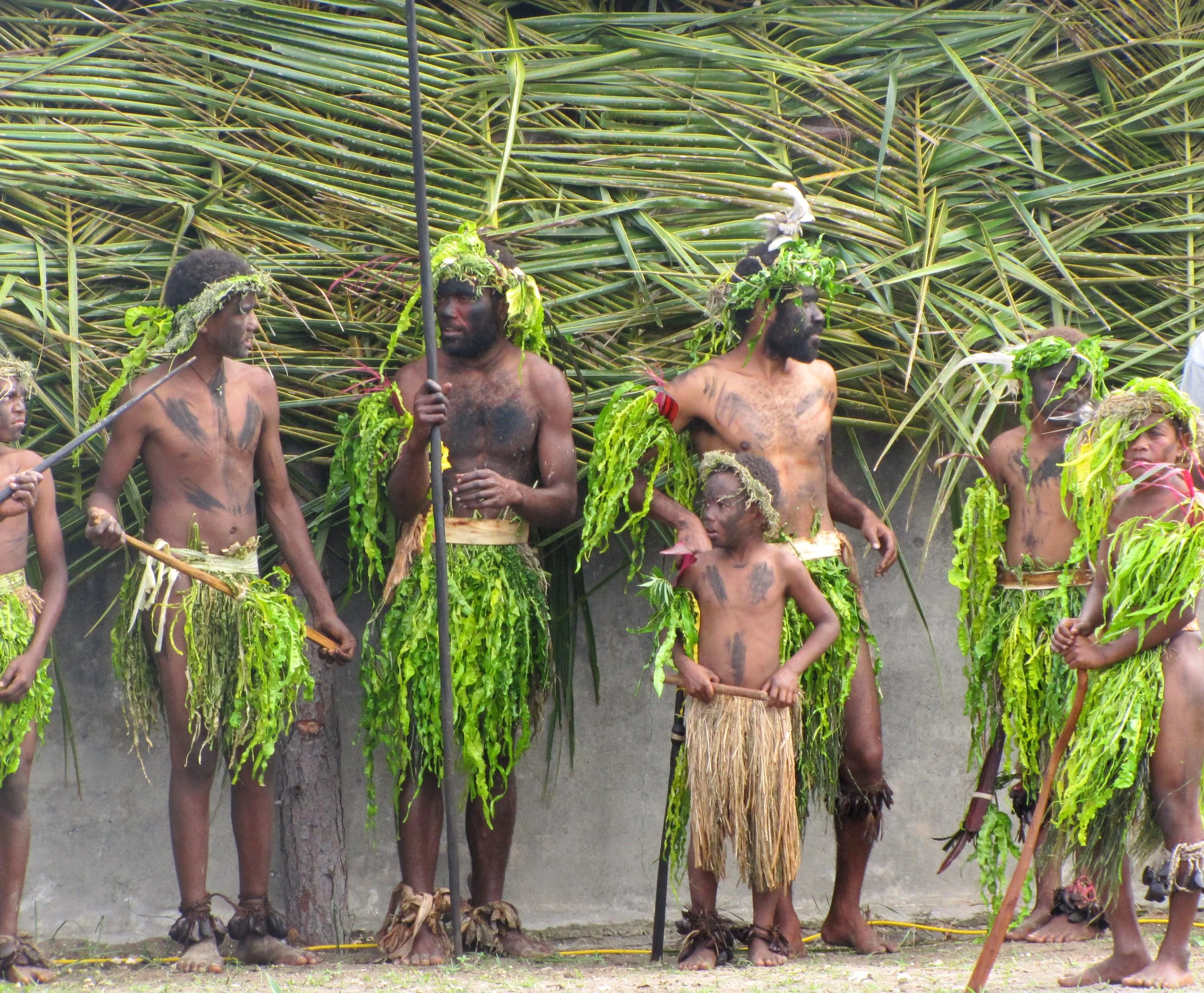
Reconciliation Ceremony
In 1841, Samoan missionaries arrived at Anatom. They were butchered and eaten. For 170 years, the islanders have felt the shame of their ancestors'
actions and have felt that any bad thing that happened to the island was due to the sins of their fathers before them. While here at Anatom, we were invited as honored guests to witness to a Reconcilation Ceremony in which the islanders begged forgiveness and were forgiven. It was an extraordinary event. The reenactment began with the ‘first’ Samoans landing. Warriors raced past us into the water to the Samoans’ boat as it neared shore, feet pounding, screaming and yelling war cries brandishing spears and war clubs. We knew it was a reenactment, but it was definitely realistic. If it was us, we would not have anchored!
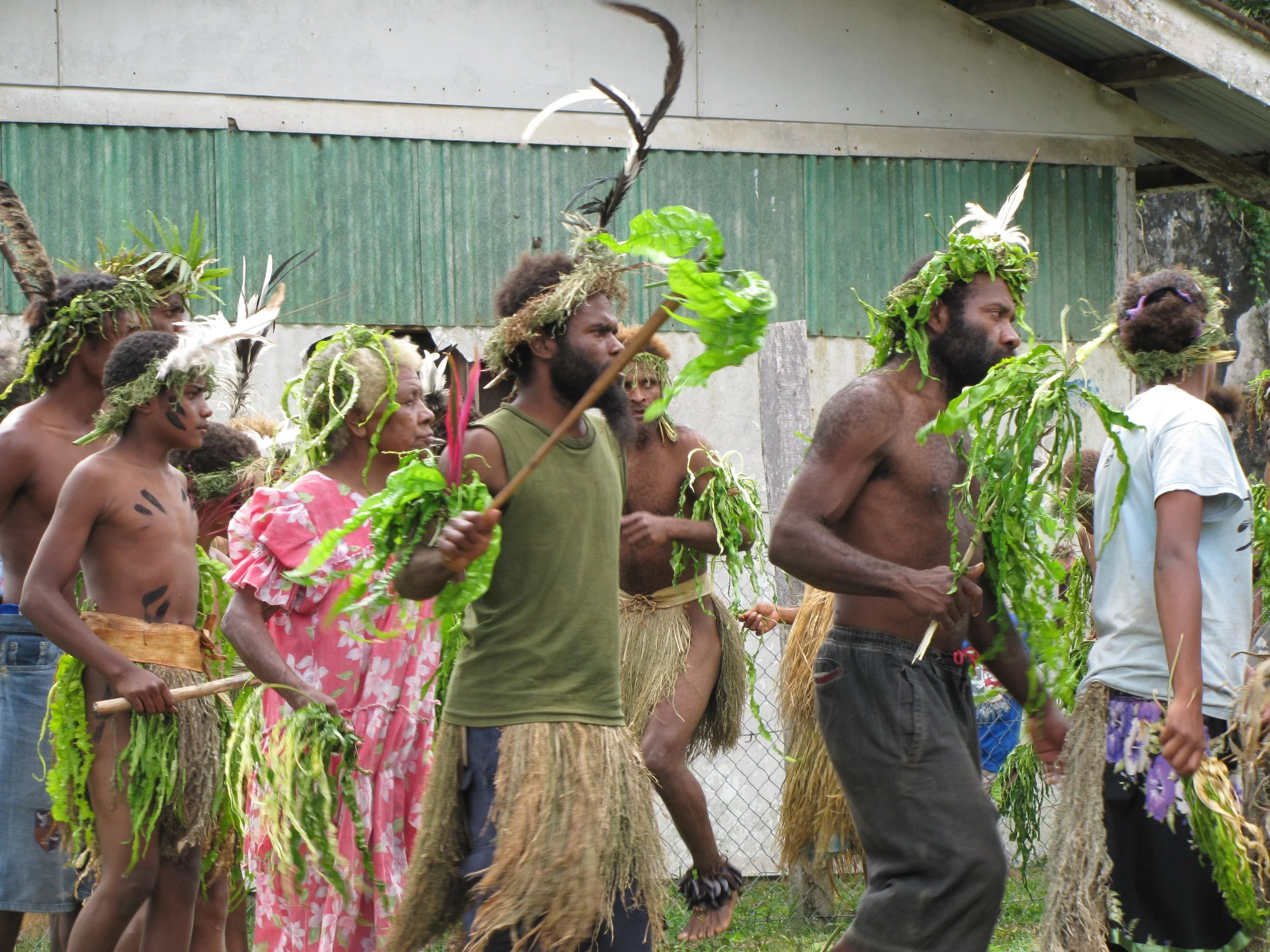
Four days were filled with ceremony and tradition. Colorful groups assembled for welcome songs and traditional “kastom” dancing. The Reconciliation was about making apologies and receiving forgiveness. The village chief and officials were blessed by the Samoan minister. Gifts were exchanged between the islanders and the Samoans. Forgiveness was the theme of these four days. After a most emotional and heartfelt ceremony, each member of the community queued up to shake hands with each member of the Samoan delegation. Then, a pig was slaughtered and prepared in a traditional manner for the evening feast. All in all, an extraordinary few days to observe and experience.


Around Anelcauhat Village
We became fast friends with Natu and her husband, Kenneth. While David worked with Kenneth and the island men repairing generators and solar panels, I spent time with Natu and her family. There are two schools on the island and 200 students. Natu teaches first grade. We had long chats about the challenges in educating the islander children. We had some school supplies aboard which we left with her. Glue sticks were like gold!


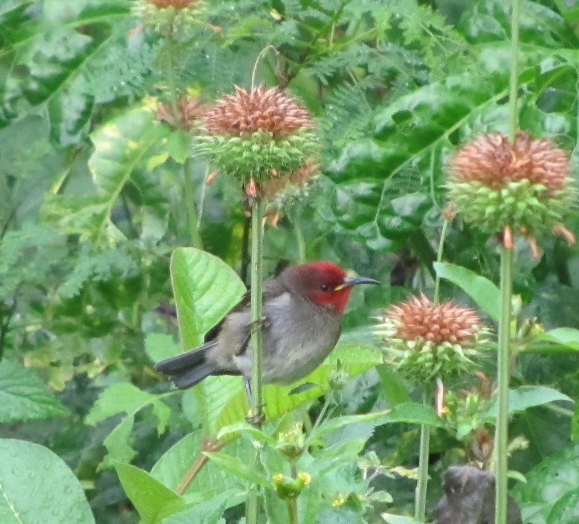
We were free to walk around the little village observing village life. Houses here are basic and either constructed of bamboo with thatch roofs or corrugated tin. Small, fast birds were common, but the villagers eat chicken and raise goats and pigs which wandered about unfettered. We were told that wild pigs (tuskers) were common, but we didn’t see any.


The anchorage is calm and well-protected. At one point, there were seven boats anchored off the island waiting for weather so they could move on.
Port Resolution, Tanna - 19S31.56 / 169E29.75 - 19' black mud
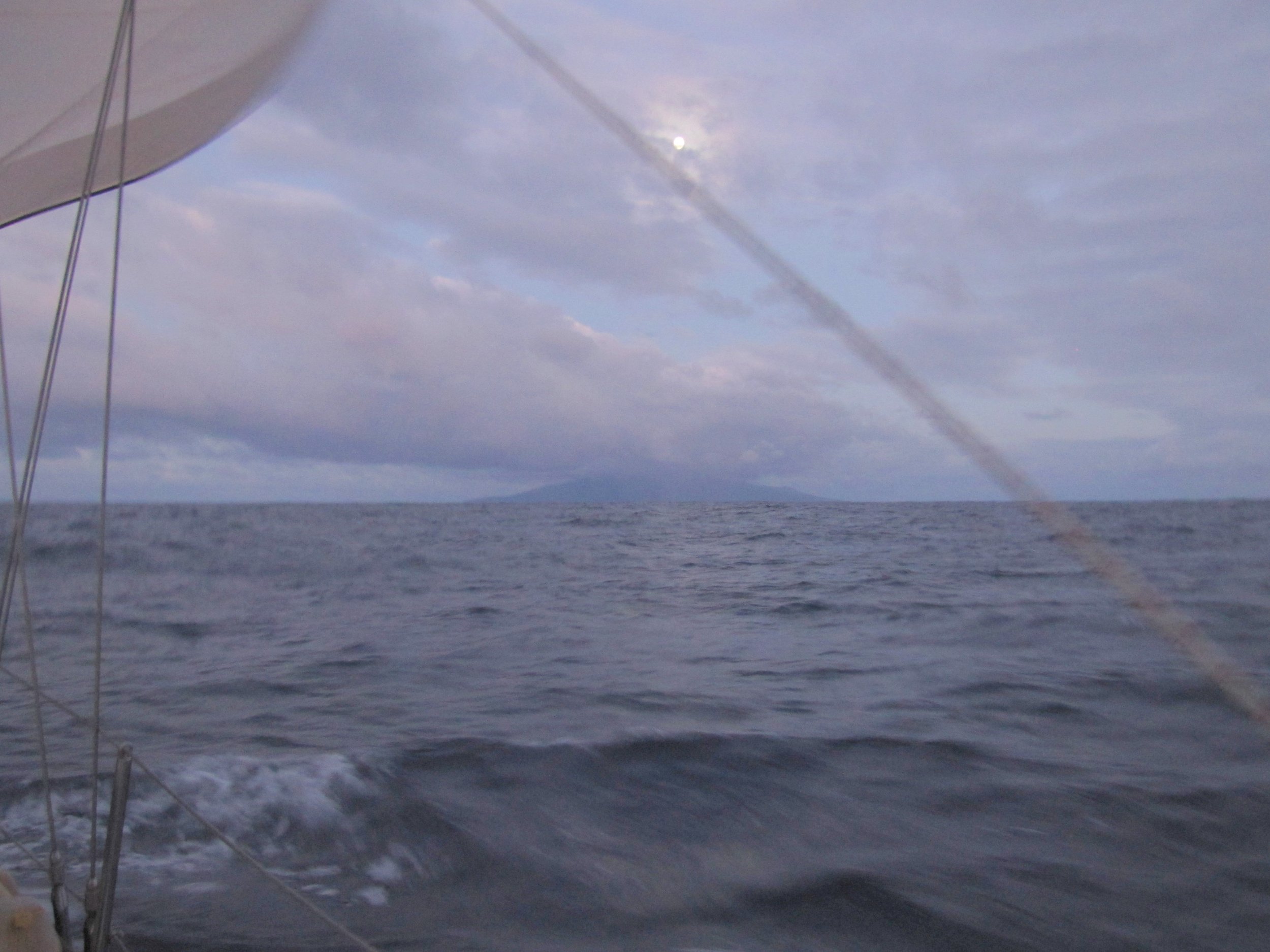
After 10 days at Anatom, we sailed along the island's west coast and headed north about 50nm to Port Resolution on Tanna Island. Captain Cook explored this area and named the village Port Resolution after his own ship in 1774. Tanna in the local language means "earth" and the island is known for its coffee plantations and gardens, but its #1 claim to fame is Mount Yasur, the most accessible active volcano in the world. We were keen to see it and we tolerated Port Resolution's notably rolly anchorage to make the trip up to the volcano's rim.
Tidy Ireupuow (Ir-ah-poh) village aka Port Resolution, has a population of about 200 very friendly people. We met Cyro, the village chief and his son,
Randy, first thing. Wouldn't you know? The chief's generator wasn't working.


The village is very organized and knows how to cater to yachties. Stanley, the yachtie coordinator, arranged a trip to the volcano via the village's 4-wheel drive, 1/2 ton Toyota truck, for us and another boat. After a long, very bumpy ride in the truck bed, we reached the entrance to the volcano. A steep path led us through a naturally black and white, barren landscape up to the crater's rim. We could hear the rumble and feel the vibration long before we reached the rim. The volcano belched thick brown smoke, heaps of steam and noxious blue sulphurous vapor. Once the sun set, all hell broke loose... literally... with a brilliant pyrotechnic display.


After a very unsettling, rolly night in the anchorage, we departed Port Resolution at dawn. Our view of the anchorage was stunning with steam vents rising in the cool morning. A rainbow stretched from the sea and arced over the billowing volcano.


Dillon's Bay, Erromango - 18S49.268 / 169E00.696 - 33' in sand
Erromango, named by Captain Cook, translates to "island of mangoes" in the local language or at least that's what he thought. In actuality, Cook asked what he was given and misunderstood ... it was a yam not a mango.
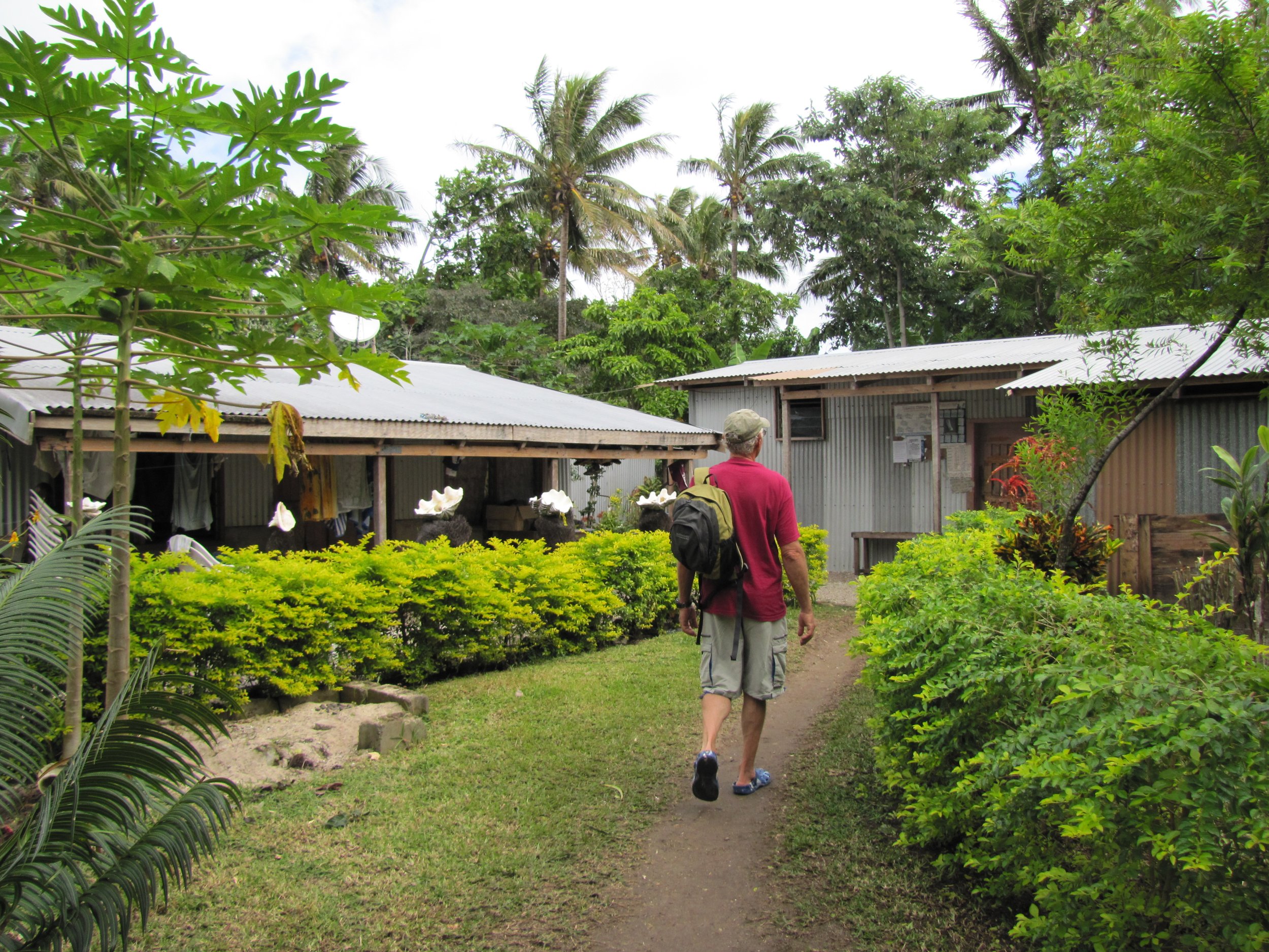
We were the only yacht in the harbor at Dillon's Bay. We could have anchored closer in, but with all the earthquakes less than 40 miles from here, we worried about tsunamis and preferred the deeper water. We met Chief William and asked his permission to stay in the anchorage for a few days. "Stay a month", he said graciously, "you add flash to the harbor and we like flash." Our first day was spent wandering around the village, visiting the school and dinghying up the Williams River to collect fresh water for laundry.
As we set about for a walk through the village, two little boys checked us out. Many of the kids were afraid of our "white faces" and shied away. We met Pastor Robbie who gave David lessons on cleaning green coconuts and then announced that his generator wasn’t working. What surprise! David fixed a generator for Robbie as well as a chainsaw. The longer David worked, the more children appeared in the yard.


We wandered through the village and visited the local school where we were warmly welcomed. We left a few school supplies with the teacher and once again glue sticks ruled! We observed women washing their clothes the traditional way in the fresh water of the Williams River. In the river we saw the bluest blue heron we'd ever seen.


We went ashore the next morning and were met with sad, teary-eyed faces and a tremendous wailing. A well-liked man in the village had been evac'd by plane from the island yesterday. The family at great expense had had to charter a flight for this to happen. Word had just been received that he had died during the night. All the village women joined together to "share" the grief with mournful wailing and keening... a haunting sound as it emanated from the huts. Robbie had planned to take us on an island tour and Chief William had offered to take us to his beach and the burial cave of his ancestors, but with the death, they understandably canceled. The village would be in mourning for the next five days. We felt out of place here and returned to the boat. We left Erromango the next afternoon for an overnight passage to Vanuatu's capital city.
Port Vila, Efate Island - 17S44.88 / 168.18.63 - Moored

Nine of Cups moored at Port Vila with the city in the background
The trip from Erromango to Vanuatu's ‘big smoke’, the capital city of Port Vila on Efate Island was 84 nm and an overnight passage. We left Dillon's Bay late afternoon and arrived in Port Vila midday. Port Vila, or just Vila as the locals call it, is situated at the head of a horseshoe bay. James Cook originally surveyed the area and named it after his patron, Lord Sandwich, but the islanders' name for it, Efate, has prevailed. With a population of about 46,000, it's one of the South Pacific's largest and most attractive towns. We were looking forward to well-stocked supermarkets, fresh market fruits and veggies and showers... oh yeah, and internet!
We picked up a mooring in the calm, deep waters right off the downtown area of Port Vila. The town lived up to expectations. Port Vila was busy and bustling and seemed to have most everything we needed or wanted. The French influence here is seen in the fresh baguettes for 60 cents each and a grand supermarket, Au Bon Marche, which was well-stocked, tidy and had so much variety we were nearly overwhelmed. People were friendly... drivers even stopped for pedestrians. As wonderful as it was, we needed to provision, do some chores and get moving in just a few days to head north through the rest of these enchanting islands before it was time to head to Australia before the cyclone season. No lingering allowed.
Though time was short, a visit to the Vanuatu National Museum was a must. Entry fees for the Nasonal Miusium Blong Vanuatu... Bislama for Vanuatu National Museum was 700 VT/each. One of the most interesting art forms in the northern islands is sandroing (sand drawing). It provides a method of illustrating local legends and telling stories with elaborate designs. Our docent, Edgar, was from the island of Espiritu Santo and drew the designs pictured below while telling accompanying stories. He began as illustrated and then, never raising his finger, completed the most intricate, beautiful designs. Drawings complete, he played a bamboo flute-like instrument and sang a traditional song in a low, quiet voice. A most fascinating demonstration made us anxious to visit the islands where this art is still practiced.


Around town in Port Vila... Tree fern carvings were a familiar sight throughout Port Vila; men play pétanque (like bocce ball) at the waterfront park. The fresh market was outstanding, spanning the area between the main street in town and the waterfront and open 24 hrs/day except Sunday. Fresh flowers, fruits and vegetables are all locally grown and we took advantage of the freshies. Green, woven pandanus palm baskets full of kumala (sweet potato) and bundles of taro were for sale.


Ai Creek, Havannah Harbour, Efate - 17S36.29 / 168E14.62 - 37'
Revolieu Bay, Epi - 16S43.65 / 168E08.62 - 36'
Lamen Bay, Epi - 16S35.72 /168E09.69 - 43'
From Vila, we anchored in Havannah Harbour for one night en route to Epi. We planned on one long day's passage, but we were slower than anticipated, and rather than risk arriving at night, we pulled into Revelieu Bay, about 10 miles shy of Lamen Bay, our planned destination. En route to Epi, we were entertained by a large pod of bottlenose dolphins. We shared the anchorage one night with ‘T6’ which brought its passengers aboard
via helicopter. They didn’t invite us for drinks… or helicopter rides.


We anchored in Lamen Bay on the island of Epi. We went ashore and wandered around, but really didn’t meet any locals. We saw folks around and though they said hello, they didn’t appear eager to engage with us. A typical Epi village hut is used only for sleeping. All cooking done outdoors. Shelves in front hold baskets and basic cooking pots and utensils.


Ranon, Ambrym - 16S08.49 / 168E07.00 - 22'
Ambrym is referred to as the Black Island perhaps because of its twin active volcanoes, Mt. Marum and Mt. Benbow and hence its black volcanic soil which reminded us of used coffee grounds. Or maybe it’s called the Black Island because it is the most mysterious island of Vanuatu with strong witchcraft, sorcery and traditions of magic? On Ambrym, we met Ronnie, a carver and our host in Ranon. He invited us for kava one afternoon and provided lots of fresh fruits and veggies. He was very articulate and openly offered information about Ambrym and its culture. At the nakamal (kava bar), we asked and he answered question after question. Yes, there really is strong magic on Ambrym. Many sorcerers practice both black and white magic. Too many unexplained, strange things have happened to ignore the power of these "men blong magik".


Gaspard Bay, Maskelyne Islands - 16S28.47 / 167E49.12 - 46'
From Ambrym, we went west and south to the tiny Maskelyne Island group off the larger island of Malekula and anchored at Gaspard Bay. We stayed one night only with hopes of seeing a dugong, a manatee-like critter and Vanuatu's only native marine mammal. We saw several, but never long enough for a photo. In this same bay Chief Jackson came aboard to show us some of his ‘magik’.
Excerpt from our blog:
Jackson, chief of the local village, paddled up in his dugout canoe. He was quite the character. First, he welcomed us and then told us he usually charged 1000 Vatu for anchoring in the bay, but he'd take a bag of rice as a contribution to the village in lieu of cash. He offered to teach us some of his tribal magic if we invited him aboard. How could we say no? Marcie was baking cookies and he waited patiently... eating a half dozen warm cookies while waiting. As soon as she finished, the magic lessons would begin. He and David chatted amiably in the cockpit. When Marcie finally joined them, he described all the wonderful things he could do with his magic... heal the sick, calm storms, make rain or catch fish anytime he wanted to. In fact, we could tie him up and throw him overboard with a huge stone attached to him and he could just walk away unharmed. Normally, this knowledge is only passed from chief to first son, but it seemed it was okay to pass it on to yachties since we were leaving and not in competition with his tribe.
He asked for a small cup of water and some "sampu"... hmmm? A sample? No, sampu! Ah, shampoo? Yes, sampu! Marcie was instructed to go below since she couldn't witness the strong magic that he was passing to David. The process included David removing all of his clothes, lying on the deck and Jackson murmuring incantations and rubbing David's body with the "sampu" and water. That phase completed, Jackson requested Marcie to remove all of her clothes and lie on the deck for the same ritual.
"Oh, I don't think so." said David. "It's not our custom for other men to see our wives naked or have strange men, even chiefs, rub our wives' bodies with water and "sampu"."
"Ah, yes, but I'm a chief, David, and it's okay to do this. Otherwise, I can't transfer the magic and something bad might happen to your yacht."
"We'll take our chances", countered David. "Perhaps, you can think strong, positive magic thoughts to keep our yacht safe."
"You should have told me before we started that your customs do not allow your wife to remove her clothes. It's very, very important to finish the transfer of the magic. Do not be afraid." Jackson was making a strong case for Marcie's nude participation.
"I didn't realize that Marcie removing her clothes was part of the magic transferral. We're very sorry for the misunderstanding, but this is tabu.”
"I can keep the sampu?"
"Certainly."
Jackson ended his argument. With a bag of rice, 1/2 dozen more cookies, the rest of the sampu and one of Cups' old hatches in his dugout, he bid us farewell and paddled off to see a friend.
Southwest Bay, Malekula - 16S29.54 / 167E25.95 - 33'
With Marcie still clothed, we left Gaspard Bay and made our way around the bottom of Malekula. We threaded our way through the narrow canals and reefs in the Maskelynes and had a great sail up the west coast of Malekula to calm, serene Southwest Bay where we stayed a week to do boat projects. We watched a sunset with Ten Stick Island in the foreground. Rumor has it that American military during WWII paid 10 sticks of tobacco to be able to use the island for target practice. During WWII, up to 500,000 military personnel were stationed in Vanuatu, then known as the New Hebrides, as a base from which to fight the Japanese in the South Pacific.
The villagers of Lembinwen Village seemed to work harder than any other island we’d visited, paddling daily to tend their gardens inside the huge Tsiri Lagoon, the entrance of which was just beyond the beach where they left their dugouts. We met Sailon and his family and David followed him into his house to works on solar panels. One day, a Swiss yachtie, Walter on Cinderella, joined David for a generator repair session. Folks queued up for time with the generator doctors.


Dixon Reefs, Malekula - 16S21.29 / 168E23.02 - 36'
These pictures do no justice to Dixon Reefs at all. Since we don't own an underwater camera, these were taken from the dinghy looking at the reef below. What you can't see is the glorious, healthy coral in different types, shapes and sizes and every color of the rainbow. The fish were wonderful. Big fish, little fish, blue fish, red fish... even sharks.


A word about Bislama...
Since over 100 languages are spoken in Vanuatu and each island in Vanuatu has at least one unique spoken language (Malekula has 23!!) which are not understood by neighboring islands and/or villages, a common language of Bislama (Bichelama) or Pidgin English developed. They speak it quickly and it's hard to follow, but we found reading it off signs and posters and then saying it out loud helped the comprehension process.
Here's a sample:
Wanem nem blong yu? What's your name?
Nem blong mi is... My name is....
Yu save tok tok long Bislama? Do you speak Bislama?
Sore, be mi no save tumas Bislama. Sorry, I don't know much Bislama.
Please/Thank you (very much) Plis / Tangkiu (tumas)
See you later, goodbye Lookim yu afta, tata
Bia blong yumi (A Tusker beer ad left) Our beer - A beer belonging to you and me
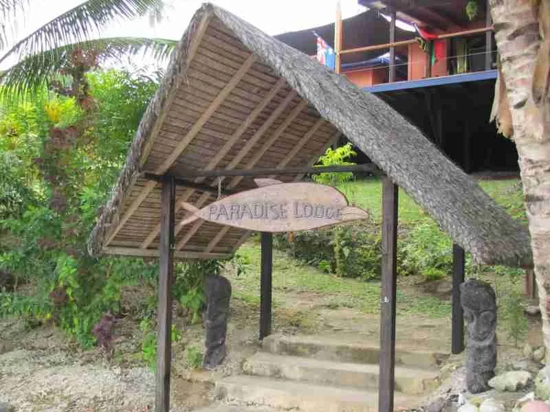
Paradise Lodge Moorings -Aore Island, Espiritu Santo -15S32.52 / 167E10.42 - Moored 122'
We anticipated a stop between Dixon Reefs and Luganville, but the winds and current were with us and we flew. When we entered the Segond Channel, the water was calm as a mill pond. Across from our mooring was the "city" of Luganville and Espiritu Santo Island, locally referred to as just ‘Santo’. James Michener was stationed at Epiritu Santo during WWII and based his book, South Pacific, on this area. The imaginary Bali Hai is supposedly the island of Ambae.
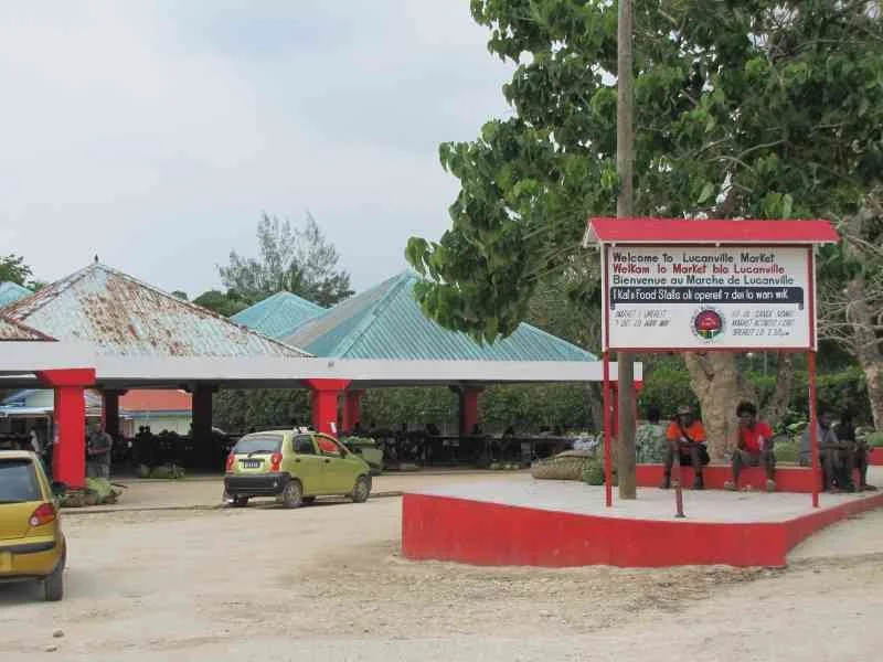
Alan & Debra Profke owned and operated the Paradise Lodge. Aussies, the Profke’s visited Santo in 2005 on a diving vacation and fell in love with the people and the place. They owned seven moorings and a beautiful home here where Alan was a physician and operated a medical clinic for the locals. Just a dinghy ride across the Segond Channel was Luganville, Vanuatu's second largest (and only other) city. We weren't in Luganville long. There wasn’t much to see. All shops and services stretched along one main road. The fresh market, however, was good and LCM, the main supermarket, had a good selection of groceries and drygoods, so we stocked up.

Peterson Bay, Oyster Island, Santo - 15S22.35 / 167E11.40
From Luganville, we headed along Santo's east coast past Million Dollar Point so named when the US Military deposited all its unneeded equipment in the sea when they departed at the end of WWII.
Peterson Bay, tucked in behind an island and several reefs, is a hurricane hole. Entrance is tricky between the reefs, but once in and solidly anchored, we felt very few effects of the wind or sea and it was a perfect place to work on the boat. Besides being well-protected, it offered another substantial bonus: the Oyster Island Resort. Oyster Island offered free internet to cruisers. With our long range antenna, we were able to have internet (albeit painstakingly slow) on the boat. Besides internet, Oyster Bay also offered a nice restaurant, a bar with happy hour for cruisers, a beautiful, private 25 hectare island to explore with well marked footpaths throughout, reefs, snorkeling areas and secluded beaches.


Between work days and projects, we managed to walk the paths and explore the island. More exciting however, was the proximity of the Nalaiafu River and its blue hole. The thickly reefed entrance to the Nalaiafu River gives way to a jungle-like setting and leads to the fresh water blue hole. Watercress encroached on the river from both sides. It was so thick in some areas it fouled the prop on the dinghy engine as we tried to get through. It was well worth the effort, however. The blue hole gets its blue hue from calcium carbonate deposits. Thewater was crystal clear, spring-fed, fresh. I


All too soon, it was time to leave Vanuatu and head to Australia to shelter during cyclone season. We missed visiting many areas that were on our planned itinerary, but what we did see and experience was fantastic. Cyclone season waits for no one. We headed back to Luganville for re-provisioning, duty-free diesel and final check-out and we were off.
Next stop? Chesterfield Reef en route to Australia. It’s an absolutely magical place. Join us!
Recommended reading:
To Kill a Bird With Two Stones - Jeremy MacClancy - a good history of Vanuatu