

A Speedy Recovery at Penitente Canyon
/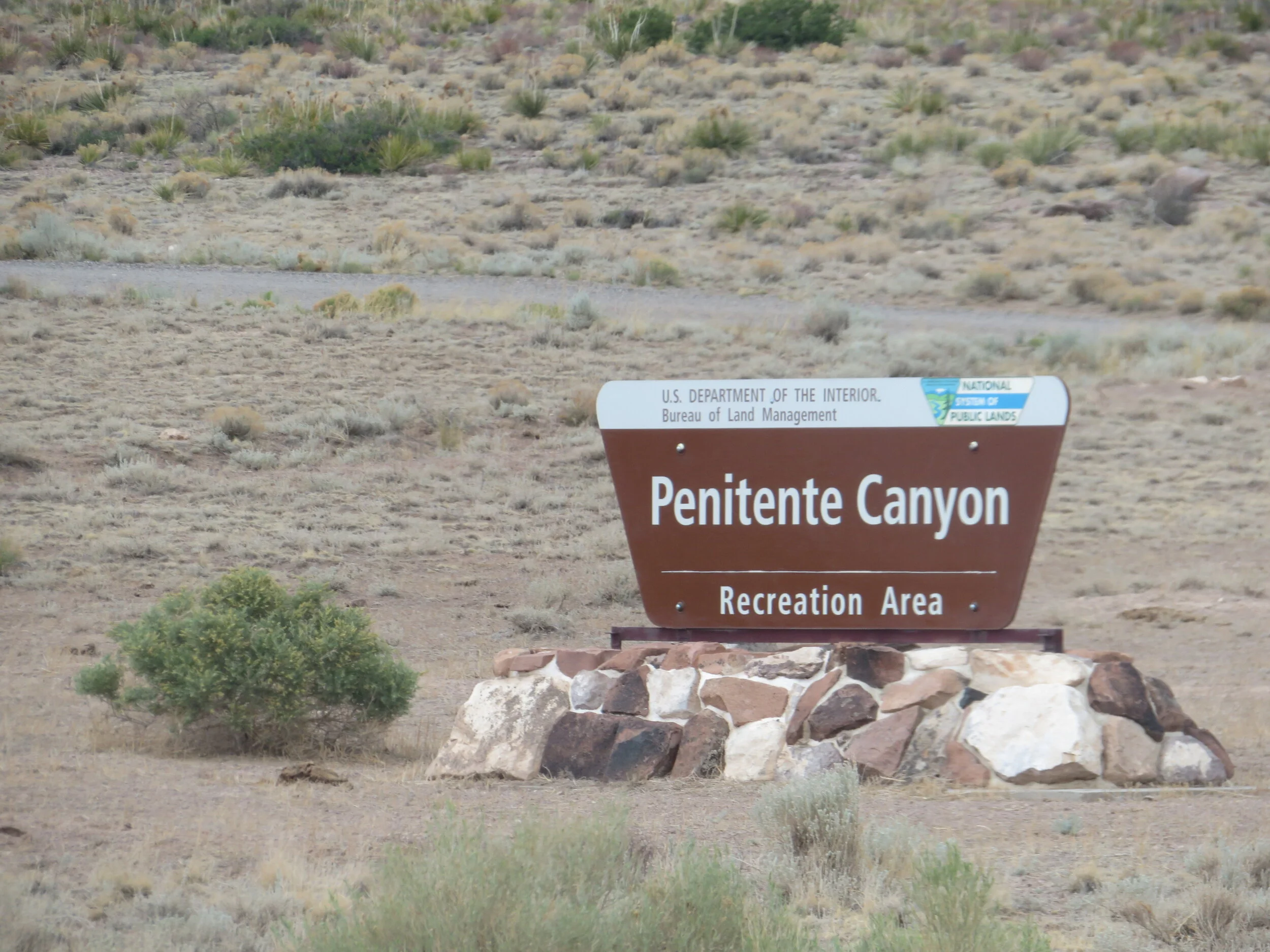
It’s amazing what antibiotics, a hot shower and a good night’s sleep can do for a body. Though I’d be taking antibiotics for the next week, I was feeling just fine and we headed back to Penitente Canyon for a couple of camping nights. These rugged canyonlands consist of 4,552 acres managed by the BLM (Bureau of Land Management) primarily for recreation including rock climbing, mountain biking and hiking.

A primo campsite
The primo campsite we’d chosen two days before and had to abandon was still available and we claimed it immediately. We decided we’d give the 7,900’ altitude another try and if either of us experienced any distress, we were only 10 miles from the highway and a lower altitude. As it worked out, we thankfully had no problems. Perhaps, we were finally acclimating to the higher altitude.

Heading off on the Blue Sky Loop
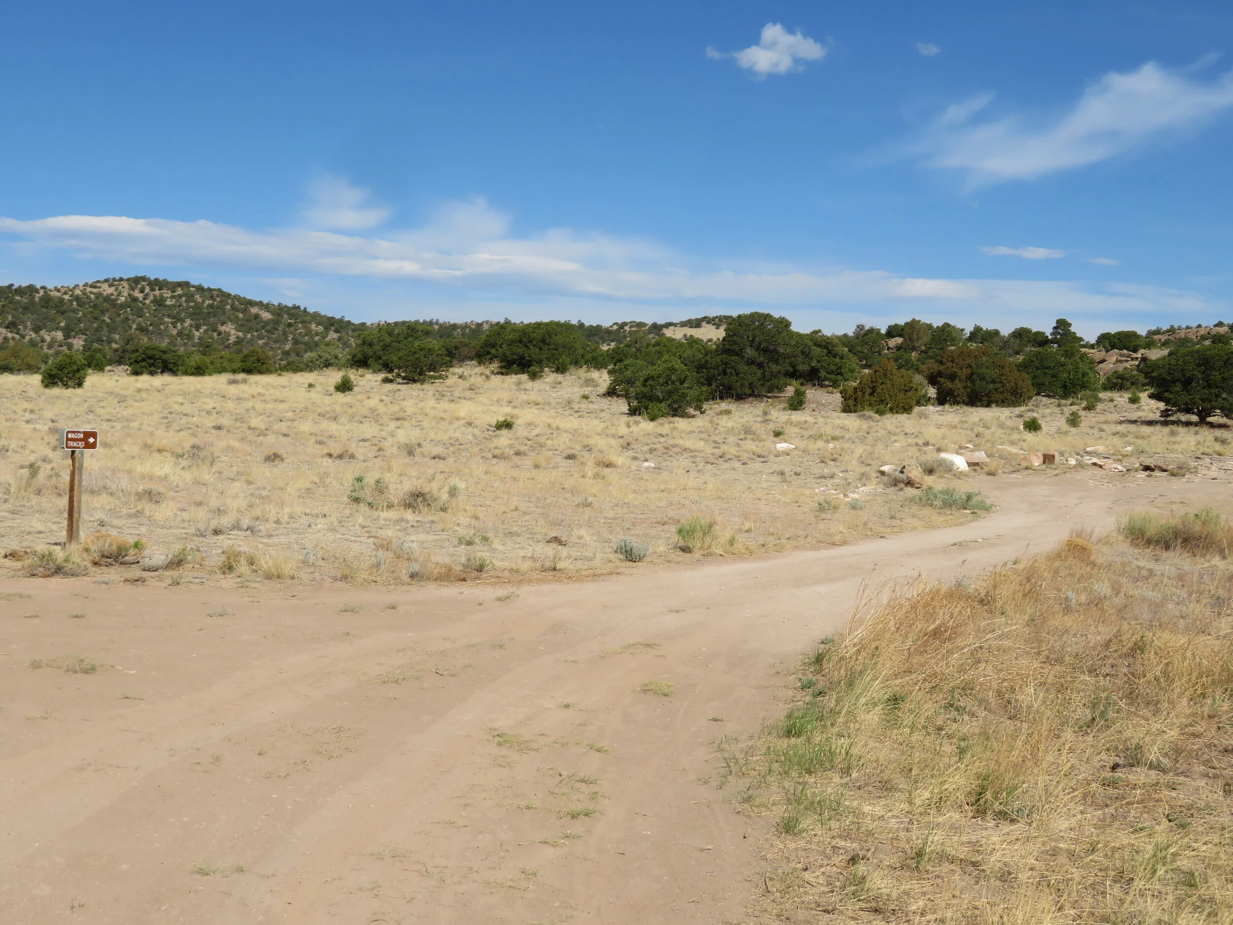
Though I was feeling pretty good, I didn’t want to overdo it. We settled on walking the Blue Sky Loop, a 3-mile, lightly trafficked, moderate trail. The path was rocky and rough in places, but not a problem for us seasoned hikers… though we did huff and puff a little. It is also a mountain bike trail and we marveled at how difficult it must be to maneuver and negotiate the steep, rocky trail on a bike. We figured at least one of us would be incapacitated for the foreseeable future with multiple cuts, contusions and broken bones if we attempted it. I think we’ve decided bike touring be our goal and even, at that, we certainly need practice.
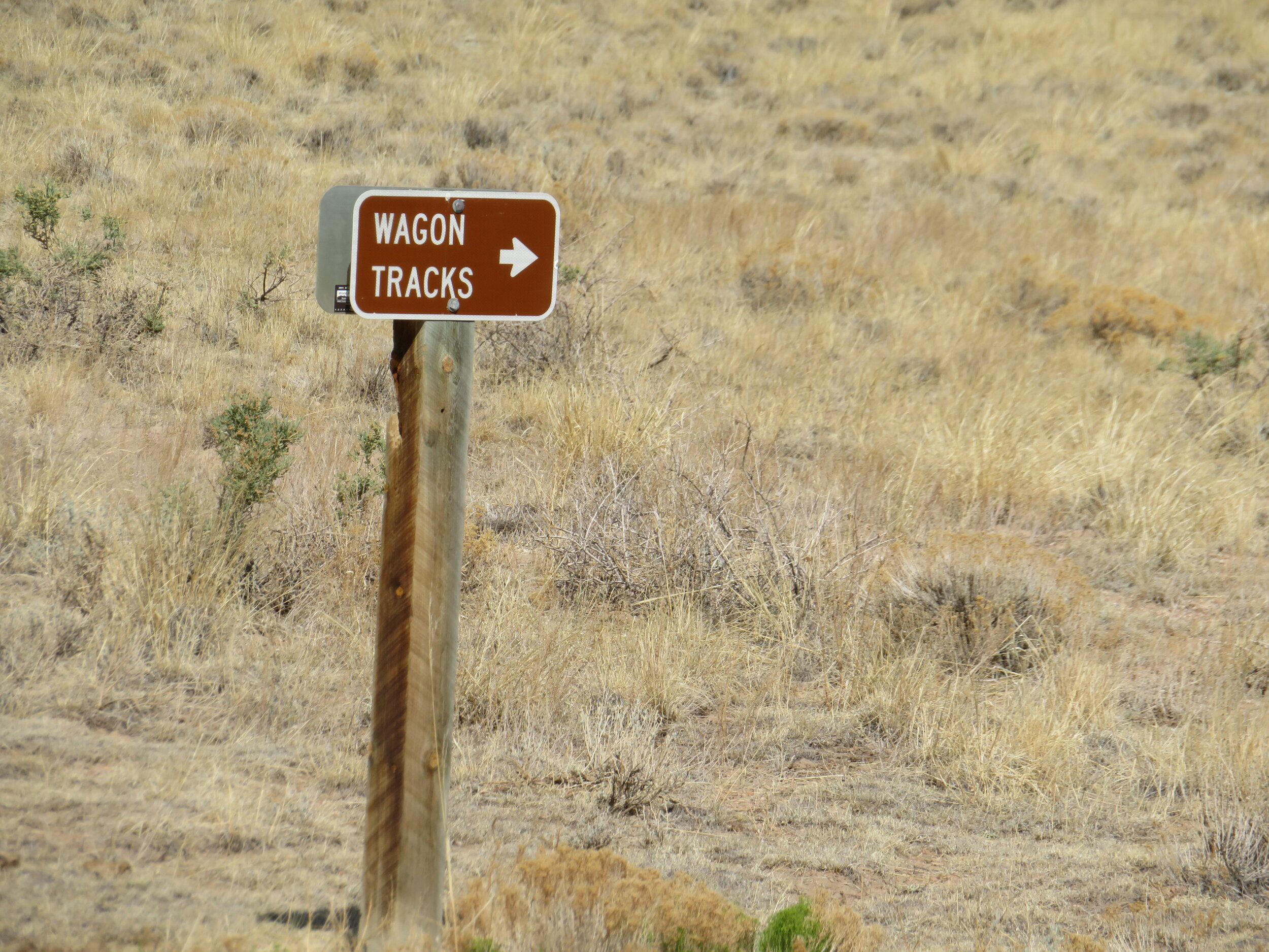
Back to walking… the area has lots of history. The canyon is a remnant of volcanic eruptions which occurred between 20-30 million years ago. Utes, Jicarilla Apache and Puebloans hunted this area as early as 2000 years ago. Explorers and trappers have roamed the area. Ruts in the road are still visible, the wagon tracks of ‘carretas’, two-wheel carts pulled by oxen across the soft bedrock, used by Hispanic farmers and sheepherders who settled in this area in the mid-19th century.
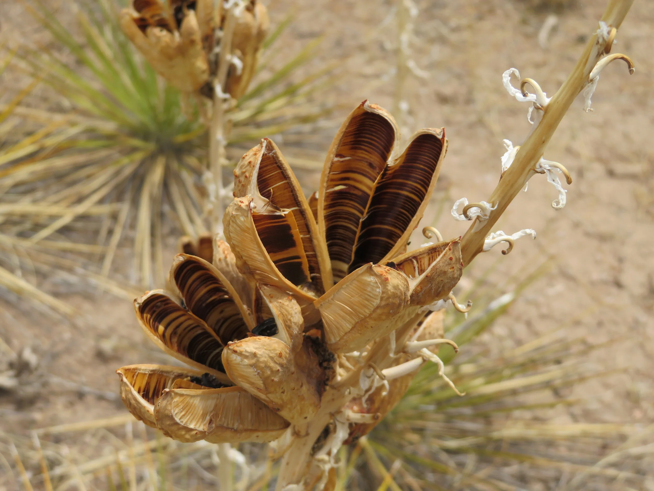
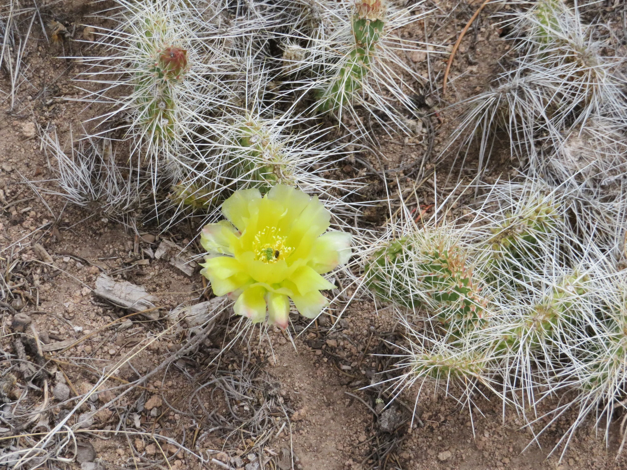
We only met a couple of other hikers in our 3 mile walk. They warned us of a rattlesnake they’d just seen, but we already had our quota of rattlesnake sightings and saw nary another one. Yucca had past and reminded me of milkweed pods in the autumn in New England, but cactus were in bloom, a colorful contrast to the drab dirt and rock of the trail.
Don’t get me wrong, the trail was wonderful… rugged and rocky enough to keep us interested and alert, but not so difficult that we couldn’t manage. In fact, we enjoyed it so much, we walked it again the next day, enjoying it just as much, but as usual, seeing it in a different perspective the second time around. We could have stayed longer and walked more, but this seemed to be my limit for the day.

The Royal Gorge Bridge over the Arkansas River … from a distance, of course!
We packed up after our two night stay and headed to Pueblo for the night. En route, we stopped at the Royal Gorge in Canon City with the intent of walking across the famous bridge. We really should have thought this through a little more. Why ever would we think we’d be the only ones interested in seeing the Royal Gorge? The place was packed. People everywhere with nary a mask in sight. Social distancing was evidently not a concern here for many people. Except for us, that is. We took a couple of pictures from a distance, then returned to Blue and headed on to Pueblo. The Royal Gorge will be there next time around.
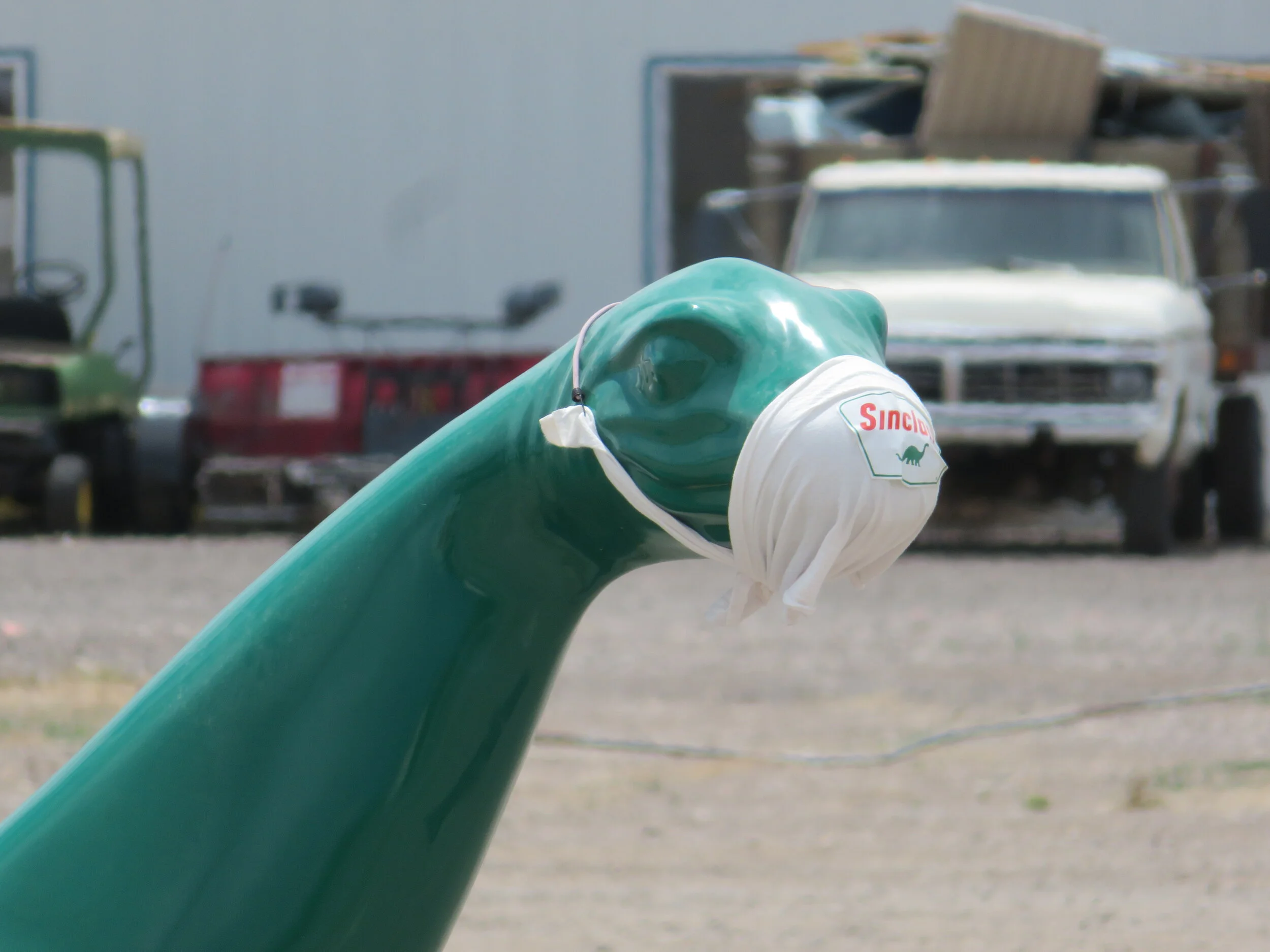
What’s so hard about wearing a mask? Even the dinosaurs do it!
Nature, despite the pandemic, is still awesome and we find if we stay in more remote places with less people and more open space, we are happier… and safer.
We’re heading to Colorado Springs and then up into the Front Range of the Rockies for a chance to catch up with our son, a ‘skoolie’ owner and current camp host. C’mon along for the ride…