

Getting to Nebraska… Now What?
/It has taken us three days to get to Nebraska. We were on the road by 0800 after our normal morning neighborhood walk and a final pack-up on our first day out. We sang Willie’s ‘On the Road Again’, our traditional departure song, as we sped up I-15 northeast 340+ miles to Nephi (that’s NEEF-eye), Utah.

We found a campsite in the Uinta National Forest at Ponderosa Campground just off the Nebo Loop Scenic Byway. Built by the CCCs in 1933, the campground is nestled in its namesake ponderosa pines towering 70’+ above the campsites below. According to the camp host, the campground was packed ‘cheek by jowl’ over the Memorial Day weekend. However, when we arrived on Tuesday after the holiday, we had our choice of primo spots and chose #6 which backed on the Salt Creek. We took our time setting up camp and then took a walk before dinner to determine that we did have the best campsite for tent camping. We did! The rushing river drowned out the noise of the generator in the RV down the road and the evening was peaceful.

We’d brought BBQd chicken and potato salad with us, so dinner prep was as easy as opening the cooler. David built a campfire and we sat and noshed while taking in the beauty around us. The campground is located in a canyon and the sun sank behind the canyon long before the darkness set in. With the sun, went the day’s warmth. We layered up and moved closer to the fire as the temperature plummeted, then finally moved into the tent to snuggle up into our sleeping bags, letting the river sounds lull us to sleep. The temp dipped into the low 40s, but we slept warm and peacefully.
The morning was chilly, but sunny. We got a lazy, late start in part due to the hour lost by crossing from the Pacific to the Mountain time zone. We determined that setting up and breaking camp for just one night was a time-consuming effort. With Blue, we packed up the ‘kitchen’ and off we’d go. I imagine we’ll become more efficient, but it was close to an hour to get the tent and gear all packed up and stowed away.
After a morning walk to to wake our bodies, we were off to Rawlins, Wyoming, a 368 mile, rather boring, long, tedious ride along I-80. We stopped a couple of times en route to stretch and have a bite, but all in all, we were glad to arrive at a hotel for a shower and comfy bed that evening.
The third day was the longest, 440+ miles from Rawlins to Valentine, Nebraska. We were up early, grabbed a hotel bagel and a coffee for the road and en route by 0615. We gratefully left I-80 in favor of smaller highways to head East, stopping at roadside rest stops every so often to stretch our stoved-up bones. The grassy roadsides were lush and green, dotted with clusters of bright purple and yellow wildflowers. Antelope grazed amicably with cattle in the huge expanses of ranches that stretched to the distant hills.

We stopped in Douglas, WY for a coffee and to bid a quick hello to our favorite jackelope in the town center, remembering our previous year’s stay at the Riverside Park camp and our rail-trail ride. We’d never noticed that Jack had whiskers before.
We crossed into Nebraska on US-20 at Harrison, then on to Chadron and finally the final leg into Valentine, the western terminus of the Cowboy Trail. We located the trailhead and found a hotel close by. Valentine was an old railroad stop on the Chicago-Northwestern line named for a Congressman rather than any romantic reasons though it’s now called ‘the Sweetheart City’.
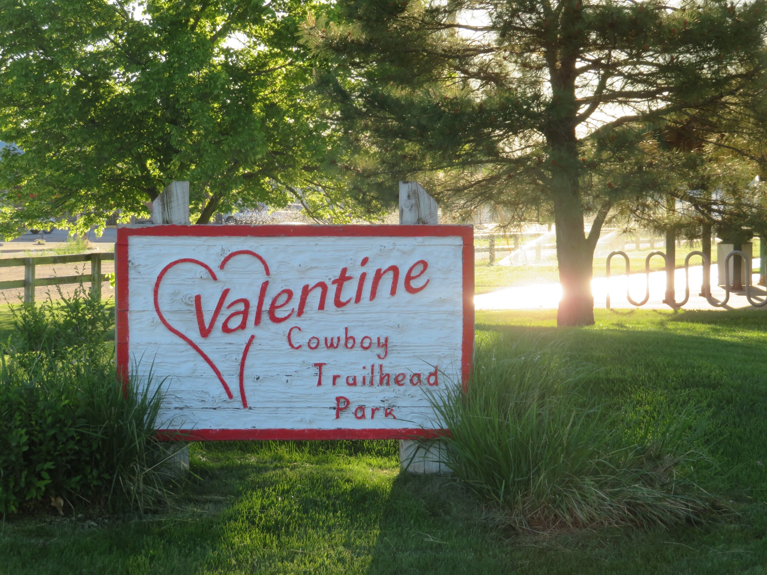
Valentine is the western terminus of the Cowboy Trail. We be back here in a week or so.

The Cowboy Trail is paved in this section, but for the most part, it is crushed limestone and/or gravel.
So what’s next? Tomorrow, we plan to do a reconnaissance drive along the 195 mile route that parallels US-20 to Norfolk, the eastern terminus of the trail. We want to scope out all the services/amenities (or lack thereof) and make sure nothing’s changed since the guide was written. We have a few major logistics to sort out. We need to arrange a place to leave the Kia for a week or so while we ride and also figure out a ride back to Norfolk from Valentine to retrieve the car.
More to come. Check back in a few days to see how we fare. Come on… ride with us!