

Cycling West - Columbus to Xenia
/Innis Park to Alton Road - 40.5 miles RT
Alum Creek Trail to 670 Connector to Scioto Trail to Camp Chase Trail
The day dawned bright, sunny, and cool. We picked up the Alum Creek Trail where we had left off at Innis Park. It’s quite a lovely path with lots of curves and trestles and boardwalks. The boardwalks were a bit slippery with the morning dew and the combination of so many different road surfaces kept us alert. There were several blind curves and at one a fellow cyclist coming fast from the opposite direction veered into David’s lane and they nearly collided. The adrenaline rush quadrupled our alertness. We signaled with our bells as we rounded subsequent blind curves.

One aspect of the Alum Creek Trail surprised us. It wasn’t the usual type of railroad. As we passed through the grounds of Old Dominican University we came across historical references to the Underground Railroad which operated extensively in this area.


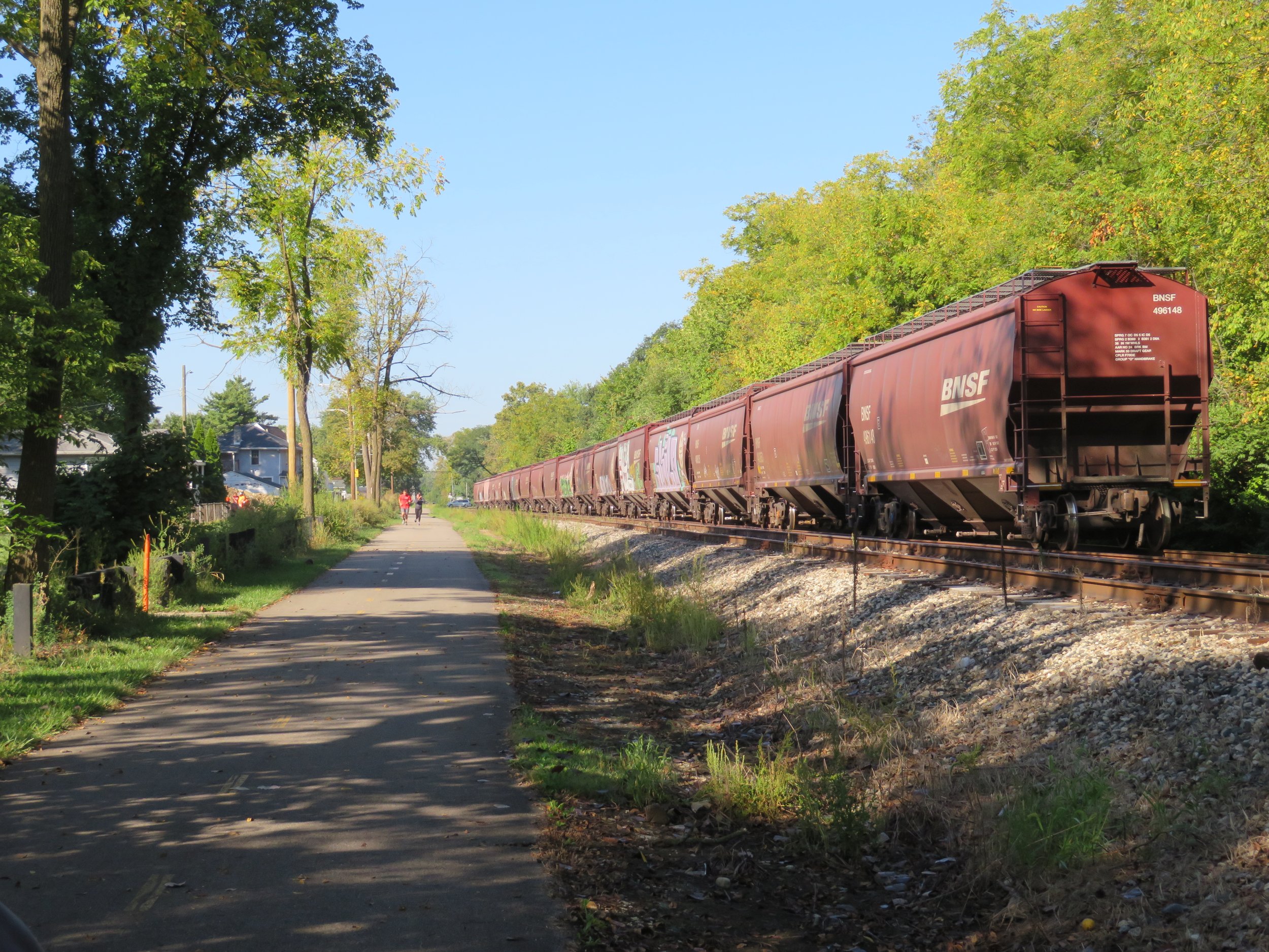
The Alum Creek Trail intersected with the 670 Connector Trail leading us to downtown Columbus. We were worried we’d be quite vulnerable on this stretch and were very pleased when the biking lanes along side the highway were behind a median and a fence. Other than being extremely loud, it wasn’t bad riding. There were several road crossings at highway exit ramps, but the majority were at crosswalks where we had pedestrian crossing lights. Most of the time the drivers would stop. A few times, even though we had the light to cross, drivers would cut us off. Subsequently, we didn’t place much trust in the walk light until all the traffic had actually come to a full stop.
The connector route dumped us onto lightly trafficked Columbus city streets and we wended our way through the Arena District and then the traffic increased. Part of the road was over brick surfaces and through downtown city intersections, riding down avenues in traffic lanes… not our favorite kind of cycling. it was, however, not as bad as anticipated.
Once across the city, we connected with the Scioto Trail which crossed the Scioto River, not once, but three times. There were hills, curves, a bit of side-of-the-road riding, a few more blind curves and some great city views.

The Scioto Trail connected to the Camp Chase Rail-Trail. This trail runs mostly parallel to the tracks (a rail with a trail), but many times crossed the tracks and then crossed back. Some of the trail was smooth and level and some stretches were like a washboard. We figured we loosened a few fillings along the way. Homeless camps were numerous in this area.

At the 20-mile mark, a crossing at Alton Road, we turned around and rode the route back. A long day, but a great ride.
Alton Road to London - 30 miles RT
Camp Chase Trail to Roberts Pass Trail

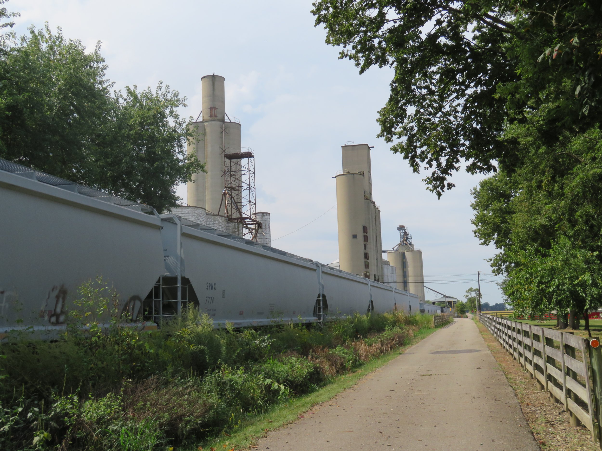
We returned to Alton Road and the Camp Chase Trail to begin our day. The trail was paved except for a section near Darby Park that diverted us onto a forested path, part of the Ohio to Erie Trail. It was rough gravel with steep hills and sharp curves, reminding us of the C&O Towpath. We were definitely out of practice on this type of trail and were glad to get back to pavement again. We did, however, have a great view of an 1870 railroad trestle built across the creek to provide access from London, Ohio to Columbus. It’s had many renovations and upfits over the years as well as many owners. It is currently owned by the Camp Chase Railroad which hauls seeds and grain during spring and fall to and from mills at nearby Lily Chapel.

We were out of the city here and in farm country. We rode past cornfield after cornfield, soybean field after soybean field. There were more tractor crossings than road crossings. Huge grain elevators were in strategic points along the tracks with grain cars waiting to be filled.
We retraced our route and called it a day. A late lunch at Tony’s Bar & Grill in London was most welcome. We washed down our sandwiches with cold draft Rheingeists, a local beer brewed in Cincinnati, then headed to Xenia, where our hotel destination for the night was well-positioned to hit the trail in the morning. Today, the high temperature was 90F… too hot and humid for camping especially without A/C. Tomorrow the high is predicted to be only in the mid- 60s. The season’s are changing.

London to South Charleston - 31 miles RT
Roberts Pass Trail to Prairie Grass Trail
True to prediction, it was chilly this morning… in the mid-50s and windy when we hit the trail. We layered up, but the wind still bit through us as we cycled along.
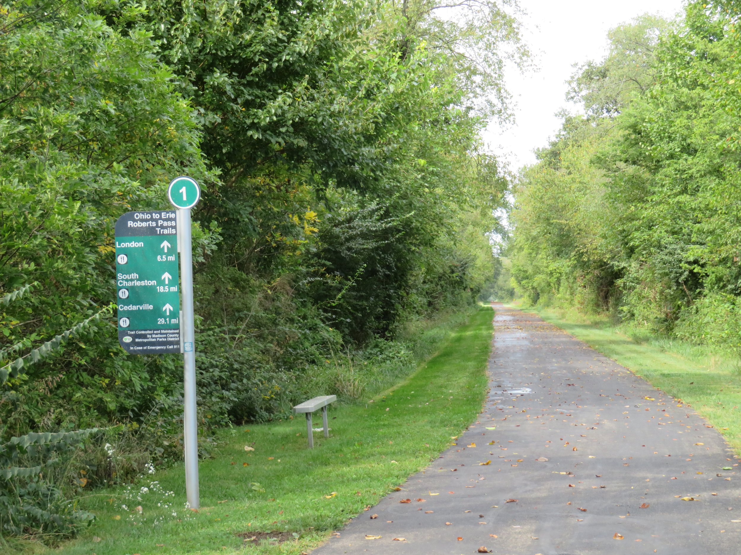
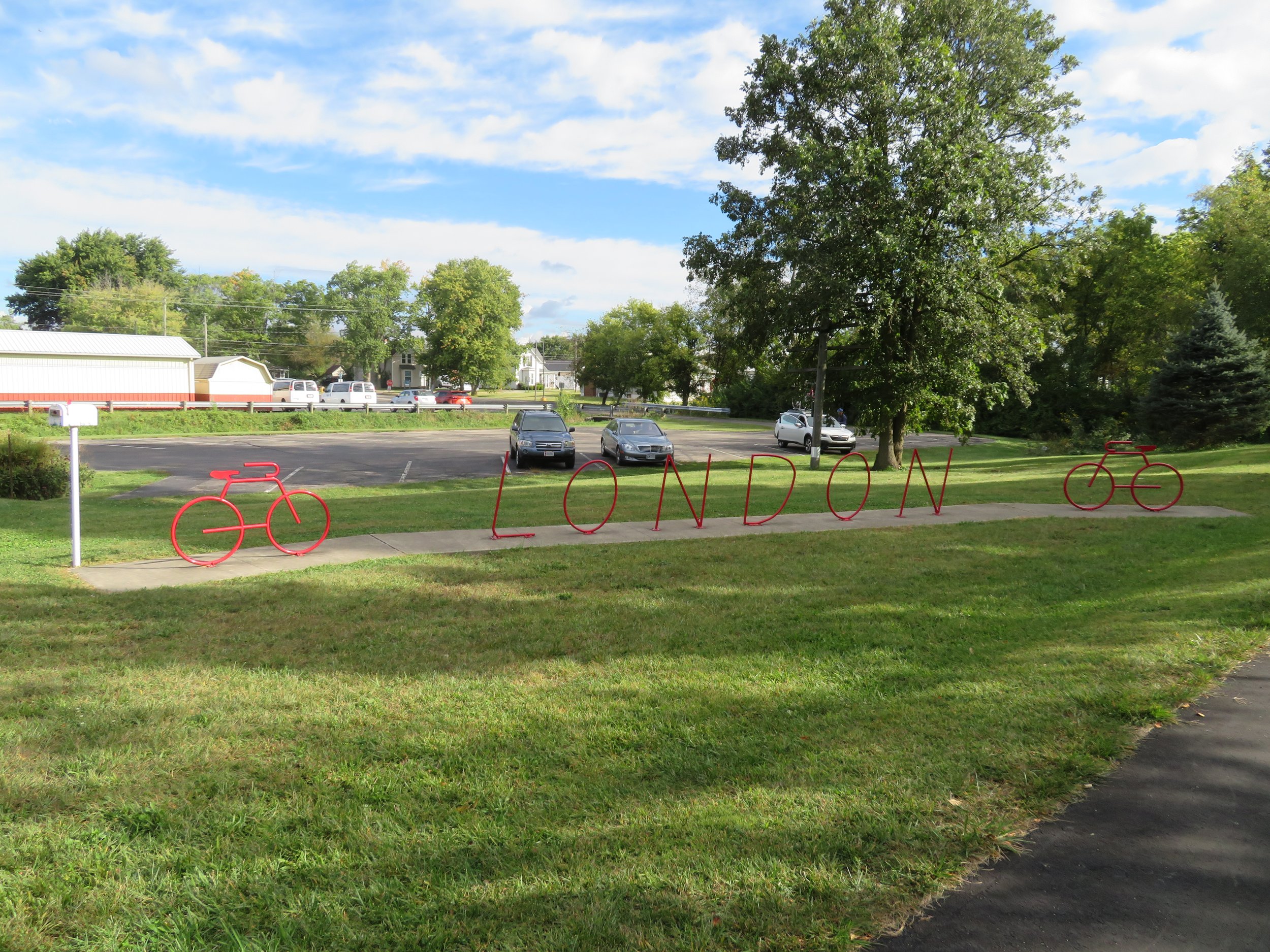
We rode on the Robert’s Pass Trail from yesterday’s end point at a railroad track crossing in London near the grain elevators, then followed a well-signed route through London’s downtown streets to the Prairie Grass Trail.

We stopped for pix and a break at the London Primitive Trailside camp area where we met Adam who’d camped there for the night. A young man from Montreal, Adam was on a cross-country biking trip of the U.S. and regularly rides 100 miles/day, but was taking a rest day. We chatted at length and learned he’s planning on biking through Las Vegas in late October. We invited him to stop by; we hope he does.
More cornfields and soybean fields, more goldenrod, the last of the hardy wildflowers and withering brown grasses bordered the aptly named, Prairie Grass Trail. The red berries of honeysuckle and pokeweed signaled the advent of autumn.

Grain elevators with railroad tracks beside them were frequent scenes. Sidetracks were crammed with cars waiting to be loaded.

There were long corridors of tree-canopied trail which provided a wind break from the gusts that blew across the open fields. Blue chicory, white asters, thistle and milkweed gone to seed all provided some color to the autumn browning that was taking place.
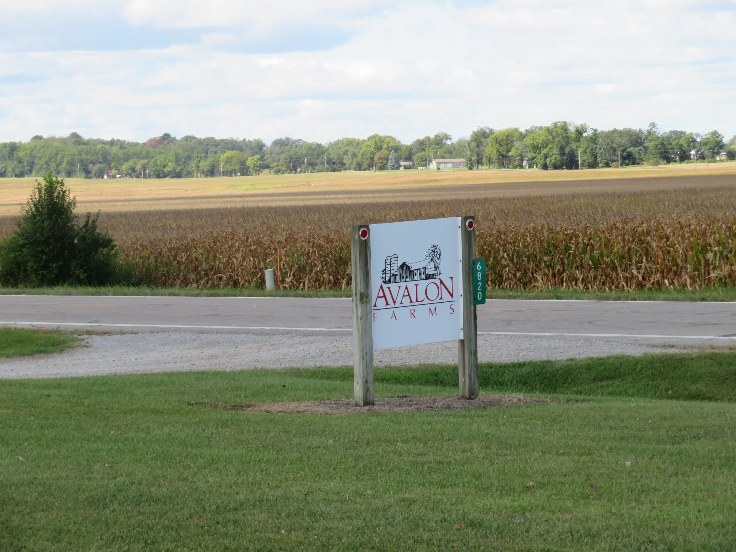
In South Charleston, we saw train engines specific to the local grain co-ops moving along the tracks. Time to get all that grain harvest to market. The trail exited town parallel, but well apart from, US-42. We stopped for the day at Avalon Farms and noted it as our connection point for tomorrow’s ride.


South Charleston to Xenia - 32 miles RT
We parked in Cedarville, about half way between our two riding points then rode back 7.5 miles to Avalon Farms, yesterday’s end point in South Charleston. It was a brisk morning, 52F with lots of wind, under partly sunny skies. We layered up, but our hands and heads were cold. We’ll definitely need some warmer clothing to ride comfortably in the future, although after riding awhile, we found ourselves shedding layers.
The trail was paved and smooth and the riding was easy, though cold. There were multiple country and farm road crossings, but it was a quick 15 mile round trip with no benches nor rest areas along the way.

Back at Blanche, we stopped for a rest and breakfast, then headed 8.5 miles to Xenia. The trail was more of the same until we reached Xenia Station. Xenia Station is a bike hub where the Prairie Grass Trail, the Ohio to Erie Trail, the Creekside Trail, the Little Miami Trail, and the Xenia-Jamestown Connector Trail all converge. It was a busy place with lots of walkers and bicyclists resting and chatting and using all the facilities. We stopped for a brief break and met Glen, an amiable local guy who asked how we liked our e-bikes. We chatted for quite awhile regarding his future plans for retirement which included biking trips and maybe even sailing off into the sunset. A good part of the pleasure of travel is the people we meet and interface with.

We retraced our route back to Cedarville, picked up Blanche, stowed the bikes, and headed back to our hotel in Xenia.
Next time, we’ll be riding to Dayton and beyond, stopping by to say a quick hello to the Wright Brothers, and then we’ll say goodbye to Ohio. Join us!