

C & O Canal Towpath - DONE & DONE
/We’re on the final legs of cycling the C&O Canal Towpath, only ~42 miles to the end in Washington, D.C. and we’re psyched.
Day 12 - Monocracy Aqueduct to Sycamore Landing - 31 miles RT
We drove back to the Menocracy Aqueduct parking area and mounted up. The forest trail was bumpy in spots with a couple of marked rough areas, but for the most part it was easily maneuvered.
We stopped at historic White’s Ferry to check it out. This ferry was the last of 100 ferries that used to cross the Potomac at convenient intervals.
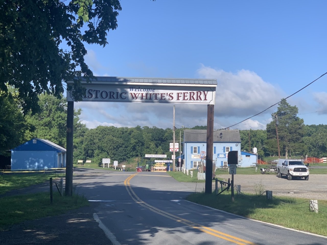

I mentioned that there are few bridges across the river in this area We had originally intended to take the ferry across to Leesburg on the Virginia side of the Potomac for a hotel. It would have been very convenient, but seemingly irreconcilable differences between the ferry’s owner and the owners of the Virginia side landing spot have halted ferry service since December 2020. No resolution is in sight though both sides feel they’ve made reasonable offers. Sigh!

Wildlife was plentiful along the towpath. A bale of turtles was catching some rays on a log.

A great blue heron stood at attention patiently waiting for any morsel that happened to be swimming by… beware frogs!

We’ve adopted a routine now. About half way to our destination, we stop for coffee (we use the rest of our morning pot carried in a plastic water bottle) and a protein bar. We take a short rest at the destination and then on the return trip we stop for ‘breakfast’, a cup of yogurt and maybe a piece of fruit.
We stopped at historic Edward’s Ferry (every place is historic here). The river is narrow and fairly shallow here. During the Civil War, Union troops were camped on the Maryland side and Confederate troops were on the Virginia side. Sometimes neighbors fought neighbors and family members fought family members. At other times, soldiers from both sides met in the middle of the river exchanging personal information and pleasantries. As for us, we ate our protein bar and took a look at the nearby lockhouse, one of the several along the canal that offered overnight accommodation.


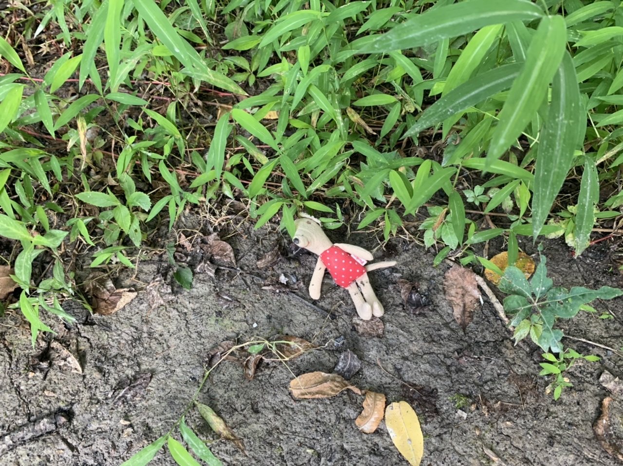
We reached our destination at Sycamore Landing then retraced our route. When we arrived at Blanche, David noticed with alarm that Miriam the mousekin was missing from her usual spot in my hydration pack. Darn it! Gone missing again, but this time we knew she hadn’t been left behind in Blanche. We were too tired to ride the route all over again, but decided we’d drive to as many spots we’d stopped at as possible, figuring those might be the most logical places she’d jumped off. Our hopes weren’t high, but it was worth a try.
Unfortunately, there were no direct routes to the parking lots, so it was a circuitous route to get to White’s Ferry, our first stop. We wandered around at the ferry on foot scanning the ground and looking around places we thought we’d traveled. We knew we’d stopped at a campground about 1/2 mile down the trail and walked there thinking maybe, just maybe, she’d be laying somewhere on the trail. No luck!
Another circuitous route to Edward’s Ferry. We returned to the bench at which we’d been sitting and looked under the bench, behind it, all around it. Sigh! Just as I rose from the bench, I noticed a little something on the side of the trail. Could it be? Miraculously, it was Miriam… a bit of dirt on her nose, but none worse for the wear. We returned to Blanche where Miriam took her seat on Blanche’s dashboard and where she would stay for the duration of the trip. No more bike rides for this mouse… too much drama! On a continuing positive note, no tumbles today, no blood spilt… a good day!
Day 13 - Angler’s Access to Sycamore Landing - 31 miles RT
Construction work at the closest parking lot was under way which limited parking spaces there. We parked in the nearby upper parking lot which was crowded with kayaks and groups being unloaded. It was a steep, rough descent to the canal over loose gravel and rocks. A small footbridge led us across the canal to the towpath. From this point, we were only 12 miles west of D.C. and the path has become more and more crowded with walkers and cyclists.
The trail today was bumpy gravel and surprisingly slow going. We had thought this part of the towpath would be easy riding, but it was not. There was, however, more water in the canal and we saw several kayakers making their way through the maze of limbs and branches that many times occluded their path. There were also very large puddles extending across the trail. We gave up trying to avoid them and just plowed through with predictable results.


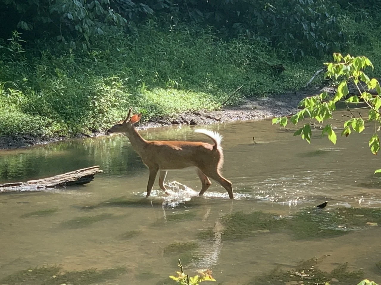
There were lots of deer on the trail or browsing near the canal this morning… we counted at least 10. Sometimes they shot across the trail, startling us and the deer. One actually stayed still on the side of the trail watching us as we passed, not moving until we slowed down.

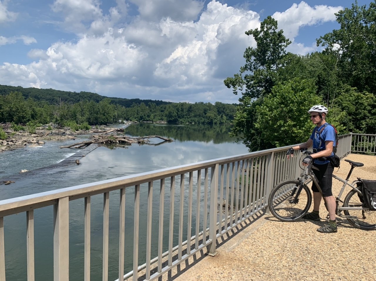
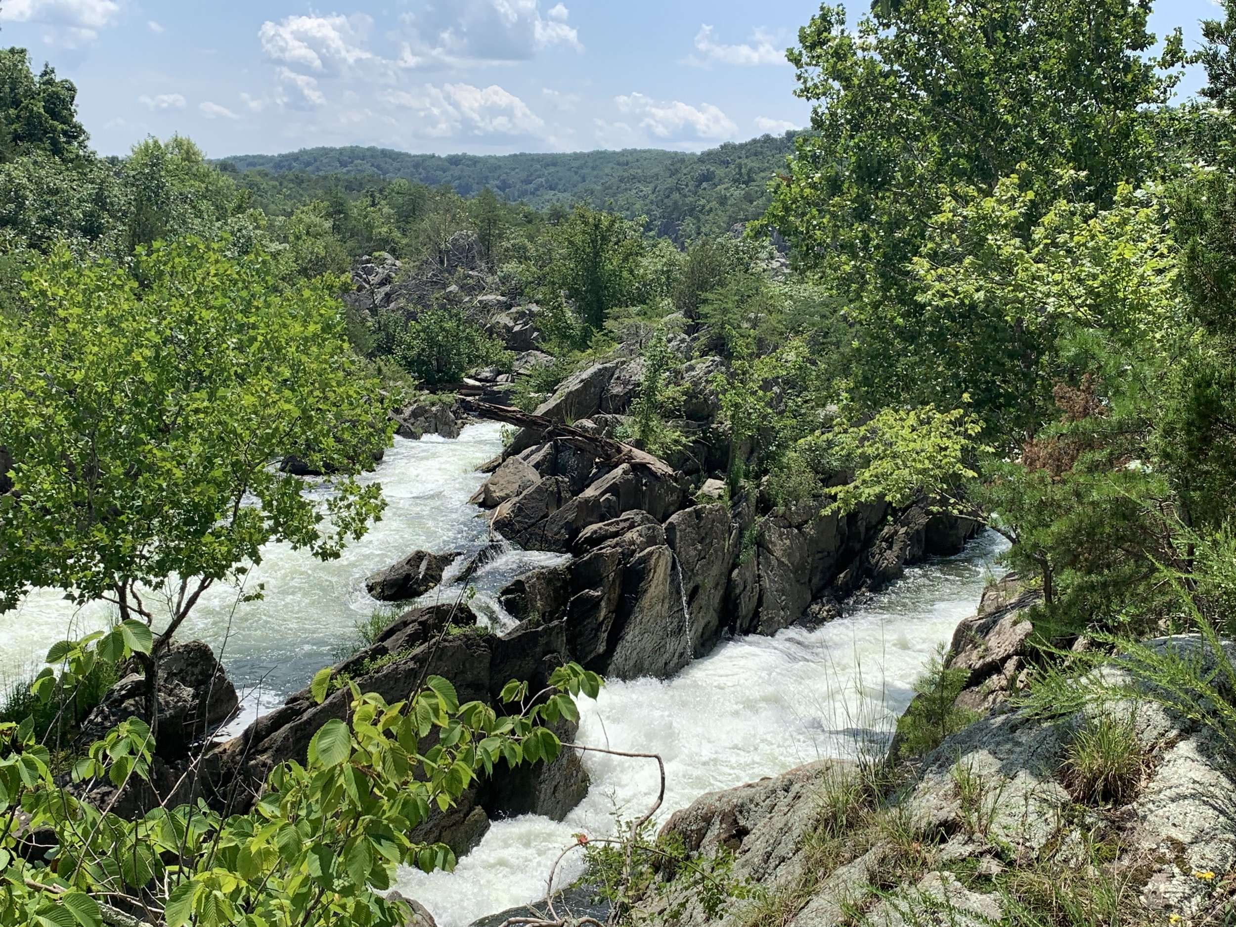
We stopped for a scenic view of Great Falls at an overlook.
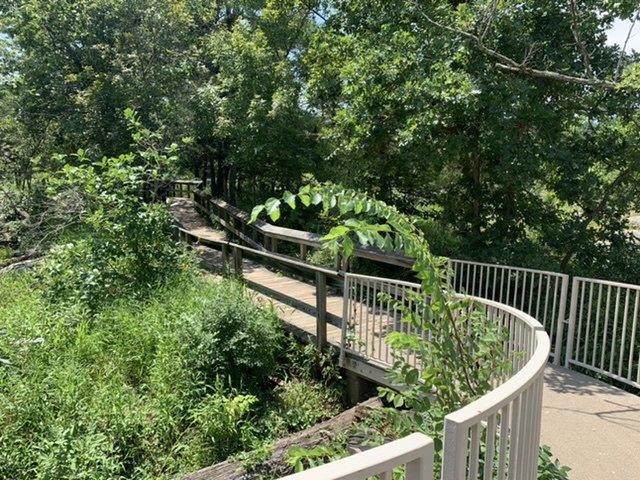
We parked the bikes and proceeded on foot to Olmstead Island, following a short walkway along boardwalks and over bridges for more great views of Great Falls and Mather Gorge. Located in the middle of the Potomac, the island is a biologically diverse habitat especially for flora.

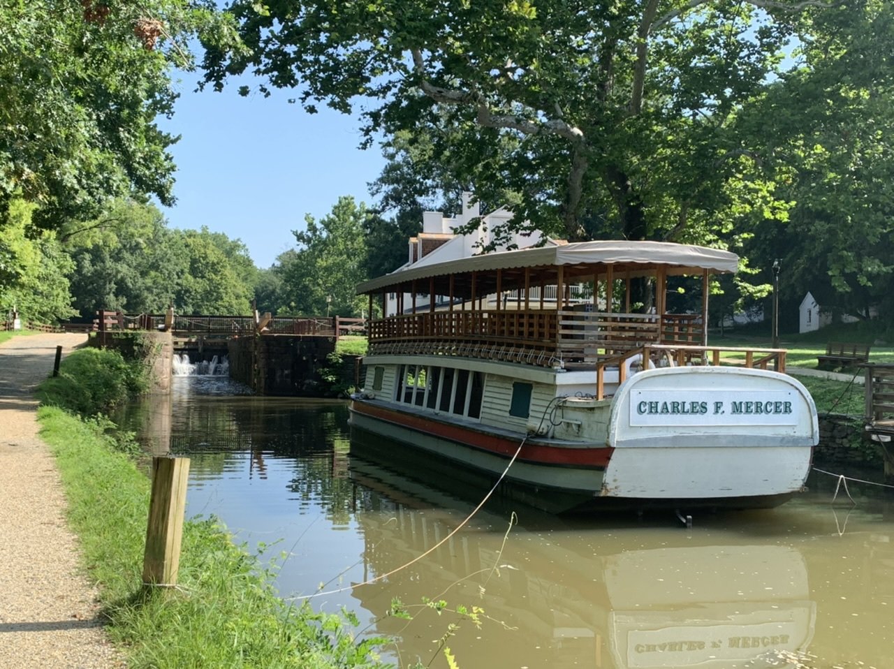
Lock 20 was a working lock and a replica packet boat, The Charles F. Mercer, was moored there in front of the historic Great Falls Tavern. On the weekends, the National Park Service conducts hour-long mule-drawn boat rides on the Mercer with guides in period clothing providing the colorful narration. According to the NPS website, ‘The Canal wasn’t all business. Packet boats like the Mercer carried travelers from Georgetown to Great Falls and those with more time [and money] could continue up the Canal for an overnight at Harpers Ferry.’ Sounds like it would have been fun.

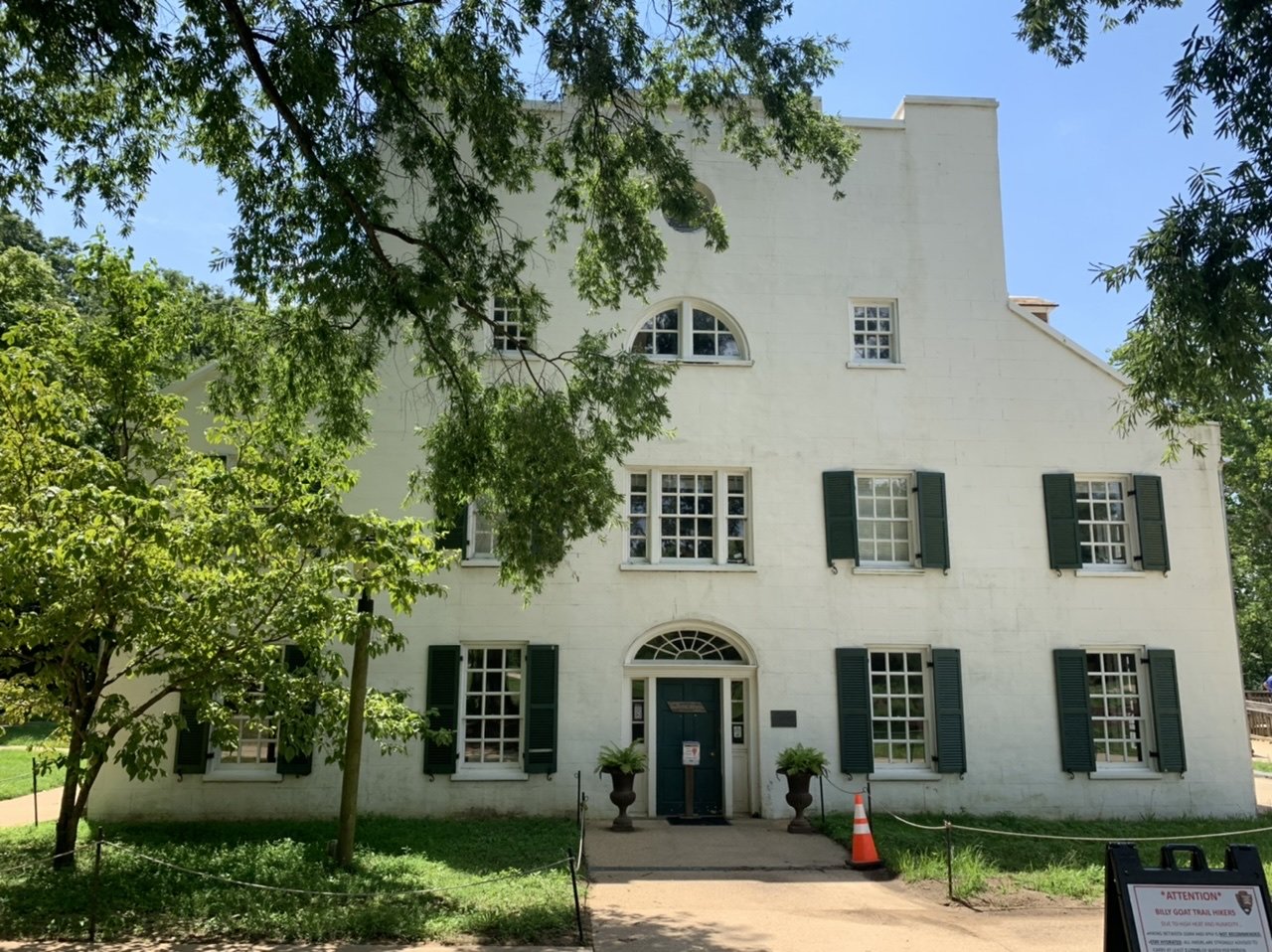
The Great Falls Tavern, built c. 1830 was owned and operated by the original lock keeper, W. W. Fenton. The building served meals, offered a ballroom for dancing, rooms and even a honeymoon suite ‘for couples with 50¢ and marriage certificate’. The building is gorgeous and now serves as an NPS Visitor Center that was, of course, closed on weekdays.
Day 14 - Angler’s Access to the National Mall - 27 miles RT
This is our final day on the C&O Canal Towpath. As always, we were anticipatory and psyched to finish and a little sad that it would be over.
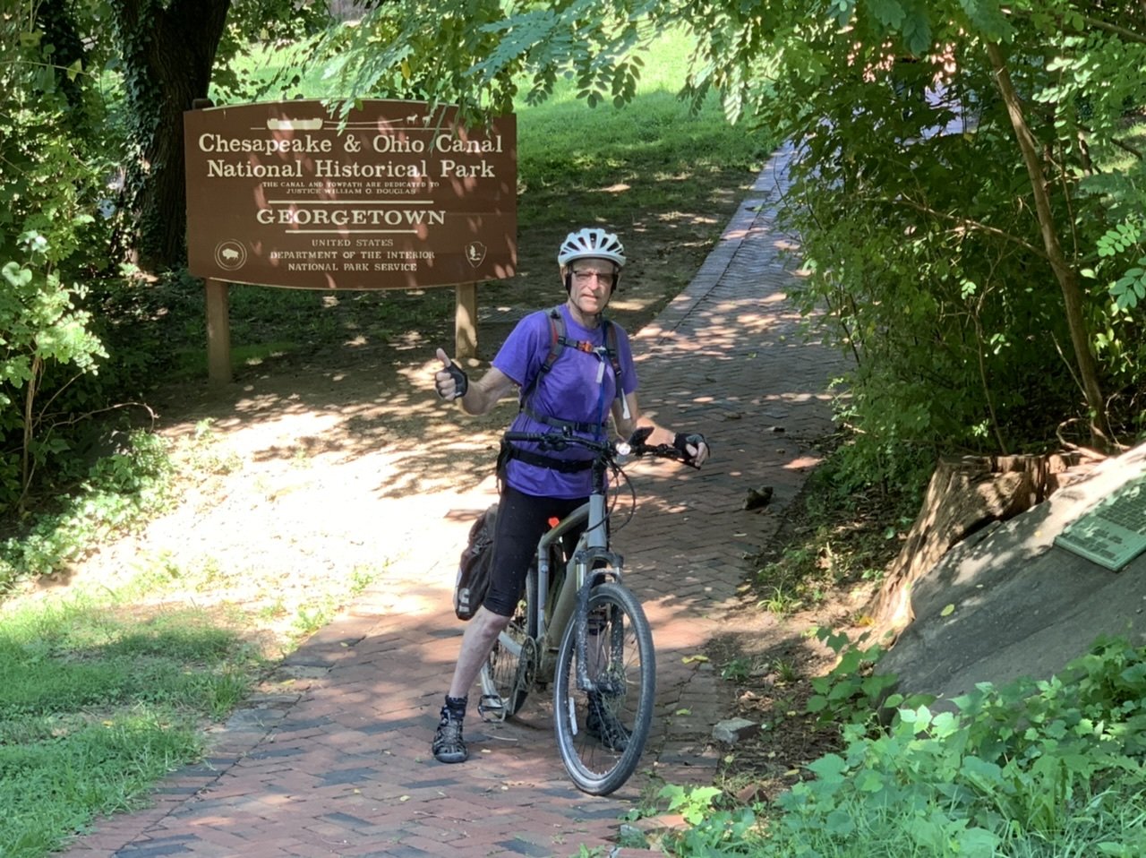
We found a much better parking spot at the Carderock Recreation Area at MP 10.5. We cycled back to MP 12.2 at Angler’s Access, turned around and began the final leg to the National Mall. The C&O Canal Towpath actually ends near the Thompson Boat House in Georgetown, but the Great American Rail-Trail (GART) begins (or ends) at the National Mall and our ultimate goal is eventually to complete the entire GART… Washington, D.C. to Washington state, hence the reason we continued on.
The beginning of the trail was quite pleasant, but as we edged closer to the city, it was crowded with pedestrians, baby strollers, kids on bikes, and other cyclists. There were several detours as we reached Georgetown, sometimes diverting us off the towpath and onto busy city streets and other times providing only a very narrow path between construction workers and fencing. We proceeded slowly and managed to dodge all obstacles in our way as well as stay seated on our bikes… a major feat. Unfortunately, the eastern terminus C&O commemorative obelisk was located above the trail on the Wisconsin Avenue Bridge which we didn’t realize and we missed it. Had we seen it, it looks like this. Photo credit: Wikipedian1234

The section of the canal with the mile 0 marker was closed off due to construction with a marked detour around it. BAH!!!! We did sneak into the far end of the closed off route for a photo of one marker before a worker bee chased us off.

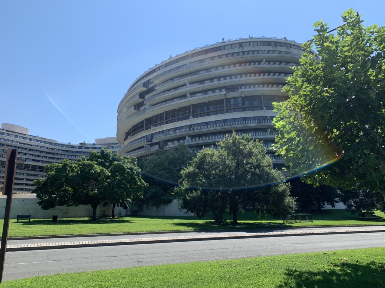
We picked up the Rock Creek Trail near the Four Seasons Hotel and followed it uneventfully to the National Mall, passing the infamous Watergate complex and the Kennedy Center.
We could see the Washington Monument‘s distinctive obelisk in the distance. We were getting close. We finally passed the Arts of War and Arts of Peace monuments and arrived at the Lincoln Memorial.


We stopped at the far west end of the Lincoln Memorial Reflecting Pool with the Washington Monument and the Capitol Building in view and posed for an ‘end of ride’ photo compliments of a most accommodating passerby we recruited for the job.

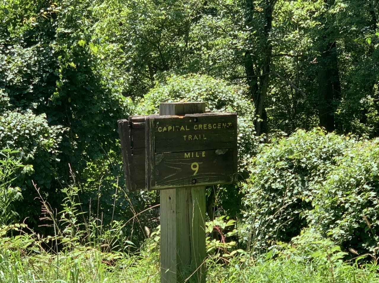
We sat in a shady spot on the Mall and savored the ride’s completion. On the return route, we rode part of the way on the Rock Creek Trail which connected to the Capital Crescent Trail, both paved, smooth and fine riding, then crossed back onto the C&O Canal towpath to finish our ride.
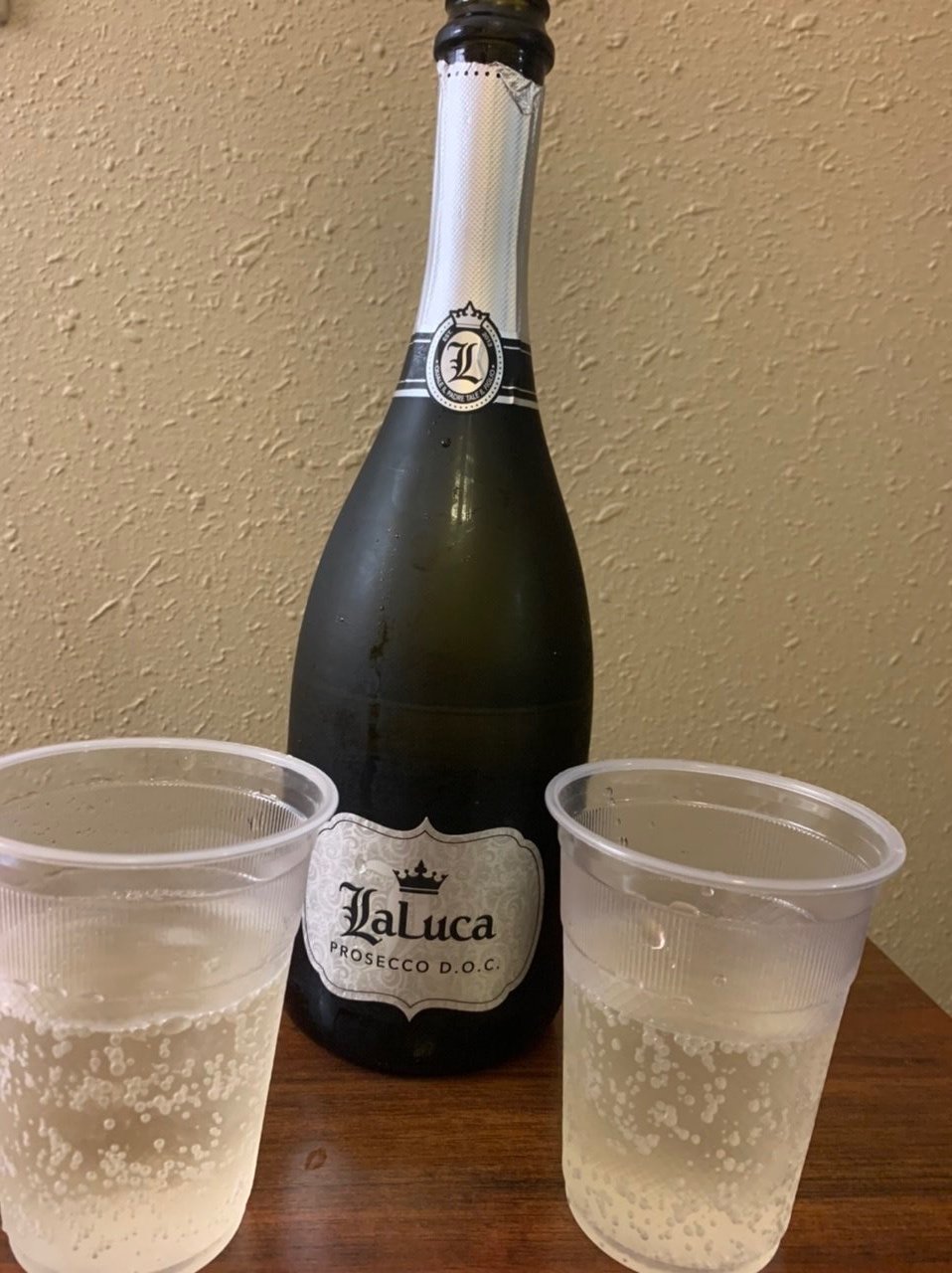
We were hot, sweaty, and exuberant. Well, I was exuberant; even-keeled David was pleasantly satisfied that we’d ridden all the way from Pittsburgh to Washington, D.C., knocking off ~335 miles of the GART. We celebrated accordingly with bubbly in the finest crystal flutes.
Check our David’s next Blue View blog… Falling Gracefully.