

Bears Ears and Natural Bridges National Monuments
/Bears Ears National Monument

Bears Ears National Monument? Huh? We’d never heard of it before, so it was a surprise when Brennan, our family geographer and travel advisor, told us it was just down the road from Arches. It was a lazy morning as we headed out of Moab on US-191 South towards Blanding, Utah. A weather advisory warned of high winds, fire dangers, and severe weather. After all the recent sunshine and fine weather, we were spoiled. This portended to be a dramatic change.
We drove past a ‘Hole in the Wall’ and a couple of arches along the route, but just like experiencing the glaciers and geysers, after a while, we were ‘arched-out’ and gave them a pass. The massive red sandstone rock formations and topography continued, but we noticed a dramatic uptick in the wind that really pushed us around whenever we reached flatland areas. After a quick stop in Blanding, we headed west on scenic byway Utah-95 towards Bears Ears National Monument.
Bears Ears was declared a national monument by President Obama in 2016 protecting 1,352,849 acres of public land that is particularly important for several Native American tribes with ancestral ties to the region. By presidential proclamation in 2017, Donald Trump reduced the size of the monument by 85%, an unprecedented action in the history of national monuments. In 2021, Joe Biden restored the area to its original size. It is jointly administered by the BLM, NFS and a coalition of five local Native American tribes. A note here: Presidents can use their executive power to declare a national monument, but only Congress can designate a national park.

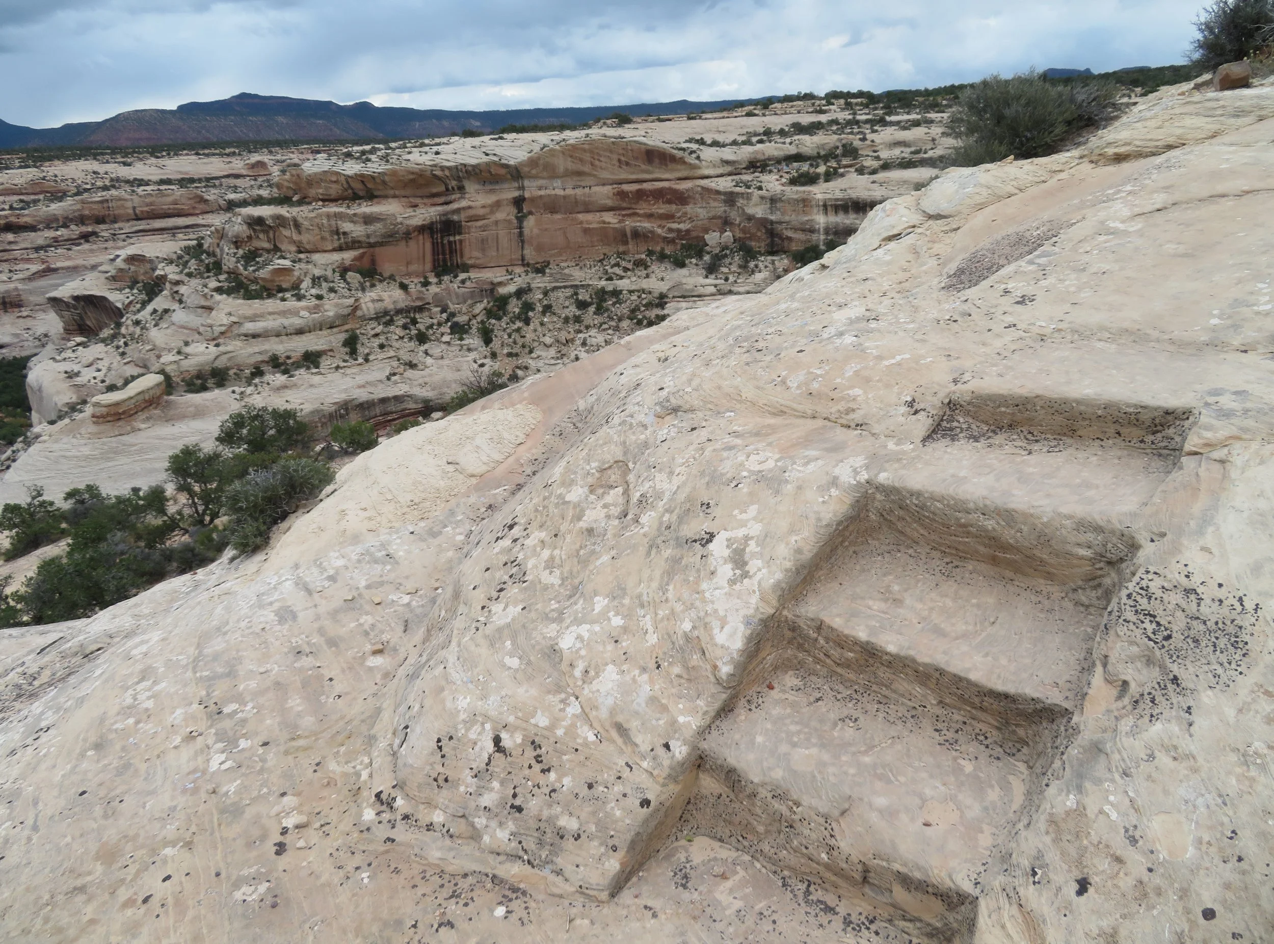
Most of the park is undeveloped, but we did get a glimpse of the Bears Ears, two prominent sandstone buttes.

We stopped at the Mule Canyon Ruins for a quick walk and to check out the 700+-year-old Anasazi ruins. We walked through the ruins. Waning Utah daisies, prickly pear, and dried milkweed pods dotted the area, constantly reminding us it was autumn. We should have done more homework because there was a nearby walk through the canyon that would have provided a better view of Anasazi dwellings and petroglyphs, but unfortunately, we missed it. Darn!


Natural Bridges National Monument
Continuing west on Utah-95, we arrived at Natural Bridges National Monument just a few minutes later. We vaguely remembered reading about this park in the past but had never visited. This park turned out to be a gem. Unlike Yellowstone with 3.3 million visitors a year or Arches with 1.5 million visitors per year, Natural Bridges gets ~100,000 and most of them had evidently already visited because it wasn’t very busy at all.

Our research indicated they had 13 first-come-first-serve campsites. It was mid-afternoon when we stopped at the Visitor Center. The ranger wasn’t sure if any sites were available, but suggested heading to the campground immediately to check it out. We were pleasantly surprised to find several unclaimed sites and we snagged a primo one for two nights ($16/night; $8 with park pass). We walked back to the Visitor Center via a gravel path, paid our fee, and picked up a park brochure and trail map.

The campsite was partially shaded with pinyon pines and junipers. We collected pine nuts from the trees just to try them… sticky with sap and not particularly tasty, but the squirrels liked them. Berries were hanging heavily on the juniper trees.


It was a gusty night with frequent lightning flashes, but no discernible thunder. The morning temps were in the mid-50s (13C) and the wind continued to blow in gusts. Heavy gray clouds portended rain, or not… after all, it is the desert and this high desert only receives a total of ~13 inches (33 cm) of rain per year. We were up very early and decided to drive the loop route and play it by ear with the weather.
It was President Teddy Roosevelt who proclaimed Natural Bridges a national monument in 1908… Utah’s first national monument, in fact. According to the park brochure, “The park features “three majestic natural bridges [inviting] you to ponder the power of water in a landscape usually defined by its absence.”

After visiting Arches, we wondered what the difference was between bridges, arches, and windows. We learned at the Visitor Center that natural bridges are formed by the erosive action of moving water, i.e. rivers. Arches are formed by other erosive forces primarily frost action, rain, and seeping water. Windows, openings formed in thin rock walls, are formed the same way as arches, but the openings are not uniform. With that in mind, we headed out to our first natural bridge.

The first stop on the park loop road was Sipapu Bridge, the second largest natural bridge in the USA. (Rainbow Bridge in Glen Canyon is larger.) We learned that in Hopi mythology a ‘sipapu’ is a portal through which souls pass to the spirit world. I love that image! This 1.5-mile roundtrip route is considered strenuous and is the steepest in the park. It also requires descending several stone staircases and metal ladders.


Whew! As we descended the trail and kept peering down over the cliff edge into the chasm below us, my acrophobia kicked in. The trail was not only steep, but it also led us across narrow cliff ledges, down uneven stone steps, around switchbacks, down steep ladders, and several sections required negotiating steep slickrock. Some sections provided an anchored rope handhold, but most did not.


My heart was beating fast, but with encouragement and a hand from David who led the way, I managed to get to the bridge. The reward was breathtaking. Heading back up was strenuous, but a bit easier and once back to the top when my heart restarted and I could breathe easily again, I was glad we did it.

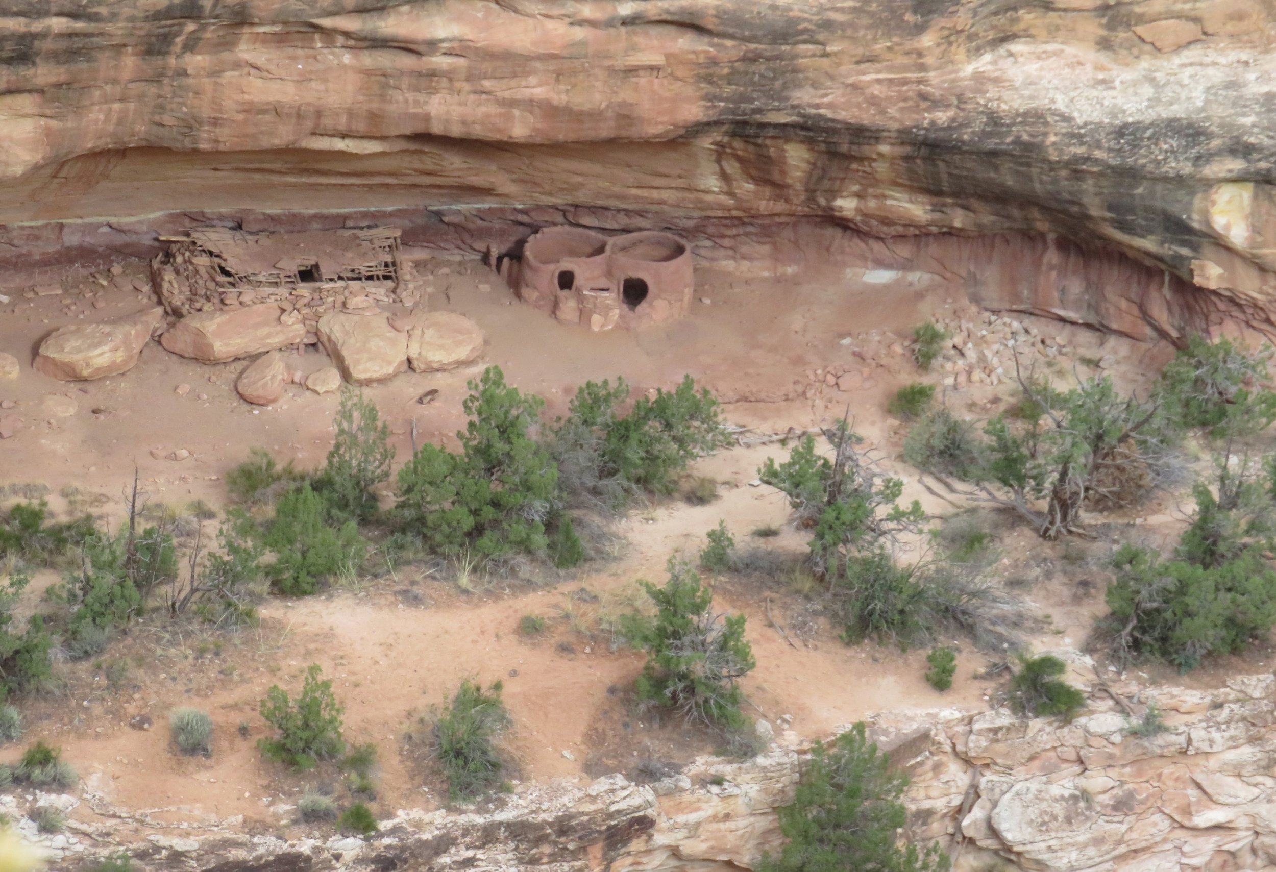
It sprinkled a bit, but the clouds were dissipating and we continued on the route. The Horsecollar House Overlook Trail was next along the loop. It was an easy half-mile out and back path over a rock mesa top to an overlook at the rim of the White Canyon. Below were the remains of an ancestral Puebloan cliff dwelling tucked into a large alcove just above the bottom of the canyon.


We stopped at the Kachina Bridge Overlook, a ¼ mile easy path, for good views of the natural bridge. Named for the dancers who dominate Hopi religious tradition, Kachina is the ‘youngest’ of the natural bridges at the park, determined by the thickness of its span. The sky was clouding up again. We figured we’d come back to hike the 3-mile trail the next day.

View of the Kachina Natural Bridge from the overlook.
Tall evening primrose and Indian paintbrush were still in bloom. Huge, bright yellow tufts of rabbitbrush lined the loop road.


The last bridge on the route was the Owachomo Bridge Trail. ‘Owachomo’ translates to rock mound in Hopi and refers to the rock formation near the end of the bridge.

Owachomo Bridge
The trail is only ½ mile roundtrip so we decided to give it a go. We walked the moderate trail to the bottom. Though steep in parts on bare slickrock, there were no ladders to maneuver and we managed without issue. We returned to the campground for dinner.
Home to some of the darkest skies in the country, Natural Bridges was the world's first "International Dark Sky Park. “According to a study on night sky quality — including darkness and light pollution — conducted by the National Park Service, Natural Bridges is one of the darkest national parks in the country, and now one of many certified Dark Sky Parks and sanctuaries of natural darkness in Utah.” Rules for night photography in the park forbid any type of artificial light sources to illuminate rock formations. Unfortunately, the clouds returned and neither night photography nor stargazing was an option.
No worries. Instead of stargazing, we plotted the rest of course home… a very circuitous route back to Las Vegas avoiding major highways as much as possible with eye-popping scenery and more national parks. Come on along. You’re really going to enjoy the views. Promise!