

Medicine Hat, A Giant King and the Tallest Teepee
/Leaving the Sparwood campground, we were back on BC-3 heading east on a very brisk 36°F (2°C) morning. We began climbing as soon as we hit the highway out of town heading up and over the Rockies. We’d noticed the highway sign was adorned with a what we thought was a raven. We found out later it was a crow signifying the Crow’s Nest Highway. We were heading up and over Crow’s Nest Pass, a slow, but steady ascent.

Before we knew it, we were out of British Columbia and into Alberta.

Welcome to Alberta
The scenery was gorgeous and all things were ‘Crow’s Nest’… the Pass, the Lake, the town and finally the Crow’s Nest itself!

We passed the site of Frank Slide Disaster, a massive rockslide in April 1903 that buried a significant portion of the mining town of Frank, Alberta. According to Wiki, about 110 million tons of limestone rock slid down the mountain and “within 100 seconds, the rock reached up the opposing hills, obliterating the eastern edge of Frank, the Canadian Pacific Railway line and the coal mine. It was one of the largest landslides in Canadian history and remains the deadliest.” 70+ people were killed and most remain buried under the rubble. Reading the story and seeing the extent of the slide which is still very, very evident was sad and sobering.

After Crow’s Nest Pass, we were over the Rockies and the land began to flatten out. Newly sown fields of rich, fertile soil, grazing livestock, and rolling verdant hills replaced the mountains. Wind turbines dotted the fields. Grain elevators stood alongside the railroad tracks. An occasional oil rig pumped away and the smell of feed lots definitely caught our attention.
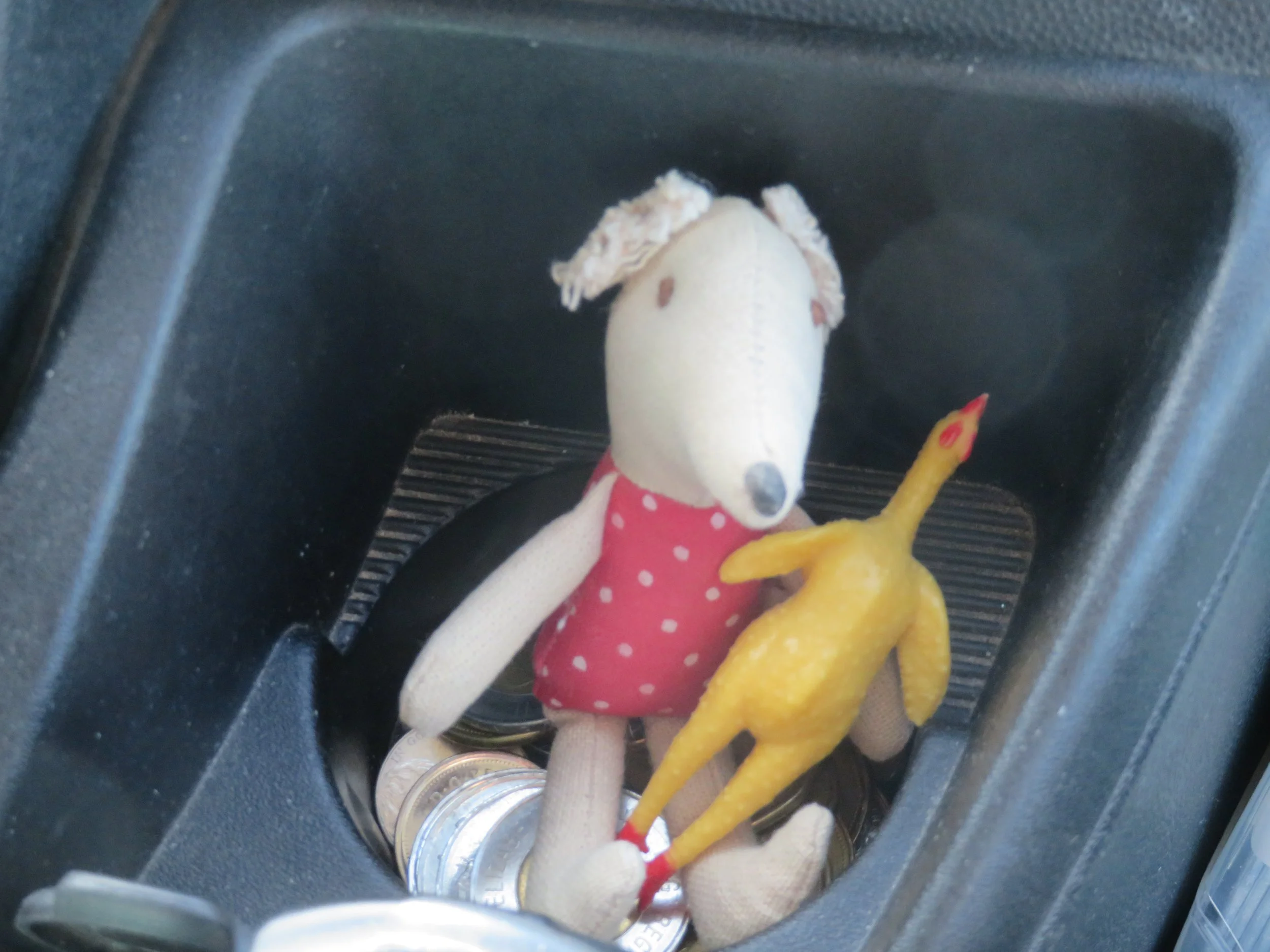
In case anyone was wondering, Miriam the mousekin (from Taos) and her friend, Chicken the chicken (from Chicken) are still traveling with us. They’re quiet, self-sufficient, occupy very little space and guard the loose change.
Lethbridge was situated along our route and we stopped to stretch our legs and find an ATM to obtain some Canadian cash. From our last trip, we still had several ‘loonies and toonies’ (one and two dollar Canadian coins), but nothing more. We found a Scotia Bank which has reciprocity with Bank of America and allows us to obtain cash without an ATM fee.
In order to get to the bank, we drove under the Lethbridge Viaduct aka High Level Bridge, a railway trestle bridge over the Oldman River. Built in 1907, it's the longest, highest bridge of its kind in the world.

We stopped briefly in Bow Island, the bean capital of Alberta, to meet the town’s famous mascot, Pinto McBean. At 18’ tall, Pinto is the largest pinto bean in the world and, accordingly to the plaque nearby, represents the importance of the dry bean industry in the area.

Our destination for the day was Medicine Hat. Known as ‘Gas City’, the town sits on a huge natural gas reserve. Rudyard Kipling, author and poet, visited Medicine Hat in 1907 and he had this to say…
“This part of the country seems to have All Hell for a basement, and the only trap door appears to be in Medicine Hat.”
Though several cities claim the title, Medicine Hat is ‘actually “the sunniest place” in Canada averaging 2,544 hours of natural light every year.’ True to its name, it was sunny the days we visited albeit chilly and windy when we arrived.
We were curious about the town’s name. Medicine Hat inherited its name from the native Blackfoot word "saamis" which means medicine man's hat. One legend explained that one winter, the Blackfoot people experienced great famine and hardship. A young man was chosen by the elders to go to the icy South Saskatchewan River to ask the spirits for help. Along with his wife and dog, he made the difficult journey to a very sacred place where the water spirits dwelled.

The spirit, in the form of a giant serpent, consented to help but only if the young brave sacrificed his wife into the frigid waters, which he finally did. In exchange, he received the ‘Saamis” which provided him with special powers as well as great hunting prowess. With the hat, he was able to save his people and subsequently became a great Medicine Man. Good story and the name stuck.
We stayed at the city-operated Gas City Campground located high on a hill above the city. It was fairly crowded and we thought a bit pricey at $52 CAD/night for electric only. The site (#29) was grassy with trees, but our neighbors were very close. Flush toilets and hot showers were welcome, but the ablutions building was unheated and the temps were quite chilly, making showers a bit nippy.
On arrival day, we just hung out, relaxed, wrote and read. The wind whipped through the trees and howled through the night, but by morning the day dawned sunny, warm and absolutely glorious. A great day for exploring on foot.
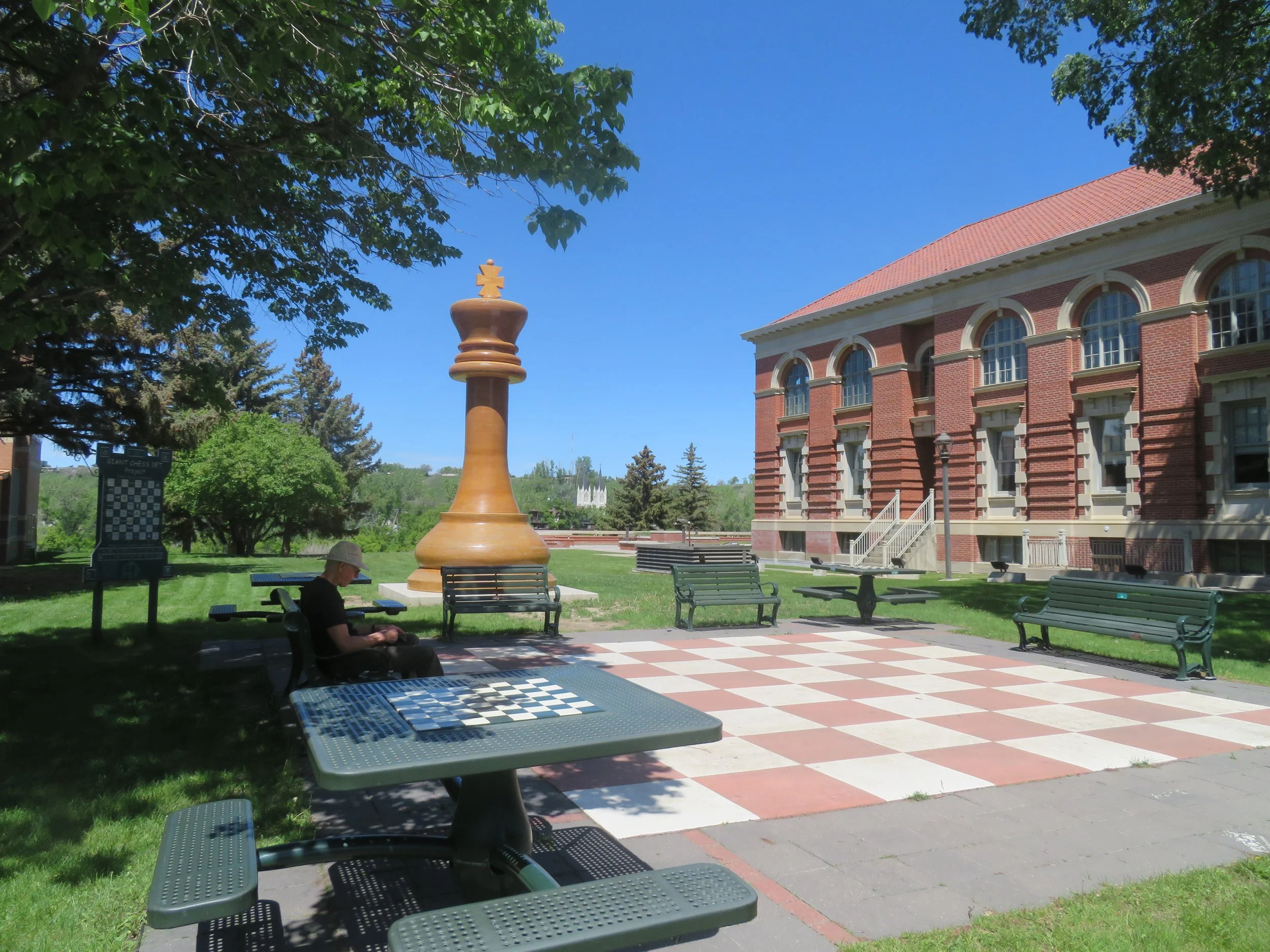
We set out mid-morning on a trail from the campground in search of the World’s Largest Chess Set in the downtown area. The trail headed down, down, down along the banks of the South Saskatchewan River. We finally left the riverside and headed into the city and spotted the giant King chess piece in a small courtyard beside the library. The King was splendid, however the rest of the set was in absentia. After the requisite photos, we shared an apple on the side of the giant chessboard and planned the rest of our day.

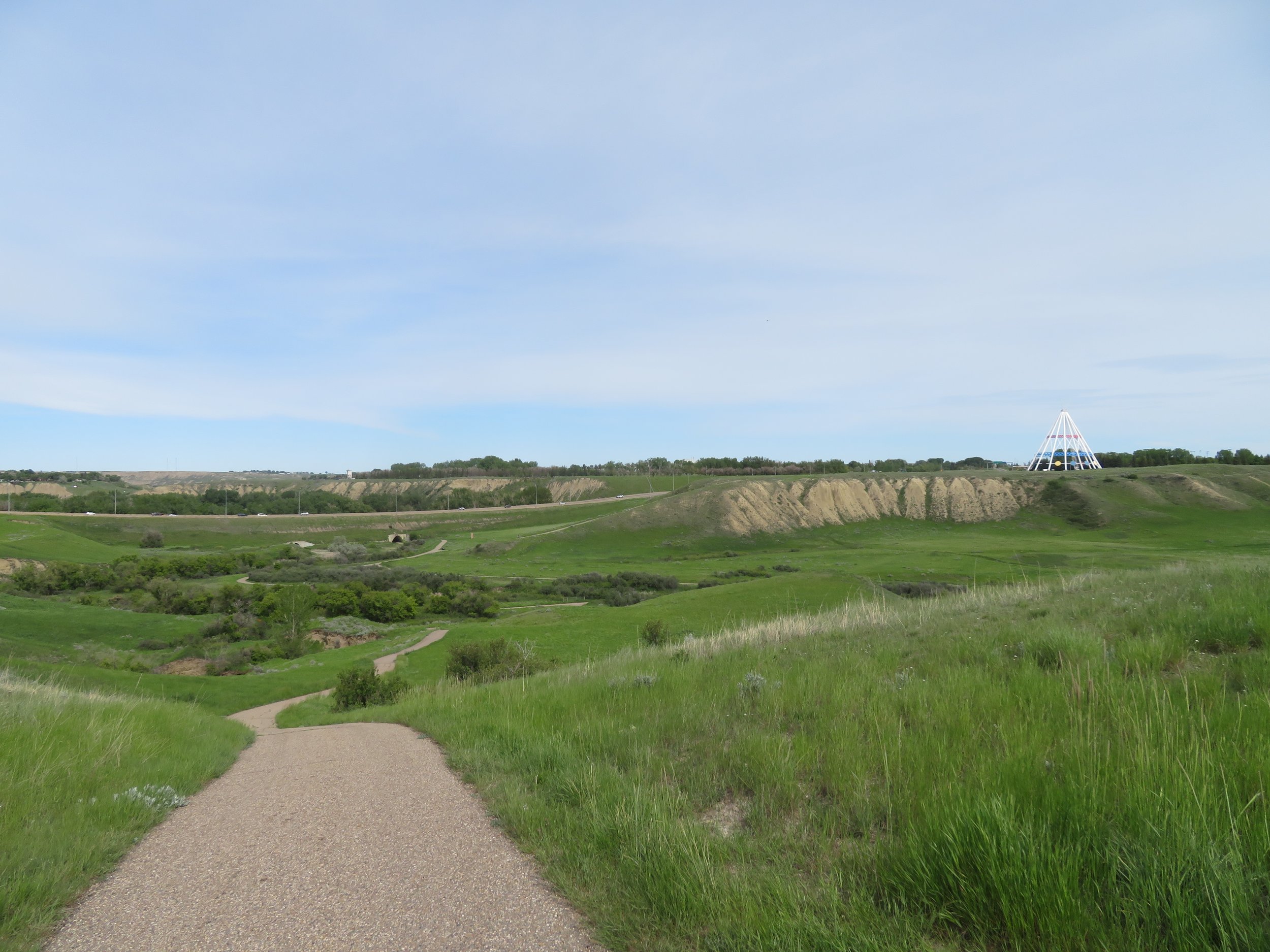
We’d learned that a summer festival was going on at the Kin Coulee Park. The city has an extensive and intricate network of trails and using the trail map, David found a reasonable route to get there. What the map lacked, however, was any reference to altitude change. We trudged up steep hills and through neighborhoods then looking down, we glimpsed the festival grounds. A coulee, by definition, is a deep ravine and hence Kin Coulee was yet another steep downhill trek.

The festival offered the usual kiosks and vendors. A local band was performing. Kids got their faces painted and the food trucks were lined up along the perimeter of the park. We passed up Pooty’s Poutine truck and headed to Friar Tucks for grilled chicken caesar wraps… pretty good actually.

we passed up Pooty’s for a chicken caesar wrap at friar Tuck’s truck.
Bellies full and bodies refreshed, we headed up, up, up out of the coulee to find the World’s Tallest Teepee. Unfortunately, once we were up and out of the coulee, the trail led down, down, down before it led up, up, up again to the site of the teepee.
a long way down and then up again to get to the teepee.
‘The Tepee is Medicine Hat's most visible landmark and is a tribute to Canada's native heritage. It's built entirely of steel and is ringed with ten large circular story-boards depicting native culture and history.’

World’s Tallest Teepee
We admired the teepee and read all the storyboards, dreading the thought of descending the steep trail, then ascending the other side once again, but there was no way around it.
We worked our way through a small industrial park and along a short stretch of highway. I groused as we made the final push up the last hill and spotted the campground. A cold beer and dinner back at our campsite improved my spirits considerably.
We racked up a total 12 miles in our walk around Medicine Hat, got to attend a local fair, saw the world’s largest chess piece and the world’s largest teepee. Our dogs were tired when we climbed into bed, but all in all, it was a fine good day.
Time to leave Alberta and head east to Saskatchewan, a new Canadian province for us to explore with lots to see along our route. Our next destination? Moose Jaw. C’mon along!
Here’s our progress so far shown in blue…
