

Labrador 2 - Icebergs and Lighthouses
/
An Iceberg Alley sign on the TransLabrador Highway lured us 18 miles up a gravel road to the picturesque little fishing village of St. Lewis for our first views of the Atlantic.
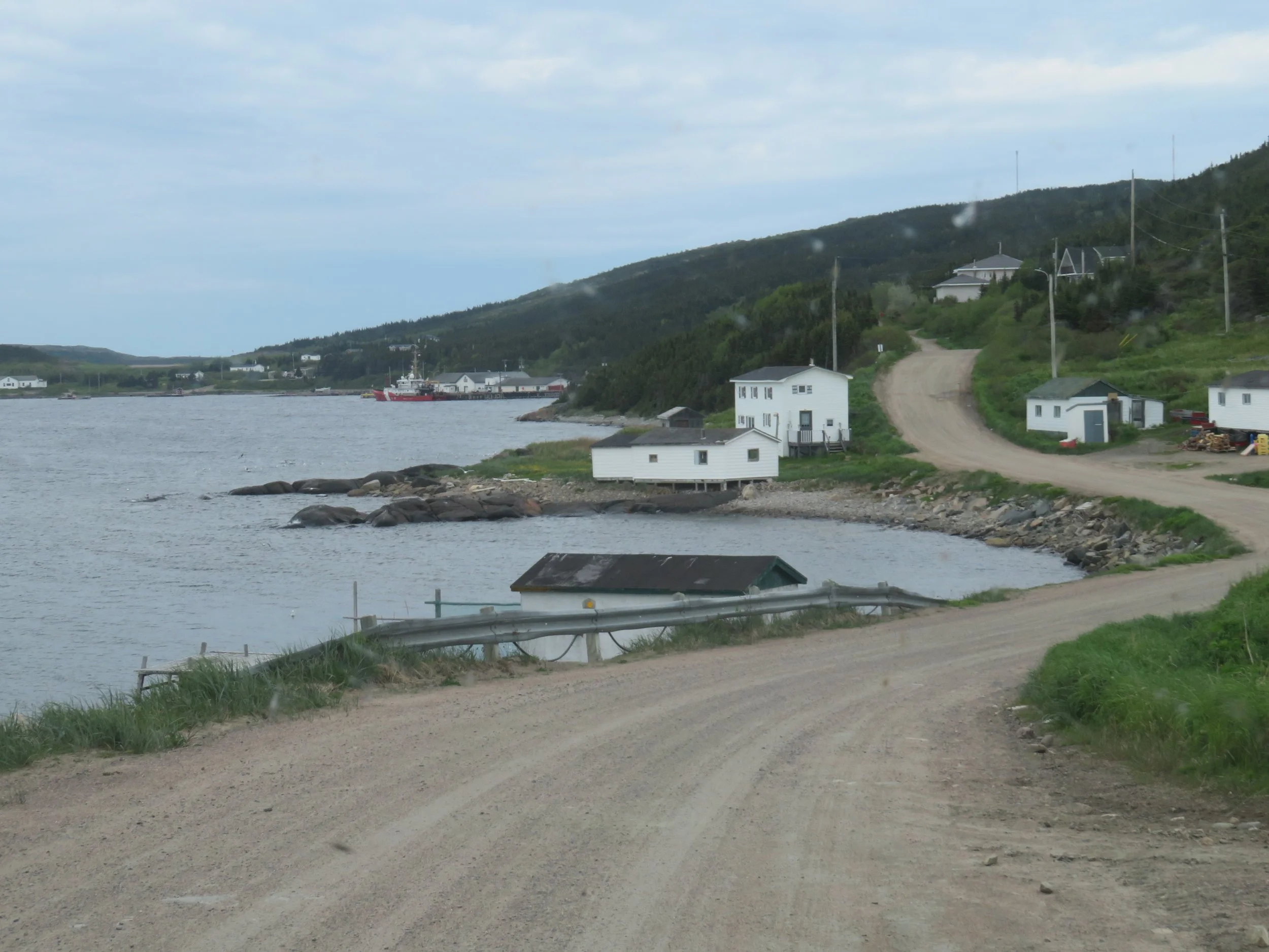
THE ICONIC LITTLE FISHING VILLAGE OF ST. Lewis
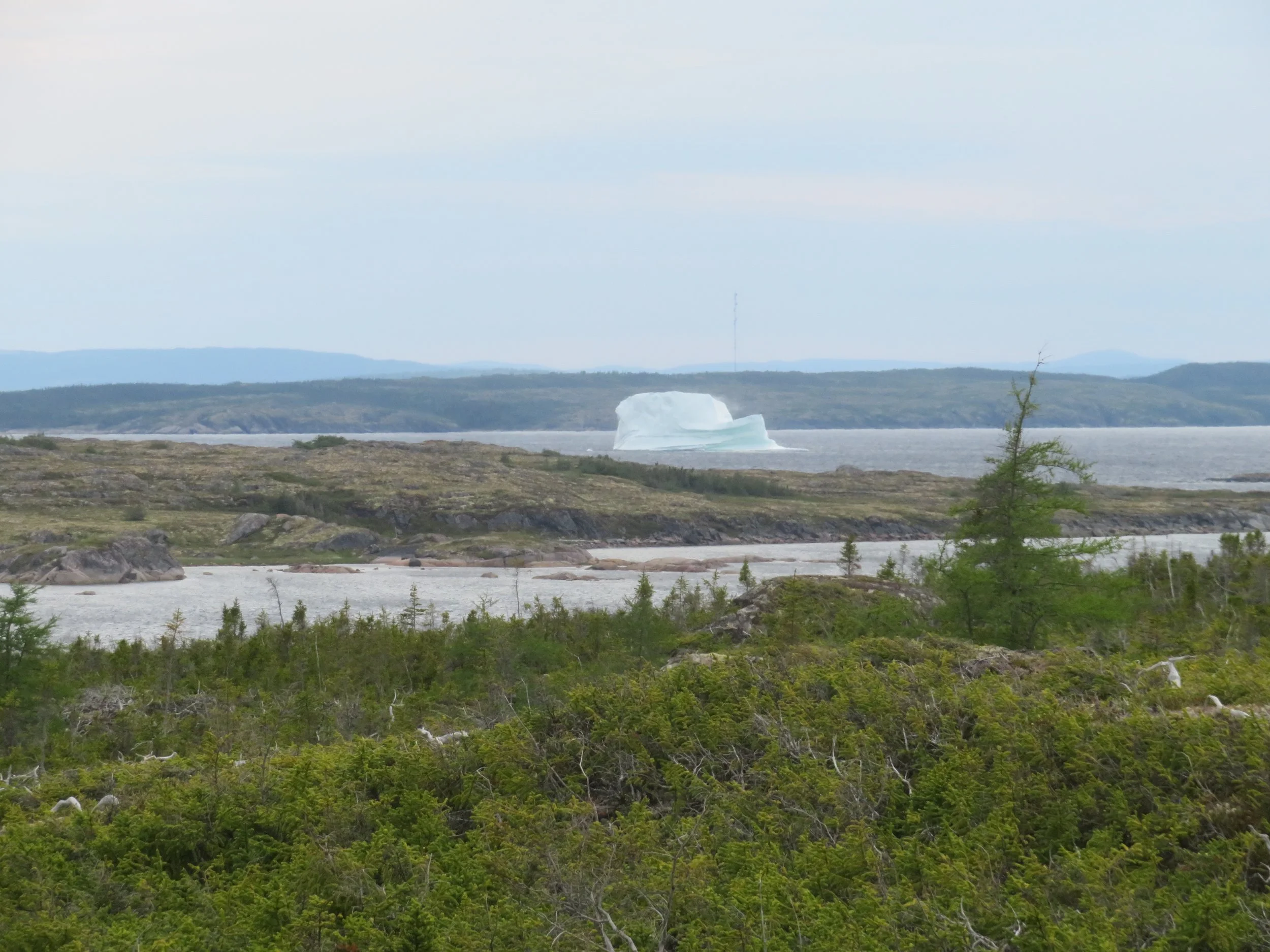
True to the sign’s promise, we spotted two huge icebergs floating by fairly close to shore. The temperature was about 10° cooler by the shore and the wind was gusty.


We climbed the little hill at Fisherman’s Point to check out the Fishermen’s Monument paying homage to locals who had been lost at sea.

St. Lewis Fishermen’s Memorial stands on a hill overlooking the atlantic
The area was lush with flowering groundcover… cloudberry, Swedish cornel aka Canadian bunchberry and rose root.


We climbed back into Blanche to get warm and out of the wind. On our way back down the road, we spotted another viewpoint for the icebergs and climbed the hill as the ice monsters slowly made their way down the coast.
Gerald Rumbolt (a common local surname, BTW) is responsible for the whimsical inukshuk statues that stand on a cliff along the roadside.

Gerald Rumbolt’s whimsical inukshuk creations caught our attention as we drove by.
We spent the night in a small, room-for-one turnout at Round Hill Park. Other than loons calling and gulls crying during the night, it was peaceful and quiet.

We had lost another 1/2 hour as we passed from the Atlantic to the Newfoundland/Labrador time zone.

We lost 1/2 hour as we entered the Newfoundland-Labrador time zone
This section of the TransLabrador Highway is called the Labrador Coastal Drive (Route 510S) and it’s beautiful as it hugs the ocean making its way south.

Our first stop on the coastal drive was Mary’s Harbour, a cute little village and home to Battle Harbour Ferry Terminal. Battle Harbour on Battle Island, is a late 18th-19th century fishing village and a Canadian National Historic Site. The M/V Iceberg Hunter is the only transport to the site, a once-a-day, hour long open-boat ride across St. Lewis Inlet, and an overnight stay on the island is required, so we passed.
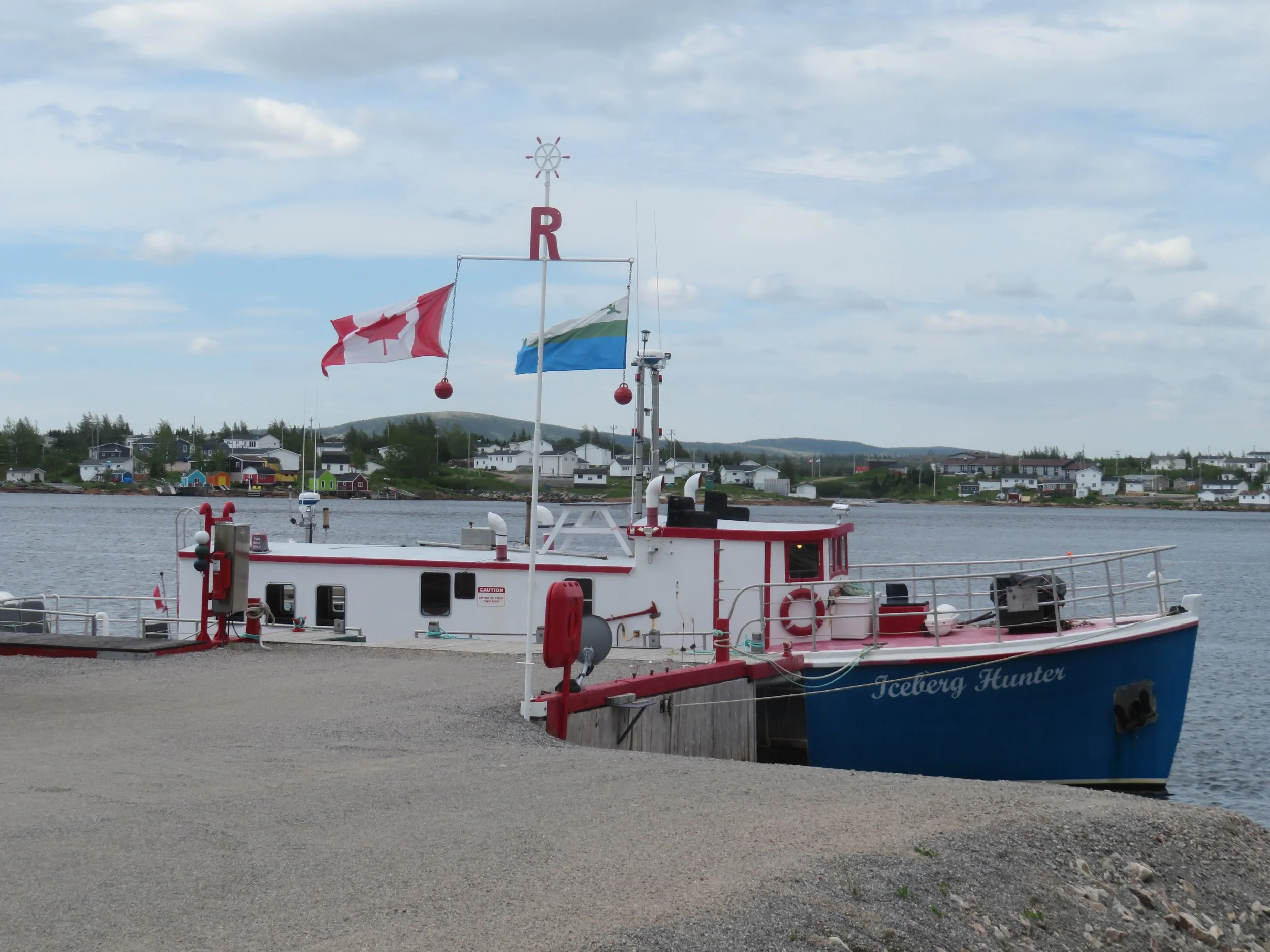
M/V Iceberg at the Battle Harbour dock

Battle Harbour National Historic Site Photo credit: Mo Laidlaw
We stopped at Red Bay, an old Basque fishing village and another National Historic Site. A site visit once again required a short boat ride across the bay. This time we could see the settlement from shore and we were content with that option as well as a quick stop at the historical site visitor’s center. According to Wiki and the brochure at the Visitor Center “Red Bay is notable as one of the most precious underwater archaeological sites in the Americas. Between 1530 and the early 17th century, it was a major Basque whaling area. Several whaling ships sank and their discovery led to the designation of Red Bay in 2013 as a UNESCO Heritage Site.
Unfortunately, a tour bus, a tour van and a school bus full of kids had arrived just before us, leaving the tiny restaurant, gift shop and Visitor’s Center very crowded.

Red Bay, an early Basque whaling site, as seen from shore
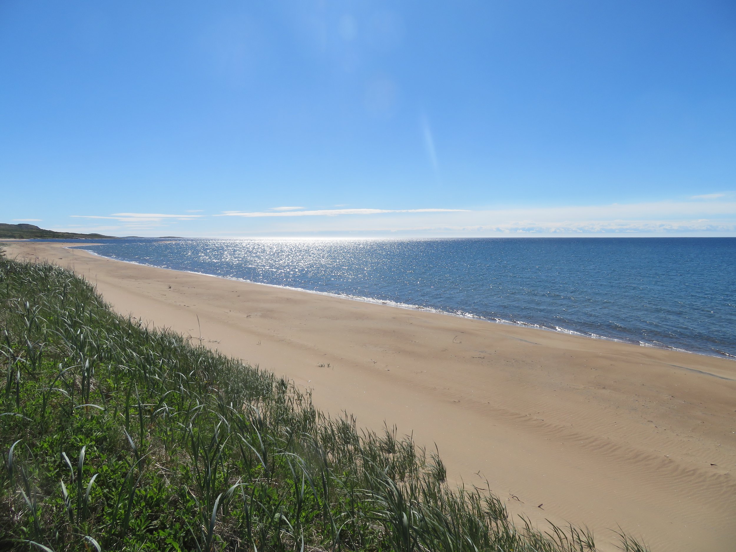
At the water’s edge, the temperature was 66F (19C) and very gusty. Once we drove further inland, the temperature rose to an uncomfortably humid 82F (28C).We spent the night at Pinware Provincial Park. Our site, #19, was absolutely awesome overlooking a sweeping beach on the Strait of Belle Isle. Swimming, however, never occurred to us. Remember those icebergs we’d just seen?

We had to walk a distance to the park’s hot showers and by the time we returned we were itching and scratching with bug bites. We’d been resisting wearing bug spray, especially after a shower, but the bugs were ravenous. Yuck! Luckily, we had Benadryl to alleviate some of the itching, but it was an uncomfortable night.
This stretch of road follows the contour of the land, up and down hills, through small villages, hugging the coast with gorgeous views of the Strait of Belle Isle.

Coastal village scenes were beautiful and frequent.
We stopped briefly at the L’Anse Amour National Historic Site (NHS) which features the the oldest known burial mound in the North America, part of one of the largest and longest used Aboriginal habitation sites in Labrador created between 6100 and 6600BCE. There’s not much to see, but the history of the area was interesting.


Close by and the highlight of the day was a visit to the Point Amour Lighthouse. (Admission:$6/pp) Constructed between 1854-1857, it is 108’ (33M) tall making it the tallest lighthouse in Atlantic Canada and the second tallest in the country.

We’ve visited lots of lighthouses in our travels, but Alfred, the tour guide at Point L’Amour Light was so knowledgeable, so entertaining and so enthusiastic about the light, the tour was outstanding. We toured the little museum first at our leisure then climbed the 132 steps of the winding stone staircase to the top of the lighthouse, the last dozen or so steps a vertical climb on a ladder.

At each landing, we stopped and Alfred provided some color commentary about the light, the lighthouse keepers and the history of the area and answered any questions we had.
At the top, we crowded around the Fresnel lens and took photos from an outstanding vantage point.

Back to the ground level, we walked along the ocean front. Several flocks of eider ducks flew by and some floated past in rafts.

At the Labrador/Quebec border we spied an iceberg floating by and found a turnout to park Blanche and a path leading down to the sea for a better view of the berg. The few miles we ventured into Quebec, by the way, regained us 1-1/2 hours of lost time as we re-entered Eastern Standard Time. We chose to ignore it however since the local ferry operates on Newfoundland Time.

I’d tried to make reservations for the Blanc Sablon (White Sand) ferry to St. Barbe, Newfoundland, but the Labrador Marine website showed that it was booked solid for the next three days. Ouch! On a hunch, we decided to head to the ferry terminal to see if there was any way to get across earlier, a cancellation perhaps? The pleasant ferry ticket agency told us there was plenty of room. In fact, the ferry regularly booked only 75% full. She sold us our tickets ($26.75 for David and Blanche and $9.50 for me). We boarded the next ferry for the 1:45 hour/ 17 mile ride across the Strait of Belle Isle.

Join us next time as we arrive in Newfoundland, affectionately known as ‘The Rock’.
Check out the map below to see how far we’ve come. The blue line is our current position and the red line is our planned itinerary… always subject to change on a whim.
