

Labrador… The Big Land
/Labrador! Just the name conjures up cold, vast, wilderness lands. Quebec Route 389 changed to Labrador Route 500 aka the TransLabrador Highway, as we crossed the provincial border and we lost yet another hour crossing into the Atlantic Time Zone.
We stopped first at the ‘Newfoundland and Labrador… ‘Welcome to the Big Land’ sign for requisite photos… and had a little breakfast before embarking on the next leg of our trip. We congratulated each other for arriving In Labrador then shot off down the highway.

Labrador is an enormous place or like the welcome sign says it’s The Big Land. It has only one major road transversing it… the one we were on! Many of the ports and places, like the remote national parks, are further north and only accessible by boat or plane. We planned to stick to the road and still felt the enormity and vastness of the place. Below is a map of Labrador with the TransLabrador Highway cutting across it. As you can see, there’s lots of Labrador that we won’t be able to explore, but on the positive side, there’s still lots to see.

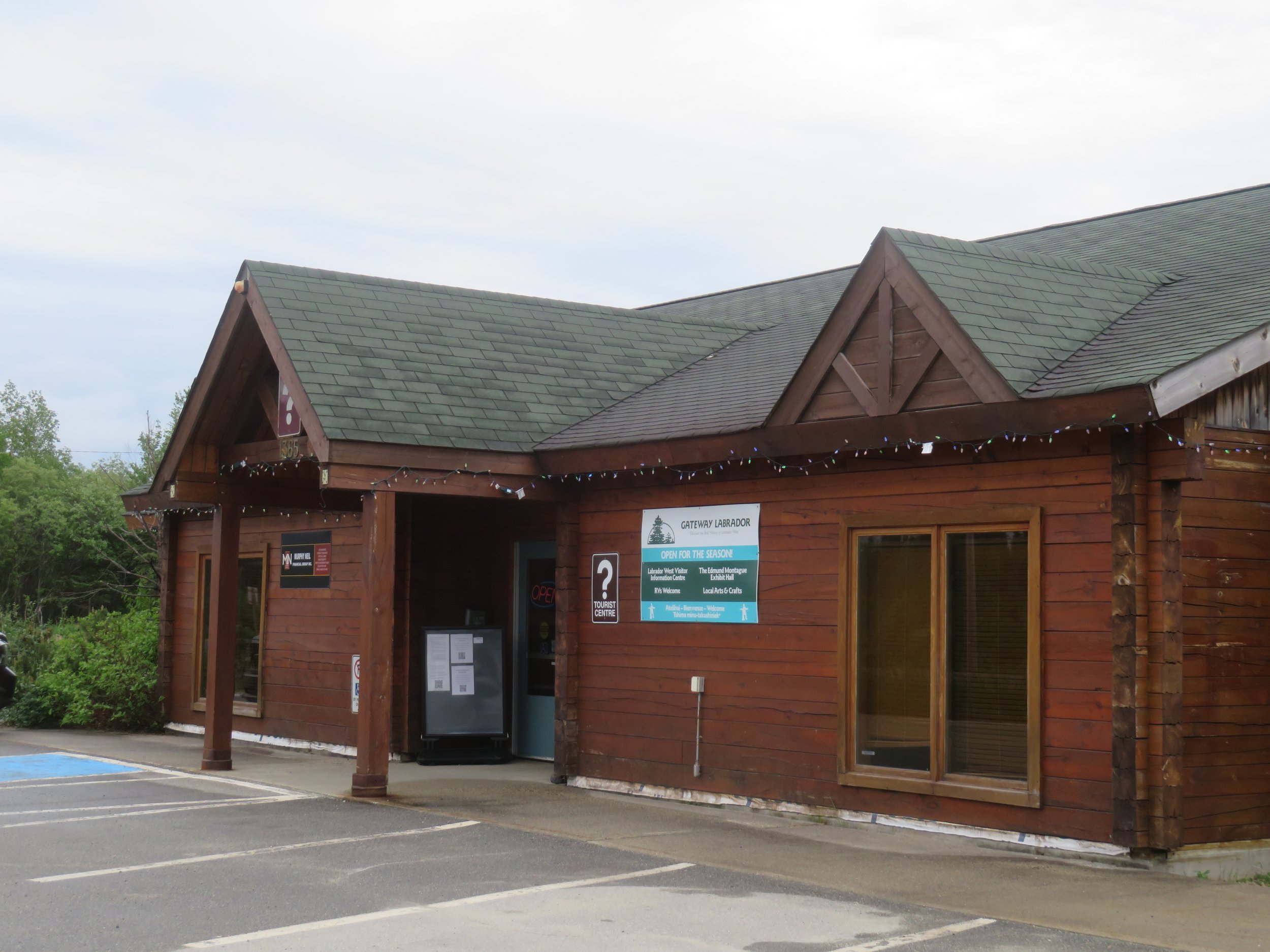
Only 17 miles further down the highway and we arrived in Labrador City. We stopped at the Gateway Labrador Visitor Center to pick up some brochures and information on service distances along the route. We also topped off our fresh water there before heading into the ‘city’.
Established as an iron mining community in the 1950s, Labrador City with a population of ~9300 people is the largest town in Labrador. Surprisingly, while there we noticed many of the usual chain stores as we traveled through town… McDs, IGA, Canadian Tire, Tim Hortons, Walmart, Subway.

Wildfires had been burning along our intended route, so we checked the Canadian Wildfire Info System to make sure it was safe to continue. All was clear and we headed towards Churchill Falls, the next gas stop. Since gas stops are few and far between, we took extra care to make sure we filled up at each opportunity. Our itinerary was set based upon gas fill-ups. Though Blanche’s range is 400+ miles on a tank, we weren’t taking any chances.
As we continued out of Labrador City along the highway, the roadsides were boggy and marshy as far as the eye could see with lots of lakes and ponds to keep the area soggy. I spotted a single common merganser on one pond. Labrador tea (how appropriate) and swamp laurel grew profusely along the road in the bogs.


About 16 miles west of Churchill Falls, we came across the burn area that had recently closed the highway. The embers were still smoldering.

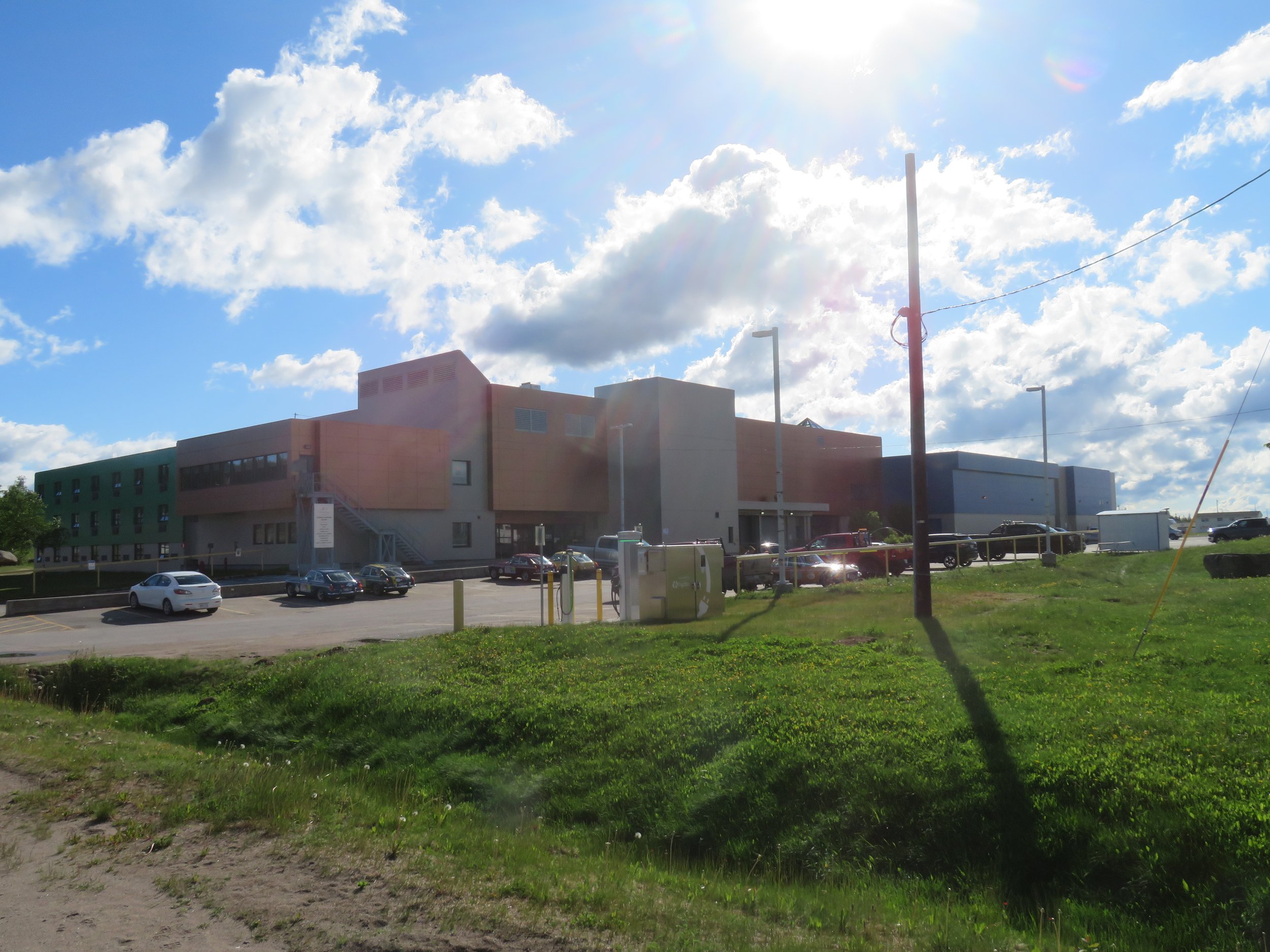
Churchill Falls’s claim to fame is a generating station which is one of the largest underground hydroelectric powerhouses in the world. We were pleased to find free RV camping with electric in the parking lot outside the Donald Gordon Community Centre. What a treat! When the center is open, there is a swimming pool, basketball courts, a curling rink, a fitness center and restrooms on site. We spent a quiet night, gassed up in the morning at the only gas station in town and hit the road once again.
Donald Gordon Community Centre offered free overnight parking or RVs.
We checked the lat/long of Churchill Falls and noted that this was the most northern point we would reach on this trip. 53.53N / 64.01W.
The day was bright and the sun sparkled on the water… brown and tannic. Cotton grass grew abundantly in the swampy areas. Star-tipped reindeer lichen, white and thick, covered the rocks and looked like snow. The miles sped by.


We traveled about ~180 miles (287 km) to Happy Valley/Goose Bay, our next stop. Developed as a strategic air base and refueling station during WWII and continuing through the Cold War years, Goose Bay is still home to a unit of the Royal Canadian Air Force. The USA maintained a SAC base there until 1976. Currently the town’s industry revolves around lumber, mining and the Lower Churchill Hydroelectric Generating Project.

Second only to Labrador City in size, Happy Valley/Goose Bay boasts a population of ~8,200 people. It’s a pleasant enough little town and the folks are friendly and helpful. We spent the night in the parking lot of the 2-year old Central Labrador YMCA. It’s a beautiful facility which allows free parking for RVs. We were lucky enough to snag one of the spots with electric and we were able to use their restrooms during our stay.
The morning was partly sunny and chilly as we gassed up and hit the highway again. Our destination was Port Hope Simpson ~250 miles (404km), the longest section of the highway between gas stations.
Cotton grass, swamp laurel, Labrador tea and the ubiquitous dandelion dotted the sides of the highway. The road is built up fairly high above the roadside and we suspect we’d sink in fairly deep if we were to step off the road. There were lots of gravel and paved turnouts to take breaks and we took advantage of a couple just to stretch.
The highlight of the day was spotting a large black bear clomping along about 100’ (30m) off the road. We stopped. He stopped. Then apparently unbothered by our presence, he continued on his way at a leisurely pace, stopping every few minutes for a mouthful of grass. This was only the second bear we’d seen on our entire trip and the first one that was in sight long enough for a pic.

By midday, the sky was overcast and the temperature had risen to 82F (28C). Whew! It seemed odd having the A/C on in Labrador. The wind was gusty, blowing dust and sand across the road. Though it’s a good solid road to travel and quite scenic, it just seems to go on and on and on and on.

A ribbon of a road
We finally arrived in Port Hope Simpson and it wasn’t much. The gas station, the Red Roof Quick Stop and General Store, was the only facility we saw. There seemed to be lots of fishing cabins in the area. We gassed up at $2.02/ltr, checked out the general store, and used the washroom, then headed out once again.

An oversized red chair and an inukshuk were photo opps in front of the Red Roof Quick Stop. Other than that there wasn’t much in Port Hope simpson.
About 15 miles down the road, we spotted a sign… Iceberg Alley and an arrow pointing east to St. Lewis, 18 miles up a gravel road. Why not?

IceBerg Alley? Absolutely!
Stay tuned for the next installment as we head east for our first glimpse of the Atlantic and see if Iceberg Alley lives up to its name. There’s lots more of Labrador to see. Join us.
See how far we’ve come. The blue line is our current location and the red line is our planned itinerary.
