

PEI - North Cape Coastal Drive and Lotsa Spuds
/
Over the Confederation Bridge
We crossed the Confederation Bridge and here we were on Prince Edward Island (PEI). I’d been reading about the island for months… things to do and places to visit. I had maps and brochures and articles galore for reference. I’d even reread Anne of Green Gables again and we’d watched the Anne with an E series, just to get into the PEI spirit. Now we were here.

Canada’s smallest province, PEI is only about 140 miles (225km) long and ranges between 2-40 miles (3-65km) wide. That said, ‘the island’, as the locals call it, has 2,038 miles (3,280 km) of shoreline due to its irregular coastline and innumerable bays and estuaries. Most of PEI is within 5 miles (8 km) of the sea or a tidal inlet, and no spot is more than 10 miles (16 km) from salt water. It’s the only Canadian province or territory with no land borders.

We still had a day to get our bearings on the island before heading into Charlottetown for our celebration. We made a last-minute reservation for the night at the Linkletter Provincial Park. On the way to the campground, we saw a sign for the Seacow Head Lighthouse and figured we might as well immediately dive into PEI sightseeing.

Seacow Head Lighthouse
Built in 1864, it stands sentry on the edge of rugged, red cliffs. Interestingly, it’s the names for the herds of walrus aka sea cows that once migrated to these shores each Spring. Walrus were regionally extinct by the early 1800s due to overhunting.
We watched kids jumping off the cliffs into the water below. It was a long way down and then they scampered back up the cliffs to jump again.

From the lighthouse, we were also able to see the Confederation Bridge in the hazy distance.

We planned to use Linkletter PP as our base for touring the western part of the island. The campground was crowded as expected and the sites were small and close together, but we were near the sea and enjoyed a lovely ocean breeze.
Our first night in PEI was a rainy one that led to a rainy morning and drizzly day. A road trip was on the agenda. The North Cape Coastal Drive pretty much hugs the coast as you’d expect all the way from the campground west to West Point, then heads north to North Cape and when it runs out of island, it turns south again along the coastal waters of the Gulf of St. Lawrence.

Take a look below to see our route.

Despite the drizzle, we stopped at L’Eglise de Notre Dame de Mont Carmel… Our Lady of Mount Carmel Church. It was such a surprise to see this imposing red brick Victorian Gothic church standing regally alongside a small country road. Built by Acadian parishioners in 1898, it’s the third church to stand on this site and it’s quite impressive
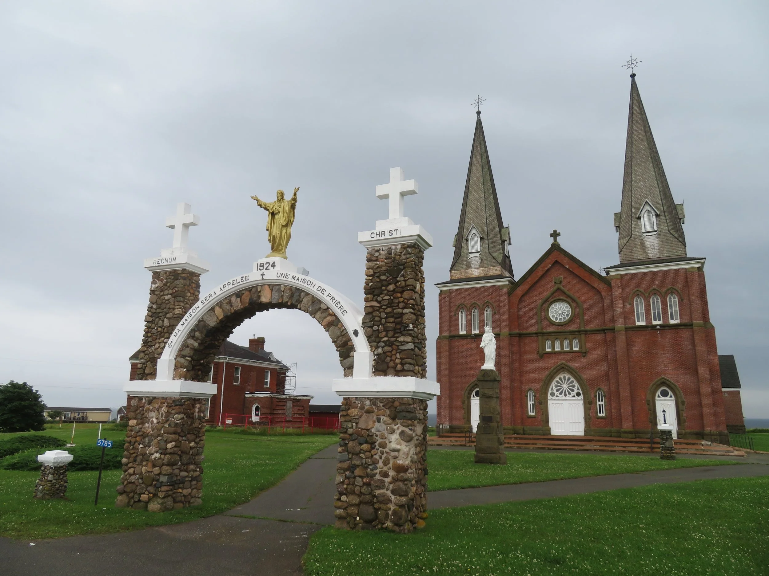
L’Eglise de Notre Dame de Mont Carmel

Mount Carmel’s Cenotaph, built in 1923, honors ten local veterans who were killed during WWI.

The cemetery overlooking the Northumberland Strait sits serenely beside the church.
We’re told one can see the Confederation Bridge in its entirety from this site, but not this day with the fog and drizzle obscuring the view.
We caught our first sight of PEI’s provincial animal, the red fox, running across the road and stopping to peek out at us from the safety of roadside bushes.

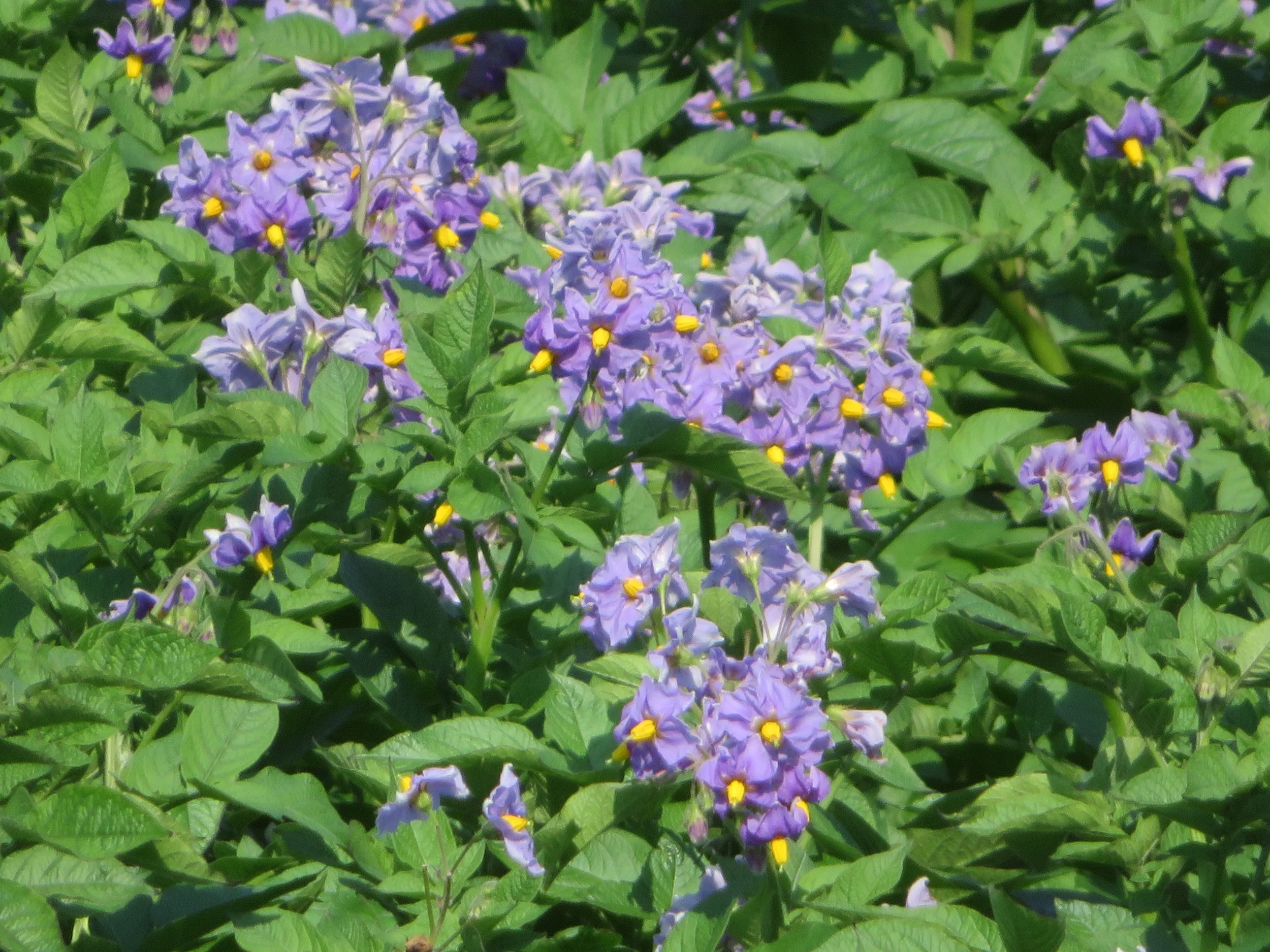
One of our first impressions of the island? Potatoes! There were potato fields everywhere. Large expanses of red soil planted with potatoes. Some were flowering… white blossoms, purple blossoms, pink blossoms. Lots of potatoes… acres and acres, field after field.


We stopped in O’Leary, home of The Canadian Potato Museum. We couldn’t resist a photo opp in front of the big potato at the museum entrance.

We learned everything there was to know about potatoes and then some. From the history of the potato, to potato equipment, to Mr. Potato Head, the museum covered it all. First domesticated by the Incas on the shores of Lake Titicaca, it was the Spanish who first brought the potato to Europe. They discovered it prevented scurvy on long passages and was easy to stow.

There are over 5000 varieties of the incredibly versatile potato AND it even prevents scurvy!
Introduced to PEI by British settlers in1758, potatoes have been a major industry of the island ever since. The first export shipment occurred in 1847 and the province is the largest potato producer in Canada. According to the PEI government website, ‘In 2019, PEI had 85,500 acres of land devoted to potato production and harvested potatoes totaled 25.2 million hundredweight (Cwt)’… that’s 2.8 billion pounds. A lot of spuds produced by a little island.


By the time we left the museum, we were potatoed-out and it was raining in earnest. We made a wet, muddy stop at West Point to check out its distinctive black and white striped lighthouse. We’d hoped to have lunch in a recommended local restaurant but it was closed ‘due to technical issues’. Disappointed and hungry, we continued up the North Cape Coastal Drive to North Cape.

West Point Light
The Wind & Reef Restaurant offered great views and mediocre food. The prices were high and the portions were small. The lobster roll was puny and the fried clam plate special consisted of 8 very tiny clams, greasy fries and a tiny plastic cup of cole slaw.


We were tired of the rain, tired of driving, and grumpy by day’s end. When we returned to the campground in the late afternoon, it was a muddy mess. We spent the evening reading, writing and grousing about the weather. But soon the celebration would begin… two days in Charlottetown. Come help us celebrate!